

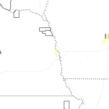
Hail Map for Tuesday, March 18, 2025

Number of Impacted Households on 3/18/2025
0
Impacted by 1" or Larger Hail
0
Impacted by 1.75" or Larger Hail
0
Impacted by 2.5" or Larger Hail
Square Miles of Populated Area Impacted on 3/18/2025
0
Impacted by 1" or Larger Hail
0
Impacted by 1.75" or Larger Hail
0
Impacted by 2.5" or Larger Hail

Cities Most Affected by Hail Storms of 3/18/2025
| Hail Size | Demographics of Zip Codes Affected | ||||||
|---|---|---|---|---|---|---|---|
| City | Count | Average | Largest | Pop Density | House Value | Income | Age |
Hail and Wind Damage Spotted on 3/18/2025
Filter by Report Type:Hail ReportsWind Reports
Idaho
| Local Time | Report Details |
|---|---|
| 10:00 AM MDT | Pilot gold msi mesonet near sweetzer summi in cassia county ID, 73.9 miles ESE of Twin Falls, ID |
| 10:15 AM MDT | Moburg canyon raw in cassia county ID, 67.8 miles ESE of Twin Falls, ID |
Nebraska
| Local Time | Report Details |
|---|---|
| 3:07 AM CDT | Quarter sized hail reported near Omaha, NE, 12.6 miles NNW of Omaha, NE, report from mping: quarter (1.00 in.). |
Iowa
| Local Time | Report Details |
|---|---|
| 4:39 AM CDT | Half Dollar sized hail reported near Ames, IA, 30.4 miles N of Des Moines, IA |
| 5:38 AM CDT | Quarter sized hail reported near Iowa Falls, IA, 42.6 miles S of Mason City, IA, report received via social media. |
Connect with Interactive Hail Maps