

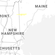
Hail Map for Saturday, October 10, 2020

Number of Impacted Households on 10/10/2020
0
Impacted by 1" or Larger Hail
0
Impacted by 1.75" or Larger Hail
0
Impacted by 2.5" or Larger Hail
Square Miles of Populated Area Impacted on 10/10/2020
0
Impacted by 1" or Larger Hail
0
Impacted by 1.75" or Larger Hail
0
Impacted by 2.5" or Larger Hail


Cities Most Affected by Hail Storms of 10/10/2020
| Hail Size | Demographics of Zip Codes Affected | ||||||
|---|---|---|---|---|---|---|---|
| City | Count | Average | Largest | Pop Density | House Value | Income | Age |
| Elizabethtown, NY | 1 | 1.75 | 1.75 | 8 | $75k | $31.5k | 52.1 |
Hail and Wind Damage Spotted on 10/10/2020
Filter by Report Type:Hail ReportsWind Reports
New York
| Local Time | Report Details |
|---|---|
| 2:41 PM EDT | Multiple trees dow in st. lawrence county NY, 42.6 miles ENE of Ogdensburg, NY |
| 3:20 PM EDT | Tree fell onto telephone pol in clinton county NY, 22.2 miles NW of Burlington, VT |
| 3:20 PM EDT | Power pole knocked down in st. lawrence county NY, 31.6 miles ENE of Ogdensburg, NY |
| 3:30 PM EDT | Tree and powerline down in franklin county NY, 46.6 miles E of Ogdensburg, NY |
| 5:27 PM EDT | Trees and wires across road in oneida county NY, 37.7 miles ENE of Syracuse, NY |
| 5:27 PM EDT | Trees and wires down. wires on fire near trailer par in oneida county NY, 35.5 miles ENE of Syracuse, NY |
| 5:28 PM EDT | Tree down on power line in essex county NY, 32.7 miles WSW of Burlington, VT |
| 5:40 PM EDT | Golf Ball sized hail reported near Elizabethtown, NY, 26.1 miles SW of Burlington, VT |
Vermont
| Local Time | Report Details |
|---|---|
| 5:58 PM EDT | Trees down on powerlines in addison county VT, 18.4 miles S of Burlington, VT |
| 6:05 PM EDT | Tree down on wires in addison county VT, 17.3 miles S of Burlington, VT |
| 6:46 PM EDT | Trees down on powerlines in caledonia county VT, 64.3 miles E of Burlington, VT |
| 6:54 PM EDT | Trees down on powerlines in essex county VT, 74.4 miles E of Burlington, VT |
| 6:58 PM EDT | Trees downe in coos county NH, 74.9 miles E of Burlington, VT |
New Hampshire
| Local Time | Report Details |
|---|---|
| 7:00 PM EDT | Numerous trees down in dalton nh. tree down on state troopers car als in coos county NH, 74.5 miles E of Burlington, VT |
| 7:21 PM EDT | Storm damage reported in coos county NH, 71 miles NW of Portland, ME |
| 7:25 PM EDT | Half Dollar sized hail reported near Gorham, NH, 67.3 miles NW of Portland, ME, delayed report. time estimated from radar. |
| 7:32 PM EDT | Trees downed on pleasant stree in coos county NH, 72.4 miles NW of Portland, ME |
| 7:40 PM EDT | Trees down hill road in bat in grafton county NH, 66.3 miles ESE of Burlington, VT |
| 7:40 PM EDT | Quarter sized hail reported near Gorham, NH, 70.1 miles NW of Portland, ME, largest hailstones slightly larger than 1 inch. tree limbs down around moose brook state park. delayed report. |
| 8:15 PM EDT | Multiple trees down in bartlett. time estimate in carroll county NH, 54 miles NW of Portland, ME |
| 8:25 PM EDT | Branch down in conway. time estimate in carroll county NH, 47.8 miles WNW of Portland, ME |
Maine
| Local Time | Report Details |
|---|---|
| 7:45 PM EDT | Quarter sized hail reported near Newry, ME, 64.5 miles NNW of Portland, ME, delayed mping report. |
| 7:55 PM EDT | Quarter sized hail reported near Bethel, ME, 58.3 miles NNW of Portland, ME |
| 8:12 PM EDT | Quarter sized hail reported near Dixfield, ME, 59.9 miles N of Portland, ME |
| 8:24 PM EDT | Trees on wires butterfield r in oxford county ME, 47.9 miles NW of Portland, ME |
Georgia
| Local Time | Report Details |
|---|---|
| 8:42 PM EDT | Multiple trees down along the 3500th block of lawrenceville hw in gwinnett county GA, 20.1 miles NE of Atlanta, GA |
| 8:51 PM EDT | Trees down near crescent drive and tanglewood driv in gwinnett county GA, 22.2 miles ENE of Atlanta, GA |
Connect with Interactive Hail Maps