

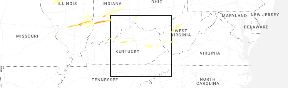
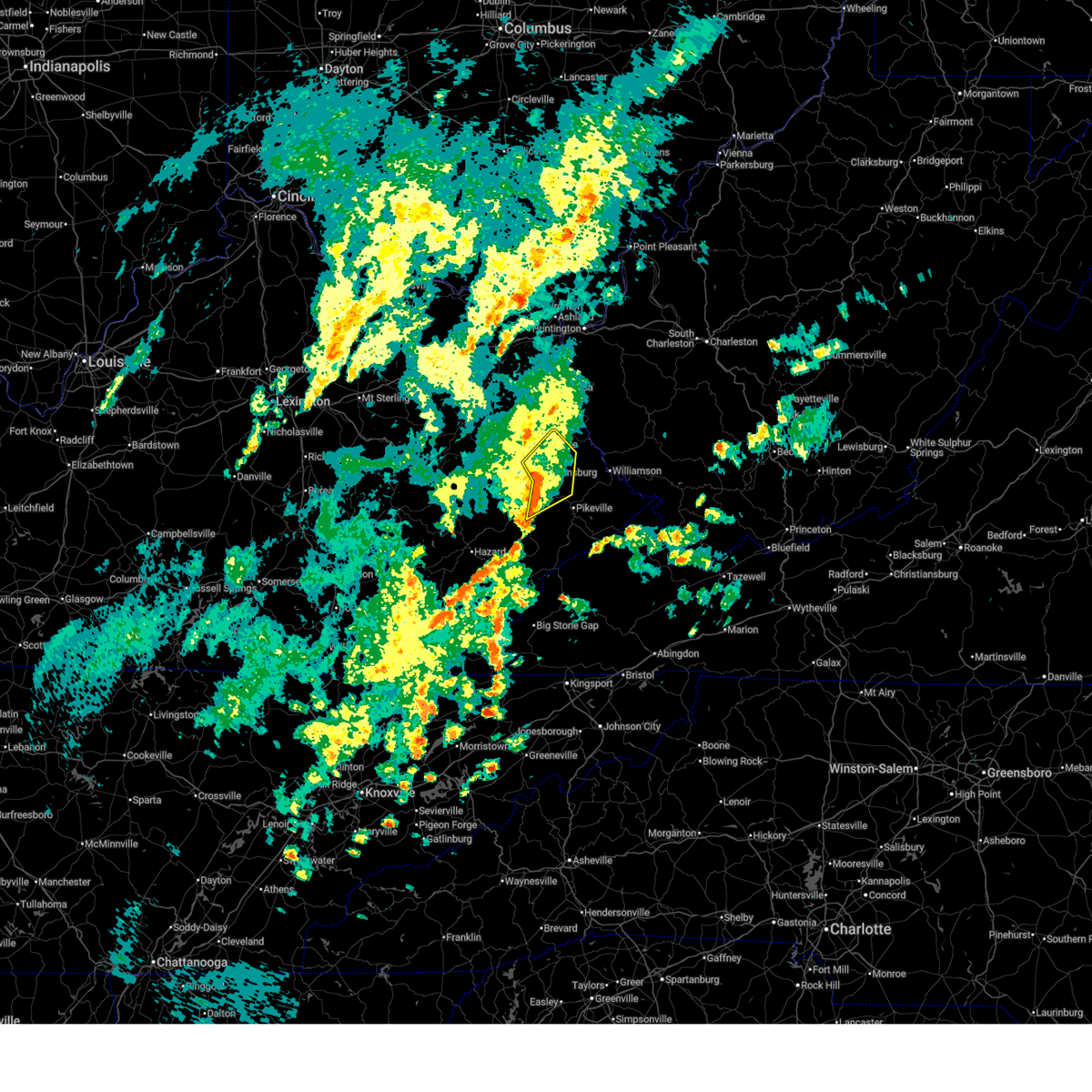
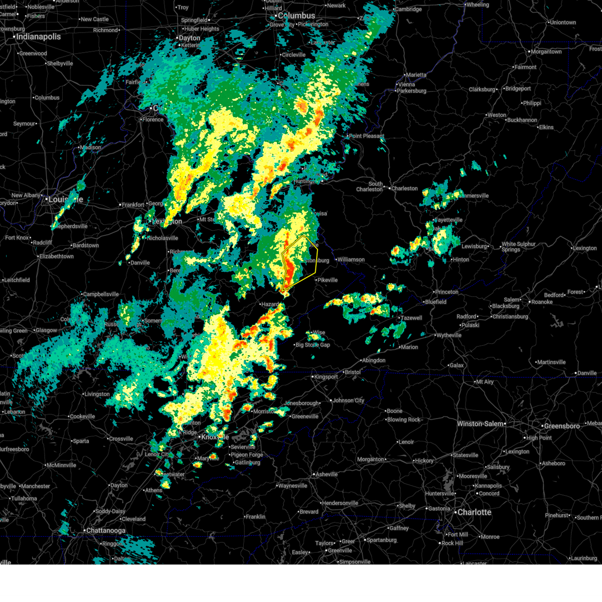
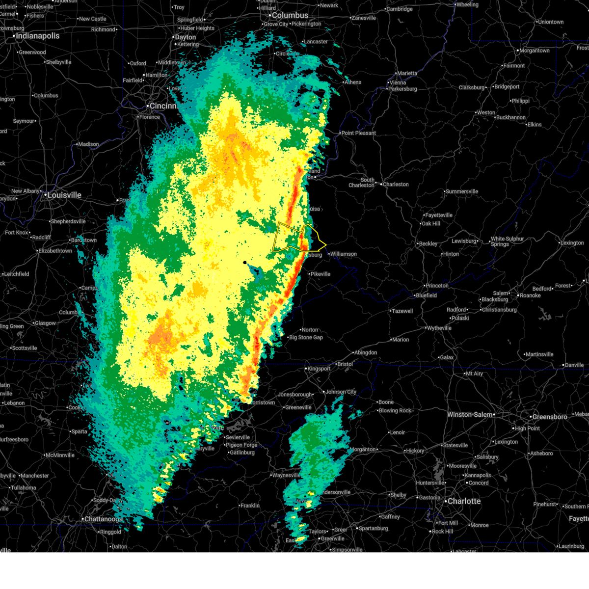
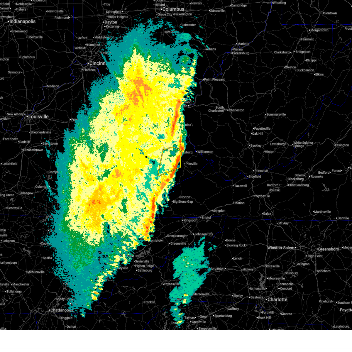
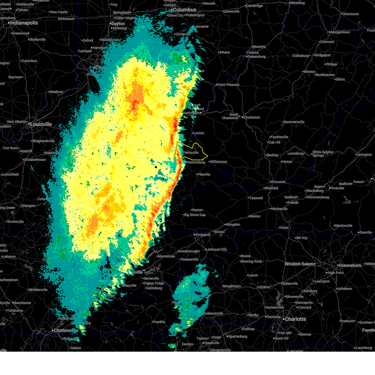
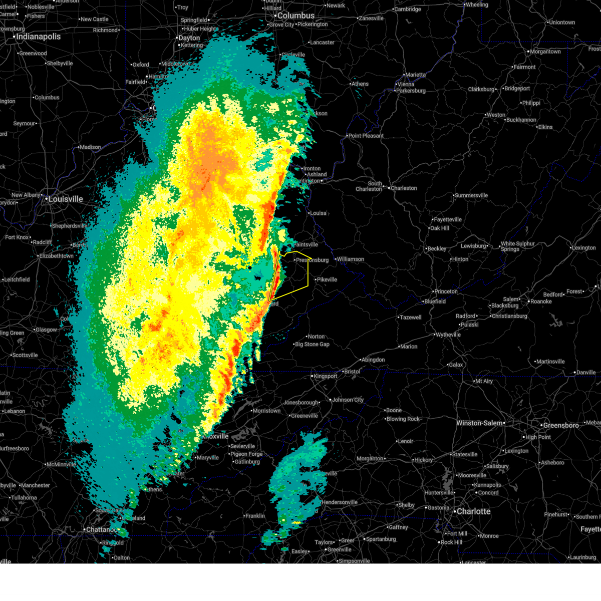
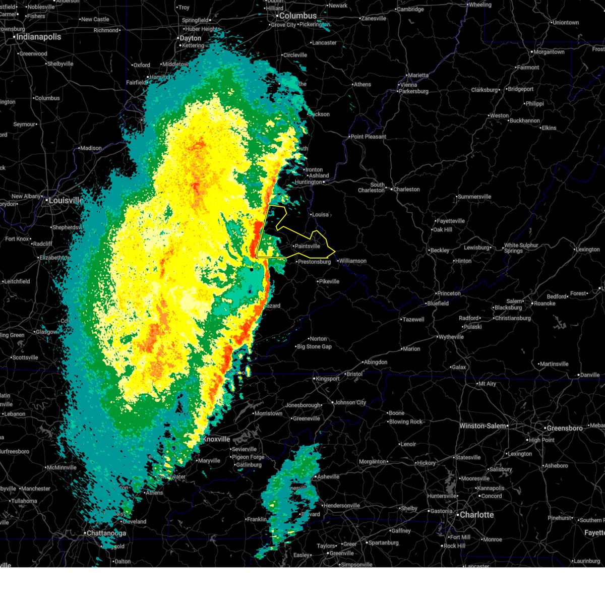
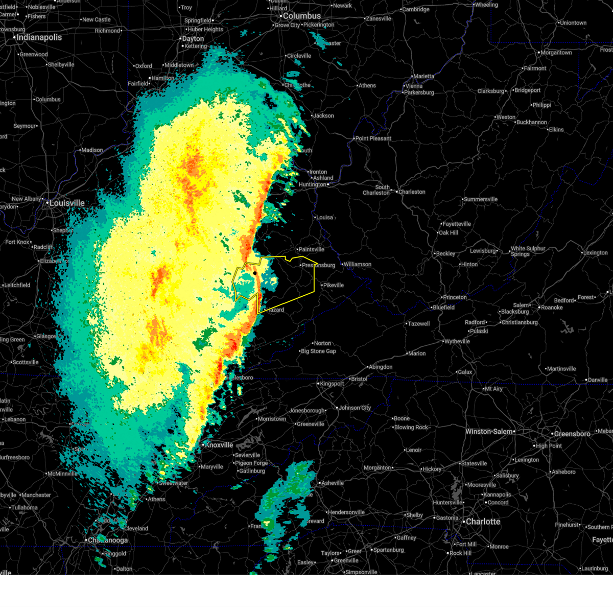
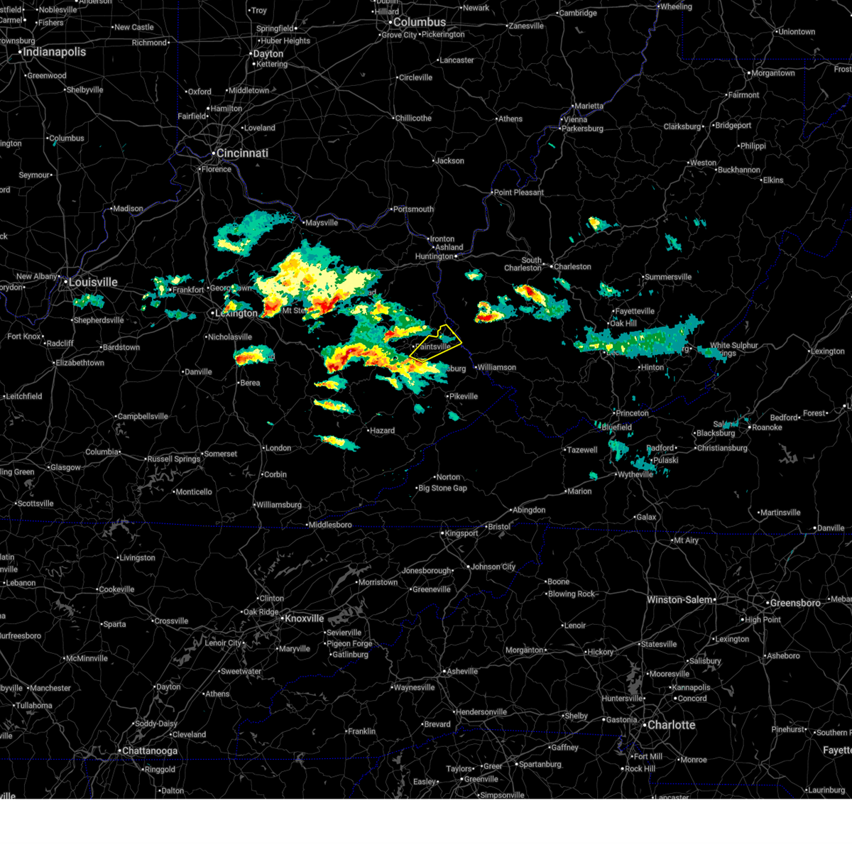
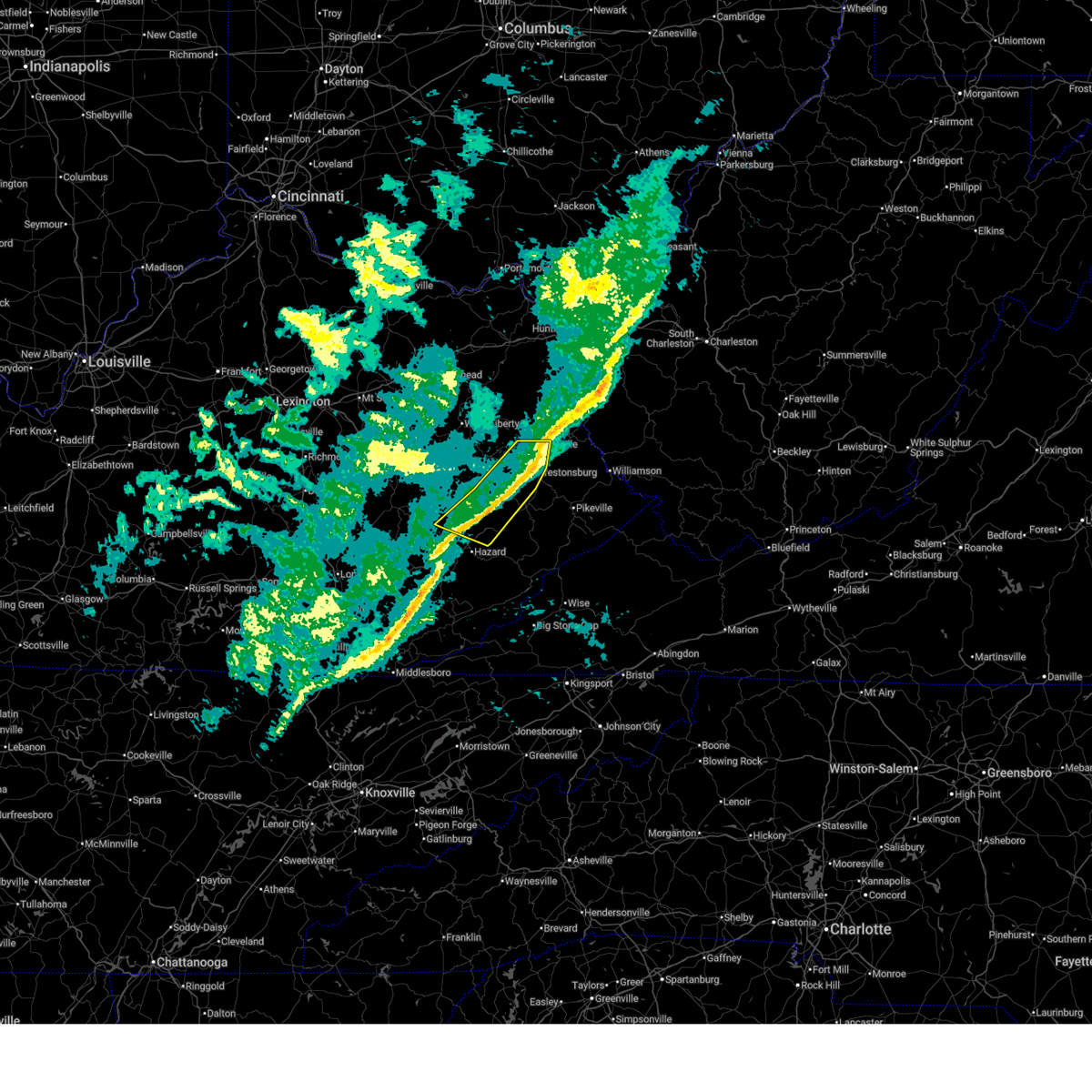
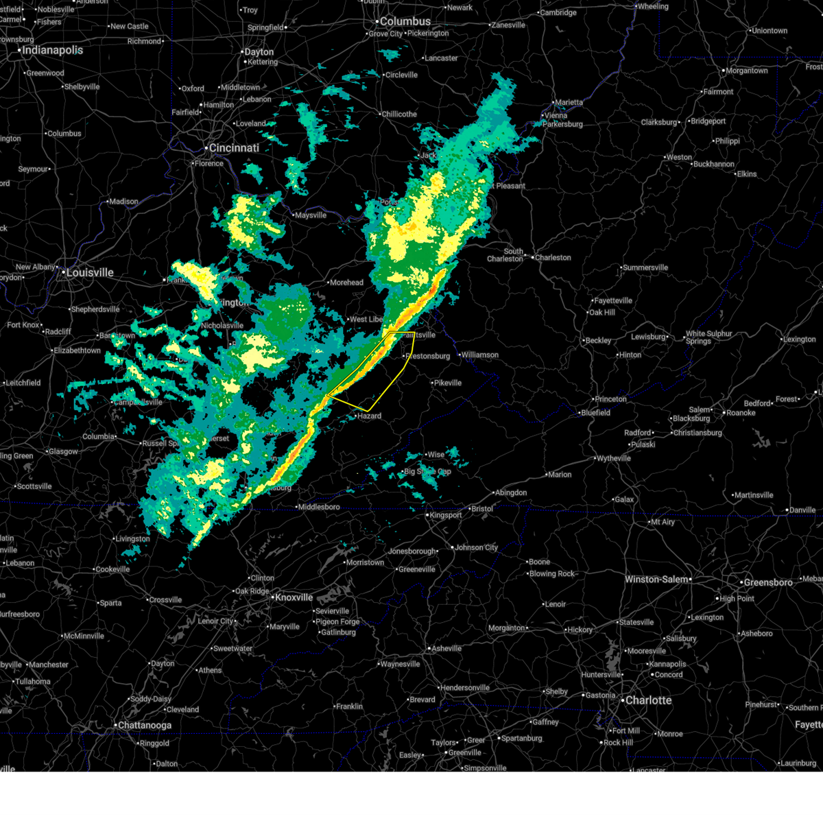
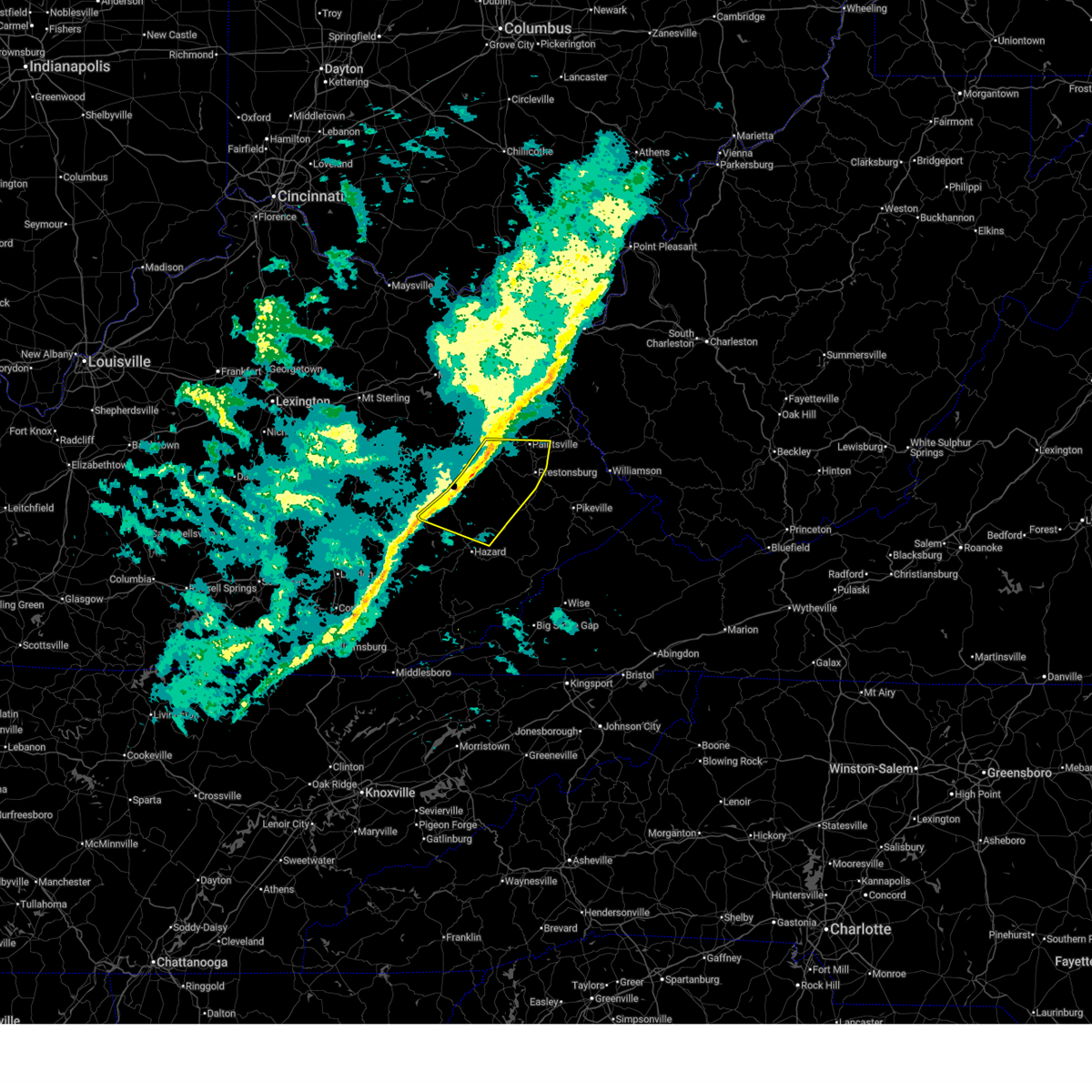
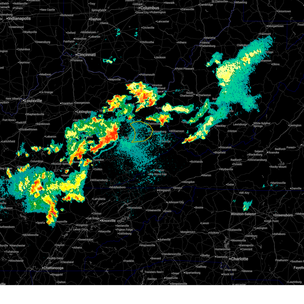
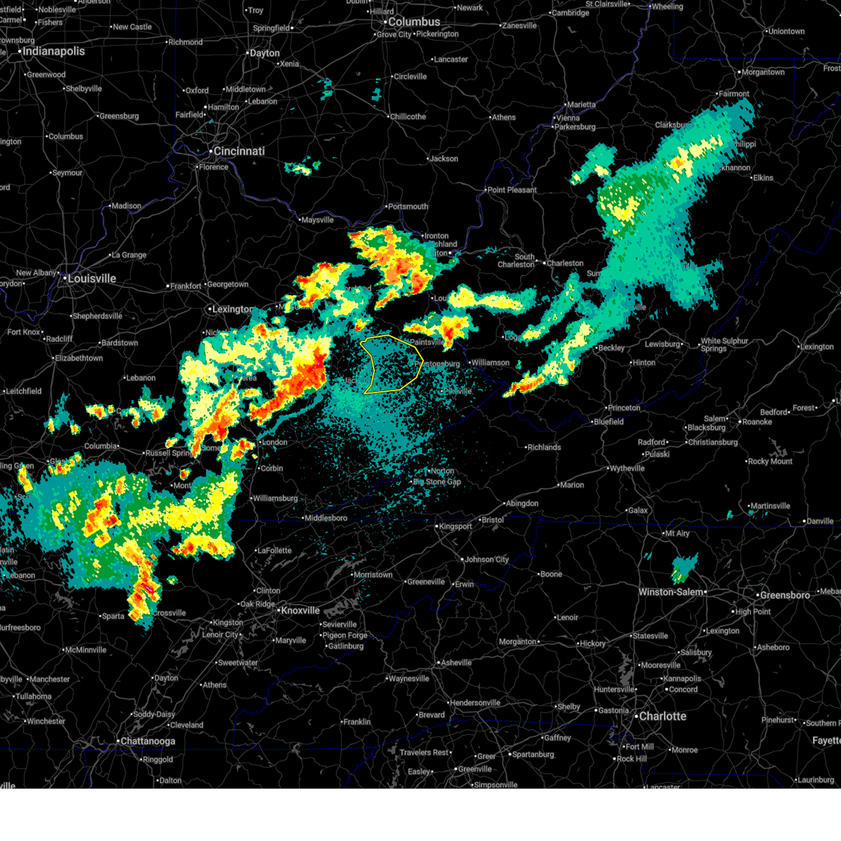
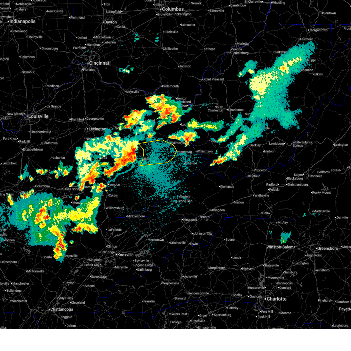
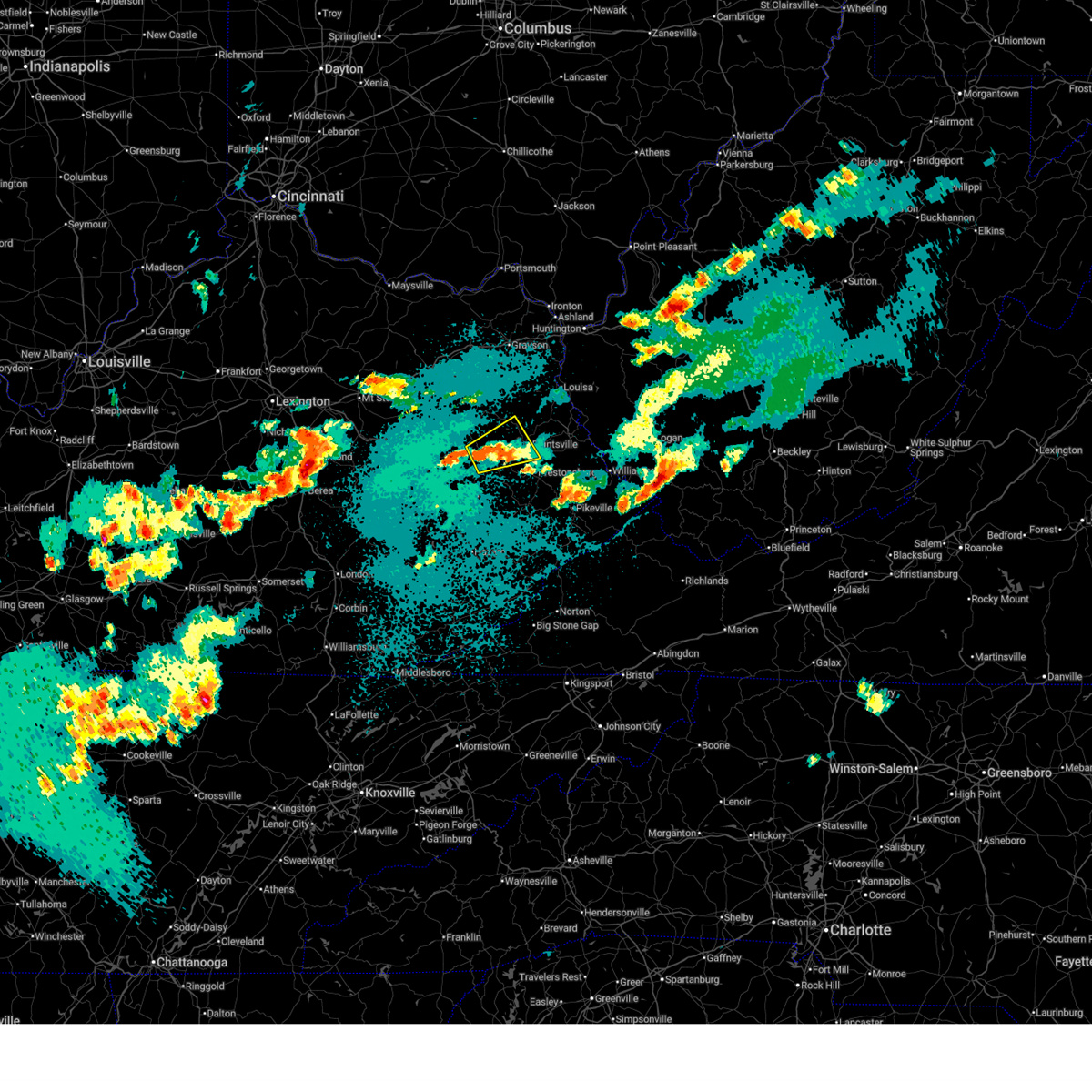
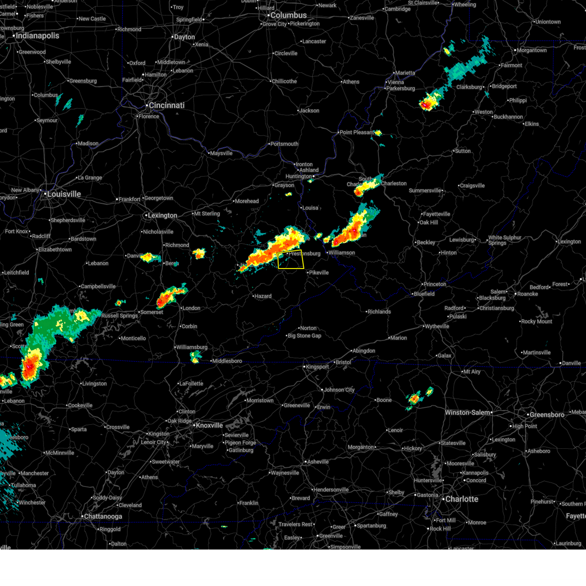
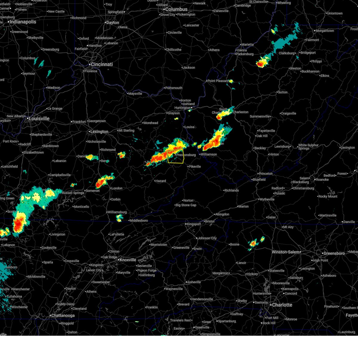
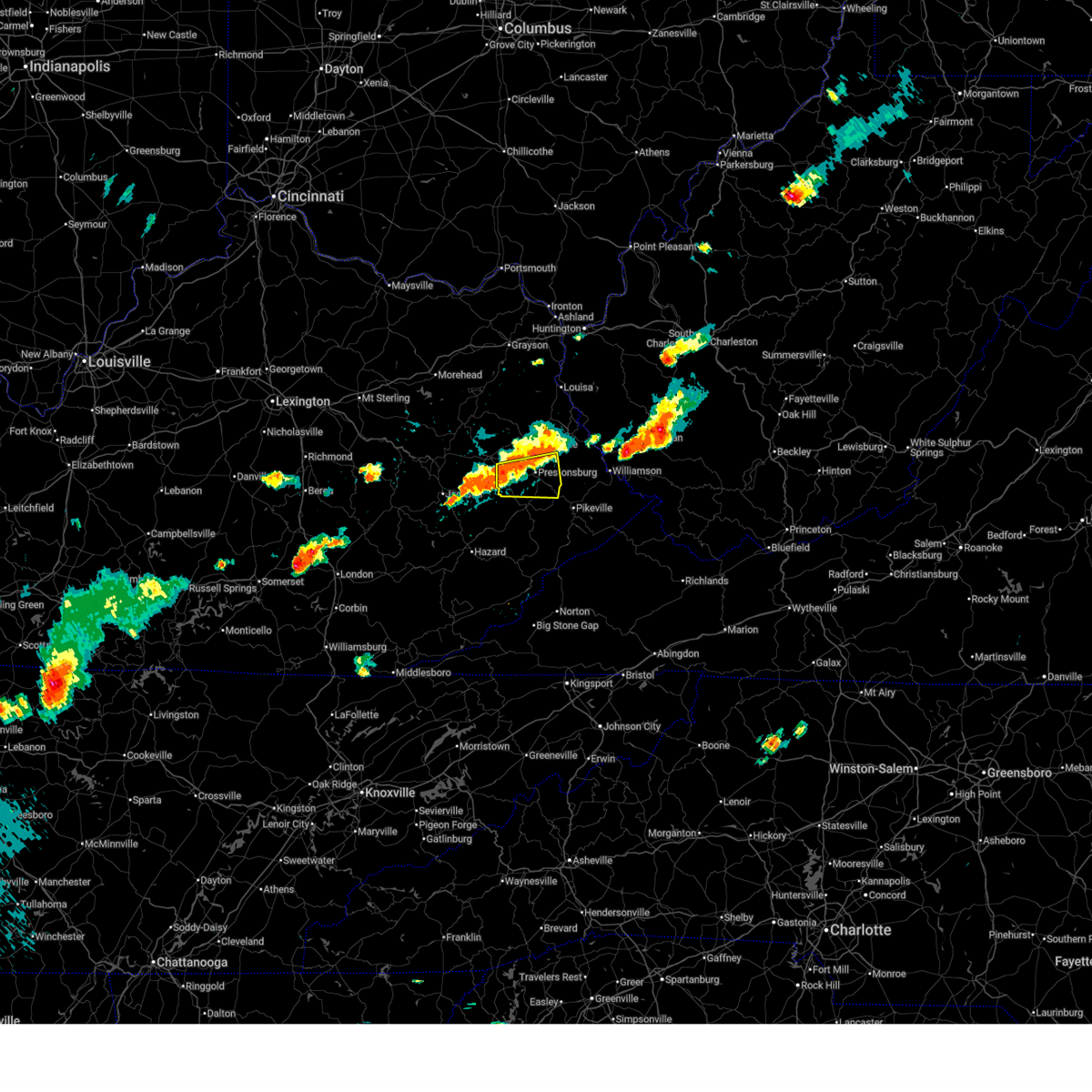
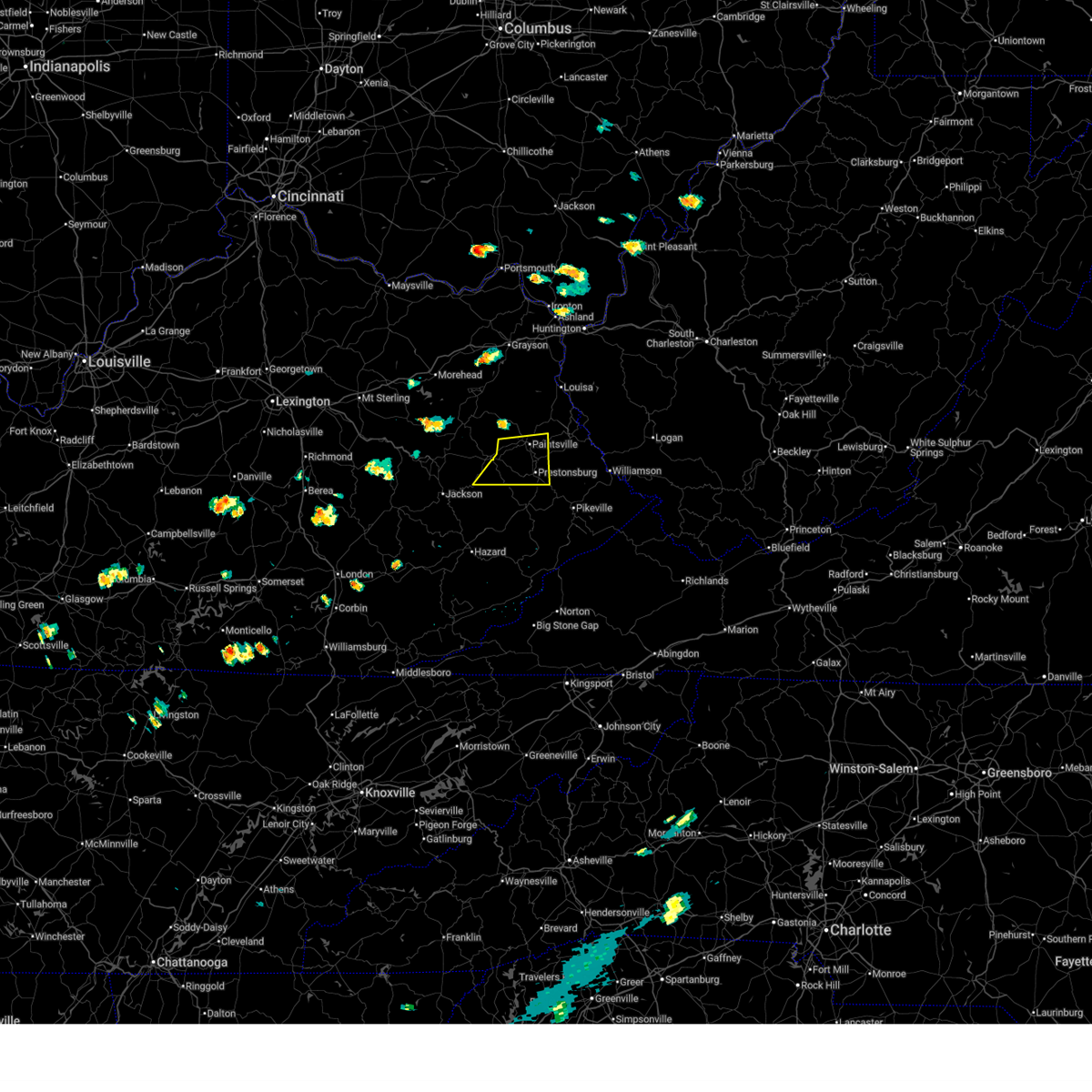
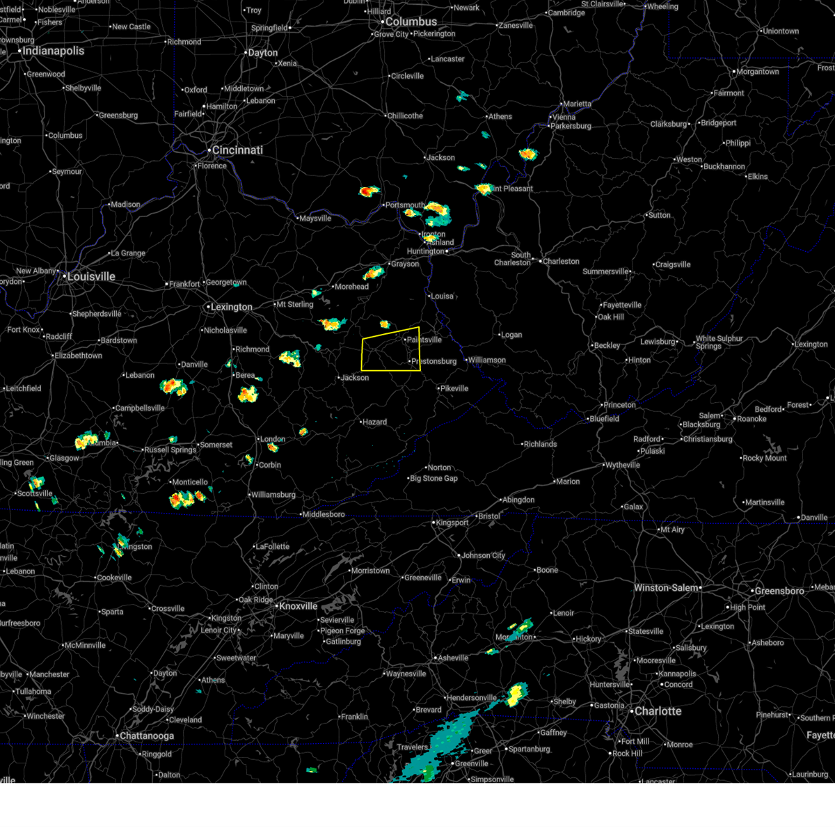
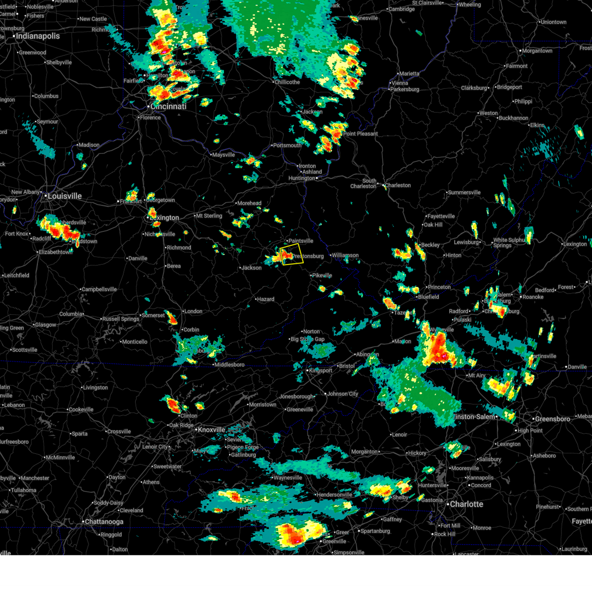
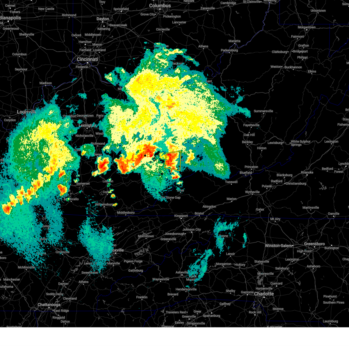
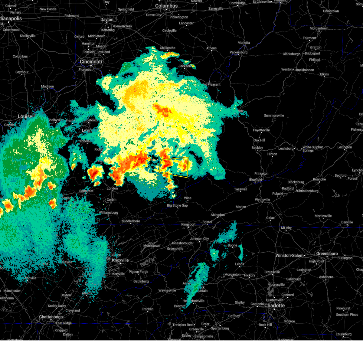
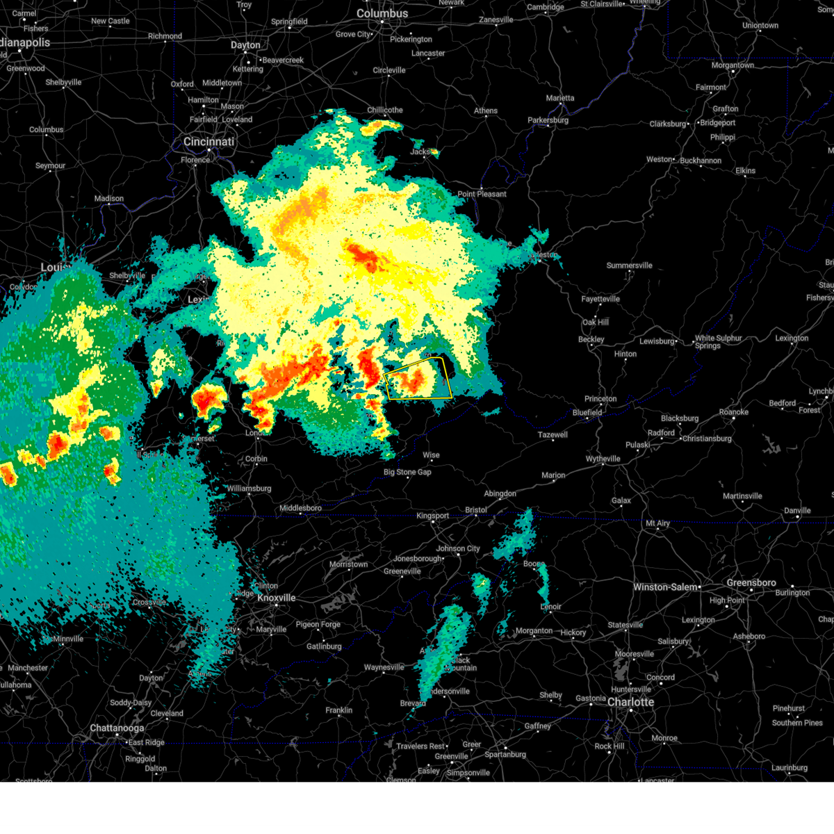
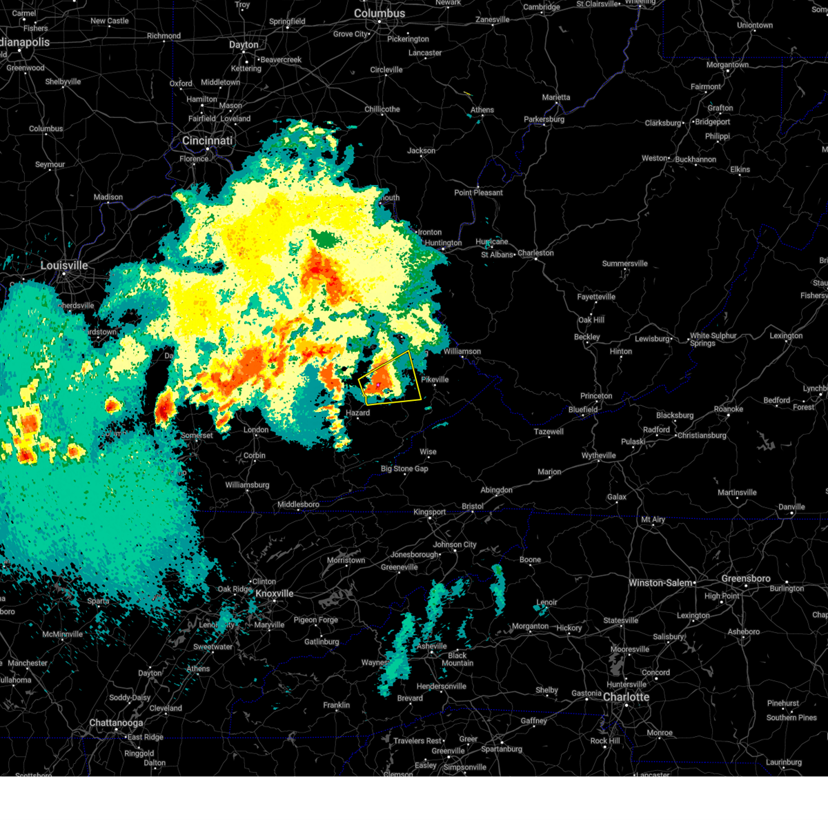
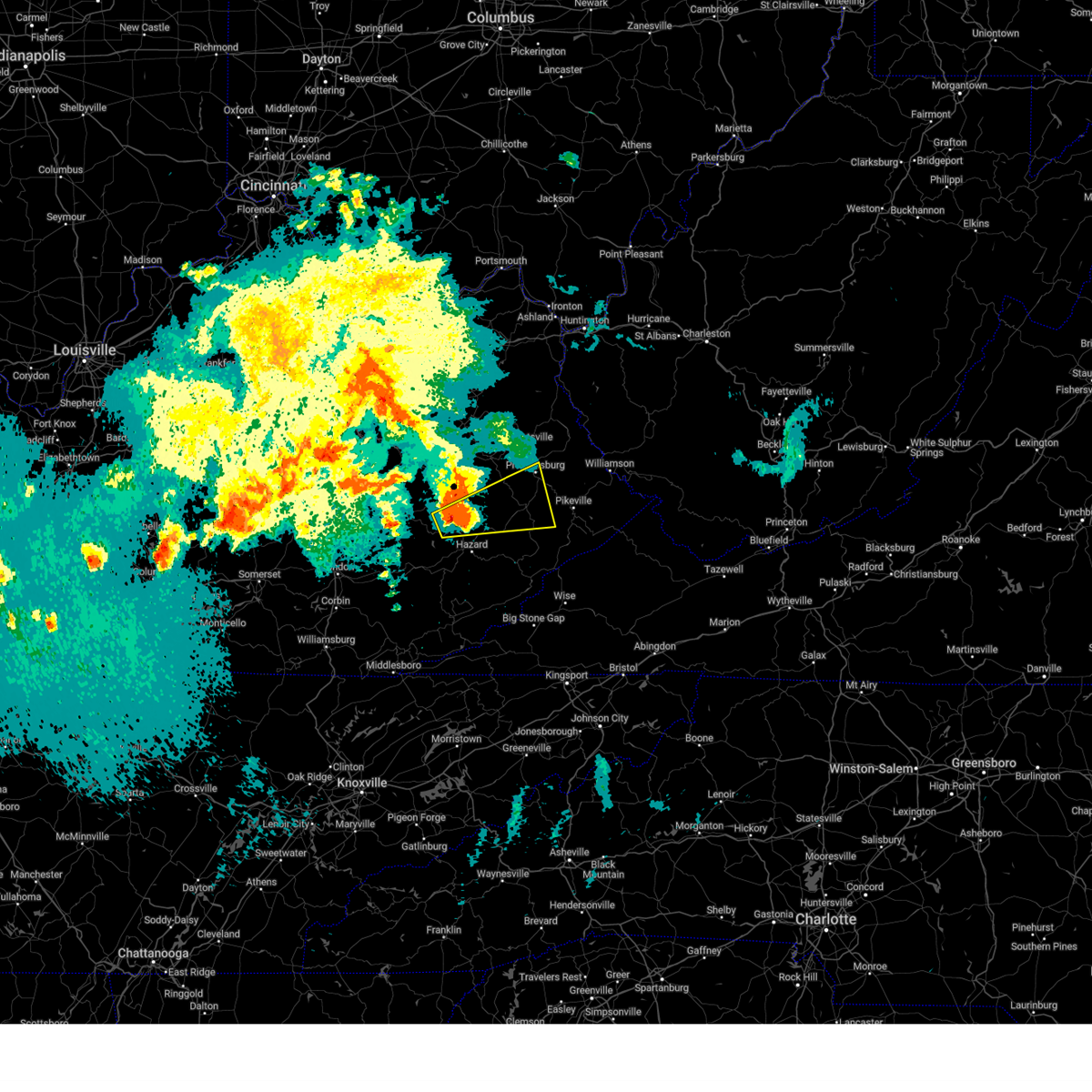
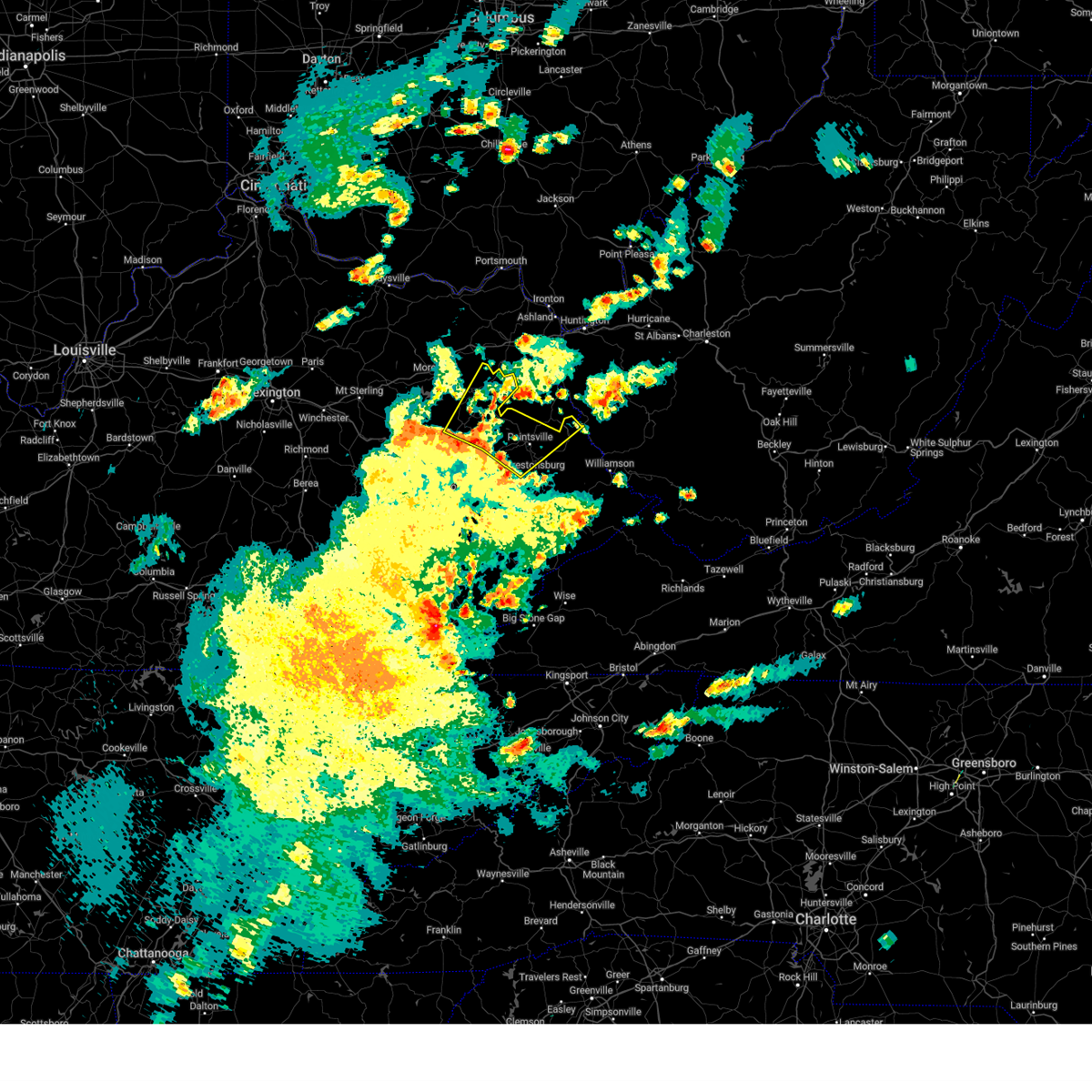
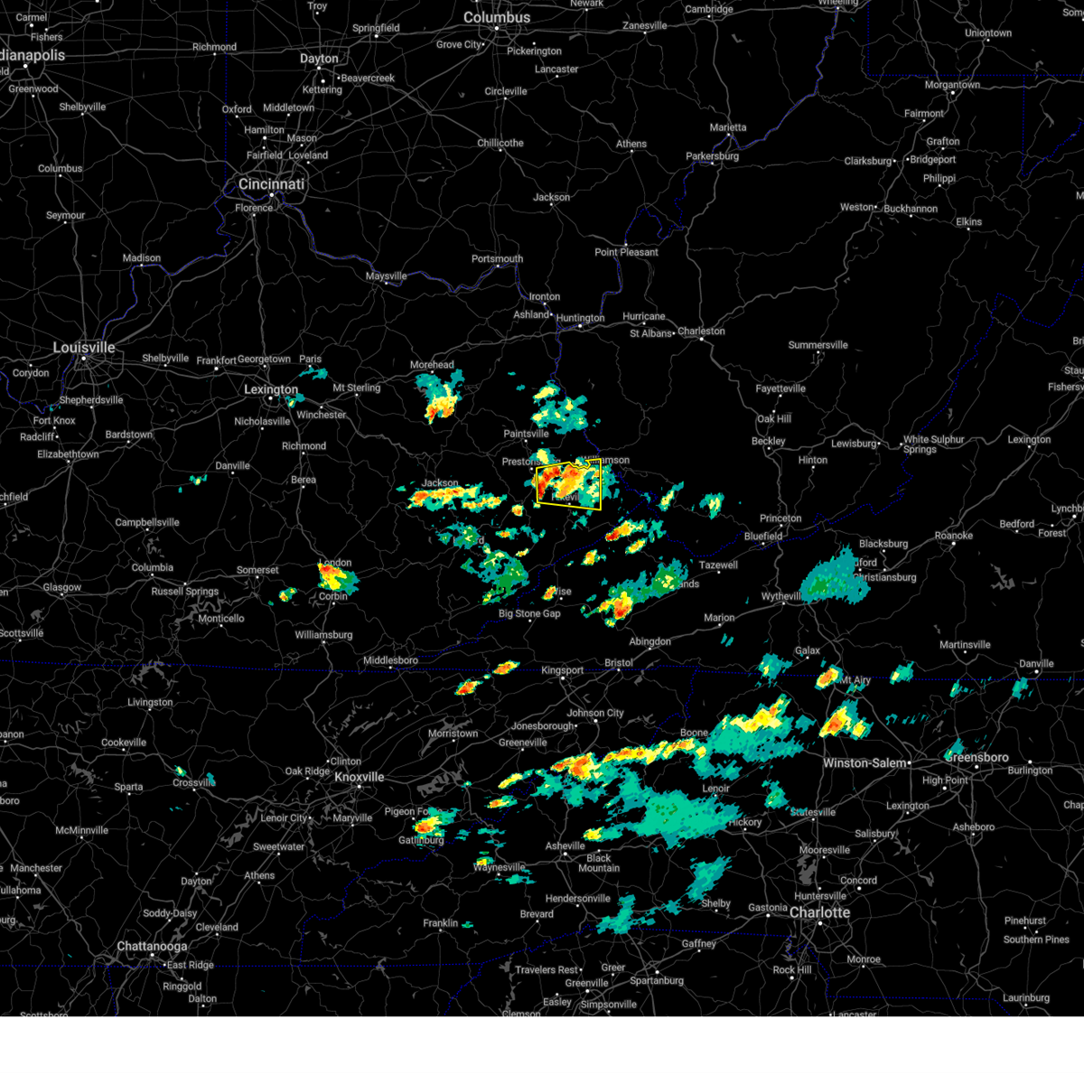
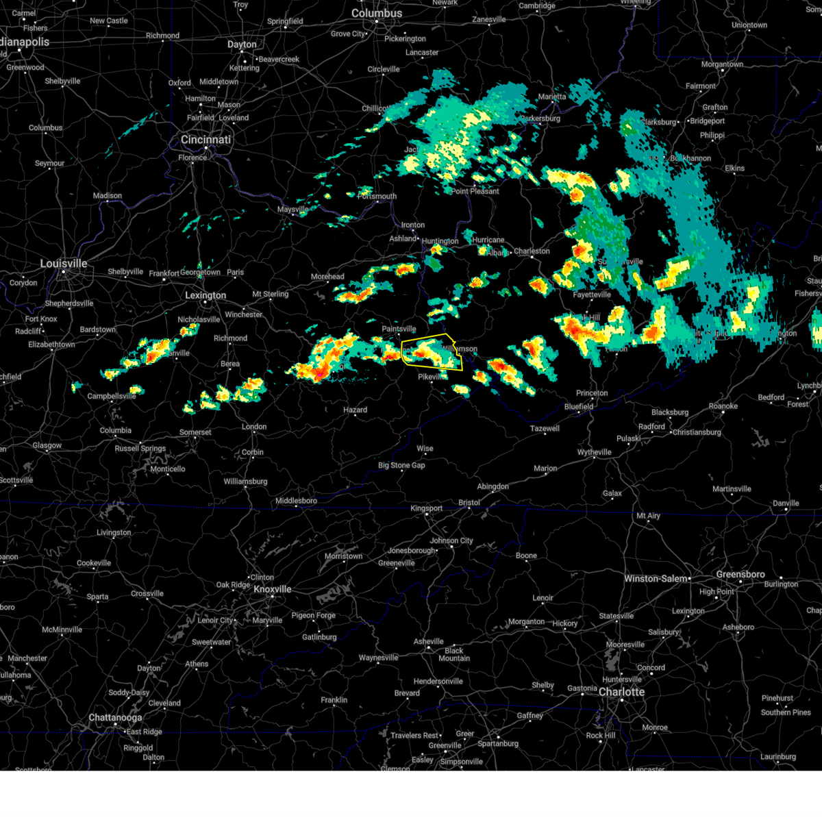
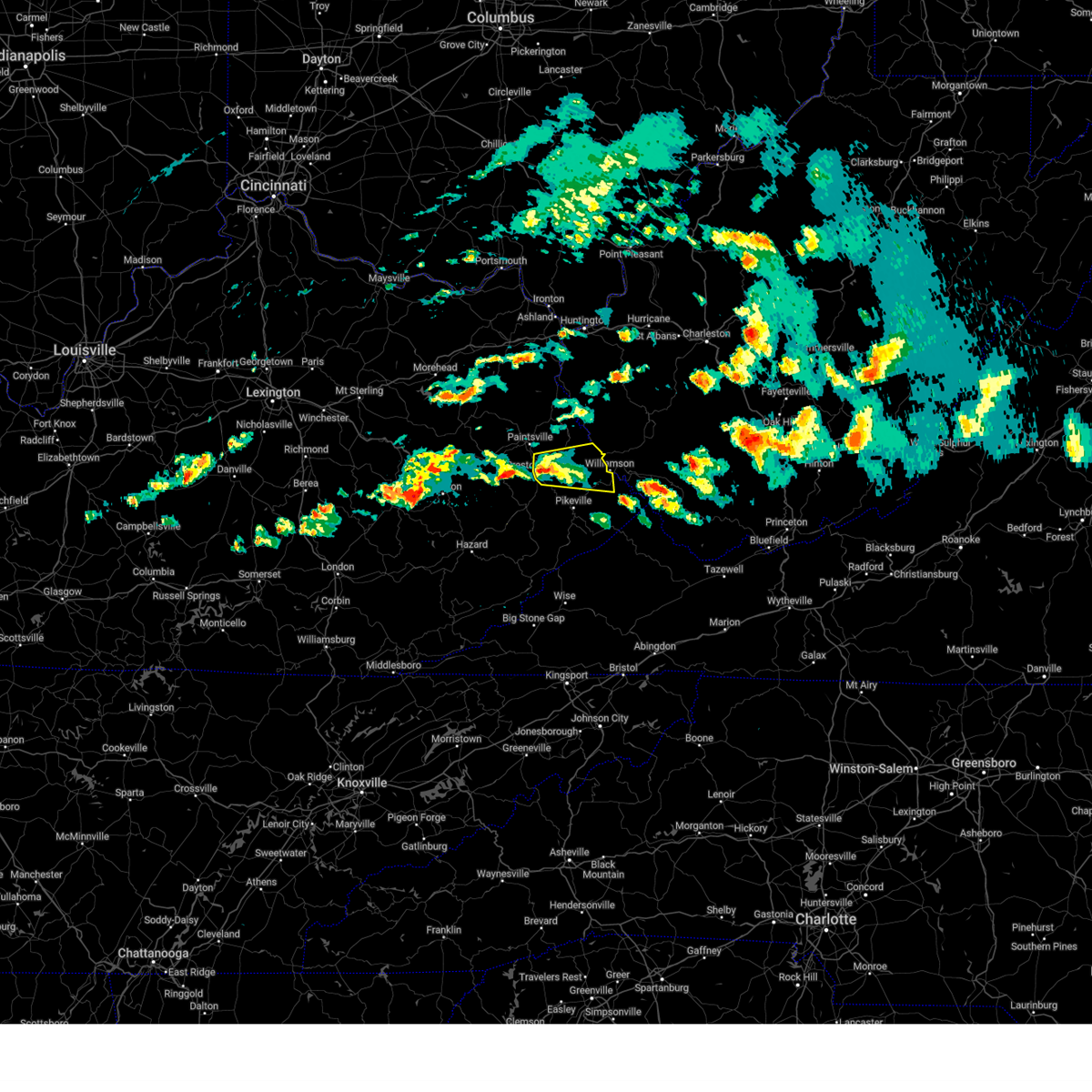
Hail Map for Prestonsburg, KY
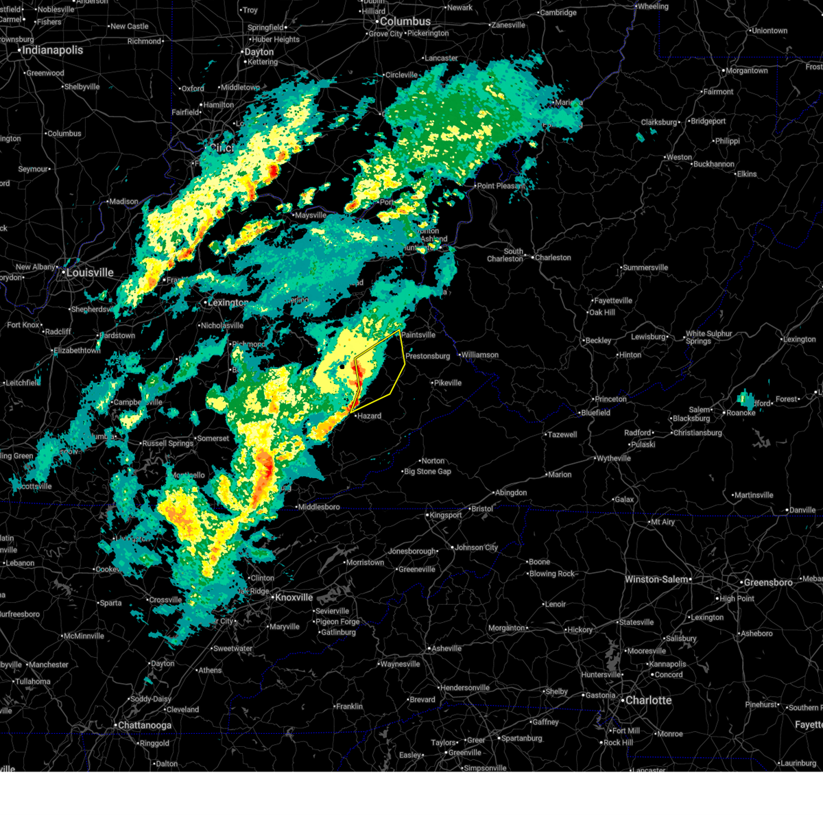
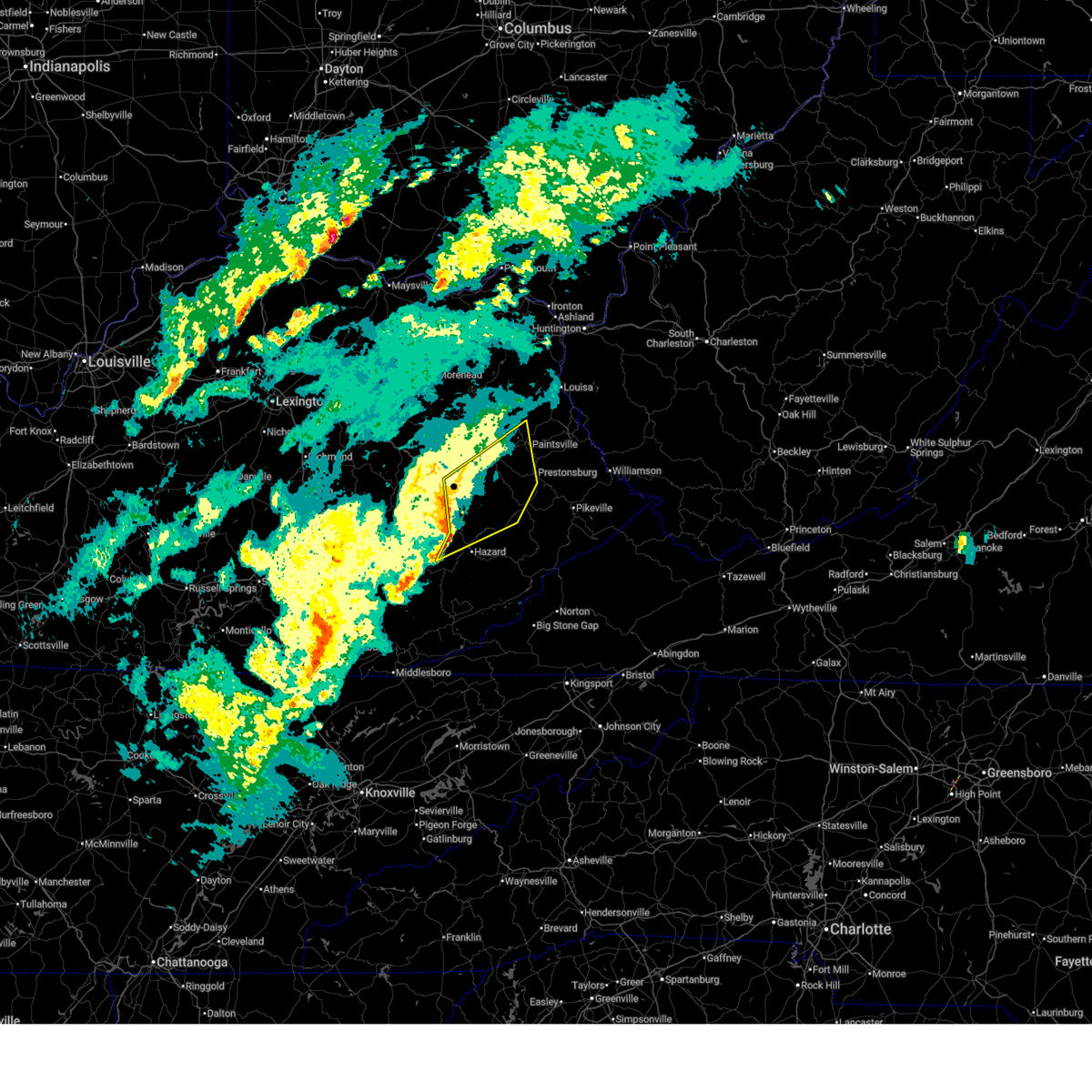
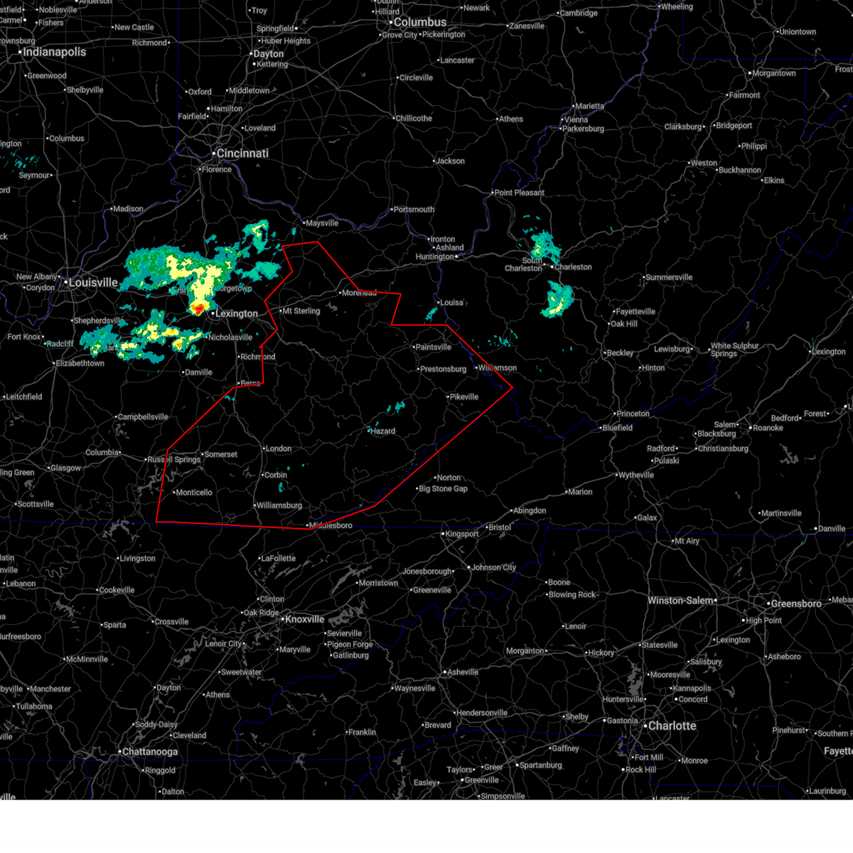
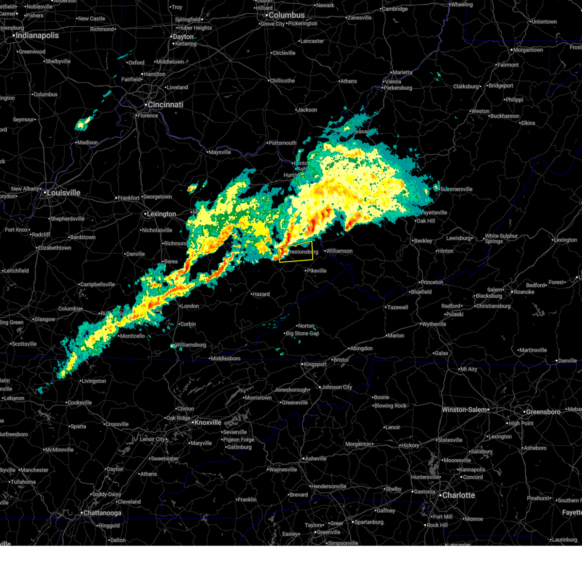
The Prestonsburg, KY area has had 7 reports of on-the-ground hail by trained spotters, and has been under severe weather warnings 47 times during the past 12 months. Doppler radar has detected hail at or near Prestonsburg, KY on 65 occasions, including 3 occasions during the past year.
| Name: | Prestonsburg, KY |
| Where Located: | 66.3 miles E of Irvine, KY |
| Map: | Google Map for Prestonsburg, KY |
| Population: | 3255 |
| Housing Units: | 1529 |
| More Info: | Search Google for Prestonsburg, KY |
1
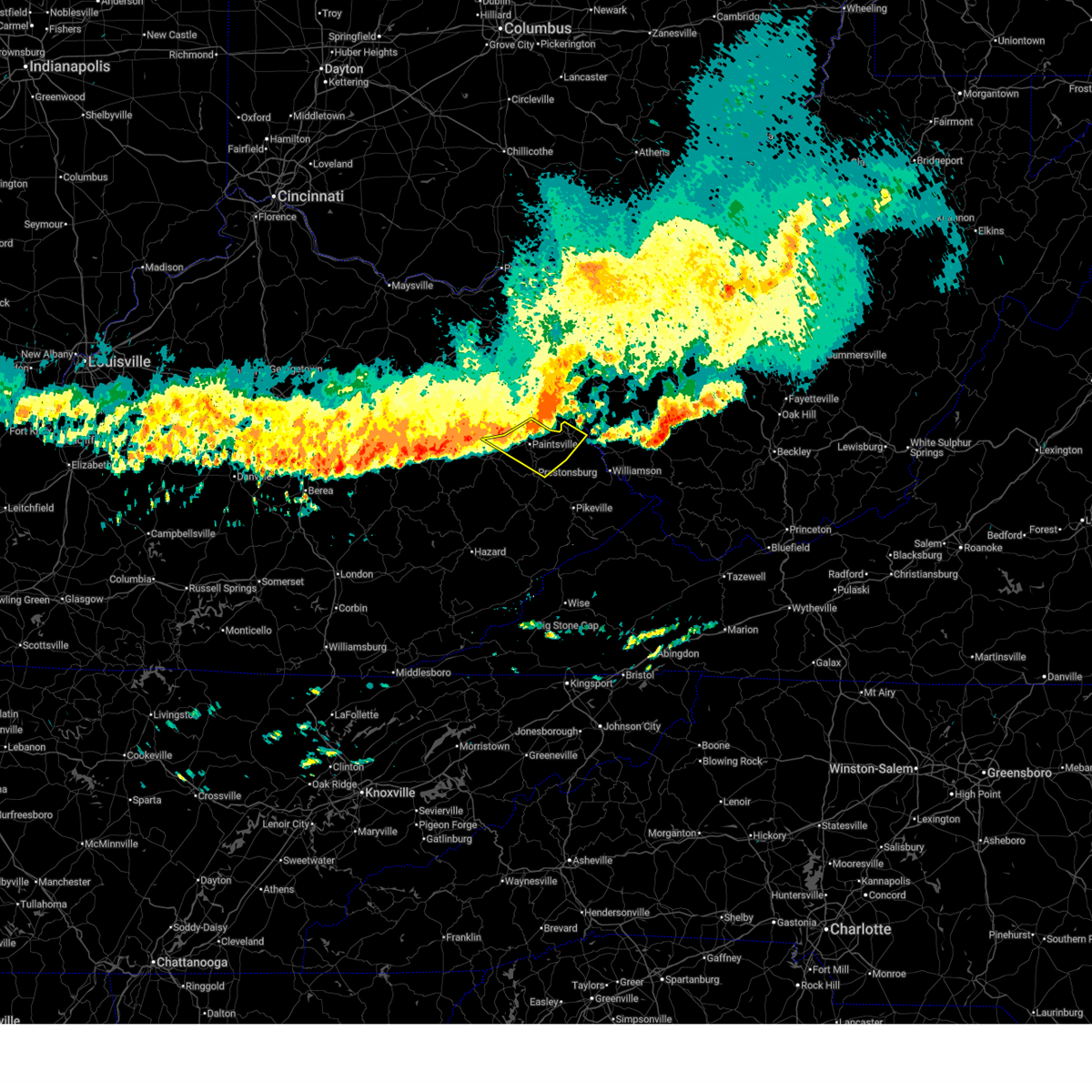
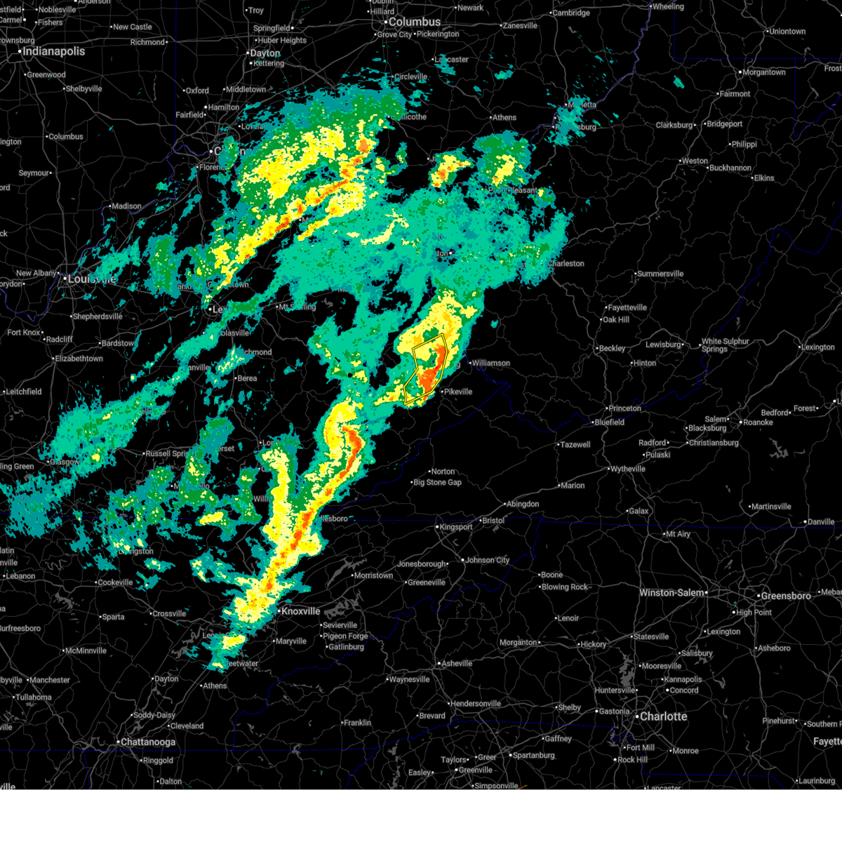
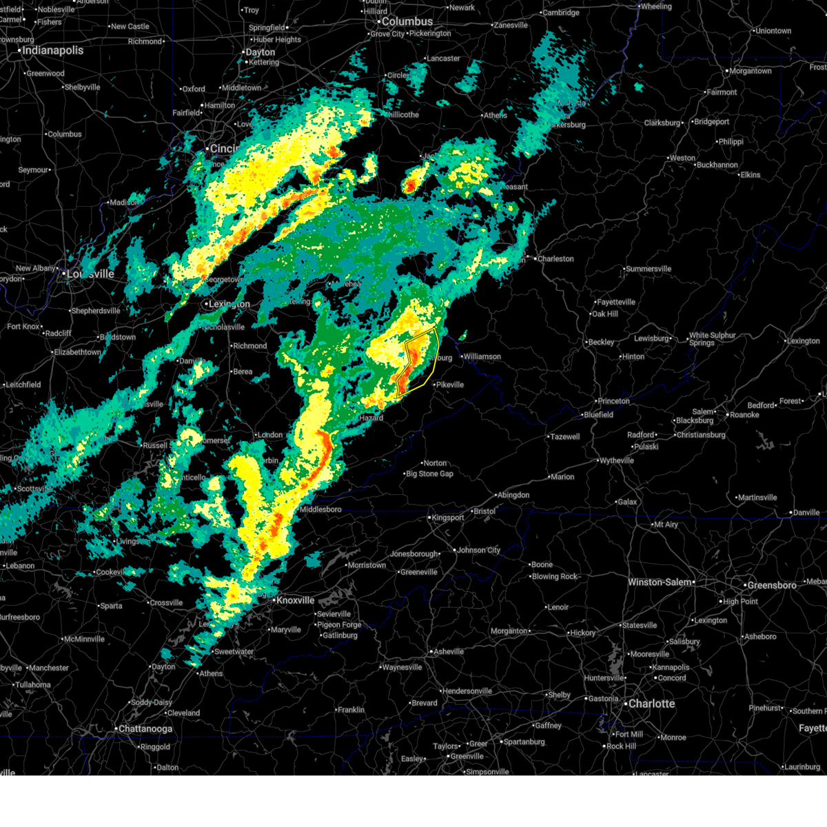
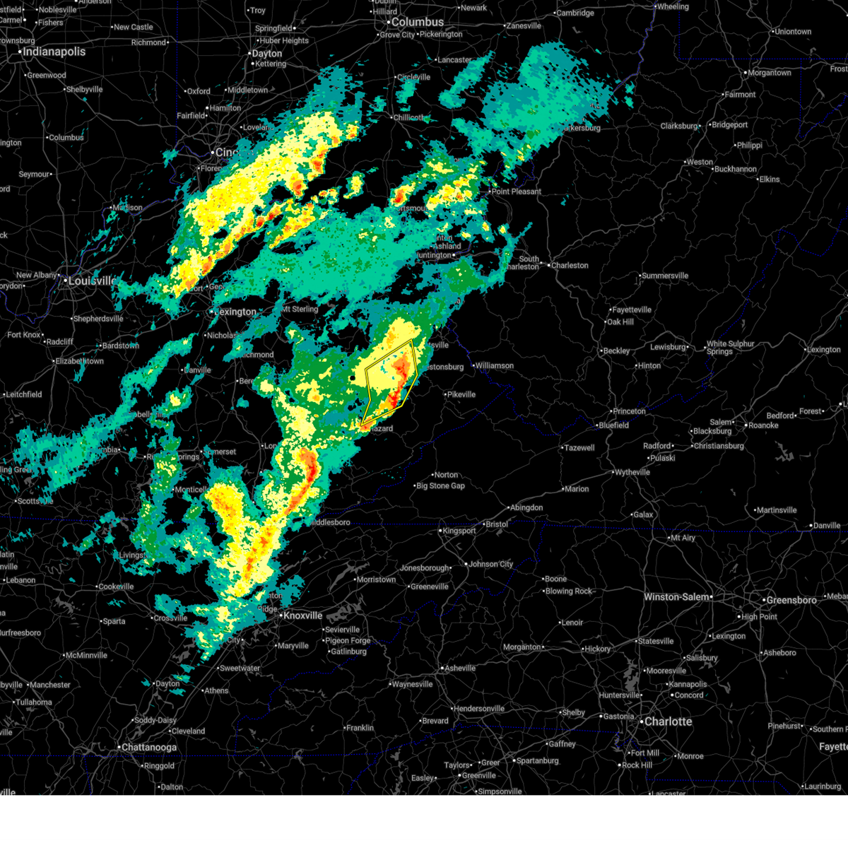
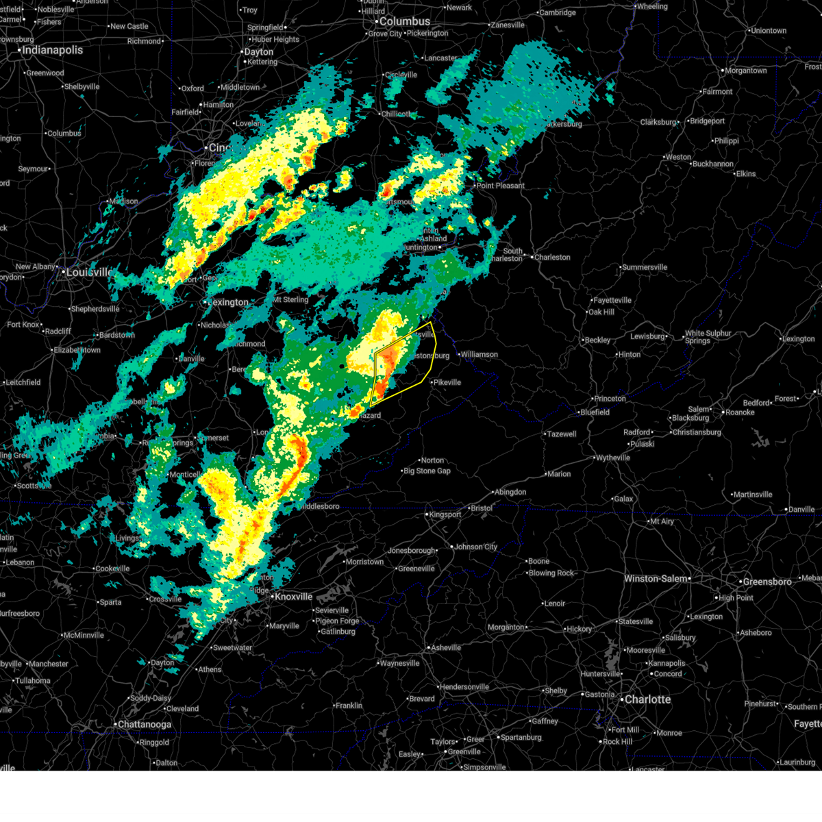
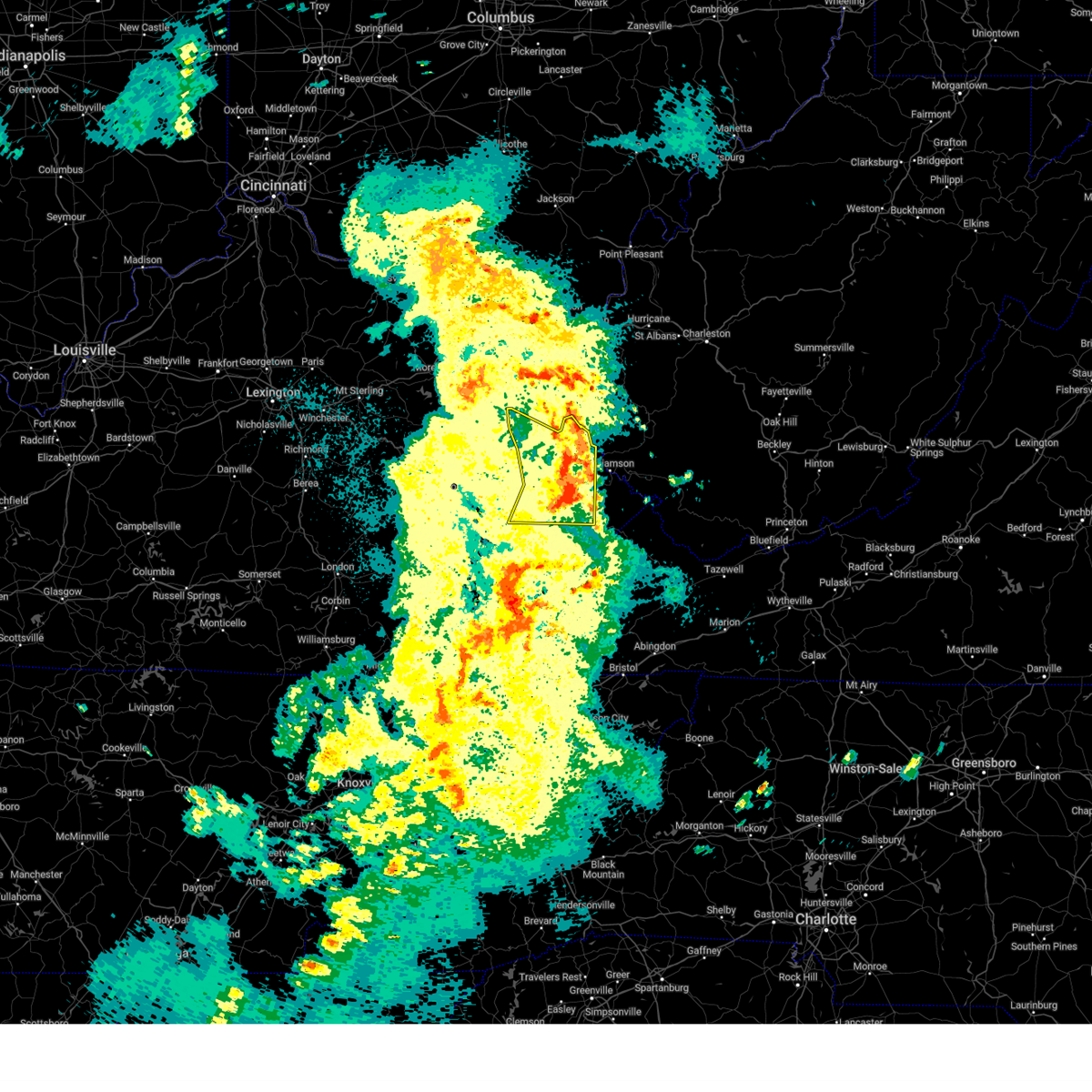
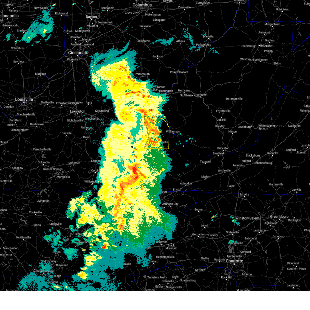
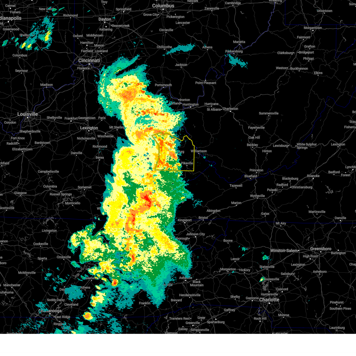
The Top Recent Hail Date for Prestonsburg, KY is Thursday, February 19, 2026 (11th out of 65)
Hail and Wind Damage Spotted near Prestonsburg, KY
| Date / Time | Report Details |
|---|---|
| 6/18/2026 7:08 AM EDT |
 At 708 am edt, severe thunderstorms were located along a line extending from near ulysses to paintsville to falcon, moving east at 45 mph (radar indicated). Hazards include 60 mph wind gusts. Expect damage to roofs, siding, and trees. Locations impacted include, paintsville and pevier. At 708 am edt, severe thunderstorms were located along a line extending from near ulysses to paintsville to falcon, moving east at 45 mph (radar indicated). Hazards include 60 mph wind gusts. Expect damage to roofs, siding, and trees. Locations impacted include, paintsville and pevier.
|
| 6/18/2026 6:52 AM EDT |
 Svrjkl the national weather service in jackson ky has issued a * severe thunderstorm warning for, western martin county in northeastern kentucky, east central morgan county in southeastern kentucky, johnson county in northeastern kentucky, north central floyd county in southeastern kentucky, northeastern magoffin county in southeastern kentucky, * until 715 am edt. * at 652 am edt, severe thunderstorms were located along a line extending from martha to ophir to florress, moving southeast at 45 mph (radar indicated). Hazards include 60 mph wind gusts. Expect damage to roofs, siding, and trees. severe thunderstorms will be near, coon around 655 am edt. paintsville around 700 am edt. Chestnut around 705 am edt. Svrjkl the national weather service in jackson ky has issued a * severe thunderstorm warning for, western martin county in northeastern kentucky, east central morgan county in southeastern kentucky, johnson county in northeastern kentucky, north central floyd county in southeastern kentucky, northeastern magoffin county in southeastern kentucky, * until 715 am edt. * at 652 am edt, severe thunderstorms were located along a line extending from martha to ophir to florress, moving southeast at 45 mph (radar indicated). Hazards include 60 mph wind gusts. Expect damage to roofs, siding, and trees. severe thunderstorms will be near, coon around 655 am edt. paintsville around 700 am edt. Chestnut around 705 am edt.
|
| 5/24/2026 5:01 PM EDT |
 At 501 pm edt, severe thunderstorms were located along a line extending from odds to near endicott to aluba, moving east at 40 mph (radar indicated). Hazards include 60 mph wind gusts and penny size hail. Expect damage to roofs, siding, and trees. These severe storms will be near, gulnare around 505 pm edt. At 501 pm edt, severe thunderstorms were located along a line extending from odds to near endicott to aluba, moving east at 40 mph (radar indicated). Hazards include 60 mph wind gusts and penny size hail. Expect damage to roofs, siding, and trees. These severe storms will be near, gulnare around 505 pm edt.
|
| 5/24/2026 4:52 PM EDT |
 At 451 pm edt, severe thunderstorms were located along a line extending from auxier to alvin to blue moon, moving northeast at 35 mph (radar indicated). Hazards include 60 mph wind gusts and penny size hail. Expect damage to roofs, siding, and trees. these severe storms will be near, prestonsburg around 455 pm edt. davella around 500 pm edt. Other locations in the path of these severe thunderstorms include delong. At 451 pm edt, severe thunderstorms were located along a line extending from auxier to alvin to blue moon, moving northeast at 35 mph (radar indicated). Hazards include 60 mph wind gusts and penny size hail. Expect damage to roofs, siding, and trees. these severe storms will be near, prestonsburg around 455 pm edt. davella around 500 pm edt. Other locations in the path of these severe thunderstorms include delong.
|
| 5/24/2026 4:52 PM EDT |
 the severe thunderstorm warning has been cancelled and is no longer in effect the severe thunderstorm warning has been cancelled and is no longer in effect
|
| 5/24/2026 4:42 PM EDT |
 Svrjkl the national weather service in jackson ky has issued a * severe thunderstorm warning for, southwestern martin county in northeastern kentucky, southeastern johnson county in northeastern kentucky, north central knott county in southeastern kentucky, floyd county in southeastern kentucky, northwestern pike county in southeastern kentucky, * until 515 pm edt. * at 442 pm edt, severe thunderstorms were located along a line extending from bonanza to dock to porter junction, moving northeast at 40 mph (radar indicated). Hazards include 60 mph wind gusts and penny size hail. Expect damage to roofs, siding, and trees. severe thunderstorms will be near, paintsville around 445 pm edt. perston estates around 450 pm edt. offutt around 455 pm edt. gulnare around 500 pm edt. Other locations in the path of these severe thunderstorms include chestnut. Svrjkl the national weather service in jackson ky has issued a * severe thunderstorm warning for, southwestern martin county in northeastern kentucky, southeastern johnson county in northeastern kentucky, north central knott county in southeastern kentucky, floyd county in southeastern kentucky, northwestern pike county in southeastern kentucky, * until 515 pm edt. * at 442 pm edt, severe thunderstorms were located along a line extending from bonanza to dock to porter junction, moving northeast at 40 mph (radar indicated). Hazards include 60 mph wind gusts and penny size hail. Expect damage to roofs, siding, and trees. severe thunderstorms will be near, paintsville around 445 pm edt. perston estates around 450 pm edt. offutt around 455 pm edt. gulnare around 500 pm edt. Other locations in the path of these severe thunderstorms include chestnut.
|
| 3/16/2026 4:28 AM EDT |
 The storms which prompted the warning have moved out of the area. therefore, the warning will be allowed to expire. however, gusty winds are still possible with these thunderstorms. a severe thunderstorm watch remains in effect until 700 am edt for southeastern and northeastern kentucky. to report severe weather, contact your nearest law enforcement agency. they will relay your report to the national weather service jackson ky. The storms which prompted the warning have moved out of the area. therefore, the warning will be allowed to expire. however, gusty winds are still possible with these thunderstorms. a severe thunderstorm watch remains in effect until 700 am edt for southeastern and northeastern kentucky. to report severe weather, contact your nearest law enforcement agency. they will relay your report to the national weather service jackson ky.
|
| 3/16/2026 4:28 AM EDT |
 The storm which prompted the warning has moved out of the area. therefore, the warning will be allowed to expire. however, gusty winds are still possible with this thunderstorm. a severe thunderstorm watch remains in effect until 700 am edt for southeastern and northeastern kentucky. to report severe weather, contact your nearest law enforcement agency. they will relay your report to the national weather service jackson ky. The storm which prompted the warning has moved out of the area. therefore, the warning will be allowed to expire. however, gusty winds are still possible with this thunderstorm. a severe thunderstorm watch remains in effect until 700 am edt for southeastern and northeastern kentucky. to report severe weather, contact your nearest law enforcement agency. they will relay your report to the national weather service jackson ky.
|
| 3/16/2026 4:11 AM EDT |
 the severe thunderstorm warning has been cancelled and is no longer in effect the severe thunderstorm warning has been cancelled and is no longer in effect
|
| 3/16/2026 4:11 AM EDT |
 At 411 am edt, severe thunderstorms were located along a line extending from near webbville to conley, moving east at 40 mph (radar indicated). Hazards include 60 mph wind gusts. Expect damage to roofs, siding, and trees. Locations impacted include, paintsville, perston estates, meally, odds and add. At 411 am edt, severe thunderstorms were located along a line extending from near webbville to conley, moving east at 40 mph (radar indicated). Hazards include 60 mph wind gusts. Expect damage to roofs, siding, and trees. Locations impacted include, paintsville, perston estates, meally, odds and add.
|
| 3/16/2026 3:58 AM EDT |
 At 358 am edt, a severe thunderstorm was located over orchard, or 10 miles southwest of prestonsburg, moving east at 55 mph (radar indicated). Hazards include 60 mph wind gusts. Expect damage to roofs, siding, and trees. Locations impacted include, prestonsburg, alvin and harold. At 358 am edt, a severe thunderstorm was located over orchard, or 10 miles southwest of prestonsburg, moving east at 55 mph (radar indicated). Hazards include 60 mph wind gusts. Expect damage to roofs, siding, and trees. Locations impacted include, prestonsburg, alvin and harold.
|
| 3/16/2026 3:58 AM EDT |
 the severe thunderstorm warning has been cancelled and is no longer in effect the severe thunderstorm warning has been cancelled and is no longer in effect
|
| 3/16/2026 3:51 AM EDT |
 Svrjkl the national weather service in jackson ky has issued a * severe thunderstorm warning for, martin county in northeastern kentucky, southeastern morgan county in southeastern kentucky, johnson county in northeastern kentucky, northern magoffin county in southeastern kentucky, central elliott county in east central kentucky, * until 430 am edt. * at 351 am edt, severe thunderstorms were located along a line extending from newfoundland to hager, moving east at 40 mph (radar indicated). Hazards include 60 mph wind gusts. Expect damage to roofs, siding, and trees. severe thunderstorms will be near, salyersville around 355 am edt. elna around 400 am edt. flatgap around 405 am edt. paintsville around 410 am edt. Other locations in the path of these severe thunderstorms include stambaugh and perston estates. Svrjkl the national weather service in jackson ky has issued a * severe thunderstorm warning for, martin county in northeastern kentucky, southeastern morgan county in southeastern kentucky, johnson county in northeastern kentucky, northern magoffin county in southeastern kentucky, central elliott county in east central kentucky, * until 430 am edt. * at 351 am edt, severe thunderstorms were located along a line extending from newfoundland to hager, moving east at 40 mph (radar indicated). Hazards include 60 mph wind gusts. Expect damage to roofs, siding, and trees. severe thunderstorms will be near, salyersville around 355 am edt. elna around 400 am edt. flatgap around 405 am edt. paintsville around 410 am edt. Other locations in the path of these severe thunderstorms include stambaugh and perston estates.
|
| 3/16/2026 3:39 AM EDT |
 Svrjkl the national weather service in jackson ky has issued a * severe thunderstorm warning for, northern perry county in southeastern kentucky, knott county in southeastern kentucky, floyd county in southeastern kentucky, breathitt county in southeastern kentucky, magoffin county in southeastern kentucky, * until 430 am edt. * at 339 am edt, a severe thunderstorm was located over rousseau, or 8 miles east of jackson, moving east at 55 mph (radar indicated). Hazards include 60 mph wind gusts. Expect damage to roofs, siding, and trees. this severe thunderstorm will be near, duco around 345 am edt. gapville around 350 am edt. pyramid around 355 am edt. Other locations in the path of this severe thunderstorm include dotson, prestonsburg and alvin. Svrjkl the national weather service in jackson ky has issued a * severe thunderstorm warning for, northern perry county in southeastern kentucky, knott county in southeastern kentucky, floyd county in southeastern kentucky, breathitt county in southeastern kentucky, magoffin county in southeastern kentucky, * until 430 am edt. * at 339 am edt, a severe thunderstorm was located over rousseau, or 8 miles east of jackson, moving east at 55 mph (radar indicated). Hazards include 60 mph wind gusts. Expect damage to roofs, siding, and trees. this severe thunderstorm will be near, duco around 345 am edt. gapville around 350 am edt. pyramid around 355 am edt. Other locations in the path of this severe thunderstorm include dotson, prestonsburg and alvin.
|
| 3/11/2026 7:53 PM EDT |
 The storms which prompted the warning have weakened below severe limits, and have exited the warned area. therefore, the warning will be allowed to expire. however, gusty winds are still possible with these thunderstorms. The storms which prompted the warning have weakened below severe limits, and have exited the warned area. therefore, the warning will be allowed to expire. however, gusty winds are still possible with these thunderstorms.
|
| 3/11/2026 7:38 PM EDT |
 the severe thunderstorm warning has been cancelled and is no longer in effect the severe thunderstorm warning has been cancelled and is no longer in effect
|
| 3/11/2026 7:38 PM EDT |
 At 738 pm edt, severe thunderstorms were located along a line extending from meally to endicott to printer to drift to demo, moving east at 50 mph (radar indicated). Hazards include 60 mph wind gusts. Expect damage to roofs, siding, and trees. Locations impacted include, inez. At 738 pm edt, severe thunderstorms were located along a line extending from meally to endicott to printer to drift to demo, moving east at 50 mph (radar indicated). Hazards include 60 mph wind gusts. Expect damage to roofs, siding, and trees. Locations impacted include, inez.
|
| 3/11/2026 7:25 PM EDT |
 The storms which prompted the warning have moved out of the area. therefore, the warning will be allowed to expire. The storms which prompted the warning have moved out of the area. therefore, the warning will be allowed to expire.
|
| 3/11/2026 7:24 PM EDT |
 Svrjkl the national weather service in jackson ky has issued a * severe thunderstorm warning for, western martin county in northeastern kentucky, southeastern johnson county in northeastern kentucky, northern knott county in southeastern kentucky, floyd county in southeastern kentucky, east central breathitt county in southeastern kentucky, northwestern pike county in southeastern kentucky, southeastern magoffin county in southeastern kentucky, * until 800 pm edt. * at 724 pm edt, severe thunderstorms were located along a line extending from riceville to pyramid to near handshoe to soft shell to hindman, moving northeast at 50 mph (radar indicated). Hazards include 60 mph wind gusts. Expect damage to roofs, siding, and trees. severe thunderstorms will be near, prestonsburg around 730 pm edt. dana around 735 pm edt. davisport around 740 pm edt. Other locations in the path of these severe thunderstorms include inez and bradbury. Svrjkl the national weather service in jackson ky has issued a * severe thunderstorm warning for, western martin county in northeastern kentucky, southeastern johnson county in northeastern kentucky, northern knott county in southeastern kentucky, floyd county in southeastern kentucky, east central breathitt county in southeastern kentucky, northwestern pike county in southeastern kentucky, southeastern magoffin county in southeastern kentucky, * until 800 pm edt. * at 724 pm edt, severe thunderstorms were located along a line extending from riceville to pyramid to near handshoe to soft shell to hindman, moving northeast at 50 mph (radar indicated). Hazards include 60 mph wind gusts. Expect damage to roofs, siding, and trees. severe thunderstorms will be near, prestonsburg around 730 pm edt. dana around 735 pm edt. davisport around 740 pm edt. Other locations in the path of these severe thunderstorms include inez and bradbury.
|
| 3/11/2026 7:11 PM EDT |
 At 710 pm edt, severe thunderstorms were located along a line extending from fritz to buck to bulan, moving northeast at 60 mph (radar indicated). Hazards include 60 mph wind gusts and penny size hail. Expect damage to roofs, siding, and trees. these severe storms will be near, mason around 715 pm edt. Other locations in the path of these severe thunderstorms include dotson and paintsville. At 710 pm edt, severe thunderstorms were located along a line extending from fritz to buck to bulan, moving northeast at 60 mph (radar indicated). Hazards include 60 mph wind gusts and penny size hail. Expect damage to roofs, siding, and trees. these severe storms will be near, mason around 715 pm edt. Other locations in the path of these severe thunderstorms include dotson and paintsville.
|
| 3/11/2026 7:11 PM EDT |
 the severe thunderstorm warning has been cancelled and is no longer in effect the severe thunderstorm warning has been cancelled and is no longer in effect
|
| 3/11/2026 6:58 PM EDT |
 Svrjkl the national weather service in jackson ky has issued a * severe thunderstorm warning for, north central leslie county in southeastern kentucky, western johnson county in northeastern kentucky, northeastern perry county in southeastern kentucky, northwestern knott county in southeastern kentucky, northwestern floyd county in southeastern kentucky, central breathitt county in southeastern kentucky, magoffin county in southeastern kentucky, southeastern wolfe county in southeastern kentucky, * until 730 pm edt. * at 658 pm edt, severe thunderstorms were located along a line extending from rock lick to dice to dryhill, moving northeast at 60 mph (radar indicated). Hazards include 60 mph wind gusts and penny size hail. Expect damage to roofs, siding, and trees. severe thunderstorms will be near, hazard around 705 pm edt. salyersville around 710 pm edt. gapville around 715 pm edt. Other locations in the path of these severe thunderstorms include dotson. Svrjkl the national weather service in jackson ky has issued a * severe thunderstorm warning for, north central leslie county in southeastern kentucky, western johnson county in northeastern kentucky, northeastern perry county in southeastern kentucky, northwestern knott county in southeastern kentucky, northwestern floyd county in southeastern kentucky, central breathitt county in southeastern kentucky, magoffin county in southeastern kentucky, southeastern wolfe county in southeastern kentucky, * until 730 pm edt. * at 658 pm edt, severe thunderstorms were located along a line extending from rock lick to dice to dryhill, moving northeast at 60 mph (radar indicated). Hazards include 60 mph wind gusts and penny size hail. Expect damage to roofs, siding, and trees. severe thunderstorms will be near, hazard around 705 pm edt. salyersville around 710 pm edt. gapville around 715 pm edt. Other locations in the path of these severe thunderstorms include dotson.
|
| 3/4/2026 10:08 AM EST |
 Torjkl the national weather service in jackson ky has issued a * tornado warning for, montgomery county in east central kentucky, mccreary county in south central kentucky, rowan county in east central kentucky, morgan county in southeastern kentucky, bath county in east central kentucky, leslie county in southeastern kentucky, estill county in east central kentucky, pulaski county in south central kentucky, rockcastle county in south central kentucky, clay county in southeastern kentucky, elliott county in east central kentucky, wayne county in south central kentucky, harlan county in southeastern kentucky, knox county in southeastern kentucky, owsley county in southeastern kentucky, jackson county in southeastern kentucky, knott county in southeastern kentucky, whitley county in south central kentucky, floyd county in southeastern kentucky, menifee county in east central kentucky, lee county in southeastern kentucky, fleming county in east central kentucky, wolfe county in southeastern kentucky, powell county in east central kentucky, laurel county in south central kentucky, martin county in northeastern kentucky, bell county in southeastern kentucky, letcher county in southeastern kentucky, johnson county in northeastern kentucky, perry county in southeastern kentucky, breathitt county in southeastern kentucky, pike county in southeastern kentucky, magoffin county in southeastern kentucky, * until 1030 am est. Torjkl the national weather service in jackson ky has issued a * tornado warning for, montgomery county in east central kentucky, mccreary county in south central kentucky, rowan county in east central kentucky, morgan county in southeastern kentucky, bath county in east central kentucky, leslie county in southeastern kentucky, estill county in east central kentucky, pulaski county in south central kentucky, rockcastle county in south central kentucky, clay county in southeastern kentucky, elliott county in east central kentucky, wayne county in south central kentucky, harlan county in southeastern kentucky, knox county in southeastern kentucky, owsley county in southeastern kentucky, jackson county in southeastern kentucky, knott county in southeastern kentucky, whitley county in south central kentucky, floyd county in southeastern kentucky, menifee county in east central kentucky, lee county in southeastern kentucky, fleming county in east central kentucky, wolfe county in southeastern kentucky, powell county in east central kentucky, laurel county in south central kentucky, martin county in northeastern kentucky, bell county in southeastern kentucky, letcher county in southeastern kentucky, johnson county in northeastern kentucky, perry county in southeastern kentucky, breathitt county in southeastern kentucky, pike county in southeastern kentucky, magoffin county in southeastern kentucky, * until 1030 am est.
|
| 2/20/2026 2:57 AM EST |
 Svrjkl the national weather service in jackson ky has issued a * severe thunderstorm warning for, southwestern martin county in northeastern kentucky, northeastern floyd county in southeastern kentucky, northwestern pike county in southeastern kentucky, * until 330 am est. * at 257 am est, a severe thunderstorm was located over dock, or near prestonsburg, moving east at 40 mph (radar indicated). Hazards include 60 mph wind gusts. Expect damage to roofs, siding, and trees. this severe thunderstorm will be near, prestonsburg around 300 am est. mccombs around 305 am est. gulnare around 310 am est. Jarad around 315 am est. Svrjkl the national weather service in jackson ky has issued a * severe thunderstorm warning for, southwestern martin county in northeastern kentucky, northeastern floyd county in southeastern kentucky, northwestern pike county in southeastern kentucky, * until 330 am est. * at 257 am est, a severe thunderstorm was located over dock, or near prestonsburg, moving east at 40 mph (radar indicated). Hazards include 60 mph wind gusts. Expect damage to roofs, siding, and trees. this severe thunderstorm will be near, prestonsburg around 300 am est. mccombs around 305 am est. gulnare around 310 am est. Jarad around 315 am est.
|
| 2/19/2026 4:45 PM EST |
 Svrjkl the national weather service in jackson ky has issued a * severe thunderstorm warning for, northwestern martin county in northeastern kentucky, southeastern johnson county in northeastern kentucky, north central floyd county in southeastern kentucky, * until 515 pm est. * at 444 pm est, a severe thunderstorm was located over van lear, or near paintsville, moving northeast at 35 mph (radar indicated). Hazards include 60 mph wind gusts and quarter size hail. Hail damage to vehicles is expected. expect wind damage to roofs, siding, and trees. this severe thunderstorm will be near, davisport around 450 pm est. tomahawk around 455 pm est. inez around 500 pm est. Other locations in the path of this severe thunderstorm include add. Svrjkl the national weather service in jackson ky has issued a * severe thunderstorm warning for, northwestern martin county in northeastern kentucky, southeastern johnson county in northeastern kentucky, north central floyd county in southeastern kentucky, * until 515 pm est. * at 444 pm est, a severe thunderstorm was located over van lear, or near paintsville, moving northeast at 35 mph (radar indicated). Hazards include 60 mph wind gusts and quarter size hail. Hail damage to vehicles is expected. expect wind damage to roofs, siding, and trees. this severe thunderstorm will be near, davisport around 450 pm est. tomahawk around 455 pm est. inez around 500 pm est. Other locations in the path of this severe thunderstorm include add.
|
| 12/29/2025 1:52 AM EST |
 The storms which prompted the warning have weakened below severe limits, and no longer pose an immediate threat to life or property. therefore, the warning will be allowed to expire. however, gusty winds are still possible with these thunderstorms. The storms which prompted the warning have weakened below severe limits, and no longer pose an immediate threat to life or property. therefore, the warning will be allowed to expire. however, gusty winds are still possible with these thunderstorms.
|
| 12/29/2025 1:41 AM EST |
 At 140 am est, severe thunderstorms were located along a line extending from fitz to gypsy to evanston to hardshell, moving east at 45 mph (radar indicated). Hazards include 60 mph wind gusts. Expect damage to roofs, siding, and trees. Locations impacted include, paintsville, prestonsburg, fredville, buck, oaklawn estates, vail, hippo, handshoe, fitz, gunlock, emmalena, and lancer. At 140 am est, severe thunderstorms were located along a line extending from fitz to gypsy to evanston to hardshell, moving east at 45 mph (radar indicated). Hazards include 60 mph wind gusts. Expect damage to roofs, siding, and trees. Locations impacted include, paintsville, prestonsburg, fredville, buck, oaklawn estates, vail, hippo, handshoe, fitz, gunlock, emmalena, and lancer.
|
| 12/29/2025 1:24 AM EST |
 Svrjkl the national weather service in jackson ky has issued a * severe thunderstorm warning for, southern johnson county in northeastern kentucky, northeastern perry county in southeastern kentucky, northwestern knott county in southeastern kentucky, northwestern floyd county in southeastern kentucky, breathitt county in southeastern kentucky, magoffin county in southeastern kentucky, * until 200 am est. * at 124 am est, severe thunderstorms were located along a line extending from perlie to foraker to stevenson to canoe, moving east at 45 mph (radar indicated). Hazards include 60 mph wind gusts. Expect damage to roofs, siding, and trees. severe thunderstorms will be near, salyersville around 130 am est. paintsville around 135 am est. prestonsburg around 140 am est. Other locations in the path of these severe thunderstorms include lancer and handshoe. Svrjkl the national weather service in jackson ky has issued a * severe thunderstorm warning for, southern johnson county in northeastern kentucky, northeastern perry county in southeastern kentucky, northwestern knott county in southeastern kentucky, northwestern floyd county in southeastern kentucky, breathitt county in southeastern kentucky, magoffin county in southeastern kentucky, * until 200 am est. * at 124 am est, severe thunderstorms were located along a line extending from perlie to foraker to stevenson to canoe, moving east at 45 mph (radar indicated). Hazards include 60 mph wind gusts. Expect damage to roofs, siding, and trees. severe thunderstorms will be near, salyersville around 130 am est. paintsville around 135 am est. prestonsburg around 140 am est. Other locations in the path of these severe thunderstorms include lancer and handshoe.
|
| 12/19/2025 12:11 AM EST |
 Svrjkl the national weather service in jackson ky has issued a * severe thunderstorm warning for, southern martin county in northeastern kentucky, northeastern letcher county in southeastern kentucky, southeastern johnson county in northeastern kentucky, east central knott county in southeastern kentucky, eastern floyd county in southeastern kentucky, pike county in southeastern kentucky, * until 1245 am est. * at 1211 am est, severe thunderstorms were located along a line extending from near endicott to fishpond lake, moving east at 55 mph (radar indicated). Hazards include 60 mph wind gusts. Expect damage to roofs, siding, and trees. severe thunderstorms will be near, pikeville around 1215 am est. conder around 1220 am est. elkhorn city around 1225 am est. phelps around 1230 am est. Other locations in the path of these severe thunderstorms include coleman and paw paw. Svrjkl the national weather service in jackson ky has issued a * severe thunderstorm warning for, southern martin county in northeastern kentucky, northeastern letcher county in southeastern kentucky, southeastern johnson county in northeastern kentucky, east central knott county in southeastern kentucky, eastern floyd county in southeastern kentucky, pike county in southeastern kentucky, * until 1245 am est. * at 1211 am est, severe thunderstorms were located along a line extending from near endicott to fishpond lake, moving east at 55 mph (radar indicated). Hazards include 60 mph wind gusts. Expect damage to roofs, siding, and trees. severe thunderstorms will be near, pikeville around 1215 am est. conder around 1220 am est. elkhorn city around 1225 am est. phelps around 1230 am est. Other locations in the path of these severe thunderstorms include coleman and paw paw.
|
| 9/5/2025 11:37 PM EDT |
 The storms which prompted the warning have weakened below severe limits, and no longer pose an immediate threat to life or property. therefore, the warning will be allowed to expire. however, gusty winds are still possible with these thunderstorms. a severe thunderstorm watch remains in effect until 100 am edt for southeastern and northeastern kentucky. The storms which prompted the warning have weakened below severe limits, and no longer pose an immediate threat to life or property. therefore, the warning will be allowed to expire. however, gusty winds are still possible with these thunderstorms. a severe thunderstorm watch remains in effect until 100 am edt for southeastern and northeastern kentucky.
|
| 9/5/2025 11:34 PM EDT |
 the severe thunderstorm warning has been cancelled and is no longer in effect the severe thunderstorm warning has been cancelled and is no longer in effect
|
| 9/5/2025 11:34 PM EDT |
 At 1133 pm edt, severe thunderstorms were located along a line extending from williams to mason to duco to evanston to buck, moving east at 45 mph (radar indicated). Hazards include 60 mph wind gusts. Expect damage to roofs, siding, and trees. Locations impacted include, gapville, paintsville and allen. At 1133 pm edt, severe thunderstorms were located along a line extending from williams to mason to duco to evanston to buck, moving east at 45 mph (radar indicated). Hazards include 60 mph wind gusts. Expect damage to roofs, siding, and trees. Locations impacted include, gapville, paintsville and allen.
|
| 9/5/2025 11:16 PM EDT |
 Svrjkl the national weather service in jackson ky has issued a * severe thunderstorm warning for, southwestern morgan county in southeastern kentucky, southwestern johnson county in northeastern kentucky, northwestern knott county in southeastern kentucky, northwestern floyd county in southeastern kentucky, central breathitt county in southeastern kentucky, magoffin county in southeastern kentucky, northeastern wolfe county in southeastern kentucky, * until 1145 pm edt. * at 1116 pm edt, severe thunderstorms were located along a line extending from helechawa to cutuno to near cornelia to sikes to flintville, moving east at 50 mph (radar indicated). Hazards include 60 mph wind gusts. Expect damage to roofs, siding, and trees. severe thunderstorms will be near, salyersville around 1120 pm edt. gapville around 1125 pm edt. dotson around 1130 pm edt. prestonsburg around 1135 pm edt. Other locations in the path of these severe thunderstorms include hueysville. Svrjkl the national weather service in jackson ky has issued a * severe thunderstorm warning for, southwestern morgan county in southeastern kentucky, southwestern johnson county in northeastern kentucky, northwestern knott county in southeastern kentucky, northwestern floyd county in southeastern kentucky, central breathitt county in southeastern kentucky, magoffin county in southeastern kentucky, northeastern wolfe county in southeastern kentucky, * until 1145 pm edt. * at 1116 pm edt, severe thunderstorms were located along a line extending from helechawa to cutuno to near cornelia to sikes to flintville, moving east at 50 mph (radar indicated). Hazards include 60 mph wind gusts. Expect damage to roofs, siding, and trees. severe thunderstorms will be near, salyersville around 1120 pm edt. gapville around 1125 pm edt. dotson around 1130 pm edt. prestonsburg around 1135 pm edt. Other locations in the path of these severe thunderstorms include hueysville.
|
| 9/5/2025 9:37 PM EDT |
 Svrjkl the national weather service in jackson ky has issued a * severe thunderstorm warning for, southeastern morgan county in southeastern kentucky, western johnson county in northeastern kentucky, northwestern floyd county in southeastern kentucky, northern magoffin county in southeastern kentucky, * until 1000 pm edt. * at 937 pm edt, a severe thunderstorm was located over gifford, or over salyersville, moving northeast at 35 mph (radar indicated). Hazards include 60 mph wind gusts and quarter size hail. Hail damage to vehicles is expected. expect wind damage to roofs, siding, and trees. this severe thunderstorm will be near, salyersville around 940 pm edt. quod around 945 pm edt. minefork around 950 pm edt. Barnetts creek around 955 pm edt. Svrjkl the national weather service in jackson ky has issued a * severe thunderstorm warning for, southeastern morgan county in southeastern kentucky, western johnson county in northeastern kentucky, northwestern floyd county in southeastern kentucky, northern magoffin county in southeastern kentucky, * until 1000 pm edt. * at 937 pm edt, a severe thunderstorm was located over gifford, or over salyersville, moving northeast at 35 mph (radar indicated). Hazards include 60 mph wind gusts and quarter size hail. Hail damage to vehicles is expected. expect wind damage to roofs, siding, and trees. this severe thunderstorm will be near, salyersville around 940 pm edt. quod around 945 pm edt. minefork around 950 pm edt. Barnetts creek around 955 pm edt.
|
| 9/5/2025 8:54 PM EDT |
 The storm which prompted the warning has weakened below severe limits, and no longer poses an immediate threat to life or property. therefore, the warning will be allowed to expire. however, small hail and gusty winds are still possible with this thunderstorm. a severe thunderstorm watch remains in effect until 100 am edt for southeastern kentucky. The storm which prompted the warning has weakened below severe limits, and no longer poses an immediate threat to life or property. therefore, the warning will be allowed to expire. however, small hail and gusty winds are still possible with this thunderstorm. a severe thunderstorm watch remains in effect until 100 am edt for southeastern kentucky.
|
| 9/5/2025 8:44 PM EDT |
 the severe thunderstorm warning has been cancelled and is no longer in effect the severe thunderstorm warning has been cancelled and is no longer in effect
|
| 9/5/2025 8:44 PM EDT |
 At 844 pm edt, a severe thunderstorm was located over martin, or 7 miles south of prestonsburg, moving east at 25 mph (radar indicated). Hazards include 60 mph wind gusts and penny size hail. Expect damage to roofs, siding, and trees. Locations impacted include, prestonsburg, emma and boldman. At 844 pm edt, a severe thunderstorm was located over martin, or 7 miles south of prestonsburg, moving east at 25 mph (radar indicated). Hazards include 60 mph wind gusts and penny size hail. Expect damage to roofs, siding, and trees. Locations impacted include, prestonsburg, emma and boldman.
|
| 9/5/2025 8:28 PM EDT |
 The storm which prompted the warning has weakened below severe limits, and no longer poses an immediate threat to life or property. therefore, the warning will be allowed to expire. a severe thunderstorm watch remains in effect until 100 am edt for southeastern and northeastern kentucky. a new severe thunderstorm warning was issued for floyd county until 9:00 pm. The storm which prompted the warning has weakened below severe limits, and no longer poses an immediate threat to life or property. therefore, the warning will be allowed to expire. a severe thunderstorm watch remains in effect until 100 am edt for southeastern and northeastern kentucky. a new severe thunderstorm warning was issued for floyd county until 9:00 pm.
|
| 9/5/2025 8:27 PM EDT |
 Svrjkl the national weather service in jackson ky has issued a * severe thunderstorm warning for, northern floyd county in southeastern kentucky, northwestern pike county in southeastern kentucky, southeastern magoffin county in southeastern kentucky, * until 900 pm edt. * at 827 pm edt, a severe thunderstorm was located over blue river, or 7 miles southwest of prestonsburg, moving east at 30 mph (radar indicated). Hazards include 60 mph wind gusts and penny size hail. Expect damage to roofs, siding, and trees. this severe thunderstorm will be near, prestonsburg around 835 pm edt. ivel around 840 pm edt. Endicott around 845 pm edt. Svrjkl the national weather service in jackson ky has issued a * severe thunderstorm warning for, northern floyd county in southeastern kentucky, northwestern pike county in southeastern kentucky, southeastern magoffin county in southeastern kentucky, * until 900 pm edt. * at 827 pm edt, a severe thunderstorm was located over blue river, or 7 miles southwest of prestonsburg, moving east at 30 mph (radar indicated). Hazards include 60 mph wind gusts and penny size hail. Expect damage to roofs, siding, and trees. this severe thunderstorm will be near, prestonsburg around 835 pm edt. ivel around 840 pm edt. Endicott around 845 pm edt.
|
| 9/5/2025 8:19 PM EDT |
 At 819 pm edt, a severe thunderstorm was located over dock, or near prestonsburg, moving east at 30 mph (radar indicated). Hazards include 60 mph wind gusts and penny size hail. Expect damage to roofs, siding, and trees. Locations impacted include, prestonsburg and ivel. At 819 pm edt, a severe thunderstorm was located over dock, or near prestonsburg, moving east at 30 mph (radar indicated). Hazards include 60 mph wind gusts and penny size hail. Expect damage to roofs, siding, and trees. Locations impacted include, prestonsburg and ivel.
|
| 9/5/2025 8:03 PM EDT |
 Svrjkl the national weather service in jackson ky has issued a * severe thunderstorm warning for, southwestern martin county in northeastern kentucky, southeastern johnson county in northeastern kentucky, northern floyd county in southeastern kentucky, southeastern magoffin county in southeastern kentucky, * until 830 pm edt. * at 803 pm edt, a severe thunderstorm was located over gapville, or 9 miles southwest of prestonsburg, moving east at 30 mph (radar indicated). Hazards include 60 mph wind gusts and quarter size hail. Hail damage to vehicles is expected. expect wind damage to roofs, siding, and trees. this severe thunderstorm will be near, prestonsburg around 810 pm edt. allen around 815 pm edt. Alvin around 820 pm edt. Svrjkl the national weather service in jackson ky has issued a * severe thunderstorm warning for, southwestern martin county in northeastern kentucky, southeastern johnson county in northeastern kentucky, northern floyd county in southeastern kentucky, southeastern magoffin county in southeastern kentucky, * until 830 pm edt. * at 803 pm edt, a severe thunderstorm was located over gapville, or 9 miles southwest of prestonsburg, moving east at 30 mph (radar indicated). Hazards include 60 mph wind gusts and quarter size hail. Hail damage to vehicles is expected. expect wind damage to roofs, siding, and trees. this severe thunderstorm will be near, prestonsburg around 810 pm edt. allen around 815 pm edt. Alvin around 820 pm edt.
|
| 9/5/2025 7:45 PM EDT |
 The storm which prompted the warning has weakened below severe limits. therefore, the warning will be allowed to expire. however, gusty winds and heavy rain are still possible with this thunderstorm, and a special weather statement has been issued until 815 pm edt. a severe thunderstorm watch remains in effect until 100 am edt for southeastern and northeastern kentucky. The storm which prompted the warning has weakened below severe limits. therefore, the warning will be allowed to expire. however, gusty winds and heavy rain are still possible with this thunderstorm, and a special weather statement has been issued until 815 pm edt. a severe thunderstorm watch remains in effect until 100 am edt for southeastern and northeastern kentucky.
|
| 9/5/2025 7:32 PM EDT |
 At 732 pm edt, a severe thunderstorm was located over swamp branch, or 7 miles southwest of paintsville, moving east at 45 mph (radar indicated). Hazards include 60 mph wind gusts and quarter size hail. Hail damage to vehicles is expected. expect wind damage to roofs, siding, and trees. this severe storm will be near, paintsville around 735 pm edt. van lear around 740 pm edt. Other locations in the path of this severe thunderstorm include corn fork hollow. At 732 pm edt, a severe thunderstorm was located over swamp branch, or 7 miles southwest of paintsville, moving east at 45 mph (radar indicated). Hazards include 60 mph wind gusts and quarter size hail. Hail damage to vehicles is expected. expect wind damage to roofs, siding, and trees. this severe storm will be near, paintsville around 735 pm edt. van lear around 740 pm edt. Other locations in the path of this severe thunderstorm include corn fork hollow.
|
| 9/5/2025 7:21 PM EDT |
 Svrjkl the national weather service in jackson ky has issued a * severe thunderstorm warning for, southern johnson county in northeastern kentucky, northwestern floyd county in southeastern kentucky, northeastern breathitt county in southeastern kentucky, magoffin county in southeastern kentucky, * until 745 pm edt. * at 721 pm edt, a severe thunderstorm was located over burning fork, or over salyersville, moving east at 45 mph (radar indicated). Hazards include 60 mph wind gusts and penny size hail. Expect damage to roofs, siding, and trees. this severe thunderstorm will be near, swamp branch around 725 pm edt. leander around 730 pm edt. paintsville around 735 pm edt. Van lear around 740 pm edt. Svrjkl the national weather service in jackson ky has issued a * severe thunderstorm warning for, southern johnson county in northeastern kentucky, northwestern floyd county in southeastern kentucky, northeastern breathitt county in southeastern kentucky, magoffin county in southeastern kentucky, * until 745 pm edt. * at 721 pm edt, a severe thunderstorm was located over burning fork, or over salyersville, moving east at 45 mph (radar indicated). Hazards include 60 mph wind gusts and penny size hail. Expect damage to roofs, siding, and trees. this severe thunderstorm will be near, swamp branch around 725 pm edt. leander around 730 pm edt. paintsville around 735 pm edt. Van lear around 740 pm edt.
|
| 6/26/2025 4:55 PM EDT |
 The storm which prompted the warning has weakened below severe limits, and no longer poses an immediate threat to life or property. therefore, the warning will be allowed to expire. however, heavy rain is still possible with this thunderstorm. to report severe weather, contact your nearest law enforcement agency. they will relay your report to the national weather service jackson ky. The storm which prompted the warning has weakened below severe limits, and no longer poses an immediate threat to life or property. therefore, the warning will be allowed to expire. however, heavy rain is still possible with this thunderstorm. to report severe weather, contact your nearest law enforcement agency. they will relay your report to the national weather service jackson ky.
|
| 6/26/2025 4:49 PM EDT | Trees reported down in the 500 block of ky-1428 east of prestonsburg. time estimated via rada in floyd county KY, 2.5 miles W of Prestonsburg, KY |
| 6/26/2025 4:44 PM EDT | Trees reported down along north central avenue behind the wendys in prestonsburg. time estimated via rada in floyd county KY, 0.9 miles ESE of Prestonsburg, KY |
| 6/26/2025 4:44 PM EDT |
 At 443 pm edt, a severe thunderstorm was located over prestonsburg, and is nearly stationary (radar indicated). Hazards include 60 mph wind gusts and penny size hail. Expect damage to roofs, siding, and trees. this severe storm will be near, prestonsburg around 450 pm edt. Other locations in the path of this severe thunderstorm include alvin. At 443 pm edt, a severe thunderstorm was located over prestonsburg, and is nearly stationary (radar indicated). Hazards include 60 mph wind gusts and penny size hail. Expect damage to roofs, siding, and trees. this severe storm will be near, prestonsburg around 450 pm edt. Other locations in the path of this severe thunderstorm include alvin.
|
| 6/26/2025 4:34 PM EDT |
 Svrjkl the national weather service in jackson ky has issued a * severe thunderstorm warning for, southeastern johnson county in northeastern kentucky, northern floyd county in southeastern kentucky, * until 500 pm edt. * at 433 pm edt, a severe thunderstorm was located over cliff, or over prestonsburg, and is nearly stationary (radar indicated). Hazards include 60 mph wind gusts and penny size hail. Expect damage to roofs, siding, and trees. This severe thunderstorm will be near, prestonsburg around 440 pm edt. Svrjkl the national weather service in jackson ky has issued a * severe thunderstorm warning for, southeastern johnson county in northeastern kentucky, northern floyd county in southeastern kentucky, * until 500 pm edt. * at 433 pm edt, a severe thunderstorm was located over cliff, or over prestonsburg, and is nearly stationary (radar indicated). Hazards include 60 mph wind gusts and penny size hail. Expect damage to roofs, siding, and trees. This severe thunderstorm will be near, prestonsburg around 440 pm edt.
|
| 6/26/2025 4:29 PM EDT | Downed trees in the 1100 block of left fork little paint road. time estimated via rada in floyd county KY, 3.9 miles SE of Prestonsburg, KY |
| 5/20/2025 11:17 PM EDT |
 The storms which prompted the warning have moved out of the area. therefore, the warning has been allowed to expire. however, gusty winds are still possible with these thunderstorms. remember, a severe thunderstorm warning still remains in effect for southeastern floyd county and central pike county until midnight edt. The storms which prompted the warning have moved out of the area. therefore, the warning has been allowed to expire. however, gusty winds are still possible with these thunderstorms. remember, a severe thunderstorm warning still remains in effect for southeastern floyd county and central pike county until midnight edt.
|
| 5/20/2025 10:59 PM EDT |
 the severe thunderstorm warning has been cancelled and is no longer in effect the severe thunderstorm warning has been cancelled and is no longer in effect
|
| 5/20/2025 10:59 PM EDT |
 At 1059 pm edt, severe thunderstorms were located along a line extending from near blaine to thelma to lancer to wayland, moving east at 45 mph (radar indicated). Hazards include 60 mph wind gusts. Expect damage to roofs, siding, and trees. Locations impacted include, pikeville, paintsville, prestonsburg, inez, estill, coal run village, martin, wayland, warfield, allen, meta, and pilgrim. At 1059 pm edt, severe thunderstorms were located along a line extending from near blaine to thelma to lancer to wayland, moving east at 45 mph (radar indicated). Hazards include 60 mph wind gusts. Expect damage to roofs, siding, and trees. Locations impacted include, pikeville, paintsville, prestonsburg, inez, estill, coal run village, martin, wayland, warfield, allen, meta, and pilgrim.
|
| 5/20/2025 10:46 PM EDT |
 At 1045 pm edt, severe thunderstorms were located along a line extending from moon to ballot to gapville to near elmrock, moving east at 55 mph (radar indicated). Hazards include 60 mph wind gusts. Expect damage to roofs, siding, and trees. Locations impacted include, paintsville, alvin, boldman, pikeville, warfield and oppy. At 1045 pm edt, severe thunderstorms were located along a line extending from moon to ballot to gapville to near elmrock, moving east at 55 mph (radar indicated). Hazards include 60 mph wind gusts. Expect damage to roofs, siding, and trees. Locations impacted include, paintsville, alvin, boldman, pikeville, warfield and oppy.
|
| 5/20/2025 10:46 PM EDT |
 the severe thunderstorm warning has been cancelled and is no longer in effect the severe thunderstorm warning has been cancelled and is no longer in effect
|
| 5/20/2025 10:20 PM EDT |
 Svrjkl the national weather service in jackson ky has issued a * severe thunderstorm warning for, martin county in northeastern kentucky, morgan county in southeastern kentucky, johnson county in northeastern kentucky, northern perry county in southeastern kentucky, northern knott county in southeastern kentucky, floyd county in southeastern kentucky, breathitt county in southeastern kentucky, northwestern pike county in southeastern kentucky, magoffin county in southeastern kentucky, northeastern wolfe county in southeastern kentucky, * until 1115 pm edt. * at 1020 pm edt, severe thunderstorms were located along a line extending from pekin to lee city to haginsville to little, moving east at 45 mph (radar indicated). Hazards include 60 mph wind gusts. Expect damage to roofs, siding, and trees. severe thunderstorms will be near, west liberty around 1025 pm edt. salyersville around 1030 pm edt. mason around 1035 pm edt. crockett around 1040 pm edt. Other locations in the path of these severe thunderstorms include elna and paintsville. Svrjkl the national weather service in jackson ky has issued a * severe thunderstorm warning for, martin county in northeastern kentucky, morgan county in southeastern kentucky, johnson county in northeastern kentucky, northern perry county in southeastern kentucky, northern knott county in southeastern kentucky, floyd county in southeastern kentucky, breathitt county in southeastern kentucky, northwestern pike county in southeastern kentucky, magoffin county in southeastern kentucky, northeastern wolfe county in southeastern kentucky, * until 1115 pm edt. * at 1020 pm edt, severe thunderstorms were located along a line extending from pekin to lee city to haginsville to little, moving east at 45 mph (radar indicated). Hazards include 60 mph wind gusts. Expect damage to roofs, siding, and trees. severe thunderstorms will be near, west liberty around 1025 pm edt. salyersville around 1030 pm edt. mason around 1035 pm edt. crockett around 1040 pm edt. Other locations in the path of these severe thunderstorms include elna and paintsville.
|
| 5/17/2025 12:47 AM EDT |
 Svrjkl the national weather service in jackson ky has issued a * severe thunderstorm warning for, martin county in northeastern kentucky, southeastern johnson county in northeastern kentucky, northeastern floyd county in southeastern kentucky, northwestern pike county in southeastern kentucky, * until 115 am edt. * at 1246 am edt, a severe thunderstorm was located over pleasant, or 8 miles east of prestonsburg, moving east at 65 mph (radar indicated). Hazards include 60 mph wind gusts and nickel size hail. Expect damage to roofs, siding, and trees. this severe thunderstorm will be near, laura around 1250 am edt. Oppy around 1255 am edt. Svrjkl the national weather service in jackson ky has issued a * severe thunderstorm warning for, martin county in northeastern kentucky, southeastern johnson county in northeastern kentucky, northeastern floyd county in southeastern kentucky, northwestern pike county in southeastern kentucky, * until 115 am edt. * at 1246 am edt, a severe thunderstorm was located over pleasant, or 8 miles east of prestonsburg, moving east at 65 mph (radar indicated). Hazards include 60 mph wind gusts and nickel size hail. Expect damage to roofs, siding, and trees. this severe thunderstorm will be near, laura around 1250 am edt. Oppy around 1255 am edt.
|
| 5/16/2025 11:26 PM EDT |
 The storms which prompted the warning have moved out of the area. therefore, the warning will be allowed to expire. however, gusty winds are still possible with these thunderstorms. a tornado watch remains in effect until 300 am edt for southeastern, northeastern and east central kentucky. to report severe weather, contact your nearest law enforcement agency. they will relay your report to the national weather service jackson ky. The storms which prompted the warning have moved out of the area. therefore, the warning will be allowed to expire. however, gusty winds are still possible with these thunderstorms. a tornado watch remains in effect until 300 am edt for southeastern, northeastern and east central kentucky. to report severe weather, contact your nearest law enforcement agency. they will relay your report to the national weather service jackson ky.
|
| 5/16/2025 11:18 PM EDT |
 Svrjkl the national weather service in jackson ky has issued a * severe thunderstorm warning for, martin county in northeastern kentucky, floyd county in southeastern kentucky, pike county in southeastern kentucky, * until midnight edt. * at 1118 pm edt, severe thunderstorms were located along a line extending from ulysses to dicks creek to buck, moving southeast at 50 mph (radar indicated). Hazards include 60 mph wind gusts and penny size hail. Expect damage to roofs, siding, and trees. severe thunderstorms will be near, inez around 1125 pm edt. pikeville around 1130 pm edt. wheelwright around 1135 pm edt. Other locations in the path of these severe thunderstorms include forest hills, virgie and coleman. Svrjkl the national weather service in jackson ky has issued a * severe thunderstorm warning for, martin county in northeastern kentucky, floyd county in southeastern kentucky, pike county in southeastern kentucky, * until midnight edt. * at 1118 pm edt, severe thunderstorms were located along a line extending from ulysses to dicks creek to buck, moving southeast at 50 mph (radar indicated). Hazards include 60 mph wind gusts and penny size hail. Expect damage to roofs, siding, and trees. severe thunderstorms will be near, inez around 1125 pm edt. pikeville around 1130 pm edt. wheelwright around 1135 pm edt. Other locations in the path of these severe thunderstorms include forest hills, virgie and coleman.
|
| 5/16/2025 11:12 PM EDT |
 the severe thunderstorm warning has been cancelled and is no longer in effect the severe thunderstorm warning has been cancelled and is no longer in effect
|
| 5/16/2025 11:12 PM EDT |
 At 1112 pm edt, severe thunderstorms were located along a line extending from near webbville to nippa to bradley, moving east at 65 mph (radar indicated). Hazards include 60 mph wind gusts and penny size hail. Expect damage to roofs, siding, and trees. Locations impacted include, paintsville and inez. At 1112 pm edt, severe thunderstorms were located along a line extending from near webbville to nippa to bradley, moving east at 65 mph (radar indicated). Hazards include 60 mph wind gusts and penny size hail. Expect damage to roofs, siding, and trees. Locations impacted include, paintsville and inez.
|
| 5/16/2025 10:54 PM EDT |
 Svrjkl the national weather service in jackson ky has issued a * severe thunderstorm warning for, northwestern martin county in northeastern kentucky, east central morgan county in southeastern kentucky, johnson county in northeastern kentucky, northwestern floyd county in southeastern kentucky, northeastern breathitt county in southeastern kentucky, magoffin county in southeastern kentucky, southeastern elliott county in east central kentucky, * until 1130 pm edt. * at 1053 pm edt, severe thunderstorms were located along a line extending from crockett to salyersville to haginsville, moving northeast at 65 mph (radar indicated). Hazards include 60 mph wind gusts and quarter size hail. Hail damage to vehicles is expected. expect wind damage to roofs, siding, and trees. severe thunderstorms will be near, paintsville around 1100 pm edt. perston estates around 1105 pm edt. buffalo around 1110 pm edt. Other locations in the path of these severe thunderstorms include tomahawk and prestonsburg. Svrjkl the national weather service in jackson ky has issued a * severe thunderstorm warning for, northwestern martin county in northeastern kentucky, east central morgan county in southeastern kentucky, johnson county in northeastern kentucky, northwestern floyd county in southeastern kentucky, northeastern breathitt county in southeastern kentucky, magoffin county in southeastern kentucky, southeastern elliott county in east central kentucky, * until 1130 pm edt. * at 1053 pm edt, severe thunderstorms were located along a line extending from crockett to salyersville to haginsville, moving northeast at 65 mph (radar indicated). Hazards include 60 mph wind gusts and quarter size hail. Hail damage to vehicles is expected. expect wind damage to roofs, siding, and trees. severe thunderstorms will be near, paintsville around 1100 pm edt. perston estates around 1105 pm edt. buffalo around 1110 pm edt. Other locations in the path of these severe thunderstorms include tomahawk and prestonsburg.
|
| 5/16/2025 12:07 PM EDT |
 The storm which prompted the warning has weakened below severe limits, and no longer poses an immediate threat to life or property. therefore, the warning will be allowed to expire. a severe thunderstorm watch remains in effect until 600 pm edt for southeastern kentucky. The storm which prompted the warning has weakened below severe limits, and no longer poses an immediate threat to life or property. therefore, the warning will be allowed to expire. a severe thunderstorm watch remains in effect until 600 pm edt for southeastern kentucky.
|
| 5/16/2025 11:54 AM EDT |
 At 1154 am edt, a severe thunderstorm was located over eastern, or 12 miles south of prestonsburg, moving east at 45 mph (radar indicated). Hazards include 60 mph wind gusts and quarter size hail. Hail damage to vehicles is expected. expect wind damage to roofs, siding, and trees. Locations impacted include, martin and osborn. At 1154 am edt, a severe thunderstorm was located over eastern, or 12 miles south of prestonsburg, moving east at 45 mph (radar indicated). Hazards include 60 mph wind gusts and quarter size hail. Hail damage to vehicles is expected. expect wind damage to roofs, siding, and trees. Locations impacted include, martin and osborn.
|
| 5/16/2025 11:54 AM EDT |
 the severe thunderstorm warning has been cancelled and is no longer in effect the severe thunderstorm warning has been cancelled and is no longer in effect
|
| 5/16/2025 11:39 AM EDT |
 Svrjkl the national weather service in jackson ky has issued a * severe thunderstorm warning for, northern knott county in southeastern kentucky, floyd county in southeastern kentucky, northeastern breathitt county in southeastern kentucky, northwestern pike county in southeastern kentucky, southeastern magoffin county in southeastern kentucky, * until 1215 pm edt. * at 1139 am edt, a severe thunderstorm was located over vail, or 12 miles north of hindman, moving east at 45 mph (radar indicated). Hazards include 60 mph wind gusts and quarter size hail. Hail damage to vehicles is expected. expect wind damage to roofs, siding, and trees. this severe thunderstorm will be near, pyramid around 1145 am edt. garret around 1150 am edt. martin around 1155 am edt. Other locations in the path of this severe thunderstorm include dana and osborn. Svrjkl the national weather service in jackson ky has issued a * severe thunderstorm warning for, northern knott county in southeastern kentucky, floyd county in southeastern kentucky, northeastern breathitt county in southeastern kentucky, northwestern pike county in southeastern kentucky, southeastern magoffin county in southeastern kentucky, * until 1215 pm edt. * at 1139 am edt, a severe thunderstorm was located over vail, or 12 miles north of hindman, moving east at 45 mph (radar indicated). Hazards include 60 mph wind gusts and quarter size hail. Hail damage to vehicles is expected. expect wind damage to roofs, siding, and trees. this severe thunderstorm will be near, pyramid around 1145 am edt. garret around 1150 am edt. martin around 1155 am edt. Other locations in the path of this severe thunderstorm include dana and osborn.
|
| 5/16/2025 11:38 AM EDT |
 The storm which prompted the warning has weakened below severe limits, and no longer poses an immediate threat to life or property. therefore, the warning will be allowed to expire. a severe thunderstorm watch remains in effect until 600 pm edt for southeastern and northeastern kentucky. to report severe weather, contact your nearest law enforcement agency. they will relay your report to the national weather service jackson ky. The storm which prompted the warning has weakened below severe limits, and no longer poses an immediate threat to life or property. therefore, the warning will be allowed to expire. a severe thunderstorm watch remains in effect until 600 pm edt for southeastern and northeastern kentucky. to report severe weather, contact your nearest law enforcement agency. they will relay your report to the national weather service jackson ky.
|
| 5/16/2025 11:33 AM EDT |
 At 1132 am edt, a severe thunderstorm was located over dana, or 10 miles south of prestonsburg, moving east at 55 mph (radar indicated). Hazards include 60 mph wind gusts and quarter size hail. Hail damage to vehicles is expected. expect wind damage to roofs, siding, and trees. Locations impacted include, coal run village and piso. At 1132 am edt, a severe thunderstorm was located over dana, or 10 miles south of prestonsburg, moving east at 55 mph (radar indicated). Hazards include 60 mph wind gusts and quarter size hail. Hail damage to vehicles is expected. expect wind damage to roofs, siding, and trees. Locations impacted include, coal run village and piso.
|
| 5/16/2025 11:33 AM EDT |
 the severe thunderstorm warning has been cancelled and is no longer in effect the severe thunderstorm warning has been cancelled and is no longer in effect
|
| 5/16/2025 11:32 AM EDT |
 The storm which prompted the warning has expired. a new severe thunderstorm warning has replaced the expired warning. a severe thunderstorm watch remains in effect until 600 pm edt for southeastern kentucky. to report severe weather, contact your nearest law enforcement agency. they will relay your report to the national weather service jackson ky. reminder a severe thunderstorm warning is still in effect for northern knott, floyd, east-central breathitt, northwestern pike, and southeastern magoffin counties. The storm which prompted the warning has expired. a new severe thunderstorm warning has replaced the expired warning. a severe thunderstorm watch remains in effect until 600 pm edt for southeastern kentucky. to report severe weather, contact your nearest law enforcement agency. they will relay your report to the national weather service jackson ky. reminder a severe thunderstorm warning is still in effect for northern knott, floyd, east-central breathitt, northwestern pike, and southeastern magoffin counties.
|
| 5/16/2025 11:16 AM EDT |
 At 1115 am edt, a severe thunderstorm was located over waldo, or 14 miles south of salyersville, moving northeast at 55 mph (radar indicated). Hazards include 60 mph wind gusts and quarter size hail. Hail damage to vehicles is expected. expect wind damage to roofs, siding, and trees. Locations impacted include, pyramid, prestonsburg and lancer. At 1115 am edt, a severe thunderstorm was located over waldo, or 14 miles south of salyersville, moving northeast at 55 mph (radar indicated). Hazards include 60 mph wind gusts and quarter size hail. Hail damage to vehicles is expected. expect wind damage to roofs, siding, and trees. Locations impacted include, pyramid, prestonsburg and lancer.
|
| 5/16/2025 11:16 AM EDT |
 the severe thunderstorm warning has been cancelled and is no longer in effect the severe thunderstorm warning has been cancelled and is no longer in effect
|
| 5/16/2025 11:14 AM EDT |
 Svrjkl the national weather service in jackson ky has issued a * severe thunderstorm warning for, northern knott county in southeastern kentucky, floyd county in southeastern kentucky, east central breathitt county in southeastern kentucky, northwestern pike county in southeastern kentucky, southeastern magoffin county in southeastern kentucky, * until 1145 am edt. * at 1114 am edt, a severe thunderstorm was located over vail, or 10 miles north of hindman, moving east at 55 mph (radar indicated). Hazards include 60 mph wind gusts and quarter size hail. Hail damage to vehicles is expected. expect wind damage to roofs, siding, and trees. this severe thunderstorm will be near, garret around 1120 am edt. martin around 1125 am edt. dana around 1130 am edt. Other locations in the path of this severe thunderstorm include coal run village and gulnare. Svrjkl the national weather service in jackson ky has issued a * severe thunderstorm warning for, northern knott county in southeastern kentucky, floyd county in southeastern kentucky, east central breathitt county in southeastern kentucky, northwestern pike county in southeastern kentucky, southeastern magoffin county in southeastern kentucky, * until 1145 am edt. * at 1114 am edt, a severe thunderstorm was located over vail, or 10 miles north of hindman, moving east at 55 mph (radar indicated). Hazards include 60 mph wind gusts and quarter size hail. Hail damage to vehicles is expected. expect wind damage to roofs, siding, and trees. this severe thunderstorm will be near, garret around 1120 am edt. martin around 1125 am edt. dana around 1130 am edt. Other locations in the path of this severe thunderstorm include coal run village and gulnare.
|
| 5/16/2025 10:57 AM EDT |
 Svrjkl the national weather service in jackson ky has issued a * severe thunderstorm warning for, northeastern perry county in southeastern kentucky, northern knott county in southeastern kentucky, central floyd county in southeastern kentucky, central breathitt county in southeastern kentucky, southeastern magoffin county in southeastern kentucky, * until 1130 am edt. * at 1057 am edt, a severe thunderstorm was located over hardshell, or 9 miles southeast of jackson, moving northeast at 55 mph (radar indicated). Hazards include 60 mph wind gusts and quarter size hail. Hail damage to vehicles is expected. expect wind damage to roofs, siding, and trees. this severe thunderstorm will be near, noble around 1100 am edt. buck around 1105 am edt. evanston around 1110 am edt. waldo around 1115 am edt. Other locations in the path of this severe thunderstorm include pyramid and prestonsburg. Svrjkl the national weather service in jackson ky has issued a * severe thunderstorm warning for, northeastern perry county in southeastern kentucky, northern knott county in southeastern kentucky, central floyd county in southeastern kentucky, central breathitt county in southeastern kentucky, southeastern magoffin county in southeastern kentucky, * until 1130 am edt. * at 1057 am edt, a severe thunderstorm was located over hardshell, or 9 miles southeast of jackson, moving northeast at 55 mph (radar indicated). Hazards include 60 mph wind gusts and quarter size hail. Hail damage to vehicles is expected. expect wind damage to roofs, siding, and trees. this severe thunderstorm will be near, noble around 1100 am edt. buck around 1105 am edt. evanston around 1110 am edt. waldo around 1115 am edt. Other locations in the path of this severe thunderstorm include pyramid and prestonsburg.
|
| 5/8/2025 7:23 PM EDT |
 The storm which prompted the warning has moved out of the area. therefore, the warning will be allowed to expire. a new warning was issued for floyd and pike counties. a severe thunderstorm watch remains in effect until 1100 pm edt for southeastern kentucky. The storm which prompted the warning has moved out of the area. therefore, the warning will be allowed to expire. a new warning was issued for floyd and pike counties. a severe thunderstorm watch remains in effect until 1100 pm edt for southeastern kentucky.
|
| 5/8/2025 7:13 PM EDT | Tennis Ball sized hail reported 4.3 miles NW of Prestonsburg, KY, picture on social media of a measured 2.5 inch hail stone found at the intersection of ky-194 and ky-1428 between 7:10 and 7:15 pm. |
| 5/8/2025 7:10 PM EDT | Golf Ball sized hail reported 4.3 miles NW of Prestonsburg, KY, social media video of large hailstones falling in emma. size estimated to be around golf ball. time estimated via radar. |
| 5/8/2025 7:06 PM EDT |
 At 706 pm edt, a severe thunderstorm was located over corn fork hollow, or near prestonsburg, moving east at 30 mph (radar indicated). Hazards include 60 mph wind gusts and quarter size hail. Hail damage to vehicles is expected. expect wind damage to roofs, siding, and trees. this severe storm will be near, mccombs around 710 pm edt. Other locations in the path of this severe thunderstorm include gulnare. At 706 pm edt, a severe thunderstorm was located over corn fork hollow, or near prestonsburg, moving east at 30 mph (radar indicated). Hazards include 60 mph wind gusts and quarter size hail. Hail damage to vehicles is expected. expect wind damage to roofs, siding, and trees. this severe storm will be near, mccombs around 710 pm edt. Other locations in the path of this severe thunderstorm include gulnare.
|
| 5/8/2025 7:06 PM EDT |
 the severe thunderstorm warning has been cancelled and is no longer in effect the severe thunderstorm warning has been cancelled and is no longer in effect
|
| 5/8/2025 7:00 PM EDT | Half Dollar sized hail reported 0.9 miles WNW of Prestonsburg, KY, social media picture of quarter to half dollar sized hail along south lake drive in prestonsburg. time provided by poster and corroborated via radar. |
| 5/8/2025 6:54 PM EDT |
 Svrjkl the national weather service in jackson ky has issued a * severe thunderstorm warning for, southwestern martin county in northeastern kentucky, southeastern johnson county in northeastern kentucky, northern floyd county in southeastern kentucky, northwestern pike county in southeastern kentucky, * until 730 pm edt. * at 654 pm edt, a severe thunderstorm was located over prestonsburg, moving east at 30 mph (radar indicated). Hazards include 60 mph wind gusts and quarter size hail. Hail damage to vehicles is expected. expect wind damage to roofs, siding, and trees. this severe thunderstorm will be near, alvin around 700 pm edt. mccombs around 705 pm edt. gulnare around 710 pm edt. Other locations in the path of this severe thunderstorm include moree. Svrjkl the national weather service in jackson ky has issued a * severe thunderstorm warning for, southwestern martin county in northeastern kentucky, southeastern johnson county in northeastern kentucky, northern floyd county in southeastern kentucky, northwestern pike county in southeastern kentucky, * until 730 pm edt. * at 654 pm edt, a severe thunderstorm was located over prestonsburg, moving east at 30 mph (radar indicated). Hazards include 60 mph wind gusts and quarter size hail. Hail damage to vehicles is expected. expect wind damage to roofs, siding, and trees. this severe thunderstorm will be near, alvin around 700 pm edt. mccombs around 705 pm edt. gulnare around 710 pm edt. Other locations in the path of this severe thunderstorm include moree.
|
| 5/2/2025 7:20 PM EDT |
 At 718 pm edt, severe thunderstorms were located along a line extending from lick branch to lacey to denver, moving northeast at 35 mph (public reported uprooted trees with this line of storms). Hazards include 60 mph wind gusts and penny size hail. Expect damage to roofs, siding, and trees. these severe storms will be near, steele around 725 pm edt. Other locations in the path of these severe thunderstorms include sandy hook, culver and bruin. At 718 pm edt, severe thunderstorms were located along a line extending from lick branch to lacey to denver, moving northeast at 35 mph (public reported uprooted trees with this line of storms). Hazards include 60 mph wind gusts and penny size hail. Expect damage to roofs, siding, and trees. these severe storms will be near, steele around 725 pm edt. Other locations in the path of these severe thunderstorms include sandy hook, culver and bruin.
|
| 5/2/2025 7:08 PM EDT |
 Svrjkl the national weather service in jackson ky has issued a * severe thunderstorm warning for, northwestern martin county in northeastern kentucky, central morgan county in southeastern kentucky, johnson county in northeastern kentucky, northwestern floyd county in southeastern kentucky, northern magoffin county in southeastern kentucky, elliott county in east central kentucky, * until 745 pm edt. * at 708 pm edt, severe thunderstorms were located along a line extending from liberty road to plutarch to swamp branch, moving northeast at 35 mph (radar indicated). Hazards include 60 mph wind gusts and penny size hail. Expect damage to roofs, siding, and trees. severe thunderstorms will be near, win around 715 pm edt. stambaugh around 720 pm edt. sandy hook around 725 pm edt. Other locations in the path of these severe thunderstorms include culver. Svrjkl the national weather service in jackson ky has issued a * severe thunderstorm warning for, northwestern martin county in northeastern kentucky, central morgan county in southeastern kentucky, johnson county in northeastern kentucky, northwestern floyd county in southeastern kentucky, northern magoffin county in southeastern kentucky, elliott county in east central kentucky, * until 745 pm edt. * at 708 pm edt, severe thunderstorms were located along a line extending from liberty road to plutarch to swamp branch, moving northeast at 35 mph (radar indicated). Hazards include 60 mph wind gusts and penny size hail. Expect damage to roofs, siding, and trees. severe thunderstorms will be near, win around 715 pm edt. stambaugh around 720 pm edt. sandy hook around 725 pm edt. Other locations in the path of these severe thunderstorms include culver.
|
| 4/30/2025 5:11 PM EDT |
 Svrjkl the national weather service in jackson ky has issued a * severe thunderstorm warning for, northeastern floyd county in southeastern kentucky, northwestern pike county in southeastern kentucky, * until 600 pm edt. * at 511 pm edt, a severe thunderstorm was located over ivel, or 9 miles southeast of prestonsburg, moving east at 25 mph (radar indicated). Hazards include 60 mph wind gusts and quarter size hail. Hail damage to vehicles is expected. expect wind damage to roofs, siding, and trees. this severe thunderstorm will be near, boldman around 515 pm edt. gulnare around 520 pm edt. meta around 530 pm edt. Other locations in the path of this severe thunderstorm include varney and canada. Svrjkl the national weather service in jackson ky has issued a * severe thunderstorm warning for, northeastern floyd county in southeastern kentucky, northwestern pike county in southeastern kentucky, * until 600 pm edt. * at 511 pm edt, a severe thunderstorm was located over ivel, or 9 miles southeast of prestonsburg, moving east at 25 mph (radar indicated). Hazards include 60 mph wind gusts and quarter size hail. Hail damage to vehicles is expected. expect wind damage to roofs, siding, and trees. this severe thunderstorm will be near, boldman around 515 pm edt. gulnare around 520 pm edt. meta around 530 pm edt. Other locations in the path of this severe thunderstorm include varney and canada.
|
| 4/14/2025 8:26 PM EDT |
 The storm which prompted the warning has weakened below severe limits, and no longer poses an immediate threat to life or property. therefore, the warning will be allowed to expire. a severe thunderstorm watch remains in effect until 1100 pm edt for southeastern and northeastern kentucky. The storm which prompted the warning has weakened below severe limits, and no longer poses an immediate threat to life or property. therefore, the warning will be allowed to expire. a severe thunderstorm watch remains in effect until 1100 pm edt for southeastern and northeastern kentucky.
|
| 4/14/2025 8:17 PM EDT |
 At 817 pm edt, a severe thunderstorm was located over dicks creek, or near prestonsburg, moving east at 55 mph (radar indicated). Hazards include 60 mph wind gusts and quarter size hail. Hail damage to vehicles is expected. expect wind damage to roofs, siding, and trees. this severe storm will be near, pleasant around 820 pm edt. jarad around 825 pm edt. Other locations in the path of this severe thunderstorm include conder and turkey creek. At 817 pm edt, a severe thunderstorm was located over dicks creek, or near prestonsburg, moving east at 55 mph (radar indicated). Hazards include 60 mph wind gusts and quarter size hail. Hail damage to vehicles is expected. expect wind damage to roofs, siding, and trees. this severe storm will be near, pleasant around 820 pm edt. jarad around 825 pm edt. Other locations in the path of this severe thunderstorm include conder and turkey creek.
|
| 4/14/2025 8:05 PM EDT |
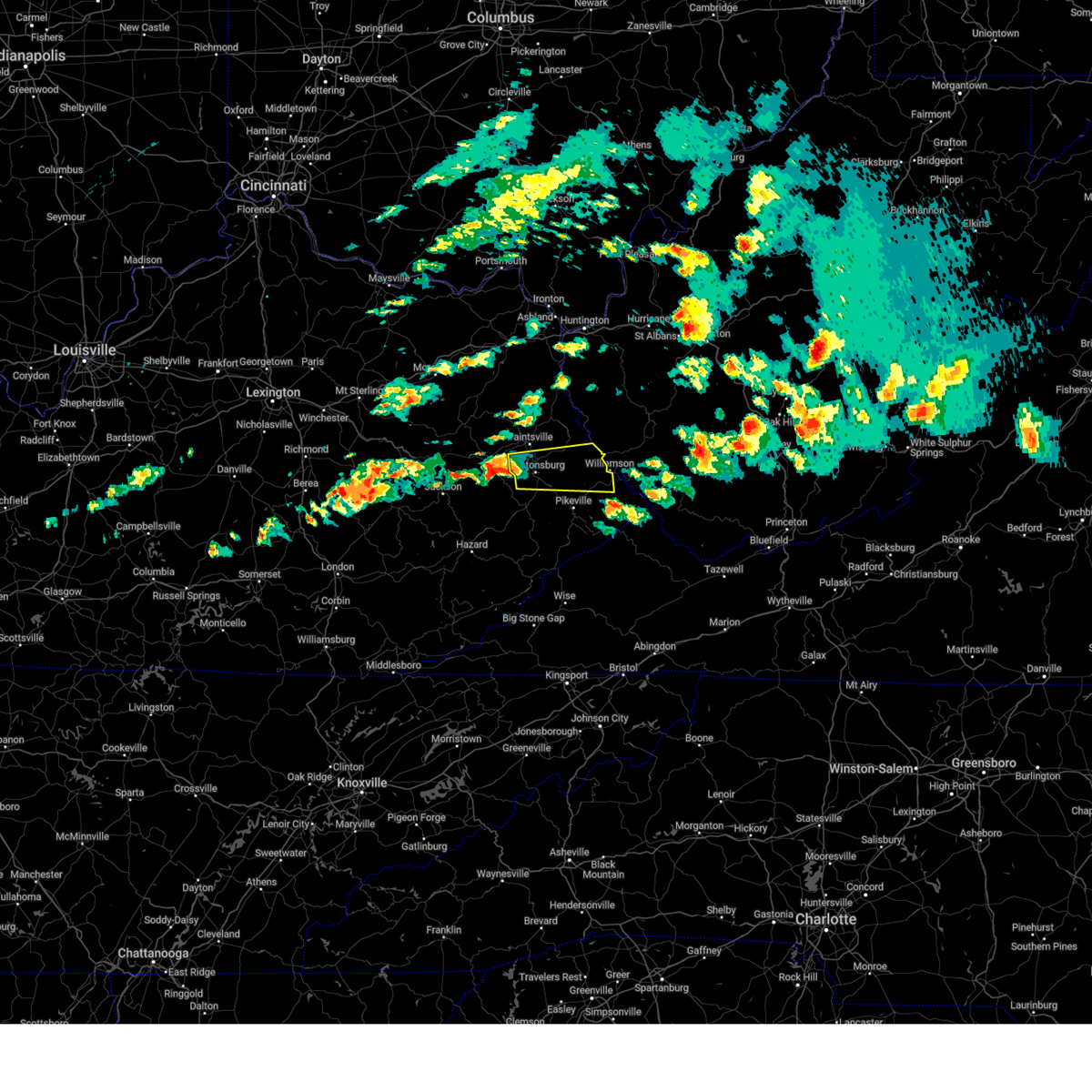 Svrjkl the national weather service in jackson ky has issued a * severe thunderstorm warning for, southern martin county in northeastern kentucky, southern johnson county in northeastern kentucky, northern floyd county in southeastern kentucky, northwestern pike county in southeastern kentucky, * until 830 pm edt. * at 804 pm edt, a severe thunderstorm was located over brainard, or 7 miles west of prestonsburg, moving east at 55 mph (radar indicated). Hazards include 60 mph wind gusts and quarter size hail. Hail damage to vehicles is expected. expect wind damage to roofs, siding, and trees. this severe thunderstorm will be near, lancer around 810 pm edt. alvin around 815 pm edt. pleasant around 820 pm edt. Other locations in the path of this severe thunderstorm include jarad. Svrjkl the national weather service in jackson ky has issued a * severe thunderstorm warning for, southern martin county in northeastern kentucky, southern johnson county in northeastern kentucky, northern floyd county in southeastern kentucky, northwestern pike county in southeastern kentucky, * until 830 pm edt. * at 804 pm edt, a severe thunderstorm was located over brainard, or 7 miles west of prestonsburg, moving east at 55 mph (radar indicated). Hazards include 60 mph wind gusts and quarter size hail. Hail damage to vehicles is expected. expect wind damage to roofs, siding, and trees. this severe thunderstorm will be near, lancer around 810 pm edt. alvin around 815 pm edt. pleasant around 820 pm edt. Other locations in the path of this severe thunderstorm include jarad.
|
| 4/3/2025 3:37 PM EDT |
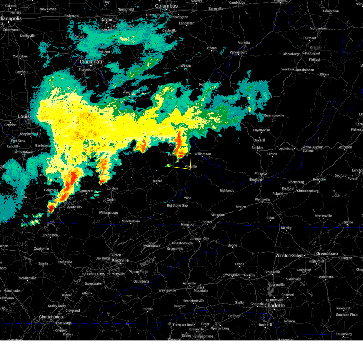 The storm which prompted the warning has weakened below severe limits, and no longer poses an immediate threat to life or property. therefore, the warning will be allowed to expire. however, gusty winds, small hail, and heavy rain are still possible with this thunderstorm. The storm which prompted the warning has weakened below severe limits, and no longer poses an immediate threat to life or property. therefore, the warning will be allowed to expire. however, gusty winds, small hail, and heavy rain are still possible with this thunderstorm.
|
| 4/3/2025 3:31 PM EDT |
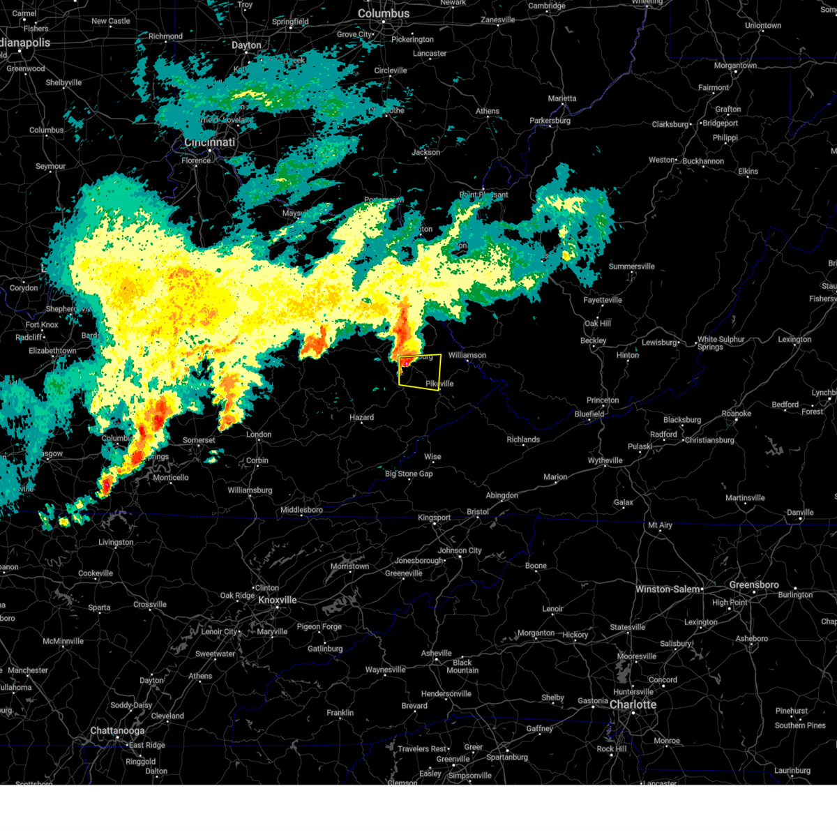 At 331 pm edt, a severe thunderstorm was located over allen city, or near prestonsburg, moving east at 45 mph (radar indicated). Hazards include 60 mph wind gusts and penny size hail. Expect damage to roofs, siding, and trees. this severe storm will be near, alvin around 335 pm edt. Other locations in the path of this severe thunderstorm include gulnare. At 331 pm edt, a severe thunderstorm was located over allen city, or near prestonsburg, moving east at 45 mph (radar indicated). Hazards include 60 mph wind gusts and penny size hail. Expect damage to roofs, siding, and trees. this severe storm will be near, alvin around 335 pm edt. Other locations in the path of this severe thunderstorm include gulnare.
|
| 4/3/2025 3:31 PM EDT |
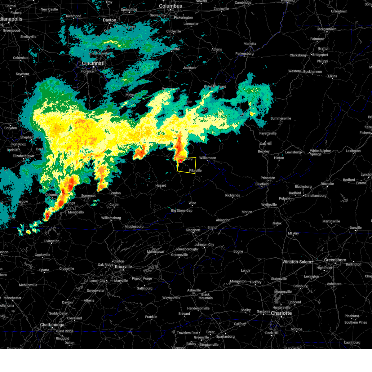 the severe thunderstorm warning has been cancelled and is no longer in effect the severe thunderstorm warning has been cancelled and is no longer in effect
|
| 4/3/2025 3:16 PM EDT |
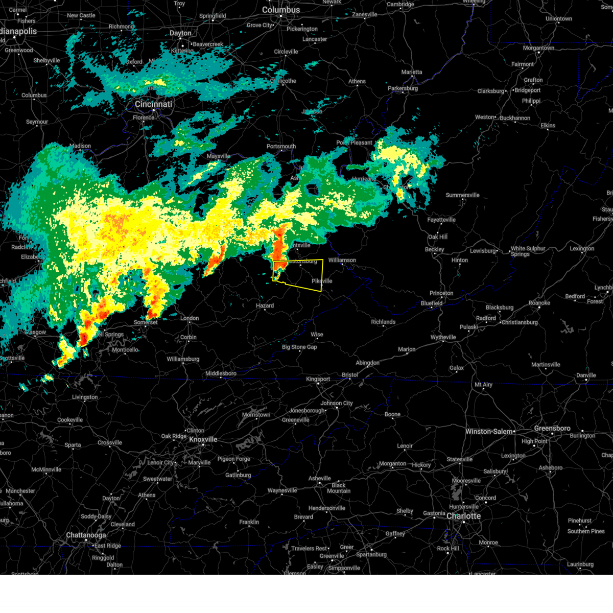 At 316 pm edt, a severe thunderstorm was located over orchard, or 11 miles southwest of prestonsburg, moving east at 50 mph (radar indicated). Hazards include 60 mph wind gusts and penny size hail. Expect damage to roofs, siding, and trees. this severe storm will be near, pyramid around 320 pm edt. Other locations in the path of this severe thunderstorm include dana, boldman and coal run. At 316 pm edt, a severe thunderstorm was located over orchard, or 11 miles southwest of prestonsburg, moving east at 50 mph (radar indicated). Hazards include 60 mph wind gusts and penny size hail. Expect damage to roofs, siding, and trees. this severe storm will be near, pyramid around 320 pm edt. Other locations in the path of this severe thunderstorm include dana, boldman and coal run.
|
| 4/3/2025 3:16 PM EDT |
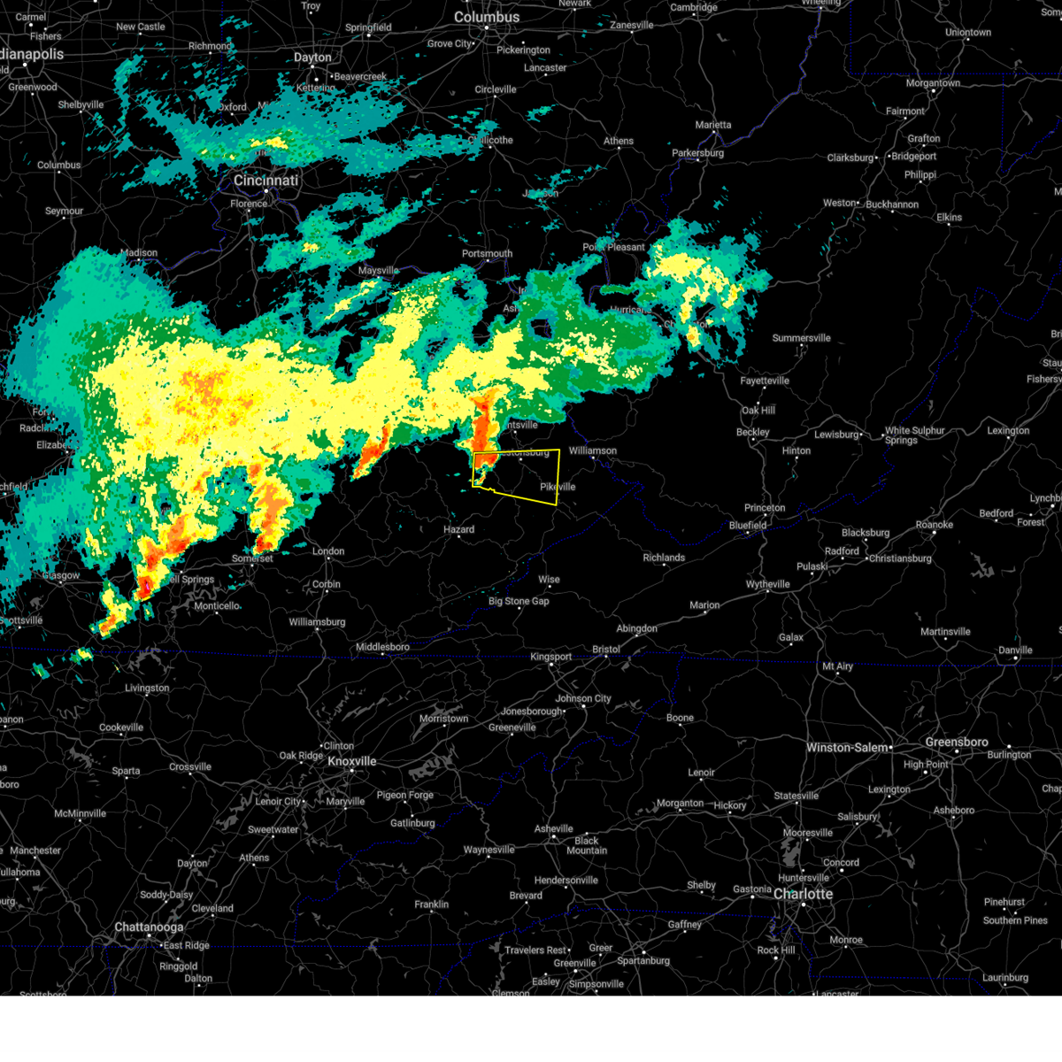 the severe thunderstorm warning has been cancelled and is no longer in effect the severe thunderstorm warning has been cancelled and is no longer in effect
|
| 4/3/2025 3:00 PM EDT |
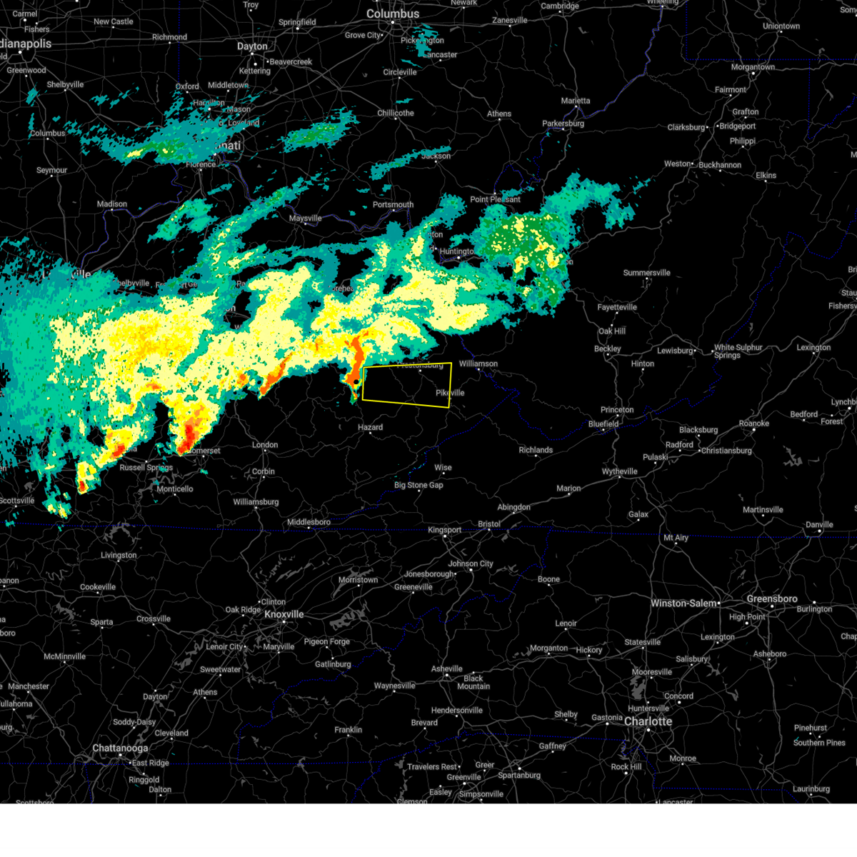 Svrjkl the national weather service in jackson ky has issued a * severe thunderstorm warning for, south central martin county in northeastern kentucky, northwestern knott county in southeastern kentucky, floyd county in southeastern kentucky, northeastern breathitt county in southeastern kentucky, northwestern pike county in southeastern kentucky, southern magoffin county in southeastern kentucky, * until 345 pm edt. * at 300 pm edt, a severe thunderstorm was located over lunah, or 12 miles east of jackson, moving east at 50 mph (radar indicated). Hazards include 60 mph wind gusts and penny size hail. Expect damage to roofs, siding, and trees. this severe thunderstorm will be near, duco around 305 pm edt. gapville around 310 pm edt. pyramid around 315 pm edt. martin around 320 pm edt. Other locations in the path of this severe thunderstorm include dana and boldman. Svrjkl the national weather service in jackson ky has issued a * severe thunderstorm warning for, south central martin county in northeastern kentucky, northwestern knott county in southeastern kentucky, floyd county in southeastern kentucky, northeastern breathitt county in southeastern kentucky, northwestern pike county in southeastern kentucky, southern magoffin county in southeastern kentucky, * until 345 pm edt. * at 300 pm edt, a severe thunderstorm was located over lunah, or 12 miles east of jackson, moving east at 50 mph (radar indicated). Hazards include 60 mph wind gusts and penny size hail. Expect damage to roofs, siding, and trees. this severe thunderstorm will be near, duco around 305 pm edt. gapville around 310 pm edt. pyramid around 315 pm edt. martin around 320 pm edt. Other locations in the path of this severe thunderstorm include dana and boldman.
|
| 4/3/2025 5:12 AM EDT |
 The storm which prompted the warning has weakened below severe limits, and has exited the warned area. therefore, the warning will be allowed to expire. however, gusty winds and heavy rain are still possible with this thunderstorm. a tornado watch remains in effect until 700 am edt for southeastern and northeastern kentucky. to report severe weather, contact your nearest law enforcement agency. they will relay your report to the national weather service jackson ky. The storm which prompted the warning has weakened below severe limits, and has exited the warned area. therefore, the warning will be allowed to expire. however, gusty winds and heavy rain are still possible with this thunderstorm. a tornado watch remains in effect until 700 am edt for southeastern and northeastern kentucky. to report severe weather, contact your nearest law enforcement agency. they will relay your report to the national weather service jackson ky.
|
| 4/3/2025 4:46 AM EDT |
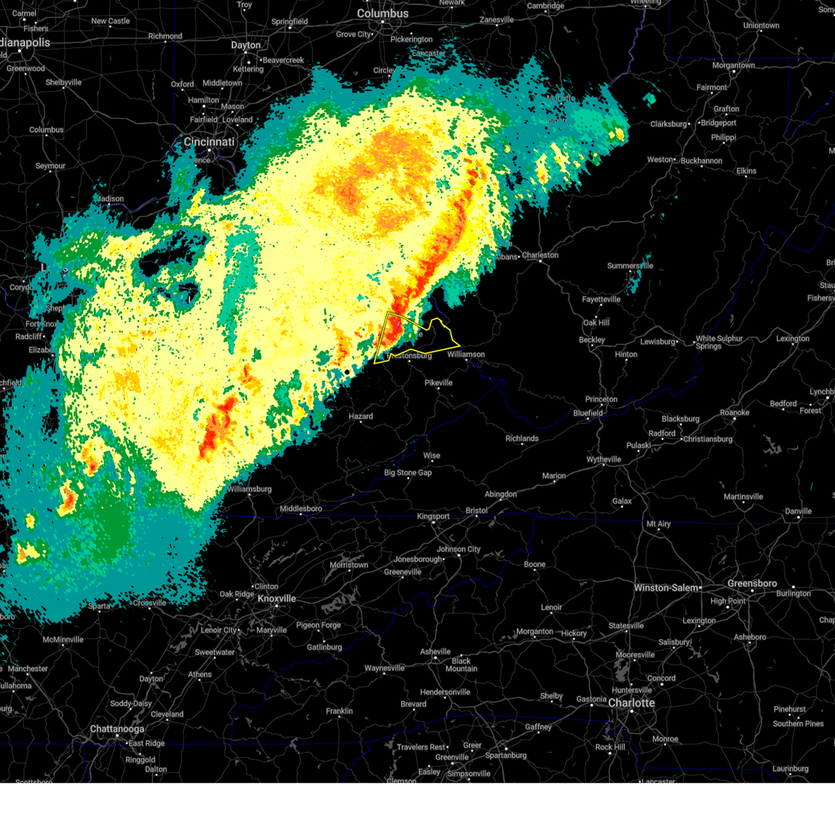 Svrjkl the national weather service in jackson ky has issued a * severe thunderstorm warning for, martin county in northeastern kentucky, east central morgan county in southeastern kentucky, johnson county in northeastern kentucky, northeastern magoffin county in southeastern kentucky, * until 515 am edt. * at 446 am edt, a severe thunderstorm was located over galen, or near paintsville, moving east at 65 mph (radar indicated). Hazards include 60 mph wind gusts and quarter size hail. Hail damage to vehicles is expected. expect wind damage to roofs, siding, and trees. this severe thunderstorm will be near, whitehouse around 450 am edt. job around 455 am edt. Calf creek around 500 am edt. Svrjkl the national weather service in jackson ky has issued a * severe thunderstorm warning for, martin county in northeastern kentucky, east central morgan county in southeastern kentucky, johnson county in northeastern kentucky, northeastern magoffin county in southeastern kentucky, * until 515 am edt. * at 446 am edt, a severe thunderstorm was located over galen, or near paintsville, moving east at 65 mph (radar indicated). Hazards include 60 mph wind gusts and quarter size hail. Hail damage to vehicles is expected. expect wind damage to roofs, siding, and trees. this severe thunderstorm will be near, whitehouse around 450 am edt. job around 455 am edt. Calf creek around 500 am edt.
|
| 3/31/2025 2:23 AM EDT |
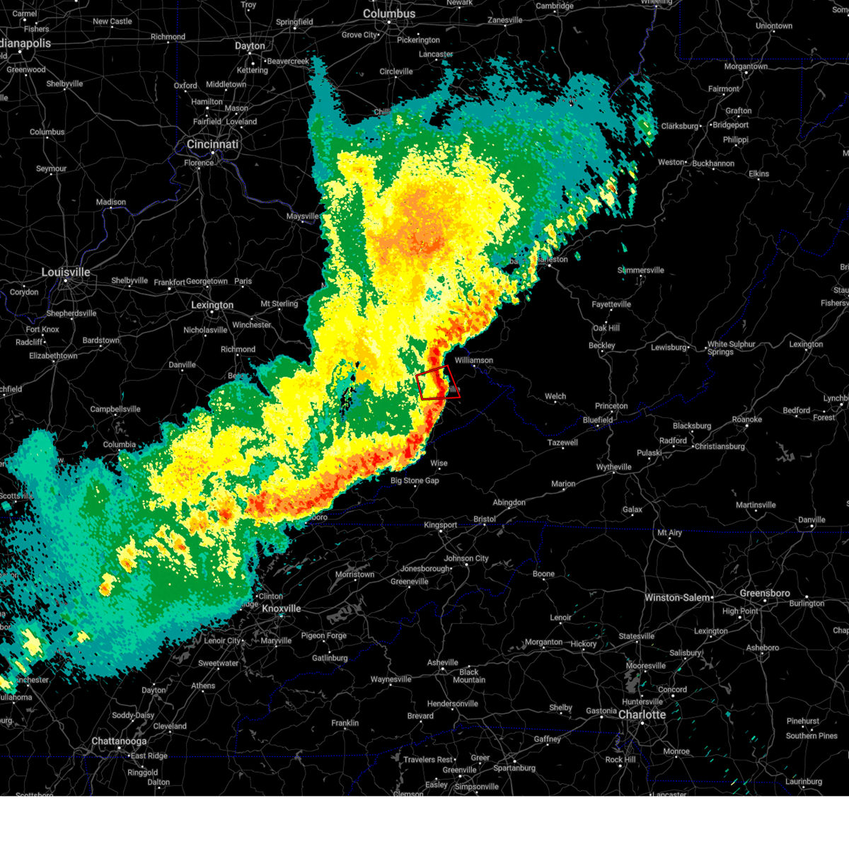 The storm which prompted the warning has weakened below severe limits, and no longer appears capable of producing a tornado. therefore, the warning will be allowed to expire. a severe thunderstorm watch remains in effect until 600 am edt for southeastern kentucky. remember, a severe thunderstorm warning still remains in effect until 2:45 am edt. The storm which prompted the warning has weakened below severe limits, and no longer appears capable of producing a tornado. therefore, the warning will be allowed to expire. a severe thunderstorm watch remains in effect until 600 am edt for southeastern kentucky. remember, a severe thunderstorm warning still remains in effect until 2:45 am edt.
|
| 3/31/2025 2:14 AM EDT |
 the tornado warning has been cancelled and is no longer in effect the tornado warning has been cancelled and is no longer in effect
|
| 3/31/2025 2:14 AM EDT |
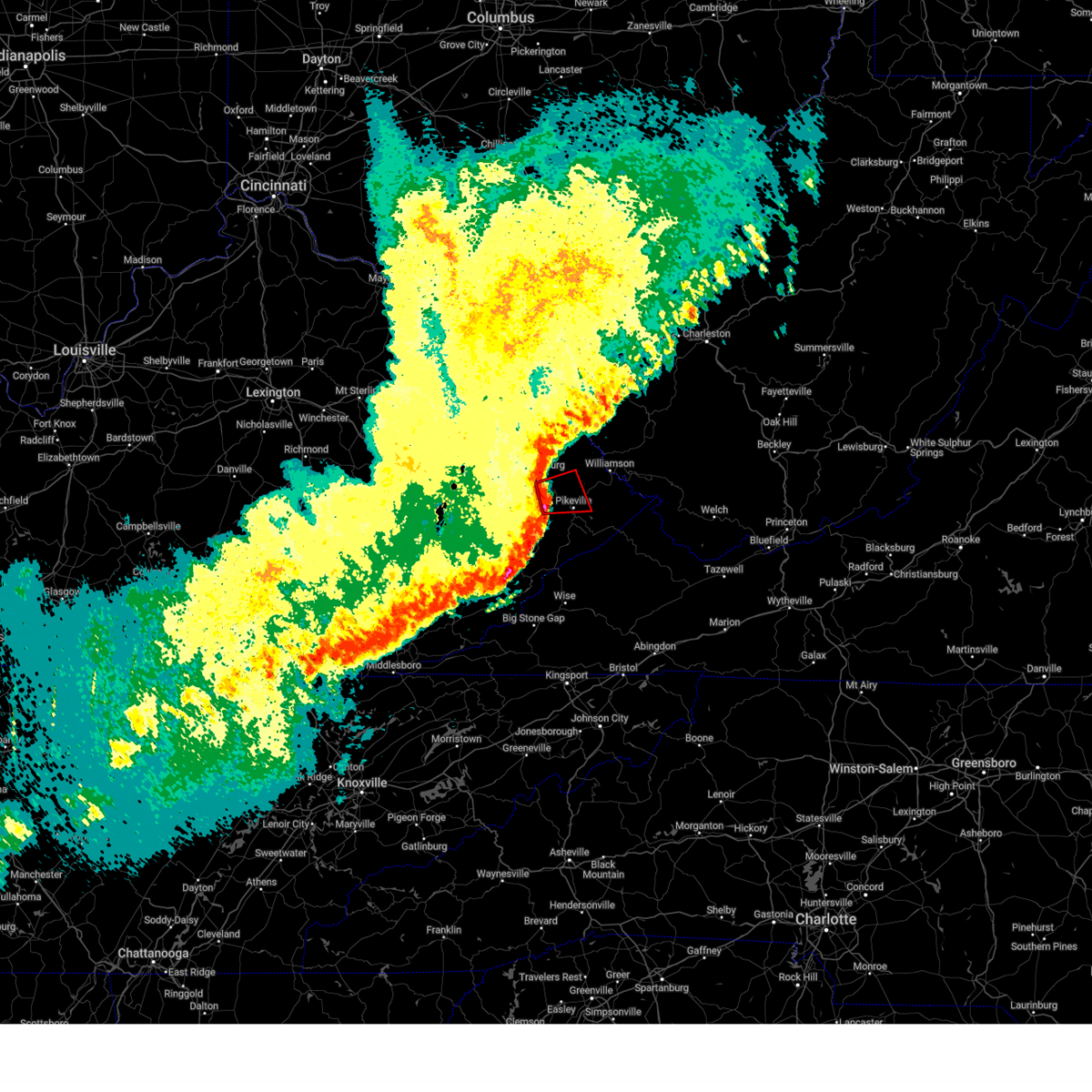 At 213 am edt, a severe thunderstorm capable of producing a tornado was located over aluba, or 9 miles northwest of pikeville, moving east at 45 mph (radar indicated rotation). Hazards include tornado. Flying debris will be dangerous to those caught without shelter. mobile homes will be damaged or destroyed. damage to roofs, windows, and vehicles will occur. tree damage is likely. this dangerous storm will be near, pikeville around 220 am edt. Other locations in the path of this tornadic thunderstorm include zebulon. At 213 am edt, a severe thunderstorm capable of producing a tornado was located over aluba, or 9 miles northwest of pikeville, moving east at 45 mph (radar indicated rotation). Hazards include tornado. Flying debris will be dangerous to those caught without shelter. mobile homes will be damaged or destroyed. damage to roofs, windows, and vehicles will occur. tree damage is likely. this dangerous storm will be near, pikeville around 220 am edt. Other locations in the path of this tornadic thunderstorm include zebulon.
|
| 3/31/2025 2:06 AM EDT |
 The storms which prompted the warning have moved out of the area. therefore, the warning will be allowed to expire. a severe thunderstorm watch remains in effect until 600 am edt for southeastern and northeastern kentucky. The storms which prompted the warning have moved out of the area. therefore, the warning will be allowed to expire. a severe thunderstorm watch remains in effect until 600 am edt for southeastern and northeastern kentucky.
|
| 3/31/2025 2:06 AM EDT |
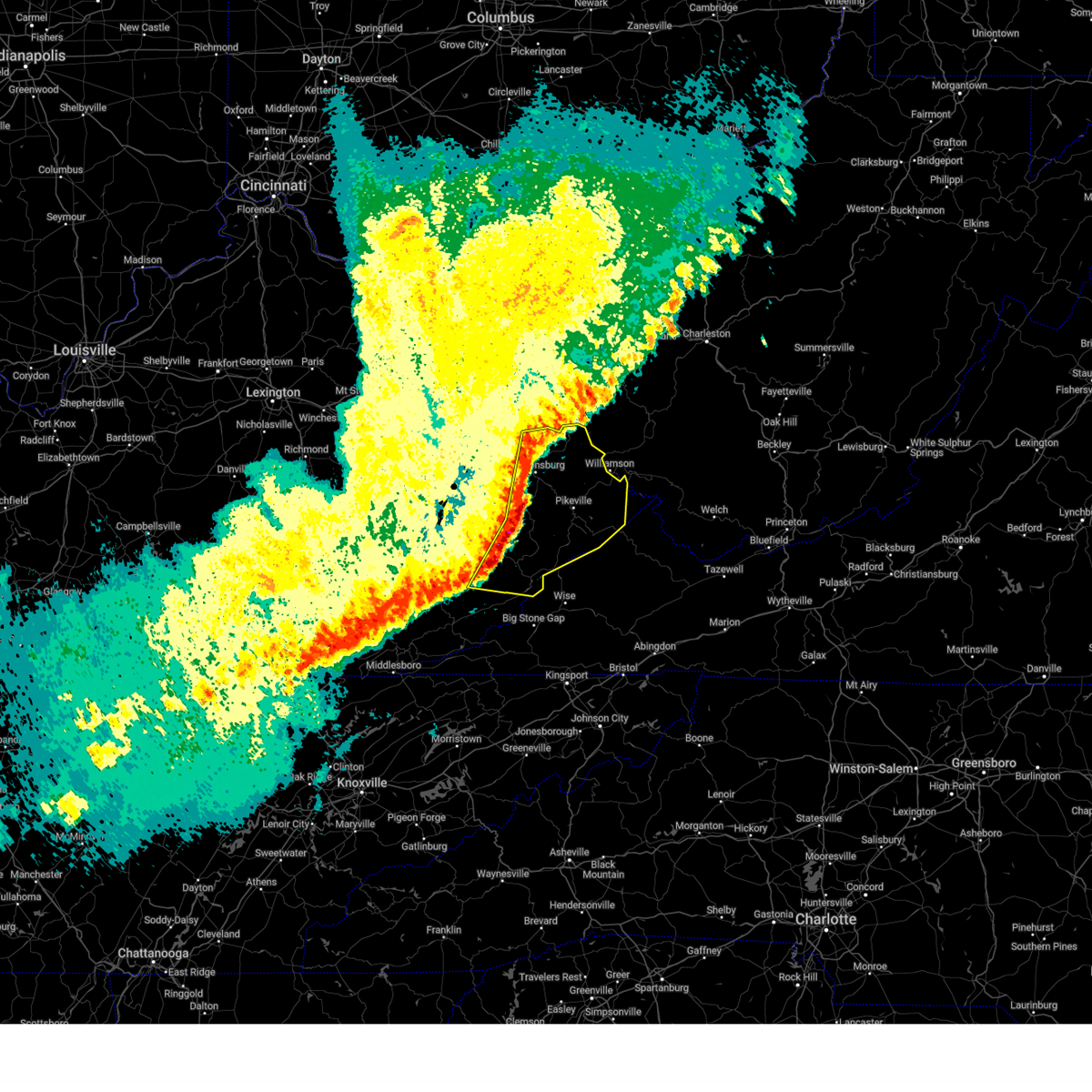 Svrjkl the national weather service in jackson ky has issued a * severe thunderstorm warning for, martin county in northeastern kentucky, eastern leslie county in southeastern kentucky, letcher county in southeastern kentucky, southeastern johnson county in northeastern kentucky, southeastern perry county in southeastern kentucky, knott county in southeastern kentucky, floyd county in southeastern kentucky, pike county in southeastern kentucky, southeastern magoffin county in southeastern kentucky, * until 245 am edt. * at 206 am edt, severe thunderstorms were located along a line extending from thealka to raven to daisy, moving east at 50 mph (radar indicated). Hazards include 60 mph wind gusts and penny size hail. Expect damage to roofs, siding, and trees. severe thunderstorms will be near, alvin around 210 am edt. flint around 215 am edt. farraday around 220 am edt. jenkins around 225 am edt. Other locations in the path of these severe thunderstorms include rockhouse and huddy. Svrjkl the national weather service in jackson ky has issued a * severe thunderstorm warning for, martin county in northeastern kentucky, eastern leslie county in southeastern kentucky, letcher county in southeastern kentucky, southeastern johnson county in northeastern kentucky, southeastern perry county in southeastern kentucky, knott county in southeastern kentucky, floyd county in southeastern kentucky, pike county in southeastern kentucky, southeastern magoffin county in southeastern kentucky, * until 245 am edt. * at 206 am edt, severe thunderstorms were located along a line extending from thealka to raven to daisy, moving east at 50 mph (radar indicated). Hazards include 60 mph wind gusts and penny size hail. Expect damage to roofs, siding, and trees. severe thunderstorms will be near, alvin around 210 am edt. flint around 215 am edt. farraday around 220 am edt. jenkins around 225 am edt. Other locations in the path of these severe thunderstorms include rockhouse and huddy.
|
| 3/31/2025 2:03 AM EDT |
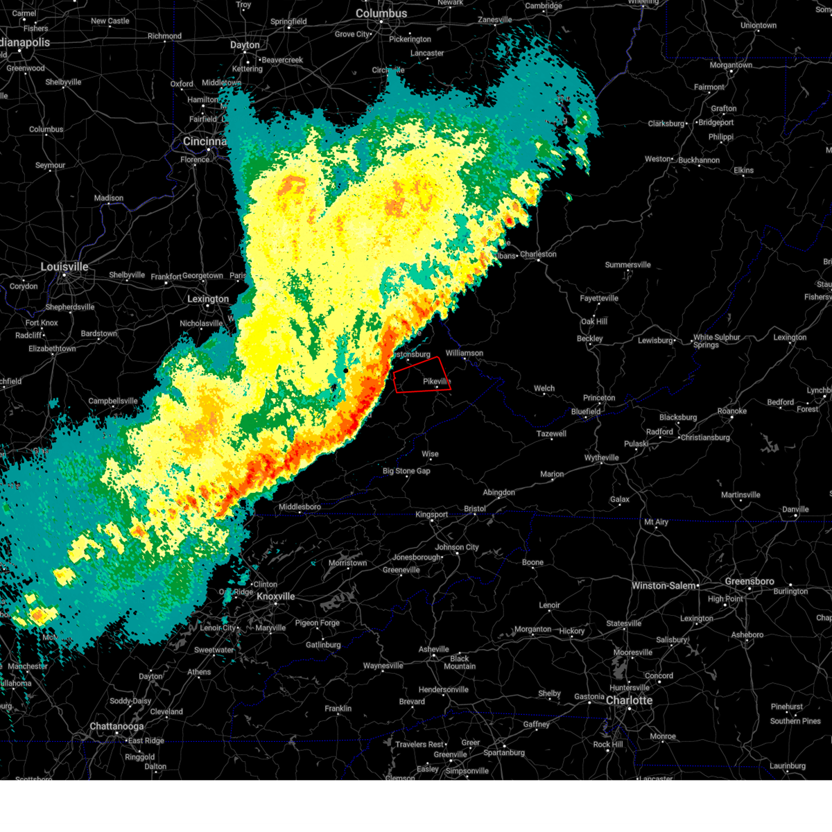 Torjkl the national weather service in jackson ky has issued a * tornado warning for, north central knott county in southeastern kentucky, central floyd county in southeastern kentucky, northwestern pike county in southeastern kentucky, * until 230 am edt. * at 203 am edt, a severe thunderstorm capable of producing a tornado was located over eastern, or 11 miles south of prestonsburg, moving east at 45 mph (radar indicated rotation). Hazards include tornado. Flying debris will be dangerous to those caught without shelter. mobile homes will be damaged or destroyed. damage to roofs, windows, and vehicles will occur. tree damage is likely. this dangerous storm will be near, dana around 210 am edt. banner around 215 am edt. Pikeville around 220 am edt. Torjkl the national weather service in jackson ky has issued a * tornado warning for, north central knott county in southeastern kentucky, central floyd county in southeastern kentucky, northwestern pike county in southeastern kentucky, * until 230 am edt. * at 203 am edt, a severe thunderstorm capable of producing a tornado was located over eastern, or 11 miles south of prestonsburg, moving east at 45 mph (radar indicated rotation). Hazards include tornado. Flying debris will be dangerous to those caught without shelter. mobile homes will be damaged or destroyed. damage to roofs, windows, and vehicles will occur. tree damage is likely. this dangerous storm will be near, dana around 210 am edt. banner around 215 am edt. Pikeville around 220 am edt.
|
| 3/31/2025 1:58 AM EDT |
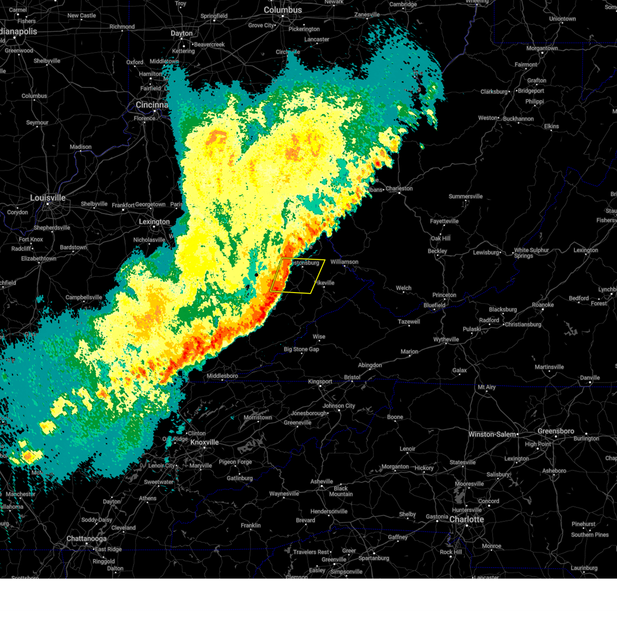 At 158 am edt, severe thunderstorms were located along a line extending from east point to soft shell, moving east at 45 mph (radar indicated). Hazards include 60 mph wind gusts. Expect damage to roofs, siding, and trees. Locations impacted include, alvin and aluba. At 158 am edt, severe thunderstorms were located along a line extending from east point to soft shell, moving east at 45 mph (radar indicated). Hazards include 60 mph wind gusts. Expect damage to roofs, siding, and trees. Locations impacted include, alvin and aluba.
|
| 3/31/2025 1:42 AM EDT |
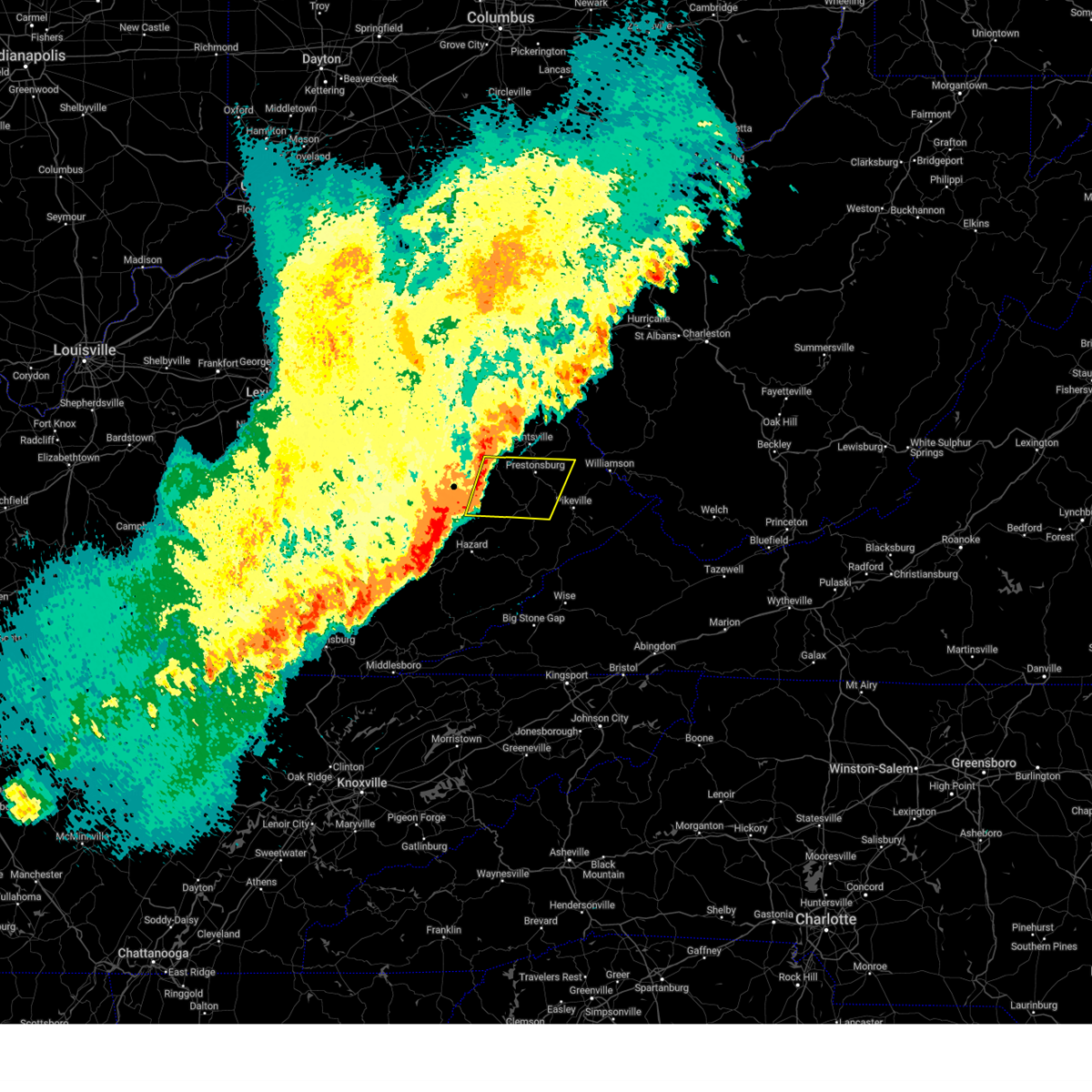 Svrjkl the national weather service in jackson ky has issued a * severe thunderstorm warning for, southwestern martin county in northeastern kentucky, southeastern johnson county in northeastern kentucky, northern knott county in southeastern kentucky, floyd county in southeastern kentucky, northeastern breathitt county in southeastern kentucky, northwestern pike county in southeastern kentucky, southeastern magoffin county in southeastern kentucky, * until 215 am edt. * at 141 am edt, severe thunderstorms were located along a line extending from conley to talcum, moving southeast at 65 mph (radar indicated). Hazards include 60 mph wind gusts. Expect damage to roofs, siding, and trees. severe thunderstorms will be near, dotson around 145 am edt. lancer around 150 am edt. alvin around 155 am edt. Mccombs around 200 am edt. Svrjkl the national weather service in jackson ky has issued a * severe thunderstorm warning for, southwestern martin county in northeastern kentucky, southeastern johnson county in northeastern kentucky, northern knott county in southeastern kentucky, floyd county in southeastern kentucky, northeastern breathitt county in southeastern kentucky, northwestern pike county in southeastern kentucky, southeastern magoffin county in southeastern kentucky, * until 215 am edt. * at 141 am edt, severe thunderstorms were located along a line extending from conley to talcum, moving southeast at 65 mph (radar indicated). Hazards include 60 mph wind gusts. Expect damage to roofs, siding, and trees. severe thunderstorms will be near, dotson around 145 am edt. lancer around 150 am edt. alvin around 155 am edt. Mccombs around 200 am edt.
|
| 2/16/2025 9:28 AM EST |
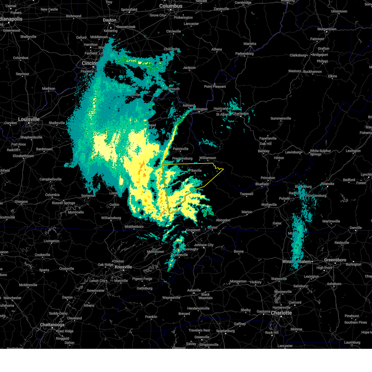 Svrjkl the national weather service in jackson ky has issued a * severe thunderstorm warning for, northeastern harlan county in southeastern kentucky, letcher county in southeastern kentucky, eastern perry county in southeastern kentucky, knott county in southeastern kentucky, floyd county in southeastern kentucky, southeastern breathitt county in southeastern kentucky, pike county in southeastern kentucky, southeastern magoffin county in southeastern kentucky, * until 1030 am est. * at 928 am est, severe thunderstorms were located along a line extending from daisydell to 6 miles southeast of pennington gap, moving east at 60 mph (radar indicated). Hazards include 60 mph wind gusts. Expect damage to roofs, siding, and trees. severe thunderstorms will be near, whitesburg around 935 am est. estill around 940 am est. jenkins around 945 am est. Other locations in the path of these severe thunderstorms include pikeville, rockhouse and elkhorn city. Svrjkl the national weather service in jackson ky has issued a * severe thunderstorm warning for, northeastern harlan county in southeastern kentucky, letcher county in southeastern kentucky, eastern perry county in southeastern kentucky, knott county in southeastern kentucky, floyd county in southeastern kentucky, southeastern breathitt county in southeastern kentucky, pike county in southeastern kentucky, southeastern magoffin county in southeastern kentucky, * until 1030 am est. * at 928 am est, severe thunderstorms were located along a line extending from daisydell to 6 miles southeast of pennington gap, moving east at 60 mph (radar indicated). Hazards include 60 mph wind gusts. Expect damage to roofs, siding, and trees. severe thunderstorms will be near, whitesburg around 935 am est. estill around 940 am est. jenkins around 945 am est. Other locations in the path of these severe thunderstorms include pikeville, rockhouse and elkhorn city.
|
| 8/31/2024 2:03 PM EDT |
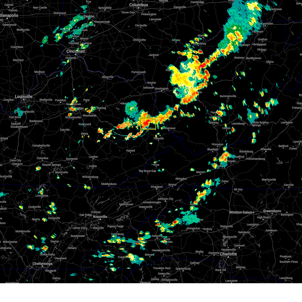 At 202 pm edt, a severe thunderstorm was located over bobbs, or near paintsville, moving east at 15 mph (radar indicated). Hazards include 60 mph wind gusts and penny size hail. Expect damage to roofs, siding, and trees. Locations impacted include, whitehouse. At 202 pm edt, a severe thunderstorm was located over bobbs, or near paintsville, moving east at 15 mph (radar indicated). Hazards include 60 mph wind gusts and penny size hail. Expect damage to roofs, siding, and trees. Locations impacted include, whitehouse.
|
| 8/31/2024 1:49 PM EDT |
 Svrjkl the national weather service in jackson ky has issued a * severe thunderstorm warning for, southwestern martin county in northeastern kentucky, johnson county in northeastern kentucky, northern floyd county in southeastern kentucky, * until 215 pm edt. * at 149 pm edt, a severe thunderstorm was located over paintsville, moving east at 15 mph (radar indicated). Hazards include 60 mph wind gusts and quarter size hail. Hail damage to vehicles is expected. expect wind damage to roofs, siding, and trees. this severe thunderstorm will be near, paintsville around 155 pm edt. Whitehouse around 205 pm edt. Svrjkl the national weather service in jackson ky has issued a * severe thunderstorm warning for, southwestern martin county in northeastern kentucky, johnson county in northeastern kentucky, northern floyd county in southeastern kentucky, * until 215 pm edt. * at 149 pm edt, a severe thunderstorm was located over paintsville, moving east at 15 mph (radar indicated). Hazards include 60 mph wind gusts and quarter size hail. Hail damage to vehicles is expected. expect wind damage to roofs, siding, and trees. this severe thunderstorm will be near, paintsville around 155 pm edt. Whitehouse around 205 pm edt.
|
| 8/17/2024 5:50 PM EDT |
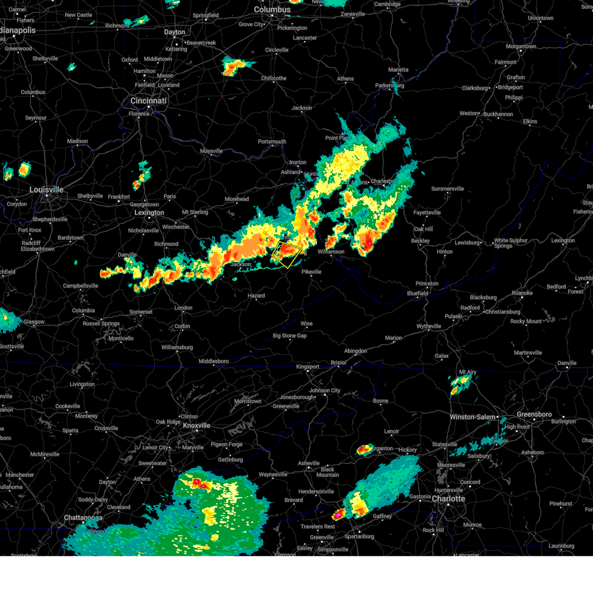 At 549 pm edt, a severe thunderstorm was located over bonanza, or near prestonsburg, moving east at 10 mph (radar indicated). Hazards include 60 mph wind gusts and penny size hail. Expect damage to roofs, siding, and trees. Locations impacted include, prestonsburg and nero. At 549 pm edt, a severe thunderstorm was located over bonanza, or near prestonsburg, moving east at 10 mph (radar indicated). Hazards include 60 mph wind gusts and penny size hail. Expect damage to roofs, siding, and trees. Locations impacted include, prestonsburg and nero.
|
| 8/17/2024 5:28 PM EDT |
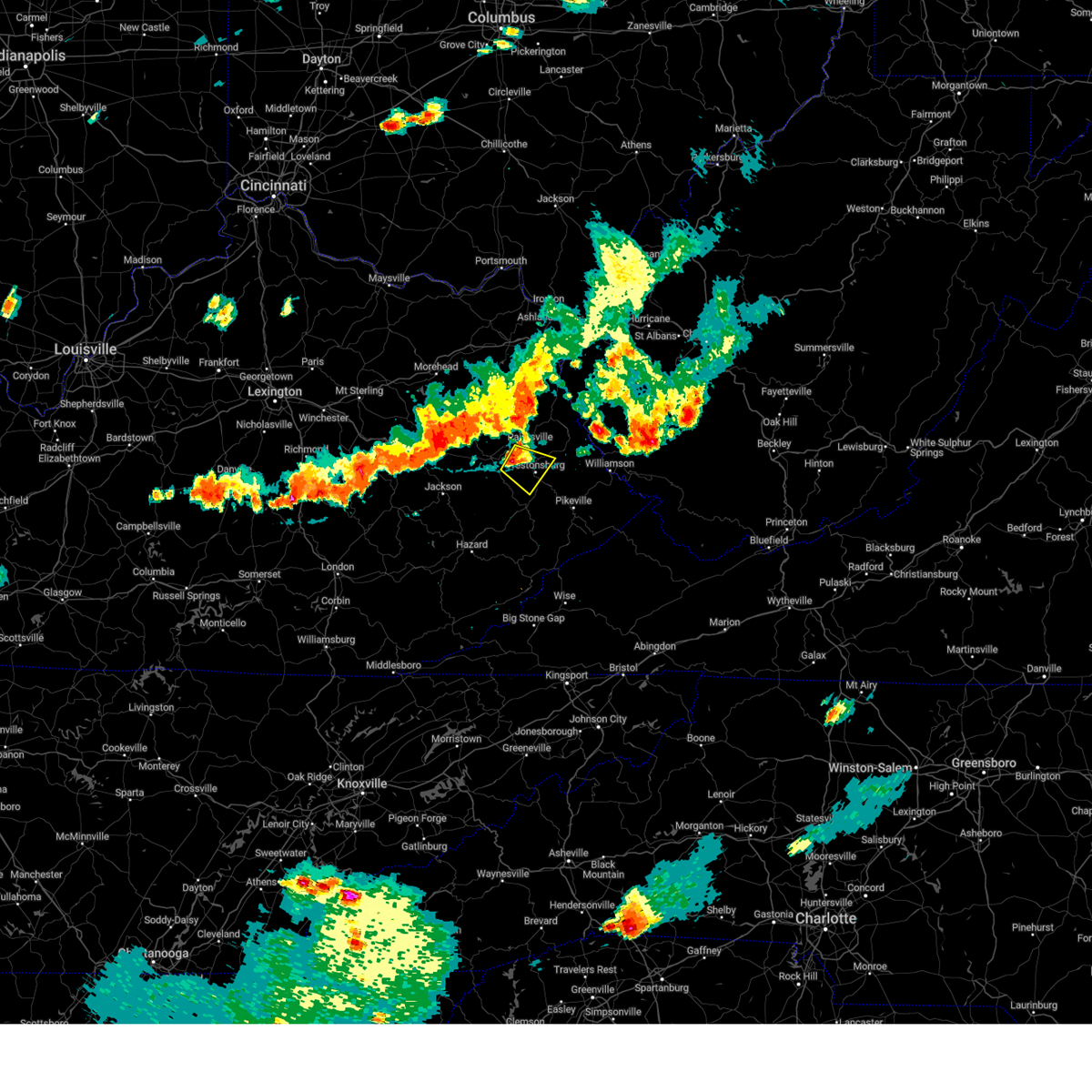 Svrjkl the national weather service in jackson ky has issued a * severe thunderstorm warning for, southern johnson county in northeastern kentucky, northwestern floyd county in southeastern kentucky, east central magoffin county in southeastern kentucky, * until 600 pm edt. * at 528 pm edt, a severe thunderstorm was located over swamp branch, or 8 miles southwest of paintsville, moving southeast at 20 mph (radar indicated). Hazards include ping pong ball size hail and 60 mph wind gusts. People and animals outdoors will be injured. expect hail damage to roofs, siding, windows, and vehicles. expect wind damage to roofs, siding, and trees. this severe thunderstorm will be near, brainard around 535 pm edt. prestonsburg around 540 pm edt. Dock around 545 pm edt. Svrjkl the national weather service in jackson ky has issued a * severe thunderstorm warning for, southern johnson county in northeastern kentucky, northwestern floyd county in southeastern kentucky, east central magoffin county in southeastern kentucky, * until 600 pm edt. * at 528 pm edt, a severe thunderstorm was located over swamp branch, or 8 miles southwest of paintsville, moving southeast at 20 mph (radar indicated). Hazards include ping pong ball size hail and 60 mph wind gusts. People and animals outdoors will be injured. expect hail damage to roofs, siding, windows, and vehicles. expect wind damage to roofs, siding, and trees. this severe thunderstorm will be near, brainard around 535 pm edt. prestonsburg around 540 pm edt. Dock around 545 pm edt.
|
| 8/1/2024 9:22 PM EDT |
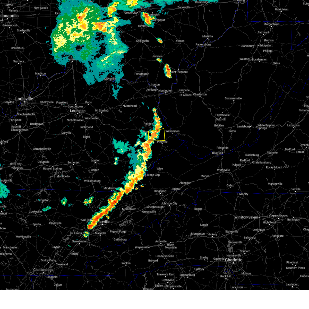 The storm which prompted the warning has weakened below severe limits, and no longer poses an immediate threat to life or property. therefore, the warning will be allowed to expire. a severe thunderstorm watch remains in effect until midnight edt for southeastern and northeastern kentucky. The storm which prompted the warning has weakened below severe limits, and no longer poses an immediate threat to life or property. therefore, the warning will be allowed to expire. a severe thunderstorm watch remains in effect until midnight edt for southeastern and northeastern kentucky.
|
| 8/1/2024 9:15 PM EDT |
 At 914 pm edt, a severe thunderstorm was located over dwale, or near prestonsburg, moving east at 25 mph (radar indicated). Hazards include 60 mph wind gusts. Expect damage to roofs, siding, and trees. this severe storm will be near, alvin around 920 pm edt. Other locations in the path of this severe thunderstorm include mccombs and gulnare. At 914 pm edt, a severe thunderstorm was located over dwale, or near prestonsburg, moving east at 25 mph (radar indicated). Hazards include 60 mph wind gusts. Expect damage to roofs, siding, and trees. this severe storm will be near, alvin around 920 pm edt. Other locations in the path of this severe thunderstorm include mccombs and gulnare.
|
| 8/1/2024 9:15 PM EDT |
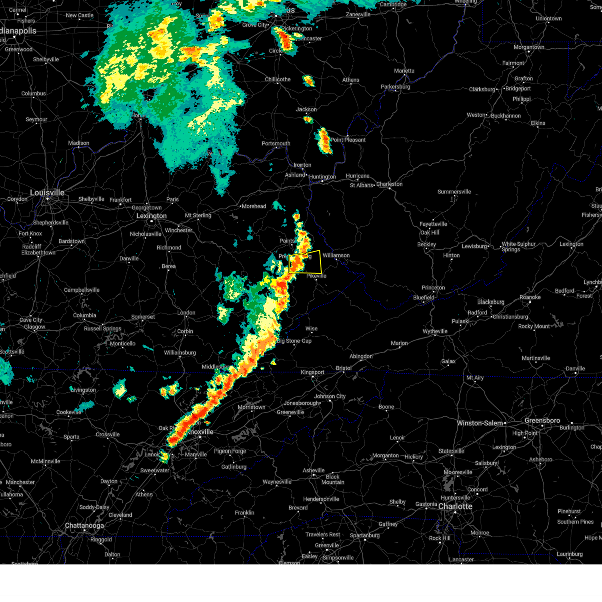 the severe thunderstorm warning has been cancelled and is no longer in effect the severe thunderstorm warning has been cancelled and is no longer in effect
|
| 8/1/2024 9:01 PM EDT |
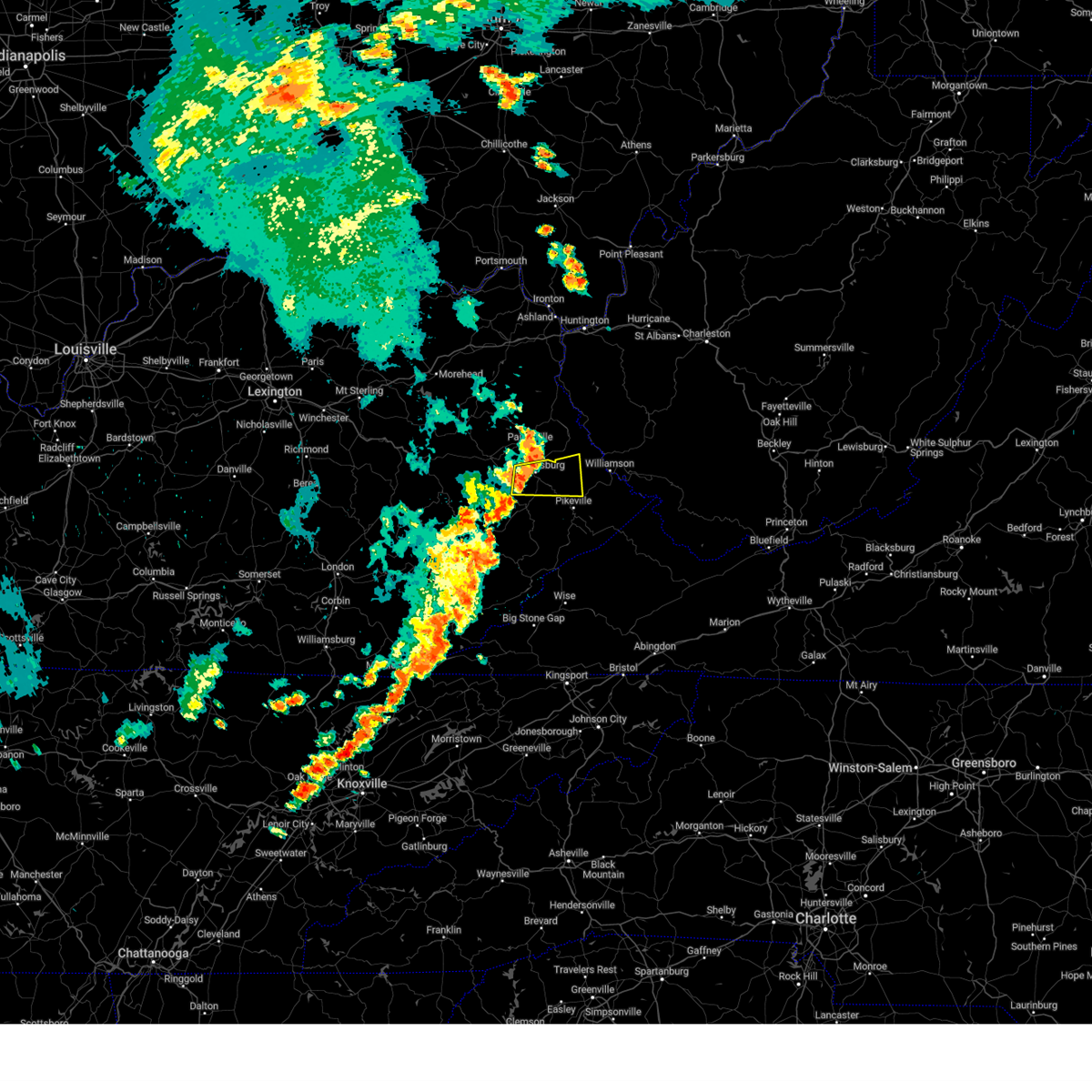 Svrjkl the national weather service in jackson ky has issued a * severe thunderstorm warning for, southwestern martin county in northeastern kentucky, northern floyd county in southeastern kentucky, northwestern pike county in southeastern kentucky, east central magoffin county in southeastern kentucky, * until 930 pm edt. * at 901 pm edt, a severe thunderstorm was located over dock, or near prestonsburg, moving east at 25 mph (radar indicated). Hazards include 60 mph wind gusts. Expect damage to roofs, siding, and trees. this severe thunderstorm will be near, prestonsburg around 905 pm edt. alvin around 910 pm edt. ivel around 915 pm edt. Endicott around 920 pm edt. Svrjkl the national weather service in jackson ky has issued a * severe thunderstorm warning for, southwestern martin county in northeastern kentucky, northern floyd county in southeastern kentucky, northwestern pike county in southeastern kentucky, east central magoffin county in southeastern kentucky, * until 930 pm edt. * at 901 pm edt, a severe thunderstorm was located over dock, or near prestonsburg, moving east at 25 mph (radar indicated). Hazards include 60 mph wind gusts. Expect damage to roofs, siding, and trees. this severe thunderstorm will be near, prestonsburg around 905 pm edt. alvin around 910 pm edt. ivel around 915 pm edt. Endicott around 920 pm edt.
|
| 7/5/2024 2:17 PM EDT |
 The storms which prompted the warning have moved out of the area. therefore, the warning has been allowed to expire. a severe thunderstorm watch remains in effect until 700 pm edt for southeastern kentucky. The storms which prompted the warning have moved out of the area. therefore, the warning has been allowed to expire. a severe thunderstorm watch remains in effect until 700 pm edt for southeastern kentucky.
|
| 7/5/2024 2:04 PM EDT |
 the severe thunderstorm warning has been cancelled and is no longer in effect the severe thunderstorm warning has been cancelled and is no longer in effect
|
| 7/5/2024 2:04 PM EDT |
 At 203 pm edt, severe thunderstorms were located along a line extending from corn fork hollow to near alvin to endicott to near ivel to grethel, moving east at 35 mph (radar indicated). Hazards include 60 mph wind gusts. Expect damage to roofs, siding, and trees. Locations impacted include, wayland, allen, hunter, endicott, banner, justell, harold, printer, arkansas, aluba, mcdowell, and dana. At 203 pm edt, severe thunderstorms were located along a line extending from corn fork hollow to near alvin to endicott to near ivel to grethel, moving east at 35 mph (radar indicated). Hazards include 60 mph wind gusts. Expect damage to roofs, siding, and trees. Locations impacted include, wayland, allen, hunter, endicott, banner, justell, harold, printer, arkansas, aluba, mcdowell, and dana.
|
| 7/5/2024 1:47 PM EDT |
 At 146 pm edt, severe thunderstorms were located along a line extending from near swamp branch to near riceville to dock to arkansas to wayland, moving east at 30 mph (radar indicated). Hazards include 60 mph wind gusts. Expect damage to roofs, siding, and trees. Locations impacted include, prestonsburg, estill, martin, wayland, allen, endicott, bosco, hippo, glo, printer, langley, and lancer. At 146 pm edt, severe thunderstorms were located along a line extending from near swamp branch to near riceville to dock to arkansas to wayland, moving east at 30 mph (radar indicated). Hazards include 60 mph wind gusts. Expect damage to roofs, siding, and trees. Locations impacted include, prestonsburg, estill, martin, wayland, allen, endicott, bosco, hippo, glo, printer, langley, and lancer.
|
| 7/5/2024 1:47 PM EDT |
 the severe thunderstorm warning has been cancelled and is no longer in effect the severe thunderstorm warning has been cancelled and is no longer in effect
|
| 7/5/2024 1:38 PM EDT |
 the severe thunderstorm warning has been cancelled and is no longer in effect the severe thunderstorm warning has been cancelled and is no longer in effect
|
| 7/5/2024 1:38 PM EDT |
 At 138 pm edt, severe thunderstorms were located along a line extending from mason to ivyton to dotson to near alphoretta to porter junction, moving east at 40 mph (radar indicated). Hazards include 60 mph wind gusts and penny size hail. Expect damage to roofs, siding, and trees. Locations impacted include, paintsville, prestonsburg, salyersville, mason, estill, martin, wayland, allen, fredville, oaklawn estates, hippo, and handshoe. At 138 pm edt, severe thunderstorms were located along a line extending from mason to ivyton to dotson to near alphoretta to porter junction, moving east at 40 mph (radar indicated). Hazards include 60 mph wind gusts and penny size hail. Expect damage to roofs, siding, and trees. Locations impacted include, paintsville, prestonsburg, salyersville, mason, estill, martin, wayland, allen, fredville, oaklawn estates, hippo, and handshoe.
|
| 7/5/2024 1:26 PM EDT |
 Svrjkl the national weather service in jackson ky has issued a * severe thunderstorm warning for, southwestern johnson county in northeastern kentucky, north central knott county in southeastern kentucky, floyd county in southeastern kentucky, northeastern breathitt county in southeastern kentucky, southern magoffin county in southeastern kentucky, * until 215 pm edt. * at 126 pm edt, severe thunderstorms were located along a line extending from cornelia to foraker to duco to gunlock to yellow mountain, moving east at 30 mph (radar indicated). Hazards include 60 mph wind gusts and penny size hail. Expect damage to roofs, siding, and trees. severe thunderstorms will be near, mason around 130 pm edt. salyersville around 135 pm edt. printer around 140 pm edt. prestonsburg around 145 pm edt. alvin around 150 pm edt. Denver around 155 pm edt. Svrjkl the national weather service in jackson ky has issued a * severe thunderstorm warning for, southwestern johnson county in northeastern kentucky, north central knott county in southeastern kentucky, floyd county in southeastern kentucky, northeastern breathitt county in southeastern kentucky, southern magoffin county in southeastern kentucky, * until 215 pm edt. * at 126 pm edt, severe thunderstorms were located along a line extending from cornelia to foraker to duco to gunlock to yellow mountain, moving east at 30 mph (radar indicated). Hazards include 60 mph wind gusts and penny size hail. Expect damage to roofs, siding, and trees. severe thunderstorms will be near, mason around 130 pm edt. salyersville around 135 pm edt. printer around 140 pm edt. prestonsburg around 145 pm edt. alvin around 150 pm edt. Denver around 155 pm edt.
|
| 6/26/2024 5:37 PM EDT |
 Svrjkl the national weather service in jackson ky has issued a * severe thunderstorm warning for, southern martin county in northeastern kentucky, southeastern johnson county in northeastern kentucky, northeastern floyd county in southeastern kentucky, northwestern pike county in southeastern kentucky, * until 600 pm edt. * at 537 pm edt, a severe thunderstorm was located over corn fork hollow, or near prestonsburg, moving east at 30 mph (radar indicated). Hazards include 60 mph wind gusts and penny size hail. Expect damage to roofs, siding, and trees. this severe thunderstorm will be near, dicks creek around 540 pm edt. pleasant around 545 pm edt. moree around 550 pm edt. Jarad around 555 pm edt. Svrjkl the national weather service in jackson ky has issued a * severe thunderstorm warning for, southern martin county in northeastern kentucky, southeastern johnson county in northeastern kentucky, northeastern floyd county in southeastern kentucky, northwestern pike county in southeastern kentucky, * until 600 pm edt. * at 537 pm edt, a severe thunderstorm was located over corn fork hollow, or near prestonsburg, moving east at 30 mph (radar indicated). Hazards include 60 mph wind gusts and penny size hail. Expect damage to roofs, siding, and trees. this severe thunderstorm will be near, dicks creek around 540 pm edt. pleasant around 545 pm edt. moree around 550 pm edt. Jarad around 555 pm edt.
|
| 6/26/2024 5:33 PM EDT | Tree down on a powerline near 32 bevins street east of prestonsbur in floyd county KY, 1.9 miles W of Prestonsburg, KY |
| 6/26/2024 5:14 PM EDT | Tree down near the intersection of howards branch road and se licking river roa in magoffin county KY, 11.3 miles ENE of Prestonsburg, KY |
| 5/26/2024 3:44 PM EDT |
 Svrjkl the national weather service in jackson ky has issued a * severe thunderstorm warning for, martin county in northeastern kentucky, southeastern johnson county in northeastern kentucky, northeastern floyd county in southeastern kentucky, northwestern pike county in southeastern kentucky, * until 415 pm edt. * at 343 pm edt, severe thunderstorms were located along a line extending from 9 miles southwest of harts to near kimper, moving east at 55 mph (radar indicated). Hazards include 60 mph wind gusts and nickel size hail. Expect damage to roofs, siding, and trees. These severe thunderstorms will remain over mainly rural areas of martin, southeastern johnson, northeastern floyd and northwestern pike counties, including the following locations, kermit. Svrjkl the national weather service in jackson ky has issued a * severe thunderstorm warning for, martin county in northeastern kentucky, southeastern johnson county in northeastern kentucky, northeastern floyd county in southeastern kentucky, northwestern pike county in southeastern kentucky, * until 415 pm edt. * at 343 pm edt, severe thunderstorms were located along a line extending from 9 miles southwest of harts to near kimper, moving east at 55 mph (radar indicated). Hazards include 60 mph wind gusts and nickel size hail. Expect damage to roofs, siding, and trees. These severe thunderstorms will remain over mainly rural areas of martin, southeastern johnson, northeastern floyd and northwestern pike counties, including the following locations, kermit.
|
| 5/26/2024 3:29 PM EDT |
 the severe thunderstorm warning has been cancelled and is no longer in effect the severe thunderstorm warning has been cancelled and is no longer in effect
|
| 5/26/2024 3:29 PM EDT |
 At 328 pm edt, severe thunderstorms were located along a line extending from hode to chloe, moving east at 60 mph (radar indicated). Hazards include 60 mph wind gusts and nickel size hail. Expect damage to roofs, siding, and trees. Locations impacted include, forest hills, phelps and paw paw. At 328 pm edt, severe thunderstorms were located along a line extending from hode to chloe, moving east at 60 mph (radar indicated). Hazards include 60 mph wind gusts and nickel size hail. Expect damage to roofs, siding, and trees. Locations impacted include, forest hills, phelps and paw paw.
|
| 5/26/2024 3:17 PM EDT | Trees were reported down near ky 404 and ky 1210 intersection. the event time is radar estimate in floyd county KY, 6.5 miles NE of Prestonsburg, KY |
| 5/26/2024 3:15 PM EDT |
 Svrjkl the national weather service in jackson ky has issued a * severe thunderstorm warning for, floyd county in southeastern kentucky, pike county in southeastern kentucky, * until 400 pm edt. * at 315 pm edt, a severe thunderstorm was located over price, or 12 miles west of pikeville, moving east at 55 mph (radar indicated). Hazards include 60 mph wind gusts and nickel size hail. Expect damage to roofs, siding, and trees. this severe thunderstorm will be near, pikeville around 320 pm edt. chloe around 325 pm edt. raccoon around 330 pm edt. kimper around 335 pm edt. Other locations in the path of this severe thunderstorm include phelps and jamboree. Svrjkl the national weather service in jackson ky has issued a * severe thunderstorm warning for, floyd county in southeastern kentucky, pike county in southeastern kentucky, * until 400 pm edt. * at 315 pm edt, a severe thunderstorm was located over price, or 12 miles west of pikeville, moving east at 55 mph (radar indicated). Hazards include 60 mph wind gusts and nickel size hail. Expect damage to roofs, siding, and trees. this severe thunderstorm will be near, pikeville around 320 pm edt. chloe around 325 pm edt. raccoon around 330 pm edt. kimper around 335 pm edt. Other locations in the path of this severe thunderstorm include phelps and jamboree.
|
| 5/26/2024 3:14 PM EDT |
 A severe thunderstorm watch remains in effect until 800 pm edt for southeastern kentucky. a severe thunderstorm watch also remains in effect until 900 pm edt for southeastern and northeastern kentucky. to report severe weather, contact your nearest law enforcement agency. they will relay your report to the national weather service jackson ky. A severe thunderstorm watch remains in effect until 800 pm edt for southeastern kentucky. a severe thunderstorm watch also remains in effect until 900 pm edt for southeastern and northeastern kentucky. to report severe weather, contact your nearest law enforcement agency. they will relay your report to the national weather service jackson ky.
|
| 5/26/2024 3:05 PM EDT |
 At 304 pm edt, severe thunderstorms were located along a line extending from hargis to carver station to soft shell to polly, moving east at 55 mph (radar indicated). Hazards include 70 mph wind gusts and nickel size hail. Expect considerable tree damage. damage is likely to mobile homes, roofs, and outbuildings. Locations impacted include, hazard, paintsville, prestonsburg, salyersville, hindman, mason, estill, bath, wheelwright, martin, pippa passes, and wayland. At 304 pm edt, severe thunderstorms were located along a line extending from hargis to carver station to soft shell to polly, moving east at 55 mph (radar indicated). Hazards include 70 mph wind gusts and nickel size hail. Expect considerable tree damage. damage is likely to mobile homes, roofs, and outbuildings. Locations impacted include, hazard, paintsville, prestonsburg, salyersville, hindman, mason, estill, bath, wheelwright, martin, pippa passes, and wayland.
|
| 5/26/2024 3:05 PM EDT |
 the severe thunderstorm warning has been cancelled and is no longer in effect the severe thunderstorm warning has been cancelled and is no longer in effect
|
| 5/26/2024 2:58 PM EDT |
 A severe thunderstorm watch remains in effect until 800 pm edt for southeastern and east central kentucky. a severe thunderstorm watch also remains in effect until 900 pm edt for southeastern and northeastern kentucky. to report severe weather, contact your nearest law enforcement agency. they will relay your report to the national weather service jackson ky. A severe thunderstorm watch remains in effect until 800 pm edt for southeastern and east central kentucky. a severe thunderstorm watch also remains in effect until 900 pm edt for southeastern and northeastern kentucky. to report severe weather, contact your nearest law enforcement agency. they will relay your report to the national weather service jackson ky.
|
| 5/26/2024 2:54 PM EDT |
 Svrjkl the national weather service in jackson ky has issued a * severe thunderstorm warning for, martin county in northeastern kentucky, east central morgan county in southeastern kentucky, johnson county in northeastern kentucky, floyd county in southeastern kentucky, pike county in southeastern kentucky, * until 400 pm edt. * at 254 pm edt, severe thunderstorms were located along a line extending from gillem branch to near amburgey, moving east at 55 mph (radar indicated). Hazards include 60 mph wind gusts and nickel size hail. Expect damage to roofs, siding, and trees. severe thunderstorms will be near, paintsville around 300 pm edt. wheelwright around 305 pm edt. alvin around 310 pm edt. Other locations in the path of these severe thunderstorms include pikeville, jarad and warfield. Svrjkl the national weather service in jackson ky has issued a * severe thunderstorm warning for, martin county in northeastern kentucky, east central morgan county in southeastern kentucky, johnson county in northeastern kentucky, floyd county in southeastern kentucky, pike county in southeastern kentucky, * until 400 pm edt. * at 254 pm edt, severe thunderstorms were located along a line extending from gillem branch to near amburgey, moving east at 55 mph (radar indicated). Hazards include 60 mph wind gusts and nickel size hail. Expect damage to roofs, siding, and trees. severe thunderstorms will be near, paintsville around 300 pm edt. wheelwright around 305 pm edt. alvin around 310 pm edt. Other locations in the path of these severe thunderstorms include pikeville, jarad and warfield.
|
| 5/26/2024 2:41 PM EDT |
 the severe thunderstorm warning has been cancelled and is no longer in effect the severe thunderstorm warning has been cancelled and is no longer in effect
|
| 5/26/2024 2:41 PM EDT |
 At 241 pm edt, severe thunderstorms were located along a line extending from holliday to keck to near krypton to daley, moving east at 55 mph (radar indicated). Hazards include 70 mph wind gusts and nickel size hail. Expect considerable tree damage. damage is likely to mobile homes, roofs, and outbuildings. Locations impacted include, hazard, mason, hindman, paintsville, estill and prestonsburg. At 241 pm edt, severe thunderstorms were located along a line extending from holliday to keck to near krypton to daley, moving east at 55 mph (radar indicated). Hazards include 70 mph wind gusts and nickel size hail. Expect considerable tree damage. damage is likely to mobile homes, roofs, and outbuildings. Locations impacted include, hazard, mason, hindman, paintsville, estill and prestonsburg.
|
| 5/26/2024 2:39 PM EDT |
 At 238 pm edt, severe thunderstorms were located along a line extending from near head of grassy to near sandy hook to matthew to burg, moving east at 35 mph (radar indicated). Hazards include 70 mph wind gusts and nickel size hail. Expect considerable tree damage. damage is likely to mobile homes, roofs, and outbuildings. Locations impacted include, salyersville, elna, conley, paintsville, perston estates and oaklawn estates. At 238 pm edt, severe thunderstorms were located along a line extending from near head of grassy to near sandy hook to matthew to burg, moving east at 35 mph (radar indicated). Hazards include 70 mph wind gusts and nickel size hail. Expect considerable tree damage. damage is likely to mobile homes, roofs, and outbuildings. Locations impacted include, salyersville, elna, conley, paintsville, perston estates and oaklawn estates.
|
| 5/26/2024 2:13 PM EDT |
 Svrjkl the national weather service in jackson ky has issued a * severe thunderstorm warning for, southwestern morgan county in southeastern kentucky, eastern owsley county in southeastern kentucky, southern johnson county in northeastern kentucky, northern leslie county in southeastern kentucky, perry county in southeastern kentucky, knott county in southeastern kentucky, floyd county in southeastern kentucky, breathitt county in southeastern kentucky, magoffin county in southeastern kentucky, eastern lee county in southeastern kentucky, wolfe county in southeastern kentucky, northeastern clay county in southeastern kentucky, * until 315 pm edt. * at 213 pm edt, severe thunderstorms were located along a line extending from stillwater to morris fork, moving east at 40 mph (radar indicated). Hazards include 70 mph wind gusts and nickel size hail. Expect considerable tree damage. damage is likely to mobile homes, roofs, and outbuildings. severe thunderstorms will be near, jackson around 220 pm edt. payton around 225 pm edt. caney around 230 pm edt. Other locations in the path of these severe thunderstorms include harper, salyersville and mason. Svrjkl the national weather service in jackson ky has issued a * severe thunderstorm warning for, southwestern morgan county in southeastern kentucky, eastern owsley county in southeastern kentucky, southern johnson county in northeastern kentucky, northern leslie county in southeastern kentucky, perry county in southeastern kentucky, knott county in southeastern kentucky, floyd county in southeastern kentucky, breathitt county in southeastern kentucky, magoffin county in southeastern kentucky, eastern lee county in southeastern kentucky, wolfe county in southeastern kentucky, northeastern clay county in southeastern kentucky, * until 315 pm edt. * at 213 pm edt, severe thunderstorms were located along a line extending from stillwater to morris fork, moving east at 40 mph (radar indicated). Hazards include 70 mph wind gusts and nickel size hail. Expect considerable tree damage. damage is likely to mobile homes, roofs, and outbuildings. severe thunderstorms will be near, jackson around 220 pm edt. payton around 225 pm edt. caney around 230 pm edt. Other locations in the path of these severe thunderstorms include harper, salyersville and mason.
|
| 5/26/2024 2:08 PM EDT |
 Svrjkl the national weather service in jackson ky has issued a * severe thunderstorm warning for, morgan county in southeastern kentucky, johnson county in northeastern kentucky, northern magoffin county in southeastern kentucky, rowan county in east central kentucky, northeastern wolfe county in southeastern kentucky, elliott county in east central kentucky, * until 300 pm edt. * at 208 pm edt, severe thunderstorms were located along a line extending from near waltz to maytown, moving east at 65 mph (radar indicated). Hazards include 70 mph wind gusts and nickel size hail. Expect considerable tree damage. damage is likely to mobile homes, roofs, and outbuildings. severe thunderstorms will be near, morehead around 215 pm edt. sandy hook around 220 pm edt. crockett around 225 pm edt. Other locations in the path of these severe thunderstorms include cyrus, paintsville and perston estates. Svrjkl the national weather service in jackson ky has issued a * severe thunderstorm warning for, morgan county in southeastern kentucky, johnson county in northeastern kentucky, northern magoffin county in southeastern kentucky, rowan county in east central kentucky, northeastern wolfe county in southeastern kentucky, elliott county in east central kentucky, * until 300 pm edt. * at 208 pm edt, severe thunderstorms were located along a line extending from near waltz to maytown, moving east at 65 mph (radar indicated). Hazards include 70 mph wind gusts and nickel size hail. Expect considerable tree damage. damage is likely to mobile homes, roofs, and outbuildings. severe thunderstorms will be near, morehead around 215 pm edt. sandy hook around 220 pm edt. crockett around 225 pm edt. Other locations in the path of these severe thunderstorms include cyrus, paintsville and perston estates.
|
| 4/2/2024 11:22 AM EDT |
 the severe thunderstorm warning has been cancelled and is no longer in effect the severe thunderstorm warning has been cancelled and is no longer in effect
|
| 4/2/2024 11:12 AM EDT |
 At 1111 am edt, severe thunderstorms were located along a line extending from near oppy to mccombs, moving east at 55 mph (radar indicated). Hazards include 60 mph wind gusts. Expect damage to roofs, siding, and trees. these severe storms will be near, jarad around 1115 am edt. Sidney around 1120 am edt. At 1111 am edt, severe thunderstorms were located along a line extending from near oppy to mccombs, moving east at 55 mph (radar indicated). Hazards include 60 mph wind gusts. Expect damage to roofs, siding, and trees. these severe storms will be near, jarad around 1115 am edt. Sidney around 1120 am edt.
|
| 4/2/2024 11:12 AM EDT |
 the severe thunderstorm warning has been cancelled and is no longer in effect the severe thunderstorm warning has been cancelled and is no longer in effect
|
| 4/2/2024 11:05 AM EDT |
 The storms which prompted the warning have moved out of the area. therefore, the warning has been allowed to expire. a tornado watch remains in effect until noon edt for southeastern kentucky. The storms which prompted the warning have moved out of the area. therefore, the warning has been allowed to expire. a tornado watch remains in effect until noon edt for southeastern kentucky.
|
| 4/2/2024 10:55 AM EDT |
 Svrjkl the national weather service in jackson ky has issued a * severe thunderstorm warning for, martin county in northeastern kentucky, southeastern johnson county in northeastern kentucky, northern floyd county in southeastern kentucky, northwestern pike county in southeastern kentucky, * until 1130 am edt. * at 1055 am edt, severe thunderstorms were located along a line extending from near hode to bonanza, moving east at 60 mph (radar indicated). Hazards include 60 mph wind gusts. Expect damage to roofs, siding, and trees. severe thunderstorms will be near, prestonsburg around 1100 am edt. laura around 1105 am edt. jarad around 1110 am edt. varney around 1115 am edt. turkey creek around 1120 am edt. Other locations impacted by these severe thunderstorms include kermit. Svrjkl the national weather service in jackson ky has issued a * severe thunderstorm warning for, martin county in northeastern kentucky, southeastern johnson county in northeastern kentucky, northern floyd county in southeastern kentucky, northwestern pike county in southeastern kentucky, * until 1130 am edt. * at 1055 am edt, severe thunderstorms were located along a line extending from near hode to bonanza, moving east at 60 mph (radar indicated). Hazards include 60 mph wind gusts. Expect damage to roofs, siding, and trees. severe thunderstorms will be near, prestonsburg around 1100 am edt. laura around 1105 am edt. jarad around 1110 am edt. varney around 1115 am edt. turkey creek around 1120 am edt. Other locations impacted by these severe thunderstorms include kermit.
|
| 4/2/2024 10:50 AM EDT |
 At 1049 am edt, severe thunderstorms were located along a line extending from chestnut to near carver, moving east at 50 mph (radar indicated). Hazards include 60 mph wind gusts. Expect damage to roofs, siding, and trees. these severe storms will be near, paintsville around 1050 am edt. Davella around 1055 am edt. At 1049 am edt, severe thunderstorms were located along a line extending from chestnut to near carver, moving east at 50 mph (radar indicated). Hazards include 60 mph wind gusts. Expect damage to roofs, siding, and trees. these severe storms will be near, paintsville around 1050 am edt. Davella around 1055 am edt.
|
| 4/2/2024 10:50 AM EDT |
 the severe thunderstorm warning has been cancelled and is no longer in effect the severe thunderstorm warning has been cancelled and is no longer in effect
|
| 4/2/2024 10:28 AM EDT |
 Svrjkl the national weather service in jackson ky has issued a * severe thunderstorm warning for, northwestern martin county in northeastern kentucky, southeastern morgan county in southeastern kentucky, johnson county in northeastern kentucky, northwestern floyd county in southeastern kentucky, northern magoffin county in southeastern kentucky, * until 1100 am edt. * at 1028 am edt, severe thunderstorms were located along a line extending from keaton to lee city, moving east at 50 mph (radar indicated). Hazards include 60 mph wind gusts. Expect damage to roofs, siding, and trees. severe thunderstorms will be near, salyersville around 1035 am edt. paintsville around 1040 am edt. perston estates around 1045 am edt. Tomahawk around 1050 am edt. Svrjkl the national weather service in jackson ky has issued a * severe thunderstorm warning for, northwestern martin county in northeastern kentucky, southeastern morgan county in southeastern kentucky, johnson county in northeastern kentucky, northwestern floyd county in southeastern kentucky, northern magoffin county in southeastern kentucky, * until 1100 am edt. * at 1028 am edt, severe thunderstorms were located along a line extending from keaton to lee city, moving east at 50 mph (radar indicated). Hazards include 60 mph wind gusts. Expect damage to roofs, siding, and trees. severe thunderstorms will be near, salyersville around 1035 am edt. paintsville around 1040 am edt. perston estates around 1045 am edt. Tomahawk around 1050 am edt.
|
| 4/2/2024 10:28 AM EDT |
 The storm which prompted the warning has weakened below severe limits, and no longer appears capable of producing a tornado. therefore, the warning will be allowed to expire. however, gusty winds are still possible with this thunderstorm. a tornado watch remains in effect until noon edt for southeastern and east central kentucky. The storm which prompted the warning has weakened below severe limits, and no longer appears capable of producing a tornado. therefore, the warning will be allowed to expire. however, gusty winds are still possible with this thunderstorm. a tornado watch remains in effect until noon edt for southeastern and east central kentucky.
|
| 4/2/2024 10:06 AM EDT |
 Torjkl the national weather service in jackson ky has issued a * tornado warning for, central morgan county in southeastern kentucky, southeastern bath county in east central kentucky, johnson county in northeastern kentucky, northeastern menifee county in east central kentucky, north central magoffin county in southeastern kentucky, southeastern rowan county in east central kentucky, elliott county in east central kentucky, * until 1030 am edt. * at 1005 am edt, a severe thunderstorm capable of producing a tornado was located over craney, or 9 miles southeast of morehead, moving southeast at 100 mph (radar indicated rotation). Hazards include tornado. Flying debris will be dangerous to those caught without shelter. mobile homes will be damaged or destroyed. damage to roofs, windows, and vehicles will occur. tree damage is likely. this dangerous storm will be near, sandy hook around 1010 am edt. moon around 1015 am edt. stambaugh around 1020 am edt. Nippa around 1025 am edt. Torjkl the national weather service in jackson ky has issued a * tornado warning for, central morgan county in southeastern kentucky, southeastern bath county in east central kentucky, johnson county in northeastern kentucky, northeastern menifee county in east central kentucky, north central magoffin county in southeastern kentucky, southeastern rowan county in east central kentucky, elliott county in east central kentucky, * until 1030 am edt. * at 1005 am edt, a severe thunderstorm capable of producing a tornado was located over craney, or 9 miles southeast of morehead, moving southeast at 100 mph (radar indicated rotation). Hazards include tornado. Flying debris will be dangerous to those caught without shelter. mobile homes will be damaged or destroyed. damage to roofs, windows, and vehicles will occur. tree damage is likely. this dangerous storm will be near, sandy hook around 1010 am edt. moon around 1015 am edt. stambaugh around 1020 am edt. Nippa around 1025 am edt.
|
| 3/6/2024 10:07 AM EST |
 Torjkl the national weather service in jackson ky has issued a * this is a test message. tornado warning for, montgomery county in east central kentucky, mccreary county in south central kentucky, rowan county in east central kentucky, morgan county in southeastern kentucky, bath county in east central kentucky, leslie county in southeastern kentucky, estill county in east central kentucky, pulaski county in south central kentucky, rockcastle county in south central kentucky, clay county in southeastern kentucky, elliott county in east central kentucky, wayne county in south central kentucky, harlan county in southeastern kentucky, knox county in southeastern kentucky, owsley county in southeastern kentucky, jackson county in southeastern kentucky, knott county in southeastern kentucky, floyd county in southeastern kentucky, whitley county in south central kentucky, menifee county in east central kentucky, lee county in southeastern kentucky, fleming county in east central kentucky, wolfe county in southeastern kentucky, powell county in east central kentucky, laurel county in south central kentucky, martin county in northeastern kentucky, bell county in southeastern kentucky, johnson county in northeastern kentucky, letcher county in southeastern kentucky, perry county in southeastern kentucky, breathitt county in southeastern kentucky, pike county in southeastern kentucky, magoffin county in southeastern kentucky, * this is a test message. until 1030 am est. * this is a test message. repeat, this is a test tornado warning message. there is no severe weather occuring at this time. this test warning message is part of the annual kentucky tornado drill. if this were an actual severe weather event, you would be given information about the hazard. the national weather service, kentucky emergency management angency, and the kentucky weather preparedness committee, encourges the use of this time to activate and review your severe weather safety plans. repeating, this has been a test tornado warning message for the 2024 kentucky tornado drill. this concludes the test. * this is a test message. Torjkl the national weather service in jackson ky has issued a * this is a test message. tornado warning for, montgomery county in east central kentucky, mccreary county in south central kentucky, rowan county in east central kentucky, morgan county in southeastern kentucky, bath county in east central kentucky, leslie county in southeastern kentucky, estill county in east central kentucky, pulaski county in south central kentucky, rockcastle county in south central kentucky, clay county in southeastern kentucky, elliott county in east central kentucky, wayne county in south central kentucky, harlan county in southeastern kentucky, knox county in southeastern kentucky, owsley county in southeastern kentucky, jackson county in southeastern kentucky, knott county in southeastern kentucky, floyd county in southeastern kentucky, whitley county in south central kentucky, menifee county in east central kentucky, lee county in southeastern kentucky, fleming county in east central kentucky, wolfe county in southeastern kentucky, powell county in east central kentucky, laurel county in south central kentucky, martin county in northeastern kentucky, bell county in southeastern kentucky, johnson county in northeastern kentucky, letcher county in southeastern kentucky, perry county in southeastern kentucky, breathitt county in southeastern kentucky, pike county in southeastern kentucky, magoffin county in southeastern kentucky, * this is a test message. until 1030 am est. * this is a test message. repeat, this is a test tornado warning message. there is no severe weather occuring at this time. this test warning message is part of the annual kentucky tornado drill. if this were an actual severe weather event, you would be given information about the hazard. the national weather service, kentucky emergency management angency, and the kentucky weather preparedness committee, encourges the use of this time to activate and review your severe weather safety plans. repeating, this has been a test tornado warning message for the 2024 kentucky tornado drill. this concludes the test. * this is a test message.
|
| 8/7/2023 3:38 PM EDT |
 The severe thunderstorm warning for southwestern martin, johnson, northern floyd and northeastern magoffin counties will expire at 345 pm edt, the storm which prompted the warning has weakened below severe limits, and no longer poses an immediate threat to life or property. therefore, the warning will be allowed to expire. however gusty winds are still possible with this thunderstorm. a tornado watch remains in effect until 600 pm edt for southeastern and northeastern kentucky. The severe thunderstorm warning for southwestern martin, johnson, northern floyd and northeastern magoffin counties will expire at 345 pm edt, the storm which prompted the warning has weakened below severe limits, and no longer poses an immediate threat to life or property. therefore, the warning will be allowed to expire. however gusty winds are still possible with this thunderstorm. a tornado watch remains in effect until 600 pm edt for southeastern and northeastern kentucky.
|
| 8/7/2023 3:33 PM EDT |
 At 333 pm edt, a severe thunderstorm was located over riceville, or 7 miles east of salyersville, moving east at 45 mph (radar indicated). Hazards include 60 mph wind gusts and quarter size hail. Hail damage to vehicles is expected. expect wind damage to roofs, siding, and trees. locations impacted include, denver, hagerhill, prestonsburg and wells chapel. hail threat, radar indicated max hail size, 1. 00 in wind threat, radar indicated max wind gust, 60 mph. At 333 pm edt, a severe thunderstorm was located over riceville, or 7 miles east of salyersville, moving east at 45 mph (radar indicated). Hazards include 60 mph wind gusts and quarter size hail. Hail damage to vehicles is expected. expect wind damage to roofs, siding, and trees. locations impacted include, denver, hagerhill, prestonsburg and wells chapel. hail threat, radar indicated max hail size, 1. 00 in wind threat, radar indicated max wind gust, 60 mph.
|
| 8/7/2023 3:19 PM EDT |
 At 318 pm edt, a severe thunderstorm was located over hendricks, or near salyersville, moving east at 45 mph (radar indicated). Hazards include 60 mph wind gusts and quarter size hail. Hail damage to vehicles is expected. expect wind damage to roofs, siding, and trees. this severe thunderstorm will be near, salyersville around 325 pm edt. ivyton around 330 pm edt. riceville around 335 pm edt. other locations in the path of this severe thunderstorm include leander and hagerhill. hail threat, radar indicated max hail size, 1. 00 in wind threat, radar indicated max wind gust, 60 mph. At 318 pm edt, a severe thunderstorm was located over hendricks, or near salyersville, moving east at 45 mph (radar indicated). Hazards include 60 mph wind gusts and quarter size hail. Hail damage to vehicles is expected. expect wind damage to roofs, siding, and trees. this severe thunderstorm will be near, salyersville around 325 pm edt. ivyton around 330 pm edt. riceville around 335 pm edt. other locations in the path of this severe thunderstorm include leander and hagerhill. hail threat, radar indicated max hail size, 1. 00 in wind threat, radar indicated max wind gust, 60 mph.
|
| 8/7/2023 2:26 PM EDT |
 At 226 pm edt, a severe thunderstorm was located over paintsville, moving east at 45 mph (radar indicated). Hazards include 60 mph wind gusts and quarter size hail. Hail damage to vehicles is expected. expect wind damage to roofs, siding, and trees. this severe thunderstorm will be near, thelma around 230 pm edt. boons camp around 235 pm edt. davisport around 240 pm edt. tomahawk around 245 pm edt. Other locations in the path of this severe thunderstorm include inez and warfield. At 226 pm edt, a severe thunderstorm was located over paintsville, moving east at 45 mph (radar indicated). Hazards include 60 mph wind gusts and quarter size hail. Hail damage to vehicles is expected. expect wind damage to roofs, siding, and trees. this severe thunderstorm will be near, thelma around 230 pm edt. boons camp around 235 pm edt. davisport around 240 pm edt. tomahawk around 245 pm edt. Other locations in the path of this severe thunderstorm include inez and warfield.
|
| 8/7/2023 2:16 PM EDT |
 At 216 pm edt, a severe thunderstorm was located over offutt, or near paintsville, moving east at 55 mph (radar indicated). Hazards include 60 mph wind gusts and quarter size hail. Hail damage to vehicles is expected. expect wind damage to roofs, siding, and trees. Locations impacted include, chestnut, stidham, inez and hode. At 216 pm edt, a severe thunderstorm was located over offutt, or near paintsville, moving east at 55 mph (radar indicated). Hazards include 60 mph wind gusts and quarter size hail. Hail damage to vehicles is expected. expect wind damage to roofs, siding, and trees. Locations impacted include, chestnut, stidham, inez and hode.
|
| 8/7/2023 1:51 PM EDT |
 At 151 pm edt, a severe thunderstorm was located over gifford, or near salyersville, moving east at 55 mph (radar indicated). Hazards include 60 mph wind gusts and quarter size hail. Hail damage to vehicles is expected. expect wind damage to roofs, siding, and trees. this severe thunderstorm will be near, salyersville around 155 pm edt. falcon around 200 pm edt. oil springs around 205 pm edt. staffordsville around 210 pm edt. Other locations in the path of this severe thunderstorm include paintsville and whitehouse. At 151 pm edt, a severe thunderstorm was located over gifford, or near salyersville, moving east at 55 mph (radar indicated). Hazards include 60 mph wind gusts and quarter size hail. Hail damage to vehicles is expected. expect wind damage to roofs, siding, and trees. this severe thunderstorm will be near, salyersville around 155 pm edt. falcon around 200 pm edt. oil springs around 205 pm edt. staffordsville around 210 pm edt. Other locations in the path of this severe thunderstorm include paintsville and whitehouse.
|
| 7/18/2023 6:00 PM EDT |
 At 559 pm edt, severe thunderstorms were located along a line extending from add to near moree to honaker, moving east at 50 mph (radar indicated). Hazards include 60 mph wind gusts. Expect damage to roofs, siding, and trees. severe thunderstorms will be near, threeforks around 605 pm edt. hatfield station around 610 pm edt. whitepost around 615 pm edt. other locations in the path of these severe thunderstorms include aflex, mcandrews and board tree. hail threat, radar indicated max hail size, <. 75 in wind threat, radar indicated max wind gust, 60 mph. At 559 pm edt, severe thunderstorms were located along a line extending from add to near moree to honaker, moving east at 50 mph (radar indicated). Hazards include 60 mph wind gusts. Expect damage to roofs, siding, and trees. severe thunderstorms will be near, threeforks around 605 pm edt. hatfield station around 610 pm edt. whitepost around 615 pm edt. other locations in the path of these severe thunderstorms include aflex, mcandrews and board tree. hail threat, radar indicated max hail size, <. 75 in wind threat, radar indicated max wind gust, 60 mph.
|
| 7/18/2023 5:41 PM EDT |
 At 541 pm edt, a severe thunderstorm was located over lancer, or over prestonsburg, moving east at 40 mph (radar indicated). Hazards include 60 mph wind gusts. Expect damage to roofs, siding, and trees. locations impacted include, pikeville, paintsville, prestonsburg, coal run village, martin, allen, oaklawn estates, hippo, davella, printer, lancer and aluba. hail threat, radar indicated max hail size, <. 75 in wind threat, observed max wind gust, 60 mph. At 541 pm edt, a severe thunderstorm was located over lancer, or over prestonsburg, moving east at 40 mph (radar indicated). Hazards include 60 mph wind gusts. Expect damage to roofs, siding, and trees. locations impacted include, pikeville, paintsville, prestonsburg, coal run village, martin, allen, oaklawn estates, hippo, davella, printer, lancer and aluba. hail threat, radar indicated max hail size, <. 75 in wind threat, observed max wind gust, 60 mph.
|
| 7/18/2023 5:21 PM EDT |
 At 520 pm edt, a severe thunderstorm was located over gapville, or 9 miles southeast of salyersville, moving east at 40 mph (observed). Hazards include 60 mph wind gusts. expect damage to roofs, siding, and trees At 520 pm edt, a severe thunderstorm was located over gapville, or 9 miles southeast of salyersville, moving east at 40 mph (observed). Hazards include 60 mph wind gusts. expect damage to roofs, siding, and trees
|
| 7/2/2023 6:55 PM EDT | Multiple trees and large limbs down on lake drive. the event time is radar estimate in floyd county KY, 0.9 miles WNW of Prestonsburg, KY |
| 7/2/2023 6:52 PM EDT | Trees were blown down onto a powerline leading to a fire in van lea in johnson county KY, 6.5 miles S of Prestonsburg, KY |
| 7/2/2023 6:45 PM EDT |
 At 644 pm edt, severe thunderstorms were located along a line extending from martha to whitehouse to lancer to blue river to carver, moving east at 55 mph (radar indicated). Hazards include 60 mph wind gusts. Expect damage to roofs, siding, and trees. locations impacted include, paintsville, prestonsburg, salyersville, mason, allen, burkhart, moon, oaklawn estates, lancer, falcon, whitehouse and wonnie. hail threat, radar indicated max hail size, <. 75 in wind threat, radar indicated max wind gust, 60 mph. At 644 pm edt, severe thunderstorms were located along a line extending from martha to whitehouse to lancer to blue river to carver, moving east at 55 mph (radar indicated). Hazards include 60 mph wind gusts. Expect damage to roofs, siding, and trees. locations impacted include, paintsville, prestonsburg, salyersville, mason, allen, burkhart, moon, oaklawn estates, lancer, falcon, whitehouse and wonnie. hail threat, radar indicated max hail size, <. 75 in wind threat, radar indicated max wind gust, 60 mph.
|
| 7/2/2023 6:28 PM EDT |
 At 627 pm edt, severe thunderstorms were located along a line extending from near crockett to mima to burning fork to guage to quicksand, moving east at 40 mph (radar indicated). Hazards include 60 mph wind gusts and penny size hail. Expect damage to roofs, siding, and trees. locations impacted include, riceville, dobson, waldo, paintsville and hueysville. hail threat, radar indicated max hail size, 0. 75 in wind threat, radar indicated max wind gust, 60 mph. At 627 pm edt, severe thunderstorms were located along a line extending from near crockett to mima to burning fork to guage to quicksand, moving east at 40 mph (radar indicated). Hazards include 60 mph wind gusts and penny size hail. Expect damage to roofs, siding, and trees. locations impacted include, riceville, dobson, waldo, paintsville and hueysville. hail threat, radar indicated max hail size, 0. 75 in wind threat, radar indicated max wind gust, 60 mph.
|
| 7/2/2023 6:11 PM EDT |
 At 610 pm edt, severe thunderstorms were located along a line extending from near blairs mills to lenox to lykins to moct to oakdale, moving east at 40 mph (radar indicated). Hazards include 60 mph wind gusts and nickel size hail. Expect damage to roofs, siding, and trees. severe thunderstorms will be near, elamton around 615 pm edt. jackson around 620 pm edt. mason around 625 pm edt. press around 630 pm edt. other locations in the path of these severe thunderstorms include keaton and waldo. hail threat, radar indicated max hail size, 0. 88 in wind threat, radar indicated max wind gust, 60 mph. At 610 pm edt, severe thunderstorms were located along a line extending from near blairs mills to lenox to lykins to moct to oakdale, moving east at 40 mph (radar indicated). Hazards include 60 mph wind gusts and nickel size hail. Expect damage to roofs, siding, and trees. severe thunderstorms will be near, elamton around 615 pm edt. jackson around 620 pm edt. mason around 625 pm edt. press around 630 pm edt. other locations in the path of these severe thunderstorms include keaton and waldo. hail threat, radar indicated max hail size, 0. 88 in wind threat, radar indicated max wind gust, 60 mph.
|
| 5/16/2023 5:09 PM EDT |
 At 508 pm edt, severe thunderstorms were located along a line extending from hagerhill to langley, moving east at 45 mph (radar indicated). Hazards include 60 mph wind gusts and half dollar size hail. Hail damage to vehicles is expected. expect wind damage to roofs, siding, and trees. Locations impacted include, paintsville, prestonsburg, martin, allen, oaklawn estates, fitz, lancer, betsy layne, meally, collista, west van lear and dotson. At 508 pm edt, severe thunderstorms were located along a line extending from hagerhill to langley, moving east at 45 mph (radar indicated). Hazards include 60 mph wind gusts and half dollar size hail. Hail damage to vehicles is expected. expect wind damage to roofs, siding, and trees. Locations impacted include, paintsville, prestonsburg, martin, allen, oaklawn estates, fitz, lancer, betsy layne, meally, collista, west van lear and dotson.
|
| 5/16/2023 4:59 PM EDT |
 At 459 pm edt, severe thunderstorms were located along a line extending from denver to pyramid, moving east at 45 mph (radar indicated). Hazards include 60 mph wind gusts and half dollar size hail. Hail damage to vehicles is expected. expect wind damage to roofs, siding, and trees. severe thunderstorms will be near, van lear around 505 pm edt. prestonsburg around 510 pm edt. Aluba around 515 pm edt. At 459 pm edt, severe thunderstorms were located along a line extending from denver to pyramid, moving east at 45 mph (radar indicated). Hazards include 60 mph wind gusts and half dollar size hail. Hail damage to vehicles is expected. expect wind damage to roofs, siding, and trees. severe thunderstorms will be near, van lear around 505 pm edt. prestonsburg around 510 pm edt. Aluba around 515 pm edt.
|
| 5/16/2023 4:27 PM EDT |
 At 426 pm edt, a severe thunderstorm was located over banner, or 7 miles southeast of prestonsburg, moving east at 40 mph (radar indicated). Hazards include ping pong ball size hail and 60 mph wind gusts. People and animals outdoors will be injured. expect hail damage to roofs, siding, windows, and vehicles. expect wind damage to roofs, siding, and trees. this severe storm will be near, justell around 430 pm edt. Other locations in the path of this severe thunderstorm include mccombs and gulnare. At 426 pm edt, a severe thunderstorm was located over banner, or 7 miles southeast of prestonsburg, moving east at 40 mph (radar indicated). Hazards include ping pong ball size hail and 60 mph wind gusts. People and animals outdoors will be injured. expect hail damage to roofs, siding, windows, and vehicles. expect wind damage to roofs, siding, and trees. this severe storm will be near, justell around 430 pm edt. Other locations in the path of this severe thunderstorm include mccombs and gulnare.
|
| 5/16/2023 4:13 PM EDT |
 At 412 pm edt, a severe thunderstorm was located over pyramid, or 9 miles southwest of prestonsburg, moving east at 40 mph (radar indicated). Hazards include 60 mph wind gusts and quarter size hail. Hail damage to vehicles is expected. expect wind damage to roofs, siding, and trees. this severe thunderstorm will be near, dock around 415 pm edt. martin around 420 pm edt. allen around 425 pm edt. ivel around 430 pm edt. Other locations in the path of this severe thunderstorm include coal run village. At 412 pm edt, a severe thunderstorm was located over pyramid, or 9 miles southwest of prestonsburg, moving east at 40 mph (radar indicated). Hazards include 60 mph wind gusts and quarter size hail. Hail damage to vehicles is expected. expect wind damage to roofs, siding, and trees. this severe thunderstorm will be near, dock around 415 pm edt. martin around 420 pm edt. allen around 425 pm edt. ivel around 430 pm edt. Other locations in the path of this severe thunderstorm include coal run village.
|
| 5/16/2023 4:05 PM EDT |
 At 404 pm edt, a severe thunderstorm was located over pyramid, or 9 miles southwest of prestonsburg, moving east at 40 mph (radar indicated). Hazards include 60 mph wind gusts and quarter size hail. Hail damage to vehicles is expected. expect wind damage to roofs, siding, and trees. Locations impacted include, prestonsburg, fredville, gapville, cliff, evanston, hueysville, gypsy, hippo, brainard, mid, gunlock and ordway. At 404 pm edt, a severe thunderstorm was located over pyramid, or 9 miles southwest of prestonsburg, moving east at 40 mph (radar indicated). Hazards include 60 mph wind gusts and quarter size hail. Hail damage to vehicles is expected. expect wind damage to roofs, siding, and trees. Locations impacted include, prestonsburg, fredville, gapville, cliff, evanston, hueysville, gypsy, hippo, brainard, mid, gunlock and ordway.
|
| 5/16/2023 4:02 PM EDT |
 At 401 pm edt, a severe thunderstorm was located over orchard, or 11 miles southwest of prestonsburg, moving east at 40 mph (radar indicated). Hazards include 60 mph wind gusts and quarter size hail. Hail damage to vehicles is expected. expect wind damage to roofs, siding, and trees. locations impacted include, pyramid and blue river. hail threat, radar indicated max hail size, 1. 00 in wind threat, radar indicated max wind gust, 60 mph. At 401 pm edt, a severe thunderstorm was located over orchard, or 11 miles southwest of prestonsburg, moving east at 40 mph (radar indicated). Hazards include 60 mph wind gusts and quarter size hail. Hail damage to vehicles is expected. expect wind damage to roofs, siding, and trees. locations impacted include, pyramid and blue river. hail threat, radar indicated max hail size, 1. 00 in wind threat, radar indicated max wind gust, 60 mph.
|
| 5/16/2023 3:44 PM EDT |
 At 344 pm edt, a severe thunderstorm was located over lambric, or 11 miles south of salyersville, moving east at 40 mph (radar indicated). Hazards include 60 mph wind gusts and quarter size hail. Hail damage to vehicles is expected. expect wind damage to roofs, siding, and trees. this severe thunderstorm will be near, tiptop around 350 pm edt. duco around 355 pm edt. ordway around 400 pm edt. other locations in the path of this severe thunderstorm include pyramid, blue river and dock. hail threat, radar indicated max hail size, 1. 00 in wind threat, radar indicated max wind gust, 60 mph. At 344 pm edt, a severe thunderstorm was located over lambric, or 11 miles south of salyersville, moving east at 40 mph (radar indicated). Hazards include 60 mph wind gusts and quarter size hail. Hail damage to vehicles is expected. expect wind damage to roofs, siding, and trees. this severe thunderstorm will be near, tiptop around 350 pm edt. duco around 355 pm edt. ordway around 400 pm edt. other locations in the path of this severe thunderstorm include pyramid, blue river and dock. hail threat, radar indicated max hail size, 1. 00 in wind threat, radar indicated max wind gust, 60 mph.
|
| 7/21/2022 1:19 AM EDT |
 At 119 am edt, a severe thunderstorm was located over hueysville, or 9 miles southwest of prestonsburg, moving east at 35 mph (radar indicated). Hazards include 60 mph wind gusts. Expect damage to roofs, siding, and trees. this severe storm will be near, martin around 125 am edt. arkansas around 130 am edt. hail threat, radar indicated max hail size, <. 75 in wind threat, radar indicated max wind gust, 60 mph. At 119 am edt, a severe thunderstorm was located over hueysville, or 9 miles southwest of prestonsburg, moving east at 35 mph (radar indicated). Hazards include 60 mph wind gusts. Expect damage to roofs, siding, and trees. this severe storm will be near, martin around 125 am edt. arkansas around 130 am edt. hail threat, radar indicated max hail size, <. 75 in wind threat, radar indicated max wind gust, 60 mph.
|
| 7/21/2022 1:12 AM EDT |
 At 112 am edt, a severe thunderstorm was located over orchard, or 12 miles southwest of prestonsburg, moving east at 35 mph (radar indicated). Hazards include 60 mph wind gusts. Expect damage to roofs, siding, and trees. this severe storm will be near, pyramid around 115 am edt. other locations in the path of this severe thunderstorm include hueysville, martin and arkansas. hail threat, radar indicated max hail size, <. 75 in wind threat, radar indicated max wind gust, 60 mph. At 112 am edt, a severe thunderstorm was located over orchard, or 12 miles southwest of prestonsburg, moving east at 35 mph (radar indicated). Hazards include 60 mph wind gusts. Expect damage to roofs, siding, and trees. this severe storm will be near, pyramid around 115 am edt. other locations in the path of this severe thunderstorm include hueysville, martin and arkansas. hail threat, radar indicated max hail size, <. 75 in wind threat, radar indicated max wind gust, 60 mph.
|
| 7/21/2022 12:59 AM EDT |
 At 1259 am edt, a severe thunderstorm was located over evanston, or 12 miles south of salyersville, moving east at 35 mph (radar indicated). Hazards include 60 mph wind gusts. Expect damage to roofs, siding, and trees. this severe storm will be near, waldo around 105 am edt. other locations in the path of this severe thunderstorm include orchard, pyramid, hueysville, martin and allen. hail threat, radar indicated max hail size, <. 75 in wind threat, radar indicated max wind gust, 60 mph. At 1259 am edt, a severe thunderstorm was located over evanston, or 12 miles south of salyersville, moving east at 35 mph (radar indicated). Hazards include 60 mph wind gusts. Expect damage to roofs, siding, and trees. this severe storm will be near, waldo around 105 am edt. other locations in the path of this severe thunderstorm include orchard, pyramid, hueysville, martin and allen. hail threat, radar indicated max hail size, <. 75 in wind threat, radar indicated max wind gust, 60 mph.
|
| 7/21/2022 12:49 AM EDT |
 At 1248 am edt, a severe thunderstorm was located over lambric, or 11 miles south of salyersville, moving east at 35 mph (radar indicated). Hazards include 60 mph wind gusts. Expect damage to roofs, siding, and trees. this severe thunderstorm will be near, duco around 1255 am edt. waldo around 100 am edt. orchard around 105 am edt. other locations in the path of this severe thunderstorm include pyramid, hueysville and alphoretta. hail threat, radar indicated max hail size, <. 75 in wind threat, radar indicated max wind gust, 60 mph. At 1248 am edt, a severe thunderstorm was located over lambric, or 11 miles south of salyersville, moving east at 35 mph (radar indicated). Hazards include 60 mph wind gusts. Expect damage to roofs, siding, and trees. this severe thunderstorm will be near, duco around 1255 am edt. waldo around 100 am edt. orchard around 105 am edt. other locations in the path of this severe thunderstorm include pyramid, hueysville and alphoretta. hail threat, radar indicated max hail size, <. 75 in wind threat, radar indicated max wind gust, 60 mph.
|
| 7/6/2022 1:54 PM EDT |
 At 154 pm edt, severe thunderstorms were located along a line extending from nero to alvin to mcdowell, moving east at 30 mph (radar indicated). Hazards include 60 mph wind gusts and penny size hail. Expect damage to roofs, siding, and trees. locations impacted include, endicott, gulnare, pleasant, pikeville, varney and laura. hail threat, radar indicated max hail size, 0. 75 in wind threat, radar indicated max wind gust, 60 mph. At 154 pm edt, severe thunderstorms were located along a line extending from nero to alvin to mcdowell, moving east at 30 mph (radar indicated). Hazards include 60 mph wind gusts and penny size hail. Expect damage to roofs, siding, and trees. locations impacted include, endicott, gulnare, pleasant, pikeville, varney and laura. hail threat, radar indicated max hail size, 0. 75 in wind threat, radar indicated max wind gust, 60 mph.
|
| 7/6/2022 1:43 PM EDT | Large limbs (greater than 3 in) down in neighbors yar in floyd county KY, 5 miles ENE of Prestonsburg, KY |
| 7/6/2022 1:38 PM EDT |
 At 138 pm edt, severe thunderstorms were located along a line extending from leander to blue river to bolyn, moving east at 30 mph (radar indicated). Hazards include 60 mph wind gusts and penny size hail. Expect damage to roofs, siding, and trees. severe thunderstorms will be near, martin around 145 pm edt. allen around 150 pm edt. prestonsburg around 155 pm edt. other locations in the path of these severe thunderstorms include craynor, galveston and pleasant. hail threat, radar indicated max hail size, 0. 75 in wind threat, radar indicated max wind gust, 60 mph. At 138 pm edt, severe thunderstorms were located along a line extending from leander to blue river to bolyn, moving east at 30 mph (radar indicated). Hazards include 60 mph wind gusts and penny size hail. Expect damage to roofs, siding, and trees. severe thunderstorms will be near, martin around 145 pm edt. allen around 150 pm edt. prestonsburg around 155 pm edt. other locations in the path of these severe thunderstorms include craynor, galveston and pleasant. hail threat, radar indicated max hail size, 0. 75 in wind threat, radar indicated max wind gust, 60 mph.
|
| 7/5/2022 2:49 PM EDT |
 At 248 pm edt, severe thunderstorms were located along a line extending from piso to tiptop, moving east at 35 mph (radar indicated). Hazards include 60 mph wind gusts. Expect damage to roofs, siding, and trees. locations impacted include, paintsville, prestonsburg, inez, forest hills, warfield, allen, add, pilgrim, oaklawn estates, davella, lancer and whitehouse. hail threat, radar indicated max hail size, <. 75 in wind threat, radar indicated max wind gust, 60 mph. At 248 pm edt, severe thunderstorms were located along a line extending from piso to tiptop, moving east at 35 mph (radar indicated). Hazards include 60 mph wind gusts. Expect damage to roofs, siding, and trees. locations impacted include, paintsville, prestonsburg, inez, forest hills, warfield, allen, add, pilgrim, oaklawn estates, davella, lancer and whitehouse. hail threat, radar indicated max hail size, <. 75 in wind threat, radar indicated max wind gust, 60 mph.
|
| 7/5/2022 2:47 PM EDT |
 At 246 pm edt, severe thunderstorms were located along a line extending from near whitepost to ivel, moving southeast at 45 mph (radar indicated). Hazards include 60 mph wind gusts. Expect damage to roofs, siding, and trees. severe thunderstorms will be near, forest hills around 250 pm edt. pikeville around 255 pm edt. buskirk around 300 pm edt. chloe around 305 pm edt. other locations in the path of these severe thunderstorms include fishtrap lake and belcher. hail threat, radar indicated max hail size, <. 75 in wind threat, radar indicated max wind gust, 60 mph. At 246 pm edt, severe thunderstorms were located along a line extending from near whitepost to ivel, moving southeast at 45 mph (radar indicated). Hazards include 60 mph wind gusts. Expect damage to roofs, siding, and trees. severe thunderstorms will be near, forest hills around 250 pm edt. pikeville around 255 pm edt. buskirk around 300 pm edt. chloe around 305 pm edt. other locations in the path of these severe thunderstorms include fishtrap lake and belcher. hail threat, radar indicated max hail size, <. 75 in wind threat, radar indicated max wind gust, 60 mph.
|
| 7/5/2022 2:20 PM EDT |
 At 220 pm edt, severe thunderstorms were located along a line extending from near davisport to adele, moving southeast at 35 mph (radar indicated). Hazards include 60 mph wind gusts. expect damage to roofs, siding, and trees At 220 pm edt, severe thunderstorms were located along a line extending from near davisport to adele, moving southeast at 35 mph (radar indicated). Hazards include 60 mph wind gusts. expect damage to roofs, siding, and trees
|
| 7/3/2022 6:48 AM EDT |
 At 646 am edt, a severe thunderstorm was located over pleasant, or 8 miles south of inez, moving southeast at 25 mph (radar indicated). Hazards include 60 mph wind gusts and quarter size hail. Hail damage to vehicles is expected. expect wind damage to roofs, siding, and trees. locations impacted include, pleasant, moree and threeforks. hail threat, radar indicated max hail size, 1. 00 in wind threat, radar indicated max wind gust, 60 mph. At 646 am edt, a severe thunderstorm was located over pleasant, or 8 miles south of inez, moving southeast at 25 mph (radar indicated). Hazards include 60 mph wind gusts and quarter size hail. Hail damage to vehicles is expected. expect wind damage to roofs, siding, and trees. locations impacted include, pleasant, moree and threeforks. hail threat, radar indicated max hail size, 1. 00 in wind threat, radar indicated max wind gust, 60 mph.
|
| 7/3/2022 6:29 AM EDT |
 At 628 am edt, a severe thunderstorm was located over meally, or near paintsville, moving southeast at 20 mph (radar indicated). Hazards include 60 mph wind gusts and quarter size hail. Hail damage to vehicles is expected. expect wind damage to roofs, siding, and trees. this severe thunderstorm will be near, odds around 635 am edt. dicks creek around 645 am edt. other locations in the path of this severe thunderstorm include pleasant and moree. hail threat, radar indicated max hail size, 1. 00 in wind threat, radar indicated max wind gust, 60 mph. At 628 am edt, a severe thunderstorm was located over meally, or near paintsville, moving southeast at 20 mph (radar indicated). Hazards include 60 mph wind gusts and quarter size hail. Hail damage to vehicles is expected. expect wind damage to roofs, siding, and trees. this severe thunderstorm will be near, odds around 635 am edt. dicks creek around 645 am edt. other locations in the path of this severe thunderstorm include pleasant and moree. hail threat, radar indicated max hail size, 1. 00 in wind threat, radar indicated max wind gust, 60 mph.
|
| 6/17/2022 2:07 PM EDT |
 The severe thunderstorm warning for martin, johnson, north central perry, knott, floyd, central breathitt, northwestern pike and southeastern magoffin counties will expire at 215 pm edt, the storms which prompted the warning have moved out of the area. therefore, the warning will be allowed to expire. a severe thunderstorm watch remains in effect until 300 pm edt for southeastern and northeastern kentucky. remember, a severe thunderstorm warning still remains in effect for portions of letcher, floyd, martin and pike counties. The severe thunderstorm warning for martin, johnson, north central perry, knott, floyd, central breathitt, northwestern pike and southeastern magoffin counties will expire at 215 pm edt, the storms which prompted the warning have moved out of the area. therefore, the warning will be allowed to expire. a severe thunderstorm watch remains in effect until 300 pm edt for southeastern and northeastern kentucky. remember, a severe thunderstorm warning still remains in effect for portions of letcher, floyd, martin and pike counties.
|
| 6/17/2022 1:37 PM EDT | Corrects previous tstm wnd dmg report from 1 wsw prestonsburg. large tree uprooted and blown over near the corner of scott lane and dingus street. numerous other trees in floyd county KY, 0.9 miles ENE of Prestonsburg, KY |
| 6/17/2022 1:34 PM EDT | Large limb down on woodland hills road. time estimated from rada in floyd county KY, 3.7 miles ENE of Prestonsburg, KY |
| 6/17/2022 1:34 PM EDT | Several trees and limbs were reported to have been blow down along ky 850 and ky 404 in the david vicinity and elsewhere in the david fire department distric in floyd county KY, 7.4 miles NE of Prestonsburg, KY |
| 6/17/2022 1:33 PM EDT | Numerous trees down along abbott creek road... or kentucky highway 1427. time estimated from rada in floyd county KY, 4.3 miles ESE of Prestonsburg, KY |
| 6/17/2022 1:31 PM EDT | Numerous trees and limbs down in the middle creek fire district in the vicinity of dotson an in floyd county KY, 5.5 miles ENE of Prestonsburg, KY |
| 6/17/2022 1:29 PM EDT |
 At 129 pm edt, severe thunderstorms were located along a line extending from near chandlerville to brainard to haddix, moving east at 35 mph (radar indicated). Hazards include 60 mph wind gusts and penny size hail. Expect damage to roofs, siding, and trees. severe thunderstorms will be near, dotson around 135 pm edt. dock around 140 pm edt. allen around 145 pm edt. other locations in the path of these severe thunderstorms include alvin, job and elmrock. hail threat, radar indicated max hail size, 0. 75 in wind threat, radar indicated max wind gust, 60 mph. At 129 pm edt, severe thunderstorms were located along a line extending from near chandlerville to brainard to haddix, moving east at 35 mph (radar indicated). Hazards include 60 mph wind gusts and penny size hail. Expect damage to roofs, siding, and trees. severe thunderstorms will be near, dotson around 135 pm edt. dock around 140 pm edt. allen around 145 pm edt. other locations in the path of these severe thunderstorms include alvin, job and elmrock. hail threat, radar indicated max hail size, 0. 75 in wind threat, radar indicated max wind gust, 60 mph.
|
| 6/17/2022 1:28 PM EDT | Powerlines were blown dow in floyd county KY, 8.6 miles E of Prestonsburg, KY |
| 6/17/2022 1:21 PM EDT |
 The severe thunderstorm warning for southwestern johnson, northwestern floyd and northeastern magoffin counties will expire at 130 pm edt, the storm which prompted the warning has moved out of the area. therefore, the warning will be allowed to expire. however gusty winds are still possible with this thunderstorm. a severe thunderstorm watch remains in effect until 300 pm edt for southeastern and northeastern kentucky. The severe thunderstorm warning for southwestern johnson, northwestern floyd and northeastern magoffin counties will expire at 130 pm edt, the storm which prompted the warning has moved out of the area. therefore, the warning will be allowed to expire. however gusty winds are still possible with this thunderstorm. a severe thunderstorm watch remains in effect until 300 pm edt for southeastern and northeastern kentucky.
|
| 6/17/2022 1:15 PM EDT |
 At 115 pm edt, a severe thunderstorm was located over dobson, or near paintsville, moving east at 30 mph (radar indicated). Hazards include 60 mph wind gusts and penny size hail. Expect damage to roofs, siding, and trees. this severe storm will be near, fitz around 120 pm edt. other locations in the path of this severe thunderstorm include east point, auxier and prestonsburg. hail threat, radar indicated max hail size, 0. 75 in wind threat, radar indicated max wind gust, 60 mph. At 115 pm edt, a severe thunderstorm was located over dobson, or near paintsville, moving east at 30 mph (radar indicated). Hazards include 60 mph wind gusts and penny size hail. Expect damage to roofs, siding, and trees. this severe storm will be near, fitz around 120 pm edt. other locations in the path of this severe thunderstorm include east point, auxier and prestonsburg. hail threat, radar indicated max hail size, 0. 75 in wind threat, radar indicated max wind gust, 60 mph.
|
| 6/17/2022 1:03 PM EDT |
 At 103 pm edt, a severe thunderstorm was located over mashfork, or near salyersville, moving east at 30 mph (radar indicated). Hazards include 60 mph wind gusts and penny size hail. Expect damage to roofs, siding, and trees. this severe thunderstorm will be near, ballot around 110 pm edt. swamp branch around 115 pm edt. leander around 120 pm edt. other locations in the path of this severe thunderstorm include east point and prestonsburg. hail threat, radar indicated max hail size, 0. 75 in wind threat, radar indicated max wind gust, 60 mph. At 103 pm edt, a severe thunderstorm was located over mashfork, or near salyersville, moving east at 30 mph (radar indicated). Hazards include 60 mph wind gusts and penny size hail. Expect damage to roofs, siding, and trees. this severe thunderstorm will be near, ballot around 110 pm edt. swamp branch around 115 pm edt. leander around 120 pm edt. other locations in the path of this severe thunderstorm include east point and prestonsburg. hail threat, radar indicated max hail size, 0. 75 in wind threat, radar indicated max wind gust, 60 mph.
|
| 5/19/2022 8:53 PM EDT |
 The severe thunderstorm warning for northeastern knott, west central floyd and southeastern magoffin counties will expire at 900 pm edt, the storm which prompted the warning has moved out of the area. therefore, the warning will be allowed to expire. a new warning has been issued for this storm. a severe thunderstorm watch remains in effect until 1000 pm edt for southeastern kentucky. The severe thunderstorm warning for northeastern knott, west central floyd and southeastern magoffin counties will expire at 900 pm edt, the storm which prompted the warning has moved out of the area. therefore, the warning will be allowed to expire. a new warning has been issued for this storm. a severe thunderstorm watch remains in effect until 1000 pm edt for southeastern kentucky.
|
| 5/19/2022 8:52 PM EDT |
 At 852 pm edt, a severe thunderstorm was located over hunter, or 12 miles south of prestonsburg, moving east at 30 mph (radar indicated). Hazards include 60 mph wind gusts and quarter size hail. Hail damage to vehicles is expected. expect wind damage to roofs, siding, and trees. this severe thunderstorm will be near, east mcdowell around 855 pm edt. blue moon around 900 pm edt. grethel around 905 pm edt. other locations in the path of this severe thunderstorm include pikeville. hail threat, radar indicated max hail size, 1. 00 in wind threat, radar indicated max wind gust, 60 mph. At 852 pm edt, a severe thunderstorm was located over hunter, or 12 miles south of prestonsburg, moving east at 30 mph (radar indicated). Hazards include 60 mph wind gusts and quarter size hail. Hail damage to vehicles is expected. expect wind damage to roofs, siding, and trees. this severe thunderstorm will be near, east mcdowell around 855 pm edt. blue moon around 900 pm edt. grethel around 905 pm edt. other locations in the path of this severe thunderstorm include pikeville. hail threat, radar indicated max hail size, 1. 00 in wind threat, radar indicated max wind gust, 60 mph.
|
| 5/19/2022 8:44 PM EDT |
 At 844 pm edt, a severe thunderstorm was located over bosco, or 13 miles south of prestonsburg, moving east at 30 mph (radar indicated). Hazards include 60 mph wind gusts and quarter size hail. Hail damage to vehicles is expected. expect wind damage to roofs, siding, and trees. locations impacted include, wayland. hail threat, radar indicated max hail size, 1. 00 in wind threat, radar indicated max wind gust, 60 mph. At 844 pm edt, a severe thunderstorm was located over bosco, or 13 miles south of prestonsburg, moving east at 30 mph (radar indicated). Hazards include 60 mph wind gusts and quarter size hail. Hail damage to vehicles is expected. expect wind damage to roofs, siding, and trees. locations impacted include, wayland. hail threat, radar indicated max hail size, 1. 00 in wind threat, radar indicated max wind gust, 60 mph.
|
| 5/19/2022 8:23 PM EDT |
 At 822 pm edt, a severe thunderstorm was located over evanston, or 12 miles north of hindman, moving east at 25 mph (radar indicated). Hazards include 60 mph wind gusts and quarter size hail. Hail damage to vehicles is expected. expect wind damage to roofs, siding, and trees. this severe thunderstorm will be near, gunlock around 835 pm edt. mid around 840 pm edt. other locations in the path of this severe thunderstorm include bosco, estill and wayland. hail threat, radar indicated max hail size, 1. 00 in wind threat, radar indicated max wind gust, 60 mph. At 822 pm edt, a severe thunderstorm was located over evanston, or 12 miles north of hindman, moving east at 25 mph (radar indicated). Hazards include 60 mph wind gusts and quarter size hail. Hail damage to vehicles is expected. expect wind damage to roofs, siding, and trees. this severe thunderstorm will be near, gunlock around 835 pm edt. mid around 840 pm edt. other locations in the path of this severe thunderstorm include bosco, estill and wayland. hail threat, radar indicated max hail size, 1. 00 in wind threat, radar indicated max wind gust, 60 mph.
|
| 5/6/2022 5:09 PM EDT |
 At 508 pm edt, a severe thunderstorm was located over oaklawn estates, or near paintsville, moving northeast at 35 mph (radar indicated). Hazards include 70 mph wind gusts. Expect considerable tree damage. damage is likely to mobile homes, roofs, and outbuildings. this severe storm will be near, odds around 515 pm edt. Other locations in the path of this severe thunderstorm include wells chapel, davisport, pevier and inez. At 508 pm edt, a severe thunderstorm was located over oaklawn estates, or near paintsville, moving northeast at 35 mph (radar indicated). Hazards include 70 mph wind gusts. Expect considerable tree damage. damage is likely to mobile homes, roofs, and outbuildings. this severe storm will be near, odds around 515 pm edt. Other locations in the path of this severe thunderstorm include wells chapel, davisport, pevier and inez.
|
| 5/6/2022 4:56 PM EDT |
 At 455 pm edt, a severe thunderstorm was located over riceville, or 8 miles east of salyersville, moving northeast at 35 mph (radar indicated). Hazards include 70 mph wind gusts. Expect considerable tree damage. damage is likely to mobile homes, roofs, and outbuildings. this severe thunderstorm will be near, dobson around 500 pm edt. patrick around 505 pm edt. oaklawn estates around 510 pm edt. prestonsburg around 515 pm edt. Other locations in the path of this severe thunderstorm include wells chapel and davisport. At 455 pm edt, a severe thunderstorm was located over riceville, or 8 miles east of salyersville, moving northeast at 35 mph (radar indicated). Hazards include 70 mph wind gusts. Expect considerable tree damage. damage is likely to mobile homes, roofs, and outbuildings. this severe thunderstorm will be near, dobson around 500 pm edt. patrick around 505 pm edt. oaklawn estates around 510 pm edt. prestonsburg around 515 pm edt. Other locations in the path of this severe thunderstorm include wells chapel and davisport.
|
| 5/6/2022 4:50 PM EDT | A large tree was blown down onto ky 1427 and a vfd was called to remove the tree from the roadway. time of event is radar estimate in floyd county KY, 5.9 miles E of Prestonsburg, KY |
| 9/22/2021 10:40 AM EDT |
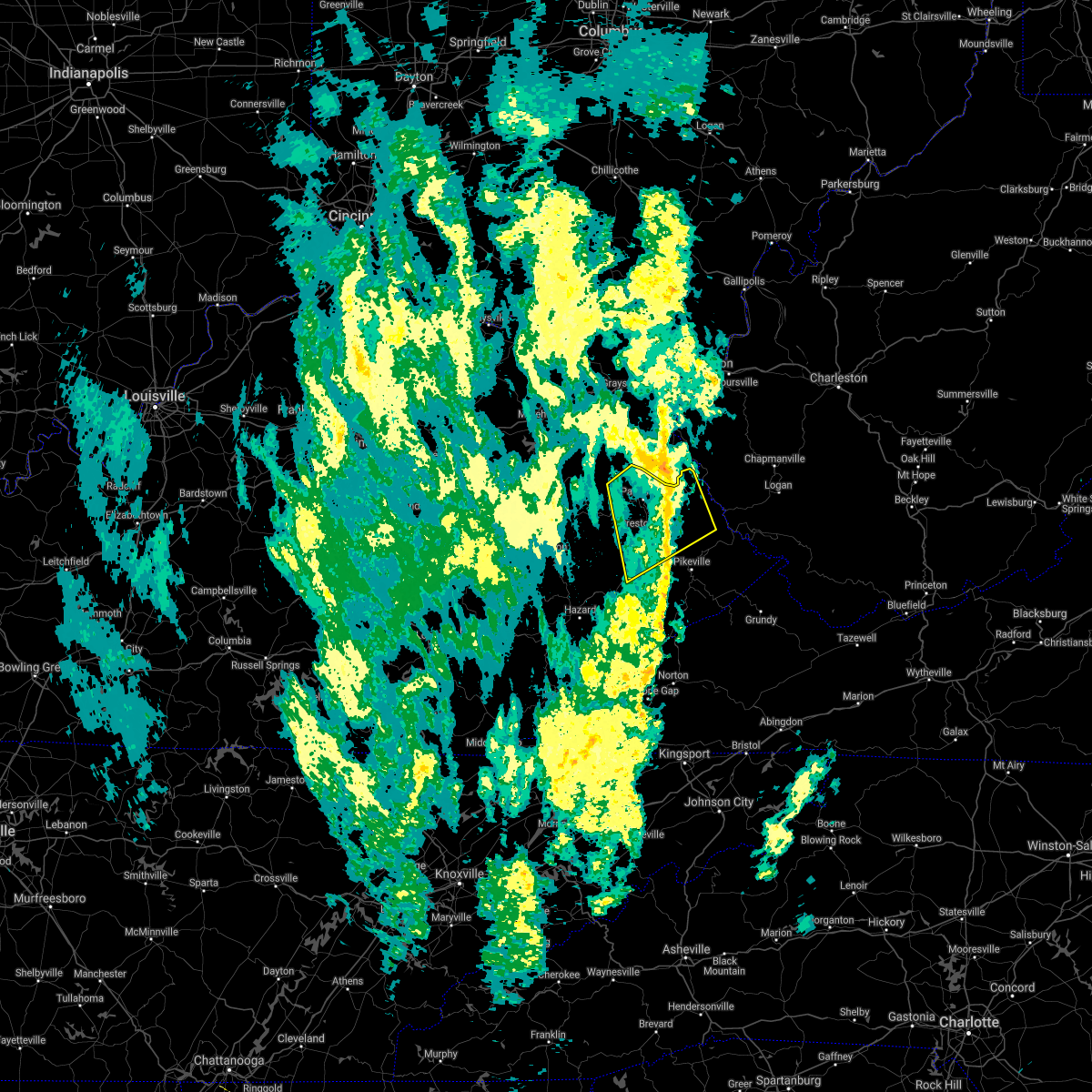 The severe thunderstorm warning for martin, east central morgan, johnson, north central knott, floyd, northwestern pike and eastern magoffin counties will expire at 1045 am edt, the storms which prompted the warning have weakened below severe limits, and no longer pose an immediate threat to life or property. therefore, the warning will be allowed to expire. however gusty winds are still possible with these thunderstorms. The severe thunderstorm warning for martin, east central morgan, johnson, north central knott, floyd, northwestern pike and eastern magoffin counties will expire at 1045 am edt, the storms which prompted the warning have weakened below severe limits, and no longer pose an immediate threat to life or property. therefore, the warning will be allowed to expire. however gusty winds are still possible with these thunderstorms.
|
| 9/22/2021 10:35 AM EDT | Highway department reported a tree down along ky-1428 in the vicinity of emma and alvin. time estimated from rada in floyd county KY, 4.7 miles NW of Prestonsburg, KY |
| 9/22/2021 10:21 AM EDT |
 At 1020 am edt, severe thunderstorms were located along a line extending from near winifred to dotson, moving northeast at 40 mph (radar indicated). Hazards include 60 mph wind gusts. Expect damage to roofs, siding, and trees. locations impacted include, bays branch, prestonsburg, meally, wells chapel, tomahawk and inez. hail threat, radar indicated max hail size, <. 75 in wind threat, radar indicated max wind gust, 60 mph. At 1020 am edt, severe thunderstorms were located along a line extending from near winifred to dotson, moving northeast at 40 mph (radar indicated). Hazards include 60 mph wind gusts. Expect damage to roofs, siding, and trees. locations impacted include, bays branch, prestonsburg, meally, wells chapel, tomahawk and inez. hail threat, radar indicated max hail size, <. 75 in wind threat, radar indicated max wind gust, 60 mph.
|
| 9/22/2021 10:14 AM EDT | Highway department reported a tree down along ky-404 in the vicinity of davi in floyd county KY, 7.4 miles NE of Prestonsburg, KY |
| 9/22/2021 10:05 AM EDT |
 At 1004 am edt, severe thunderstorms were located along a line extending from minefork to vail, moving northeast at 40 mph (radar indicated). Hazards include 60 mph wind gusts. Expect damage to roofs, siding, and trees. severe thunderstorms will be near, win around 1010 am edt. redbush around 1015 am edt. dotson around 1020 am edt. other locations in the path of these severe thunderstorms include bonanza, bays branch and prestonsburg. hail threat, radar indicated max hail size, <. 75 in wind threat, radar indicated max wind gust, 60 mph. At 1004 am edt, severe thunderstorms were located along a line extending from minefork to vail, moving northeast at 40 mph (radar indicated). Hazards include 60 mph wind gusts. Expect damage to roofs, siding, and trees. severe thunderstorms will be near, win around 1010 am edt. redbush around 1015 am edt. dotson around 1020 am edt. other locations in the path of these severe thunderstorms include bonanza, bays branch and prestonsburg. hail threat, radar indicated max hail size, <. 75 in wind threat, radar indicated max wind gust, 60 mph.
|
| 7/11/2021 5:29 PM EDT |
 At 529 pm edt, a severe thunderstorm was located over conley station, or near salyersville, moving northeast at 45 mph (radar indicated). Hazards include 60 mph wind gusts. Expect damage to roofs, siding, and trees. this severe thunderstorm will be near, bradley around 535 pm edt. riceville around 540 pm edt. Leander around 545 pm edt. At 529 pm edt, a severe thunderstorm was located over conley station, or near salyersville, moving northeast at 45 mph (radar indicated). Hazards include 60 mph wind gusts. Expect damage to roofs, siding, and trees. this severe thunderstorm will be near, bradley around 535 pm edt. riceville around 540 pm edt. Leander around 545 pm edt.
|
| 6/21/2021 5:06 PM EDT |
 The severe thunderstorm warning for southwestern martin, southeastern johnson, floyd and northwestern pike counties will expire at 515 pm edt, the storm which prompted the warning has weakened below severe limits, and no longer poses an immediate threat to life or property. therefore, the warning will be allowed to expire. however gusty winds are still possible with this thunderstorm. a severe thunderstorm watch remains in effect until 900 pm edt for southeastern and northeastern kentucky. The severe thunderstorm warning for southwestern martin, southeastern johnson, floyd and northwestern pike counties will expire at 515 pm edt, the storm which prompted the warning has weakened below severe limits, and no longer poses an immediate threat to life or property. therefore, the warning will be allowed to expire. however gusty winds are still possible with this thunderstorm. a severe thunderstorm watch remains in effect until 900 pm edt for southeastern and northeastern kentucky.
|
| 6/21/2021 4:48 PM EDT | Floyd county 911 call center reports downed tree blocking highway 194 on a hill near cow creek. time estimated from rada in floyd county KY, 6.5 miles WNW of Prestonsburg, KY |
| 6/21/2021 4:45 PM EDT |
 At 444 pm edt, a severe thunderstorm was located over pyramid, or 9 miles southwest of prestonsburg, moving east at 25 mph (radar indicated). Hazards include 60 mph wind gusts. Expect damage to roofs, siding, and trees. Locations impacted include, hueysville, dock and martin. At 444 pm edt, a severe thunderstorm was located over pyramid, or 9 miles southwest of prestonsburg, moving east at 25 mph (radar indicated). Hazards include 60 mph wind gusts. Expect damage to roofs, siding, and trees. Locations impacted include, hueysville, dock and martin.
|
| 6/21/2021 4:42 PM EDT |
 At 442 pm edt, a severe thunderstorm was located over cliff, or over prestonsburg, moving east at 35 mph (radar indicated). Hazards include 60 mph wind gusts. Expect damage to roofs, siding, and trees. this severe thunderstorm will be near, bays branch around 445 pm edt. corn fork hollow around 450 pm edt. dicks creek around 455 pm edt. mccombs around 500 pm edt. Other locations in the path of this severe thunderstorm include pleasant. At 442 pm edt, a severe thunderstorm was located over cliff, or over prestonsburg, moving east at 35 mph (radar indicated). Hazards include 60 mph wind gusts. Expect damage to roofs, siding, and trees. this severe thunderstorm will be near, bays branch around 445 pm edt. corn fork hollow around 450 pm edt. dicks creek around 455 pm edt. mccombs around 500 pm edt. Other locations in the path of this severe thunderstorm include pleasant.
|
| 6/21/2021 4:28 PM EDT |
 At 428 pm edt, a severe thunderstorm was located over duco, or 11 miles south of salyersville, moving east at 25 mph (radar indicated). Hazards include 60 mph wind gusts. Expect damage to roofs, siding, and trees. this severe thunderstorm will be near, gapville around 435 pm edt. orchard around 440 pm edt. pyramid around 445 pm edt. Other locations in the path of this severe thunderstorm include blue river, dock and martin. At 428 pm edt, a severe thunderstorm was located over duco, or 11 miles south of salyersville, moving east at 25 mph (radar indicated). Hazards include 60 mph wind gusts. Expect damage to roofs, siding, and trees. this severe thunderstorm will be near, gapville around 435 pm edt. orchard around 440 pm edt. pyramid around 445 pm edt. Other locations in the path of this severe thunderstorm include blue river, dock and martin.
|
| 7/27/2020 7:15 PM EDT | 2 trees and large limbs were blown down along woodland hills roa in floyd county KY, 3.7 miles ENE of Prestonsburg, KY |
| 7/12/2020 8:42 PM EDT |
 The severe thunderstorm warning for north central knott, northwestern floyd, northeastern breathitt and southeastern magoffin counties will expire at 845 pm edt, the storm which prompted the warning has weakened below severe limits, and no longer poses an immediate threat to life or property. therefore, the warning will be allowed to expire. The severe thunderstorm warning for north central knott, northwestern floyd, northeastern breathitt and southeastern magoffin counties will expire at 845 pm edt, the storm which prompted the warning has weakened below severe limits, and no longer poses an immediate threat to life or property. therefore, the warning will be allowed to expire.
|
| 7/12/2020 8:22 PM EDT |
 At 821 pm edt, a severe thunderstorm was located over fredville, or 11 miles southwest of prestonsburg, moving southeast at 20 mph (radar indicated). Hazards include 60 mph wind gusts and penny size hail. Expect damage to roofs, siding, and trees. Locations impacted include, fredville, vail, hippo, handshoe, gunlock, ordway, carver, pyramid, swampton, orchard, dotson and west royalton station. At 821 pm edt, a severe thunderstorm was located over fredville, or 11 miles southwest of prestonsburg, moving southeast at 20 mph (radar indicated). Hazards include 60 mph wind gusts and penny size hail. Expect damage to roofs, siding, and trees. Locations impacted include, fredville, vail, hippo, handshoe, gunlock, ordway, carver, pyramid, swampton, orchard, dotson and west royalton station.
|
| 7/12/2020 8:08 PM EDT |
 At 807 pm edt, a severe thunderstorm was located over duco, or 9 miles south of salyersville, moving southeast at 20 mph (radar indicated). Hazards include 60 mph wind gusts and quarter size hail. Hail damage to vehicles is expected. Expect wind damage to roofs, siding, and trees. At 807 pm edt, a severe thunderstorm was located over duco, or 9 miles south of salyersville, moving southeast at 20 mph (radar indicated). Hazards include 60 mph wind gusts and quarter size hail. Hail damage to vehicles is expected. Expect wind damage to roofs, siding, and trees.
|
| 7/10/2020 2:56 PM EDT |
 The severe thunderstorm warning for martin, central johnson and north central floyd counties will expire at 300 pm edt, the storm which prompted the warning has weakened below severe limits, and no longer poses an immediate threat to life or property. therefore, the warning will be allowed to expire. however gusty winds are still possible with this thunderstorm. The severe thunderstorm warning for martin, central johnson and north central floyd counties will expire at 300 pm edt, the storm which prompted the warning has weakened below severe limits, and no longer poses an immediate threat to life or property. therefore, the warning will be allowed to expire. however gusty winds are still possible with this thunderstorm.
|
| 7/10/2020 2:44 PM EDT |
 At 244 pm edt, a severe thunderstorm was located over meally, or near paintsville, moving east at 35 mph (radar indicated). Hazards include 60 mph wind gusts and penny size hail. Expect damage to roofs, siding, and trees. Locations impacted include, paintsville, prestonsburg, inez, add, oaklawn estates, fitz, davella, whitehouse, meally, prince, collista and west van lear. At 244 pm edt, a severe thunderstorm was located over meally, or near paintsville, moving east at 35 mph (radar indicated). Hazards include 60 mph wind gusts and penny size hail. Expect damage to roofs, siding, and trees. Locations impacted include, paintsville, prestonsburg, inez, add, oaklawn estates, fitz, davella, whitehouse, meally, prince, collista and west van lear.
|
| 7/10/2020 2:31 PM EDT |
 At 231 pm edt, a severe thunderstorm was located over denver, or near paintsville, moving east at 35 mph (radar indicated). Hazards include 60 mph wind gusts and penny size hail. expect damage to roofs, siding, and trees At 231 pm edt, a severe thunderstorm was located over denver, or near paintsville, moving east at 35 mph (radar indicated). Hazards include 60 mph wind gusts and penny size hail. expect damage to roofs, siding, and trees
|
| 6/10/2020 8:31 PM EDT |
 At 831 pm edt, a severe thunderstorm was located over swamp branch, or 7 miles west of prestonsburg, moving east at 45 mph (radar indicated). Hazards include 60 mph wind gusts and penny size hail. Expect damage to roofs, siding, and trees. Locations impacted include, paintsville, prestonsburg, salyersville, mason, oaklawn estates, lancer, falcon, whitehouse, burning fork, collista, west van lear and west royalton station. At 831 pm edt, a severe thunderstorm was located over swamp branch, or 7 miles west of prestonsburg, moving east at 45 mph (radar indicated). Hazards include 60 mph wind gusts and penny size hail. Expect damage to roofs, siding, and trees. Locations impacted include, paintsville, prestonsburg, salyersville, mason, oaklawn estates, lancer, falcon, whitehouse, burning fork, collista, west van lear and west royalton station.
|
| 6/10/2020 8:17 PM EDT |
 At 817 pm edt, a severe thunderstorm was located over conley station, or near salyersville, moving east at 40 mph (radar indicated). Hazards include 60 mph wind gusts and penny size hail. expect damage to roofs, siding, and trees At 817 pm edt, a severe thunderstorm was located over conley station, or near salyersville, moving east at 40 mph (radar indicated). Hazards include 60 mph wind gusts and penny size hail. expect damage to roofs, siding, and trees
|
| 5/3/2020 7:55 PM EDT |
 The severe thunderstorm warning for southwestern martin, northwestern floyd and northeastern magoffin counties will expire at 800 pm edt, the storm which prompted the warning has weakened below severe limits, and has exited the warned area. therefore, the warning will be allowed to expire. however gusty winds and heavy rain are still possible with this thunderstorm. a severe thunderstorm watch remains in effect until 1100 pm edt for southeastern and northeastern kentucky. The severe thunderstorm warning for southwestern martin, northwestern floyd and northeastern magoffin counties will expire at 800 pm edt, the storm which prompted the warning has weakened below severe limits, and has exited the warned area. therefore, the warning will be allowed to expire. however gusty winds and heavy rain are still possible with this thunderstorm. a severe thunderstorm watch remains in effect until 1100 pm edt for southeastern and northeastern kentucky.
|
| 5/3/2020 7:35 PM EDT |
 At 734 pm edt, a severe thunderstorm was located over emma, or near salyersville, moving east at 30 mph (radar indicated). Hazards include 60 mph wind gusts and quarter size hail. Hail damage to vehicles is expected. expect wind damage to roofs, siding, and trees. Locations impacted include, paintsville, prestonsburg, salyersville, mason, warfield, oaklawn estates, davella, lancer, falcon, whitehouse, wonnie and burning fork. At 734 pm edt, a severe thunderstorm was located over emma, or near salyersville, moving east at 30 mph (radar indicated). Hazards include 60 mph wind gusts and quarter size hail. Hail damage to vehicles is expected. expect wind damage to roofs, siding, and trees. Locations impacted include, paintsville, prestonsburg, salyersville, mason, warfield, oaklawn estates, davella, lancer, falcon, whitehouse, wonnie and burning fork.
|
| 5/3/2020 7:14 PM EDT |
 At 714 pm edt, a severe thunderstorm was located over gordon ford, or over west liberty, moving east at 35 mph (radar indicated). Hazards include 60 mph wind gusts and quarter size hail. Hail damage to vehicles is expected. Expect wind damage to roofs, siding, and trees. At 714 pm edt, a severe thunderstorm was located over gordon ford, or over west liberty, moving east at 35 mph (radar indicated). Hazards include 60 mph wind gusts and quarter size hail. Hail damage to vehicles is expected. Expect wind damage to roofs, siding, and trees.
|
| 4/9/2020 1:55 AM EDT |
 The severe thunderstorm warning for letcher, perry, knott, floyd, southeastern breathitt, pike and southeastern magoffin counties will expire at 200 am edt, the storms which prompted the warning are still capable of producing damaging winds and hail. the warning will be allowed to expire at its designated time, but has been replaced with a new severe thunderstorm warning in effect until 6:15 am edt. a tornado watch remains in effect until 400 am edt for southeastern and northeastern kentucky. The severe thunderstorm warning for letcher, perry, knott, floyd, southeastern breathitt, pike and southeastern magoffin counties will expire at 200 am edt, the storms which prompted the warning are still capable of producing damaging winds and hail. the warning will be allowed to expire at its designated time, but has been replaced with a new severe thunderstorm warning in effect until 6:15 am edt. a tornado watch remains in effect until 400 am edt for southeastern and northeastern kentucky.
|
| 4/9/2020 1:42 AM EDT |
 At 141 am edt, severe thunderstorms were located along a line extending from near red jacket to osborn to soft shell to near hazard, moving southeast at 45 mph (radar indicated). Hazards include 60 mph wind gusts and penny size hail. Expect damage to roofs, siding, and trees. Locations impacted include, pikeville, hazard, prestonsburg, whitesburg, hindman, letcher, estill, bath, cumberland, jenkins, coal run village and elkhorn city. At 141 am edt, severe thunderstorms were located along a line extending from near red jacket to osborn to soft shell to near hazard, moving southeast at 45 mph (radar indicated). Hazards include 60 mph wind gusts and penny size hail. Expect damage to roofs, siding, and trees. Locations impacted include, pikeville, hazard, prestonsburg, whitesburg, hindman, letcher, estill, bath, cumberland, jenkins, coal run village and elkhorn city.
|
| 4/9/2020 1:18 AM EDT |
 At 118 am edt, severe thunderstorms were located along a line extending from near oppy to dotson to lunah to canoe, moving southeast at 45 mph (radar indicated). Hazards include 60 mph wind gusts and penny size hail. expect damage to roofs, siding, and trees At 118 am edt, severe thunderstorms were located along a line extending from near oppy to dotson to lunah to canoe, moving southeast at 45 mph (radar indicated). Hazards include 60 mph wind gusts and penny size hail. expect damage to roofs, siding, and trees
|
| 12/29/2019 11:27 PM EST |
 The severe thunderstorm warning for martin, johnson, northern floyd and northwestern pike counties will expire at 1130 pm est, the storms which prompted the warning have weakened below severe limits, and no longer pose an immediate threat to life or property. therefore, the warning will be allowed to expire. The severe thunderstorm warning for martin, johnson, northern floyd and northwestern pike counties will expire at 1130 pm est, the storms which prompted the warning have weakened below severe limits, and no longer pose an immediate threat to life or property. therefore, the warning will be allowed to expire.
|
| 12/29/2019 11:17 PM EST |
 At 1116 pm est, severe thunderstorms were located along a line extending from falcon to near ivyton to orchard, moving northeast at 55 mph (radar indicated). Hazards include 60 mph wind gusts. Expect damage to roofs, siding, and trees. Locations impacted include, paintsville, prestonsburg, inez, martin, allen, oaklawn estates, bammer, davella, lancer, whitehouse, collista and west van lear. At 1116 pm est, severe thunderstorms were located along a line extending from falcon to near ivyton to orchard, moving northeast at 55 mph (radar indicated). Hazards include 60 mph wind gusts. Expect damage to roofs, siding, and trees. Locations impacted include, paintsville, prestonsburg, inez, martin, allen, oaklawn estates, bammer, davella, lancer, whitehouse, collista and west van lear.
|
| 12/29/2019 11:05 PM EST |
 At 1105 pm est, severe thunderstorms were located along a line extending from gullett to carver station to near vail, moving northeast at 55 mph (radar indicated). Hazards include 60 mph wind gusts. expect damage to roofs, siding, and trees At 1105 pm est, severe thunderstorms were located along a line extending from gullett to carver station to near vail, moving northeast at 55 mph (radar indicated). Hazards include 60 mph wind gusts. expect damage to roofs, siding, and trees
|
| 7/30/2019 6:47 PM EDT |
 At 646 pm edt, a severe thunderstorm was located over arkansas, or 7 miles south of prestonsburg, moving east at 15 mph (radar indicated). Hazards include 60 mph wind gusts and quarter size hail. Hail damage to vehicles is expected. Expect wind damage to roofs, siding, and trees. At 646 pm edt, a severe thunderstorm was located over arkansas, or 7 miles south of prestonsburg, moving east at 15 mph (radar indicated). Hazards include 60 mph wind gusts and quarter size hail. Hail damage to vehicles is expected. Expect wind damage to roofs, siding, and trees.
|
| 7/2/2019 5:28 PM EDT |
 At 527 pm edt, severe thunderstorms were located along a line extending from steele to dingus to brownlow to royalton, moving east at 15 mph (radar indicated). Hazards include 60 mph wind gusts and penny size hail. Expect damage to roofs, siding, and trees. Locations impacted include, paintsville, west liberty, salyersville, mason, moon, florress, lick branch, falcon, wonnie, burning fork, collista and west royalton station. At 527 pm edt, severe thunderstorms were located along a line extending from steele to dingus to brownlow to royalton, moving east at 15 mph (radar indicated). Hazards include 60 mph wind gusts and penny size hail. Expect damage to roofs, siding, and trees. Locations impacted include, paintsville, west liberty, salyersville, mason, moon, florress, lick branch, falcon, wonnie, burning fork, collista and west royalton station.
|
| 7/2/2019 5:14 PM EDT |
 At 514 pm edt, severe thunderstorms were located along a line extending from lenox to dingus to stringtown to tiptop, moving east at 15 mph (radar indicated). Hazards include 60 mph wind gusts and quarter size hail. Hail damage to vehicles is expected. Expect wind damage to roofs, siding, and trees. At 514 pm edt, severe thunderstorms were located along a line extending from lenox to dingus to stringtown to tiptop, moving east at 15 mph (radar indicated). Hazards include 60 mph wind gusts and quarter size hail. Hail damage to vehicles is expected. Expect wind damage to roofs, siding, and trees.
|
| 6/24/2019 5:55 PM EDT |
 At 555 pm edt, severe thunderstorms were located along a line extending from near ulysses to pevier to mccombs, moving northeast at 50 mph (radar indicated). Hazards include 60 mph wind gusts. Expect damage to roofs, siding, and trees. Locations impacted include, prestonsburg, inez, martin, forest hills, warfield, allen, add, pilgrim, bammer, davella, lancer and whitehouse. At 555 pm edt, severe thunderstorms were located along a line extending from near ulysses to pevier to mccombs, moving northeast at 50 mph (radar indicated). Hazards include 60 mph wind gusts. Expect damage to roofs, siding, and trees. Locations impacted include, prestonsburg, inez, martin, forest hills, warfield, allen, add, pilgrim, bammer, davella, lancer and whitehouse.
|
| 6/24/2019 5:44 PM EDT |
 At 544 pm edt, severe thunderstorms were located along a line extending from near stambaugh to odds to beaver junction, moving northeast at 50 mph (radar indicated). Hazards include 60 mph wind gusts. Expect damage to roofs, siding, and trees. Locations impacted include, paintsville, prestonsburg, inez, martin, forest hills, warfield, allen, pilgrim, oaklawn estates, bammer, davella and lancer. At 544 pm edt, severe thunderstorms were located along a line extending from near stambaugh to odds to beaver junction, moving northeast at 50 mph (radar indicated). Hazards include 60 mph wind gusts. Expect damage to roofs, siding, and trees. Locations impacted include, paintsville, prestonsburg, inez, martin, forest hills, warfield, allen, pilgrim, oaklawn estates, bammer, davella and lancer.
|
| 6/24/2019 5:38 PM EDT | A large limb was blown down. this is a report shared via twitter with pictur in floyd county KY, 0.5 miles NE of Prestonsburg, KY |
| 6/24/2019 5:36 PM EDT | A tree was uprooted along ky 321 with the tree pullling gas lines out of the groun in floyd county KY, 1.3 miles SE of Prestonsburg, KY |
| 6/24/2019 5:35 PM EDT | A tree was blown down along little paint creek roa in floyd county KY, 3.7 miles SSE of Prestonsburg, KY |
| 6/24/2019 5:33 PM EDT |
 At 532 pm edt, severe thunderstorms were located along a line extending from near hargis to bonanza to orchard, moving northeast at 50 mph (radar indicated). Hazards include 60 mph wind gusts. Expect damage to roofs, siding, and trees. Locations impacted include, paintsville, prestonsburg, salyersville, inez, martin, forest hills, warfield, allen, pilgrim, oaklawn estates, bammer and davella. At 532 pm edt, severe thunderstorms were located along a line extending from near hargis to bonanza to orchard, moving northeast at 50 mph (radar indicated). Hazards include 60 mph wind gusts. Expect damage to roofs, siding, and trees. Locations impacted include, paintsville, prestonsburg, salyersville, inez, martin, forest hills, warfield, allen, pilgrim, oaklawn estates, bammer and davella.
|
| 6/24/2019 5:22 PM EDT | A tree was blown down onto the moutain parkway and struck a vehicle that had stopped due to the heavy rain and strong winds. no injuries occurre in floyd county KY, 9.8 miles E of Prestonsburg, KY |
| 6/24/2019 5:18 PM EDT |
 At 517 pm edt, severe thunderstorms were located along a line extending from elsie to carver to decoy, moving east at 50 mph (radar indicated). Hazards include 60 mph wind gusts. expect damage to roofs, siding, and trees At 517 pm edt, severe thunderstorms were located along a line extending from elsie to carver to decoy, moving east at 50 mph (radar indicated). Hazards include 60 mph wind gusts. expect damage to roofs, siding, and trees
|
| 5/29/2019 2:40 PM EDT |
 The severe thunderstorm warning for southwestern martin, southwestern johnson, northeastern knott, floyd, eastern breathitt, northwestern pike and southeastern magoffin counties will expire at 245 pm edt, the storms which prompted the warning have moved out of the area. therefore, the warning will be allowed to expire. however heavy rain is still possible with these thunderstorms. The severe thunderstorm warning for southwestern martin, southwestern johnson, northeastern knott, floyd, eastern breathitt, northwestern pike and southeastern magoffin counties will expire at 245 pm edt, the storms which prompted the warning have moved out of the area. therefore, the warning will be allowed to expire. however heavy rain is still possible with these thunderstorms.
|
| 5/29/2019 2:20 PM EDT |
 At 220 pm edt, severe thunderstorms were located along a line extending from tomahawk to ivel to mid, moving east at 60 mph (radar indicated). Hazards include 60 mph wind gusts and penny size hail. expect damage to roofs, siding, and trees At 220 pm edt, severe thunderstorms were located along a line extending from tomahawk to ivel to mid, moving east at 60 mph (radar indicated). Hazards include 60 mph wind gusts and penny size hail. expect damage to roofs, siding, and trees
|
| 5/29/2019 2:17 PM EDT |
 At 217 pm edt, severe thunderstorms were located along a line extending from odds to martin to bosco, moving southeast at 55 mph (radar indicated). Hazards include 60 mph wind gusts and penny size hail. Expect damage to roofs, siding, and trees. Locations impacted include, paintsville, prestonsburg, estill, coal run village, martin, wayland, allen, east mcdowell, fredville, oaklawn estates, bammer and hippo. At 217 pm edt, severe thunderstorms were located along a line extending from odds to martin to bosco, moving southeast at 55 mph (radar indicated). Hazards include 60 mph wind gusts and penny size hail. Expect damage to roofs, siding, and trees. Locations impacted include, paintsville, prestonsburg, estill, coal run village, martin, wayland, allen, east mcdowell, fredville, oaklawn estates, bammer and hippo.
|
| 5/29/2019 2:15 PM EDT | Roof blown off business. roof on top of cars and blocking street in floyd county KY, 0.5 miles NE of Prestonsburg, KY |
| 5/29/2019 2:15 PM EDT | Estimated 60 mph winds. broke out top of pear tree. large limbs dow in floyd county KY, 3.7 miles ENE of Prestonsburg, KY |
| 5/29/2019 2:12 PM EDT | *** 1 fatal *** a roof was lifted off a building and blown on the road below. this struck a vehicle and led to a fatality near the hock shop on w court st in downtown p in floyd county KY, 0.5 miles NE of Prestonsburg, KY |
| 5/29/2019 2:10 PM EDT | Tree fell on a hous in floyd county KY, 0.9 miles ENE of Prestonsburg, KY |
| 5/29/2019 2:00 PM EDT |
 At 200 pm edt, severe thunderstorms were located along a line extending from near hargis to hendricks to saldee, moving southeast at 40 mph (radar indicated). Hazards include 60 mph wind gusts and quarter size hail. Hail damage to vehicles is expected. Expect wind damage to roofs, siding, and trees. At 200 pm edt, severe thunderstorms were located along a line extending from near hargis to hendricks to saldee, moving southeast at 40 mph (radar indicated). Hazards include 60 mph wind gusts and quarter size hail. Hail damage to vehicles is expected. Expect wind damage to roofs, siding, and trees.
|
| 6/22/2018 5:08 PM EDT |
 At 507 pm edt, severe thunderstorms were located along a line extending from west royalton station to gapville to mid, moving east at 35 mph (radar indicated). Hazards include 60 mph wind gusts. expect damage to roofs, siding, and trees At 507 pm edt, severe thunderstorms were located along a line extending from west royalton station to gapville to mid, moving east at 35 mph (radar indicated). Hazards include 60 mph wind gusts. expect damage to roofs, siding, and trees
|
| 5/29/2018 5:32 PM EDT |
 At 532 pm edt, severe thunderstorms were located along a line extending from near odds to prestonsburg to near lancer, moving northwest at 25 mph (radar indicated). Hazards include 60 mph wind gusts. Expect damage to roofs, siding, and trees. Locations impacted include, paintsville, prestonsburg, martin, allen, oaklawn estates, bammer, fitz, davella, lancer, meally, prince, collista, west van lear, dotson, ivel, williamsport, blue river, buffalo, swamp branch and auxier. At 532 pm edt, severe thunderstorms were located along a line extending from near odds to prestonsburg to near lancer, moving northwest at 25 mph (radar indicated). Hazards include 60 mph wind gusts. Expect damage to roofs, siding, and trees. Locations impacted include, paintsville, prestonsburg, martin, allen, oaklawn estates, bammer, fitz, davella, lancer, meally, prince, collista, west van lear, dotson, ivel, williamsport, blue river, buffalo, swamp branch and auxier.
|
| 5/29/2018 5:13 PM EDT |
 At 513 pm edt, severe thunderstorms were located along a line extending from near mccombs to endicott to ivel, moving northwest at 25 mph (radar indicated). Hazards include 60 mph wind gusts. expect damage to roofs, siding, and trees At 513 pm edt, severe thunderstorms were located along a line extending from near mccombs to endicott to ivel, moving northwest at 25 mph (radar indicated). Hazards include 60 mph wind gusts. expect damage to roofs, siding, and trees
|
| 4/4/2018 12:12 AM EDT |
 The severe thunderstorm warning for southwestern johnson, northwestern floyd, northeastern breathitt and magoffin counties will expire at 1215 am edt, the storm which prompted the warning has weakened below severe limits, and no longer poses an immediate threat to life or property. therefore the warning will be allowed to expire. a severe thunderstorm watch remains in effect until 300 am edt for southeastern and northeastern kentucky. The severe thunderstorm warning for southwestern johnson, northwestern floyd, northeastern breathitt and magoffin counties will expire at 1215 am edt, the storm which prompted the warning has weakened below severe limits, and no longer poses an immediate threat to life or property. therefore the warning will be allowed to expire. a severe thunderstorm watch remains in effect until 300 am edt for southeastern and northeastern kentucky.
|
| 4/4/2018 12:01 AM EDT |
 At 1200 am edt, a severe thunderstorm was located over conley station, or near salyersville, moving east at 45 mph (radar indicated). Hazards include 60 mph wind gusts. Expect damage to roofs, siding, and trees. Locations impacted include, paintsville, prestonsburg, salyersville, mason, fredville, fitz, oil springs, gifford, falcon, carver, burning fork, kernie, collista, dotson, west royalton station, carver station, blue river, swamp branch, riceville and cliff. At 1200 am edt, a severe thunderstorm was located over conley station, or near salyersville, moving east at 45 mph (radar indicated). Hazards include 60 mph wind gusts. Expect damage to roofs, siding, and trees. Locations impacted include, paintsville, prestonsburg, salyersville, mason, fredville, fitz, oil springs, gifford, falcon, carver, burning fork, kernie, collista, dotson, west royalton station, carver station, blue river, swamp branch, riceville and cliff.
|
| 4/3/2018 11:44 PM EDT |
 At 1144 pm edt, a severe thunderstorm was located over rock lick, or 7 miles northeast of jackson, moving east at 45 mph (radar indicated). Hazards include 60 mph wind gusts. expect damage to roofs, siding, and trees At 1144 pm edt, a severe thunderstorm was located over rock lick, or 7 miles northeast of jackson, moving east at 45 mph (radar indicated). Hazards include 60 mph wind gusts. expect damage to roofs, siding, and trees
|
| 3/17/2018 6:17 PM EDT | Quarter sized hail reported 5.9 miles N of Prestonsburg, KY |
| 6/23/2017 10:07 PM EDT |
 The severe thunderstorm warning for northwestern knott, northwestern floyd and southeastern magoffin counties will expire at 1015 pm edt, the showers which prompted the warning has weakened below severe limits, and has exited the warned area. therefore, the warning will be allowed to expire. however gusty winds and heavy rain are still possible with these showers. The severe thunderstorm warning for northwestern knott, northwestern floyd and southeastern magoffin counties will expire at 1015 pm edt, the showers which prompted the warning has weakened below severe limits, and has exited the warned area. therefore, the warning will be allowed to expire. however gusty winds and heavy rain are still possible with these showers.
|
| 6/23/2017 9:54 PM EDT |
 At 953 pm edt, a severe thunderstorm was located over vail, or 12 miles north of hindman, moving southeast at 35 mph (radar indicated). Hazards include 60 mph wind gusts. Expect damage to roofs, siding, and trees. locations impacted include, prestonsburg, hindman, fredville, bosco, mousie, leburn, vail, hippo, handshoe, gunlock, ordway, bearville, pyramid, orchard, dotson, garner, vest, blue river, soft shell and gapville. A tornado watch remains in effect until 1000 pm edt for southeastern and northeastern kentucky. At 953 pm edt, a severe thunderstorm was located over vail, or 12 miles north of hindman, moving southeast at 35 mph (radar indicated). Hazards include 60 mph wind gusts. Expect damage to roofs, siding, and trees. locations impacted include, prestonsburg, hindman, fredville, bosco, mousie, leburn, vail, hippo, handshoe, gunlock, ordway, bearville, pyramid, orchard, dotson, garner, vest, blue river, soft shell and gapville. A tornado watch remains in effect until 1000 pm edt for southeastern and northeastern kentucky.
|
| 6/23/2017 9:42 PM EDT |
 At 925 pm edt, a severe thunderstorm was located over guage, or 9 miles northeast of jackson, moving southeast at 35 mph (radar indicated). Hazards include 60 mph wind gusts. expect damage to roofs, siding, and trees At 925 pm edt, a severe thunderstorm was located over guage, or 9 miles northeast of jackson, moving southeast at 35 mph (radar indicated). Hazards include 60 mph wind gusts. expect damage to roofs, siding, and trees
|
| 6/23/2017 9:25 PM EDT |
 At 925 pm edt, a severe thunderstorm was located over guage, or 9 miles northeast of jackson, moving southeast at 35 mph (radar indicated). Hazards include 60 mph wind gusts. expect damage to roofs, siding, and trees At 925 pm edt, a severe thunderstorm was located over guage, or 9 miles northeast of jackson, moving southeast at 35 mph (radar indicated). Hazards include 60 mph wind gusts. expect damage to roofs, siding, and trees
|
| 5/31/2017 4:10 PM EDT | Tree reported down in the city limits of prestonsburg...time estimated based on rada in floyd county KY, 0.5 miles NE of Prestonsburg, KY |
| 5/31/2017 4:07 PM EDT |
 At 406 pm edt, a severe thunderstorm was located over alvin, or near prestonsburg, moving east at 30 mph (radar indicated). Hazards include 60 mph wind gusts and quarter size hail. Hail damage to vehicles is expected. Expect wind damage to roofs, siding, and trees. At 406 pm edt, a severe thunderstorm was located over alvin, or near prestonsburg, moving east at 30 mph (radar indicated). Hazards include 60 mph wind gusts and quarter size hail. Hail damage to vehicles is expected. Expect wind damage to roofs, siding, and trees.
|
| 5/31/2017 3:52 PM EDT |
 At 351 pm edt, a severe thunderstorm was located over swamp branch, or 7 miles southwest of paintsville, moving east at 30 mph (radar indicated). Hazards include 60 mph wind gusts and quarter size hail. Hail damage to vehicles is expected. expect wind damage to roofs, siding, and trees. Locations impacted include, paintsville, prestonsburg, allen, oaklawn estates, bammer, east point, fitz, wells chapel, lancer, thelma, dobson, meally, thealka, collista, west van lear, dotson, williamsport, denver, blue river and buffalo. At 351 pm edt, a severe thunderstorm was located over swamp branch, or 7 miles southwest of paintsville, moving east at 30 mph (radar indicated). Hazards include 60 mph wind gusts and quarter size hail. Hail damage to vehicles is expected. expect wind damage to roofs, siding, and trees. Locations impacted include, paintsville, prestonsburg, allen, oaklawn estates, bammer, east point, fitz, wells chapel, lancer, thelma, dobson, meally, thealka, collista, west van lear, dotson, williamsport, denver, blue river and buffalo.
|
| 5/31/2017 3:35 PM EDT |
 At 335 pm edt, a severe thunderstorm was located over burning fork, or over salyersville, moving east at 25 mph (radar indicated). Hazards include 60 mph wind gusts and quarter size hail. Hail damage to vehicles is expected. Expect wind damage to roofs, siding, and trees. At 335 pm edt, a severe thunderstorm was located over burning fork, or over salyersville, moving east at 25 mph (radar indicated). Hazards include 60 mph wind gusts and quarter size hail. Hail damage to vehicles is expected. Expect wind damage to roofs, siding, and trees.
|
| 5/20/2017 9:26 PM EDT |
 At 925 pm edt, severe thunderstorms were located along a line extending from near elna to brainard, moving northeast at 30 mph (radar indicated). Hazards include 60 mph wind gusts and quarter size hail. Hail damage to vehicles is expected. expect wind damage to roofs, siding, and trees. Locations impacted include, paintsville, prestonsburg, oaklawn estates, fitz, oil springs, falcon, meally, collista, west van lear, dotson, williamsport, offutt, buffalo, swamp branch, riceville, auxier, cliff, niles, gypsy and brainard. At 925 pm edt, severe thunderstorms were located along a line extending from near elna to brainard, moving northeast at 30 mph (radar indicated). Hazards include 60 mph wind gusts and quarter size hail. Hail damage to vehicles is expected. expect wind damage to roofs, siding, and trees. Locations impacted include, paintsville, prestonsburg, oaklawn estates, fitz, oil springs, falcon, meally, collista, west van lear, dotson, williamsport, offutt, buffalo, swamp branch, riceville, auxier, cliff, niles, gypsy and brainard.
|
| 5/20/2017 9:19 PM EDT |
 At 919 pm edt, a severe thunderstorm was located over bradley, or near salyersville, moving northeast at 20 mph (radar indicated). Hazards include 60 mph wind gusts and half dollar size hail. Hail damage to vehicles is expected. expect wind damage to roofs, siding, and trees. Locations impacted include, prestonsburg, brownlow, fredville, bradley, east point, gunlock, oil springs, ordway, lancer, falcon, ivyton, dobson, burning fork, cyrus, orchard, dotson, mashfork, denver, conley and blue river. At 919 pm edt, a severe thunderstorm was located over bradley, or near salyersville, moving northeast at 20 mph (radar indicated). Hazards include 60 mph wind gusts and half dollar size hail. Hail damage to vehicles is expected. expect wind damage to roofs, siding, and trees. Locations impacted include, prestonsburg, brownlow, fredville, bradley, east point, gunlock, oil springs, ordway, lancer, falcon, ivyton, dobson, burning fork, cyrus, orchard, dotson, mashfork, denver, conley and blue river.
|
| 5/20/2017 9:12 PM EDT |
 At 910 pm edt, severe thunderstorms were located along a line extending from falcon to dobson to dotson to waldo, moving northeast at 30 mph (radar indicated). Hazards include 60 mph wind gusts and quarter size hail. Hail damage to vehicles is expected. expect wind damage to roofs, siding, and trees. Locations impacted include, paintsville, prestonsburg, fredville, oaklawn estates, fitz, gunlock, oil springs, lancer, falcon, burning fork, meally, collista, orchard, west van lear, dotson, williamsport, offutt, blue river, buffalo and swamp branch. At 910 pm edt, severe thunderstorms were located along a line extending from falcon to dobson to dotson to waldo, moving northeast at 30 mph (radar indicated). Hazards include 60 mph wind gusts and quarter size hail. Hail damage to vehicles is expected. expect wind damage to roofs, siding, and trees. Locations impacted include, paintsville, prestonsburg, fredville, oaklawn estates, fitz, gunlock, oil springs, lancer, falcon, burning fork, meally, collista, orchard, west van lear, dotson, williamsport, offutt, blue river, buffalo and swamp branch.
|
| 5/20/2017 9:08 PM EDT |
 At 907 pm edt, severe thunderstorms were located along a line extending from falcon to swamp branch to dotson to near waldo, moving northeast at 30 mph (radar indicated). Hazards include 60 mph wind gusts and quarter size hail. Hail damage to vehicles is expected. Expect wind damage to roofs, siding, and trees. At 907 pm edt, severe thunderstorms were located along a line extending from falcon to swamp branch to dotson to near waldo, moving northeast at 30 mph (radar indicated). Hazards include 60 mph wind gusts and quarter size hail. Hail damage to vehicles is expected. Expect wind damage to roofs, siding, and trees.
|
| 5/20/2017 8:49 PM EDT |
 At 849 pm edt, a severe thunderstorm was located over tiptop, or 10 miles south of salyersville, moving northeast at 20 mph (radar indicated). Hazards include 60 mph wind gusts and quarter size hail. Hail damage to vehicles is expected. Expect wind damage to roofs, siding, and trees. At 849 pm edt, a severe thunderstorm was located over tiptop, or 10 miles south of salyersville, moving northeast at 20 mph (radar indicated). Hazards include 60 mph wind gusts and quarter size hail. Hail damage to vehicles is expected. Expect wind damage to roofs, siding, and trees.
|
| 5/19/2017 10:52 PM EDT |
 At 1051 pm edt, severe thunderstorms were located along a line extending from bradbury to corn fork hollow to blue river to sikes, moving east at 25 mph (radar indicated). Hazards include 60 mph wind gusts. Expect damage to roofs, siding, and trees. Locations impacted include, pikeville, prestonsburg, jackson, inez, estill, coal run village, martin, wayland, warfield, allen, meta, pilgrim, buck, bammer, vail, handshoe, davella, glo, lancer and bearville. At 1051 pm edt, severe thunderstorms were located along a line extending from bradbury to corn fork hollow to blue river to sikes, moving east at 25 mph (radar indicated). Hazards include 60 mph wind gusts. Expect damage to roofs, siding, and trees. Locations impacted include, pikeville, prestonsburg, jackson, inez, estill, coal run village, martin, wayland, warfield, allen, meta, pilgrim, buck, bammer, vail, handshoe, davella, glo, lancer and bearville.
|
| 5/19/2017 10:44 PM EDT | Tree down around mile marker 2 on ky 11 in floyd county KY, 2.6 miles NE of Prestonsburg, KY |
| 5/19/2017 10:40 PM EDT | Quarter sized hail reported 9.8 miles E of Prestonsburg, KY |
| 5/19/2017 10:31 PM EDT |
 At 1030 pm edt, severe thunderstorms were located along a line extending from hammond to bonanza to swampton to jackson, moving east at 25 mph (radar indicated). Hazards include 60 mph wind gusts and quarter size hail. Hail damage to vehicles is expected. Expect wind damage to roofs, siding, and trees. At 1030 pm edt, severe thunderstorms were located along a line extending from hammond to bonanza to swampton to jackson, moving east at 25 mph (radar indicated). Hazards include 60 mph wind gusts and quarter size hail. Hail damage to vehicles is expected. Expect wind damage to roofs, siding, and trees.
|
| 5/19/2017 10:18 PM EDT |
 At 1017 pm edt, a severe thunderstorm was located over dobson, or 7 miles southwest of paintsville, moving east at 30 mph (radar indicated). Hazards include 60 mph wind gusts and quarter size hail. Hail damage to vehicles is expected. expect wind damage to roofs, siding, and trees. Locations impacted include, paintsville, prestonsburg, salyersville, inez, mason, martin, allen, oaklawn estates, lancer, falcon, whitehouse, wonnie, burning fork, kernie, collista, west van lear, west royalton station, williamsport, blue river and redbush. At 1017 pm edt, a severe thunderstorm was located over dobson, or 7 miles southwest of paintsville, moving east at 30 mph (radar indicated). Hazards include 60 mph wind gusts and quarter size hail. Hail damage to vehicles is expected. expect wind damage to roofs, siding, and trees. Locations impacted include, paintsville, prestonsburg, salyersville, inez, mason, martin, allen, oaklawn estates, lancer, falcon, whitehouse, wonnie, burning fork, kernie, collista, west van lear, west royalton station, williamsport, blue river and redbush.
|
| 5/19/2017 10:05 PM EDT |
 At 1004 pm edt, a severe thunderstorm was located over mashfork, or near salyersville, moving east at 30 mph (radar indicated). Hazards include 60 mph wind gusts and half dollar size hail. Hail damage to vehicles is expected. expect wind damage to roofs, siding, and trees. Locations impacted include, paintsville, prestonsburg, salyersville, inez, mason, lewis, martin, allen, oaklawn estates, florress, lancer, falcon, whitehouse, wonnie, burning fork, kernie, collista, west van lear, west royalton station and panama. At 1004 pm edt, a severe thunderstorm was located over mashfork, or near salyersville, moving east at 30 mph (radar indicated). Hazards include 60 mph wind gusts and half dollar size hail. Hail damage to vehicles is expected. expect wind damage to roofs, siding, and trees. Locations impacted include, paintsville, prestonsburg, salyersville, inez, mason, lewis, martin, allen, oaklawn estates, florress, lancer, falcon, whitehouse, wonnie, burning fork, kernie, collista, west van lear, west royalton station and panama.
|
| 5/19/2017 9:46 PM EDT |
 At 946 pm edt, a severe thunderstorm was located over wonnie, or near salyersville, moving east at 30 mph (radar indicated). Hazards include 60 mph wind gusts and half dollar size hail. Hail damage to vehicles is expected. Expect wind damage to roofs, siding, and trees. At 946 pm edt, a severe thunderstorm was located over wonnie, or near salyersville, moving east at 30 mph (radar indicated). Hazards include 60 mph wind gusts and half dollar size hail. Hail damage to vehicles is expected. Expect wind damage to roofs, siding, and trees.
|
| 5/11/2017 4:49 PM EDT |
 At 448 pm edt, a severe thunderstorm was located over riceville, or 8 miles east of salyersville, moving southeast at 40 mph (radar indicated). Hazards include 60 mph wind gusts and penny size hail. Expect damage to roofs, siding, and trees. Locations impacted include, paintsville, prestonsburg, salyersville, mason, oaklawn estates, fitz, oil springs, falcon, burning fork, meally, collista, west van lear, dotson, west royalton station, blue river, buffalo, swamp branch, riceville, auxier and cliff. At 448 pm edt, a severe thunderstorm was located over riceville, or 8 miles east of salyersville, moving southeast at 40 mph (radar indicated). Hazards include 60 mph wind gusts and penny size hail. Expect damage to roofs, siding, and trees. Locations impacted include, paintsville, prestonsburg, salyersville, mason, oaklawn estates, fitz, oil springs, falcon, burning fork, meally, collista, west van lear, dotson, west royalton station, blue river, buffalo, swamp branch, riceville, auxier and cliff.
|
| 5/11/2017 4:30 PM EDT |
 At 429 pm edt, a severe thunderstorm was located over licksburg, or near salyersville, moving southeast at 40 mph (radar indicated). Hazards include 60 mph wind gusts and quarter size hail. Hail damage to vehicles is expected. expect wind damage to roofs, siding, and trees. Locations impacted include, paintsville, prestonsburg, salyersville, mason, haleburg, oaklawn estates, fitz, oil springs, bethanna, gifford, falcon, logville, wonnie, burning fork, kernie, meally, collista, west van lear, dotson and west royalton station. At 429 pm edt, a severe thunderstorm was located over licksburg, or near salyersville, moving southeast at 40 mph (radar indicated). Hazards include 60 mph wind gusts and quarter size hail. Hail damage to vehicles is expected. expect wind damage to roofs, siding, and trees. Locations impacted include, paintsville, prestonsburg, salyersville, mason, haleburg, oaklawn estates, fitz, oil springs, bethanna, gifford, falcon, logville, wonnie, burning fork, kernie, meally, collista, west van lear, dotson and west royalton station.
|
| 5/11/2017 4:19 PM EDT |
 At 418 pm edt, a severe thunderstorm was located over white oak, or near west liberty, moving southeast at 40 mph (radar indicated). Hazards include 60 mph wind gusts and quarter size hail. Hail damage to vehicles is expected. Expect wind damage to roofs, siding, and trees. At 418 pm edt, a severe thunderstorm was located over white oak, or near west liberty, moving southeast at 40 mph (radar indicated). Hazards include 60 mph wind gusts and quarter size hail. Hail damage to vehicles is expected. Expect wind damage to roofs, siding, and trees.
|
| 4/29/2017 11:27 PM EDT |
 At 1126 pm edt, a severe thunderstorm was located over odds, or 7 miles northeast of prestonsburg, moving northeast at 35 mph (radar indicated). Hazards include 60 mph wind gusts and quarter size hail. Hail damage to vehicles is expected. Expect wind damage to roofs, siding, and trees. At 1126 pm edt, a severe thunderstorm was located over odds, or 7 miles northeast of prestonsburg, moving northeast at 35 mph (radar indicated). Hazards include 60 mph wind gusts and quarter size hail. Hail damage to vehicles is expected. Expect wind damage to roofs, siding, and trees.
|
| 4/29/2017 11:20 PM EDT |
 At 1119 pm edt, a severe thunderstorm was located over odds, or near prestonsburg, moving north at 40 mph (radar indicated). Hazards include 60 mph wind gusts and quarter size hail. Hail damage to vehicles is expected. expect wind damage to roofs, siding, and trees. Locations impacted include, paintsville, prestonsburg, inez, warfield, add, pilgrim, oaklawn estates, davella, lancer, whitehouse, meally, prince, west van lear, williamsport, offutt, milo, lovely, buffalo, auxier and cliff. At 1119 pm edt, a severe thunderstorm was located over odds, or near prestonsburg, moving north at 40 mph (radar indicated). Hazards include 60 mph wind gusts and quarter size hail. Hail damage to vehicles is expected. expect wind damage to roofs, siding, and trees. Locations impacted include, paintsville, prestonsburg, inez, warfield, add, pilgrim, oaklawn estates, davella, lancer, whitehouse, meally, prince, west van lear, williamsport, offutt, milo, lovely, buffalo, auxier and cliff.
|
| 4/29/2017 11:12 PM EDT | Quarter sized hail reported 1.4 miles WNW of Prestonsburg, KY, quarter sized hail in lancer. |
| 4/29/2017 11:03 PM EDT |
 At 1103 pm edt, severe thunderstorms were located along a line extending from martin to coal run village to near mcandrews, moving northeast at 40 mph (radar indicated). Hazards include 60 mph wind gusts and quarter size hail. Hail damage to vehicles is expected. Expect wind damage to roofs, siding, and trees. At 1103 pm edt, severe thunderstorms were located along a line extending from martin to coal run village to near mcandrews, moving northeast at 40 mph (radar indicated). Hazards include 60 mph wind gusts and quarter size hail. Hail damage to vehicles is expected. Expect wind damage to roofs, siding, and trees.
|
| 3/27/2017 2:53 PM EDT |
 The severe thunderstorm warning for southwestern martin, northeastern floyd and northwestern pike counties will expire at 300 pm edt, the storm which prompted the warning has moved out of the area. therefore the warning will be allowed to expire. The severe thunderstorm warning for southwestern martin, northeastern floyd and northwestern pike counties will expire at 300 pm edt, the storm which prompted the warning has moved out of the area. therefore the warning will be allowed to expire.
|
| 3/27/2017 2:39 PM EDT |
 At 239 pm edt, a severe thunderstorm was located over corn fork hollow, or near prestonsburg, moving northeast at 20 mph (radar indicated). Hazards include 60 mph wind gusts and quarter size hail. Hail damage to vehicles is expected. expect wind damage to roofs, siding, and trees. Locations impacted include, prestonsburg, davisport, gulnare, dicks creek, endicott, corn fork hollow, alvin, ivel, pleasant and mccombs. At 239 pm edt, a severe thunderstorm was located over corn fork hollow, or near prestonsburg, moving northeast at 20 mph (radar indicated). Hazards include 60 mph wind gusts and quarter size hail. Hail damage to vehicles is expected. expect wind damage to roofs, siding, and trees. Locations impacted include, prestonsburg, davisport, gulnare, dicks creek, endicott, corn fork hollow, alvin, ivel, pleasant and mccombs.
|
| 3/27/2017 2:31 PM EDT |
 At 230 pm edt, a severe thunderstorm was located over lancer, or over prestonsburg, moving northeast at 20 mph (radar indicated). Hazards include 60 mph wind gusts and quarter size hail. Hail damage to vehicles is expected. expect wind damage to roofs, siding, and trees. Locations impacted include, prestonsburg, martin, allen, endicott, bammer, lancer, arkansas, pyramid, dotson, ivel, blue river, auxier, gulnare, dicks creek, cliff, brainard, pleasant, beaver junction, bays branch and mccombs. At 230 pm edt, a severe thunderstorm was located over lancer, or over prestonsburg, moving northeast at 20 mph (radar indicated). Hazards include 60 mph wind gusts and quarter size hail. Hail damage to vehicles is expected. expect wind damage to roofs, siding, and trees. Locations impacted include, prestonsburg, martin, allen, endicott, bammer, lancer, arkansas, pyramid, dotson, ivel, blue river, auxier, gulnare, dicks creek, cliff, brainard, pleasant, beaver junction, bays branch and mccombs.
|
| 3/27/2017 2:14 PM EDT |
 At 214 pm edt, a severe thunderstorm was located over blue river, or near prestonsburg, moving northeast at 20 mph (radar indicated). Hazards include 60 mph wind gusts and half dollar size hail. Hail damage to vehicles is expected. Expect wind damage to roofs, siding, and trees. At 214 pm edt, a severe thunderstorm was located over blue river, or near prestonsburg, moving northeast at 20 mph (radar indicated). Hazards include 60 mph wind gusts and half dollar size hail. Hail damage to vehicles is expected. Expect wind damage to roofs, siding, and trees.
|
| 3/1/2017 9:42 AM EST | Roof damaged on a house and a well pump house turned over on sugarloaf branch roa in floyd county KY, 4.1 miles W of Prestonsburg, KY |
| 3/1/2017 9:35 AM EST | A 20x24 outbuilding was blown off its foundation. numerous trees downe in floyd county KY, 5.2 miles E of Prestonsburg, KY |
| 3/1/2017 9:25 AM EST |
 At 925 am est, severe thunderstorms were located along a line extending from ulysses to evanston to tanksley, moving east at 60 mph (radar indicated). Hazards include 70 mph wind gusts. Expect considerable tree damage. Damage is likely to mobile homes, roofs, and outbuildings. At 925 am est, severe thunderstorms were located along a line extending from ulysses to evanston to tanksley, moving east at 60 mph (radar indicated). Hazards include 70 mph wind gusts. Expect considerable tree damage. Damage is likely to mobile homes, roofs, and outbuildings.
|
| 3/1/2017 9:12 AM EST | Roof damaged on a house and a well pump house turned over on sugarloaf branch roa in floyd county KY, 4.1 miles W of Prestonsburg, KY |
| 8/17/2016 11:57 AM EDT |
 At 1156 am edt, a severe thunderstorm was located over east point, or near prestonsburg, moving east at 25 mph (radar indicated). Hazards include 60 mph wind gusts and nickel size hail. Expect damage to roofs. siding. and trees. locations impacted include, paintsville, prestonsburg, riceville, meally, west van lear, hagerhill, swamp branch, staffordsville, corn fork hollow, boons camp, offutt, dobson, niles, bays branch, oil springs, lancer, auxier, dicks creek, ballot and tutor key. this includes the following highways, kentucky highway 3 in floyd county between mile markers 1 and 4. kentucky highway 3 in johnson county u. s. highway 23 in floyd county between mile markers 17 and 21. u. s. Highway 23 in johnson county between mile markers 0 and 8. At 1156 am edt, a severe thunderstorm was located over east point, or near prestonsburg, moving east at 25 mph (radar indicated). Hazards include 60 mph wind gusts and nickel size hail. Expect damage to roofs. siding. and trees. locations impacted include, paintsville, prestonsburg, riceville, meally, west van lear, hagerhill, swamp branch, staffordsville, corn fork hollow, boons camp, offutt, dobson, niles, bays branch, oil springs, lancer, auxier, dicks creek, ballot and tutor key. this includes the following highways, kentucky highway 3 in floyd county between mile markers 1 and 4. kentucky highway 3 in johnson county u. s. highway 23 in floyd county between mile markers 17 and 21. u. s. Highway 23 in johnson county between mile markers 0 and 8.
|
| 8/17/2016 11:42 AM EDT |
 At 1142 am edt, a severe thunderstorm was located over riceville, or 8 miles east of salyersville, moving east at 25 mph (radar indicated). Hazards include 60 mph wind gusts. Expect damage to roofs. siding. And trees. At 1142 am edt, a severe thunderstorm was located over riceville, or 8 miles east of salyersville, moving east at 25 mph (radar indicated). Hazards include 60 mph wind gusts. Expect damage to roofs. siding. And trees.
|
| 7/4/2016 6:40 PM EDT |
 At 639 pm edt, severe thunderstorms were located along a line extending from alphoretta to orkney to deane, moving east at 45 mph (radar indicated). Hazards include 60 mph wind gusts. Expect damage to roofs. siding. And trees. At 639 pm edt, severe thunderstorms were located along a line extending from alphoretta to orkney to deane, moving east at 45 mph (radar indicated). Hazards include 60 mph wind gusts. Expect damage to roofs. siding. And trees.
|
| 7/4/2016 6:23 PM EDT |
 At 623 pm edt, severe thunderstorms were located along a line extending from swampton to waldo to garner to amburgey, moving east at 50 mph (radar indicated). Hazards include 60 mph wind gusts. Expect damage to roofs. siding. and trees. locations impacted include, hindman, estill, wheelwright, martin, pippa passes, wayland, greenleaf, vest, bearville, orchard, ritchie, hi hat, mid, gunlock, marshallville, evanston, gypsy, tiptop, swampton and east mcdowell. this includes the following highways, kentucky highway 80 in floyd county between mile markers 1 and 12. Kentucky highway 80 in knott county between mile markers 2 and 20. At 623 pm edt, severe thunderstorms were located along a line extending from swampton to waldo to garner to amburgey, moving east at 50 mph (radar indicated). Hazards include 60 mph wind gusts. Expect damage to roofs. siding. and trees. locations impacted include, hindman, estill, wheelwright, martin, pippa passes, wayland, greenleaf, vest, bearville, orchard, ritchie, hi hat, mid, gunlock, marshallville, evanston, gypsy, tiptop, swampton and east mcdowell. this includes the following highways, kentucky highway 80 in floyd county between mile markers 1 and 12. Kentucky highway 80 in knott county between mile markers 2 and 20.
|
| 7/4/2016 6:11 PM EDT |
 At 610 pm edt, severe thunderstorms were located along a line extending from cornelia, to lunah, to talcum, to bulan, and were moving east at 45 mph (radar indicated). Hazards include 60 mph wind gusts. Expect damage to roofs. siding. And trees. At 610 pm edt, severe thunderstorms were located along a line extending from cornelia, to lunah, to talcum, to bulan, and were moving east at 45 mph (radar indicated). Hazards include 60 mph wind gusts. Expect damage to roofs. siding. And trees.
|
| 7/4/2016 2:15 PM EDT | Large tree dow in floyd county KY, 5.2 miles E of Prestonsburg, KY |
| 7/4/2016 2:05 PM EDT |
 At 204 pm edt, a severe thunderstorm was located over duco, or 9 miles south of salyersville, moving east at 30 mph (radar indicated). Hazards include 60 mph wind gusts. Expect damage to roofs. siding. and trees. locations impacted include, prestonsburg, martin, skaggs, orchard, riceville, swamp branch, eastern, gunlock, marshallville, ordway, hippo, gypsy, swampton, dobson, bradley, alphoretta, waldo, dotson, blue river and hueysville. this includes the following highways, kentucky highway 3 in floyd county near mile marker 1. kentucky highway 80 in floyd county between mile markers 5 and 8. u. s. highway 23 in floyd county between mile markers 14 and 21. u. s. Highway 23 in johnson county between mile markers 0 and 1. At 204 pm edt, a severe thunderstorm was located over duco, or 9 miles south of salyersville, moving east at 30 mph (radar indicated). Hazards include 60 mph wind gusts. Expect damage to roofs. siding. and trees. locations impacted include, prestonsburg, martin, skaggs, orchard, riceville, swamp branch, eastern, gunlock, marshallville, ordway, hippo, gypsy, swampton, dobson, bradley, alphoretta, waldo, dotson, blue river and hueysville. this includes the following highways, kentucky highway 3 in floyd county near mile marker 1. kentucky highway 80 in floyd county between mile markers 5 and 8. u. s. highway 23 in floyd county between mile markers 14 and 21. u. s. Highway 23 in johnson county between mile markers 0 and 1.
|
| 7/4/2016 1:57 PM EDT |
 At 157 pm edt, a severe thunderstorm was located over tiptop, or 11 miles south of salyersville, moving east at 30 mph (radar indicated). Hazards include 60 mph wind gusts. Expect damage to roofs. siding. And trees. At 157 pm edt, a severe thunderstorm was located over tiptop, or 11 miles south of salyersville, moving east at 30 mph (radar indicated). Hazards include 60 mph wind gusts. Expect damage to roofs. siding. And trees.
|
| 6/23/2016 6:11 PM EDT |
 At 611 pm edt, severe thunderstorms were located along a line extending from near whitepost to thelma, moving southeast at 65 mph (radar indicated). Hazards include 60 mph wind gusts and penny size hail. Expect damage to roofs. siding. and trees. locations impacted include, paintsville, prestonsburg, inez, forest hills, warfield, allen, corn fork hollow, bradbury, threeforks, davella, boons camp, offutt, bammer, dicks creek, tutor key, whitepost, davisport, nero, laura and debord. A tornado watch remains in effect until 1000 pm edt for northeastern and southeastern kentucky. At 611 pm edt, severe thunderstorms were located along a line extending from near whitepost to thelma, moving southeast at 65 mph (radar indicated). Hazards include 60 mph wind gusts and penny size hail. Expect damage to roofs. siding. and trees. locations impacted include, paintsville, prestonsburg, inez, forest hills, warfield, allen, corn fork hollow, bradbury, threeforks, davella, boons camp, offutt, bammer, dicks creek, tutor key, whitepost, davisport, nero, laura and debord. A tornado watch remains in effect until 1000 pm edt for northeastern and southeastern kentucky.
|
| 6/23/2016 5:44 PM EDT |
 At 544 pm edt, a severe thunderstorm was located over stidham, or near inez, moving southeast at 40 mph (radar indicated). Hazards include 60 mph wind gusts and quarter size hail. Hail damage to vehicles is expected. Expect wind damage to roofs, siding, and trees. At 544 pm edt, a severe thunderstorm was located over stidham, or near inez, moving southeast at 40 mph (radar indicated). Hazards include 60 mph wind gusts and quarter size hail. Hail damage to vehicles is expected. Expect wind damage to roofs, siding, and trees.
|
| 6/21/2016 3:43 PM EDT |
 The severe thunderstorm warning for southwestern martin, southeastern johnson, northwestern pike and northeastern floyd counties will expire at 345 pm edt, the storm which prompted the warning has weakened below severe limits, and no longer pose an immediate threat to life or property. therefore the warning will be allowed to expire. however gusty winds are still possible with this thunderstorm. a severe thunderstorm watch remains in effect until 1000 pm edt for northeastern and southeastern kentucky. The severe thunderstorm warning for southwestern martin, southeastern johnson, northwestern pike and northeastern floyd counties will expire at 345 pm edt, the storm which prompted the warning has weakened below severe limits, and no longer pose an immediate threat to life or property. therefore the warning will be allowed to expire. however gusty winds are still possible with this thunderstorm. a severe thunderstorm watch remains in effect until 1000 pm edt for northeastern and southeastern kentucky.
|
| 6/21/2016 3:28 PM EDT |
 At 327 pm edt, a severe thunderstorm was located over dicks creek, or near prestonsburg, moving southeast at 30 mph (radar indicated). Hazards include 60 mph wind gusts and quarter size hail. Hail damage to vehicles is expected. expect wind damage to roofs, siding, and trees. locations impacted include, paintsville, prestonsburg, meally, west van lear, hagerhill, corn fork hollow, prince, davella, alvin, bays branch, mccombs, lancer, auxier, dicks creek, bobbs, nero, van lear, woodland estates, endicott and oaklawn estates. this includes the following highways, kentucky highway 3 in floyd county between mile markers 1 and 4. kentucky highway 3 in johnson county kentucky highway 3 in martin county between mile markers 1 and 5. u. s. highway 23 in floyd county between mile markers 17 and 21. u. s. Highway 23 in johnson county between mile markers 0 and 2. At 327 pm edt, a severe thunderstorm was located over dicks creek, or near prestonsburg, moving southeast at 30 mph (radar indicated). Hazards include 60 mph wind gusts and quarter size hail. Hail damage to vehicles is expected. expect wind damage to roofs, siding, and trees. locations impacted include, paintsville, prestonsburg, meally, west van lear, hagerhill, corn fork hollow, prince, davella, alvin, bays branch, mccombs, lancer, auxier, dicks creek, bobbs, nero, van lear, woodland estates, endicott and oaklawn estates. this includes the following highways, kentucky highway 3 in floyd county between mile markers 1 and 4. kentucky highway 3 in johnson county kentucky highway 3 in martin county between mile markers 1 and 5. u. s. highway 23 in floyd county between mile markers 17 and 21. u. s. Highway 23 in johnson county between mile markers 0 and 2.
|
| 6/21/2016 3:07 PM EDT |
 At 306 pm edt, a severe thunderstorm was located over collista, or over paintsville, moving southeast at 30 mph (radar indicated). Hazards include 60 mph wind gusts and quarter size hail. Hail damage to vehicles is expected. expect wind damage to roofs, siding, and trees. locations impacted include, paintsville, prestonsburg, meally, west van lear, hagerhill, swamp branch, staffordsville, corn fork hollow, prince, davella, alvin, dobson, bays branch, mccombs, lancer, auxier, dicks creek, tutor key, bobbs and nero. this includes the following highways, kentucky highway 3 in floyd county between mile markers 1 and 4. kentucky highway 3 in johnson county kentucky highway 3 in martin county between mile markers 1 and 5. u. s. highway 23 in floyd county between mile markers 17 and 21. u. s. Highway 23 in johnson county between mile markers 0 and 9. At 306 pm edt, a severe thunderstorm was located over collista, or over paintsville, moving southeast at 30 mph (radar indicated). Hazards include 60 mph wind gusts and quarter size hail. Hail damage to vehicles is expected. expect wind damage to roofs, siding, and trees. locations impacted include, paintsville, prestonsburg, meally, west van lear, hagerhill, swamp branch, staffordsville, corn fork hollow, prince, davella, alvin, dobson, bays branch, mccombs, lancer, auxier, dicks creek, tutor key, bobbs and nero. this includes the following highways, kentucky highway 3 in floyd county between mile markers 1 and 4. kentucky highway 3 in johnson county kentucky highway 3 in martin county between mile markers 1 and 5. u. s. highway 23 in floyd county between mile markers 17 and 21. u. s. Highway 23 in johnson county between mile markers 0 and 9.
|
| 6/21/2016 2:59 PM EDT |
 At 258 pm edt, a severe thunderstorm was located over barnetts creek, or near paintsville, moving southeast at 30 mph (radar indicated). Hazards include 60 mph wind gusts and quarter size hail. Hail damage to vehicles is expected. Expect wind damage to roofs, siding, and trees. At 258 pm edt, a severe thunderstorm was located over barnetts creek, or near paintsville, moving southeast at 30 mph (radar indicated). Hazards include 60 mph wind gusts and quarter size hail. Hail damage to vehicles is expected. Expect wind damage to roofs, siding, and trees.
|
| 5/10/2016 9:32 PM EDT |
 At 931 pm edt, a severe thunderstorm was located over blue moon, or 10 miles west of pikeville, moving east at 25 mph (radar indicated). Hazards include 60 mph wind gusts and half dollar size hail. Hail damage to vehicles is expected. expect wind damage to roofs, siding, and trees. locations impacted include, pikeville, prestonsburg, estill, coal run village, martin, wayland, allen, chloe, threeforks, raccoon, east mcdowell, bammer, harold, alphoretta, osborn, whitepost, hueysville, porter junction, langley and honaker. this includes the following highways, kentucky highway 80 in floyd county between mile markers 1 and 13. u. s. highway 119 in pike county between mile markers 1 and 17. u. s. highway 23 in floyd county between mile markers 1 and 11. u. s. Highway 23 in pike county between mile markers 19 and 32. At 931 pm edt, a severe thunderstorm was located over blue moon, or 10 miles west of pikeville, moving east at 25 mph (radar indicated). Hazards include 60 mph wind gusts and half dollar size hail. Hail damage to vehicles is expected. expect wind damage to roofs, siding, and trees. locations impacted include, pikeville, prestonsburg, estill, coal run village, martin, wayland, allen, chloe, threeforks, raccoon, east mcdowell, bammer, harold, alphoretta, osborn, whitepost, hueysville, porter junction, langley and honaker. this includes the following highways, kentucky highway 80 in floyd county between mile markers 1 and 13. u. s. highway 119 in pike county between mile markers 1 and 17. u. s. highway 23 in floyd county between mile markers 1 and 11. u. s. Highway 23 in pike county between mile markers 19 and 32.
|
| 5/10/2016 9:13 PM EDT |
 At 912 pm edt, a severe thunderstorm was located over eastern, or 13 miles south of prestonsburg, moving east at 30 mph (radar indicated). Hazards include 60 mph wind gusts and half dollar size hail. Hail damage to vehicles is expected. Expect wind damage to roofs, siding, and trees. At 912 pm edt, a severe thunderstorm was located over eastern, or 13 miles south of prestonsburg, moving east at 30 mph (radar indicated). Hazards include 60 mph wind gusts and half dollar size hail. Hail damage to vehicles is expected. Expect wind damage to roofs, siding, and trees.
|
| 5/10/2016 8:56 PM EDT |
 At 855 pm edt, a severe thunderstorm was located over evanston, or 14 miles south of salyersville, moving east at 25 mph (radar indicated). Hazards include ping pong ball size hail and 60 mph wind gusts. People and animals outdoors will be injured. expect hail damage to roofs, siding, windows, and vehicles. expect wind damage to roofs, siding, and trees. locations impacted include, prestonsburg, estill, martin, wayland, orchard, mid, eastern, gunlock, ordway, evanston, hippo, alphoretta, waldo, mcdowell, minnie, blue river, bolyn, hueysville, porter junction and orkney. this includes the following highways, kentucky highway 80 in floyd county between mile markers 1 and 13. kentucky highway 80 in knott county between mile markers 13 and 20. u. s. Highway 23 in floyd county between mile markers 14 and 16. At 855 pm edt, a severe thunderstorm was located over evanston, or 14 miles south of salyersville, moving east at 25 mph (radar indicated). Hazards include ping pong ball size hail and 60 mph wind gusts. People and animals outdoors will be injured. expect hail damage to roofs, siding, windows, and vehicles. expect wind damage to roofs, siding, and trees. locations impacted include, prestonsburg, estill, martin, wayland, orchard, mid, eastern, gunlock, ordway, evanston, hippo, alphoretta, waldo, mcdowell, minnie, blue river, bolyn, hueysville, porter junction and orkney. this includes the following highways, kentucky highway 80 in floyd county between mile markers 1 and 13. kentucky highway 80 in knott county between mile markers 13 and 20. u. s. Highway 23 in floyd county between mile markers 14 and 16.
|
| 5/10/2016 8:31 PM EDT |
 At 831 pm edt, a severe thunderstorm was located over noble, or 12 miles southeast of jackson, moving east at 25 mph (radar indicated). Hazards include ping pong ball size hail and 60 mph wind gusts. People and animals outdoors will be injured. expect hail damage to roofs, siding, windows, and vehicles. Expect wind damage to roofs, siding, and trees. At 831 pm edt, a severe thunderstorm was located over noble, or 12 miles southeast of jackson, moving east at 25 mph (radar indicated). Hazards include ping pong ball size hail and 60 mph wind gusts. People and animals outdoors will be injured. expect hail damage to roofs, siding, windows, and vehicles. Expect wind damage to roofs, siding, and trees.
|
| 5/2/2016 3:21 PM EDT |
 At 320 pm edt, a severe thunderstorm was located over handshoe, or 9 miles northeast of hindman, moving east at 40 mph (trained weather spotters). Hazards include 60 mph wind gusts and quarter size hail. Hail damage to vehicles is expected. expect wind damage to roofs, siding, and trees. locations impacted include, prestonsburg, estill, wheelwright, martin, pippa passes, wayland, allen, orchard, hi hat, mid, gunlock, east mcdowell, alphoretta, buckingham, waldo, kite, blue river, hueysville, porter junction and dry creek. this includes the following highways, kentucky highway 80 in floyd county between mile markers 1 and 14. kentucky highway 80 in knott county between mile markers 10 and 20. u. s. Highway 23 in floyd county between mile markers 11 and 14. At 320 pm edt, a severe thunderstorm was located over handshoe, or 9 miles northeast of hindman, moving east at 40 mph (trained weather spotters). Hazards include 60 mph wind gusts and quarter size hail. Hail damage to vehicles is expected. expect wind damage to roofs, siding, and trees. locations impacted include, prestonsburg, estill, wheelwright, martin, pippa passes, wayland, allen, orchard, hi hat, mid, gunlock, east mcdowell, alphoretta, buckingham, waldo, kite, blue river, hueysville, porter junction and dry creek. this includes the following highways, kentucky highway 80 in floyd county between mile markers 1 and 14. kentucky highway 80 in knott county between mile markers 10 and 20. u. s. Highway 23 in floyd county between mile markers 11 and 14.
|
| 5/2/2016 3:19 PM EDT |
 At 319 pm edt, a severe thunderstorm was located over wayland, or 13 miles northeast of hindman, moving east at 35 mph (trained weather spotters). Hazards include 60 mph wind gusts and half dollar size hail. Hail damage to vehicles is expected. Expect wind damage to roofs, siding, and trees. At 319 pm edt, a severe thunderstorm was located over wayland, or 13 miles northeast of hindman, moving east at 35 mph (trained weather spotters). Hazards include 60 mph wind gusts and half dollar size hail. Hail damage to vehicles is expected. Expect wind damage to roofs, siding, and trees.
|
| 5/2/2016 2:55 PM EDT |
 At 255 pm edt, a severe thunderstorm was located over rowdy, or 11 miles north of hazard, moving east at 40 mph (trained weather spotters). Hazards include golf ball size hail and 60 mph wind gusts. People and animals outdoors will be injured. expect hail damage to roofs, siding, windows, and vehicles. Expect wind damage to roofs, siding, and trees. At 255 pm edt, a severe thunderstorm was located over rowdy, or 11 miles north of hazard, moving east at 40 mph (trained weather spotters). Hazards include golf ball size hail and 60 mph wind gusts. People and animals outdoors will be injured. expect hail damage to roofs, siding, windows, and vehicles. Expect wind damage to roofs, siding, and trees.
|
| 5/2/2016 2:05 PM EDT | Quarter sized hail reported 3.2 miles WNW of Prestonsburg, KY, via local business |
| 5/2/2016 1:59 PM EDT |
 At 158 pm edt, a severe thunderstorm was located over lancer, or over prestonsburg, moving east at 30 mph (radar indicated). Hazards include 60 mph wind gusts and quarter size hail. Hail damage to vehicles is expected. Expect wind damage to roofs, siding, and trees. At 158 pm edt, a severe thunderstorm was located over lancer, or over prestonsburg, moving east at 30 mph (radar indicated). Hazards include 60 mph wind gusts and quarter size hail. Hail damage to vehicles is expected. Expect wind damage to roofs, siding, and trees.
|
| 5/1/2016 7:25 PM EDT | The severe thunderstorm warning for west central martin, johnson and northern magoffin counties will expire at 730 pm edt, the storm which prompted the warning has weakened below severe limits, and no longer pose an immediate threat to life or property. therefore the warning will be allowed to expire. a severe thunderstorm watch remains in effect until 1100 pm edt for northeastern and southeastern kentucky. to report severe weather, contact your nearest law enforcement agency. they will relay your report to the national weather service jackson ky. |
| 5/1/2016 7:03 PM EDT |
 At 703 pm edt, a severe thunderstorm was located over ballot, or 7 miles northeast of salyersville, moving east at 25 mph (radar indicated). Hazards include 60 mph wind gusts and quarter size hail. Hail damage to vehicles is expected. Expect wind damage to roofs, siding, and trees. At 703 pm edt, a severe thunderstorm was located over ballot, or 7 miles northeast of salyersville, moving east at 25 mph (radar indicated). Hazards include 60 mph wind gusts and quarter size hail. Hail damage to vehicles is expected. Expect wind damage to roofs, siding, and trees.
|
| 5/1/2016 4:56 PM EDT |
 The severe thunderstorm warning for southwestern martin, southeastern johnson, northwestern pike and northeastern floyd counties will expire at 500 pm edt, the severe thunderstorm continues and has been reissued farther eastward. a severe thunderstorm watch remains in effect until 1100 pm edt for northeastern and southeastern kentucky. to report severe weather, contact your nearest law enforcement agency. they will relay your report to the national weather service jackson ky. The severe thunderstorm warning for southwestern martin, southeastern johnson, northwestern pike and northeastern floyd counties will expire at 500 pm edt, the severe thunderstorm continues and has been reissued farther eastward. a severe thunderstorm watch remains in effect until 1100 pm edt for northeastern and southeastern kentucky. to report severe weather, contact your nearest law enforcement agency. they will relay your report to the national weather service jackson ky.
|
| 5/1/2016 4:54 PM EDT |
 At 454 pm edt, a severe thunderstorm was located over dicks creek, or near prestonsburg, moving east at 20 mph (radar indicated). Hazards include 60 mph wind gusts and quarter size hail. Hail damage to vehicles is expected. Expect wind damage to roofs, siding, and trees. At 454 pm edt, a severe thunderstorm was located over dicks creek, or near prestonsburg, moving east at 20 mph (radar indicated). Hazards include 60 mph wind gusts and quarter size hail. Hail damage to vehicles is expected. Expect wind damage to roofs, siding, and trees.
|
| 5/1/2016 4:42 PM EDT |
 At 440 pm edt, a severe thunderstorm was located over corn fork hollow, or over prestonsburg, moving east at 30 mph (quarter size hail reported by public). Hazards include 60 mph wind gusts and up to half dollar size hail. Hail damage to vehicles is expected. expect wind damage to roofs, siding, and trees. locations impacted include, prestonsburg, nero, van lear, endicott, corn fork hollow, oaklawn estates, alvin, bays branch, mccombs, east point, lancer, auxier, dicks creek, cliff, pleasant and odds. this includes the following highways, kentucky highway 3 in floyd county between mile markers 1 and 4. kentucky highway 3 in johnson county kentucky highway 3 in martin county between mile markers 1 and 3. u. s. highway 23 in floyd county between mile markers 16 and 21. u. s. Highway 23 in johnson county between mile markers 0 and 2. At 440 pm edt, a severe thunderstorm was located over corn fork hollow, or over prestonsburg, moving east at 30 mph (quarter size hail reported by public). Hazards include 60 mph wind gusts and up to half dollar size hail. Hail damage to vehicles is expected. expect wind damage to roofs, siding, and trees. locations impacted include, prestonsburg, nero, van lear, endicott, corn fork hollow, oaklawn estates, alvin, bays branch, mccombs, east point, lancer, auxier, dicks creek, cliff, pleasant and odds. this includes the following highways, kentucky highway 3 in floyd county between mile markers 1 and 4. kentucky highway 3 in johnson county kentucky highway 3 in martin county between mile markers 1 and 3. u. s. highway 23 in floyd county between mile markers 16 and 21. u. s. Highway 23 in johnson county between mile markers 0 and 2.
|
| 5/1/2016 4:27 PM EDT | The severe thunderstorm warning for southern johnson, northeastern magoffin and northwestern floyd counties will expire at 430 pm edt, the severe thunderstorm continues and has been reissued farther eastward. a severe thunderstorm watch remains in effect until 1100 pm edt for northeastern and southeastern kentucky. to report severe weather, contact your nearest law enforcement agency. they will relay your report to the national weather service jackson ky. |
| 5/1/2016 4:24 PM EDT |
 At 424 pm edt, a severe thunderstorm was located over bonanza, or near prestonsburg, moving east at 30 mph (radar indicated). Hazards include 60 mph wind gusts and half dollar size hail. Hail damage to vehicles is expected. Expect wind damage to roofs, siding, and trees. At 424 pm edt, a severe thunderstorm was located over bonanza, or near prestonsburg, moving east at 30 mph (radar indicated). Hazards include 60 mph wind gusts and half dollar size hail. Hail damage to vehicles is expected. Expect wind damage to roofs, siding, and trees.
|
| 5/1/2016 4:11 PM EDT |
 At 411 pm edt, a severe thunderstorm was located over leander, or near paintsville, moving east at 30 mph (radar indicated). Hazards include 60 mph wind gusts and quarter size hail. Hail damage to vehicles is expected. expect wind damage to roofs, siding, and trees. locations impacted include, paintsville, prestonsburg, brownlow, riceville, meally, west van lear, hagerhill, swamp branch, staffordsville, boons camp, offutt, dobson, bays branch, falcon, oil springs, auxier, ballot, tutor key, mashfork and bobbs. this includes the following highways, kentucky highway 3 in floyd county between mile markers 1 and 4. kentucky highway 3 in johnson county u. s. highway 23 in floyd county between mile markers 19 and 21. u. s. Highway 23 in johnson county between mile markers 0 and 7. At 411 pm edt, a severe thunderstorm was located over leander, or near paintsville, moving east at 30 mph (radar indicated). Hazards include 60 mph wind gusts and quarter size hail. Hail damage to vehicles is expected. expect wind damage to roofs, siding, and trees. locations impacted include, paintsville, prestonsburg, brownlow, riceville, meally, west van lear, hagerhill, swamp branch, staffordsville, boons camp, offutt, dobson, bays branch, falcon, oil springs, auxier, ballot, tutor key, mashfork and bobbs. this includes the following highways, kentucky highway 3 in floyd county between mile markers 1 and 4. kentucky highway 3 in johnson county u. s. highway 23 in floyd county between mile markers 19 and 21. u. s. Highway 23 in johnson county between mile markers 0 and 7.
|
| 5/1/2016 4:04 PM EDT |
 At 403 pm edt, a severe thunderstorm was located over conley, or near salyersville, moving east at 30 mph (radar indicated). Hazards include 60 mph wind gusts and quarter size hail. Hail damage to vehicles is expected. Expect wind damage to roofs, siding, and trees. At 403 pm edt, a severe thunderstorm was located over conley, or near salyersville, moving east at 30 mph (radar indicated). Hazards include 60 mph wind gusts and quarter size hail. Hail damage to vehicles is expected. Expect wind damage to roofs, siding, and trees.
|
| 3/14/2016 3:54 PM EDT |
 At 351 pm edt, severe thunderstorms were located along a line extending from moon to near staffordsville to dwale, moving northeast at 45 mph (radar indicated). Hazards include 60 mph wind gusts and penny size hail. Expect damage to roofs. siding. and trees. locations impacted include, paintsville, prestonsburg, inez, martin, warfield, allen, staffordsville, corn fork hollow, bradbury, kerz, alphoretta, dicks creek, ballot, blue river, barnrock, davisport, nero, winifred, pevier and chestnut. this includes the following highways, kentucky highway 3 in floyd county between mile markers 1 and 4. kentucky highway 3 in johnson county kentucky highway 3 in martin county between mile markers 1 and 9. kentucky highway 80 in floyd county between mile markers 7 and 14. u. s. highway 23 in floyd county between mile markers 7 and 21. u. s. Highway 23 in johnson county between mile markers 0 and 16. At 351 pm edt, severe thunderstorms were located along a line extending from moon to near staffordsville to dwale, moving northeast at 45 mph (radar indicated). Hazards include 60 mph wind gusts and penny size hail. Expect damage to roofs. siding. and trees. locations impacted include, paintsville, prestonsburg, inez, martin, warfield, allen, staffordsville, corn fork hollow, bradbury, kerz, alphoretta, dicks creek, ballot, blue river, barnrock, davisport, nero, winifred, pevier and chestnut. this includes the following highways, kentucky highway 3 in floyd county between mile markers 1 and 4. kentucky highway 3 in johnson county kentucky highway 3 in martin county between mile markers 1 and 9. kentucky highway 80 in floyd county between mile markers 7 and 14. u. s. highway 23 in floyd county between mile markers 7 and 21. u. s. Highway 23 in johnson county between mile markers 0 and 16.
|
| 3/14/2016 3:50 PM EDT | Trees dow in floyd county KY, 1.4 miles WNW of Prestonsburg, KY |
| 3/14/2016 3:49 PM EDT | A tree down on richmond hill roa in johnson county KY, 6.5 miles S of Prestonsburg, KY |
| 3/14/2016 3:32 PM EDT |
 At 331 pm edt, severe thunderstorms were located along a line extending from matthew to ivyton to garret, moving northeast at 45 mph (radar indicated). Hazards include 60 mph wind gusts and penny size hail. Expect damage to roofs. siding. And trees. At 331 pm edt, severe thunderstorms were located along a line extending from matthew to ivyton to garret, moving northeast at 45 mph (radar indicated). Hazards include 60 mph wind gusts and penny size hail. Expect damage to roofs. siding. And trees.
|
| 8/4/2015 12:35 AM EDT |
 At 1235 am edt, a severe thunderstorm was located over bosco, or 12 miles northeast of hindman, moving east at 35 mph (radar indicated). Hazards include 60 mph wind gusts and penny size hail. Expect damage to roofs. siding and trees. locations impacted include, prestonsburg, estill, martin, pippa passes, wayland, allen, vest, orchard, mid, gunlock, alphoretta, waldo, kite, blue river, hueysville, porter junction, dry creek, topmost, langley and gapville. this includes the following highways, kentucky highway 80 in floyd county between mile markers 1 and 13. kentucky highway 80 in knott county between mile markers 10 and 20. u. s. Highway 23 in floyd county between mile markers 11 and 12. At 1235 am edt, a severe thunderstorm was located over bosco, or 12 miles northeast of hindman, moving east at 35 mph (radar indicated). Hazards include 60 mph wind gusts and penny size hail. Expect damage to roofs. siding and trees. locations impacted include, prestonsburg, estill, martin, pippa passes, wayland, allen, vest, orchard, mid, gunlock, alphoretta, waldo, kite, blue river, hueysville, porter junction, dry creek, topmost, langley and gapville. this includes the following highways, kentucky highway 80 in floyd county between mile markers 1 and 13. kentucky highway 80 in knott county between mile markers 10 and 20. u. s. Highway 23 in floyd county between mile markers 11 and 12.
|
| 8/4/2015 12:16 AM EDT |
 At 1216 am edt, a severe thunderstorm was located over decoy, or 14 miles north of hindman, moving east at 35 mph (radar indicated). Hazards include quarter size hail and 60 mph wind gusts. Hail damage to vehicles is expected. expect wind damage to roofs, siding and trees. locations impacted include, prestonsburg, estill, martin, pippa passes, wayland, allen, vest, orchard, mid, daisydell, gunlock, evanston, tiptop, noble, alphoretta, waldo, lambric, kite, blue river and hueysville. this includes the following highways, kentucky highway 80 in floyd county between mile markers 1 and 14. kentucky highway 80 in knott county between mile markers 9 and 20. u. s. Highway 23 in floyd county between mile markers 11 and 12. At 1216 am edt, a severe thunderstorm was located over decoy, or 14 miles north of hindman, moving east at 35 mph (radar indicated). Hazards include quarter size hail and 60 mph wind gusts. Hail damage to vehicles is expected. expect wind damage to roofs, siding and trees. locations impacted include, prestonsburg, estill, martin, pippa passes, wayland, allen, vest, orchard, mid, daisydell, gunlock, evanston, tiptop, noble, alphoretta, waldo, lambric, kite, blue river and hueysville. this includes the following highways, kentucky highway 80 in floyd county between mile markers 1 and 14. kentucky highway 80 in knott county between mile markers 9 and 20. u. s. Highway 23 in floyd county between mile markers 11 and 12.
|
| 8/4/2015 12:03 AM EDT |
 At 1202 am edt, a severe thunderstorm was located over lunah, or 9 miles east of jackson, moving east at 35 mph (radar indicated). Hazards include quarter size hail and 60 mph wind gusts. Hail damage to vehicles is expected. Expect wind damage to roofs, siding and trees. At 1202 am edt, a severe thunderstorm was located over lunah, or 9 miles east of jackson, moving east at 35 mph (radar indicated). Hazards include quarter size hail and 60 mph wind gusts. Hail damage to vehicles is expected. Expect wind damage to roofs, siding and trees.
|
| 7/14/2015 7:45 PM EDT | Trees down across prestonsburg and floyd county...including mays branch...corn fork...and a tree which fell on and damaged a fire truck on jenny wiley roa in floyd county KY, 0.5 miles NE of Prestonsburg, KY |
| 7/14/2015 6:47 PM EDT |
 At 645 pm edt, severe thunderstorms were located along a line extending from 6 miles northwest of mount gay-shamrock to hode to hammond to kerz to ballot to kernie to murphyfork, moving southeast at 55 mph (radar indicated). Hazards include half dollar size hail and 70 mph wind gusts. Hail damage to vehicles is expected. expect considerable tree damage. Wind damage is also likely to mobile homes, roofs and outbuildings. At 645 pm edt, severe thunderstorms were located along a line extending from 6 miles northwest of mount gay-shamrock to hode to hammond to kerz to ballot to kernie to murphyfork, moving southeast at 55 mph (radar indicated). Hazards include half dollar size hail and 70 mph wind gusts. Hail damage to vehicles is expected. expect considerable tree damage. Wind damage is also likely to mobile homes, roofs and outbuildings.
|
| 7/14/2015 6:27 PM EDT |
 At 626 pm edt, severe thunderstorms were located along a line extending from near blaine to near culver to near isonville to near crockett to pomp to near big woods, moving southeast at 55 mph (radar indicated). Hazards include quarter size hail and 60 mph wind gusts. Hail damage to vehicles is expected. expect wind damage to roofs, siding and trees. locations impacted include, morehead, paintsville, west liberty, prestonsburg, salyersville, sandy hook, marshall, mason, henry, lewis, salt lick, brownlow, gordon ford, kerz, bruin, lenox, ballot, elsie, plutarch and liberty road. this includes the following highways, bert t. combs mountain parkway between mile markers 61 and 76. interstate 64 in eastern kentucky between mile markers 129 and 139. kentucky highway 3 in floyd county between mile markers 3 and 4. kentucky highway 3 in johnson county u. s. Highway 23 in johnson county between mile markers 0 and 16. At 626 pm edt, severe thunderstorms were located along a line extending from near blaine to near culver to near isonville to near crockett to pomp to near big woods, moving southeast at 55 mph (radar indicated). Hazards include quarter size hail and 60 mph wind gusts. Hail damage to vehicles is expected. expect wind damage to roofs, siding and trees. locations impacted include, morehead, paintsville, west liberty, prestonsburg, salyersville, sandy hook, marshall, mason, henry, lewis, salt lick, brownlow, gordon ford, kerz, bruin, lenox, ballot, elsie, plutarch and liberty road. this includes the following highways, bert t. combs mountain parkway between mile markers 61 and 76. interstate 64 in eastern kentucky between mile markers 129 and 139. kentucky highway 3 in floyd county between mile markers 3 and 4. kentucky highway 3 in johnson county u. s. Highway 23 in johnson county between mile markers 0 and 16.
|
| 7/14/2015 5:54 PM EDT |
 At 554 pm edt, severe thunderstorms were located along a line extending from olive hill to near head of grassy to near waltz to near cranston to grange city to sherburne, moving southeast at 55 mph (radar indicated). Hazards include quarter size hail and 60 mph wind gusts. Hail damage to vehicles is expected. Expect wind damage to roofs, siding and trees. At 554 pm edt, severe thunderstorms were located along a line extending from olive hill to near head of grassy to near waltz to near cranston to grange city to sherburne, moving southeast at 55 mph (radar indicated). Hazards include quarter size hail and 60 mph wind gusts. Hail damage to vehicles is expected. Expect wind damage to roofs, siding and trees.
|
| 7/13/2015 4:54 PM EDT |
 At 453 pm edt, severe thunderstorms were located along a line extending from near logan to near majestic to betsy layne, moving east at 55 mph (radar indicated). Hazards include 60 mph wind gusts. Expect damage to roofs. siding and trees. locations impacted include, pikeville, prestonsburg, coal run village, martin, forest hills, allen, chloe, corn fork hollow, threeforks, fishtrap lake, raccoon, harold, alphoretta, shelbiana, dotson, garden village, osborn, dicks creek, blue river and whitepost. this includes the following highways, kentucky highway 80 in floyd county between mile markers 7 and 14. u. s. highway 119 in pike county between mile markers 1 and 24. u. s. highway 23 in floyd county between mile markers 1 and 18. u. s. Highway 23 in pike county between mile markers 16 and 32. At 453 pm edt, severe thunderstorms were located along a line extending from near logan to near majestic to betsy layne, moving east at 55 mph (radar indicated). Hazards include 60 mph wind gusts. Expect damage to roofs. siding and trees. locations impacted include, pikeville, prestonsburg, coal run village, martin, forest hills, allen, chloe, corn fork hollow, threeforks, fishtrap lake, raccoon, harold, alphoretta, shelbiana, dotson, garden village, osborn, dicks creek, blue river and whitepost. this includes the following highways, kentucky highway 80 in floyd county between mile markers 7 and 14. u. s. highway 119 in pike county between mile markers 1 and 24. u. s. highway 23 in floyd county between mile markers 1 and 18. u. s. Highway 23 in pike county between mile markers 16 and 32.
|
| 7/13/2015 4:49 PM EDT |
 At 448 pm edt, severe thunderstorms were located along a line extending from near logan to buskirk to dana, moving east at 55 mph (radar indicated). Hazards include 60 mph wind gusts. Expect damage to roofs. siding and trees. locations impacted include, pikeville, prestonsburg, inez, coal run village, martin, forest hills, warfield, allen, chloe, corn fork hollow, bradbury, threeforks, fishtrap lake, alphoretta, garden village, dicks creek, blue river, whitepost, davisport and laura. this includes the following highways, kentucky highway 3 in floyd county between mile markers 1 and 4. kentucky highway 3 in martin county between mile markers 1 and 9. kentucky highway 80 in floyd county between mile markers 7 and 14. u. s. highway 119 in pike county between mile markers 1 and 24. u. s. highway 23 in floyd county between mile markers 1 and 20. u. s. Highway 23 in pike county between mile markers 16 and 32. At 448 pm edt, severe thunderstorms were located along a line extending from near logan to buskirk to dana, moving east at 55 mph (radar indicated). Hazards include 60 mph wind gusts. Expect damage to roofs. siding and trees. locations impacted include, pikeville, prestonsburg, inez, coal run village, martin, forest hills, warfield, allen, chloe, corn fork hollow, bradbury, threeforks, fishtrap lake, alphoretta, garden village, dicks creek, blue river, whitepost, davisport and laura. this includes the following highways, kentucky highway 3 in floyd county between mile markers 1 and 4. kentucky highway 3 in martin county between mile markers 1 and 9. kentucky highway 80 in floyd county between mile markers 7 and 14. u. s. highway 119 in pike county between mile markers 1 and 24. u. s. highway 23 in floyd county between mile markers 1 and 20. u. s. Highway 23 in pike county between mile markers 16 and 32.
|
| 7/13/2015 4:28 PM EDT |
 At 428 pm edt, severe thunderstorms were located along a line extending from 9 miles southwest of harts to threeforks to duco, moving east at 60 mph (radar indicated). Hazards include 60 mph wind gusts. Expect damage to roofs. siding and trees. locations impacted include, pikeville, paintsville, prestonsburg, salyersville, inez, mason, coal run village, martin, forest hills, warfield, allen, chloe, corn fork hollow, bradbury, threeforks, fishtrap lake, alphoretta, garden village, dicks creek and blue river. this includes the following highways, bert t. combs mountain parkway near mile marker 75. kentucky highway 3 in floyd county between mile markers 1 and 4. kentucky highway 3 in johnson county kentucky highway 3 in martin county between mile markers 1 and 9. kentucky highway 80 in floyd county between mile markers 7 and 14. u. s. highway 119 in pike county between mile markers 1 and 24. u. s. highway 23 in floyd county between mile markers 1 and 21. u. s. highway 23 in johnson county between mile markers 0 and 4. u. s. Highway 23 in pike county between mile markers 16 and 32. At 428 pm edt, severe thunderstorms were located along a line extending from 9 miles southwest of harts to threeforks to duco, moving east at 60 mph (radar indicated). Hazards include 60 mph wind gusts. Expect damage to roofs. siding and trees. locations impacted include, pikeville, paintsville, prestonsburg, salyersville, inez, mason, coal run village, martin, forest hills, warfield, allen, chloe, corn fork hollow, bradbury, threeforks, fishtrap lake, alphoretta, garden village, dicks creek and blue river. this includes the following highways, bert t. combs mountain parkway near mile marker 75. kentucky highway 3 in floyd county between mile markers 1 and 4. kentucky highway 3 in johnson county kentucky highway 3 in martin county between mile markers 1 and 9. kentucky highway 80 in floyd county between mile markers 7 and 14. u. s. highway 119 in pike county between mile markers 1 and 24. u. s. highway 23 in floyd county between mile markers 1 and 21. u. s. highway 23 in johnson county between mile markers 0 and 4. u. s. Highway 23 in pike county between mile markers 16 and 32.
|
| 7/13/2015 4:23 PM EDT | Numerous trees and powerlines were blown dow in floyd county KY, 3.6 miles W of Prestonsburg, KY |
| 7/13/2015 4:20 PM EDT | Trees and power lines across hwy 321 near the highland hospita in floyd county KY, 3.1 miles S of Prestonsburg, KY |
| 7/13/2015 4:20 PM EDT | Downed tree in floyd county KY, 0.5 miles NE of Prestonsburg, KY |
| 7/13/2015 4:15 PM EDT |
 At 414 pm edt, severe thunderstorms were located along a line extending from near dunlow to bays, moving east at 55 mph (radar indicated). Hazards include 60 mph wind gusts. Expect damage to roofs. Siding and trees. At 414 pm edt, severe thunderstorms were located along a line extending from near dunlow to bays, moving east at 55 mph (radar indicated). Hazards include 60 mph wind gusts. Expect damage to roofs. Siding and trees.
|
| 7/13/2015 3:42 PM EDT |
 At 341 pm edt, severe thunderstorms were located along a line extending from near blaine to dehart to stanton, moving southeast at 55 mph (radar indicated). Hazards include 70 mph wind gusts and penny size hail. Expect considerable tree damage. Damage is likely to mobile homes, roofs and outbuildings. At 341 pm edt, severe thunderstorms were located along a line extending from near blaine to dehart to stanton, moving southeast at 55 mph (radar indicated). Hazards include 70 mph wind gusts and penny size hail. Expect considerable tree damage. Damage is likely to mobile homes, roofs and outbuildings.
|
| 7/9/2015 4:03 PM EDT |
 At 403 pm edt, a severe thunderstorm was located over thealka, or over paintsville, moving east at 55 mph (radar indicated). Hazards include 60 mph wind gusts. Expect damage to roofs. siding and trees. locations impacted include, paintsville, swamp branch, staffordsville, elna, kerz, boons camp, offutt, nippa, tutor key, ballot, barnrock, nero, winifred, chestnut, leander, east point, patrick, thelma, buffalo and whitehouse. this includes the following highways, u. s. Highway 23 in johnson county between mile markers 0 and 16. At 403 pm edt, a severe thunderstorm was located over thealka, or over paintsville, moving east at 55 mph (radar indicated). Hazards include 60 mph wind gusts. Expect damage to roofs. siding and trees. locations impacted include, paintsville, swamp branch, staffordsville, elna, kerz, boons camp, offutt, nippa, tutor key, ballot, barnrock, nero, winifred, chestnut, leander, east point, patrick, thelma, buffalo and whitehouse. this includes the following highways, u. s. Highway 23 in johnson county between mile markers 0 and 16.
|
| 7/9/2015 3:59 PM EDT | Tree down on hwy 32 in floyd county KY, 0.5 miles NE of Prestonsburg, KY |
| 7/9/2015 3:57 PM EDT | Tree down on hwy 40 in floyd county KY, 0.5 miles NE of Prestonsburg, KY |
| 7/9/2015 3:57 PM EDT |
 At 356 pm edt, severe thunderstorms were located along a line extending from flatgap to the city of martin, moving east at 50 mph (radar indicated). Hazards include 60 mph wind gusts. Expect damage to roofs. Siding and trees. At 356 pm edt, severe thunderstorms were located along a line extending from flatgap to the city of martin, moving east at 50 mph (radar indicated). Hazards include 60 mph wind gusts. Expect damage to roofs. Siding and trees.
|
| 7/9/2015 3:47 PM EDT |
 At 346 pm edt, a severe thunderstorm was located over 12 miles southwest of prestonsburg, moving east at 50 mph (radar indicated). Hazards include 60 mph wind gusts. Expect damage to roofs. siding and trees. locations impacted include, prestonsburg, hindman, estill, wheelwright, martin, pippa passes, wayland, allen, vest, bearville, orchard, ritchie, hi hat, mid, gunlock, marshallville, evanston, gypsy, tiptop and swampton. this includes the following highways, kentucky highway 80 in floyd county between mile markers 1 and 14. u. s. Highway 23 in floyd county between mile markers 9 and 21. At 346 pm edt, a severe thunderstorm was located over 12 miles southwest of prestonsburg, moving east at 50 mph (radar indicated). Hazards include 60 mph wind gusts. Expect damage to roofs. siding and trees. locations impacted include, prestonsburg, hindman, estill, wheelwright, martin, pippa passes, wayland, allen, vest, bearville, orchard, ritchie, hi hat, mid, gunlock, marshallville, evanston, gypsy, tiptop and swampton. this includes the following highways, kentucky highway 80 in floyd county between mile markers 1 and 14. u. s. Highway 23 in floyd county between mile markers 9 and 21.
|
| 7/9/2015 3:43 PM EDT | Several trees down off of rt 7 on rt 40 in magoffin county KY, 11.3 miles ENE of Prestonsburg, KY |
| 7/9/2015 3:41 PM EDT |
 At 340 pm edt, a severe thunderstorm was located near salyersville, moving east at 55 mph (radar indicated). Hazards include 60 mph wind gusts. Expect damage to roofs. Siding and trees. At 340 pm edt, a severe thunderstorm was located near salyersville, moving east at 55 mph (radar indicated). Hazards include 60 mph wind gusts. Expect damage to roofs. Siding and trees.
|
| 7/9/2015 3:23 PM EDT |
 At 322 pm edt, a severe thunderstorm was located over hardshell, or 9 miles southeast of jackson, moving east at 50 mph (radar indicated). Hazards include 60 mph wind gusts. Expect damage to roofs. Siding and trees. At 322 pm edt, a severe thunderstorm was located over hardshell, or 9 miles southeast of jackson, moving east at 50 mph (radar indicated). Hazards include 60 mph wind gusts. Expect damage to roofs. Siding and trees.
|
| 7/9/2015 1:37 PM EDT |
 The severe thunderstorm warning for northeastern floyd county will expire at 145 pm edt, the storm which prompted the warning has weakened below severe limits and exited the warned area. therefore the warning will be allowed to expire. however gusty winds are still possible with this thunderstorm. The severe thunderstorm warning for northeastern floyd county will expire at 145 pm edt, the storm which prompted the warning has weakened below severe limits and exited the warned area. therefore the warning will be allowed to expire. however gusty winds are still possible with this thunderstorm.
|
| 7/9/2015 1:31 PM EDT |
 At 131 pm edt, a severe thunderstorm was located over dock, or near prestonsburg, moving east at 30 mph (radar indicated). Hazards include 60 mph wind gusts. Expect damage to roofs. siding and trees. locations impacted include, prestonsburg, martin, allen, justell, corn fork hollow, dana, betsy layne, alvin, dwale, allen city, harold, alphoretta, dicks creek, ivel, banner, beaver junction and arkansas. this includes the following highways, kentucky highway 80 in floyd county between mile markers 8 and 14. u. s. Highway 23 in floyd county between mile markers 1 and 13. At 131 pm edt, a severe thunderstorm was located over dock, or near prestonsburg, moving east at 30 mph (radar indicated). Hazards include 60 mph wind gusts. Expect damage to roofs. siding and trees. locations impacted include, prestonsburg, martin, allen, justell, corn fork hollow, dana, betsy layne, alvin, dwale, allen city, harold, alphoretta, dicks creek, ivel, banner, beaver junction and arkansas. this includes the following highways, kentucky highway 80 in floyd county between mile markers 8 and 14. u. s. Highway 23 in floyd county between mile markers 1 and 13.
|
| 7/9/2015 1:20 PM EDT |
 At 119 pm edt, a severe thunderstorm was located 9 miles west of prestonsburg, moving east at 30 mph (radar indicated). Hazards include 60 mph wind gusts. Expect damage to roofs. siding and trees. locations impacted include, prestonsburg, martin, allen, corn fork hollow, dana, betsy layne, alvin, dwale, bays branch, harold, alphoretta, dotson, lancer, auxier, dicks creek, blue river, beaver junction, justell, pyramid and bonanza. this includes the following highways, kentucky highway 80 in floyd county between mile markers 7 and 14. u. s. Highway 23 in floyd county between mile markers 1 and 21. At 119 pm edt, a severe thunderstorm was located 9 miles west of prestonsburg, moving east at 30 mph (radar indicated). Hazards include 60 mph wind gusts. Expect damage to roofs. siding and trees. locations impacted include, prestonsburg, martin, allen, corn fork hollow, dana, betsy layne, alvin, dwale, bays branch, harold, alphoretta, dotson, lancer, auxier, dicks creek, blue river, beaver junction, justell, pyramid and bonanza. this includes the following highways, kentucky highway 80 in floyd county between mile markers 7 and 14. u. s. Highway 23 in floyd county between mile markers 1 and 21.
|
| 7/9/2015 1:09 PM EDT |
 At 109 pm edt, a severe thunderstorm was located 8 miles south of salyersville, moving east at 30 mph (radar indicated). Hazards include 60 mph wind gusts. Expect damage to roofs. Siding and trees. At 109 pm edt, a severe thunderstorm was located 8 miles south of salyersville, moving east at 30 mph (radar indicated). Hazards include 60 mph wind gusts. Expect damage to roofs. Siding and trees.
|
| 6/19/2015 5:41 PM EDT |
 At 541 pm edt, severe thunderstorms were located along a line extending from ulysses to near davisport to near dicks creek, moving east at 25 mph (radar indicated). Hazards include 60 mph wind gusts. Expect damage to roofs. siding and trees. locations impacted include, inez, warfield, meally, bradbury, threeforks, prince, davella, boons camp, stidham, offutt, calf creek, hode, river, davisport, bobbs, nero, laura, debord, van lear and wells chapel. this includes the following highways, kentucky highway 3 in floyd county near mile marker 4. Kentucky highway 3 in johnson county kentucky highway 3 in martin county between mile markers 1 and 9. At 541 pm edt, severe thunderstorms were located along a line extending from ulysses to near davisport to near dicks creek, moving east at 25 mph (radar indicated). Hazards include 60 mph wind gusts. Expect damage to roofs. siding and trees. locations impacted include, inez, warfield, meally, bradbury, threeforks, prince, davella, boons camp, stidham, offutt, calf creek, hode, river, davisport, bobbs, nero, laura, debord, van lear and wells chapel. this includes the following highways, kentucky highway 3 in floyd county near mile marker 4. Kentucky highway 3 in johnson county kentucky highway 3 in martin county between mile markers 1 and 9.
|
| 6/19/2015 5:28 PM EDT |
 At 527 pm edt, severe thunderstorms were located along a line extending from near stambaugh to meally to lancer, moving east at 25 mph (radar indicated). Hazards include 60 mph wind gusts. Expect damage to roofs. Siding and trees. At 527 pm edt, severe thunderstorms were located along a line extending from near stambaugh to meally to lancer, moving east at 25 mph (radar indicated). Hazards include 60 mph wind gusts. Expect damage to roofs. Siding and trees.
|
| 6/18/2015 4:55 PM EDT | The severe thunderstorm warning for northwestern floyd and southeastern magoffin counties will expire at 500 pm edt, the storm which prompted the warning has weakened below severe limits and exited the warned area. therefore the warning will be allowed to expire. however gusty winds are still possible with this thunderstorm. |
| 6/18/2015 4:36 PM EDT | At 434 pm edt, a severe thunderstorm was located over duco, or 9 miles south of salyersville, moving east at 25 mph (radar indicated). Hazards include 60 mph wind gusts and penny size hail. Expect damage to roofs. siding and trees. Locations impacted include, skaggs, orchard, mid, gunlock, marshallville, ordway, hippo, gypsy, tiptop, swampton, bradley, waldo, dotson, blue river, west royalton station, royalton, duco, conley station, gapville and pyramid. |
| 6/18/2015 4:22 PM EDT | At 421 pm edt, a severe thunderstorm was located over foraker, or 9 miles southwest of salyersville, moving east at 20 mph (radar indicated). Hazards include 60 mph wind gusts and penny size hail. Expect damage to roofs. Siding and trees. |
| 6/8/2015 2:29 PM EDT |
 At 227 pm edt, a severe thunderstorm was located over laura, or 9 miles northwest of williamson, moving east at 40 mph (radar indicated). Hazards include 60 mph wind gusts and penny size hail. Expect damage to roofs. siding and trees. locations impacted include, prestonsburg, inez, martin, forest hills, warfield, allen, corn fork hollow, bradbury, threeforks, davella, alphoretta, dicks creek, whitepost, davisport, laura, debord, langley, pevier, hatfield station and mcclure. this includes the following highways, kentucky highway 3 in johnson county kentucky highway 3 in martin county between mile markers 1 and 9. kentucky highway 80 in floyd county between mile markers 4 and 14. u. s. highway 119 in pike county between mile markers 10 and 17, and between mile markers 20 and 24. u. s. Highway 23 in floyd county between mile markers 2 and 14. At 227 pm edt, a severe thunderstorm was located over laura, or 9 miles northwest of williamson, moving east at 40 mph (radar indicated). Hazards include 60 mph wind gusts and penny size hail. Expect damage to roofs. siding and trees. locations impacted include, prestonsburg, inez, martin, forest hills, warfield, allen, corn fork hollow, bradbury, threeforks, davella, alphoretta, dicks creek, whitepost, davisport, laura, debord, langley, pevier, hatfield station and mcclure. this includes the following highways, kentucky highway 3 in johnson county kentucky highway 3 in martin county between mile markers 1 and 9. kentucky highway 80 in floyd county between mile markers 4 and 14. u. s. highway 119 in pike county between mile markers 10 and 17, and between mile markers 20 and 24. u. s. Highway 23 in floyd county between mile markers 2 and 14.
|
| 6/8/2015 2:15 PM EDT | 6-8 inch tree limb broken. branch fell on power lin in floyd county KY, 0.5 miles NE of Prestonsburg, KY |
| 6/8/2015 1:55 PM EDT |
 At 154 pm edt, a severe thunderstorm was located over david, or 8 miles west of prestonsburg, moving east at 60 mph (radar indicated). Hazards include 60 mph wind gusts and penny size hail. Expect damage to roofs. Siding and trees. At 154 pm edt, a severe thunderstorm was located over david, or 8 miles west of prestonsburg, moving east at 60 mph (radar indicated). Hazards include 60 mph wind gusts and penny size hail. Expect damage to roofs. Siding and trees.
|
| 6/10/2014 7:52 PM EDT | Tree down between mile marker 8 and 9 on ky 114 in floyd county KY, 3.2 miles ENE of Prestonsburg, KY |
| 2/21/2014 8:08 AM EST | Report made by big sandy recc. this is a county-wide report of downed trees and powerlines. 10 outages have been reporte in floyd county KY, 0.5 miles NE of Prestonsburg, KY |
| 5/21/2013 6:46 PM EDT | Two trees were blown down between milemarkers 2 and 4 along ky highway 11 in floyd county KY, 6.6 miles ENE of Prestonsburg, KY |
| 4/24/2013 2:07 PM EDT | Tree snapped and is blocking both lanes of highway 114...near owens street...between mile marker 8 and 9. time estimate in floyd county KY, 2 miles E of Prestonsburg, KY |
| 4/24/2013 2:03 PM EDT | Tree snapped and is blocking both lanes of highway 114...near owens street...between mile marker 8 and 9. time estimate in floyd county KY, 2 miles E of Prestonsburg, KY |
| 4/24/2013 2:01 PM EDT | Tree snapped and is blocking both lanes of highway 114...near owens street...between mile marker 8 and 9. time estimate in floyd county KY, 3.2 miles ENE of Prestonsburg, KY |
| 1/30/2013 8:30 AM EST | A large limb was blown dow in floyd county KY, 3.7 miles ENE of Prestonsburg, KY |
| 8/9/2012 4:55 PM EDT | A tree was reported down on the west side of prestonsbur in floyd county KY, 0.5 miles NE of Prestonsburg, KY |
| 7/1/2012 9:10 PM EDT | Tree down on stone coal r in johnson county KY, 7 miles SSW of Prestonsburg, KY |
| 7/1/2012 9:05 PM EDT | Two 18 inch in diameter water birches were snapped off. one of the birches was lying in the in floyd county KY, 5.3 miles E of Prestonsburg, KY |
| 7/1/2012 9:05 PM EDT | Large tree down in floyd county KY, 5.2 miles E of Prestonsburg, KY |
| 7/1/2012 8:55 PM EDT | Downed trees in the silk stocking are in johnson county KY, 6.5 miles S of Prestonsburg, KY |
| 6/29/2012 7:36 PM EDT | Numerous calls of trees and powerlines dow in floyd county KY, 0.5 miles NE of Prestonsburg, KY |
| 1/1/0001 12:00 AM | Large limbs were blown down. time of event is estimated from rada in floyd county KY, 3.7 miles ENE of Prestonsburg, KY |
| 1/1/0001 12:00 AM | Tree blown over onto a bridge on highway 1502 just south of waldo. some damage occurred to bridge. time based on rada in magoffin county KY, 13.5 miles ENE of Prestonsburg, KY |
| 1/1/0001 12:00 AM | Trees down throughout the county. several trees were blown down...including some snapped or uprooted as well as powerlines were downed along hwy 114 and in rough and to in floyd county KY, 5.5 miles ENE of Prestonsburg, KY |
| 1/1/0001 12:00 AM | Trees down throughout the county. particularly along hwy 11 in floyd county KY, 5.2 miles E of Prestonsburg, KY |
| 1/1/0001 12:00 AM | Large limbs and one tree was down along or near kentucky highway 11 in floyd county KY, 4.5 miles ENE of Prestonsburg, KY |
| 1/1/0001 12:00 AM | Wind gust measured by bsak2 big sandy raws located at the big sandy regional airpor in martin county KY, 9 miles SW of Prestonsburg, KY |
| 1/1/0001 12:00 AM | Several trees down along highway 404 in floyd county KY, 5.6 miles NE of Prestonsburg, KY |
| 1/1/0001 12:00 AM | Large limbs were reported to have been blown dow in floyd county KY, 3.2 miles ENE of Prestonsburg, KY |
| 1/1/0001 12:00 AM | A tree was blown down on a powerlin in floyd county KY, 3.2 miles ENE of Prestonsburg, KY |
Hail Maps for Prestonsburg, KY
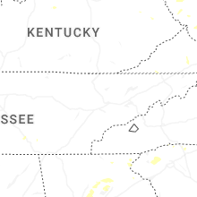

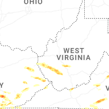


Connect with Interactive Hail Maps