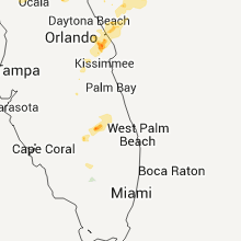
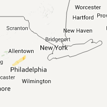
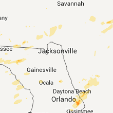
Hail Map for Thursday, April 28, 2011

Number of Impacted Households on 4/28/2011
0
Impacted by 1" or Larger Hail
0
Impacted by 1.75" or Larger Hail
0
Impacted by 2.5" or Larger Hail
Square Miles of Populated Area Impacted on 4/28/2011
0
Impacted by 1" or Larger Hail
0
Impacted by 1.75" or Larger Hail
0
Impacted by 2.5" or Larger Hail
Regions Impacted by Hail on 4/28/2011
Cities Most Affected by Hail Storms of 4/28/2011
| Hail Size | Demographics of Zip Codes Affected | ||||||
|---|---|---|---|---|---|---|---|
| City | Count | Average | Largest | Pop Density | House Value | Income | Age |
| Okeechobee, FL | 6 | 2.50 | 2.75 | 62 | $86k | $30.7k | 46.3 |
| Chadbourn, NC | 2 | 2.38 | 2.75 | 92 | $72k | $24.3k | 40.3 |
| Vanceboro, NC | 1 | 2.75 | 2.75 | 59 | $80k | $30.6k | 37.6 |
| Lumberton, NC | 1 | 1.75 | 1.75 | 180 | $71k | $29.3k | 36.0 |
| Titusville, FL | 1 | 1.75 | 1.75 | 569 | $85k | $38.6k | 46.5 |
| Whiteville, NC | 1 | 1.75 | 1.75 | 101 | $80k | $27.1k | 40.2 |
| Cerro Gordo, NC | 1 | 1.75 | 1.75 | 36 | $56k | $23.7k | 39.7 |
Hail and Wind Damage Spotted on 4/28/2011
Filter by Report Type:Hail ReportsWind Reports
States Impacted
South Carolina, North Carolina, Georgia, Florida, Pennsylvania, New York, Virginia, Maryland, New Jersey, Indiana, Ohio, KentuckySouth Carolina
| Local Time | Report Details |
|---|---|
| 12:02 PM UTC | Trees down on powerlines near mayewood middle school. reported by black river electric co-o in sumter county SC, 49 miles NNW of Charleston, SC |
| 12:17 PM UTC | Sheriff dispatch relayed numerous trees down in the snelling are in barnwell county SC, 34.1 miles ESE of Augusta, GA |
| 12:34 PM UTC | Ham radio operator reported trees down...stop signs bent over...trees uprooted and power lines down in town. straight line wind damag in calhoun county SC, 54.6 miles NW of Charleston, SC |
| 12:40 PM UTC | A few pine trees and large tree limbs dow in florence county SC, 63.2 miles NNE of Charleston, SC |
| 12:47 PM UTC | Tree reported on church at intersection of e friendfield rd and union school r in florence county SC, 55.9 miles NNE of Charleston, SC |
| 1:00 PM UTC | Front porch destroyed and additional damage to mobile home on e friendfield rd near hwy 5 in florence county SC, 55.4 miles NNE of Charleston, SC |
| 1:00 PM UTC | Trees on power lines in the gable area. reported by black river electric co-o in clarendon county SC, 43.9 miles N of Charleston, SC |
| 1:10 PM UTC | Several trees blocking roadway near hwy 76 and 30 in florence county SC, 71.8 miles NNE of Charleston, SC |
| 1:15 PM UTC | Trees down on powerlines in summerton. reported by black river electric co-o in clarendon county SC, 34 miles NW of Charleston, SC |
| 2:18 PM UTC | Wxj20 noaa weather radio transmitter tower antenna damaged by wind gust. reported by etv contracto in richland county SC, 73.3 miles NE of Augusta, GA |
| 2:48 PM UTC | Limbs on powerlines in bethune. reported by black river electric co-o in kershaw county SC, 62.5 miles SSE of Charlotte, NC |
North Carolina
| Local Time | Report Details |
|---|---|
| 12:04 PM UTC | Trees down on blues farm road in laurinbur8 in scotland county NC, 82.1 miles ESE of Charlotte, NC |
| 12:05 PM UTC | Trees down on pea bridge road in scotland county NC, 86.5 miles ESE of Charlotte, NC |
| 12:11 PM UTC | Khff gusted 52 knot in scotland county NC, 71.6 miles SW of Raleigh, NC |
| 2:12 PM UTC | Trees down on broad street in rockingham. time estimated by rada in richmond county NC, 63.5 miles ESE of Charlotte, NC |
| 2:13 PM UTC | Trees down on bryan street in rockingham in richmond county NC, 63.2 miles ESE of Charlotte, NC |
| 2:15 PM UTC | Tree on detached garage in richmond county NC, 65 miles ESE of Charlotte, NC |
| 2:20 PM UTC | Road closed due to trees down on rockingham road in richmond county NC, 63.5 miles ESE of Charlotte, NC |
| 2:22 PM UTC | Tree down on hawthorne avenue in rockingham in richmond county NC, 64.1 miles ESE of Charlotte, NC |
| 2:22 PM UTC | Richmond road was closed due to multiple trees down in the richmond park community in richmond county NC, 64.4 miles ESE of Charlotte, NC |
| 2:22 PM UTC | Large oak trees down on covington street in rockingham in richmond county NC, 63.3 miles ESE of Charlotte, NC |
| 2:22 PM UTC | Tree down on steele street in rockingham in richmond county NC, 63.3 miles ESE of Charlotte, NC |
| 2:22 PM UTC | Tree down on caroline street in rockingham in richmond county NC, 63 miles ESE of Charlotte, NC |
| 5:54 PM UTC | Snake road and highway 21 in robeson county NC, 63.2 miles WNW of Wilmington, NC |
| 5:54 PM UTC | Golf Ball sized hail reported near Lumberton, NC, 63.2 miles WNW of Wilmington, NC, snake road and highway 211. |
| 6:52 PM UTC | Several trees down. time estimated by rada in duplin county NC, 37.1 miles N of Wilmington, NC |
| 6:52 PM UTC | Golf Ball sized hail reported near Cerro Gordo, NC, 55.4 miles W of Wilmington, NC |
| 6:56 PM UTC | Quarter sized hail reported near Chadbourn, NC, 50.4 miles W of Wilmington, NC |
| 7:01 PM UTC | Turkey barns and outbuildings damaged. trees down. near nc903 and halls pond r in duplin county NC, 41.8 miles N of Wilmington, NC |
| 3:04 PM EDT | Baseball sized hail reported near Chadbourn, NC, 51.1 miles W of Wilmington, NC, golfball to baseball size hail on alfred hays drive near andrew jackson hwy. |
| 7:09 PM UTC | Golf Ball sized hail reported near Whiteville, NC, 47.5 miles WNW of Wilmington, NC |
| 7:15 PM UTC | Hen Egg sized hail reported near Chadbourn, NC, 50.9 miles W of Wilmington, NC, large hail smashed the windows out of two police vehicles. |
| 7:45 PM UTC | Quarter sized hail reported near Pink Hill, NC, 58.7 miles NNE of Wilmington, NC |
| 8:07 PM UTC | Quarter sized hail reported near Willard, NC, 26 miles NNW of Wilmington, NC, hail up to the size of quarters was reported along u.s. 421. |
| 8:15 PM UTC | Two trees down on a shed on belltown rd. time estimated based on rada in martin county NC, 83.9 miles SW of Virginia Beach, VA |
| 8:35 PM UTC | Baseball sized hail reported near Vanceboro, NC, 89.5 miles NNE of Wilmington, NC |
| 8:35 PM UTC | Trees and powerlines down on belltown roa in craven county NC, 80 miles NNE of Wilmington, NC |
| 8:40 PM UTC | Quarter sized hail reported near Vanceboro, NC, 88.9 miles ESE of Raleigh, NC, relayed from 911 center |
| 8:50 PM UTC | Barn reported leveled on lynnhaven dr in chowan county NC, 56.9 miles SW of Virginia Beach, VA |
| 9:06 PM UTC | Powerlines down on cherry st in washington county NC, 72.8 miles SSW of Virginia Beach, VA |
| 9:06 PM UTC | Powerlines down on cherry st in washington county NC, 68 miles SSW of Virginia Beach, VA |
| 9:30 PM UTC | Trees down on pike road in addition to 1 inch hail in washington county NC, 77.5 miles SSW of Virginia Beach, VA |
Georgia
| Local Time | Report Details |
|---|---|
| 12:20 PM UTC | Numerous trees reported down just east of us-319 in thomas county near the community of merrillville. one old barn collapsed with only minor damage to other structure in thomas county GA, 42.5 miles NE of Tallahassee, FL |
| 12:43 PM UTC | Quarter sized hail reported near Albany, GA, 78.7 miles W of Douglas, GA, quarter size and slightly larger hail fell for near 5 minutes. |
| 7:45 PM UTC | Trees reported down by emergency management between waynesville and browntow in brantley county GA, 63.1 miles N of Jacksonville, FL |
| 8:15 PM UTC | Large tree down near hwy 82 and cr110 in brantley county GA, 59.9 miles N of Jacksonville, FL |
| 8:25 PM UTC | Quarter sized hail reported near Brunswick, GA, 60.5 miles N of Jacksonville, FL, quarter-sized hail was reported at the intersection of highways 303 and 341. |
Florida
| Local Time | Report Details |
|---|---|
| 12:20 PM UTC | Quarter sized hail reported near Midway, FL, 11.2 miles WNW of Tallahassee, FL, quarter to ping pong size hail reported. |
| 12:38 PM UTC | Possible tornado near bradfordville and centerville rds. spotter reported a funnel cloud just northeast of capital regional medical center. trees down...hail...and powe in leon county FL, 0 miles ENE of Tallahassee, FL |
| 12:38 PM UTC | Numerous trees down...hail...and power outages across northern leon county have been reported. storm survey in the area confirmed straight line wind damage up to 65 mph in leon county FL, 6.6 miles NNE of Tallahassee, FL |
| 2:58 PM UTC | A couple of trees down near i-10 south of greenville. time estimated by rada in madison county FL, 38.2 miles E of Tallahassee, FL |
| 4:35 PM UTC | Quarter sized hail reported near Lee, FL, 58.6 miles E of Tallahassee, FL, quarter sized hail reported in lee. |
| 5:20 PM UTC | Quarter sized hail reported near Mayo, FL, 61.2 miles ESE of Tallahassee, FL, spotter reported quarter sized hail |
| 5:56 PM UTC | Powerlines are reported down in dowling par in suwannee county FL, 63.7 miles ESE of Tallahassee, FL |
| 6:55 PM EDT | Golf Ball sized hail reported near Okeechobee, FL, 33.7 miles WSW of Port Saint Lucie, FL, reported by the sheriff department as well as lightsey fish company. blew off screen porch. |
| 6:55 PM EDT | Golf Ball sized hail reported near Titusville, FL, 34.1 miles E of Orlando, FL, estimated golf ball sized hail. |
| 7:05 PM EDT | Baseball sized hail reported near Okeechobee, FL, 29.2 miles W of Port Saint Lucie, FL, report of baseball size hail south of city of okeechobee. report relayed by wfo miami. |
| 11:09 PM UTC | Storm damage reported in brevard county FL, 42.4 miles E of Orlando, FL |
| 7:10 PM EDT | Baseball sized hail reported near Okeechobee, FL, 29.2 miles W of Port Saint Lucie, FL, report of baseball size hail south of city of okeechobee. report relayed by wfo miami. |
| 11:15 PM UTC | Quarter sized hail reported near Okeechobee, FL, 28.5 miles W of Port Saint Lucie, FL |
| 7:15 PM EDT | Tennis Ball sized hail reported near Okeechobee, FL, 29.2 miles W of Port Saint Lucie, FL |
| 7:26 PM EDT | Tennis Ball sized hail reported near Okeechobee, FL, 29.2 miles W of Port Saint Lucie, FL |
| 7:34 PM EDT | Baseball sized hail reported near Okeechobee, FL, 29.2 miles W of Port Saint Lucie, FL, report of baseball size hail south of city of okeechobee. report relayed by wfo miami. |
Pennsylvania
| Local Time | Report Details |
|---|---|
| 12:30 PM UTC | Numerous trees down. man reported front end of car lifted off groun in york county PA, 57.6 miles NNW of Baltimore, MD |
| 12:39 PM UTC | Numerous trees dow in wyoming county PA, 12.1 miles WNW of Scranton, PA |
| 12:45 PM UTC | Barn destroyed in lackawanna county PA, 9.9 miles NNW of Scranton, PA |
| 12:50 PM UTC | Trees down near exit 201 off i-81 state route 438 in lackawanna county PA, 11.7 miles N of Scranton, PA |
| 12:57 PM UTC | Tree down in lackawanna county PA, 9.9 miles NNW of Scranton, PA |
| 1:08 PM UTC | Tree down on school bus on south galen hill drive near galen hal in berks county PA, 75.6 miles NNE of Baltimore, MD |
| 1:42 PM UTC | Roof blown off moble home -- possible tornado in bradford county PA, 39.8 miles NW of Scranton, PA |
| 2:05 PM UTC | Large tree limbs down in berks county PA, 62.1 miles S of Scranton, PA |
| 2:15 PM UTC | Trees on houses in monroe county PA, 31.2 miles SSE of Scranton, PA |
| 2:15 PM UTC | Scattered trees and wires down county wid in monroe county PA, 38.9 miles SE of Scranton, PA |
| 2:15 PM UTC | Trees down in monroe county PA, 38.9 miles SE of Scranton, PA |
| 2:50 PM UTC | Wires down in springfield townshi in bucks county PA, 64.8 miles SSE of Scranton, PA |
| 3:06 PM UTC | Trees and wires down in cumru twp in berks county PA, 77.8 miles NNE of Baltimore, MD |
New York
| Local Time | Report Details |
|---|---|
| 1:53 PM UTC | Numerous trees down throughout the county in delaware county NY, 60.4 miles NNE of Scranton, PA |
| 2:47 PM UTC | Tree down in sullivan county NY, 64.1 miles ENE of Scranton, PA |
| 2:51 PM UTC | One tree limb on wires and burning. sutonhollow road in greene county NY, 40.6 miles SSW of Schenectady, NY |
| 3:07 PM UTC | Tree down in sullivan county NY, 64.1 miles ENE of Scranton, PA |
| 3:08 PM UTC | Trees and wires down. time is estimate in ulster county NY, 70.9 miles ENE of Scranton, PA |
| 3:19 PM UTC | Possible down in hamilton county NY, 68.8 miles NNW of Schenectady, NY |
Virginia
| Local Time | Report Details |
|---|---|
| 2:00 PM UTC | Tree down along i-6 in goochland county VA, 19 miles NNW of Richmond, VA |
| 2:00 PM UTC | Tree down at poorhouse and turner r in goochland county VA, 20.4 miles NW of Richmond, VA |
| 2:00 PM UTC | Tree down at rockcastle and three square r in goochland county VA, 21 miles WNW of Richmond, VA |
| 2:30 PM UTC | Trees down...snapped off on beaver dam road and tyler station. trees down on old ridge roa in hanover county VA, 26.7 miles NNE of Richmond, VA |
| 2:30 PM UTC | Multiple trees down along us route 1 from the caroline/hanover county line northward toward ladysmith in caroline county VA, 29.3 miles NNE of Richmond, VA |
| 2:40 PM UTC | 3 trees down along route 301 along the hanover/caroline county lin in caroline county VA, 25.6 miles NE of Richmond, VA |
| 3:00 PM UTC | Trees down at nu in westmoreland county VA, 58.7 miles NE of Richmond, VA |
| 3:00 PM UTC | Two trees dow in westmoreland county VA, 58.7 miles NE of Richmond, VA |
| 3:10 PM UTC | Tree down across bull neck rd in essex county VA, 47.3 miles NE of Richmond, VA |
| 3:15 PM UTC | Two trees dow in westmoreland county VA, 60.9 miles NE of Richmond, VA |
| 5:23 PM UTC | Tree down across bull neck rd in essex county VA, 47.3 miles NE of Richmond, VA |
Maryland
| Local Time | Report Details |
|---|---|
| 2:25 PM UTC | Multiple trees topped and uprooted in st. marys county MD, 71.2 miles S of Baltimore, MD |
| 2:42 PM UTC | Several trees damaged in calvert county MD, 64 miles S of Baltimore, MD |
| 3:25 PM UTC | Large hardwood limb snapped...and a trampoline was lofted and moved in anne arundel county MD, 28.8 miles S of Baltimore, MD |
New Jersey
| Local Time | Report Details |
|---|---|
| 3:10 PM UTC | Trees and power lines dow in hunterdon county NJ, 55.1 miles W of Brooklyn, NY |
| 4:05 PM UTC | A tree blown down onto power lines in denvill in morris county NJ, 29.1 miles WNW of Brooklyn, NY |
| 4:50 PM UTC | Tree limbs and wires dow in somerset county NJ, 24.2 miles WSW of Brooklyn, NY |
Indiana
| Local Time | Report Details |
|---|---|
| 9:30 PM UTC | Approximately 2 dozen homes received minor roof damage from shingle loss or fallen trees. trees also on some cars and blocking some roads. damage occurred between sr46 in decatur county IN, 46.3 miles SE of Indianapolis, IN |
| 9:45 PM UTC | Trees blocked interstate 65 for a p in jackson county IN, 57.4 miles SSE of Indianapolis, IN |
| 10:30 PM UTC | Tree fell on house in north verno in jennings county IN, 59.2 miles SSE of Indianapolis, IN |
Ohio
| Local Time | Report Details |
|---|---|
| 11:55 PM UTC | Large branches broke in perry county OH, 38.2 miles E of Columbus, OH |
Kentucky
| Local Time | Report Details |
|---|---|
| 12:08 AM UTC | Quarter sized hail reported near Owensboro, KY, 29.5 miles ESE of Evansville, IN, quarter size hail reported on the east side of town. |
| 12:38 AM UTC | Quarter sized hail reported near Whitesville, KY, 43.1 miles ESE of Evansville, IN |


Connect with Interactive Hail Maps