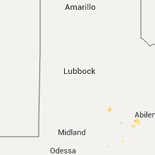
Hail Map for Tuesday, August 25, 2015

Number of Impacted Households on 8/25/2015
0
Impacted by 1" or Larger Hail
0
Impacted by 1.75" or Larger Hail
0
Impacted by 2.5" or Larger Hail
Square Miles of Populated Area Impacted on 8/25/2015
0
Impacted by 1" or Larger Hail
0
Impacted by 1.75" or Larger Hail
0
Impacted by 2.5" or Larger Hail
Regions Impacted by Hail on 8/25/2015
Cities Most Affected by Hail Storms of 8/25/2015
| Hail Size | Demographics of Zip Codes Affected | ||||||
|---|---|---|---|---|---|---|---|
| City | Count | Average | Largest | Pop Density | House Value | Income | Age |
Hail and Wind Damage Spotted on 8/25/2015
Filter by Report Type:Hail ReportsWind Reports
Texas
| Local Time | Report Details |
|---|---|
| 7:15 AM CDT | Tree down on county road 452 in smith county TX, 81.9 miles E of Dallas, TX |
| 7:30 AM CDT | Tree down on county road 46 in smith county TX, 82.9 miles NNW of Lufkin, TX |
| 7:35 AM CDT | Tree down on county road 334 in smith county TX, 76.2 miles NNW of Lufkin, TX |
| 7:35 AM CDT | Tree down on county road 1120 in smith county TX, 81.1 miles NNW of Lufkin, TX |
| 8:00 AM CDT | Tree down on county road 272 and 219 in smith county TX, 75.3 miles NNW of Lufkin, TX |
| 8:02 AM CDT | Tree down on fm 848 near whitehouse in smith county TX, 67.9 miles NNW of Lufkin, TX |
| 8:03 AM CDT | Tree down on fm 856 south of troup in cherokee county TX, 59.8 miles NNW of Lufkin, TX |
| 8:15 AM CDT | Tree down on highway 79 around new summerfield in cherokee county TX, 50 miles NNW of Lufkin, TX |
| 12:15 PM CDT | Marble size hail reported by public. some roof damage due to straight line wind in brazos county TX, 86.1 miles NW of Houston, TX |
| 12:28 PM CDT | 59 knot wind gust reported by asos at cl in brazos county TX, 80.7 miles NW of Houston, TX |
| 1:31 PM CDT | Trees down near the intersection of old independence road and prairie hill roa in washington county TX, 69.3 miles WNW of Houston, TX |
| 1:40 PM CDT | Damage to pier 36 marina in cedar ridge park near lake belton in bell county TX, 21.2 miles E of Killeen, TX |
| 3:30 PM CDT | Several trees and large branches snapped in hood county TX, 61.2 miles WSW of Dallas, TX |
New Hampshire
| Local Time | Report Details |
|---|---|
| 12:50 PM EDT | Trees down in weare. 1400 people without powe in hillsborough county NH, 84 miles WSW of Portland, ME |
| 1:02 PM EDT | Quarter sized hail reported near Bow, NH, 74.7 miles WSW of Portland, ME |
| 5:25 PM EDT | Trees on wires in wear in hillsborough county NH, 84 miles WSW of Portland, ME |
| 5:40 PM EDT | Quarter sized hail reported near Bow, NH, 74.7 miles WSW of Portland, ME, 1 inch hail in bow nh |
| 5:45 PM EDT | Troop f reported trees down in holderness nh in grafton county NH, 67 miles W of Portland, ME |
Massachusetts
| Local Time | Report Details |
|---|---|
| 3:50 PM EDT | Trees and wires down on rte 5 near old deerfield entrance in franklin county MA, 70.3 miles ESE of Schenectady, NY |
| 3:52 PM EDT | Trees and wires down on a car at the route 5 and 10 entrance to old deerfield road north in franklin county MA, 70.3 miles ESE of Schenectady, NY |
| 4:03 PM EDT | Trees and wires down on turners falls road in franklin county MA, 71.8 miles ESE of Schenectady, NY |
| 4:06 PM EDT | Trees and wires down on river road near grist mill road in franklin county MA, 74.3 miles E of Schenectady, NY |
| 4:19 PM EDT | Group of 6 trees down on pine meadow road in franklin county MA, 76.2 miles E of Schenectady, NY |
Connecticut
| Local Time | Report Details |
|---|---|
| 4:14 PM EDT | Tree down on route 189 at old hartford road and on floydville road in hartford county CT, 68.4 miles W of Providence, RI |
Arizona
| Local Time | Report Details |
|---|---|
| 2:35 PM MST | Marana airport asos recorded a 51 knot wind gust at 235 p in pima county AZ, 19.6 miles NW of Tucson, AZ |
| 3:30 PM MST | 1000 customers were without power in marana due to downed power poles. total at this time down to 40 in pima county AZ, 17.5 miles NW of Tucson, AZ |
Oklahoma
| Local Time | Report Details |
|---|---|
| 8:14 PM CDT | Quarter sized hail reported near Frederick, OK, 44.6 miles NW of Wichita Falls, TX, pea to quarter hail |


Connect with Interactive Hail Maps