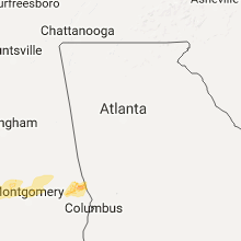
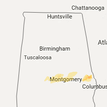
Hail Map for Wednesday, February 7, 2018

Number of Impacted Households on 2/7/2018
0
Impacted by 1" or Larger Hail
0
Impacted by 1.75" or Larger Hail
0
Impacted by 2.5" or Larger Hail
Square Miles of Populated Area Impacted on 2/7/2018
0
Impacted by 1" or Larger Hail
0
Impacted by 1.75" or Larger Hail
0
Impacted by 2.5" or Larger Hail
Regions Impacted by Hail on 2/7/2018
Cities Most Affected by Hail Storms of 2/7/2018
| Hail Size | Demographics of Zip Codes Affected | ||||||
|---|---|---|---|---|---|---|---|
| City | Count | Average | Largest | Pop Density | House Value | Income | Age |
Hail and Wind Damage Spotted on 2/7/2018
Filter by Report Type:Hail ReportsWind Reports
Alabama
| Local Time | Report Details |
|---|---|
| 6:05 AM CST | Roof damage to at least 2 structures at the intersection of church st and 25th st... and multiple trees down in the surrounding area. reports/photos via social media. t in chilton county AL, 38.7 miles S of Birmingham, AL |
| 6:05 AM CST | Corrects previous tstm wnd dmg report from jemison. debris in roadway near intersection of alabama highway 191 and u.s. highway 31 in jemison. corrected event tim in chilton county AL, 38.8 miles S of Birmingham, AL |
| 6:05 AM CST | Corrects previous tstm wnd dmg report from jemison. tree fell across railroad tracks near jemison. corrected event tim in chilton county AL, 38.8 miles S of Birmingham, AL |
| 6:15 AM CST | Tree reported down near cub in sumter county AL, 70.6 miles WNW of Camden, AL |
| 6:37 AM CST | Tree fell across railroad tracks near jemiso in chilton county AL, 38.8 miles S of Birmingham, AL |
| 6:40 AM CST | Corrects previous tstm wnd dmg report from jemison. report of uprooted trees in jemison from social media. corrected for estimated tim in chilton county AL, 38.1 miles S of Birmingham, AL |
| 6:49 AM CST | Debris in roadway near intersection of alabama highway 191 and u.s. highway 31 in jemiso in chilton county AL, 38.8 miles S of Birmingham, AL |
| 7:27 AM CST | Report of uprooted trees in jemison from social medi in chilton county AL, 38.1 miles S of Birmingham, AL |
| 9:15 AM CST | Half Dollar sized hail reported near Salem, AL, 20 miles E of Auburn, AL |
| 12:12 PM CST | Tree down across the carport of a residenc in houston county AL, 73.2 miles NE of Miramar Beach, FL |
| 12:14 PM CST | 6 mobile homes damaged. 1 with significant damag in houston county AL, 74.1 miles NE of Miramar Beach, FL |
Georgia
| Local Time | Report Details |
|---|---|
| 7:43 AM EST | Roof damage at an apartment complex on kaiser st. within the city of bremen. 4 trees reported down at this locatio in haralson county GA, 43.7 miles W of Atlanta, GA |
| 8:58 AM EST | Multiple trees down along huff roa in heard county GA, 48.3 miles WSW of Atlanta, GA |
| 9:04 AM EST | Multiple trees down near victory road and highway 21 in heard county GA, 44.9 miles NNE of Auburn, AL |
| 9:05 AM EST | Multiple trees reported down on 300 block of ridge rd in heard count in heard county GA, 49.4 miles NNE of Auburn, AL |
| 10:15 AM EST | Tree reported down at intersection of hwy 219 and hopewell church r in harris county GA, 30.3 miles ENE of Auburn, AL |
| 11:11 AM EST | Multiple trees reported down on broadwood cir in junction cit in talbot county GA, 60.2 miles E of Auburn, AL |
| 11:11 AM EST | Multiple trees reported down near the intersection of rock church rd and junction city st and on sand pit r in talbot county GA, 59.6 miles E of Auburn, AL |
| 11:54 AM EST | Large tree fell onto interstate 20 blocking all lanes on one side of i20 in newton county GA, 28 miles ESE of Atlanta, GA |
| 1:02 PM EST | Multiple trees and powerlines down in the 1500 block of the chester-cochran highwa in dodge county GA, 65.3 miles NNW of Douglas, GA |
| 1:55 PM EST | Telephone or cable lines were downed near wells ave and mlk jr dr not blocking the roa in dougherty county GA, 76.8 miles N of Tallahassee, FL |
Florida
| Local Time | Report Details |
|---|---|
| 12:08 PM CST | 65mph wind gust at the mossy cove weatherflow site on the bay near axelson poin in santa rosa county FL, 35 miles W of Miramar Beach, FL |


Connect with Interactive Hail Maps