

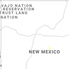
Hail Map for Sunday, July 25, 2021

Number of Impacted Households on 7/25/2021
0
Impacted by 1" or Larger Hail
0
Impacted by 1.75" or Larger Hail
0
Impacted by 2.5" or Larger Hail
Square Miles of Populated Area Impacted on 7/25/2021
0
Impacted by 1" or Larger Hail
0
Impacted by 1.75" or Larger Hail
0
Impacted by 2.5" or Larger Hail


Cities Most Affected by Hail Storms of 7/25/2021
| Hail Size | Demographics of Zip Codes Affected | ||||||
|---|---|---|---|---|---|---|---|
| City | Count | Average | Largest | Pop Density | House Value | Income | Age |
| Ashton, SD | 3 | 2.58 | 3.00 | 2 | $19k | $36.3k | 47.3 |
| Clarendon, TX | 2 | 2.00 | 2.00 | 1 | $51k | $29.3k | 42.4 |
| Faulkton, SD | 1 | 2.50 | 2.50 | 1 | $43k | $29.4k | 44.1 |
| Pierre, SD | 1 | 1.75 | 1.75 | 27 | $96k | $43.5k | 39.7 |
| Turton, SD | 1 | 1.75 | 1.75 | 1 | $24k | $29.4k | 52.8 |
| Ree Heights, SD | 1 | 1.75 | 1.75 | 1 | $13k | $53.4k | 45.5 |
| Barney, ND | 1 | 1.75 | 1.75 | 4 | $51k | $41.6k | 46.9 |
| Wallace, SD | 1 | 1.75 | 1.75 | 2 | $29k | $20.0k | 35.8 |
Hail and Wind Damage Spotted on 7/25/2021
Filter by Report Type:Hail ReportsWind Reports
States Impacted
Kansas, Oklahoma, Texas, Utah, South Dakota, Colorado, Arizona, Nevada, Minnesota, North Dakota, New YorkKansas
| Local Time | Report Details |
|---|---|
| 8:03 AM CDT | 58 mph wind with thunderstorm outflow. reported at kcn in cloud county KS, 63.4 miles WNW of Manhattan, KS |
| 12:35 PM CDT | Tree blown over onto hot tub and roof of house. damage to roof and hot tub. tree was partially dea in ford county KS, 48.1 miles ESE of Garden City, KS |
| 12:52 PM CDT | Asos station kddc dodge city regional airpor in ford county KS, 51.2 miles ESE of Garden City, KS |
| 1:27 PM CDT | Power poles blown down at u.s. highway 50 and 121 r in ford county KS, 58.1 miles E of Garden City, KS |
| 1:50 PM CDT | 4 inch diameter tree limbs blown dow in ford county KS, 70.8 miles ESE of Garden City, KS |
| 1:50 PM CDT | 1 to 2 inch diameter tree limbs blown dow in ford county KS, 71.1 miles ESE of Garden City, KS |
Oklahoma
| Local Time | Report Details |
|---|---|
| 3:40 PM CDT | Storm damage reported in woodward county OK, 25.3 miles NE of Woodward, OK |
| 5:50 PM CDT | 6-12 inch tree limbs snapped. picture from social media. time estimated from rada in tulsa county OK, 17.2 miles NE of Tulsa, OK |
| 5:50 PM CDT | Corrects previous tstm wnd dmg report from 2 sse collinsville. report from mping: 3-inch tree limbs broken; power poles broken - time estimated form rada in tulsa county OK, 16 miles NE of Tulsa, OK |
| 6:00 PM CDT | Picture relayed via social media of 6-12 inch diameter tree branch blown over onto ca in tulsa county OK, 11.1 miles NE of Tulsa, OK |
| 6:01 PM CDT | Tul asos measured peak wind gust of 63 mp in tulsa county OK, 7.2 miles ENE of Tulsa, OK |
| 6:01 PM CDT | Report from mping: 1-inch tree limbs broken; shingles blown of in rogers county OK, 15.6 miles NE of Tulsa, OK |
| 6:01 PM CDT | Storm damage reported in tulsa county OK, 4.3 miles ESE of Tulsa, OK |
| 6:01 PM CDT | Limbs down... shingles blown off roofs in rogers county OK, 16.3 miles NE of Tulsa, OK |
| 6:15 PM CDT | Storm damage reported in jackson county OK, 51.6 miles ENE of Childress, TX |
| 6:15 PM CDT | Nws employee reports 1 inch tree limbs broken and shingles blown off. time estimated from rada in tulsa county OK, 10.3 miles ESE of Tulsa, OK |
| 6:19 PM CDT | Report from mping: 3-inch tree limbs broken; power poles broke in tulsa county OK, 16 miles NE of Tulsa, OK |
| 6:20 PM CDT | Storm damage reported in jackson county OK, 51.8 miles ENE of Childress, TX |
| 7:28 PM CDT | Storm damage reported in kingfisher county OK, 35.3 miles NW of Oklahoma City, OK |
| 7:50 PM CDT | Storm damage reported in custer county OK, 59.4 miles S of Woodward, OK |
| 8:15 PM CDT | Storm damage reported in beckham county OK, 69.9 miles S of Woodward, OK |
| 8:35 PM CDT | Storm damage reported in canadian county OK, 27.6 miles W of Oklahoma City, OK |
| 8:45 PM CDT | Storm damage reported in washita county OK, 73.2 miles SSE of Woodward, OK |
| 9:36 PM CDT | Outflow boundar in comanche county OK, 60.7 miles NNE of Wichita Falls, TX |
Texas
| Local Time | Report Details |
|---|---|
| 4:08 PM CDT | Hen Egg sized hail reported near Clarendon, TX, 53.3 miles E of Amarillo, TX, golf ball to 2 inch hail... with damage to windshield of vehicle. |
| 4:09 PM CDT | West texas mesonet site measured 59 mph wind gus in gray county TX, 52.9 miles E of Amarillo, TX |
| 4:13 PM CDT | Hen Egg sized hail reported near Clarendon, TX, 53.3 miles E of Amarillo, TX, corrects time of the previous hail report from 5 n howardwick. golf ball to 2 inch hail... with damage to windshield of vehicle. |
| 5:30 PM CDT | Pine tree uprooted in plainview. time estimated by rada in hale county TX, 41.9 miles N of Lubbock, TX |
| 6:36 PM CDT | Occurred along outflow boundary that surged north of the main convective cor in lamb county TX, 37.5 miles NNW of Lubbock, TX |
| 8:10 PM CDT | Nws employee estimates 60 mph wind in midland county TX, 19.5 miles NE of Odessa, TX |
Utah
| Local Time | Report Details |
|---|---|
| 4:10 PM MDT | Measured at the udot rwis along i-15 at mp 62.5 in iron county UT, 50.7 miles NNE of Saint George, UT |
| 4:10 PM MDT | Tree down on power line in greenville shortly after 400 p.m. report received from beaver county sherif in beaver county UT, 38 miles SW of Monroe, UT |
| 4:30 PM MDT | *** 6 fatal *** thunderstorm outflow winds generated blowing dust with near zero visibility along interstate 15 near mp 152 south of fillmore. this resulted in a multi in millard county UT, 23.8 miles WNW of Monroe, UT |
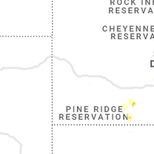
South Dakota
| Local Time | Report Details |
|---|---|
| 5:42 PM CDT | Golf Ball sized hail reported near Pierre, SD, 2.5 miles NE of Pierre, SD, quarter to golf ball size hail reported on social media with photo. time estimated. |
| 6:32 PM CDT | Golf Ball sized hail reported near Ree Heights, SD, 54.6 miles E of Pierre, SD |
| 6:35 PM CDT | Tennis Ball sized hail reported near Faulkton, SD, 54.9 miles SW of Aberdeen, SD, verified by social media photos. time estimated. |
| 6:46 PM CDT | Quarter sized hail reported near Faulkton, SD, 49.7 miles SW of Aberdeen, SD |
| 7:07 PM CDT | Ping Pong Ball sized hail reported near Highmore, SD, 57 miles ENE of Pierre, SD |
| 6:15 PM MDT | Storm damage reported in bennett county SD, 62.2 miles WNW of Valentine, NE |
| 7:19 PM CDT | Ping Pong Ball sized hail reported near Wessington, SD, 72.4 miles S of Aberdeen, SD, 5 minutes of hail... mostly small hail but a couple stones were the size of ping pongs. |
| 7:32 PM CDT | Half Dollar sized hail reported near White River, SD, 48.8 miles N of Valentine, NE, dime to half dollar hail |
| 7:36 PM CDT | Tea Cup sized hail reported near Ashton, SD, 30.3 miles S of Aberdeen, SD, verified by photo. time estimated by radar. |
| 7:37 PM CDT | Golf Ball sized hail reported near Ashton, SD, 28.3 miles S of Aberdeen, SD, time estimated by radar. |
| 7:39 PM CDT | Quarter sized hail reported near Miller, SD, 64.4 miles SSW of Aberdeen, SD |
| 7:40 PM CDT | Tea Cup sized hail reported near Ashton, SD, 30.3 miles S of Aberdeen, SD, corrects previous hail report from 2 n ashton. verified by photo. time estimated by radar. |
| 8:04 PM CDT | Quarter sized hail reported near White River, SD, 43.4 miles N of Valentine, NE, pea to quarter size hail |
| 8:07 PM CDT | Half Dollar sized hail reported near Turton, SD, 34 miles SE of Aberdeen, SD |
| 8:11 PM CDT | Golf Ball sized hail reported near Turton, SD, 34 miles SE of Aberdeen, SD |
| 9:02 PM CDT | Golf Ball sized hail reported near Wallace, SD, 55.3 miles ESE of Aberdeen, SD |
| 9:07 PM CDT | Half Dollar sized hail reported near Florence, SD, 61.1 miles ESE of Aberdeen, SD, time estimated. |
| 9:07 PM CDT | Quarter sized hail reported near Florence, SD, 62.8 miles ESE of Aberdeen, SD, verified by social media photos. time estimated. |
Colorado
| Local Time | Report Details |
|---|---|
| 5:44 PM MDT | Storm damage reported in prowers county CO, 84.2 miles W of Garden City, KS |
| 6:00 PM MDT | Quarter sized hail reported near Holly, CO, 79.5 miles W of Garden City, KS, corrects time of previous hail report from 3 n bristol. public reported quarter-size hail just north of the bristol area. |
| 6:02 PM MDT | Half Dollar sized hail reported near Holly, CO, 79.3 miles W of Garden City, KS, trained spotter reported half dollar size hail with storm that moved through the bristol area earlier. |
| 6:18 PM MDT | Quarter sized hail reported near Holly, CO, 79.5 miles W of Garden City, KS, public reported quarter-size hail just north of the bristol area. |
| 6:48 PM MDT | A personal weather station recorded a sustained wind of 59.7 mph with a gust of 68.4 mph between 6:47 and 6:49 p in boulder county CO, 31 miles NNW of Denver, CO |
Arizona
| Local Time | Report Details |
|---|---|
| 5:23 PM MST | Kingman airport asos reported a gust of 66 mph at 1723. gusts above 58 mph began at 1657 and ended at 173 in mohave county AZ, 59.1 miles NNE of Lake Havasu City, AZ |
| 6:48 PM MST | Trained spotter reported a power outage due to severe thunderstorm winds in dolan spring in mohave county AZ, 64.2 miles SE of Las Vegas, NV |
| 7:14 PM MST | Nevada dot hoover dam sensor at highway 93 measured a gust of 70 mp in clark county NV, 25 miles ESE of Las Vegas, NV |
Nevada
| Local Time | Report Details |
|---|---|
| 6:57 PM PDT | Nvenergy reports 205 customers without power due to thunderstorm wind in clark county NV, 61.3 miles SSE of Las Vegas, NV |
| 8:10 PM PDT | Wind gust of 61 mph reported at union pacific railroad mesowest sensor in dike nevad in clark county NV, 9.9 miles NE of Las Vegas, NV |
| 8:23 PM PDT | Gust of 64 measured from a thunderstorm in north las vegas. data courtesy of earth network in clark county NV, 3.4 miles N of Las Vegas, NV |
| 8:27 PM PDT | North las vegas airport reported a gust of 68 mph at 2027 from a thunderstor in clark county NV, 3.8 miles NW of Las Vegas, NV |
| 8:38 PM PDT | Power outage reported in east las vegas due to thunderstorm related wind gusts via social medi in clark county NV, 4.1 miles ENE of Las Vegas, NV |
| 9:03 PM PDT | Wind gust of 62 mph reported at henderson airpor in clark county NV, 13.9 miles S of Las Vegas, NV |
| 9:03 PM PDT | Henderson executive airport gusted to 62 mph at 2103 from thunderstorm in clark county NV, 13.2 miles S of Las Vegas, NV |
| 9:12 PM PDT | Indian springs airport measured a gust of 69 mph at 2114. they also measured a gust of 63 at 2112 due to thunderstorm in clark county NV, 42.1 miles NW of Las Vegas, NV |
| 9:15 PM PDT | Thunderstorm wind related damage reported by the public on bruce and lone mountain. lawn furniture destroyed and security camera blown off of the moun in clark county NV, 5.4 miles N of Las Vegas, NV |
| 9:15 PM PDT | Mesquite tree blow down by thunderstorm winds and fell onto a 52 chevy truc in clark county NV, 9 miles NW of Las Vegas, NV |
| 9:30 PM PDT | Thunderstorm wind damage in pahrump. roofs blown off multiple structures. trees 3 to 4 feet in diamter snapped... car windows broken. most of the damage is near pershin in nye county NV, 47.5 miles W of Las Vegas, NV |
| 9:32 PM PDT | Wind gust of 60 mph was reported at sandy valley school. data courtesy of earth network in clark county NV, 35.8 miles SW of Las Vegas, NV |
| 9:32 PM PDT | Wind gust of 68 mph reported at desert rock airpor in nye county NV, 58.4 miles WNW of Las Vegas, NV |
| 9:58 PM PDT | Nvenergy reports over 14000 customers are without power across the las vegas valley due to thunderstorm wind in clark county NV, 1.4 miles SW of Las Vegas, NV |
Minnesota
| Local Time | Report Details |
|---|---|
| 10:10 PM CDT | Half Dollar sized hail reported near Campbell, MN, 56.5 miles SSE of Fargo, ND, half dollar sized hail picture relayed via facebook. |
| 10:10 PM CDT | Ping Pong Ball sized hail reported near Campbell, MN, 56.5 miles SSE of Fargo, ND, 1.5 inch hail picture relayed by broadcast media. |
| 11:05 PM CDT | Quarter sized hail reported near Wheaton, MN, 70.5 miles NNW of Montevideo, MN |
North Dakota
| Local Time | Report Details |
|---|---|
| 10:25 PM CDT | Golf Ball sized hail reported near Barney, ND, 43.1 miles SSW of Fargo, ND, picture of estimated 1.75 inch hail relayed by broadcast media. time estimated by radar. |
New York
| Local Time | Report Details |
|---|---|
| 11:25 PM EDT | Tree down on i-87 southbound between exit 7a and 7. tree blocking right lane. time estimated from rada in westchester county NY, 24.6 miles NNE of Brooklyn, NY |
Connect with Interactive Hail Maps