Hail Map for Thursday, June 29, 2017

Number of Impacted Households on 6/29/2017
0
Impacted by 1" or Larger Hail
0
Impacted by 1.75" or Larger Hail
0
Impacted by 2.5" or Larger Hail
Square Miles of Populated Area Impacted on 6/29/2017
0
Impacted by 1" or Larger Hail
0
Impacted by 1.75" or Larger Hail
0
Impacted by 2.5" or Larger Hail
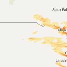
Regions Impacted by Hail on 6/29/2017
Cities Most Affected by Hail Storms of 6/29/2017
| Hail Size | Demographics of Zip Codes Affected | ||||||
|---|---|---|---|---|---|---|---|
| City | Count | Average | Largest | Pop Density | House Value | Income | Age |
| Omaha, NE | 8 | 1.94 | 3.00 | 3215 | $126k | $57.8k | 32.4 |
| Papillion, NE | 6 | 1.83 | 2.00 | 922 | $136k | $67.6k | 35.1 |
| Wiley, CO | 3 | 2.42 | 2.75 | 5 | $79k | $37.8k | 40.0 |
| Walsh, CO | 3 | 1.92 | 2.00 | 0 | $49k | $29.9k | 46.8 |
| Saint Helena, NE | 2 | 2.75 | 2.75 | 7 | $67k | $30.8k | 45.3 |
| Johnson, KS | 2 | 2.38 | 3.00 | 1 | $73k | $39.9k | 35.1 |
| Yankton, SD | 2 | 2.38 | 2.75 | 159 | $82k | $35.4k | 41.1 |
| Sioux City, IA | 1 | 4.25 | 4.25 | 845 | $84k | $42.4k | 34.8 |
| Turon, KS | 2 | 1.88 | 2.00 | 3 | $31k | $28.1k | 44.3 |
| Bellevue, NE | 2 | 1.88 | 2.00 | 1332 | $110k | $49.6k | 32.8 |
| Two Buttes, CO | 1 | 2.75 | 2.75 | 0 | $35k | $31.6k | 49.5 |
| Sun City, KS | 1 | 2.75 | 2.75 | 0 | $10k | $21.7k | 54.0 |
| Eads, CO | 1 | 2.00 | 2.00 | 0 | $49k | $30.4k | 48.7 |
| Little Sioux, IA | 1 | 2.00 | 2.00 | 10 | $36k | $28.2k | 45.0 |
| Akron, IA | 1 | 2.00 | 2.00 | 14 | $74k | $35.9k | 43.1 |
| Amelia, NE | 1 | 1.75 | 1.75 | 1 | $23k | $25.2k | 49.8 |
| Coats, KS | 1 | 1.75 | 1.75 | 1 | $17k | $33.4k | 37.5 |
| Spencer, IA | 1 | 1.75 | 1.75 | 80 | $81k | $35.4k | 41.9 |
| Haswell, CO | 1 | 1.75 | 1.75 | 0 | $51k | $19.6k | 50.3 |
| Craig, NE | 1 | 1.75 | 1.75 | 6 | $50k | $31.0k | 45.2 |
| Vermillion, SD | 1 | 1.75 | 1.75 | 62 | $85k | $25.7k | 23.9 |
| Karval, CO | 1 | 1.75 | 1.75 | 0 | $40k | $29.5k | 46.4 |
| Anthon, IA | 1 | 1.75 | 1.75 | 8 | $54k | $32.8k | 46.1 |
| Rush, CO | 1 | 1.75 | 1.75 | 1 | $105k | $34.3k | 43.5 |
Hail and Wind Damage Spotted on 6/29/2017
Filter by Report Type:Hail ReportsWind Reports
States Impacted
Nebraska, North Dakota, Colorado, Wyoming, Missouri, South Dakota, Iowa, Ohio, Kansas, Illinois, Pennsylvania, OklahomaNebraska
| Local Time | Report Details |
|---|---|
| 11:50 AM CDT | Ping Pong Ball sized hail reported near Papillion, NE, 8.7 miles SW of Omaha, NE, 96th and highway 370 |
| 3:08 PM CDT | Half Dollar sized hail reported near Amelia, NE, 29.4 miles SW of Oneill, NE, estimated hail in size from dime to half dollar. |
| 3:30 PM CDT | Quarter sized hail reported near Amelia, NE, 24.1 miles SW of Oneill, NE |
| 3:32 PM CDT | Golf Ball sized hail reported near Amelia, NE, 25.5 miles SW of Oneill, NE, chambers fire department mesaured golf ball size hail with gusts to 40 mph. |
| 3:35 PM CDT | Quarter sized hail reported near Ponca, NE, 67.3 miles S of Sioux Falls, SD |
| 3:45 PM CDT | Ping Pong Ball sized hail reported near Ponca, NE, 67.3 miles S of Sioux Falls, SD |
| 3:50 PM CDT | Quarter sized hail reported near Ewing, NE, 18.8 miles S of Oneill, NE, hail lasted ten minutes. |
| 3:52 PM CDT | Half Dollar sized hail reported near Oneill, NE, 1 miles E of Oneill, NE, trained spotter reports half dollar size hail 1 mile ese of oneill. |
| 4:00 PM CDT | Quarter sized hail reported near Ewing, NE, 18.8 miles S of Oneill, NE, hail began at 1550 and lasted until 1600. winds were 30-40 mph. |
| 4:00 PM CDT | Quarter sized hail reported near Bartlett, NE, 32.3 miles S of Oneill, NE, hail was mainly nickel size... but a few one inch hail stones were observed. |
| 4:27 PM CDT | Half Dollar sized hail reported near South Sioux City, NE, 65 miles W of Storm Lake, IA, also several tree branches down. |
| 4:30 PM CDT | Storm damage reported in dakota county NE, 62 miles WSW of Storm Lake, IA |
| 4:48 PM CDT | Quarter sized hail reported near Winside, NE, 78.1 miles ESE of Oneill, NE, quarter size hail and estimated 60 mph wind gust |
| 5:00 PM CDT | Quarter sized hail reported near Bartlett, NE, 32.3 miles S of Oneill, NE, hail was mainly nickel size... but a few one inch hail stones were observed. |
| 5:02 PM CDT | Quarter sized hail reported near Wayne, NE, 84.5 miles NW of Omaha, NE, quarter size hail and estimated 50 to 60 mph winds |
| 5:46 PM CDT | Quarter sized hail reported near Pender, NE, 70.9 miles NW of Omaha, NE, quarter size hail and 45 mph wind gusts |
| 5:53 PM CDT | Baseball sized hail reported near Saint Helena, NE, 55.9 miles SSW of Sioux Falls, SD |
| 6:05 PM CDT | Baseball sized hail reported near Saint Helena, NE, 59.6 miles SSW of Sioux Falls, SD |
| 6:55 PM CDT | Quarter sized hail reported near Omaha, NE, 3.6 miles W of Omaha, NE, omaha - 106th and browne streets |
| 7:37 PM CDT | Quarter sized hail reported near Howells, NE, 63.5 miles WNW of Omaha, NE |
| 7:47 PM CDT | Quarter sized hail reported near Howells, NE, 63.5 miles WNW of Omaha, NE |
| 7:49 PM CDT | Ping Pong Ball sized hail reported near Howells, NE, 63.5 miles WNW of Omaha, NE |
| 8:22 PM CDT | Golf Ball sized hail reported near Craig, NE, 40.2 miles NNW of Omaha, NE |
| 8:30 PM CDT | Quarter sized hail reported near Tekamah, NE, 37.4 miles NNW of Omaha, NE |
| 8:44 PM CDT | Quarter sized hail reported near Wilsonville, NE, 68.7 miles NE of Colby, KS, dime to quarter sized hail with heavy rain. |
| 9:20 PM CDT | Quarter sized hail reported near Bennington, NE, 13.7 miles WNW of Omaha, NE |
| 9:29 PM CDT | Quarter sized hail reported near Omaha, NE, 10.4 miles N of Omaha, NE |
| 9:30 PM CDT | Quarter sized hail reported near Omaha, NE, 3.6 miles W of Omaha, NE, omaha - 106th and browne streets |
| 9:35 PM CDT | Golf Ball sized hail reported near Omaha, NE, 7.6 miles WNW of Omaha, NE, 114th and fort. |
| 9:36 PM CDT | Ping Pong Ball sized hail reported near Omaha, NE, 4.7 miles W of Omaha, NE, 82nd and blondo. |
| 9:38 PM CDT | Golf Ball sized hail reported near Omaha, NE, 2.9 miles WNW of Omaha, NE |
| 9:39 PM CDT | Hen Egg sized hail reported near Omaha, NE, 1.5 miles W of Omaha, NE, 35th and charles. |
| 9:40 PM CDT | Tea Cup sized hail reported near Omaha, NE, 3.2 miles WNW of Omaha, NE, several 2 inch stones... one up to 3.75 inches. |
| 9:40 PM CDT | Ping Pong Ball sized hail reported near Omaha, NE, 4.1 miles NW of Omaha, NE, 60th and ames. |
| 9:41 PM CDT | Quarter sized hail reported near Omaha, NE, 0.5 miles E of Omaha, NE, downtown omaha. |
| 9:49 PM CDT | Ping Pong Ball sized hail reported near Omaha, NE, 1.3 miles SE of Omaha, NE |
| 9:51 PM CDT | Quarter sized hail reported near Elkhorn, NE, 15.7 miles W of Omaha, NE, near 216 and pacific. |
| 9:53 PM CDT | Ping Pong Ball sized hail reported near Omaha, NE, 3.6 miles W of Omaha, NE, omaha-chalco 164th and giles |
| 10:00 PM CDT | Golf Ball sized hail reported near Omaha, NE, 13 miles WSW of Omaha, NE |
| 10:00 PM CDT | Golf Ball sized hail reported near Omaha, NE, 13.5 miles WSW of Omaha, NE |
| 10:01 PM CDT | Golf Ball sized hail reported near Omaha, NE, 13.3 miles WSW of Omaha, NE, 174th and f. |
| 10:05 PM CDT | Ping Pong Ball sized hail reported near Omaha, NE, 12 miles WSW of Omaha, NE |
| 10:07 PM CDT | Golf Ball sized hail reported near Omaha, NE, 10.5 miles WSW of Omaha, NE, 160th to 132nd along harrison. |
| 10:09 PM CDT | Quarter sized hail reported near Omaha, NE, 11.3 miles WSW of Omaha, NE |
| 10:15 PM CDT | Golf Ball sized hail reported near Papillion, NE, 8.7 miles SW of Omaha, NE |
| 10:18 PM CDT | Quarter sized hail reported near Papillion, NE, 8.7 miles SW of Omaha, NE |
| 10:18 PM CDT | Golf Ball sized hail reported near Papillion, NE, 11.5 miles SSW of Omaha, NE |
| 10:19 PM CDT | Hen Egg sized hail reported near Papillion, NE, 10.9 miles SW of Omaha, NE |
| 10:20 PM CDT | Golf Ball sized hail reported near Papillion, NE, 10.7 miles SW of Omaha, NE |
| 10:23 PM CDT | Golf Ball sized hail reported near Papillion, NE, 8.7 miles SW of Omaha, NE |
| 10:23 PM CDT | Half Dollar sized hail reported near Papillion, NE, 9.8 miles SSW of Omaha, NE |
| 10:25 PM CDT | Hen Egg sized hail reported near Papillion, NE, 9.3 miles SSW of Omaha, NE |
| 10:25 PM CDT | Hen Egg sized hail reported near Bellevue, NE, 8.5 miles S of Omaha, NE |
| 10:27 PM CDT | Golf Ball sized hail reported near Bellevue, NE, 7 miles S of Omaha, NE |
| 10:31 PM CDT | Half Dollar sized hail reported near Offutt A F B, NE, 10.5 miles S of Omaha, NE |
| 10:52 PM CDT | Quarter sized hail reported near Plattsmouth, NE, 16.8 miles S of Omaha, NE |
| 11:34 PM CDT | Half Dollar sized hail reported near Superior, NE, 64 miles SSE of Grand Island, NE, hail accompanied by 50 mph winds. hail ongoing. |
| 11:50 PM CDT | Ping Pong Ball sized hail reported near Papillion, NE, 8.7 miles SW of Omaha, NE, 96th and highway 370 |
| 11:56 PM CDT | Half Dollar sized hail reported near Papillion, NE, 10.5 miles SW of Omaha, NE |
| 12:02 AM CDT | Quarter sized hail reported near Bellevue, NE, 7 miles S of Omaha, NE |
| 12:04 AM CDT | Quarter sized hail reported near Papillion, NE, 8.7 miles SW of Omaha, NE |
North Dakota
| Local Time | Report Details |
|---|---|
| 2:15 PM CDT | Quarter sized hail reported near Ross, ND, 48.1 miles ENE of Williston, ND |
Colorado
| Local Time | Report Details |
|---|---|
| 1:30 PM MDT | Quarter sized hail reported near Calhan, CO, 56.1 miles NNE of Pueblo, CO, time estimated from radar. |
| 1:55 PM MDT | Quarter sized hail reported near Ramah, CO, 55.9 miles SE of Denver, CO |
| 2:48 PM MDT | Golf Ball sized hail reported near Rush, CO, 60.1 miles NE of Pueblo, CO |
| 3:27 PM MDT | Golf Ball sized hail reported near Karval, CO, 60.3 miles ENE of Pueblo, CO |
| 4:38 PM MDT | Quarter sized hail reported near Ramah, CO, 65.9 miles NE of Pueblo, CO |
| 4:49 PM MDT | Golf Ball sized hail reported near Haswell, CO, 82.8 miles E of Pueblo, CO |
| 5:03 PM MDT | Quarter sized hail reported near Rush, CO, 50.3 miles NE of Pueblo, CO |
| 5:28 PM MDT | Ping Pong Ball sized hail reported near Calhan, CO, 53.2 miles NNE of Pueblo, CO |
| 5:46 PM MDT | Golf Ball sized hail reported near Wiley, CO, 100.8 miles E of Pueblo, CO |
| 5:50 PM MDT | Hen Egg sized hail reported near Eads, CO, 102.8 miles WNW of Garden City, KS, lots of hail. covered the ground. |
| 5:55 PM MDT | Baseball sized hail reported near Wiley, CO, 102 miles W of Garden City, KS |
| 6:43 PM MDT | Baseball sized hail reported near Wiley, CO, 102 miles W of Garden City, KS |
| 7:11 PM MDT | Ping Pong Ball sized hail reported near Holly, CO, 66.3 miles W of Garden City, KS |
| 7:25 PM MDT | Quarter sized hail reported near Mc Clave, CO, 96.7 miles E of Pueblo, CO |
| 7:56 PM MDT | Ping Pong Ball sized hail reported near Lamar, CO, 95.5 miles W of Garden City, KS |
| 8:30 PM MDT | Baseball sized hail reported near Two Buttes, CO, 87.7 miles WSW of Garden City, KS |
| 8:56 PM MDT | Hen Egg sized hail reported near Walsh, CO, 86.9 miles WSW of Garden City, KS |
| 8:57 PM MDT | Ping Pong Ball sized hail reported near Walsh, CO, 81.7 miles WSW of Garden City, KS, broke the spotter's windshield. |
| 9:13 PM MDT | Golf Ball sized hail reported near Walsh, CO, 86.1 miles WSW of Garden City, KS |
| 9:20 PM MDT | Hen Egg sized hail reported near Walsh, CO, 84.1 miles SW of Garden City, KS |
Wyoming
| Local Time | Report Details |
|---|---|
| 1:50 PM MDT | Quarter sized hail reported near , , 6.4 miles SSW of Riverton, WY, mostly nickle sized hail with a few quarter sized hail reported about 3 miles east and 5 miles south of arapahoe. |
Missouri
| Local Time | Report Details |
|---|---|
| 3:10 PM CDT | Trees down across route 185 and also down on a residenc in warren county MO, 52 miles W of Saint Louis, MO |
| 3:23 PM CDT | Large tree branches down partially blocking southbound lane on hwy 47 north of washingto in franklin county MO, 44.2 miles W of Saint Louis, MO |
| 3:30 PM CDT | 2 trees down. one on a house and another across hwy 185 about a quarter mile south of washington. time of damage estimated from rada in franklin county MO, 44.2 miles W of Saint Louis, MO |
| 3:45 PM CDT | Limbs down along highway 94 in defianc in st. charles county MO, 31.4 miles W of Saint Louis, MO |
| 8:40 PM CDT | Quarter sized hail reported near Boonville, MO, 22.5 miles W of Columbia, MO |
| 10:00 PM CDT | Quarter sized hail reported near Kansas City, MO, 12.2 miles NNW of Kansas City, MO, mping report. |
| 10:00 PM CDT | Quarter sized hail reported near Kansas City, MO, 12 miles NW of Kansas City, MO, penny to quarter hail size - time estimated |
| 10:08 PM CDT | Quarter sized hail reported near Kansas City, MO, 12.2 miles NNW of Kansas City, MO |
| 10:35 PM CDT | Quarter sized hail reported near Kansas City, MO, 8.1 miles N of Kansas City, MO |
| 11:15 PM CDT | Multiple trees and power lines down along hwy 24 between keytesville and salisbury. also report of a grain bin blown over and shed roof blown off along hwy 2 in chariton county MO, 46.3 miles NW of Columbia, MO |
| 11:21 PM CDT | Numerous power poles down across southern chariton count in chariton county MO, 46.3 miles NW of Columbia, MO |
| 5:27 AM CDT | Minor roof damage reported to a few homes. roofing material blown into stree in greene county MO, 2.8 miles E of Springfield, MO |
South Dakota
| Local Time | Report Details |
|---|---|
| 3:55 PM CDT | Half Dollar sized hail reported near Jefferson, SD, 65.8 miles S of Sioux Falls, SD |
| 4:05 PM CDT | Quarter sized hail reported near Corsica, SD, 67.5 miles N of Oneill, NE |
| 4:43 PM CDT | Quarter sized hail reported near Tripp, SD, 60.3 miles NNE of Oneill, NE |
| 4:45 PM CDT | Ping Pong Ball sized hail reported near Avon, SD, 55.6 miles NE of Oneill, NE |
| 4:45 PM CDT | Quarter sized hail reported near Tyndall, SD, 54.4 miles NE of Oneill, NE, wind gusts estimated at 55 mph. 4 inch tree limbs down around the yard. |
| 5:24 PM CDT | Storm damage reported in bon homme county SD, 58.9 miles WSW of Sioux Falls, SD |
| 5:37 PM CDT | Baseball sized hail reported near Yankton, SD, 59.1 miles SW of Sioux Falls, SD, report via social media. |
| 5:48 PM CDT | Quarter sized hail reported near Yankton, SD, 56.1 miles SW of Sioux Falls, SD, report via social media. |
| 5:54 PM CDT | Hen Egg sized hail reported near Yankton, SD, 56.4 miles SW of Sioux Falls, SD, report via social media. |
| 5:56 PM CDT | Storm damage reported in yankton county SD, 56.1 miles SW of Sioux Falls, SD |
| 6:02 PM CDT | Quarter sized hail reported near Gayville, SD, 50.4 miles SSW of Sioux Falls, SD |
| 6:17 PM CDT | Golf Ball sized hail reported near Vermillion, SD, 54.4 miles SSW of Sioux Falls, SD |
Iowa
| Local Time | Report Details |
|---|---|
| 4:20 PM CDT | Ping Pong Ball sized hail reported near Westfield, IA, 57.2 miles S of Sioux Falls, SD |
| 4:22 PM CDT | Quarter sized hail reported near Sioux City, IA, 61.5 miles W of Storm Lake, IA |
| 4:30 PM CDT | Grapefruit sized hail reported near Sioux City, IA, 61 miles WSW of Storm Lake, IA |
| 4:33 PM CDT | Storm damage reported in woodbury county IA, 63 miles WSW of Storm Lake, IA |
| 4:43 PM CDT | Hen Egg sized hail reported near Akron, IA, 50.1 miles S of Sioux Falls, SD, report via social media. |
| 4:59 PM CDT | Half Dollar sized hail reported near Bronson, IA, 54 miles WSW of Storm Lake, IA |
| 5:08 PM CDT | Half Dollar sized hail reported near Ireton, IA, 44.2 miles SSE of Sioux Falls, SD, hail is covering the ground. |
| 5:18 PM CDT | Golf Ball sized hail reported near Anthon, IA, 47.8 miles WSW of Storm Lake, IA |
| 5:24 PM CDT | Quarter sized hail reported near Sioux Center, IA, 42.8 miles SE of Sioux Falls, SD |
| 5:30 PM CDT | Quarter sized hail reported near Sioux Center, IA, 42.8 miles SE of Sioux Falls, SD |
| 5:45 PM CDT | Golf Ball sized hail reported near Spencer, IA, 34.7 miles N of Storm Lake, IA |
| 5:50 PM CDT | Quarter sized hail reported near Boyden, IA, 44.6 miles SE of Sioux Falls, SD, report via social media. |
| 6:00 PM CDT | Quarter sized hail reported near Smithland, IA, 47.5 miles SW of Storm Lake, IA |
| 6:54 PM CDT | Quarter sized hail reported near Stanton, IA, 47.9 miles ESE of Omaha, NE |
| 6:55 PM CDT | Hen Egg sized hail reported near Little Sioux, IA, 39.7 miles N of Omaha, NE, wind speed 55 to 60 mph |
| 7:01 PM CDT | Quarter sized hail reported near Pisgah, IA, 37.9 miles N of Omaha, NE |
| 7:04 PM CDT | Quarter sized hail reported near Pisgah, IA, 39.3 miles N of Omaha, NE |
| 7:28 PM CDT | Several 6" limbs down as wel in crawford county IA, 39.5 miles S of Storm Lake, IA |
| 7:37 PM CDT | Quarter sized hail reported near Logan, IA, 27.8 miles N of Omaha, NE |
| 8:05 PM CDT | Quarter sized hail reported near Missouri Valley, IA, 20.8 miles N of Omaha, NE |
| 8:40 PM CDT | Mesonet station rwii4... 5 ssw dow in wright county IA, 41.9 miles SSW of Mason City, IA |
| 8:52 PM CDT | Near latimer and coulte in franklin county IA, 27.2 miles SSW of Mason City, IA |
| 9:02 PM CDT | Very strong winds... had to pull off the road. can't see across the parking lot... estimated around 60 mp in franklin county IA, 28.2 miles SSW of Mason City, IA |
| 9:15 PM CDT | Storm damage reported in hancock county IA, 21.9 miles WNW of Mason City, IA |
| 9:15 PM CDT | Fxy awos gusted to 64 mp in hancock county IA, 22.1 miles WNW of Mason City, IA |
| 9:28 PM CDT | Measured by home weather statio in cerro gordo county IA, 1.2 miles S of Mason City, IA |
| 9:33 PM CDT | From a home weather statio in worth county IA, 14.5 miles NNE of Mason City, IA |
| 9:40 PM CDT | Wind measured at marshalltown airpor in marshall county IA, 50.8 miles NE of Des Moines, IA |
| 9:48 PM CDT | Tree down on road by riverside park. time estimated by rada in mitchell county IA, 29.3 miles NE of Mason City, IA |
| 9:50 PM CDT | Ping Pong Ball sized hail reported near Council Bluffs, IA, 4.4 miles ESE of Omaha, NE |
| 9:50 PM CDT | Ping Pong Ball sized hail reported near Council Bluffs, IA, 3.7 miles E of Omaha, NE, quarter to ping pong ball size hail. |
| 10:00 PM CDT | Iowa dot rwis site along highway 2 in black hawk county IA, 46.7 miles NW of Cedar Rapids, IA |
| 10:01 PM CDT | Ping Pong Ball sized hail reported near Council Bluffs, IA, 4.4 miles ESE of Omaha, NE |
| 10:21 PM CDT | Wind gusts estimated at 70 mph with sustained winds around 60 mph for about 3 minutes starting around 1021 pm north of independence on highway 150 north. visibility a q in buchanan county IA, 37.1 miles NNW of Cedar Rapids, IA |
| 10:23 PM CDT | Estimated wind gusts around 60 mp in buchanan county IA, 36.2 miles NNW of Cedar Rapids, IA |
| 10:45 PM CDT | Half Dollar sized hail reported near Carson, IA, 32.1 miles ESE of Omaha, NE |
| 10:45 PM CDT | Semi blown ove in mills county IA, 15.8 miles SSE of Omaha, NE |
| 10:50 PM CDT | Quarter sized hail reported near Pacific Junction, IA, 17.1 miles SSE of Omaha, NE |
| 11:44 PM CDT | Estimated 50 to 60 mph wind gust in dubuque county IA, 61.2 miles ENE of Cedar Rapids, IA |
| 11:50 PM CDT | Quarter sized hail reported near Essex, IA, 44.8 miles SE of Omaha, NE |
Ohio
| Local Time | Report Details |
|---|---|
| 7:18 PM EDT | Storm damage reported in hancock county OH, 75.2 miles E of Fort Wayne, IN |
| 8:48 PM EDT | Couple trees down in the vicinity of newton falls. time estimated from rada in trumbull county OH, 43.7 miles ESE of Cleveland, OH |
| 8:57 PM EDT | Couple trees down in the vicinity of warren time estimated from rada in trumbull county OH, 51 miles ESE of Cleveland, OH |
| 9:03 PM EDT | Couple trees down in the vicinity of niles. time estimated from rada in trumbull county OH, 53.3 miles ESE of Cleveland, OH |
| 9:07 PM EDT | Several trees down across plain and lake townships. time estimated from rada in stark county OH, 45.1 miles SSE of Cleveland, OH |
| 9:09 PM EDT | Couple trees down in liberty township. generally north and northwest of churchill. time estimated from rada in trumbull county OH, 56.6 miles ESE of Cleveland, OH |
| 10:19 PM EDT | Trees on rt 518 in columbiana county OH, 46.2 miles WNW of Pittsburgh, PA |
| 10:36 PM EDT | Large tree down on midland fredricktown road in columbiana county OH, 34.9 miles WNW of Pittsburgh, PA |
| 10:50 PM EDT | Tree down on a car on route 332 in carroll county OH, 57.8 miles W of Pittsburgh, PA |
| 10:50 PM EDT | Tree down on a car on route 332 in carroll county OH, 50.8 miles W of Pittsburgh, PA |
Kansas
| Local Time | Report Details |
|---|---|
| 7:39 PM CDT | Quarter sized hail reported near Yates Center, KS, 27.3 miles NW of Chanute, KS |
| 7:39 PM CDT | Storm damage reported in woodson county KS, 27.3 miles NW of Chanute, KS |
| 8:00 PM CDT | Kksrexfo2 mesonet site at fdk plant measured 61 mph wind gus in thomas county KS, 19.4 miles ENE of Colby, KS |
| 8:01 PM CDT | Cwop site f0981 measured 62 mph wind gus in thomas county KS, 10.8 miles ENE of Colby, KS |
| 8:07 PM CDT | Storm spotter...ray duffey... measured 62.6 mph on a handheld anemomete in sheridan county KS, 19.6 miles E of Colby, KS |
| 8:22 PM CDT | Site selde2 measured wind gust of 60 mp in sheridan county KS, 28.2 miles ENE of Colby, KS |
| 8:51 PM CDT | Golf Ball sized hail reported near Johnson, KS, 60.8 miles WSW of Garden City, KS |
| 9:10 PM CDT | Tea Cup sized hail reported near Johnson, KS, 58.3 miles SW of Garden City, KS |
| 9:26 PM CDT | Quarter sized hail reported near Hugoton, KS, 58.8 miles SW of Garden City, KS |
| 10:55 PM CDT | Golf Ball sized hail reported near Coats, KS, 70.4 miles NNE of Woodward, OK |
| 11:06 PM CDT | Baseball sized hail reported near Sun City, KS, 73.4 miles NNE of Woodward, OK |
| 11:09 PM CDT | Ping Pong Ball sized hail reported near Coldwater, KS, 55.9 miles N of Woodward, OK |
| 11:40 PM CDT | Golf Ball sized hail reported near Turon, KS, 60.5 miles W of Wichita, KS, reported received via social media. |
| 11:45 PM CDT | Hen Egg sized hail reported near Turon, KS, 60.5 miles W of Wichita, KS, report recived via social media. |
| 12:01 AM CDT | Storm damage reported in reno county KS, 41 miles NW of Wichita, KS |
| 12:02 AM CDT | Storm damage reported in saline county KS, 62.1 miles WSW of Manhattan, KS |
| 12:30 AM CDT | 3-4 inch tree limbs down as wel in kingman county KS, 42.5 miles W of Wichita, KS |
| 1:22 AM CDT | Storm damage reported in sumner county KS, 46.1 miles SSW of Wichita, KS |
| 1:46 AM CDT | Storm damage reported in sedgwick county KS, 5.9 miles SE of Wichita, KS |
| 1:46 AM CDT | Storm damage reported in neosho county KS, 1 miles SSW of Chanute, KS |
| 1:58 AM CDT | Storm damage reported in sumner county KS, 47.4 miles SSW of Wichita, KS |
| 2:38 AM CDT | Corrected for time in neosho county KS, 1 miles SSW of Chanute, KS |
| 2:40 AM CDT | Trees and power lines were blown down across town. the report was received at 320 am cd in neosho county KS, 1 miles SSW of Chanute, KS |
| 2:46 AM CDT | Corrected for time in neosho county KS, 1 miles SSW of Chanute, KS |
| 3:41 AM CDT | Garage blown in along with multiple trees dow in linn county KS, 53.1 miles NE of Chanute, KS |
| 3:41 AM CDT | Semi truck blown into ditch on hwy 69 at mile marker 109. wind damage extends down hwy 69 to pleasanto in linn county KS, 56.9 miles S of Kansas City, MO |
Illinois
| Local Time | Report Details |
|---|---|
| 8:15 PM CDT | Large tree limb was blown on to a vehicl in champaign county IL, 41.4 miles N of Mattoon, IL |
Pennsylvania
| Local Time | Report Details |
|---|---|
| 11:05 PM EDT | Numerous trees and wires down blocking freedom-crider road. road is close in beaver county PA, 20.4 miles NW of Pittsburgh, PA |
| 11:33 PM EDT | Tree down in butler county PA, 23.8 miles N of Pittsburgh, PA |
Oklahoma
| Local Time | Report Details |
|---|---|
| 12:20 AM CDT | Storm damage reported in woods county OK, 43.7 miles NNE of Woodward, OK |
| 12:25 AM CDT | Storm damage reported in woods county OK, 43.7 miles NNE of Woodward, OK |
| 12:30 AM CDT | Storm damage reported in woods county OK, 43.7 miles NNE of Woodward, OK |
| 12:35 AM CDT | Storm damage reported in woods county OK, 43.7 miles NNE of Woodward, OK |
| 12:55 AM CDT | Storm damage reported in woods county OK, 47.4 miles ENE of Woodward, OK |
| 1:05 AM CDT | Storm damage reported in alfalfa county OK, 61.5 miles ENE of Woodward, OK |
| 1:10 AM CDT | Storm damage reported in alfalfa county OK, 61.5 miles ENE of Woodward, OK |
| 1:15 AM CDT | Storm damage reported in alfalfa county OK, 61.5 miles ENE of Woodward, OK |
| 1:20 AM CDT | Storm damage reported in alfalfa county OK, 61.5 miles ENE of Woodward, OK |










Connect with Interactive Hail Maps