Hail Map for Sunday, May 10, 2015

Number of Impacted Households on 5/10/2015
0
Impacted by 1" or Larger Hail
0
Impacted by 1.75" or Larger Hail
0
Impacted by 2.5" or Larger Hail
Square Miles of Populated Area Impacted on 5/10/2015
0
Impacted by 1" or Larger Hail
0
Impacted by 1.75" or Larger Hail
0
Impacted by 2.5" or Larger Hail
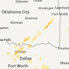
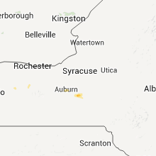
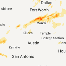
Regions Impacted by Hail on 5/10/2015
Cities Most Affected by Hail Storms of 5/10/2015
| Hail Size | Demographics of Zip Codes Affected | ||||||
|---|---|---|---|---|---|---|---|
| City | Count | Average | Largest | Pop Density | House Value | Income | Age |
| Lake City, IA | 1 | 2.75 | 2.75 | 22 | $53k | $32.6k | 48.1 |
| Webster, SD | 1 | 2.50 | 2.50 | 7 | $41k | $33.4k | 47.3 |
| Barry, TX | 1 | 1.75 | 1.75 | 21 | $45k | $40.2k | 40.4 |
| Marietta, OK | 1 | 1.75 | 1.75 | 27 | $47k | $32.3k | 39.0 |
| Sonora, TX | 1 | 1.75 | 1.75 | 2 | $50k | $35.0k | 38.9 |
| Clifton, TX | 1 | 1.75 | 1.75 | 24 | $63k | $34.7k | 47.4 |
| Homer, NY | 1 | 1.75 | 1.75 | 93 | $81k | $41.0k | 41.5 |
| Doland, SD | 1 | 1.75 | 1.75 | 1 | $19k | $32.1k | 49.9 |
| Mellette, SD | 1 | 1.75 | 1.75 | 2 | $36k | $37.0k | 47.0 |
Hail and Wind Damage Spotted on 5/10/2015
Filter by Report Type:Hail ReportsWind Reports
States Impacted
Oklahoma, Arkansas, Texas, Nebraska, Missouri, Iowa, New York, Florida, South Dakota, Indiana, Georgia, Vermont, Illinois, New Hampshire, North CarolinaOklahoma
| Local Time | Report Details |
|---|---|
| 9:06 AM CDT | Extensive tree damage from thunderstorm winds. social media report with picture in pittsburg county OK, 42.7 miles NNE of Atoka, OK |
| 9:30 AM CDT | Several power poles down... n 270 rd... gun club rd... and banyan rd. few small trees damaged or broke in okmulgee county OK, 36.6 miles S of Tulsa, OK |
| 9:38 AM CDT | Numerous trees and some power lines downed in wilburton. at least one power pole was leaning significantl in latimer county OK, 59.4 miles NE of Atoka, OK |
| 9:38 AM CDT | Tree damage. large limbs broken. near intersection of highway 1 and highway in latimer county OK, 55.8 miles ENE of Atoka, OK |
| 9:45 AM CDT | Trees and power poles dow in haskell county OK, 50.8 miles WSW of Fort Smith, AR |
| 10:05 AM CDT | Extensive tree limbs downed or damaged by thunderstorm wind in muskogee county OK, 48.1 miles ESE of Tulsa, OK |
| 12:45 PM CDT | Golf Ball sized hail reported near Marietta, OK, 57.8 miles WSW of Atoka, OK |
| 5:35 PM CDT | Quarter sized hail reported near Madill, OK, 42 miles WSW of Atoka, OK, reported at love/s country store |
| 7:10 PM CDT | Quarter sized hail reported near Smithville, OK, 62.9 miles SSW of Fort Smith, AR, penny to quarter size hail |
| 7:47 PM CDT | Vehicle and barn damaged by wind. reported over county scanne in latimer county OK, 47.8 miles SW of Fort Smith, AR |
| 8:32 PM CDT | Storm damage reported in le flore county OK, 22.1 miles SW of Fort Smith, AR |
| 8:42 PM CDT | Storm damage reported in le flore county OK, 20.4 miles SW of Fort Smith, AR |
Arkansas
| Local Time | Report Details |
|---|---|
| 10:55 AM CDT | Large tree downed by thunderstorm winds near euper lane and burnha in sebastian county AR, 1.3 miles ENE of Fort Smith, AR |
| 12:08 PM CDT | Large tree downed onto auto by thunderstorm winds on f street in fort smit in sebastian county AR, 1.3 miles ENE of Fort Smith, AR |
| 12:26 PM CDT | Tree downed by thunderstorm winds between new hope rd and hwy 10 west of greenwoo in sebastian county AR, 14.6 miles SE of Fort Smith, AR |
| 6:01 PM CDT | Quarter sized hail reported near Morrilton, AR, 46.8 miles NW of Little Rock, AR |
| 11:20 PM CDT | *** 2 fatal *** 2 fatalities in mobile home park - possible tornado... any injuries cannot be confirmed at this tim in howard county AR, 0.6 miles SSW of Nashville, AR |
Texas
| Local Time | Report Details |
|---|---|
| 11:03 AM CDT | Quarter sized hail reported near Mesquite, TX, 11.4 miles E of Dallas, TX, quarter sized hail reported near the intersection of collins road and highway 80. |
| 11:14 AM CDT | Quarter sized hail reported near Rowlett, TX, 14.2 miles ENE of Dallas, TX, report relayed via social media of 1" hail near lake ray hubbard |
| 12:04 PM CDT | Golf Ball sized hail reported near Sonora, TX, 84.1 miles NNE of Del Rio, TX |
| 4:55 PM CDT | Tree damage between clifton and cranfills gap in bosque county TX, 45.1 miles N of Killeen, TX |
| 5:08 PM CDT | Quarter sized hail reported near Meridian, TX, 55.5 miles N of Killeen, TX, quarter size hail in meridian. |
| 5:28 PM CDT | Trees uprooted near lake whitney. estimated 70 to 80 mph winds in bosque county TX, 57.7 miles NNE of Killeen, TX |
| 5:28 PM CDT | Golf Ball sized hail reported near Clifton, TX, 49.4 miles N of Killeen, TX, hail up to the size of golf balls reported between meridian and clifton on route 6. |
| 5:28 PM CDT | Barn was damaged on route 6 between clifton and meridia in bosque county TX, 49.4 miles N of Killeen, TX |
| 6:38 PM CDT | Quarter sized hail reported near Milford, TX, 49.5 miles SSW of Dallas, TX, quarter sized hail near the i35w/i35e split at carl's corner. |
| 7:28 PM CDT | Multiple large trees and branches down across hwy at this locatio in hill county TX, 52.3 miles SSW of Dallas, TX |
| 8:31 PM CDT | Golf Ball sized hail reported near Barry, TX, 47.7 miles SSE of Dallas, TX, golfball hail reported south of barry. |
| 9:10 PM CDT | Large trees down across fm 31 in van zandt county TX, 69.3 miles ESE of Dallas, TX |
| 11:44 PM CDT | Widespread trees down in area in wood county TX, 76.4 miles E of Dallas, TX |
| 1:19 AM CDT | Numerous trees down around area in smith county TX, 82.9 miles ESE of Dallas, TX |
| 2:59 AM CDT | Winds 50 to 60 with higher gusts... power out in henderson... pea sized hail in rusk county TX, 56.5 miles N of Lufkin, TX |
| 3:10 AM CDT | Large tree down on fordall near civic center... large branches blocking road in rusk county TX, 56.5 miles N of Lufkin, TX |
| 3:57 AM CDT | Tree down at fm 959 near fm 124 in panola county TX, 45.8 miles WSW of Shreveport, LA |
| 6:13 AM CDT | Public report via facebook of winds gusting over 60 mp in real county TX, 68.8 miles ENE of Del Rio, TX |
Nebraska
| Local Time | Report Details |
|---|---|
| 12:20 PM CDT | Almost blew pickup off the roa in nemaha county NE, 60.9 miles S of Omaha, NE |
| 1:25 PM CDT | Measured at omaha eppley airfield in douglas county NE, 3.6 miles W of Omaha, NE |
| 1:37 PM CDT | Ping Pong Ball sized hail reported near Laurel, NE, 80.7 miles SSW of Sioux Falls, SD |
| 1:43 PM CDT | Storm damage reported in washington county NE, 15.7 miles NNW of Omaha, NE |
| 1:57 PM CDT | Quarter sized hail reported near Dixon, NE, 74.4 miles S of Sioux Falls, SD, in addition to the quarter sized hail... there were strong wind gusts... but no damage reported. |
| 2:02 PM CDT | 55kt measured at tekamah asos in burt county NE, 38.7 miles NNW of Omaha, NE |
| 2:38 PM CDT | Large tree dow in thurston county NE, 58.2 miles NNW of Omaha, NE |
Missouri
| Local Time | Report Details |
|---|---|
| 1:00 PM CDT | 5 to 6 large trees blown down and numerous shingles blown off buildings at the holiday hills resort at highway 76 and county in taney county MO, 40.4 miles S of Springfield, MO |
| 4:50 PM CDT | Bradford pear tree trunked snapped along with several other limbs down around are in jefferson county MO, 23.2 miles SSW of Saint Louis, MO |
| 4:53 PM CDT | Trees down. roof off a mobile hom in madison county MO, 44.7 miles WNW of Cape Girardeau, MO |
| 4:55 PM CDT | Pecan tree snappe in jefferson county MO, 16.5 miles SW of Saint Louis, MO |
| 4:55 PM CDT | Pecan tree snappe in ste. genevieve county MO, 42.6 miles S of Saint Louis, MO |
| 5:03 PM CDT | Two tree limbs downed that were 2 to 3 inches in diamete in st. louis county MO, 11 miles SW of Saint Louis, MO |
| 5:11 PM CDT | Event location. north hwy 94 near orchard farm. tree damage reporte in st. charles county MO, 20.6 miles WNW of Saint Louis, MO |
Iowa
| Local Time | Report Details |
|---|---|
| 1:43 PM CDT | Storm damage reported in harrison county IA, 20.7 miles N of Omaha, NE |
| 1:43 PM CDT | Storm damage reported in harrison county IA, 20.7 miles N of Omaha, NE |
| 1:44 PM CDT | Relayed via spotter network in harrison county IA, 20.8 miles N of Omaha, NE |
| 2:00 PM CDT | Also up to 1/2 inch size hail briefly in harrison county IA, 38.2 miles N of Omaha, NE |
| 7:43 PM CDT | Machine shed on farm destroye in audubon county IA, 60.1 miles SSE of Storm Lake, IA |
| 8:24 PM CDT | Storm damage reported in carroll county IA, 46.3 miles SSE of Storm Lake, IA |
| 8:30 PM CDT | Baseball sized hail reported near Lake City, IA, 35.5 miles SE of Storm Lake, IA |
| 9:08 PM CDT | Measured 65 mph wind gust with hand held anemomete in pocahontas county IA, 27.8 miles ENE of Storm Lake, IA |
| 9:34 PM CDT | Power lines and poles down just south of van meter near 360th and r avenu in dallas county IA, 18.5 miles WSW of Des Moines, IA |
New York
| Local Time | Report Details |
|---|---|
| 3:58 PM EDT | Golf Ball sized hail reported near Homer, NY, 28.3 miles S of Syracuse, NY |
| 3:59 PM EDT | Quarter sized hail reported near Homer, NY, 28.3 miles S of Syracuse, NY |
| 4:00 PM EDT | Storm damage reported in cortland county NY, 28.3 miles S of Syracuse, NY |
| 4:10 PM EDT | Several trees broken or uprooted. some roof damage in a moble home park and a few home in cortland county NY, 28.3 miles S of Syracuse, NY |
| 4:11 PM EDT | Quarter sized hail reported near Homer, NY, 28.3 miles S of Syracuse, NY |
| 4:31 PM EDT | Quarter sized hail reported near Scipio Center, NY, 30.1 miles SW of Syracuse, NY |
Florida
| Local Time | Report Details |
|---|---|
| 4:15 PM EDT | Trees down at the intersection of davis and collier blvd in collier county FL, 6.6 miles E of Naples, FL |
| 4:15 PM EDT | Trees down at the intersection of lely cultural parkway and collier blvd in collier county FL, 7.1 miles ESE of Naples, FL |
South Dakota
| Local Time | Report Details |
|---|---|
| 3:18 PM CDT | Ping Pong Ball sized hail reported near Hazel, SD, 72.5 miles SE of Aberdeen, SD |
| 3:19 PM CDT | Quarter sized hail reported near Jefferson, SD, 65.8 miles S of Sioux Falls, SD |
| 3:23 PM CDT | Half Dollar sized hail reported near Hazel, SD, 72.7 miles SE of Aberdeen, SD |
| 3:31 PM CDT | Half Dollar sized hail reported near Henry, SD, 68.8 miles SE of Aberdeen, SD |
| 3:52 PM CDT | Quarter sized hail reported near Florence, SD, 62.3 miles ESE of Aberdeen, SD |
| 4:01 PM CDT | Half Dollar sized hail reported near Webster, SD, 54.2 miles ESE of Aberdeen, SD |
| 4:15 PM CDT | Tennis Ball sized hail reported near Webster, SD, 55.5 miles ESE of Aberdeen, SD, relayed via day county sheriff |
| 4:18 PM CDT | Quarter sized hail reported near Roslyn, SD, 48.5 miles E of Aberdeen, SD |
| 4:20 PM CDT | Golf Ball sized hail reported near Doland, SD, 45.5 miles SSE of Aberdeen, SD |
| 4:45 PM CDT | Golf Ball sized hail reported near Mellette, SD, 23 miles S of Aberdeen, SD |
Indiana
| Local Time | Report Details |
|---|---|
| 4:35 PM EDT | 1 large tree snapped. picture from twitter relayed by broadcast medi in orange county IN, 57.7 miles NW of Louisville, KY |
| 4:40 PM EDT | Wind damage to a barn near cr 200n and 50 in orange county IN, 57.6 miles NW of Louisville, KY |
Georgia
| Local Time | Report Details |
|---|---|
| 5:03 PM EDT | Quarter sized hail reported near Toccoa, GA, 46.5 miles WSW of Greenville, SC, quarter size hail reported on black mountain road. |
| 5:03 PM EDT | Few trees blown down along black mountain roa in stephens county GA, 46.5 miles WSW of Greenville, SC |
Vermont
| Local Time | Report Details |
|---|---|
| 6:20 PM EDT | Media report multiple trees and powerlines down in windsor county VT, 61.2 miles SE of Burlington, VT |
| 6:24 PM EDT | State police report a few trees down in windsor county VT, 67.8 miles SSE of Burlington, VT |
| 6:25 PM EDT | Tree down in windsor county VT, 69.7 miles SSE of Burlington, VT |
| 6:29 PM EDT | State police report a few trees down in windsor county VT, 76.3 miles SSE of Burlington, VT |
| 6:30 PM EDT | Local police report multiple trees and powerlines down in windsor county VT, 68.9 miles SE of Burlington, VT |
Illinois
| Local Time | Report Details |
|---|---|
| 5:30 PM CDT | Near west main and north 17 street. branches blown off a few trees along with a medium-sized tree blown down knocking off a power pol in st. clair county IL, 12.7 miles ESE of Saint Louis, MO |
| 6:05 PM CDT | Numerous 5-7 inch diameter tree limbs dow in madison county IL, 17.2 miles NE of Saint Louis, MO |
| 6:45 PM CDT | Tree uprooted in sangamon county IL, 63 miles S of Peoria, IL |
| 6:50 PM CDT | Tree limbs down and a couple of trees down per the public and via social medi in jefferson county IL, 73.1 miles ESE of Saint Louis, MO |
| 8:04 PM CDT | Tree down in tow in coles county IL, 0.3 miles ESE of Mattoon, IL |
| 8:05 PM CDT | Trees and powerlines down on southwest side of newto in jasper county IL, 35.8 miles SSE of Mattoon, IL |
| 8:15 PM CDT | Tree blown down in charlesto in coles county IL, 10.5 miles E of Mattoon, IL |
| 8:38 PM CDT | Storm damage reported in douglas county IL, 27.7 miles NE of Mattoon, IL |
| 8:41 PM CDT | Power poles blown dow in champaign county IL, 35.7 miles NE of Mattoon, IL |
| 9:15 PM CDT | Tree blown down and large tree limb blown down... both blocking roa in vermilion county IL, 60.7 miles NE of Mattoon, IL |
New Hampshire
| Local Time | Report Details |
|---|---|
| 6:40 PM EDT | Minor limbs down in grafton county NH, 78.6 miles SE of Burlington, VT |
| 6:40 PM EDT | Trees and power lines down in grafton county NH, 70.6 miles SE of Burlington, VT |
| 7:05 PM EDT | Trees and power lines down in grafton county NH, 84.7 miles W of Portland, ME |
| 7:25 PM EDT | Limbs and wires down thompson stree in grafton county NH, 68.9 miles W of Portland, ME |
North Carolina
| Local Time | Report Details |
|---|---|
| 7:07 PM EDT | Trees and power lines down...and a couple of chicken houses damaged. time estimated by rada in wilson county NC, 31.9 miles E of Raleigh, NC |













Connect with Interactive Hail Maps