Hail Map for Thursday, May 12, 2016

Number of Impacted Households on 5/12/2016
0
Impacted by 1" or Larger Hail
0
Impacted by 1.75" or Larger Hail
0
Impacted by 2.5" or Larger Hail
Square Miles of Populated Area Impacted on 5/12/2016
0
Impacted by 1" or Larger Hail
0
Impacted by 1.75" or Larger Hail
0
Impacted by 2.5" or Larger Hail
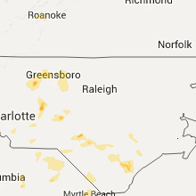
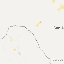
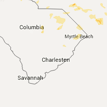
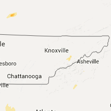
Regions Impacted by Hail on 5/12/2016
Cities Most Affected by Hail Storms of 5/12/2016
| Hail Size | Demographics of Zip Codes Affected | ||||||
|---|---|---|---|---|---|---|---|
| City | Count | Average | Largest | Pop Density | House Value | Income | Age |
| Corinth, MS | 1 | 1.75 | 1.75 | 134 | $64k | $28.5k | 39.1 |
| Winston Salem, NC | 1 | 1.75 | 1.75 | 1423 | $86k | $24.2k | 37.2 |
| Rocksprings, TX | 1 | 1.75 | 1.75 | 0 | $35k | $24.1k | 46.1 |
| Denton, NC | 1 | 1.75 | 1.75 | 54 | $87k | $38.1k | 43.0 |
| Houston, TX | 1 | 1.75 | 1.75 | 3519 | $87k | $50.2k | 32.6 |
| Magnolia, KY | 1 | 1.75 | 1.75 | 36 | $60k | $30.8k | 41.3 |
Hail and Wind Damage Spotted on 5/12/2016
Filter by Report Type:Hail ReportsWind Reports
States Impacted
Arkansas, South Carolina, Tennessee, Alabama, Virginia, Kentucky, North Carolina, Mississippi, TexasArkansas
| Local Time | Report Details |
|---|---|
| 7:04 AM CDT | Tree reported down along camp robinson road near remoun in pulaski county AR, 5 miles N of Little Rock, AR |
| 7:05 AM CDT | Large tree limbs dow in pulaski county AR, 10 miles NNE of Little Rock, AR |
| 7:05 AM CDT | Large tree limbs down near batesville pike with one large limb on a hom in pulaski county AR, 8.6 miles NNE of Little Rock, AR |
| 7:05 AM CDT | Tree reported down near batesville pike and frenchman mountain r in pulaski county AR, 11.7 miles NNE of Little Rock, AR |
| 7:15 AM CDT | Tree reported down at greyston in lonoke county AR, 22.1 miles NE of Little Rock, AR |
| 7:15 AM CDT | Large tree reported dow in lonoke county AR, 21 miles NE of Little Rock, AR |
| 7:28 AM CDT | A few small trees down with numerous branches down as wel in white county AR, 31.1 miles NE of Little Rock, AR |
| 7:30 AM CDT | A few small trees down near highway 3 in lonoke county AR, 29.5 miles ENE of Little Rock, AR |
| 8:05 AM CDT | Numerous trees down in and around augusta with some uprooted. a lone metal outbuilding was damage in woodruff county AR, 63.9 miles NE of Little Rock, AR |
South Carolina
| Local Time | Report Details |
|---|---|
| 1:26 PM EDT | Tree down at horrell hill fd. estmd 60 kt gust. pea-size hail in richland county SC, 70.5 miles NW of Charleston, SC |
| 1:56 PM EDT | 3 trees down reported at tomb field road camden sc in kershaw county SC, 73.7 miles SSE of Charlotte, NC |
| 2:22 PM EDT | Tree down dinkins mill rd and hwy 26 in sumter county SC, 65.3 miles NNW of Charleston, SC |
| 2:35 PM EDT | Quarter sized hail reported near Tamassee, SC, 26.7 miles WNW of Greenville, SC, dime size hail along north little river road at highway 30...with some larger stones as big as quarters. |
| 3:30 PM EDT | Tree down at intersection of rochester hwy and w sizemore r in oconee county SC, 20.5 miles WSW of Greenville, SC |
| 4:27 PM EDT | Quarter sized hail reported near Chesterfield, SC, 53.9 miles SE of Charlotte, NC, quarter size hail reported in the city of chesterfield. report received via social media . |
| 6:15 PM EDT | Kand asos measured a 51 kt gus in anderson county SC, 23.6 miles SSW of Greenville, SC |
| 6:15 PM EDT | Large tree fell...blocking both lanes of dobbins bridge rd. time estimated from rada in anderson county SC, 26.5 miles SSW of Greenville, SC |
| 6:22 PM EDT | Tree down on house and power lines down on west side of anderso in anderson county SC, 22.5 miles S of Greenville, SC |
| 7:00 PM EDT | Large tree fell...blocking both lanes of dobbins ridge dr. time estimated from rada in greenville county SC, 22.2 miles SSE of Greenville, SC |
| 7:05 PM EDT | Tree down on harrison bridge rd at parkgate c in greenville county SC, 19.8 miles ESE of Greenville, SC |
| 7:10 PM EDT | Tree fell on power line...causing power outage on n almond d in greenville county SC, 21.1 miles ESE of Greenville, SC |
| 7:18 PM EDT | Approx 20 foot tree split by strong winds in simpsonvill in greenville county SC, 20.6 miles ESE of Greenville, SC |
| 7:36 PM EDT | Power line down at sutton rd. and u.s. 21 intersectio in york county SC, 17.7 miles SSW of Charlotte, NC |
Tennessee
| Local Time | Report Details |
|---|---|
| 12:28 PM CDT | Sign blown down near birdsong marina. time estimated from rada in benton county TN, 27.8 miles ESE of Mc Kenzie, TN |
| 1:55 PM EDT | A couple of trees dow in campbell county TN, 29.6 miles NNW of Knoxville, TN |
| 1:34 PM CDT | Tree down at vantage way and french landing dr in davidson county TN, 1.5 miles NW of Nashville, TN |
| 1:34 PM CDT | A dozen trees down across the county. 2300 people without powe in davidson county TN, 0.2 miles NNW of Nashville, TN |
| 1:34 PM CDT | Tree down on 3rd ave sout in davidson county TN, 0.7 miles SE of Nashville, TN |
| 1:35 PM CDT | Tree down at vantage way and french landing dr in davidson county TN, 1.5 miles NW of Nashville, TN |
| 1:38 PM CDT | Trees and powerlines down at the corner of meridian and cleveland s in davidson county TN, 1 miles NNE of Nashville, TN |
| 1:40 PM CDT | Several tree limbs down around shelby park in davidson county TN, 0.5 miles ENE of Nashville, TN |
| 2:06 PM CDT | Storm damage reported in davidson county TN, 2.7 miles E of Nashville, TN |
| 2:11 PM CDT | Several trees down...one on a house along hartsville pike. powerlines down in and around lebano in wilson county TN, 25.8 miles E of Nashville, TN |
| 2:22 PM CDT | Trees down...one on a car and one caused minor damage to a hom in wilson county TN, 33.8 miles ENE of Nashville, TN |
| 2:34 PM CDT | Several trees down...some down on homes in trousdale county TN, 39.9 miles ENE of Nashville, TN |
| 3:35 PM EDT | 2 trees down western part of knoxville in knox county TN, 1.8 miles WNW of Knoxville, TN |
| 2:47 PM CDT | Tree down along union camp road in macon county TN, 52 miles ENE of Nashville, TN |
| 3:55 PM EDT | Several trees downed near and west of newpor in cocke county TN, 39.8 miles E of Knoxville, TN |
| 3:55 PM EDT | A couple of trees down halls are in knox county TN, 1.8 miles WNW of Knoxville, TN |
| 3:15 PM CDT | Tree down along hwy 52 near moss in clay county TN, 71.3 miles ENE of Nashville, TN |
| 4:20 PM EDT | Several trees down across count in jefferson county TN, 26.5 miles ENE of Knoxville, TN |
| 4:50 PM EDT | A couple of trees down morristown and east side of morristow in hamblen county TN, 39.8 miles ENE of Knoxville, TN |
| 4:55 PM EDT | Storm damage reported in hamblen county TN, 45.3 miles ENE of Knoxville, TN |
| 5:30 PM EDT | Tree downe in hawkins county TN, 27.5 miles W of Bristol, TN |
| 5:40 PM EDT | Few trees downe in hawkins county TN, 24.5 miles W of Bristol, TN |
Alabama
| Local Time | Report Details |
|---|---|
| 1:00 PM CDT | Large tree limb down and blocking piney branch rd. time is radar estimate in madison county AL, 59.5 miles E of Florence, AL |
| 5:37 PM CDT | Trained spotter measured a wind gust of 62mph. he is located just north of athens state universit in limestone county AL, 40.7 miles E of Florence, AL |
| 5:44 PM CDT | Tree down along smith vasser road... south of yarbrough roa in madison county AL, 50.9 miles E of Florence, AL |
| 5:59 PM CDT | Tree down near maple hill cemeter in madison county AL, 63.1 miles E of Florence, AL |
Virginia
| Local Time | Report Details |
|---|---|
| 3:30 PM EDT | Half Dollar sized hail reported near Roanoke, VA, 6.4 miles NW of Roanoke, VA |
| 3:32 PM EDT | Large tree limbs down. penny sized hail as wel in roanoke county VA, 5.6 miles NW of Roanoke, VA |
| 4:16 PM EDT | Large tree limbs dow in bedford county VA, 5.6 miles E of Roanoke, VA |
| 5:15 PM EDT | A few trees down in big stone gap area and elsewhere in count in wise county VA, 36.1 miles WNW of Bristol, TN |
| 6:10 PM EDT | Multiple trees down castlewood area in russell county VA, 20.2 miles N of Bristol, TN |
| 6:10 PM EDT | Multiple trees down just west of bristol v in city of bristol county VA, 2.1 miles NE of Bristol, TN |
| 6:40 PM EDT | Trees down near the city of abingdon... v in washington county VA, 16.2 miles ENE of Bristol, TN |
| 6:50 PM EDT | A few trees down across the eastern half of russell county... v in russell county VA, 32.4 miles NNE of Bristol, TN |
Kentucky
| Local Time | Report Details |
|---|---|
| 2:46 PM CDT | Quarter sized hail reported near Bonnieville, KY, 44 miles SSW of Louisville, KY |
| 3:03 PM CDT | Golf Ball sized hail reported near Magnolia, KY, 40.1 miles S of Louisville, KY |
North Carolina
| Local Time | Report Details |
|---|---|
| 3:47 PM EDT | Quarter sized hail reported near Roaring River, NC, 70.1 miles N of Charlotte, NC, hail up to quarter size on ruritan road |
| 4:35 PM EDT | Quarter sized hail reported near Wilmington, NC, 7.2 miles ENE of Wilmington, NC, report of quarter sized hail in brittany lakes. |
| 5:10 PM EDT | Quarter sized hail reported near Denton, NC, 48.2 miles ENE of Charlotte, NC, hail up to quarter size. |
| 5:19 PM EDT | Golf Ball sized hail reported near Denton, NC, 50.2 miles ENE of Charlotte, NC, up to golf ball size hail reported on social media. time estimated by radar. |
| 5:30 PM EDT | Quarter sized hail reported near Robbins, NC, 58.5 miles WSW of Raleigh, NC, quarter size hail reported near robbins by sherriff in the area at the time. |
| 5:35 PM EDT | Wind damage near the casar-belwood rd and hull rd intersection including two downed trees and flag pole bent at 90-degree angl in cleveland county NC, 46.3 miles WNW of Charlotte, NC |
| 5:58 PM EDT | Golf Ball sized hail reported near Winston Salem, NC, 68.9 miles NNE of Charlotte, NC, up to golf ball size hail near winston-salem state university. time estimated by radar. |
| 6:05 PM EDT | Several trees down around property and shutters torn off hom in cleveland county NC, 37.2 miles WNW of Charlotte, NC |
| 6:08 PM EDT | Numerous trees and power lines down on the east side of winston-salem. time approximate... estimated by rada in forsyth county NC, 69.8 miles NNE of Charlotte, NC |
| 6:15 PM EDT | Trees reported down on oak grove rd near moss lake...borders rd...and n post r in cleveland county NC, 36 miles W of Charlotte, NC |
| 6:30 PM EDT | One tree down across highway 31 in stokes county NC, 64.7 miles S of Roanoke, VA |
| 6:45 PM EDT | A tree was blown down at the intersection of witty road and spring creek roa in rockingham county NC, 70 miles S of Roanoke, VA |
| 7:08 PM EDT | 2 trees reported down at coble church roa in guilford county NC, 57.8 miles WNW of Raleigh, NC |
| 7:26 PM EDT | Several trees reported down near altamahaw. time estimated by rada in alamance county NC, 55.7 miles WNW of Raleigh, NC |
| 7:48 PM EDT | Quarter sized hail reported near Charlotte, NC, 9.2 miles S of Charlotte, NC |
| 7:52 PM EDT | Multiple trees down near n.c. 51 and n.c. 16. time estimated by rada in mecklenburg county NC, 9.1 miles SSE of Charlotte, NC |
| 7:55 PM EDT | A power line was blown dow in caswell county NC, 51.2 miles NW of Raleigh, NC |
Mississippi
| Local Time | Report Details |
|---|---|
| 3:08 PM CDT | Two trees downed on county road 185 right by greenwood-leflore airport. one tree downed northwest of the airport on highway 82 near the carroll and leflore county lin in carroll county MS, 72.6 miles W of Starkville, MS |
| 3:11 PM CDT | Golf Ball sized hail reported near Corinth, MS, 47 miles W of Florence, AL, brief golfball size hail. caused damage to a vehicle. time is radar estimated. |
| 3:11 PM CDT | Utility lines down on county road 300 near town of gle in alcorn county MS, 47 miles W of Florence, AL |
| 4:25 PM CDT | A couple of trees knocked down and a light pole snapped in two on county road 261 in bisse in lee county MS, 53.4 miles N of Starkville, MS |
Texas
| Local Time | Report Details |
|---|---|
| 6:50 PM CDT | Quarter sized hail reported near Rocksprings, TX, 53.4 miles NE of Del Rio, TX, quarter size hail observed about halfway between hwy 377 and cr674 |
| 7:09 PM CDT | Golf Ball sized hail reported near Rocksprings, TX, 61.1 miles NE of Del Rio, TX |
| 8:13 PM CDT | Quarter sized hail reported near Houston, TX, 12.7 miles NW of Houston, TX, quarter size hail |
| 8:13 PM CDT | Golf Ball sized hail reported near Houston, TX, 14.1 miles NW of Houston, TX, quarter to golf ball size hail in lakeview drive area of jersey village that fell for around 20 minutes |
| 9:07 PM CDT | Quarter sized hail reported near Katy, TX, 21.1 miles W of Houston, TX, quarter size hail |







Connect with Interactive Hail Maps