| 6/3/2022 1:25 PM PDT |
Colville tribe reports debris on road near the intersection of sr 21 and silver creek rd. not impeding trave in ferry county WA, 1.3 miles W of Keller, WA
|
| 6/3/2022 1:25 PM PDT |
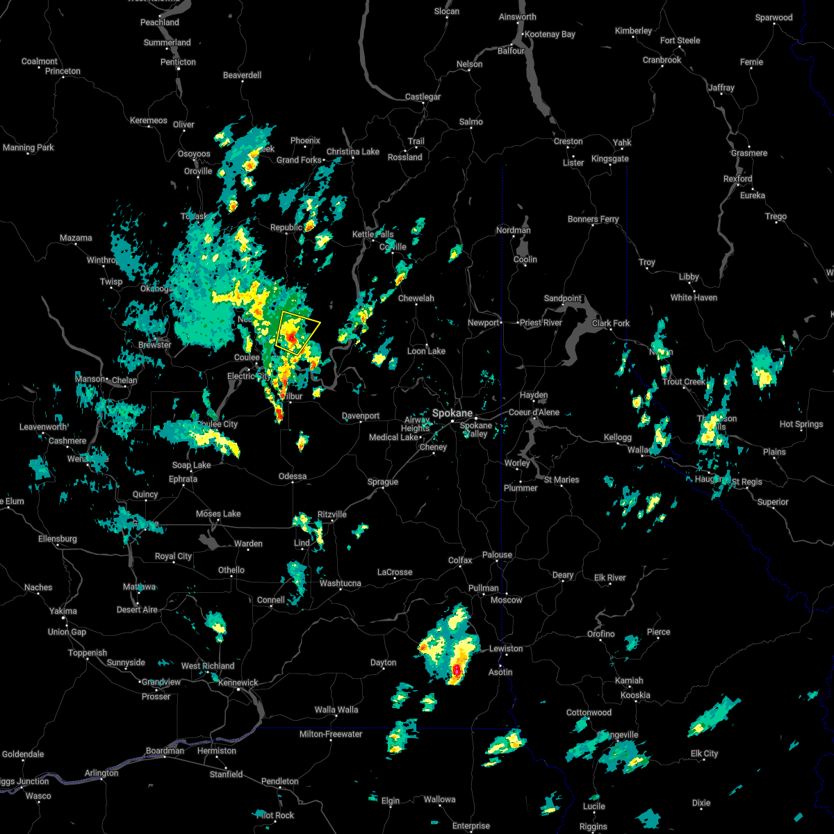
 At 124 pm pdt, a severe thunderstorm was located 14 miles southeast of nespelem community, or 43 miles southeast of omak, moving north at 15 mph (radar indicated). Hazards include ping pong ball size hail. People and animals outdoors will be injured. expect damage to roofs, siding, windows, and vehicles. locations impacted include, keller. hail threat, radar indicated max hail size, 1. 50 in wind threat, radar indicated max wind gust, <50 mph. At 124 pm pdt, a severe thunderstorm was located 14 miles southeast of nespelem community, or 43 miles southeast of omak, moving north at 15 mph (radar indicated). Hazards include ping pong ball size hail. People and animals outdoors will be injured. expect damage to roofs, siding, windows, and vehicles. locations impacted include, keller. hail threat, radar indicated max hail size, 1. 50 in wind threat, radar indicated max wind gust, <50 mph.
|
| 6/3/2022 1:10 PM PDT |
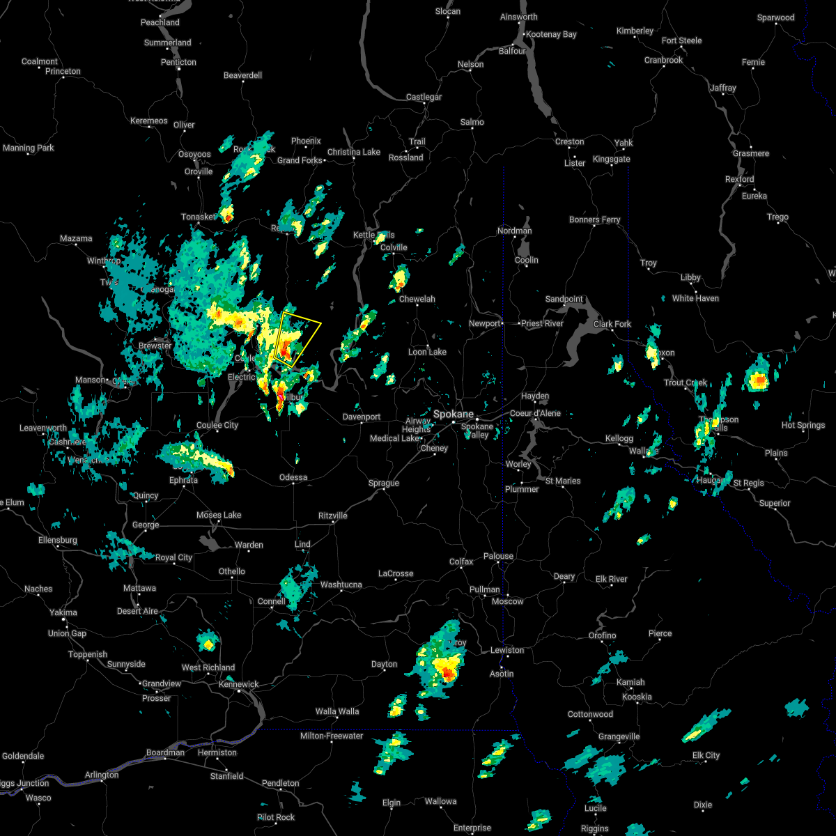
 At 110 pm pdt, a severe thunderstorm was located 15 miles southeast of nespelem community, or 44 miles southeast of omak, moving north at 15 mph (radar indicated). Hazards include quarter size hail. damage to vehicles is expected At 110 pm pdt, a severe thunderstorm was located 15 miles southeast of nespelem community, or 44 miles southeast of omak, moving north at 15 mph (radar indicated). Hazards include quarter size hail. damage to vehicles is expected
|
| 8/12/2014 7:05 PM PDT |
Trees down in keller. gusts estimated at 40-50 mph. relayed to spotter via ham radi in ferry county WA, 1.8 miles W of Keller, WA
|
| 7/23/2014 4:30 PM PDT |
Trees and power lines reported down in the community of keller. time estimated based on rada in ferry county WA, 2 miles WNW of Keller, WA
|
| 7/20/2012 3:42 PM PDT |
Trees and power lines down on highway 21 in ferry county WA, 4.1 miles SSW of Keller, WA
|
| 7/20/2012 3:35 PM PDT |
Trees down on silver creek road in ferry county WA, 5.3 miles WNW of Keller, WA
|
| 7/20/2012 3:30 PM PDT |
Trees down on houses in ferry county WA, 2 miles WNW of Keller, WA
|
| 7/20/2012 3:30 PM PDT |
Numerous trees fell on houses in the town of keller. several houses were damaged or destroye in ferry county WA, 1.8 miles W of Keller, WA
|
| 7/20/2012 3:30 PM PDT |
Trees down on manilla creek rd in ferry county WA, 6.6 miles NE of Keller, WA
|
 At 124 pm pdt, a severe thunderstorm was located 14 miles southeast of nespelem community, or 43 miles southeast of omak, moving north at 15 mph (radar indicated). Hazards include ping pong ball size hail. People and animals outdoors will be injured. expect damage to roofs, siding, windows, and vehicles. locations impacted include, keller. hail threat, radar indicated max hail size, 1. 50 in wind threat, radar indicated max wind gust, <50 mph.
 At 110 pm pdt, a severe thunderstorm was located 15 miles southeast of nespelem community, or 44 miles southeast of omak, moving north at 15 mph (radar indicated). Hazards include quarter size hail. damage to vehicles is expected


Connect with Interactive Hail Maps