

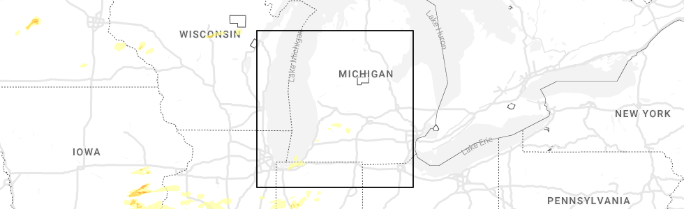
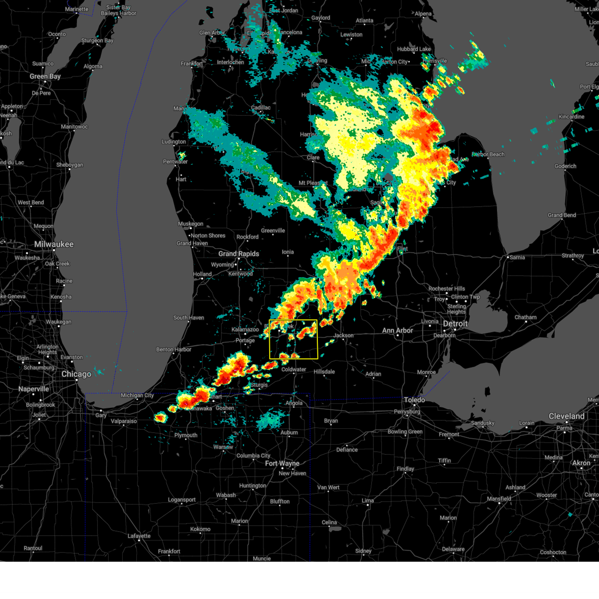
Hail Map for Level Park-Oak Park, MI
The Level Park-Oak Park, MI area has had 0 reports of on-the-ground hail by trained spotters, and has been under severe weather warnings 26 times during the past 12 months. Doppler radar has detected hail at or near Level Park-Oak Park, MI on 23 occasions.
| Name: | Level Park-Oak Park, MI |
| Where Located: | 46.6 miles SSE of Grand Rapids, MI |
| Map: | Google Map for Level Park-Oak Park, MI |
| Population: | 3409 |
| Housing Units: | 1492 |
| More Info: | Search Google for Level Park-Oak Park, MI |
0
The Top Recent Hail Date for Level Park-Oak Park, MI is Saturday, May 6, 2023 (23rd out of 23)
Hail and Wind Damage Spotted near Level Park-Oak Park, MI
| Date / Time | Report Details |
|---|---|
| 3/30/2025 5:56 PM EDT | At 554 pm edt, severe thunderstorms were located along a line extending from near sparta to 7 miles southwest of hastings to near marshall, moving northeast at 60 mph. these are destructive storms for southwest michigan (at 5:50 pm grand rapids asos reported 80 mph winds). Hazards include 80 mph wind gusts and penny size hail. Flying debris will be dangerous to those caught without shelter. mobile homes will be heavily damaged. expect considerable damage to roofs, windows, and vehicles. extensive tree damage and power outages are likely. Locations impacted include, cutlerville, wyoming, battle creek, belmont, grandville, duck lake, yankee springs, hickory corners, grattan, alto, brownlee park, dutton, sparta, banfield, comstock park, walker, marshall, nashville, athens, tekonsha,. |
| 3/30/2025 5:48 PM EDT | At 547 pm edt, severe thunderstorms were located along a line extending from 6 miles southwest of sparta to 5 miles east of martin to near burlington, moving northeast at 60 mph (radar indicated). Hazards include 70 mph wind gusts and penny size hail. Expect considerable tree damage. damage is likely to mobile homes, roofs, and outbuildings. Locations impacted include, cutlerville, wyoming, battle creek, belmont, grandville, duck lake, yankee springs, hickory corners, grattan, alto, brownlee park, dutton, sparta, banfield, comstock park, walker, marshall, nashville, athens, tekonsha,. |
| 3/30/2025 5:24 PM EDT | Svrgrr the national weather service in grand rapids has issued a * severe thunderstorm warning for, calhoun county in south central michigan, kent county in southwestern michigan, barry county in southwestern michigan, * until 630 pm edt. * at 523 pm edt, severe thunderstorms were located along a line extending from near beechwood to near schoolcraft, moving northeast at 65 mph (radar indicated). Hazards include 70 mph wind gusts and penny size hail. Expect considerable tree damage. Damage is likely to mobile homes, roofs, and outbuildings. |
| 8/27/2024 4:50 PM EDT |
 Svrgrr the national weather service in grand rapids has issued a * severe thunderstorm warning for, calhoun county in south central michigan, * until 545 pm edt. * at 449 pm edt, severe thunderstorms were located along a line extending from bellevue to near climax, moving east at 45 mph. other scattered strong cells were developing out ahead of this line (radar indicated). Hazards include 60 mph wind gusts and penny size hail. expect damage to roofs, siding, and trees Svrgrr the national weather service in grand rapids has issued a * severe thunderstorm warning for, calhoun county in south central michigan, * until 545 pm edt. * at 449 pm edt, severe thunderstorms were located along a line extending from bellevue to near climax, moving east at 45 mph. other scattered strong cells were developing out ahead of this line (radar indicated). Hazards include 60 mph wind gusts and penny size hail. expect damage to roofs, siding, and trees
|
| 7/16/2024 1:04 AM EDT |
 the severe thunderstorm warning has been cancelled and is no longer in effect the severe thunderstorm warning has been cancelled and is no longer in effect
|
| 7/16/2024 12:51 AM EDT |
 the severe thunderstorm warning has been cancelled and is no longer in effect the severe thunderstorm warning has been cancelled and is no longer in effect
|
| 7/16/2024 12:51 AM EDT |
 At 1250 am edt, severe thunderstorms were located along a line extending from near battle creek to near union city, moving east at 35 mph (radar indicated). Hazards include 60 mph wind gusts. Expect damage to roofs, siding, and trees. Locations impacted include, battle creek, union city, burlington, brownlee park, athens, pine creek, bedford,. At 1250 am edt, severe thunderstorms were located along a line extending from near battle creek to near union city, moving east at 35 mph (radar indicated). Hazards include 60 mph wind gusts. Expect damage to roofs, siding, and trees. Locations impacted include, battle creek, union city, burlington, brownlee park, athens, pine creek, bedford,.
|
| 7/16/2024 12:25 AM EDT |
 Svrgrr the national weather service in grand rapids has issued a * severe thunderstorm warning for, western calhoun county in south central michigan, southeastern barry county in southwestern michigan, eastern kalamazoo county in southwestern michigan, * until 130 am edt. * at 1224 am edt, severe thunderstorms were located along a line extending from near richland to near galesburg to near vicksburg, moving northeast at 50 mph (radar indicated). Hazards include 60 mph wind gusts. expect damage to roofs, siding, and trees Svrgrr the national weather service in grand rapids has issued a * severe thunderstorm warning for, western calhoun county in south central michigan, southeastern barry county in southwestern michigan, eastern kalamazoo county in southwestern michigan, * until 130 am edt. * at 1224 am edt, severe thunderstorms were located along a line extending from near richland to near galesburg to near vicksburg, moving northeast at 50 mph (radar indicated). Hazards include 60 mph wind gusts. expect damage to roofs, siding, and trees
|
| 6/25/2024 7:51 AM EDT |
 At 751 am edt, severe thunderstorms were located along a line extending from near schoolcraft to near climax to near albion, moving southeast at 35 mph (radar indicated). Hazards include 60 mph wind gusts. Expect damage to roofs, siding, and trees. Locations impacted include, kalamazoo, portage, albion, marshall, battle creek, vicksburg, galesburg, homer, union city, schoolcraft, climax, burlington, westwood, brownlee park, comstock northwest, fulton, marengo, athens, augusta, tekonsha,. At 751 am edt, severe thunderstorms were located along a line extending from near schoolcraft to near climax to near albion, moving southeast at 35 mph (radar indicated). Hazards include 60 mph wind gusts. Expect damage to roofs, siding, and trees. Locations impacted include, kalamazoo, portage, albion, marshall, battle creek, vicksburg, galesburg, homer, union city, schoolcraft, climax, burlington, westwood, brownlee park, comstock northwest, fulton, marengo, athens, augusta, tekonsha,.
|
| 6/25/2024 7:27 AM EDT |
 Svrgrr the national weather service in grand rapids has issued a * severe thunderstorm warning for, calhoun county in south central michigan, kalamazoo county in southwestern michigan, * until 815 am edt. * at 726 am edt, severe thunderstorms were located along a line extending from near westwood to near bellevue, moving southeast at 40 mph (radar indicated). Hazards include 60 mph wind gusts. expect damage to roofs, siding, and trees Svrgrr the national weather service in grand rapids has issued a * severe thunderstorm warning for, calhoun county in south central michigan, kalamazoo county in southwestern michigan, * until 815 am edt. * at 726 am edt, severe thunderstorms were located along a line extending from near westwood to near bellevue, moving southeast at 40 mph (radar indicated). Hazards include 60 mph wind gusts. expect damage to roofs, siding, and trees
|
| 6/17/2024 12:30 AM EDT |
 The storms which prompted the warning have weakened below severe limits, and no longer pose an immediate threat to life or property. therefore, the warning has been allowed to expire. The storms which prompted the warning have weakened below severe limits, and no longer pose an immediate threat to life or property. therefore, the warning has been allowed to expire.
|
| 6/16/2024 11:30 PM EDT |
 Svrgrr the national weather service in grand rapids has issued a * severe thunderstorm warning for, western calhoun county in south central michigan, eastern kalamazoo county in southwestern michigan, * until 1230 am edt. * at 1129 pm edt, severe thunderstorms were located along a line extending from near comstock northwest to near schoolcraft, moving northeast at 30 mph (radar indicated). Hazards include 60 mph wind gusts and penny size hail. expect damage to roofs, siding, and trees Svrgrr the national weather service in grand rapids has issued a * severe thunderstorm warning for, western calhoun county in south central michigan, eastern kalamazoo county in southwestern michigan, * until 1230 am edt. * at 1129 pm edt, severe thunderstorms were located along a line extending from near comstock northwest to near schoolcraft, moving northeast at 30 mph (radar indicated). Hazards include 60 mph wind gusts and penny size hail. expect damage to roofs, siding, and trees
|
| 6/16/2024 10:23 PM EDT |
 Svrgrr the national weather service in grand rapids has issued a * severe thunderstorm warning for, calhoun county in south central michigan, eaton county in south central michigan, * until 1130 pm edt. * at 1022 pm edt, severe thunderstorms were located along a line extending from 5 miles east of lake odessa to near vicksburg, moving east at 35 mph (radar indicated). Hazards include 60 mph wind gusts and penny size hail. expect damage to roofs, siding, and trees Svrgrr the national weather service in grand rapids has issued a * severe thunderstorm warning for, calhoun county in south central michigan, eaton county in south central michigan, * until 1130 pm edt. * at 1022 pm edt, severe thunderstorms were located along a line extending from 5 miles east of lake odessa to near vicksburg, moving east at 35 mph (radar indicated). Hazards include 60 mph wind gusts and penny size hail. expect damage to roofs, siding, and trees
|
| 5/7/2024 8:13 PM EDT |
 At 813 pm edt, a severe thunderstorm was located over marshall, moving northeast at 25 mph (radar indicated). Hazards include 60 mph wind gusts and quarter size hail. Hail damage to vehicles is expected. expect wind damage to roofs, siding, and trees. Locations impacted include, albion, marshall, battle creek, homer, union city, burlington, brownlee park, marengo, athens, tekonsha, duck lake, pine creek, bedford, ceresco,. At 813 pm edt, a severe thunderstorm was located over marshall, moving northeast at 25 mph (radar indicated). Hazards include 60 mph wind gusts and quarter size hail. Hail damage to vehicles is expected. expect wind damage to roofs, siding, and trees. Locations impacted include, albion, marshall, battle creek, homer, union city, burlington, brownlee park, marengo, athens, tekonsha, duck lake, pine creek, bedford, ceresco,.
|
| 5/7/2024 8:00 PM EDT |
 the tornado warning has been cancelled and is no longer in effect the tornado warning has been cancelled and is no longer in effect
|
| 5/7/2024 7:51 PM EDT |
 At 750 pm edt, a severe thunderstorm capable of producing a tornado was located over brownlee park, or near battle creek, moving northeast at 40 mph (radar indicated rotation). Hazards include tornado and quarter size hail. Flying debris will be dangerous to those caught without shelter. mobile homes will be damaged or destroyed. damage to roofs, windows, and vehicles will occur. tree damage is likely. This tornadic thunderstorm will track through northern parts of calhoun county impacting the following locations, pine creek, bedford, ceresco, duck lake, and marengo. At 750 pm edt, a severe thunderstorm capable of producing a tornado was located over brownlee park, or near battle creek, moving northeast at 40 mph (radar indicated rotation). Hazards include tornado and quarter size hail. Flying debris will be dangerous to those caught without shelter. mobile homes will be damaged or destroyed. damage to roofs, windows, and vehicles will occur. tree damage is likely. This tornadic thunderstorm will track through northern parts of calhoun county impacting the following locations, pine creek, bedford, ceresco, duck lake, and marengo.
|
| 5/7/2024 7:44 PM EDT |
 At 743 pm edt, a confirmed tornado was located over battle creek, moving northeast at 40 mph (weather spotters earlier confirmed tornado just west of battle creek near galesburg). Hazards include damaging tornado and quarter size hail. Flying debris will be dangerous to those caught without shelter. mobile homes will be damaged or destroyed. damage to roofs, windows, and vehicles will occur. tree damage is likely. this tornado will be near, battle creek and brownlee park around 750 pm edt. Other locations impacted by this tornadic thunderstorm include pine creek, bedford, ceresco, duck lake, and marengo. At 743 pm edt, a confirmed tornado was located over battle creek, moving northeast at 40 mph (weather spotters earlier confirmed tornado just west of battle creek near galesburg). Hazards include damaging tornado and quarter size hail. Flying debris will be dangerous to those caught without shelter. mobile homes will be damaged or destroyed. damage to roofs, windows, and vehicles will occur. tree damage is likely. this tornado will be near, battle creek and brownlee park around 750 pm edt. Other locations impacted by this tornadic thunderstorm include pine creek, bedford, ceresco, duck lake, and marengo.
|
| 5/7/2024 7:35 PM EDT |
 Torgrr the national weather service in grand rapids has issued a * tornado warning for, calhoun county in south central michigan, * until 830 pm edt. * at 735 pm edt, a confirmed large and extremely dangerous tornado was located near climax, or near battle creek, moving northeast at 45 mph. this is a particularly dangerous situation. take cover now! (weather spotters confirmed tornado). Hazards include damaging tornado. You are in a life-threatening situation. flying debris may be deadly to those caught without shelter. mobile homes will be destroyed. considerable damage to homes, businesses, and vehicles is likely and complete destruction is possible. the tornado will be near, battle creek and brownlee park around 740 pm edt. Other locations impacted by this tornadic thunderstorm include pine creek, bedford, ceresco, duck lake, and marengo. Torgrr the national weather service in grand rapids has issued a * tornado warning for, calhoun county in south central michigan, * until 830 pm edt. * at 735 pm edt, a confirmed large and extremely dangerous tornado was located near climax, or near battle creek, moving northeast at 45 mph. this is a particularly dangerous situation. take cover now! (weather spotters confirmed tornado). Hazards include damaging tornado. You are in a life-threatening situation. flying debris may be deadly to those caught without shelter. mobile homes will be destroyed. considerable damage to homes, businesses, and vehicles is likely and complete destruction is possible. the tornado will be near, battle creek and brownlee park around 740 pm edt. Other locations impacted by this tornadic thunderstorm include pine creek, bedford, ceresco, duck lake, and marengo.
|
| 5/7/2024 7:26 PM EDT |
 Svrgrr the national weather service in grand rapids has issued a * severe thunderstorm warning for, calhoun county in south central michigan, * until 900 pm edt. * at 725 pm edt, a severe thunderstorm was located near burlington, or 7 miles north of coldwater, moving northeast at 25 mph (radar indicated). Hazards include 60 mph wind gusts and quarter size hail. Hail damage to vehicles is expected. Expect wind damage to roofs, siding, and trees. Svrgrr the national weather service in grand rapids has issued a * severe thunderstorm warning for, calhoun county in south central michigan, * until 900 pm edt. * at 725 pm edt, a severe thunderstorm was located near burlington, or 7 miles north of coldwater, moving northeast at 25 mph (radar indicated). Hazards include 60 mph wind gusts and quarter size hail. Hail damage to vehicles is expected. Expect wind damage to roofs, siding, and trees.
|
| 5/7/2024 6:35 PM EDT |
 At 633 pm edt, a severe thunderstorm capable of producing a tornado was located near battle creek, moving northeast at 30 mph. a second severe thunderstorm in south central calhoun county was approaching homer. both of these storms have had a history of producing damaging tornadoes (radar indicated rotation). Hazards include tornado and golf ball size hail. Flying debris will be dangerous to those caught without shelter. mobile homes will be damaged or destroyed. damage to roofs, windows, and vehicles will occur. tree damage is likely. this dangerous storm will be near, battle creek and brownlee park around 640 pm edt. Other locations impacted by this tornadic thunderstorm include pine creek, marengo, bedford, athens, ceresco, duck lake, and tekonsha. At 633 pm edt, a severe thunderstorm capable of producing a tornado was located near battle creek, moving northeast at 30 mph. a second severe thunderstorm in south central calhoun county was approaching homer. both of these storms have had a history of producing damaging tornadoes (radar indicated rotation). Hazards include tornado and golf ball size hail. Flying debris will be dangerous to those caught without shelter. mobile homes will be damaged or destroyed. damage to roofs, windows, and vehicles will occur. tree damage is likely. this dangerous storm will be near, battle creek and brownlee park around 640 pm edt. Other locations impacted by this tornadic thunderstorm include pine creek, marengo, bedford, athens, ceresco, duck lake, and tekonsha.
|
| 5/7/2024 6:22 PM EDT |
 At 620 pm edt, a confirmed large and extremely dangerous tornado was located near burlington, or 11 miles south of marshall, moving northeast at 40 mph. this is a particularly dangerous situation. take cover now! (radar confirmed tornado). Hazards include damaging tornado. You are in a life-threatening situation. flying debris may be deadly to those caught without shelter. mobile homes will be destroyed. considerable damage to homes, businesses, and vehicles is likely and complete destruction is possible. the tornado will be near, albion, tekonsha and homer around 635 pm edt. Other locations impacted by this tornadic thunderstorm include pine creek, marengo, bedford, athens, ceresco, duck lake, and tekonsha. At 620 pm edt, a confirmed large and extremely dangerous tornado was located near burlington, or 11 miles south of marshall, moving northeast at 40 mph. this is a particularly dangerous situation. take cover now! (radar confirmed tornado). Hazards include damaging tornado. You are in a life-threatening situation. flying debris may be deadly to those caught without shelter. mobile homes will be destroyed. considerable damage to homes, businesses, and vehicles is likely and complete destruction is possible. the tornado will be near, albion, tekonsha and homer around 635 pm edt. Other locations impacted by this tornadic thunderstorm include pine creek, marengo, bedford, athens, ceresco, duck lake, and tekonsha.
|
| 5/7/2024 6:13 PM EDT |
 Torgrr the national weather service in grand rapids has issued a * tornado warning for, calhoun county in south central michigan, * until 715 pm edt. * at 613 pm edt, a confirmed large and extremely dangerous tornado was located near burlington, or 9 miles northwest of coldwater, moving northeast at 45 mph. this is a particularly dangerous situation. take cover now! (radar confirmed tornado). Hazards include damaging tornado. You are in a life-threatening situation. flying debris may be deadly to those caught without shelter. mobile homes will be destroyed. considerable damage to homes, businesses, and vehicles is likely and complete destruction is possible. the tornado will be near, homer around 630 pm edt. albion around 635 pm edt. Other locations impacted by this tornadic thunderstorm include pine creek, marengo, bedford, athens, ceresco, duck lake, and tekonsha. Torgrr the national weather service in grand rapids has issued a * tornado warning for, calhoun county in south central michigan, * until 715 pm edt. * at 613 pm edt, a confirmed large and extremely dangerous tornado was located near burlington, or 9 miles northwest of coldwater, moving northeast at 45 mph. this is a particularly dangerous situation. take cover now! (radar confirmed tornado). Hazards include damaging tornado. You are in a life-threatening situation. flying debris may be deadly to those caught without shelter. mobile homes will be destroyed. considerable damage to homes, businesses, and vehicles is likely and complete destruction is possible. the tornado will be near, homer around 630 pm edt. albion around 635 pm edt. Other locations impacted by this tornadic thunderstorm include pine creek, marengo, bedford, athens, ceresco, duck lake, and tekonsha.
|
| 5/7/2024 5:55 PM EDT |
 Svrgrr the national weather service in grand rapids has issued a * severe thunderstorm warning for, calhoun county in south central michigan, * until 730 pm edt. * at 555 pm edt, a severe thunderstorm was located near union city, or 14 miles south of battle creek, moving northeast at 55 mph (radar indicated). Hazards include golf ball size hail and 60 mph wind gusts. People and animals outdoors will be injured. expect hail damage to roofs, siding, windows, and vehicles. Expect wind damage to roofs, siding, and trees. Svrgrr the national weather service in grand rapids has issued a * severe thunderstorm warning for, calhoun county in south central michigan, * until 730 pm edt. * at 555 pm edt, a severe thunderstorm was located near union city, or 14 miles south of battle creek, moving northeast at 55 mph (radar indicated). Hazards include golf ball size hail and 60 mph wind gusts. People and animals outdoors will be injured. expect hail damage to roofs, siding, windows, and vehicles. Expect wind damage to roofs, siding, and trees.
|
| 5/5/2024 12:01 AM EDT |
 the severe thunderstorm warning has been cancelled and is no longer in effect the severe thunderstorm warning has been cancelled and is no longer in effect
|
| 5/5/2024 12:01 AM EDT |
 At 1201 am edt, a severe thunderstorm was located 9 miles south of hastings, moving northeast at 35 mph (radar indicated). Hazards include 60 mph wind gusts. Expect damage to roofs, siding, and trees. Locations impacted include, hastings, nashville, freeport, assyria, woodland, delton, banfield, prairieville, hickory corners, dowling, woodbury, pine lake, bedford, cloverdale, lacey,. At 1201 am edt, a severe thunderstorm was located 9 miles south of hastings, moving northeast at 35 mph (radar indicated). Hazards include 60 mph wind gusts. Expect damage to roofs, siding, and trees. Locations impacted include, hastings, nashville, freeport, assyria, woodland, delton, banfield, prairieville, hickory corners, dowling, woodbury, pine lake, bedford, cloverdale, lacey,.
|
| 5/4/2024 11:42 PM EDT |
 Svrgrr the national weather service in grand rapids has issued a * severe thunderstorm warning for, northwestern calhoun county in south central michigan, barry county in southwestern michigan, northeastern kalamazoo county in southwestern michigan, * until 1245 am edt. * at 1141 pm edt, a severe thunderstorm was located near richland, or 8 miles north of kalamazoo, moving northeast at 30 mph (radar indicated). Hazards include 60 mph wind gusts. expect damage to roofs, siding, and trees Svrgrr the national weather service in grand rapids has issued a * severe thunderstorm warning for, northwestern calhoun county in south central michigan, barry county in southwestern michigan, northeastern kalamazoo county in southwestern michigan, * until 1245 am edt. * at 1141 pm edt, a severe thunderstorm was located near richland, or 8 miles north of kalamazoo, moving northeast at 30 mph (radar indicated). Hazards include 60 mph wind gusts. expect damage to roofs, siding, and trees
|
| 2/28/2024 12:01 AM EST |
 Torgrr the national weather service in grand rapids has issued a * tornado warning for, northern calhoun county in south central michigan, * until 100 am est. * at 1201 am est, a severe thunderstorm capable of producing a tornado was located near galesburg, or 9 miles southwest of battle creek, moving east at 35 mph (radar indicated rotation). Hazards include tornado. Flying debris will be dangerous to those caught without shelter. mobile homes will be damaged or destroyed. damage to roofs, windows, and vehicles will occur. tree damage is likely. this dangerous storm will be near, battle creek, springfield, and level park-oak park around 1205 am est. brownlee park around 1210 am est. Other locations in the path of this tornadic thunderstorm include marshall. Torgrr the national weather service in grand rapids has issued a * tornado warning for, northern calhoun county in south central michigan, * until 100 am est. * at 1201 am est, a severe thunderstorm capable of producing a tornado was located near galesburg, or 9 miles southwest of battle creek, moving east at 35 mph (radar indicated rotation). Hazards include tornado. Flying debris will be dangerous to those caught without shelter. mobile homes will be damaged or destroyed. damage to roofs, windows, and vehicles will occur. tree damage is likely. this dangerous storm will be near, battle creek, springfield, and level park-oak park around 1205 am est. brownlee park around 1210 am est. Other locations in the path of this tornadic thunderstorm include marshall.
|
| 2/27/2024 10:31 PM EST |
 Svrgrr the national weather service in grand rapids has issued a * severe thunderstorm warning for, northwestern calhoun county in south central michigan, southeastern barry county in southwestern michigan, eaton county in south central michigan, * until 1115 pm est. * at 1030 pm est, a severe thunderstorm was located over brownlee park, or 6 miles east of battle creek, moving northeast at 40 mph (radar indicated). Hazards include quarter size hail. damage to vehicles is expected Svrgrr the national weather service in grand rapids has issued a * severe thunderstorm warning for, northwestern calhoun county in south central michigan, southeastern barry county in southwestern michigan, eaton county in south central michigan, * until 1115 pm est. * at 1030 pm est, a severe thunderstorm was located over brownlee park, or 6 miles east of battle creek, moving northeast at 40 mph (radar indicated). Hazards include quarter size hail. damage to vehicles is expected
|
| 6/25/2023 4:10 PM EDT |
 At 409 pm edt, a severe thunderstorm was located near battle creek, moving northeast at 35 mph (radar indicated). Hazards include 60 mph wind gusts and penny size hail. expect damage to roofs, siding, and trees At 409 pm edt, a severe thunderstorm was located near battle creek, moving northeast at 35 mph (radar indicated). Hazards include 60 mph wind gusts and penny size hail. expect damage to roofs, siding, and trees
|
| 4/5/2023 11:26 AM EDT |
 At 1126 am edt, severe thunderstorms were located along a line extending from 5 miles southwest of climax to 8 miles northwest of union city to 7 miles northwest of colon, moving northeast at 60 mph (radar indicated). Hazards include 60 mph wind gusts. expect damage to roofs, siding, and trees At 1126 am edt, severe thunderstorms were located along a line extending from 5 miles southwest of climax to 8 miles northwest of union city to 7 miles northwest of colon, moving northeast at 60 mph (radar indicated). Hazards include 60 mph wind gusts. expect damage to roofs, siding, and trees
|
| 8/29/2022 4:37 PM EDT |
 The severe thunderstorm warning for western calhoun, southern barry and eastern kalamazoo counties will expire at 445 pm edt, the severe thunderstorm which prompted the warning has moved out of the warned area. therefore, the warning will be allowed to expire. a severe thunderstorm watch remains in effect until 800 pm edt for south central and southwestern michigan. The severe thunderstorm warning for western calhoun, southern barry and eastern kalamazoo counties will expire at 445 pm edt, the severe thunderstorm which prompted the warning has moved out of the warned area. therefore, the warning will be allowed to expire. a severe thunderstorm watch remains in effect until 800 pm edt for south central and southwestern michigan.
|
| 8/29/2022 4:19 PM EDT |
 At 418 pm edt, a severe thunderstorm was located near brownlee park, or 6 miles northeast of battle creek, moving east at 55 mph (radar indicated). Hazards include 60 mph wind gusts and quarter size hail. Expect wind damage to roofs, siding, and trees. locations impacted include, kalamazoo, portage, battle creek, vicksburg, galesburg, climax, richland, burlington, kalamazoo-battle cre, brownlee park, comstock northwest, level park-oak park, gull lake, fulton, assyria, athens, augusta, delton, pine creek, hickory corners, hail threat, radar indicated max hail size, 1. 00 in wind threat, observed max wind gust, 60 mph. At 418 pm edt, a severe thunderstorm was located near brownlee park, or 6 miles northeast of battle creek, moving east at 55 mph (radar indicated). Hazards include 60 mph wind gusts and quarter size hail. Expect wind damage to roofs, siding, and trees. locations impacted include, kalamazoo, portage, battle creek, vicksburg, galesburg, climax, richland, burlington, kalamazoo-battle cre, brownlee park, comstock northwest, level park-oak park, gull lake, fulton, assyria, athens, augusta, delton, pine creek, hickory corners, hail threat, radar indicated max hail size, 1. 00 in wind threat, observed max wind gust, 60 mph.
|
| 8/29/2022 3:40 PM EDT |
 At 340 pm edt, a severe thunderstorm was located near otsego, or 9 miles southeast of allegan, moving east at 45 mph (radar indicated). Hazards include 60 mph wind gusts and quarter size hail. Hail damage to vehicles is expected. Expect wind damage to roofs, siding, and trees. At 340 pm edt, a severe thunderstorm was located near otsego, or 9 miles southeast of allegan, moving east at 45 mph (radar indicated). Hazards include 60 mph wind gusts and quarter size hail. Hail damage to vehicles is expected. Expect wind damage to roofs, siding, and trees.
|
| 8/3/2022 5:05 PM EDT |
 At 505 pm edt, a severe thunderstorm was located near climax, or near battle creek, moving east at 60 mph (radar indicated). Hazards include 60 mph wind gusts. expect damage to roofs, siding, and trees At 505 pm edt, a severe thunderstorm was located near climax, or near battle creek, moving east at 60 mph (radar indicated). Hazards include 60 mph wind gusts. expect damage to roofs, siding, and trees
|
| 6/14/2022 12:33 AM EDT |
 At 1233 am edt, severe thunderstorms were located along a line extending from 5 miles southeast of bellevue to near galesburg to near paw paw lake, moving east at 40 mph (radar indicated). Hazards include 60 mph wind gusts and quarter size hail. Hail damage to vehicles is expected. expect wind damage to roofs, siding, and trees. locations impacted include, kalamazoo, portage, albion, marshall, battle creek, paw paw, vicksburg, hartford, galesburg, mattawan, lawton, bangor, decatur, homer, union city, schoolcraft, climax, richland, burlington, brownlee park, hail threat, radar indicated max hail size, 1. 00 in wind threat, radar indicated max wind gust, 60 mph. At 1233 am edt, severe thunderstorms were located along a line extending from 5 miles southeast of bellevue to near galesburg to near paw paw lake, moving east at 40 mph (radar indicated). Hazards include 60 mph wind gusts and quarter size hail. Hail damage to vehicles is expected. expect wind damage to roofs, siding, and trees. locations impacted include, kalamazoo, portage, albion, marshall, battle creek, paw paw, vicksburg, hartford, galesburg, mattawan, lawton, bangor, decatur, homer, union city, schoolcraft, climax, richland, burlington, brownlee park, hail threat, radar indicated max hail size, 1. 00 in wind threat, radar indicated max wind gust, 60 mph.
|
| 6/14/2022 12:21 AM EDT |
 At 1221 am edt, severe thunderstorms were located along a line extending from near bellevue to near galesburg to near van buren sp, moving southeast at 35 mph (radar indicated). Hazards include 60 mph wind gusts and quarter size hail. Hail damage to vehicles is expected. Expect wind damage to roofs, siding, and trees. At 1221 am edt, severe thunderstorms were located along a line extending from near bellevue to near galesburg to near van buren sp, moving southeast at 35 mph (radar indicated). Hazards include 60 mph wind gusts and quarter size hail. Hail damage to vehicles is expected. Expect wind damage to roofs, siding, and trees.
|
| 9/7/2021 5:13 PM EDT |
 At 512 pm edt, severe thunderstorms were located along a line extending from 5 miles northeast of gull lake to 5 miles southeast of vicksburg, moving east at 60 mph (radar indicated). Hazards include 60 mph wind gusts. expect damage to roofs, siding, and trees At 512 pm edt, severe thunderstorms were located along a line extending from 5 miles northeast of gull lake to 5 miles southeast of vicksburg, moving east at 60 mph (radar indicated). Hazards include 60 mph wind gusts. expect damage to roofs, siding, and trees
|
| 8/24/2021 8:37 PM EDT |
 At 837 pm edt, a severe thunderstorm was located near climax, or 8 miles east of portage, moving east at 35 mph (radar indicated). Hazards include 60 mph wind gusts. expect damage to roofs, siding, and trees At 837 pm edt, a severe thunderstorm was located near climax, or 8 miles east of portage, moving east at 35 mph (radar indicated). Hazards include 60 mph wind gusts. expect damage to roofs, siding, and trees
|
| 8/10/2021 11:35 PM EDT |
 The severe thunderstorm warning for calhoun, ionia, osceola, eaton, mecosta and montcalm counties will expire at 1145 pm edt, the storms which prompted the warning have moved out of the area. therefore, the warning will be allowed to expire. a severe thunderstorm watch remains in effect until 300 am edt for south central, central and southwestern michigan. The severe thunderstorm warning for calhoun, ionia, osceola, eaton, mecosta and montcalm counties will expire at 1145 pm edt, the storms which prompted the warning have moved out of the area. therefore, the warning will be allowed to expire. a severe thunderstorm watch remains in effect until 300 am edt for south central, central and southwestern michigan.
|
| 8/10/2021 10:41 PM EDT |
 At 1040 pm edt, severe thunderstorms were located along a line extending from near copemish to near reed city to near rockford to middleville to portage, moving east at 55 mph (radar indicated). Hazards include 60 mph wind gusts. expect damage to roofs, siding, and trees At 1040 pm edt, severe thunderstorms were located along a line extending from near copemish to near reed city to near rockford to middleville to portage, moving east at 55 mph (radar indicated). Hazards include 60 mph wind gusts. expect damage to roofs, siding, and trees
|
| 7/29/2021 4:47 AM EDT |
 At 446 am edt, severe thunderstorms were located along a line extending from 6 miles west of wayland to 9 miles southwest of otsego to near decatur, moving southeast at 45 mph (radar indicated). Hazards include 60 mph wind gusts. expect damage to roofs, siding, and trees At 446 am edt, severe thunderstorms were located along a line extending from 6 miles west of wayland to 9 miles southwest of otsego to near decatur, moving southeast at 45 mph (radar indicated). Hazards include 60 mph wind gusts. expect damage to roofs, siding, and trees
|
| 7/7/2021 5:06 PM EDT |
 At 506 pm edt, a severe thunderstorm was located over battle creek, moving northeast at 30 mph (radar indicated). Hazards include 60 mph wind gusts. expect damage to roofs, siding, and trees At 506 pm edt, a severe thunderstorm was located over battle creek, moving northeast at 30 mph (radar indicated). Hazards include 60 mph wind gusts. expect damage to roofs, siding, and trees
|
| 6/26/2021 4:55 PM EDT |
 At 454 pm edt, severe thunderstorms were located along a line extending from 8 miles southwest of portland to near vicksburg, moving northeast at 35 mph. another severe storm was located just northeast of battle creek (radar indicated). Hazards include 60 mph wind gusts. expect damage to roofs, siding, and trees At 454 pm edt, severe thunderstorms were located along a line extending from 8 miles southwest of portland to near vicksburg, moving northeast at 35 mph. another severe storm was located just northeast of battle creek (radar indicated). Hazards include 60 mph wind gusts. expect damage to roofs, siding, and trees
|
| 6/20/2021 8:44 PM EDT |
 At 843 pm edt, severe thunderstorms were located along a line extending from near wayland to 7 miles northeast of level park-oak park to near marshall, moving northeast at 45 mph (radar indicated). Hazards include 60 mph wind gusts and quarter size hail. Hail damage to vehicles is expected. expect wind damage to roofs, siding, and trees. Locations impacted include, albion, hastings, marshall, battle creek, homer, burlington, brownlee park, level park-oak park, orangeville, marengo, assyria, tekonsha, delton, banfield, gun lake, yankee springs, prairieville, hickory corners, dowling, pine lake,. At 843 pm edt, severe thunderstorms were located along a line extending from near wayland to 7 miles northeast of level park-oak park to near marshall, moving northeast at 45 mph (radar indicated). Hazards include 60 mph wind gusts and quarter size hail. Hail damage to vehicles is expected. expect wind damage to roofs, siding, and trees. Locations impacted include, albion, hastings, marshall, battle creek, homer, burlington, brownlee park, level park-oak park, orangeville, marengo, assyria, tekonsha, delton, banfield, gun lake, yankee springs, prairieville, hickory corners, dowling, pine lake,.
|
| 6/20/2021 8:24 PM EDT |
 At 824 pm edt, severe thunderstorms were located along a line extending from near allegan to near comstock northwest to near union city, moving northeast at 40 mph (radar indicated). Hazards include 60 mph wind gusts and quarter size hail. Hail damage to vehicles is expected. expect wind damage to roofs, siding, and trees. Locations impacted include, kalamazoo, portage, albion, hastings, marshall, battle creek, allegan, wayland, otsego, plainwell, galesburg, homer, union city, fennville, climax, richland, martin, burlington, brownlee park, comstock northwest,. At 824 pm edt, severe thunderstorms were located along a line extending from near allegan to near comstock northwest to near union city, moving northeast at 40 mph (radar indicated). Hazards include 60 mph wind gusts and quarter size hail. Hail damage to vehicles is expected. expect wind damage to roofs, siding, and trees. Locations impacted include, kalamazoo, portage, albion, hastings, marshall, battle creek, allegan, wayland, otsego, plainwell, galesburg, homer, union city, fennville, climax, richland, martin, burlington, brownlee park, comstock northwest,.
|
| 6/20/2021 7:56 PM EDT |
 At 755 pm edt, severe thunderstorms were located along a line extending from near south haven to near mattawan to 5 miles northeast of centreville, moving northeast at 35 mph (radar indicated). Hazards include 60 mph wind gusts and quarter size hail. Hail damage to vehicles is expected. Expect wind damage to roofs, siding, and trees. At 755 pm edt, severe thunderstorms were located along a line extending from near south haven to near mattawan to 5 miles northeast of centreville, moving northeast at 35 mph (radar indicated). Hazards include 60 mph wind gusts and quarter size hail. Hail damage to vehicles is expected. Expect wind damage to roofs, siding, and trees.
|
| 8/28/2020 11:25 PM EDT |
 At 1125 pm edt, severe thunderstorms were located along a line extending from near brownlee park to near battle creek to near kalamazoo, moving southeast at 40 mph (radar indicated). Hazards include 60 mph wind gusts and penny size hail. expect damage to roofs, siding, and trees At 1125 pm edt, severe thunderstorms were located along a line extending from near brownlee park to near battle creek to near kalamazoo, moving southeast at 40 mph (radar indicated). Hazards include 60 mph wind gusts and penny size hail. expect damage to roofs, siding, and trees
|
| 6/26/2020 9:54 PM EDT |
 At 953 pm edt, a severe thunderstorm was located near galesburg, or 9 miles east of kalamazoo, moving east at 50 mph (radar indicated). Hazards include 60 mph wind gusts. expect damage to roofs, siding, and trees At 953 pm edt, a severe thunderstorm was located near galesburg, or 9 miles east of kalamazoo, moving east at 50 mph (radar indicated). Hazards include 60 mph wind gusts. expect damage to roofs, siding, and trees
|
| 6/10/2020 2:25 PM EDT |
 At 225 pm edt, a severe thunderstorm was located near coldwater, moving northeast at 50 mph. this is a very dangerous storm (radar indicated). Hazards include 85 mph wind gusts. You are in a life-threatening situation. flying debris may be deadly to those caught without shelter. mobile homes will be heavily damaged or destroyed. homes and businesses will have substantial roof and window damage. Expect extensive tree damage and power outages. At 225 pm edt, a severe thunderstorm was located near coldwater, moving northeast at 50 mph. this is a very dangerous storm (radar indicated). Hazards include 85 mph wind gusts. You are in a life-threatening situation. flying debris may be deadly to those caught without shelter. mobile homes will be heavily damaged or destroyed. homes and businesses will have substantial roof and window damage. Expect extensive tree damage and power outages.
|
| 6/10/2020 2:02 PM EDT |
 At 201 pm edt, a severe thunderstorm was located near battle creek, moving northeast at 40 mph (radar indicated). Hazards include 60 mph wind gusts and quarter size hail. Hail damage to vehicles is expected. expect wind damage to roofs, siding, and trees. Locations impacted include, marshall, battle creek, union city, burlington, level park-oak park, brownlee park, athens, pine creek, bedford, ceresco,. At 201 pm edt, a severe thunderstorm was located near battle creek, moving northeast at 40 mph (radar indicated). Hazards include 60 mph wind gusts and quarter size hail. Hail damage to vehicles is expected. expect wind damage to roofs, siding, and trees. Locations impacted include, marshall, battle creek, union city, burlington, level park-oak park, brownlee park, athens, pine creek, bedford, ceresco,.
|
| 6/10/2020 1:47 PM EDT |
 At 146 pm edt, a severe thunderstorm was located 6 miles southeast of climax, or 12 miles south of battle creek, moving northeast at 50 mph (radar indicated). Hazards include 60 mph wind gusts. expect damage to roofs, siding, and trees At 146 pm edt, a severe thunderstorm was located 6 miles southeast of climax, or 12 miles south of battle creek, moving northeast at 50 mph (radar indicated). Hazards include 60 mph wind gusts. expect damage to roofs, siding, and trees
|
| 6/9/2020 8:53 PM EDT |
 The severe thunderstorm warning for allegan, northeastern van buren, southwestern barry and kalamazoo counties will expire at 900 pm edt, the storms which prompted the warning have weakened below severe limits, and no longer pose an immediate threat to life or property. therefore, the warning will be allowed to expire. The severe thunderstorm warning for allegan, northeastern van buren, southwestern barry and kalamazoo counties will expire at 900 pm edt, the storms which prompted the warning have weakened below severe limits, and no longer pose an immediate threat to life or property. therefore, the warning will be allowed to expire.
|
| 6/9/2020 8:30 PM EDT |
 At 830 pm edt, severe thunderstorms were located along a line extending from near south haven to 9 miles north of paw paw to near schoolcraft, moving north at 40 mph (radar indicated). Hazards include 60 mph wind gusts. Expect damage to roofs, siding, and trees. Locations impacted include, kalamazoo, portage, battle creek, allegan, south haven, paw paw, otsego, plainwell, vicksburg, galesburg, mattawan, schoolcraft, fennville, climax, richland, martin, westwood, comstock northwest, gull lake, level park-oak park, people attending stone church, patterson & douglas should seek safe shelter immediately!. At 830 pm edt, severe thunderstorms were located along a line extending from near south haven to 9 miles north of paw paw to near schoolcraft, moving north at 40 mph (radar indicated). Hazards include 60 mph wind gusts. Expect damage to roofs, siding, and trees. Locations impacted include, kalamazoo, portage, battle creek, allegan, south haven, paw paw, otsego, plainwell, vicksburg, galesburg, mattawan, schoolcraft, fennville, climax, richland, martin, westwood, comstock northwest, gull lake, level park-oak park, people attending stone church, patterson & douglas should seek safe shelter immediately!.
|
| 6/9/2020 8:05 PM EDT |
 At 804 pm edt, severe thunderstorms were located along a line extending from near van buren sp to near paw paw moving northeast at 35 mph (radar indicated). Hazards include 60 mph wind gusts. expect damage to roofs, siding, and trees At 804 pm edt, severe thunderstorms were located along a line extending from near van buren sp to near paw paw moving northeast at 35 mph (radar indicated). Hazards include 60 mph wind gusts. expect damage to roofs, siding, and trees
|
| 6/9/2020 5:58 PM EDT |
 At 558 pm edt, a severe thunderstorm was located near battle creek, moving north at 45 mph (radar indicated). Hazards include 60 mph wind gusts. Expect damage to roofs, siding, and trees. Locations impacted include, battle creek, galesburg, climax, richland, gull lake, level park-oak park, brownlee park, augusta, pine creek, bedford,. At 558 pm edt, a severe thunderstorm was located near battle creek, moving north at 45 mph (radar indicated). Hazards include 60 mph wind gusts. Expect damage to roofs, siding, and trees. Locations impacted include, battle creek, galesburg, climax, richland, gull lake, level park-oak park, brownlee park, augusta, pine creek, bedford,.
|
| 6/9/2020 5:45 PM EDT |
 At 544 pm edt, a severe thunderstorm was located 6 miles northwest of union city, or 11 miles south of battle creek, moving north at 45 mph (radar indicated). Hazards include 60 mph wind gusts. expect damage to roofs, siding, and trees At 544 pm edt, a severe thunderstorm was located 6 miles northwest of union city, or 11 miles south of battle creek, moving north at 45 mph (radar indicated). Hazards include 60 mph wind gusts. expect damage to roofs, siding, and trees
|
| 4/7/2020 9:29 PM EDT |
 At 927 pm edt, severe thunderstorms were located along a line extending from north of battle creek, to richland, to schoolcraft, moving southeast at 40 mph (radar indicated). Hazards include golf ball size hail and 60 mph wind gusts. People and animals outdoors will be injured. expect hail damage to roofs, siding, windows, and vehicles. expect wind damage to roofs, siding, and trees. Locations impacted include, kalamazoo, portage, albion, marshall, westwood, battle creek, vicksburg, galesburg, homer, union city, schoolcraft, climax, richland, burlington, brownlee park, comstock northwest, level park-oak park, south gull lake, fulton, marengo,. At 927 pm edt, severe thunderstorms were located along a line extending from north of battle creek, to richland, to schoolcraft, moving southeast at 40 mph (radar indicated). Hazards include golf ball size hail and 60 mph wind gusts. People and animals outdoors will be injured. expect hail damage to roofs, siding, windows, and vehicles. expect wind damage to roofs, siding, and trees. Locations impacted include, kalamazoo, portage, albion, marshall, westwood, battle creek, vicksburg, galesburg, homer, union city, schoolcraft, climax, richland, burlington, brownlee park, comstock northwest, level park-oak park, south gull lake, fulton, marengo,.
|
| 4/7/2020 9:13 PM EDT |
 At 913 pm edt, severe thunderstorms were located along a line extending from near hastings to 7 miles north of paw paw, moving southeast at 40 mph (radar indicated). Hazards include golf ball size hail and 60 mph wind gusts. People and animals outdoors will be injured. expect hail damage to roofs, siding, windows, and vehicles. Expect wind damage to roofs, siding, and trees. At 913 pm edt, severe thunderstorms were located along a line extending from near hastings to 7 miles north of paw paw, moving southeast at 40 mph (radar indicated). Hazards include golf ball size hail and 60 mph wind gusts. People and animals outdoors will be injured. expect hail damage to roofs, siding, windows, and vehicles. Expect wind damage to roofs, siding, and trees.
|
| 7/20/2019 3:26 AM EDT |
 The severe thunderstorm warning for calhoun, van buren, kalamazoo and southern eaton counties will expire at 330 am edt, the storms which prompted the warning have moved out of the area. therefore, the warning will be allowed to expire. The severe thunderstorm warning for calhoun, van buren, kalamazoo and southern eaton counties will expire at 330 am edt, the storms which prompted the warning have moved out of the area. therefore, the warning will be allowed to expire.
|
| 7/20/2019 2:58 AM EDT |
 At 257 am edt, severe thunderstorms were located along a line extending from 5 miles northwest of leslie to near dowagiac, moving southeast at 45 mph (mesonets and numerous reports of tree damage. a 57 mph wind gust was measured in kalamazoo. additionally, a large tree branch fell on a house in eaton rapids. you may not hear thunder with these damaging winds). Hazards include 60 mph wind gusts. Expect damage to roofs, siding, and trees. Locations impacted include, kalamazoo, portage, charlotte, albion, marshall, eaton rapids, south haven, paw paw, van buren sp, westwood, battle creek, vicksburg, hartford, galesburg, mattawan, lawton, bangor, decatur, homer, union city,. At 257 am edt, severe thunderstorms were located along a line extending from 5 miles northwest of leslie to near dowagiac, moving southeast at 45 mph (mesonets and numerous reports of tree damage. a 57 mph wind gust was measured in kalamazoo. additionally, a large tree branch fell on a house in eaton rapids. you may not hear thunder with these damaging winds). Hazards include 60 mph wind gusts. Expect damage to roofs, siding, and trees. Locations impacted include, kalamazoo, portage, charlotte, albion, marshall, eaton rapids, south haven, paw paw, van buren sp, westwood, battle creek, vicksburg, hartford, galesburg, mattawan, lawton, bangor, decatur, homer, union city,.
|
| 7/20/2019 2:39 AM EDT |
 At 238 am edt, severe thunderstorms were located along a line extending from near waverly to near hartford, moving southeast at 45 mph (radar indicated. there are numerous power outages across allegan and barry counties likely due to downed tree limbs on power lines). Hazards include 60 mph wind gusts. Expect damage to roofs, siding, and trees. Locations impacted include, lansing, kalamazoo, portage, charlotte, albion, marshall, eaton rapids, south haven, paw paw, waverly, van buren sp, westwood, grand ledge, battle creek, vicksburg, hartford, potterville, galesburg, mattawan, lawton,. At 238 am edt, severe thunderstorms were located along a line extending from near waverly to near hartford, moving southeast at 45 mph (radar indicated. there are numerous power outages across allegan and barry counties likely due to downed tree limbs on power lines). Hazards include 60 mph wind gusts. Expect damage to roofs, siding, and trees. Locations impacted include, lansing, kalamazoo, portage, charlotte, albion, marshall, eaton rapids, south haven, paw paw, waverly, van buren sp, westwood, grand ledge, battle creek, vicksburg, hartford, potterville, galesburg, mattawan, lawton,.
|
| 7/20/2019 2:05 AM EDT |
 At 203 am edt, severe thunderstorms were located along a line extending from 10 miles north of portland to 8 miles northwest of south haven, moving southeast at 45 mph (radar indicated). Hazards include 60 mph wind gusts. expect damage to roofs, siding, and trees At 203 am edt, severe thunderstorms were located along a line extending from 10 miles north of portland to 8 miles northwest of south haven, moving southeast at 45 mph (radar indicated). Hazards include 60 mph wind gusts. expect damage to roofs, siding, and trees
|
| 6/1/2019 7:02 PM EDT |
 A severe thunderstorm warning remains in effect until 730 pm edt for calhoun county. at 701 pm edt, severe thunderstorms were located along a line extending from marshall to near climax, moving southeast at 20 mph. hazard. tennis ball size hail and 60 mph wind gusts. source. Radar indicated. A severe thunderstorm warning remains in effect until 730 pm edt for calhoun county. at 701 pm edt, severe thunderstorms were located along a line extending from marshall to near climax, moving southeast at 20 mph. hazard. tennis ball size hail and 60 mph wind gusts. source. Radar indicated.
|
| 6/1/2019 6:41 PM EDT |
 At 641 pm edt, severe thunderstorms were located along a line extending from 6 miles east of brownlee park to climax, moving east at 25 mph (radar indicated). Hazards include golf ball size hail and 60 mph wind gusts. People and animals outdoors will be injured. expect hail damage to roofs, siding, windows, and vehicles. expect wind damage to roofs, siding, and trees. Locations impacted include, albion, marshall, battle creek, galesburg, climax, level park-oak park, brownlee park, marengo, augusta, pine creek, bedford, ceresco, scotts,. At 641 pm edt, severe thunderstorms were located along a line extending from 6 miles east of brownlee park to climax, moving east at 25 mph (radar indicated). Hazards include golf ball size hail and 60 mph wind gusts. People and animals outdoors will be injured. expect hail damage to roofs, siding, windows, and vehicles. expect wind damage to roofs, siding, and trees. Locations impacted include, albion, marshall, battle creek, galesburg, climax, level park-oak park, brownlee park, marengo, augusta, pine creek, bedford, ceresco, scotts,.
|
| 6/1/2019 6:31 PM EDT |
 At 630 pm edt, severe thunderstorms were located along a line extending from near brownlee park to near galesburg, moving east at 25 mph (radar indicated). Hazards include 60 mph wind gusts and quarter size hail. Hail damage to vehicles is expected. Expect wind damage to roofs, siding, and trees. At 630 pm edt, severe thunderstorms were located along a line extending from near brownlee park to near galesburg, moving east at 25 mph (radar indicated). Hazards include 60 mph wind gusts and quarter size hail. Hail damage to vehicles is expected. Expect wind damage to roofs, siding, and trees.
|
| 7/7/2017 4:01 AM EDT |
 At 400 am edt, severe thunderstorms were located along a line extending from near lake odessa to 6 miles southeast of nashville to near level park-oak park, moving southeast at 60 mph (trained weather spotters). Hazards include 60 mph wind gusts. Expect damage to roofs, siding, and trees. Locations impacted include, charlotte, marshall, eaton rapids, grand ledge, battle creek, potterville, nashville, bellevue, richland, brownlee park, level park-oak park, south gull lake, assyria, kalamo, olivet, brookfield, augusta, vermontville, sunfield, mulliken,. At 400 am edt, severe thunderstorms were located along a line extending from near lake odessa to 6 miles southeast of nashville to near level park-oak park, moving southeast at 60 mph (trained weather spotters). Hazards include 60 mph wind gusts. Expect damage to roofs, siding, and trees. Locations impacted include, charlotte, marshall, eaton rapids, grand ledge, battle creek, potterville, nashville, bellevue, richland, brownlee park, level park-oak park, south gull lake, assyria, kalamo, olivet, brookfield, augusta, vermontville, sunfield, mulliken,.
|
| 7/7/2017 3:42 AM EDT |
 At 341 am edt, severe thunderstorms were located along a line extending from near lowell to near hastings to near plainwell, moving southeast at 55 mph (radar indicated). Hazards include 60 mph wind gusts. expect damage to roofs, siding, and trees At 341 am edt, severe thunderstorms were located along a line extending from near lowell to near hastings to near plainwell, moving southeast at 55 mph (radar indicated). Hazards include 60 mph wind gusts. expect damage to roofs, siding, and trees
|
| 8/20/2016 2:16 PM EDT |
 At 216 pm edt, a severe thunderstorm was located over level park-oak park, moving northeast at 35 mph (radar indicated). Hazards include 60 mph wind gusts. Expect damage to roofs. siding. And trees. At 216 pm edt, a severe thunderstorm was located over level park-oak park, moving northeast at 35 mph (radar indicated). Hazards include 60 mph wind gusts. Expect damage to roofs. siding. And trees.
|
| 7/18/2016 2:08 AM EDT |
 At 206 am edt, a severe thunderstorm was located near marshall, moving east at 40 mph (radar indicated). Hazards include 60 mph wind gusts. Expect damage to roofs. siding and trees. Locations impacted include, battle creek, springfield, union city, burlington, level park-oak park, brownlee park, athens, ceresco, pine creek, bedford,. At 206 am edt, a severe thunderstorm was located near marshall, moving east at 40 mph (radar indicated). Hazards include 60 mph wind gusts. Expect damage to roofs. siding and trees. Locations impacted include, battle creek, springfield, union city, burlington, level park-oak park, brownlee park, athens, ceresco, pine creek, bedford,.
|
| 7/18/2016 1:34 AM EDT |
 At 133 am edt, a severe thunderstorm was located near portage, moving east at 40 mph (radar indicated). Hazards include 60 mph wind gusts and quarter size hail. Hail damage to vehicles is expected. Expect wind damage to roofs, siding and trees. At 133 am edt, a severe thunderstorm was located near portage, moving east at 40 mph (radar indicated). Hazards include 60 mph wind gusts and quarter size hail. Hail damage to vehicles is expected. Expect wind damage to roofs, siding and trees.
|
| 4/25/2016 9:54 PM EDT |
 At 954 pm edt, a severe thunderstorm was located near south gull lake, moving east at 40 mph (radar indicated). Hazards include 60 mph wind gusts and quarter size hail. Hail damage to vehicles is expected. Expect wind damage to roofs, siding and trees. At 954 pm edt, a severe thunderstorm was located near south gull lake, moving east at 40 mph (radar indicated). Hazards include 60 mph wind gusts and quarter size hail. Hail damage to vehicles is expected. Expect wind damage to roofs, siding and trees.
|
| 6/22/2015 11:14 PM EDT |
 At 1114 pm edt, a severe thunderstorm was located near martin, moving east at 50 mph (radar indicated). Hazards include 60 mph wind gusts. Expect damage to roofs. Siding and trees. At 1114 pm edt, a severe thunderstorm was located near martin, moving east at 50 mph (radar indicated). Hazards include 60 mph wind gusts. Expect damage to roofs. Siding and trees.
|
| 6/22/2015 10:49 PM EDT |
 At 1047 pm edt, a severe thunderstorm was located near brownlee park, moving east at 25 mph (radar indicated). Hazards include 60 mph wind gusts and quarter size hail. Hail damage to vehicles is expected. expect wind damage to roofs, siding and trees. Locations impacted include, battle creek, charlotte, albion, marshall, eaton rapids, springfield, bellevue, level park-oak park, brownlee park, marengo, assyria, kalamo, olivet, brookfield, beford, dowling, lacey, ceresco, banfield, a tornado watch remains in effect until 300 am edt for southwestern michigan. At 1047 pm edt, a severe thunderstorm was located near brownlee park, moving east at 25 mph (radar indicated). Hazards include 60 mph wind gusts and quarter size hail. Hail damage to vehicles is expected. expect wind damage to roofs, siding and trees. Locations impacted include, battle creek, charlotte, albion, marshall, eaton rapids, springfield, bellevue, level park-oak park, brownlee park, marengo, assyria, kalamo, olivet, brookfield, beford, dowling, lacey, ceresco, banfield, a tornado watch remains in effect until 300 am edt for southwestern michigan.
|
| 6/22/2015 10:27 PM EDT |
 At 1025 pm edt, a severe thunderstorm was located 7 miles west of bellevue, moving east at 30 mph (radar indicated). Hazards include 60 mph wind gusts and quarter size hail. Hail damage to vehicles is expected. expect wind damage to roofs, siding and trees. Locations impacted include, battle creek, charlotte, albion, marshall, eaton rapids, springfield, bellevue, level park-oak park, brownlee park, marengo, assyria, kalamo, olivet, brookfield, beford, dowling, lacey, ceresco, banfield, a tornado watch remains in effect until 300 am edt for southwestern michigan. At 1025 pm edt, a severe thunderstorm was located 7 miles west of bellevue, moving east at 30 mph (radar indicated). Hazards include 60 mph wind gusts and quarter size hail. Hail damage to vehicles is expected. expect wind damage to roofs, siding and trees. Locations impacted include, battle creek, charlotte, albion, marshall, eaton rapids, springfield, bellevue, level park-oak park, brownlee park, marengo, assyria, kalamo, olivet, brookfield, beford, dowling, lacey, ceresco, banfield, a tornado watch remains in effect until 300 am edt for southwestern michigan.
|
| 6/22/2015 10:14 PM EDT |
 At 1013 pm edt, a severe thunderstorm was located near level park-oak park, moving east at 30 mph (radar indicated). Hazards include 60 mph wind gusts. Expect damage to roofs. Siding and trees. At 1013 pm edt, a severe thunderstorm was located near level park-oak park, moving east at 30 mph (radar indicated). Hazards include 60 mph wind gusts. Expect damage to roofs. Siding and trees.
|
| 6/13/2015 7:25 PM EDT |
 The severe thunderstorm warning for southern barry, northeastern kalamazoo and northwestern calhoun counties will expire at 730 pm edt, the severe thunderstorm which prompted the warning has shifted south of barry county and has been replaced with a tornado warning for parts of kalamazoo and calhoun counties. The severe thunderstorm warning for southern barry, northeastern kalamazoo and northwestern calhoun counties will expire at 730 pm edt, the severe thunderstorm which prompted the warning has shifted south of barry county and has been replaced with a tornado warning for parts of kalamazoo and calhoun counties.
|
| 6/13/2015 7:21 PM EDT |
 At 719 pm edt, a severe thunderstorm capable of producing a tornado was located over northwestern battle creek, moving southeast at 25 mph (radar indicated rotation). Hazards include tornado and golf ball size hail. Flying debris will be dangerous to those caught without shelter. mobile homes will be damaged or destroyed. damage to roofs, windows and vehicles will occur. tree damage is likely. this dangerous storm will be near, brownlee park and battle creek around 730 pm edt. marshall around 800 pm edt. Other locations impacted by this tornadic thunderstorm include beford, ceresco, augusta and midland park. At 719 pm edt, a severe thunderstorm capable of producing a tornado was located over northwestern battle creek, moving southeast at 25 mph (radar indicated rotation). Hazards include tornado and golf ball size hail. Flying debris will be dangerous to those caught without shelter. mobile homes will be damaged or destroyed. damage to roofs, windows and vehicles will occur. tree damage is likely. this dangerous storm will be near, brownlee park and battle creek around 730 pm edt. marshall around 800 pm edt. Other locations impacted by this tornadic thunderstorm include beford, ceresco, augusta and midland park.
|
| 6/13/2015 7:04 PM EDT |
 At 704 pm edt, a severe thunderstorm capable of producing a tornado was located over south gull lake, moving east at 25 mph (radar indicated rotation). Hazards include tornado and golf ball size hail. Flying debris will be dangerous to those caught without shelter. mobile homes will be damaged or destroyed. damage to roofs, windows and vehicles will occur. tree damage is likely. this dangerous storm will be near, level park-oak park around 710 pm edt. springfield around 715 pm edt. battle creek and brownlee park around 730 pm edt. marshall around 755 pm edt. Other locations impacted by this tornadic thunderstorm include midland park, beford, ceresco, hickory corners and augusta. At 704 pm edt, a severe thunderstorm capable of producing a tornado was located over south gull lake, moving east at 25 mph (radar indicated rotation). Hazards include tornado and golf ball size hail. Flying debris will be dangerous to those caught without shelter. mobile homes will be damaged or destroyed. damage to roofs, windows and vehicles will occur. tree damage is likely. this dangerous storm will be near, level park-oak park around 710 pm edt. springfield around 715 pm edt. battle creek and brownlee park around 730 pm edt. marshall around 755 pm edt. Other locations impacted by this tornadic thunderstorm include midland park, beford, ceresco, hickory corners and augusta.
|
| 6/13/2015 6:53 PM EDT |
 At 652 pm edt, a severe thunderstorm was located over south gull lake, moving east at 25 mph (radar indicated). Hazards include golf ball size hail and 60 mph wind gusts. People and animals outdoors will be injured. expect hail damage to roofs, siding, windows and vehicles. expect wind damage to roofs, siding and trees. Locations impacted include, northern battle cree, springfield, richland, level park-oak park, south gull lake, orangeville, delton, lacey, hickory corners, midland park, beford, banfield, dowling,. At 652 pm edt, a severe thunderstorm was located over south gull lake, moving east at 25 mph (radar indicated). Hazards include golf ball size hail and 60 mph wind gusts. People and animals outdoors will be injured. expect hail damage to roofs, siding, windows and vehicles. expect wind damage to roofs, siding and trees. Locations impacted include, northern battle cree, springfield, richland, level park-oak park, south gull lake, orangeville, delton, lacey, hickory corners, midland park, beford, banfield, dowling,.
|
| 6/13/2015 6:42 PM EDT |
 At 641 pm edt, a severe thunderstorm was located near south gull lake, moving east at 20 mph (radar indicated). Hazards include 60 mph wind gusts and quarter size hail. Hail damage to vehicles is expected. expect wind damage to roofs, siding and trees. Locations impacted include, northern battle cree, springfield, richland, level park-oak park, south gull lake, orangeville, delton, lacey, hickory corners, midland park, beford, banfield, dowling,. At 641 pm edt, a severe thunderstorm was located near south gull lake, moving east at 20 mph (radar indicated). Hazards include 60 mph wind gusts and quarter size hail. Hail damage to vehicles is expected. expect wind damage to roofs, siding and trees. Locations impacted include, northern battle cree, springfield, richland, level park-oak park, south gull lake, orangeville, delton, lacey, hickory corners, midland park, beford, banfield, dowling,.
|
| 6/13/2015 6:25 PM EDT |
 At 624 pm edt, a severe thunderstorm was located 7 miles north of richland, moving east at 35 mph (radar indicated). Hazards include 60 mph wind gusts and quarter size hail. Hail damage to vehicles is expected. Expect wind damage to roofs, siding and trees. At 624 pm edt, a severe thunderstorm was located 7 miles north of richland, moving east at 35 mph (radar indicated). Hazards include 60 mph wind gusts and quarter size hail. Hail damage to vehicles is expected. Expect wind damage to roofs, siding and trees.
|
| 9/5/2014 6:15 PM EDT | Trees and wires down in bedford twp. also trees down in emmett tw in calhoun county MI, 2.9 miles SSW of Level Park-Oak Park, MI |
Hail Maps for Level Park-Oak Park, MI


Connect with Interactive Hail Maps