

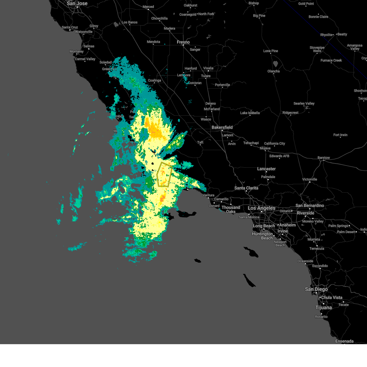
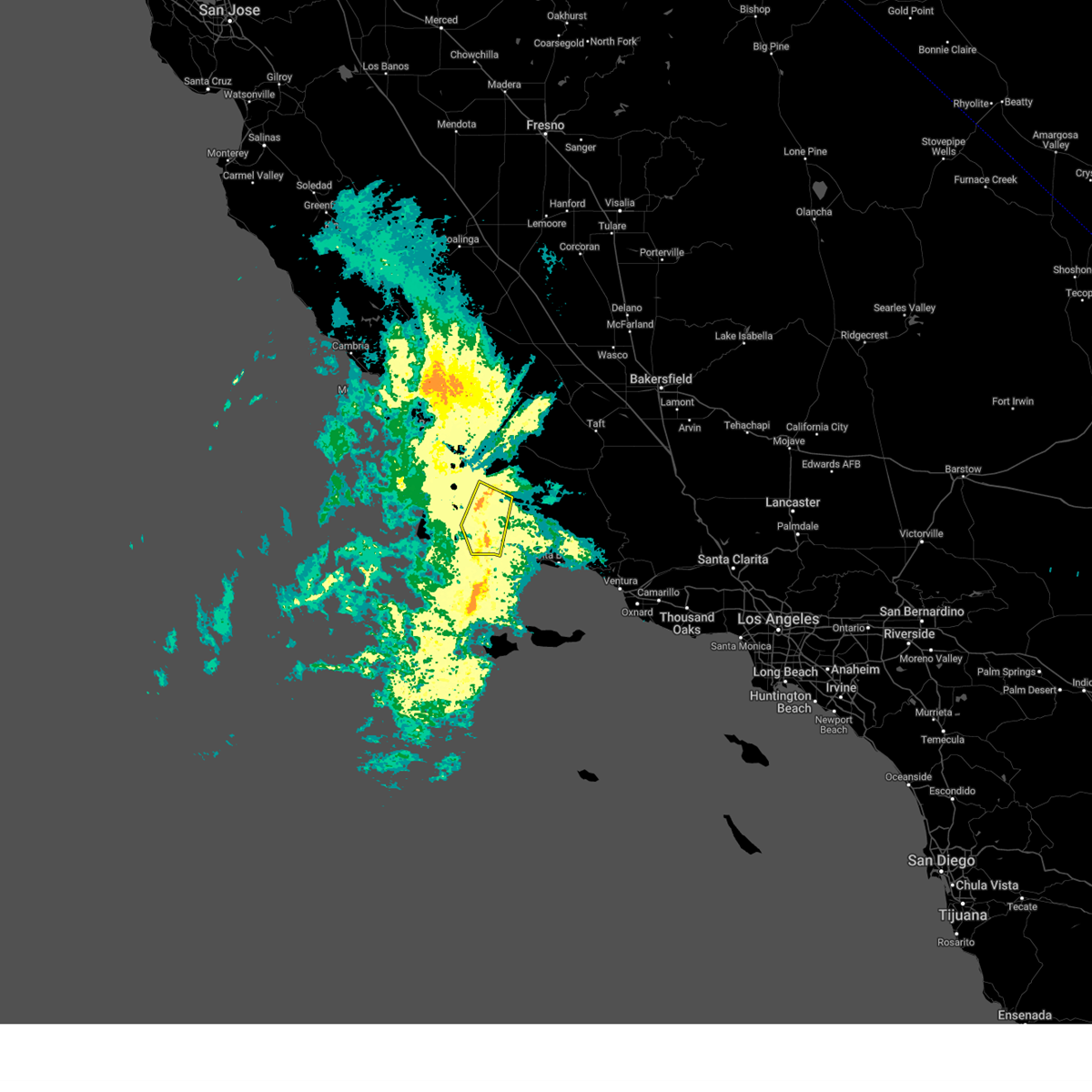
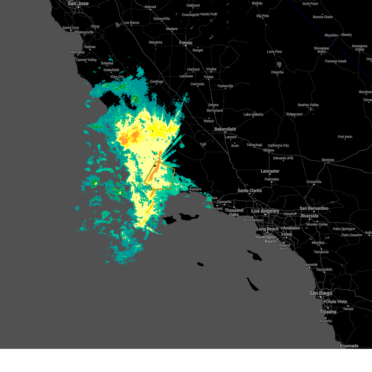
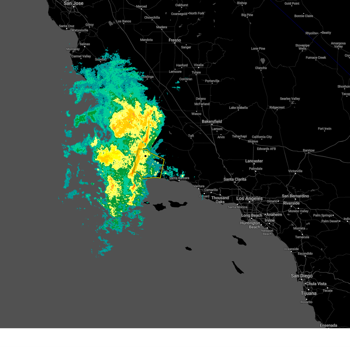
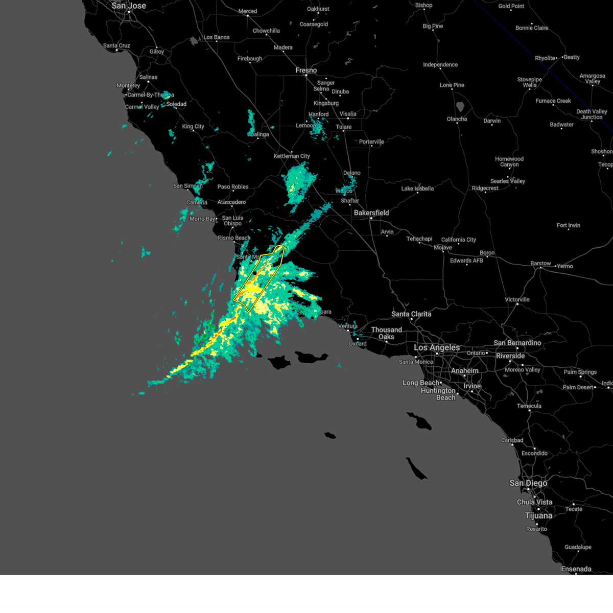
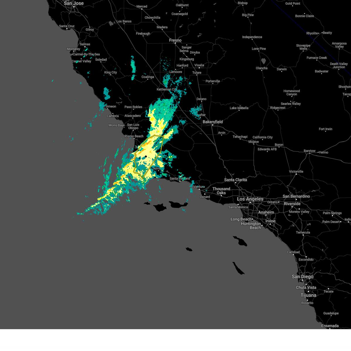
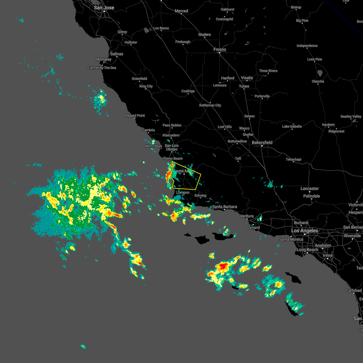
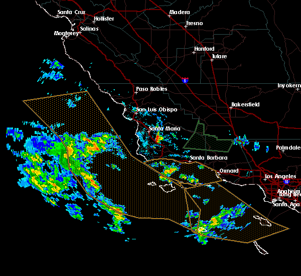
Hail Map for Los Alamos, CA
The Los Alamos, CA area has had 0 reports of on-the-ground hail by trained spotters, and has been under severe weather warnings 5 times during the past 12 months. Doppler radar has detected hail at or near Los Alamos, CA on 1 occasion.
| Name: | Los Alamos, CA |
| Where Located: | 50.7 miles SE of Los Osos, CA |
| Map: | Google Map for Los Alamos, CA |
| Population: | 1890 |
| Housing Units: | 681 |
| More Info: | Search Google for Los Alamos, CA |
0
The Top Recent Hail Date for Los Alamos, CA is Thursday, July 7, 2011 (1st out of 1)

Hail and Wind Damage Spotted near Los Alamos, CA
| Date / Time | Report Details |
|---|---|
| 3/12/2025 9:24 PM PDT |
 The storms which prompted the warning have weakened below severe limits, and no longer pose an immediate threat to life or property. therefore, the warning will be allowed to expire. however, gusty winds are still possible with these thunderstorms. The storms which prompted the warning have weakened below severe limits, and no longer pose an immediate threat to life or property. therefore, the warning will be allowed to expire. however, gusty winds are still possible with these thunderstorms.
|
| 3/12/2025 9:19 PM PDT |
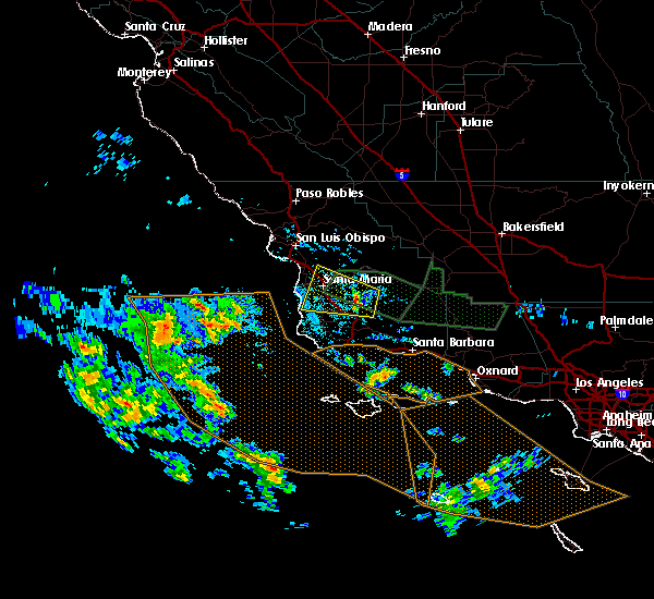
 At 918 pm pdt, severe thunderstorms were located along a line extending from 14 miles north of santa ynez to near los alamos to near refugio state beach, moving east at 20 mph (radar indicated). Hazards include 60 mph wind gusts. Expect damage to roofs, siding, and trees. Locations impacted include, santa ynez, los alamos, solvang, buellton, and highway 101 through gaviota state park. At 918 pm pdt, severe thunderstorms were located along a line extending from 14 miles north of santa ynez to near los alamos to near refugio state beach, moving east at 20 mph (radar indicated). Hazards include 60 mph wind gusts. Expect damage to roofs, siding, and trees. Locations impacted include, santa ynez, los alamos, solvang, buellton, and highway 101 through gaviota state park.
|
| 3/12/2025 9:14 PM PDT |
 At 914 pm pdt, severe thunderstorms were located along a line extending from 14 miles north of santa ynez to near los alamos to near highway 101 through gaviota state park, moving east at 15 mph (radar indicated). Hazards include 60 mph wind gusts. Expect damage to roofs, siding, and trees. Locations impacted include, santa ynez, los alamos, solvang, buellton, and highway 101 through gaviota state park. At 914 pm pdt, severe thunderstorms were located along a line extending from 14 miles north of santa ynez to near los alamos to near highway 101 through gaviota state park, moving east at 15 mph (radar indicated). Hazards include 60 mph wind gusts. Expect damage to roofs, siding, and trees. Locations impacted include, santa ynez, los alamos, solvang, buellton, and highway 101 through gaviota state park.
|
| 3/12/2025 8:36 PM PDT |
 At 835 pm pdt, showers capable of producing damaging wind gusts were located along a line extending from 6 miles east of orcutt to near point conception, moving southeast at 30 mph (radar indicated). Hazards include 60 mph wind gusts. Expect damage to roofs, siding, and trees. Locations impacted include, buellton, lompoc, santa ynez, vandenberg village, los alamos, mission hills, solvang, highway 101 through gaviota state park, sisquoc, orcutt, and vandenberg space force base. At 835 pm pdt, showers capable of producing damaging wind gusts were located along a line extending from 6 miles east of orcutt to near point conception, moving southeast at 30 mph (radar indicated). Hazards include 60 mph wind gusts. Expect damage to roofs, siding, and trees. Locations impacted include, buellton, lompoc, santa ynez, vandenberg village, los alamos, mission hills, solvang, highway 101 through gaviota state park, sisquoc, orcutt, and vandenberg space force base.
|
| 3/12/2025 8:01 PM PDT |
 Svrlox the national weather service in oxnard has issued a * severe thunderstorm warning for, much of western and central santa barbara county in southwestern california, * until 930 pm pdt. * at 800 pm pdt, showers capable of producing damaging wind gusts were located along a line extending from 6 miles east of nipomo to 9 miles northwest of point conception, moving east at 25 mph (radar indicated). Hazards include 60 mph wind gusts. expect damage to roofs, siding, and trees Svrlox the national weather service in oxnard has issued a * severe thunderstorm warning for, much of western and central santa barbara county in southwestern california, * until 930 pm pdt. * at 800 pm pdt, showers capable of producing damaging wind gusts were located along a line extending from 6 miles east of nipomo to 9 miles northwest of point conception, moving east at 25 mph (radar indicated). Hazards include 60 mph wind gusts. expect damage to roofs, siding, and trees
|
| 2/7/2024 4:52 PM PST |
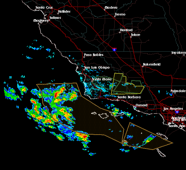
 At 450 pm pst, a line of showers producing damaging wind gusts over 60 mph were located along a line extending from 22 miles east of santa maria to near lompoc, moving southeast at 30 mph (automated wind sensors and law enforcement). Hazards include 60 mph wind gusts and penny size hail. Expect damage to roofs, siding, and trees. Locations impacted include, lompoc, vandenberg space force base, los alamos, orcutt, sisquoc, vandenberg village, highway 166 between twitchell dam and the cuyama valley, and mission hills. At 450 pm pst, a line of showers producing damaging wind gusts over 60 mph were located along a line extending from 22 miles east of santa maria to near lompoc, moving southeast at 30 mph (automated wind sensors and law enforcement). Hazards include 60 mph wind gusts and penny size hail. Expect damage to roofs, siding, and trees. Locations impacted include, lompoc, vandenberg space force base, los alamos, orcutt, sisquoc, vandenberg village, highway 166 between twitchell dam and the cuyama valley, and mission hills.
|
| 2/7/2024 4:28 PM PST |
 At 427 pm pst, a line of showers producing damaging wind gusts over 60 mph were located along a line extending from 14 miles east of nipomo to 10 miles west of vandenberg space force base, moving east at 60 mph (automated wind sensors and law enforcement). Hazards include 60 mph wind gusts and penny size hail. expect damage to roofs, siding, and trees At 427 pm pst, a line of showers producing damaging wind gusts over 60 mph were located along a line extending from 14 miles east of nipomo to 10 miles west of vandenberg space force base, moving east at 60 mph (automated wind sensors and law enforcement). Hazards include 60 mph wind gusts and penny size hail. expect damage to roofs, siding, and trees
|
| 9/10/2017 7:57 PM PDT |
 The severe thunderstorm warning for northwestern santa barbara and south central san luis obispo counties will expire at 800 pm pdt, the storm which prompted the warning has moved out of the area. therefore the warning will be allowed to expire. The severe thunderstorm warning for northwestern santa barbara and south central san luis obispo counties will expire at 800 pm pdt, the storm which prompted the warning has moved out of the area. therefore the warning will be allowed to expire.
|
| 9/10/2017 7:19 PM PDT |
 At 718 pm pdt, a severe thunderstorm was located 7 miles north of los alamos, or 10 miles southeast of santa maria, moving west at 35 mph (radar indicated). Hazards include 70 mph wind gusts and nickel size hail. Expect considerable tree damage. Damage is likely to mobile homes, roofs, and outbuildings. At 718 pm pdt, a severe thunderstorm was located 7 miles north of los alamos, or 10 miles southeast of santa maria, moving west at 35 mph (radar indicated). Hazards include 70 mph wind gusts and nickel size hail. Expect considerable tree damage. Damage is likely to mobile homes, roofs, and outbuildings.
|
| 9/10/2017 7:08 PM PDT |
 At 707 pm pdt, a severe thunderstorm was located 9 miles south of trona, or 18 miles east of ridgecrest, moving west northwest at 45 mph (radar indicated). Hazards include 70 mph wind gusts and quarter size hail. Hail damage to vehicles is expected. expect considerable tree damage. wind damage is also likely to mobile homes, roofs, and outbuildings. Locations impacted include, santa maria, nipomo, vandenberg air force base, los alamos, orcutt, and sisquoc. At 707 pm pdt, a severe thunderstorm was located 9 miles south of trona, or 18 miles east of ridgecrest, moving west northwest at 45 mph (radar indicated). Hazards include 70 mph wind gusts and quarter size hail. Hail damage to vehicles is expected. expect considerable tree damage. wind damage is also likely to mobile homes, roofs, and outbuildings. Locations impacted include, santa maria, nipomo, vandenberg air force base, los alamos, orcutt, and sisquoc.
|
| 9/10/2017 6:45 PM PDT |
 At 643 pm pdt, doppler radar indicated a severe thunderstorm capable of producing quarter size hail and damaging winds in excess of 60 mph. this storm was located 7 miles north of randsburg, or 11 miles south of ridgecrest, and moving northeast at 40 mph. At 643 pm pdt, doppler radar indicated a severe thunderstorm capable of producing quarter size hail and damaging winds in excess of 60 mph. this storm was located 7 miles north of randsburg, or 11 miles south of ridgecrest, and moving northeast at 40 mph.
|
Hail Maps for Los Alamos, CA

Connect with Interactive Hail Maps