

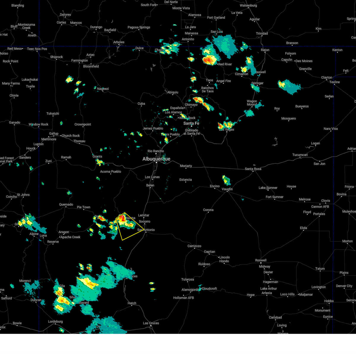
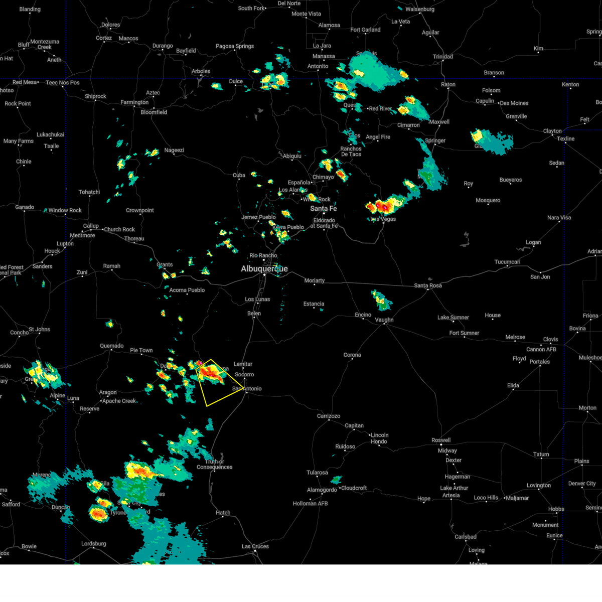
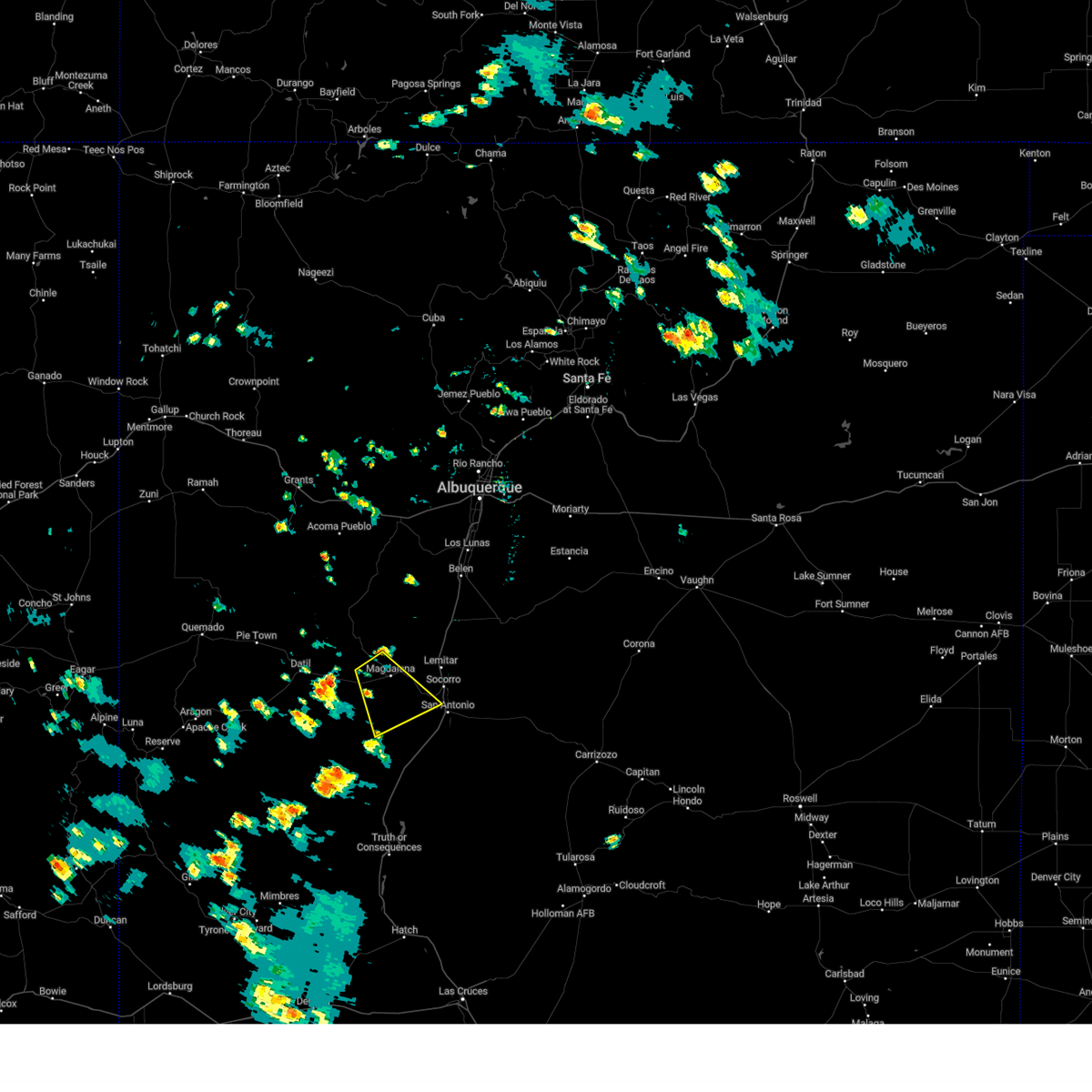
Hail Map for Magdalena, NM
The Magdalena, NM area has had 3 reports of on-the-ground hail by trained spotters, and has been under severe weather warnings 3 times during the past 12 months. Doppler radar has detected hail at or near Magdalena, NM on 20 occasions, including 2 occasions during the past year.
| Name: | Magdalena, NM |
| Where Located: | 75 miles SSW of Albuquerque, NM |
| Map: | Google Map for Magdalena, NM |
| Population: | 938 |
| Housing Units: | 485 |
| More Info: | Search Google for Magdalena, NM |
0
The Top Recent Hail Date for Magdalena, NM is Tuesday, July 9, 2024 (8th out of 20)

Hail and Wind Damage Spotted near Magdalena, NM
| Date / Time | Report Details |
|---|---|
| 7/27/2024 5:16 PM MDT |
 The storm which prompted the warning has weakened below severe limits, and no longer poses an immediate threat of severe hail. therefore, the warning has been allowed to expire. however, heavy rain is still possible with this thunderstorm. The storm which prompted the warning has weakened below severe limits, and no longer poses an immediate threat of severe hail. therefore, the warning has been allowed to expire. however, heavy rain is still possible with this thunderstorm.
|
| 7/27/2024 4:51 PM MDT |
 At 451 pm mdt, a severe thunderstorm was located near magdalena, or 23 miles west of socorro, moving southeast at 15 mph (radar indicated). Hazards include 60 mph wind gusts and quarter size hail. Hail damage to vehicles is expected. expect wind damage to roofs, siding, and trees. locations impacted include, magdalena. This includes highway 60 between mile markers 100 and 133. At 451 pm mdt, a severe thunderstorm was located near magdalena, or 23 miles west of socorro, moving southeast at 15 mph (radar indicated). Hazards include 60 mph wind gusts and quarter size hail. Hail damage to vehicles is expected. expect wind damage to roofs, siding, and trees. locations impacted include, magdalena. This includes highway 60 between mile markers 100 and 133.
|
| 7/27/2024 4:34 PM MDT |
 Svrabq the national weather service in albuquerque has issued a * severe thunderstorm warning for, west central socorro county in central new mexico, * until 515 pm mdt. * at 434 pm mdt, a severe thunderstorm was located 7 miles west of magdalena, or 26 miles west of socorro, moving southeast at 15 mph (radar indicated). Hazards include 60 mph wind gusts and quarter size hail. Hail damage to vehicles is expected. Expect wind damage to roofs, siding, and trees. Svrabq the national weather service in albuquerque has issued a * severe thunderstorm warning for, west central socorro county in central new mexico, * until 515 pm mdt. * at 434 pm mdt, a severe thunderstorm was located 7 miles west of magdalena, or 26 miles west of socorro, moving southeast at 15 mph (radar indicated). Hazards include 60 mph wind gusts and quarter size hail. Hail damage to vehicles is expected. Expect wind damage to roofs, siding, and trees.
|
| 6/6/2023 5:57 PM MDT |
 At 557 pm mdt, a severe thunderstorm was located 16 miles south of magdalena, or 27 miles southwest of socorro, moving northeast at 20 mph (radar indicated). Hazards include 60 mph wind gusts and half dollar size hail. Hail damage to vehicles is expected. Expect wind damage to roofs, siding, and trees. At 557 pm mdt, a severe thunderstorm was located 16 miles south of magdalena, or 27 miles southwest of socorro, moving northeast at 20 mph (radar indicated). Hazards include 60 mph wind gusts and half dollar size hail. Hail damage to vehicles is expected. Expect wind damage to roofs, siding, and trees.
|
| 7/10/2021 8:57 PM MDT |
 The severe thunderstorm warning for northwestern socorro county will expire at 900 pm mdt, the storm which prompted the warning has weakened below severe limits, and no longer poses an immediate threat to life or property. therefore, the warning will be allowed to expire. however gusty winds and heavy rain are still possible with this thunderstorm. The severe thunderstorm warning for northwestern socorro county will expire at 900 pm mdt, the storm which prompted the warning has weakened below severe limits, and no longer poses an immediate threat to life or property. therefore, the warning will be allowed to expire. however gusty winds and heavy rain are still possible with this thunderstorm.
|
| 7/10/2021 8:43 PM MDT |
 At 843 pm mdt, a severe thunderstorm was located 8 miles northwest of lemitar, or 13 miles northwest of socorro, moving southeast at 25 mph (radar indicated). Hazards include 60 mph wind gusts. Expect damage to roofs, siding, and trees. locations impacted include, magdalena, lemitar, bernardo, la joya, san acacia, chamizal and contreras. this includes the following highways, interstate 25 between mile markers 154 and 177. Highway 60 between mile markers 109 and 120, and between mile markers 166 and 167. At 843 pm mdt, a severe thunderstorm was located 8 miles northwest of lemitar, or 13 miles northwest of socorro, moving southeast at 25 mph (radar indicated). Hazards include 60 mph wind gusts. Expect damage to roofs, siding, and trees. locations impacted include, magdalena, lemitar, bernardo, la joya, san acacia, chamizal and contreras. this includes the following highways, interstate 25 between mile markers 154 and 177. Highway 60 between mile markers 109 and 120, and between mile markers 166 and 167.
|
| 7/10/2021 8:17 PM MDT |
 At 816 pm mdt, a severe thunderstorm was located 14 miles north of magdalena, or 25 miles northwest of socorro, moving south at 30 mph (radar indicated). Hazards include 70 mph wind gusts and quarter size hail. Hail damage to vehicles is expected. expect considerable tree damage. wind damage is also likely to mobile homes, roofs, and outbuildings. locations impacted include, magdalena, lemitar, bernardo, la joya, san acacia, chamizal and contreras. this includes the following highways, interstate 25 between mile markers 154 and 178. Highway 60 between mile markers 106 and 107, between mile markers 109 and 120, and between mile markers 166 and 167. At 816 pm mdt, a severe thunderstorm was located 14 miles north of magdalena, or 25 miles northwest of socorro, moving south at 30 mph (radar indicated). Hazards include 70 mph wind gusts and quarter size hail. Hail damage to vehicles is expected. expect considerable tree damage. wind damage is also likely to mobile homes, roofs, and outbuildings. locations impacted include, magdalena, lemitar, bernardo, la joya, san acacia, chamizal and contreras. this includes the following highways, interstate 25 between mile markers 154 and 178. Highway 60 between mile markers 106 and 107, between mile markers 109 and 120, and between mile markers 166 and 167.
|
| 7/10/2021 7:56 PM MDT |
 At 755 pm mdt, a severe thunderstorm was located 23 miles north of magdalena, or 29 miles southwest of belen, moving south at 30 mph (radar indicated). Hazards include 70 mph wind gusts and quarter size hail. Hail damage to vehicles is expected. expect considerable tree damage. Wind damage is also likely to mobile homes, roofs, and outbuildings. At 755 pm mdt, a severe thunderstorm was located 23 miles north of magdalena, or 29 miles southwest of belen, moving south at 30 mph (radar indicated). Hazards include 70 mph wind gusts and quarter size hail. Hail damage to vehicles is expected. expect considerable tree damage. Wind damage is also likely to mobile homes, roofs, and outbuildings.
|
| 6/25/2017 2:30 PM MDT | Quarter sized hail reported 26.6 miles SE of Magdalena, NM |
| 10/19/2015 6:15 AM MDT |
 At 614 am mdt, a severe thunderstorm was located 16 miles south of magdalena, or 27 miles southwest of socorro, moving northeast at 30 mph (radar indicated). Hazards include 60 mph wind gusts and quarter size hail. Hail damage to vehicles is expected. expect wind damage to roofs, siding and trees. Locations impacted include, state road 107 and the magdalena mountains. At 614 am mdt, a severe thunderstorm was located 16 miles south of magdalena, or 27 miles southwest of socorro, moving northeast at 30 mph (radar indicated). Hazards include 60 mph wind gusts and quarter size hail. Hail damage to vehicles is expected. expect wind damage to roofs, siding and trees. Locations impacted include, state road 107 and the magdalena mountains.
|
| 10/19/2015 6:02 AM MDT |
 At 601 am mdt, a severe thunderstorm was located 18 miles southeast of national radio astronomy observatory, or 30 miles southeast of datil, moving northeast at 30 mph (radar indicated). Hazards include half dollar size hail and 60 mph wind gusts. Hail damage to vehicles is expected. Expect wind damage to roofs, siding and trees. At 601 am mdt, a severe thunderstorm was located 18 miles southeast of national radio astronomy observatory, or 30 miles southeast of datil, moving northeast at 30 mph (radar indicated). Hazards include half dollar size hail and 60 mph wind gusts. Hail damage to vehicles is expected. Expect wind damage to roofs, siding and trees.
|
| 6/19/2015 2:51 PM MDT | Quarter sized hail reported 17.9 miles NNE of Magdalena, NM, grassy lookout usfs personnel reported dime to quarter sized up to 2 inches deep. |
| 5/13/2012 3:15 PM MDT | Off highway 107 in socorro county NM, 0.8 miles SSE of Magdalena, NM |
| 5/13/2012 3:15 PM MDT | Trees down off highway 107 in socorro county NM, 0.8 miles SSE of Magdalena, NM |
| 5/13/2012 2:04 PM MDT | Quarter sized hail reported 1.7 miles ESE of Magdalena, NM |
Hail Maps for Magdalena, NM


Connect with Interactive Hail Maps