| 3/12/2025 8:36 PM PDT |
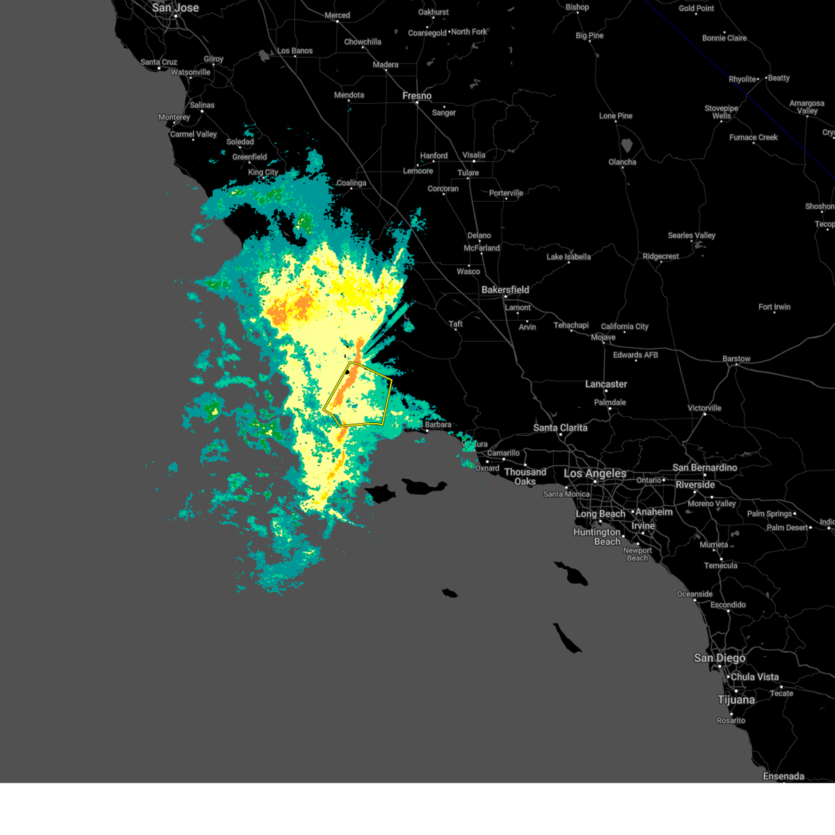 At 835 pm pdt, showers capable of producing damaging wind gusts were located along a line extending from 6 miles east of orcutt to near point conception, moving southeast at 30 mph (radar indicated). Hazards include 60 mph wind gusts. Expect damage to roofs, siding, and trees. Locations impacted include, buellton, lompoc, santa ynez, vandenberg village, los alamos, mission hills, solvang, highway 101 through gaviota state park, sisquoc, orcutt, and vandenberg space force base. At 835 pm pdt, showers capable of producing damaging wind gusts were located along a line extending from 6 miles east of orcutt to near point conception, moving southeast at 30 mph (radar indicated). Hazards include 60 mph wind gusts. Expect damage to roofs, siding, and trees. Locations impacted include, buellton, lompoc, santa ynez, vandenberg village, los alamos, mission hills, solvang, highway 101 through gaviota state park, sisquoc, orcutt, and vandenberg space force base.
|
| 3/12/2025 8:01 PM PDT |
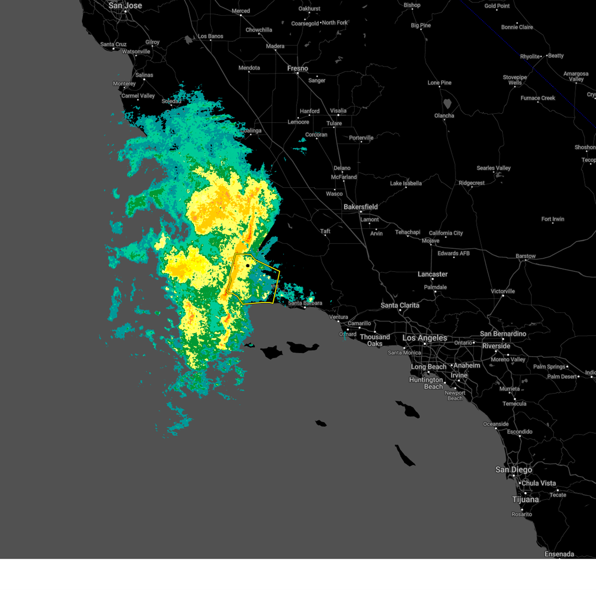 Svrlox the national weather service in oxnard has issued a * severe thunderstorm warning for, much of western and central santa barbara county in southwestern california, * until 930 pm pdt. * at 800 pm pdt, showers capable of producing damaging wind gusts were located along a line extending from 6 miles east of nipomo to 9 miles northwest of point conception, moving east at 25 mph (radar indicated). Hazards include 60 mph wind gusts. expect damage to roofs, siding, and trees Svrlox the national weather service in oxnard has issued a * severe thunderstorm warning for, much of western and central santa barbara county in southwestern california, * until 930 pm pdt. * at 800 pm pdt, showers capable of producing damaging wind gusts were located along a line extending from 6 miles east of nipomo to 9 miles northwest of point conception, moving east at 25 mph (radar indicated). Hazards include 60 mph wind gusts. expect damage to roofs, siding, and trees
|
| 2/7/2024 4:52 PM PST |
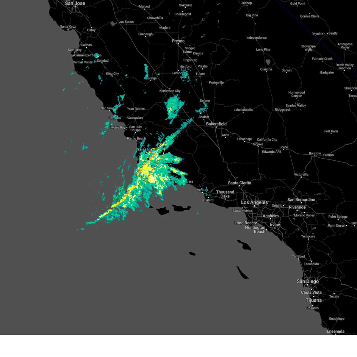 At 450 pm pst, a line of showers producing damaging wind gusts over 60 mph were located along a line extending from 22 miles east of santa maria to near lompoc, moving southeast at 30 mph (automated wind sensors and law enforcement). Hazards include 60 mph wind gusts and penny size hail. Expect damage to roofs, siding, and trees. Locations impacted include, lompoc, vandenberg space force base, los alamos, orcutt, sisquoc, vandenberg village, highway 166 between twitchell dam and the cuyama valley, and mission hills. At 450 pm pst, a line of showers producing damaging wind gusts over 60 mph were located along a line extending from 22 miles east of santa maria to near lompoc, moving southeast at 30 mph (automated wind sensors and law enforcement). Hazards include 60 mph wind gusts and penny size hail. Expect damage to roofs, siding, and trees. Locations impacted include, lompoc, vandenberg space force base, los alamos, orcutt, sisquoc, vandenberg village, highway 166 between twitchell dam and the cuyama valley, and mission hills.
|
| 2/7/2024 4:28 PM PST |
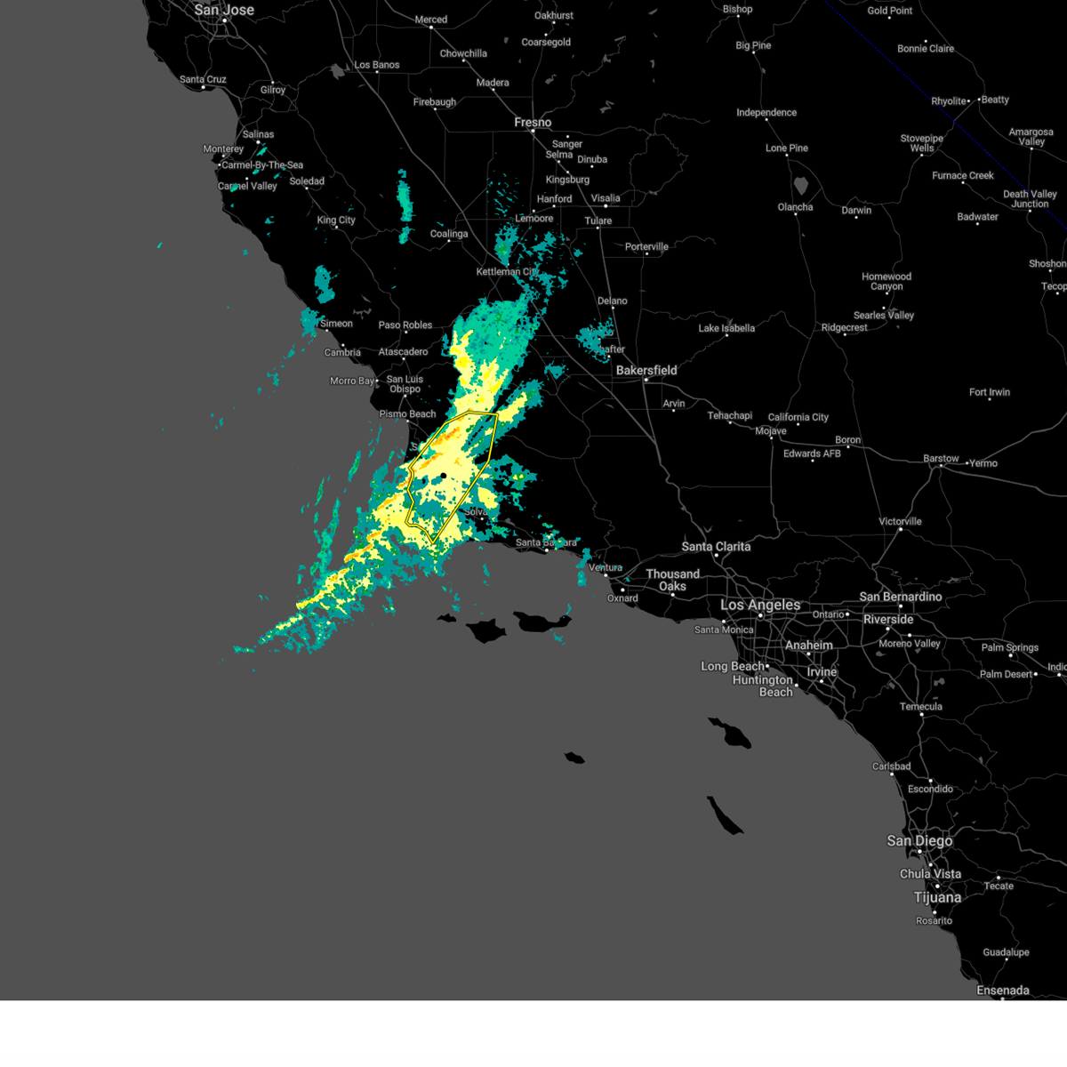 At 427 pm pst, a line of showers producing damaging wind gusts over 60 mph were located along a line extending from 14 miles east of nipomo to 10 miles west of vandenberg space force base, moving east at 60 mph (automated wind sensors and law enforcement). Hazards include 60 mph wind gusts and penny size hail. expect damage to roofs, siding, and trees At 427 pm pst, a line of showers producing damaging wind gusts over 60 mph were located along a line extending from 14 miles east of nipomo to 10 miles west of vandenberg space force base, moving east at 60 mph (automated wind sensors and law enforcement). Hazards include 60 mph wind gusts and penny size hail. expect damage to roofs, siding, and trees
|
| 1/23/2017 5:36 AM PST |
 At 525 am pst, doppler radar indicated a severe thunderstorm capable of producing a tornado just coming onshore at vandenberg air force base. there has been a history of rotation with this storm suggesting that it produced a waterspout, which will likely come onshore as a weak tornado. otherwise, expect wind gusts to 60 mph and hail up to one inch in diameter with this storm as it moves across vandenberg air force base by 6 am pst. the storm may also affect lompoc, vandenberg village, and mission hills. At 525 am pst, doppler radar indicated a severe thunderstorm capable of producing a tornado just coming onshore at vandenberg air force base. there has been a history of rotation with this storm suggesting that it produced a waterspout, which will likely come onshore as a weak tornado. otherwise, expect wind gusts to 60 mph and hail up to one inch in diameter with this storm as it moves across vandenberg air force base by 6 am pst. the storm may also affect lompoc, vandenberg village, and mission hills.
|
| 1/23/2017 5:06 AM PST |
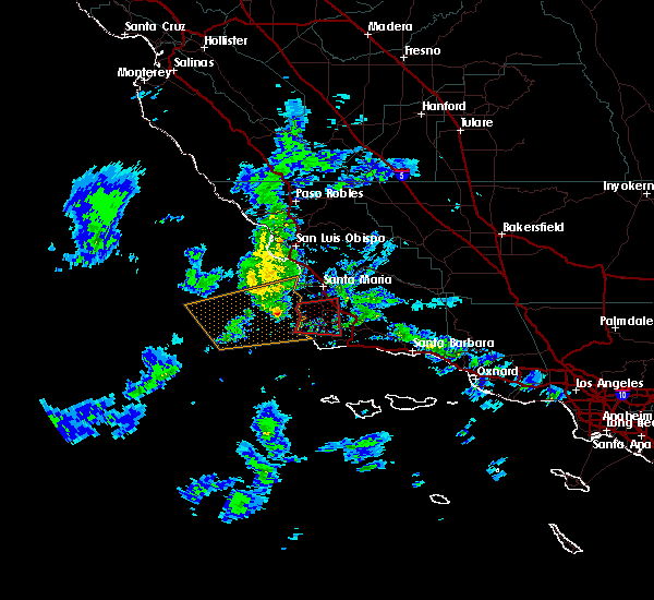 At 500 am pst, doppler radar indicated a thunderstorm about 10 miles west of vandenberg air force base. there has been sustained rotation with this storm, and it likely was producing a waterspout. this waterspout is expected to come onshore as a weak tornado at vandenberg air force base, and may affect vandenberg village and lompoc as well through 6 am pst. At 500 am pst, doppler radar indicated a thunderstorm about 10 miles west of vandenberg air force base. there has been sustained rotation with this storm, and it likely was producing a waterspout. this waterspout is expected to come onshore as a weak tornado at vandenberg air force base, and may affect vandenberg village and lompoc as well through 6 am pst.
|


Connect with Interactive Hail Maps