| 5/13/2024 7:06 PM MDT |
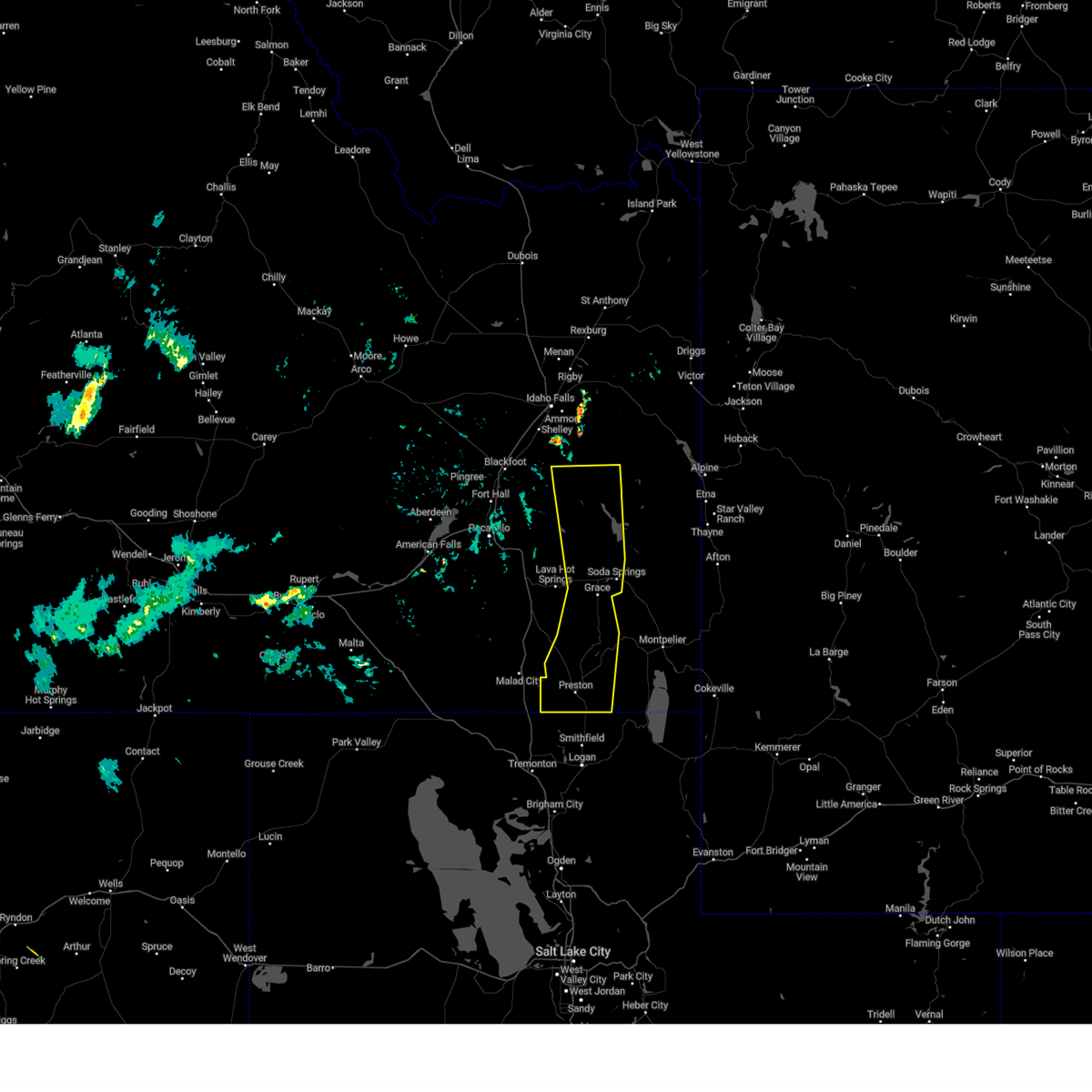 The storms which prompted the warning have weakened. therefore, the warning will be allowed to expire. however, gusty winds are still possible with these thunderstorms as they move east. The storms which prompted the warning have weakened. therefore, the warning will be allowed to expire. however, gusty winds are still possible with these thunderstorms as they move east.
|
| 5/13/2024 6:54 PM MDT |
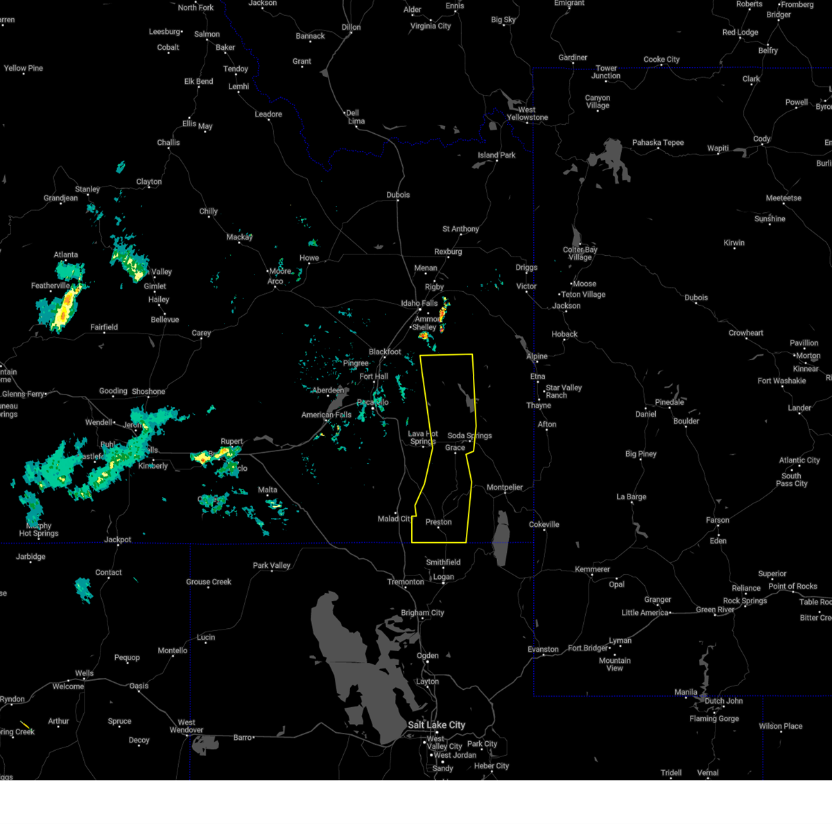 the severe thunderstorm warning has been cancelled and is no longer in effect the severe thunderstorm warning has been cancelled and is no longer in effect
|
| 5/13/2024 6:54 PM MDT |
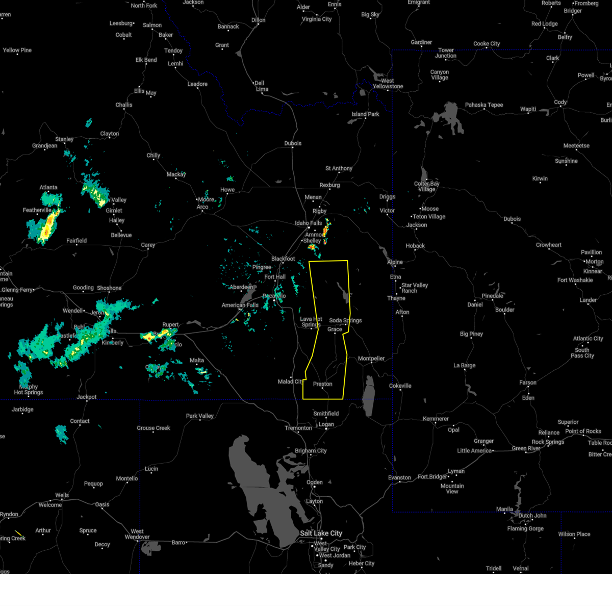 At 653 pm mdt, severe thunderstorms were located along a line extending from 8 miles east of fort hall lincoln creek lodge to 6 miles south of chesterfield to near trenton, moving east at 35 mph (radar indicated). Hazards include 60 mph wind gusts. Expect damage to roofs, siding, and trees. Locations impacted include, preston, soda springs, blackfoot reservoir, swanlake, chesterfield reservoir, grace, franklin, oneida narrows reservoir, thatcher, chesterfield, dayton, weston, clifton, oxford, cutthroat trout campground, trail creek campground, mapleton, mink creek, whitney, and riverdale. At 653 pm mdt, severe thunderstorms were located along a line extending from 8 miles east of fort hall lincoln creek lodge to 6 miles south of chesterfield to near trenton, moving east at 35 mph (radar indicated). Hazards include 60 mph wind gusts. Expect damage to roofs, siding, and trees. Locations impacted include, preston, soda springs, blackfoot reservoir, swanlake, chesterfield reservoir, grace, franklin, oneida narrows reservoir, thatcher, chesterfield, dayton, weston, clifton, oxford, cutthroat trout campground, trail creek campground, mapleton, mink creek, whitney, and riverdale.
|
| 5/13/2024 6:05 PM MDT |
 Svrpih the national weather service in pocatello has issued a * severe thunderstorm warning for, western caribou county in southeastern idaho, eastern oneida county in southeastern idaho, bannock county in southeastern idaho, central bonneville county in southeastern idaho, franklin county in southeastern idaho, southeastern bingham county in southeastern idaho, * until 715 pm mdt. * at 604 pm mdt, severe thunderstorms were located along a line extending from rockford to near portneuf gap to 12 miles southwest of pleasantview, moving east at 35 mph (radar indicated). Hazards include 60 mph wind gusts. expect damage to roofs, siding, and trees Svrpih the national weather service in pocatello has issued a * severe thunderstorm warning for, western caribou county in southeastern idaho, eastern oneida county in southeastern idaho, bannock county in southeastern idaho, central bonneville county in southeastern idaho, franklin county in southeastern idaho, southeastern bingham county in southeastern idaho, * until 715 pm mdt. * at 604 pm mdt, severe thunderstorms were located along a line extending from rockford to near portneuf gap to 12 miles southwest of pleasantview, moving east at 35 mph (radar indicated). Hazards include 60 mph wind gusts. expect damage to roofs, siding, and trees
|
| 9/3/2023 6:56 PM MDT |
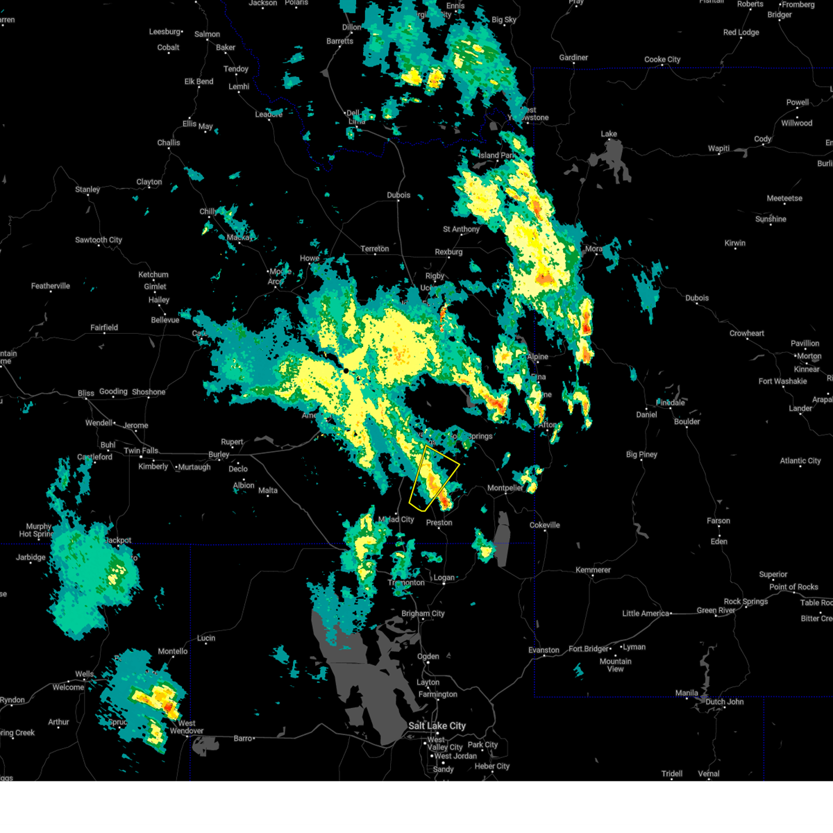 The severe thunderstorm warning for southwestern caribou, east central oneida, southeastern bannock and northwestern franklin counties will expire at 700 pm mdt, the storm which prompted the warning has weakened below severe limits, and no longer poses an immediate threat to life or property. therefore, the warning will be allowed to expire. however, gusty winds and heavy rain are still possible with this thunderstorm. a severe thunderstorm watch remains in effect until 1000 pm mdt for southeastern idaho. The severe thunderstorm warning for southwestern caribou, east central oneida, southeastern bannock and northwestern franklin counties will expire at 700 pm mdt, the storm which prompted the warning has weakened below severe limits, and no longer poses an immediate threat to life or property. therefore, the warning will be allowed to expire. however, gusty winds and heavy rain are still possible with this thunderstorm. a severe thunderstorm watch remains in effect until 1000 pm mdt for southeastern idaho.
|
| 9/3/2023 6:45 PM MDT |
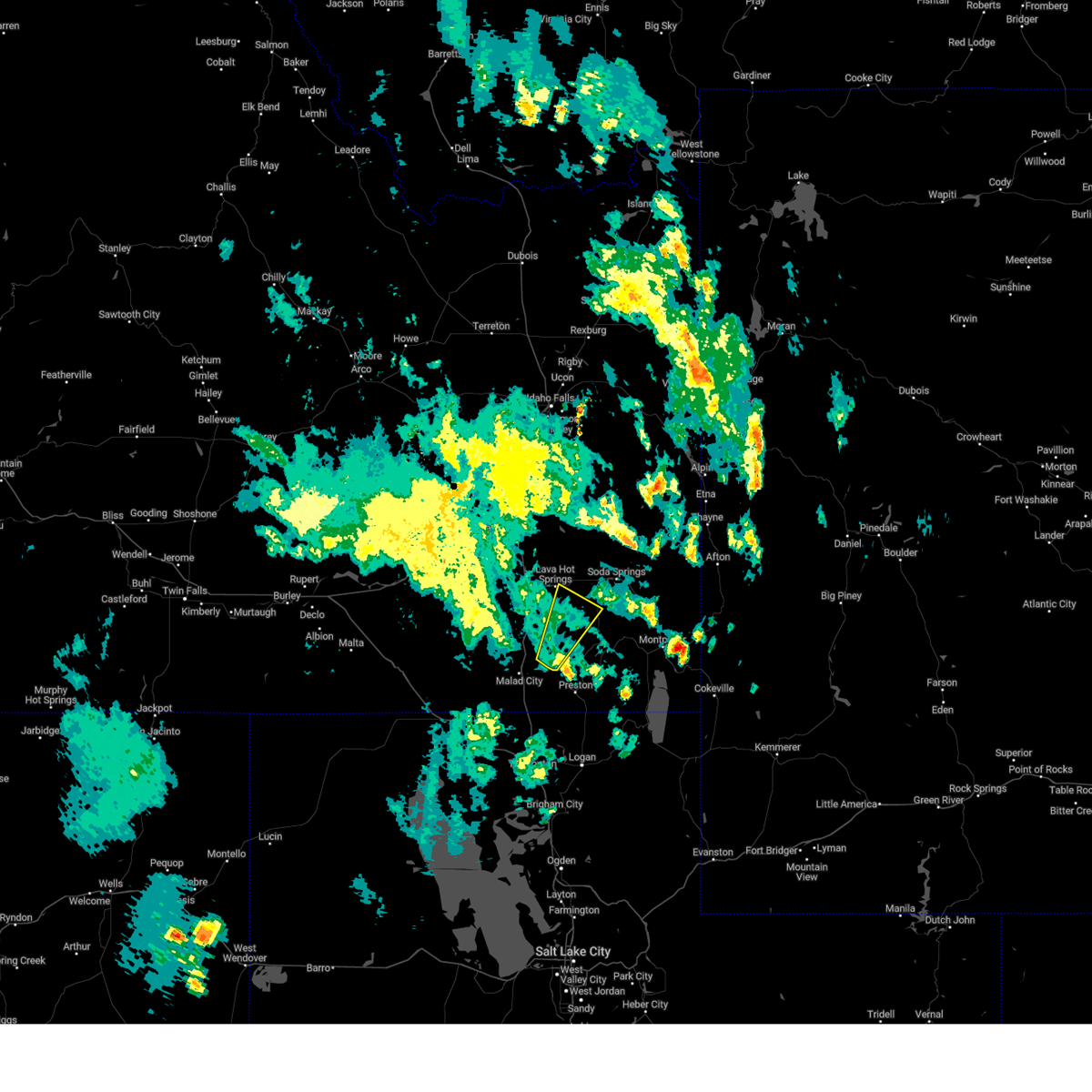 At 645 pm mdt, a severe thunderstorm was located over swanlake, moving northeast at 45 mph (radar indicated. this storm has a history of producing 50 to 60 mph winds). Hazards include 60 mph wind gusts. Expect damage to roofs, siding, and trees. locations impacted include, swanlake, oxford, and niter. hail threat, radar indicated max hail size, <. 75 in wind threat, radar indicated max wind gust, 60 mph. At 645 pm mdt, a severe thunderstorm was located over swanlake, moving northeast at 45 mph (radar indicated. this storm has a history of producing 50 to 60 mph winds). Hazards include 60 mph wind gusts. Expect damage to roofs, siding, and trees. locations impacted include, swanlake, oxford, and niter. hail threat, radar indicated max hail size, <. 75 in wind threat, radar indicated max wind gust, 60 mph.
|
| 9/3/2023 6:32 PM MDT |
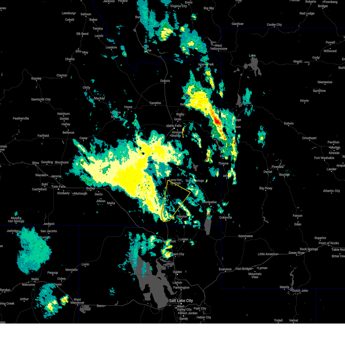 At 631 pm mdt, a severe thunderstorm was located 7 miles west of swanlake, moving northeast at 50 mph (radar indicated and mesonet. this storm has a history of producing 50 to 60 mph winds). Hazards include 60 mph wind gusts. Expect damage to roofs, siding, and trees. locations impacted include, malad, mccammon, lava hot springs, swanlake, downey, arimo, cherry creek rest area, virginia, clifton, oxford, niter, and malad pass. hail threat, radar indicated max hail size, <. 75 in wind threat, observed max wind gust, 60 mph. At 631 pm mdt, a severe thunderstorm was located 7 miles west of swanlake, moving northeast at 50 mph (radar indicated and mesonet. this storm has a history of producing 50 to 60 mph winds). Hazards include 60 mph wind gusts. Expect damage to roofs, siding, and trees. locations impacted include, malad, mccammon, lava hot springs, swanlake, downey, arimo, cherry creek rest area, virginia, clifton, oxford, niter, and malad pass. hail threat, radar indicated max hail size, <. 75 in wind threat, observed max wind gust, 60 mph.
|
| 9/3/2023 6:20 PM MDT |
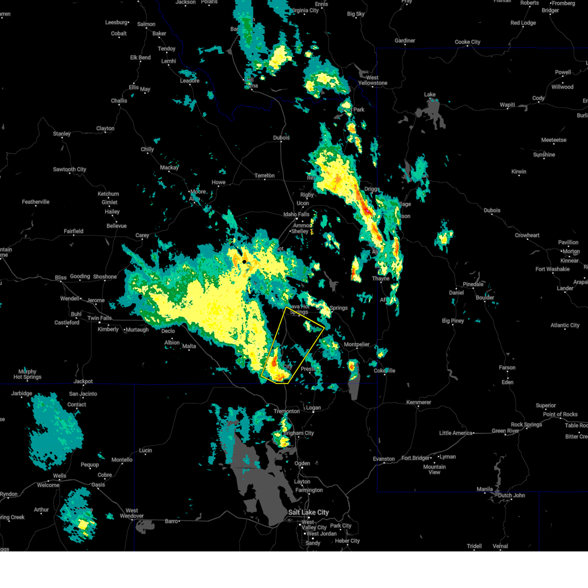 At 619 pm mdt, a severe thunderstorm was located over malad, moving northeast at 35 mph (radar indicated and mesonet. at 615 pm mdt, 57 mph winds were reported near samaria). Hazards include 60 mph wind gusts. expect damage to roofs, siding, and trees At 619 pm mdt, a severe thunderstorm was located over malad, moving northeast at 35 mph (radar indicated and mesonet. at 615 pm mdt, 57 mph winds were reported near samaria). Hazards include 60 mph wind gusts. expect damage to roofs, siding, and trees
|
| 7/24/2023 7:39 PM MDT |
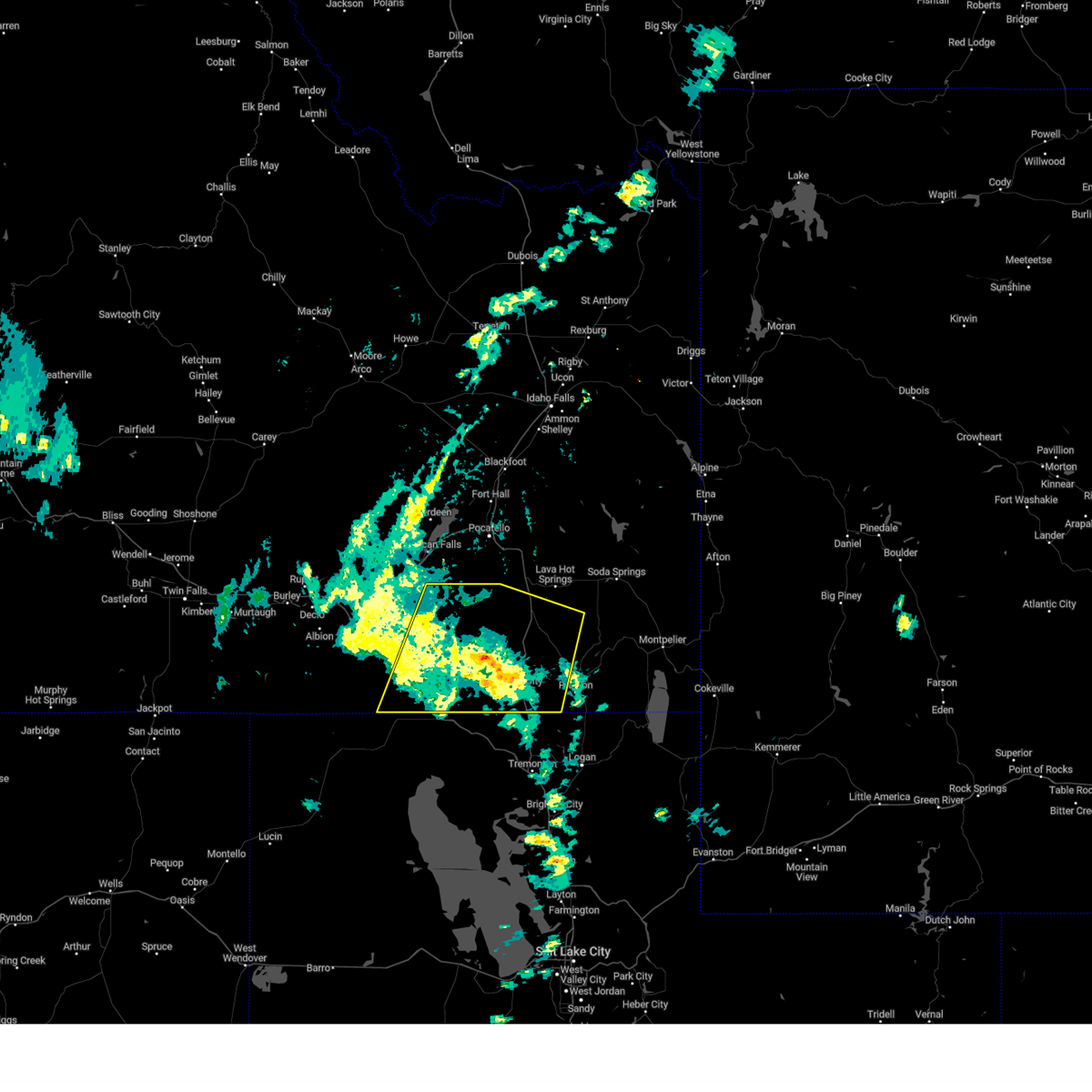 At 739 pm mdt, severe thunderstorms were located along a line extending from 15 miles northeast of juniper to 11 miles northeast of holbrook summit to 8 miles east of malad, moving northeast at 40 mph (radar indicated). Hazards include 60 mph wind gusts. Expect damage to roofs, siding, and trees. locations impacted include, malad, swanlake, downey, arimo, rockland, juniper, holbrook summit, pleasantview, fort hall bannock peak, cherry creek rest area, virginia, dayton, weston, clifton, oxford, stone, sweetzer summit, hawkins reservoir, samaria, and arbon. hail threat, radar indicated max hail size, <. 75 in wind threat, radar indicated max wind gust, 60 mph. At 739 pm mdt, severe thunderstorms were located along a line extending from 15 miles northeast of juniper to 11 miles northeast of holbrook summit to 8 miles east of malad, moving northeast at 40 mph (radar indicated). Hazards include 60 mph wind gusts. Expect damage to roofs, siding, and trees. locations impacted include, malad, swanlake, downey, arimo, rockland, juniper, holbrook summit, pleasantview, fort hall bannock peak, cherry creek rest area, virginia, dayton, weston, clifton, oxford, stone, sweetzer summit, hawkins reservoir, samaria, and arbon. hail threat, radar indicated max hail size, <. 75 in wind threat, radar indicated max wind gust, 60 mph.
|
| 7/24/2023 7:17 PM MDT |
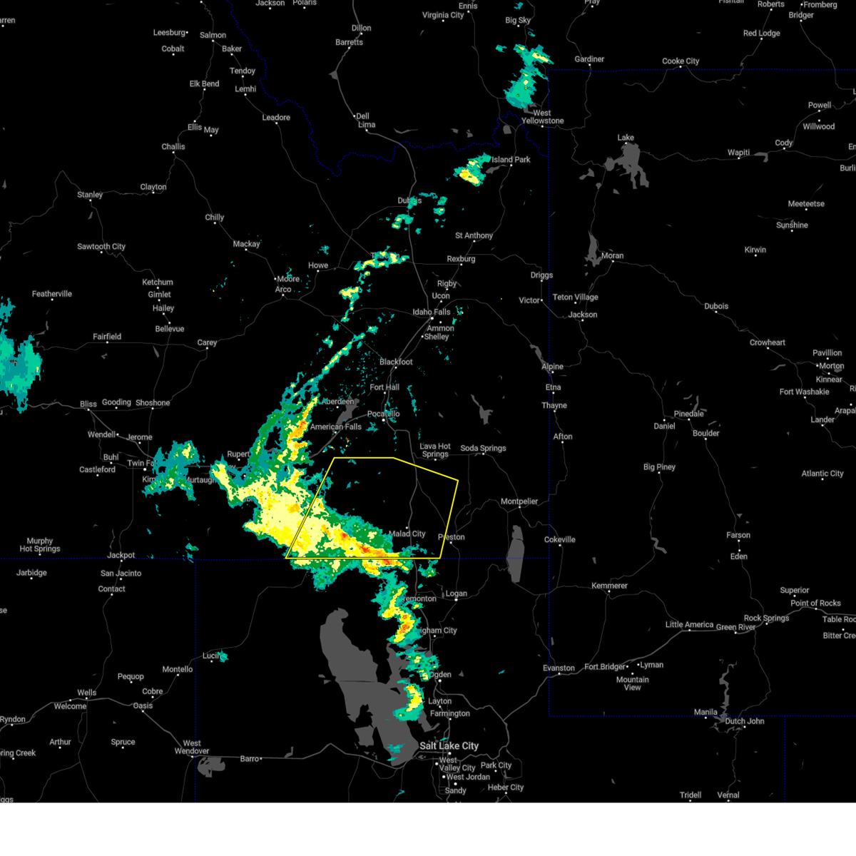 At 716 pm mdt, severe thunderstorms were located along a line extending from 8 miles west of juniper to 7 miles west of holbrook summit to 8 miles southwest of cherry creek rest area, moving northeast at 40 mph (radar indicated). Hazards include 60 mph wind gusts. Expect damage to roofs, siding, and trees. locations impacted include, malad, swanlake, downey, arimo, rockland, juniper, holbrook summit, pleasantview, fort hall bannock peak, cherry creek rest area, virginia, dayton, weston, clifton, oxford, stone, sweetzer summit, hawkins reservoir, samaria, and arbon. hail threat, radar indicated max hail size, <. 75 in wind threat, radar indicated max wind gust, 60 mph. At 716 pm mdt, severe thunderstorms were located along a line extending from 8 miles west of juniper to 7 miles west of holbrook summit to 8 miles southwest of cherry creek rest area, moving northeast at 40 mph (radar indicated). Hazards include 60 mph wind gusts. Expect damage to roofs, siding, and trees. locations impacted include, malad, swanlake, downey, arimo, rockland, juniper, holbrook summit, pleasantview, fort hall bannock peak, cherry creek rest area, virginia, dayton, weston, clifton, oxford, stone, sweetzer summit, hawkins reservoir, samaria, and arbon. hail threat, radar indicated max hail size, <. 75 in wind threat, radar indicated max wind gust, 60 mph.
|
| 7/24/2023 7:00 PM MDT |
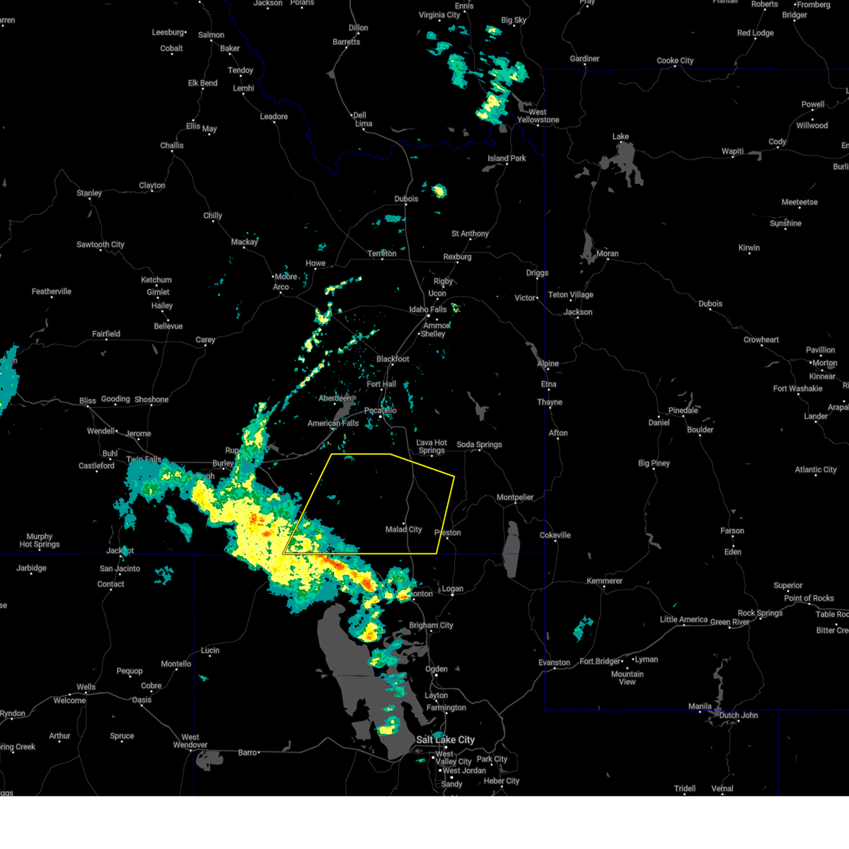 At 659 pm mdt, severe thunderstorms were located along a line extending from 10 miles west of juniper to 6 miles northwest of snowville to 10 miles north of howell, moving northeast at 45 mph (radar indicated). Hazards include 60 mph wind gusts. expect damage to roofs, siding, and trees At 659 pm mdt, severe thunderstorms were located along a line extending from 10 miles west of juniper to 6 miles northwest of snowville to 10 miles north of howell, moving northeast at 45 mph (radar indicated). Hazards include 60 mph wind gusts. expect damage to roofs, siding, and trees
|
| 6/1/2023 5:26 PM MDT |
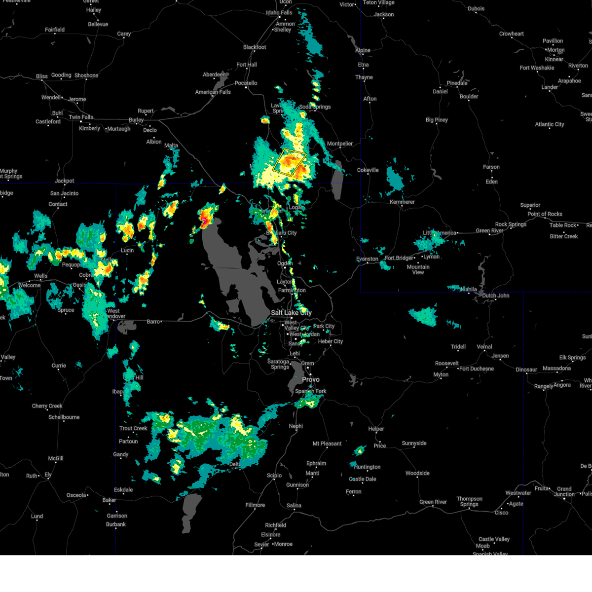 The severe thunderstorm warning for eastern oneida, southeastern bannock and southwestern franklin counties will expire at 530 pm mdt, the storm which prompted the warning has weakened below severe limits, and no longer poses an immediate threat to life or property. therefore, the warning will be allowed to expire. however heavy rain is still possible with this thunderstorm. The severe thunderstorm warning for eastern oneida, southeastern bannock and southwestern franklin counties will expire at 530 pm mdt, the storm which prompted the warning has weakened below severe limits, and no longer poses an immediate threat to life or property. therefore, the warning will be allowed to expire. however heavy rain is still possible with this thunderstorm.
|
| 6/1/2023 5:06 PM MDT |
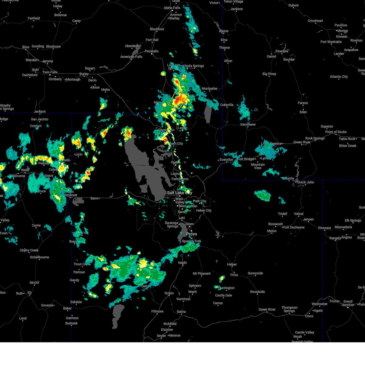 At 505 pm mdt, a severe thunderstorm was located 7 miles northwest of preston. the storm is nearly stationary (radar indicated). Hazards include quarter size hail. damage to vehicles is expected At 505 pm mdt, a severe thunderstorm was located 7 miles northwest of preston. the storm is nearly stationary (radar indicated). Hazards include quarter size hail. damage to vehicles is expected
|
| 6/6/2020 4:42 PM MDT |
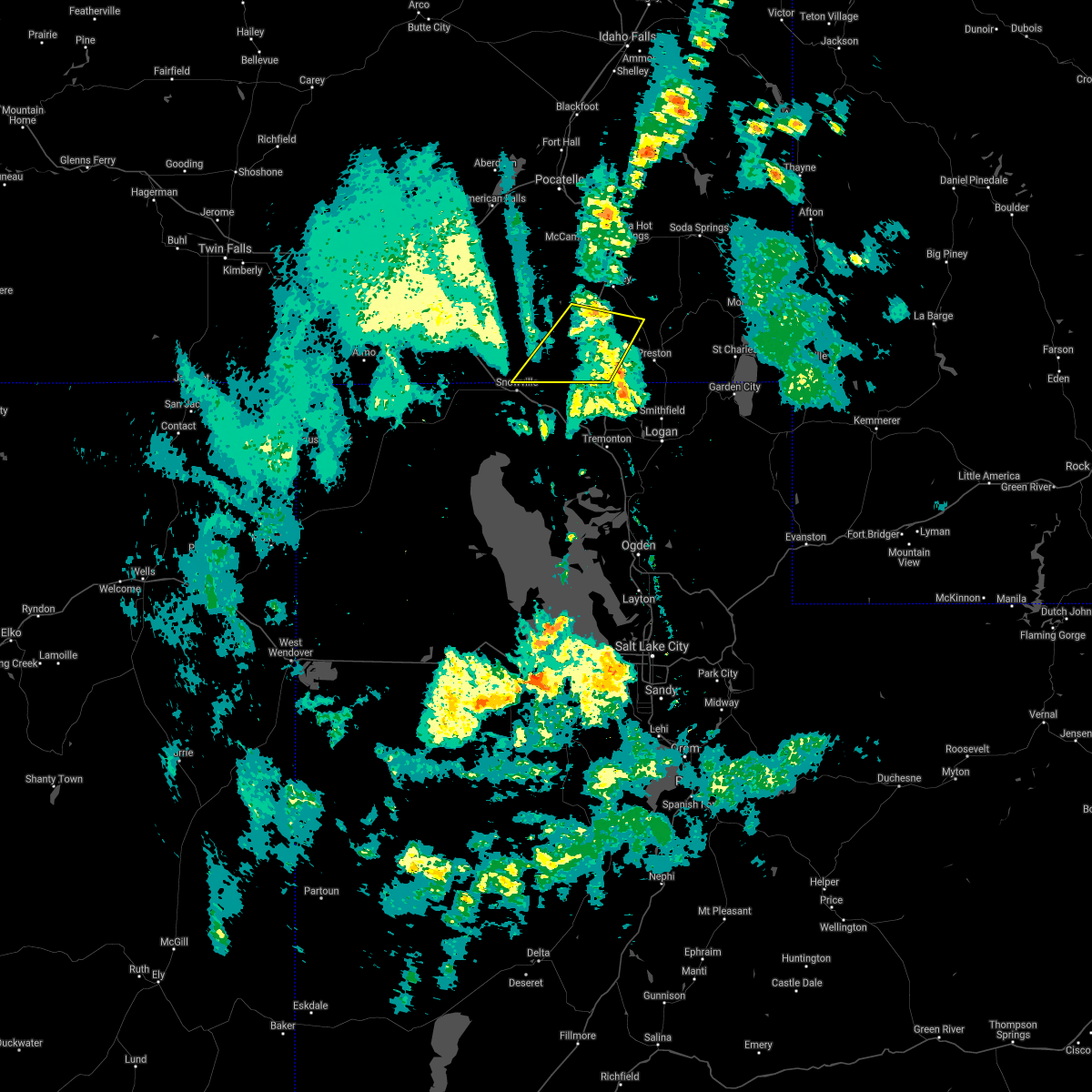 The severe thunderstorm warning for southeastern oneida, south central bannock and west central franklin counties will expire at 445 pm mdt, the storm which prompted the warning has weakened below severe limits, and no longer poses an immediate threat to life or property. therefore, the warning will be allowed to expire. The severe thunderstorm warning for southeastern oneida, south central bannock and west central franklin counties will expire at 445 pm mdt, the storm which prompted the warning has weakened below severe limits, and no longer poses an immediate threat to life or property. therefore, the warning will be allowed to expire.
|
| 6/6/2020 4:20 PM MDT |
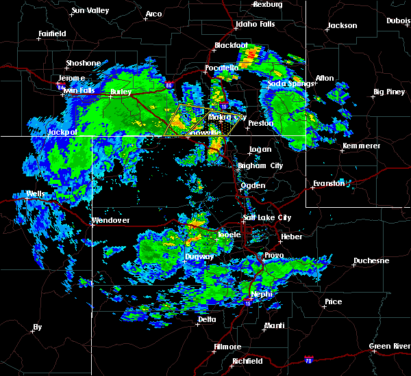 At 419 pm mdt, a severe thunderstorm was located near pleasantview, or 10 miles west of malad, moving northeast at 45 mph (radar indicated). Hazards include 60 mph wind gusts and quarter size hail. Hail damage to vehicles is expected. expect wind damage to roofs, siding, and trees. Locations impacted include, malad, cherry creek rest area, pleasantview, holbrook summit, clifton, oxford, samaria and stone. At 419 pm mdt, a severe thunderstorm was located near pleasantview, or 10 miles west of malad, moving northeast at 45 mph (radar indicated). Hazards include 60 mph wind gusts and quarter size hail. Hail damage to vehicles is expected. expect wind damage to roofs, siding, and trees. Locations impacted include, malad, cherry creek rest area, pleasantview, holbrook summit, clifton, oxford, samaria and stone.
|
| 6/6/2020 4:03 PM MDT |
 At 402 pm mdt, a severe thunderstorm was located near snowville, moving northeast at 45 mph (radar indicated). Hazards include 60 mph wind gusts and quarter size hail. Hail damage to vehicles is expected. Expect wind damage to roofs, siding, and trees. At 402 pm mdt, a severe thunderstorm was located near snowville, moving northeast at 45 mph (radar indicated). Hazards include 60 mph wind gusts and quarter size hail. Hail damage to vehicles is expected. Expect wind damage to roofs, siding, and trees.
|
| 8/22/2018 8:30 AM MDT |
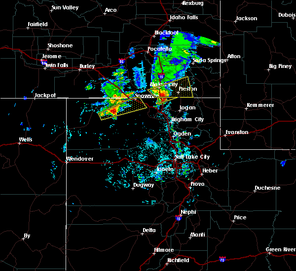 At 830 am mdt, a severe thunderstorm was located over cherry creek rest area or near malad, moving east at 30 mph (radar indicated). Hazards include 60 mph wind gusts and quarter size hail. Hail damage to vehicles is expected. expect wind damage to roofs, siding, and trees. Locations impacted include, preston, malad, franklin, oneida narrows reservoir, pleasantview, cherry creek rest area, dayton, weston, clifton, oxford, mapleton, mink creek, samaria, whitney and riverdale. At 830 am mdt, a severe thunderstorm was located over cherry creek rest area or near malad, moving east at 30 mph (radar indicated). Hazards include 60 mph wind gusts and quarter size hail. Hail damage to vehicles is expected. expect wind damage to roofs, siding, and trees. Locations impacted include, preston, malad, franklin, oneida narrows reservoir, pleasantview, cherry creek rest area, dayton, weston, clifton, oxford, mapleton, mink creek, samaria, whitney and riverdale.
|
| 8/22/2018 8:12 AM MDT |
 At 811 am mdt, a severe thunderstorm was located 10 miles southeast of holbrook summit or 11 miles northeast of snowville, moving east at 15 mph (radar indicated). Hazards include 60 mph wind gusts and quarter size hail. Hail damage to vehicles is expected. Expect wind damage to roofs, siding, and trees. At 811 am mdt, a severe thunderstorm was located 10 miles southeast of holbrook summit or 11 miles northeast of snowville, moving east at 15 mph (radar indicated). Hazards include 60 mph wind gusts and quarter size hail. Hail damage to vehicles is expected. Expect wind damage to roofs, siding, and trees.
|
| 8/27/2015 3:00 PM MDT |
Half Dollar sized hail reported 4.2 miles SSW of Oxford, ID, photo submitted to channel 8s facebook page. time based from radar.
|
| 8/4/2015 5:27 PM MDT |
 At 526 pm mdt, doppler radar indicated a severe thunderstorm capable of producing quarter size hail. this storm was located over malad, and moving east at 10 mph. weak rotation was also indicated with this storm to the west of malad. At 526 pm mdt, doppler radar indicated a severe thunderstorm capable of producing quarter size hail. this storm was located over malad, and moving east at 10 mph. weak rotation was also indicated with this storm to the west of malad.
|
| 7/15/2015 6:30 PM MDT |
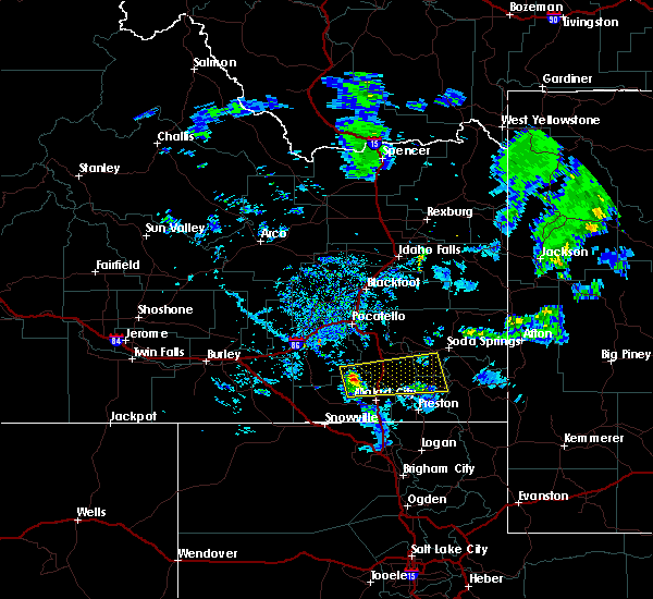 At 630 pm mdt, doppler radar indicated a severe thunderstorm capable of producing quarter size hail. this storm was located 14 miles north of pleasantview, or 16 miles northwest of malad, and moving east at 35 mph. At 630 pm mdt, doppler radar indicated a severe thunderstorm capable of producing quarter size hail. this storm was located 14 miles north of pleasantview, or 16 miles northwest of malad, and moving east at 35 mph.
|
| 6/1/2015 5:13 PM MDT |
At 512 pm mdt, doppler radar indicated a severe thunderstorm capable of producing quarter size hail and damaging winds in excess of 60 mph. this storm was located near swanlake, and moving northeast at 55 mph.
|
| 6/1/2015 4:53 PM MDT |
At 453 pm mdt, doppler radar indicated a severe thunderstorm capable of producing quarter size hail and damaging winds in excess of 60 mph. this storm was located 7 miles northeast of cherry creek rest area, or 8 miles east of malad, moving east at 45 mph. locations impacted include, preston, malad, swanlake, franklin, oneida narrows reservoir, pleasantview, cherry creek rest area, dayton, weston, clifton, oxford, riverdale, whitney, samaria, mapleton and mink creek.
|
| 6/1/2015 4:35 PM MDT |
At 434 pm mdt, doppler radar indicated a severe thunderstorm capable of producing quarter size hail and damaging winds in excess of 60 mph. this storm was located near cherry creek rest area, or 9 miles southwest of malad, and moving east at 45 mph.
|
 The storms which prompted the warning have weakened. therefore, the warning will be allowed to expire. however, gusty winds are still possible with these thunderstorms as they move east.
 the severe thunderstorm warning has been cancelled and is no longer in effect
 At 653 pm mdt, severe thunderstorms were located along a line extending from 8 miles east of fort hall lincoln creek lodge to 6 miles south of chesterfield to near trenton, moving east at 35 mph (radar indicated). Hazards include 60 mph wind gusts. Expect damage to roofs, siding, and trees. Locations impacted include, preston, soda springs, blackfoot reservoir, swanlake, chesterfield reservoir, grace, franklin, oneida narrows reservoir, thatcher, chesterfield, dayton, weston, clifton, oxford, cutthroat trout campground, trail creek campground, mapleton, mink creek, whitney, and riverdale.
 Svrpih the national weather service in pocatello has issued a * severe thunderstorm warning for, western caribou county in southeastern idaho, eastern oneida county in southeastern idaho, bannock county in southeastern idaho, central bonneville county in southeastern idaho, franklin county in southeastern idaho, southeastern bingham county in southeastern idaho, * until 715 pm mdt. * at 604 pm mdt, severe thunderstorms were located along a line extending from rockford to near portneuf gap to 12 miles southwest of pleasantview, moving east at 35 mph (radar indicated). Hazards include 60 mph wind gusts. expect damage to roofs, siding, and trees
 The severe thunderstorm warning for southwestern caribou, east central oneida, southeastern bannock and northwestern franklin counties will expire at 700 pm mdt, the storm which prompted the warning has weakened below severe limits, and no longer poses an immediate threat to life or property. therefore, the warning will be allowed to expire. however, gusty winds and heavy rain are still possible with this thunderstorm. a severe thunderstorm watch remains in effect until 1000 pm mdt for southeastern idaho.
 At 645 pm mdt, a severe thunderstorm was located over swanlake, moving northeast at 45 mph (radar indicated. this storm has a history of producing 50 to 60 mph winds). Hazards include 60 mph wind gusts. Expect damage to roofs, siding, and trees. locations impacted include, swanlake, oxford, and niter. hail threat, radar indicated max hail size, <. 75 in wind threat, radar indicated max wind gust, 60 mph.
 At 631 pm mdt, a severe thunderstorm was located 7 miles west of swanlake, moving northeast at 50 mph (radar indicated and mesonet. this storm has a history of producing 50 to 60 mph winds). Hazards include 60 mph wind gusts. Expect damage to roofs, siding, and trees. locations impacted include, malad, mccammon, lava hot springs, swanlake, downey, arimo, cherry creek rest area, virginia, clifton, oxford, niter, and malad pass. hail threat, radar indicated max hail size, <. 75 in wind threat, observed max wind gust, 60 mph.
 At 619 pm mdt, a severe thunderstorm was located over malad, moving northeast at 35 mph (radar indicated and mesonet. at 615 pm mdt, 57 mph winds were reported near samaria). Hazards include 60 mph wind gusts. expect damage to roofs, siding, and trees
 At 739 pm mdt, severe thunderstorms were located along a line extending from 15 miles northeast of juniper to 11 miles northeast of holbrook summit to 8 miles east of malad, moving northeast at 40 mph (radar indicated). Hazards include 60 mph wind gusts. Expect damage to roofs, siding, and trees. locations impacted include, malad, swanlake, downey, arimo, rockland, juniper, holbrook summit, pleasantview, fort hall bannock peak, cherry creek rest area, virginia, dayton, weston, clifton, oxford, stone, sweetzer summit, hawkins reservoir, samaria, and arbon. hail threat, radar indicated max hail size, <. 75 in wind threat, radar indicated max wind gust, 60 mph.
 At 716 pm mdt, severe thunderstorms were located along a line extending from 8 miles west of juniper to 7 miles west of holbrook summit to 8 miles southwest of cherry creek rest area, moving northeast at 40 mph (radar indicated). Hazards include 60 mph wind gusts. Expect damage to roofs, siding, and trees. locations impacted include, malad, swanlake, downey, arimo, rockland, juniper, holbrook summit, pleasantview, fort hall bannock peak, cherry creek rest area, virginia, dayton, weston, clifton, oxford, stone, sweetzer summit, hawkins reservoir, samaria, and arbon. hail threat, radar indicated max hail size, <. 75 in wind threat, radar indicated max wind gust, 60 mph.
 At 659 pm mdt, severe thunderstorms were located along a line extending from 10 miles west of juniper to 6 miles northwest of snowville to 10 miles north of howell, moving northeast at 45 mph (radar indicated). Hazards include 60 mph wind gusts. expect damage to roofs, siding, and trees
 The severe thunderstorm warning for eastern oneida, southeastern bannock and southwestern franklin counties will expire at 530 pm mdt, the storm which prompted the warning has weakened below severe limits, and no longer poses an immediate threat to life or property. therefore, the warning will be allowed to expire. however heavy rain is still possible with this thunderstorm.
 At 505 pm mdt, a severe thunderstorm was located 7 miles northwest of preston. the storm is nearly stationary (radar indicated). Hazards include quarter size hail. damage to vehicles is expected
 The severe thunderstorm warning for southeastern oneida, south central bannock and west central franklin counties will expire at 445 pm mdt, the storm which prompted the warning has weakened below severe limits, and no longer poses an immediate threat to life or property. therefore, the warning will be allowed to expire.
 At 419 pm mdt, a severe thunderstorm was located near pleasantview, or 10 miles west of malad, moving northeast at 45 mph (radar indicated). Hazards include 60 mph wind gusts and quarter size hail. Hail damage to vehicles is expected. expect wind damage to roofs, siding, and trees. Locations impacted include, malad, cherry creek rest area, pleasantview, holbrook summit, clifton, oxford, samaria and stone.
 At 402 pm mdt, a severe thunderstorm was located near snowville, moving northeast at 45 mph (radar indicated). Hazards include 60 mph wind gusts and quarter size hail. Hail damage to vehicles is expected. Expect wind damage to roofs, siding, and trees.
 At 830 am mdt, a severe thunderstorm was located over cherry creek rest area or near malad, moving east at 30 mph (radar indicated). Hazards include 60 mph wind gusts and quarter size hail. Hail damage to vehicles is expected. expect wind damage to roofs, siding, and trees. Locations impacted include, preston, malad, franklin, oneida narrows reservoir, pleasantview, cherry creek rest area, dayton, weston, clifton, oxford, mapleton, mink creek, samaria, whitney and riverdale.
 At 811 am mdt, a severe thunderstorm was located 10 miles southeast of holbrook summit or 11 miles northeast of snowville, moving east at 15 mph (radar indicated). Hazards include 60 mph wind gusts and quarter size hail. Hail damage to vehicles is expected. Expect wind damage to roofs, siding, and trees.
 At 526 pm mdt, doppler radar indicated a severe thunderstorm capable of producing quarter size hail. this storm was located over malad, and moving east at 10 mph. weak rotation was also indicated with this storm to the west of malad.
 At 630 pm mdt, doppler radar indicated a severe thunderstorm capable of producing quarter size hail. this storm was located 14 miles north of pleasantview, or 16 miles northwest of malad, and moving east at 35 mph.






Connect with Interactive Hail Maps