

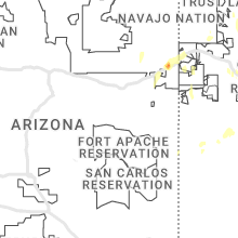
Hail Map for Tuesday, June 6, 2023

Number of Impacted Households on 6/6/2023
0
Impacted by 1" or Larger Hail
0
Impacted by 1.75" or Larger Hail
0
Impacted by 2.5" or Larger Hail
Square Miles of Populated Area Impacted on 6/6/2023
0
Impacted by 1" or Larger Hail
0
Impacted by 1.75" or Larger Hail
0
Impacted by 2.5" or Larger Hail


Cities Most Affected by Hail Storms of 6/6/2023
| Hail Size | Demographics of Zip Codes Affected | ||||||
|---|---|---|---|---|---|---|---|
| City | Count | Average | Largest | Pop Density | House Value | Income | Age |
| King Of Prussia, PA | 1 | 1.75 | 1.75 | 1743 | $158k | $62.0k | 37.8 |
Hail and Wind Damage Spotted on 6/6/2023
Filter by Report Type:Hail ReportsWind Reports
States Impacted
Pennsylvania, New York, Massachusetts, New Mexico, Utah, Connecticut, Mississippi, California, Oklahoma, South Carolina, Montana, Georgia, Minnesota, Nevada, Colorado, Texas, Idaho, IowaPennsylvania
| Local Time | Report Details |
|---|---|
| 1:30 PM EDT | Roof damage to a home in yeagertow in mifflin county PA, 18.2 miles SE of State College, PA |
| 2:25 PM EDT | Multiple reports of trees and wires down in newberry... conewango... and manchester township in york county PA, 60.1 miles NNW of Baltimore, MD |
| 3:45 PM EDT | Storm damage reported in montgomery county PA, 80.1 miles S of Scranton, PA |
| 3:45 PM EDT | Storm damage reported in montgomery county PA, 80.1 miles S of Scranton, PA |
| 4:05 PM EDT | Golf Ball sized hail reported near King Of Prussia, PA, 84.3 miles WSW of Brooklyn, NY |
| 4:05 PM EDT | Tree fell on wires at haws ave. and w. oak s in montgomery county PA, 81.9 miles WSW of Brooklyn, NY |
New York
| Local Time | Report Details |
|---|---|
| 1:46 PM EDT | Quarter sized hail reported near Schuylerville, NY, 26.7 miles NE of Schenectady, NY |
| 1:47 PM EDT | Quarter sized hail reported near Gansevoort, NY, 26.8 miles NNE of Schenectady, NY |
| 1:50 PM EDT | Quarter sized hail reported near Gansevoort, NY, 26.8 miles NNE of Schenectady, NY |
| 2:19 PM EDT | Ping Pong Ball sized hail reported near Greenwich, NY, 29.5 miles NE of Schenectady, NY, corrected time. |
| 2:35 PM EDT | Quarter sized hail reported near Gansevoort, NY, 27.3 miles NNE of Schenectady, NY, quarter size hail... some slightly larger. comfirmed by picture. time estimated by radar. |
| 2:38 PM EDT | Ping Pong Ball sized hail reported near Greenfield Center, NY, 22.4 miles NNE of Schenectady, NY, estimated by picture. time estimated by radar. |
| 2:53 PM EDT | Quarter sized hail reported near Saratoga Springs, NY, 19.6 miles NNE of Schenectady, NY, estimated by pictures. |
| 3:08 PM EDT | Quarter sized hail reported near Purchase, NY, 26.7 miles NNE of Brooklyn, NY |
| 3:08 PM EDT | Quarter sized hail reported near Rye, NY, 25.5 miles NNE of Brooklyn, NY |
| 3:10 PM EDT | Quarter sized hail reported near Valley Falls, NY, 23 miles E of Schenectady, NY |
| 3:19 PM EDT | Ping Pong Ball sized hail reported near Greenwich, NY, 29.5 miles NE of Schenectady, NY, time estimated from radar |
| 3:21 PM EDT | Quarter sized hail reported near Petersburg, NY, 25.6 miles E of Schenectady, NY |
| 3:28 PM EDT | Half Dollar sized hail reported near Bayville, NY, 28.4 miles ENE of Brooklyn, NY, center island police department. |
| 5:38 PM EDT | Quarter sized hail reported near Hagaman, NY, 15.2 miles NW of Schenectady, NY |
| 7:23 PM EDT | Quarter sized hail reported near Chatham, NY, 35.7 miles SSE of Schenectady, NY, time estimated by radar |
Massachusetts
| Local Time | Report Details |
|---|---|
| 3:25 PM EDT | Quarter sized hail reported near Charlton, MA, 35.7 miles NW of Providence, RI, reported by nws employee traveling on massachusetts pike. |
| 4:39 PM EDT | Quarter sized hail reported near Rehoboth, MA, 7.4 miles E of Providence, RI, social media photo of hail ranging from dime to quarter size in rehoboth. report time radar-estimated. |
New Mexico
| Local Time | Report Details |
|---|---|
| 2:01 PM MDT | Quarter sized hail reported near Ocate, NM, 32.8 miles ESE of Taos, NM, very heavy rain and quarter sized hail falling at the time of report. |
| 4:30 PM MDT | Ping Pong Ball sized hail reported near Sapello, NM, 47.8 miles SSE of Taos, NM |
| 4:31 PM MDT | Quarter sized hail reported near Rociada, NM, 41.9 miles SSE of Taos, NM |
| 4:34 PM MDT | Ping Pong Ball sized hail reported near Sapello, NM, 44.7 miles SSE of Taos, NM |
| 4:40 PM MDT | Quarter sized hail reported near Sapello, NM, 47 miles SSE of Taos, NM, new mexico forest and watershed institute. |
| 5:36 PM MDT | Quarter sized hail reported near Las Vegas, NM, 58.2 miles S of Taos, NM, observed by mineral hill fire department. |
Utah
| Local Time | Report Details |
|---|---|
| 2:15 PM MDT | White sage - 4363 ft in tooele county UT, 67.1 miles SW of Salt Lake City, UT |
| 2:35 PM MDT | Camel back mtn - 5077 ft in tooele county UT, 71.3 miles SW of Salt Lake City, UT |
| 2:55 PM MDT | Salt flats - 4265 ft in tooele county UT, 76.8 miles WSW of Salt Lake City, UT |
| 3:10 PM MDT | West of wildcat mtn - 4259 ft in tooele county UT, 85.9 miles WSW of Salt Lake City, UT |
| 3:35 PM MDT | Interstate 80 - 4125 ft in tooele county UT, 83 miles W of Salt Lake City, UT |
| 3:40 PM MDT | I-80 at mp 29 - 4223 ft in tooele county UT, 84.6 miles W of Salt Lake City, UT |
| 3:41 PM MDT | Storm damage reported in tooele county UT, 88.8 miles W of Salt Lake City, UT |
| 3:45 PM MDT | Bonneville salt flats - 4218 ft in tooele county UT, 101.7 miles E of Elko, NV |
| 4:10 PM MDT | Wendover port of entry - 4227 ft in tooele county UT, 93.4 miles E of Elko, NV |
| 4:15 PM MDT | Hat island - 4242 ft in box elder county UT, 42.5 miles WNW of Salt Lake City, UT |
| 4:23 PM MDT | Mesonet station ur305 27.0 e lucin (upr in box elder county UT, 87.6 miles WNW of Salt Lake City, UT |
| 4:49 PM MDT | Mesonet station ur308 2.5 nw lucin (upr in box elder county UT, 86 miles SSE of Twin Falls, ID |
| 5:40 PM MDT | Mesonet station ut30 3.1 e collinston (utah dot in box elder county UT, 70.8 miles N of Salt Lake City, UT |
| 5:42 PM MDT | Mesonet station rsbu1 rosebu in box elder county UT, 79.4 miles SE of Twin Falls, ID |
| 6:30 PM MDT | Mesonet station pc358 hansel valle in box elder county UT, 85.6 miles NNW of Salt Lake City, UT |
Connecticut
| Local Time | Report Details |
|---|---|
| 4:26 PM EDT | Quarter sized hail reported near Stafford Springs, CT, 46.7 miles WNW of Providence, RI, at the momson ma and stafford ct border. relayed by amateur radio. |
Mississippi
| Local Time | Report Details |
|---|---|
| 3:27 PM CDT | Quarter sized hail reported near Olive Branch, MS, 16.8 miles SE of Memphis, TN, quarter size hail reported at walmart in olive branch. |
California
| Local Time | Report Details |
|---|---|
| 1:27 PM PDT | Mesonet station xmlc1 mill canyo in mono county CA, 74.7 miles SSE of Reno, NV |
Oklahoma
| Local Time | Report Details |
|---|---|
| 3:28 PM CDT | Quarter sized hail reported near Mulhall, OK, 36.4 miles N of Oklahoma City, OK |
| 3:45 PM CDT | Quarter sized hail reported near Stillwater, OK, 52.7 miles NNE of Oklahoma City, OK |
| 4:06 PM CDT | Ping Pong Ball sized hail reported near Stillwater, OK, 54.8 miles NNE of Oklahoma City, OK |
| 4:08 PM CDT | Half Dollar sized hail reported near Stillwater, OK, 53.2 miles NNE of Oklahoma City, OK |
| 5:11 PM CDT | Shared a twitter photo from a viewer of some tree damage near 101st and 193rd in ba...time estimated by rada in tulsa county OK, 15.8 miles SE of Tulsa, OK |
| 5:17 PM CDT | Quarter sized hail reported near Hulbert, OK, 51.5 miles E of Tulsa, OK, report from mping: quarter (1.00 in.). |
| 6:30 PM CDT | Twitter photos of tree damage at the citiplex towers near 81st and lewis in tulsa...time estimated by rada in tulsa county OK, 7.3 miles SSE of Tulsa, OK |
| 6:30 PM CDT | Twitter photo of tree damage near 91st and delaware in south tulsa/jenks area...time estimated by rada in tulsa county OK, 8.6 miles SSE of Tulsa, OK |
| 6:30 PM CDT | Large tree branches and small trees down along riverside south of 81s in tulsa county OK, 7.8 miles SSE of Tulsa, OK |
| 7:34 PM CDT | Quarter sized hail reported near Tulsa, OK, 4 miles SSW of Tulsa, OK, report from mping: quarter (1.00 in.). |
South Carolina
| Local Time | Report Details |
|---|---|
| 4:34 PM EDT | Broadcast media relayed a report... via social media... of a medium size tree down onto the westbound lanes of us hwy 1/601 (w dekalb st)... between bay lane and the br in kershaw county SC, 68 miles S of Charlotte, NC |
| 5:06 PM EDT | Tree down on a home on canebrake l in greenville county SC, 21.1 miles ESE of Greenville, SC |
| 5:06 PM EDT | Social media picture of two traffic lights blown down at the fairview rd exit from i-38 in greenville county SC, 20.8 miles ESE of Greenville, SC |
| 5:06 PM EDT | Social media picture of restaurant sign blown ou in greenville county SC, 21.3 miles ESE of Greenville, SC |
| 5:11 PM EDT | Tree down in the hunters woods neighborhoo in greenville county SC, 21.1 miles ESE of Greenville, SC |
| 5:11 PM EDT | Tree down in the hunters woods neighborhoo in greenville county SC, 21.1 miles ESE of Greenville, SC |
| 5:11 PM EDT | Social media picture of a large tree uprooted along southeast main s in greenville county SC, 21.9 miles ESE of Greenville, SC |
| 5:16 PM EDT | Quarter sized hail reported near Simpsonville, SC, 20.7 miles ESE of Greenville, SC, two rounds of hail occurred with the second round containing up to quarter size hail with hail covering the ground. |
| 5:21 PM EDT | Quarter sized hail reported near Fountain Inn, SC, 22.4 miles ESE of Greenville, SC, motorist reported on social media that they drove through quarter size hail on i-385 between simpsonville and fountain inn. |
| 5:26 PM EDT | Half Dollar sized hail reported near Fountain Inn, SC, 24.2 miles ESE of Greenville, SC, 1.25 inch hail reported at coleman avenue in fountain inn. |
| 6:48 PM EDT | The charleston county 911 call center received a report of a tree down near the intersection of lincolnville and von ohsen rd. time estimated via radar dat in charleston county SC, 15.4 miles SSW of Charleston, SC |
| 10:00 PM EDT | A tree fell on us hwy 378 and hwy 261... just west of shaw afb. time estimate in sumter county SC, 59.6 miles NNW of Charleston, SC |
| 10:50 PM EDT | A tree fell on us hwy 521 and alice dr. time estimate in sumter county SC, 57.4 miles NNW of Charleston, SC |
| 11:30 PM EDT | Lee county sheriff reported to 911 dispatch 3 trees down on raccoon road near hwy 401. time estimated by rada in lee county SC, 59.9 miles NNW of Charleston, SC |
Montana
| Local Time | Report Details |
|---|---|
| 2:50 PM MDT | Quarter sized hail reported near Whitewater, MT, 60 miles NW of Glasgow, MT, also reported heavy rain... 35 mph wind gusts estimated. |
| 8:00 PM MDT | Quarter sized hail reported near Hardin, MT, 43.9 miles E of Billings, MT |
| 8:00 PM MDT | Ping Pong Ball sized hail reported near Hardin, MT, 42.1 miles E of Billings, MT, heavy rain in addition to the hail. |
| 8:04 PM MDT | Half Dollar sized hail reported near Hardin, MT, 43 miles E of Billings, MT |
Georgia
| Local Time | Report Details |
|---|---|
| 4:54 PM EDT | Richmond co dispatch reported a tree and power line down at peach orchard rd and brown rd. time estimate in richmond county GA, 10.2 miles SSW of Augusta, GA |
| 5:00 PM EDT | Couple trees down at i20 at mm 15 in warren county GA, 48.2 miles W of Augusta, GA |
| 5:04 PM EDT | Quarter sized hail reported near Augusta, GA, 10.4 miles S of Augusta, GA, quarter size hail reported by personnel at graphic packaging international plant south of bush field. |
| 5:20 PM EDT | Quarter sized hail reported near Marietta, GA, 12.7 miles NNW of Atlanta, GA |
| 5:20 PM EDT | Tree down at bentley and terrell mill r in cobb county GA, 12.9 miles NNW of Atlanta, GA |
| 5:33 PM EDT | Quarter sized hail reported near Norwood, GA, 48.2 miles W of Augusta, GA |
| 8:25 PM EDT | Multiple trees down within the town limits of harlem... including one down on a house and car on w. forrest st. time estimate in columbia county GA, 19.8 miles WSW of Augusta, GA |
| 8:30 PM EDT | Trees down at wrightsboro rd and gateway blvd. time estimate in columbia county GA, 11.9 miles W of Augusta, GA |
Minnesota
| Local Time | Report Details |
|---|---|
| 4:30 PM CDT | Estimated 8 inch diameter pine snapped a few feet above the groun in clay county MN, 14.8 miles N of Fargo, ND |
Nevada
| Local Time | Report Details |
|---|---|
| 2:53 PM PDT | Mesonet station tornv 9.8 ne trinity junction (nv dot in pershing county NV, 72 miles ENE of Reno, NV |
| 3:19 PM PDT | Mesonet station up994 3.1 se west wendover (upr in elko county NV, 88.3 miles E of Elko, NV |
| 3:26 PM PDT | Mesonet station crsn2 crane springs raws station elevation: 6414 f in elko county NV, 26.3 miles S of Elko, NV |
Colorado
| Local Time | Report Details |
|---|---|
| 4:43 PM MDT | Quarter sized hail reported near Parker, CO, 19.6 miles SE of Denver, CO, la786. |
| 5:08 PM MDT | Quarter sized hail reported near Aurora, CO, 11.8 miles E of Denver, CO, ab117. |
| 5:12 PM MDT | Quarter sized hail reported near Aurora, CO, 14 miles SE of Denver, CO |
Texas
| Local Time | Report Details |
|---|---|
| 5:10 PM MDT | Quarter sized hail reported near El Paso, TX, 13.1 miles ESE of El Paso, TX, time and location estimated based on social media report. |
| 5:25 PM MDT | Severe wind gust of 63 mph reported from mesonet site in fabens... t in el paso county TX, 29 miles SE of El Paso, TX |
| 5:50 PM MDT | Tree down in the street... size is unknow in el paso county TX, 10 miles NNW of El Paso, TX |
| 5:53 PM MDT | Severe wind gust of 63 mph reported by a observation site on south franklin pea in el paso county TX, 6.9 miles N of El Paso, TX |
| 5:55 PM MDT | Quarter sized hail reported near El Paso, TX, 10.8 miles ENE of El Paso, TX |
| 6:03 PM MDT | Tree down at the intersection of dyer st and hayes av in el paso county TX, 5 miles NNE of El Paso, TX |
Idaho
| Local Time | Report Details |
|---|---|
| 5:45 PM MDT | Itd rwis itd47 juniper interchange with sustained winds at 48 mph gusting to 70 mph reducing visibility to a quarter mil in oneida county ID, 81.5 miles ESE of Twin Falls, ID |
| 6:10 PM MDT | Private weather station kidmalta in cassia county ID, 51.6 miles ESE of Twin Falls, ID |
Iowa
| Local Time | Report Details |
|---|---|
| 7:05 PM CDT | Quarter sized hail reported near Waucoma, IA, 60 miles E of Mason City, IA, report via twitter picture. time taken from twitter comment on aforementioned twitter picture. |
Connect with Interactive Hail Maps