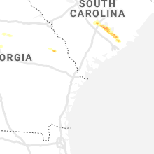
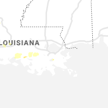
Hail Map for Tuesday, May 11, 2021

Number of Impacted Households on 5/11/2021
0
Impacted by 1" or Larger Hail
0
Impacted by 1.75" or Larger Hail
0
Impacted by 2.5" or Larger Hail
Square Miles of Populated Area Impacted on 5/11/2021
0
Impacted by 1" or Larger Hail
0
Impacted by 1.75" or Larger Hail
0
Impacted by 2.5" or Larger Hail
Regions Impacted by Hail on 5/11/2021
Cities Most Affected by Hail Storms of 5/11/2021
| Hail Size | Demographics of Zip Codes Affected | ||||||
|---|---|---|---|---|---|---|---|
| City | Count | Average | Largest | Pop Density | House Value | Income | Age |
| Sanderson, TX | 1 | 1.75 | 1.75 | 0 | $26k | $23.9k | 44.7 |
| Eutawville, SC | 1 | 1.75 | 1.75 | 95 | $83k | $28.2k | 45.4 |
| Moncks Corner, SC | 1 | 1.75 | 1.75 | 195 | $97k | $35.8k | 37.6 |
Hail and Wind Damage Spotted on 5/11/2021
Filter by Report Type:Hail ReportsWind Reports
Louisiana
| Local Time | Report Details |
|---|---|
| 7:14 AM CDT | Quarter sized hail reported near Church Point, LA, 22.3 miles NW of Lafayette, LA, spotter reports dime to quarter size hail. photo received of quarter size hail. |
| 2:09 AM CDT | Downtown heliport awos...7n0...measured wind gust of 54 kts/62 mph at 0709 in orleans county LA, 1.1 miles N of New Orleans, LA |
| 2:10 AM CDT | Large tree downed onto vehicle near the intersection of hickory street and lowerline stree in orleans county LA, 1.1 miles N of New Orleans, LA |
| 2:10 AM CDT | Large tree downed onto vehicle near the intersection of hickory street and lowerline stree in orleans county LA, 1.1 miles N of New Orleans, LA |
| 2:11 AM CDT | Oak tree blocking claiborne avenue near calhoun street and tulane universit in orleans county LA, 1.1 miles N of New Orleans, LA |
| 2:14 AM CDT | Power pole down on car and tree blocking road near the intersection of cohn street and lowerline stree in orleans county LA, 1.7 miles NW of New Orleans, LA |
| 2:16 AM CDT | Power pole down on truck in the 400 block of bouny stree in orleans county LA, 1.2 miles NNE of New Orleans, LA |
| 2:17 AM CDT | Power lines down along with debris scattered near the corner of behrman avenue and opelousas avenue in the federal city neighboorhoo in orleans county LA, 1.2 miles NNE of New Orleans, LA |
| 2:17 AM CDT | Power lines down along with debris scattered near the corner of behrman avenue and opelousas avenue in the federal city neighboorhoo in orleans county LA, 1.2 miles NNE of New Orleans, LA |
Texas
| Local Time | Report Details |
|---|---|
| 7:30 AM CDT | Quarter sized hail reported near Livingston, TX, 47.7 miles S of Lufkin, TX, hail in wilson lake estates. |
| 7:30 AM CDT | Downed trees over roadways and on homes in wilson lake estates. residents also reported seeing quarter size hail during the storm. approximately 10-15 homes were impact in polk county TX, 47.7 miles S of Lufkin, TX |
| 3:13 PM CDT | Quarter sized hail reported near Whitehouse, TX, 67.9 miles NNW of Lufkin, TX, nickels to quarters in whitehouse. |
| 3:20 PM CDT | Trees reported down on sh 135 and fm 1639 north of overto in rusk county TX, 67.6 miles W of Shreveport, LA |
| 3:45 PM CDT | Quarter sized hail reported near Rusk, TX, 46.5 miles NW of Lufkin, TX, reported between rusk and jacksonville. |
| 3:45 PM CDT | Very large tree down .5 miles of of us 259 n to the w on cr 10 in rusk county TX, 61 miles N of Lufkin, TX |
| 4:11 PM CDT | Report from mping: 1-inch tree limbs broken; shingles blown of in brazos county TX, 79.6 miles NW of Houston, TX |
| 4:20 PM CDT | Large tree downed on highway 90 just north of bedia in grimes county TX, 79 miles NNW of Houston, TX |
| 4:30 PM CDT | Trees down south of crockett at the intersection of fm 2712 and county road 402 in houston county TX, 43.6 miles W of Lufkin, TX |
| 4:30 PM CDT | Tree fallen across power lines in the 29th street area near villa maria in bryan. time estimated by rada in brazos county TX, 85.3 miles NW of Houston, TX |
| 5:02 PM CDT | Trees down sh 135 and fm 1639 north of overto in gregg county TX, 71 miles W of Shreveport, LA |
| 5:48 PM CDT | Quarter sized hail reported near Livingston, TX, 46.2 miles SSW of Lufkin, TX, nickle and quarter sized hail ne of livingston. |
| 6:08 PM CDT | Quarter sized hail reported near San Antonio, TX, 15.1 miles WSW of San Antonio, TX, quarter sized hail reported at u.s. 90 and montgomery rd. |
| 6:15 PM CDT | Quarter sized hail reported near Warren, TX, 50.7 miles NW of Beaumont, TX, quarter size hail reported 5 miles south of warren... tx. |
| 6:18 PM CDT | Large limbs down in tarkington prairi in liberty county TX, 45.4 miles NNE of Houston, TX |
| 6:19 PM CDT | 15-20 trees and powerlines blown dow in liberty county TX, 43.4 miles NNE of Houston, TX |
| 6:45 PM CDT | Trees reported down in tyler county... t in tyler county TX, 42.1 miles SSE of Lufkin, TX |
| 6:59 PM CDT | Half Dollar sized hail reported near Sanderson, TX, 76.4 miles E of Alpine, TX |
| 7:23 PM CDT | Golf Ball sized hail reported near Sanderson, TX, 89 miles ESE of Alpine, TX, measured by ibhs hail study researchers. time estimated from radar. |
| 9:10 PM CDT | Quarter sized hail reported near Leander, TX, 49.8 miles SSW of Killeen, TX, broadcast media relayed a viewer report of 1 inch hail in lago vista. |
| 10:10 PM CDT | Zapata fire department reported multiple downed power lines and telephone poles along with roof damage to multiple homes in the city of zapat in zapata county TX, 44.4 miles SSE of Laredo, TX |
| 10:15 PM CDT | Tree limb damage reported in the town of zapata. reported through social medi in zapata county TX, 46.6 miles SSE of Laredo, TX |
| 1:07 AM CDT | Mcallen airport asos reported a wind gust to 63 mph in hidalgo county TX, 51.3 miles WNW of Brownsville, TX |
| 1:30 AM CDT | Palm tree uprooted near the intersection of interstate-2 and hutto roa in hidalgo county TX, 40.6 miles WNW of Brownsville, TX |
Oklahoma
| Local Time | Report Details |
|---|---|
| 10:17 AM CDT | Quarter sized hail reported near Marietta, OK, 65 miles WSW of Atoka, OK, at the hospital. |
Florida
| Local Time | Report Details |
|---|---|
| 3:29 PM EDT | The putnam county sheriffs office reported a tree downed near 121 weertz rd just off of us 17 in san mateo. time estimate based on rada in putnam county FL, 49.8 miles S of Jacksonville, FL |
| 5:26 PM CDT | Power line reported down near 11548 nw county road 27 in calhoun county FL, 54.1 miles W of Tallahassee, FL |
| 6:12 AM CDT | Pensacola airport measures thunderstorm wind gust to 58mp in escambia county FL, 50 miles W of Miramar Beach, FL |
Georgia
| Local Time | Report Details |
|---|---|
| 4:45 PM EDT | Report of a tree blown down across hwy 83... in southwestern jasper county in jasper county GA, 52.2 miles SE of Atlanta, GA |
| 6:20 PM EDT | Spotter reported the wall blown off a metal farm she in screven county GA, 53.2 miles S of Augusta, GA |
| 8:02 PM EDT | Report of a tree blown down at hwy 129 and adams park rd in twiggs county GA, 83.7 miles NNW of Douglas, GA |
South Carolina
| Local Time | Report Details |
|---|---|
| 5:57 PM EDT | Corrects previous tstm wnd dmg report from 4 wsw santee. orangeburg county emergency management reports roof damage to a home on buckhead drive near five chop road. no in orangeburg county SC, 36.8 miles WNW of Charleston, SC |
| 6:06 PM EDT | Corrects previous report from 2 ese santee. report of trees down on five chop rd near old number six hwy. time estimated from rada in orangeburg county SC, 31.5 miles NW of Charleston, SC |
| 6:06 PM EDT | Corrects previous report from 2 ese santee. report of trees down on five chop rd near old number six hwy. time estimated from rada in orangeburg county SC, 31.5 miles NW of Charleston, SC |
| 6:26 PM EDT | Golf Ball sized hail reported near Eutawville, SC, 24.9 miles NW of Charleston, SC, law enforcement report of golf ball sized hail. time estimated from radar. |
| 6:27 PM EDT | Corrects previous tstm wnd dmg report from 2 nw eutawville. orangeburg county emergency management reports one tree top snapped near the intersection of highway 6 and m in orangeburg county SC, 25.3 miles NW of Charleston, SC |
| 6:27 PM EDT | Corrects previous tstm wnd dmg report from 2 nw eutawville. orangeburg county emergency management reports one tree top snapped near the intersection of highway 6 and m in orangeburg county SC, 25.3 miles NW of Charleston, SC |
| 6:57 PM EDT | Orangeburg county emergency management reports roof damage to a home on buckhead drive near five chop road. no injurie in orangeburg county SC, 36.8 miles WNW of Charleston, SC |
| 7:07 PM EDT | Quarter sized hail reported near Moncks Corner, SC, 1 miles NNW of Charleston, SC, quarter size hail lasted 5 minutes. shredded a canvas deck cover. |
| 7:14 PM EDT | Golf Ball sized hail reported near Moncks Corner, SC, 0.9 miles ESE of Charleston, SC, spotter reported hail ranging from marble to golf ball size in moncks corner. |


Connect with Interactive Hail Maps