

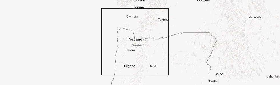
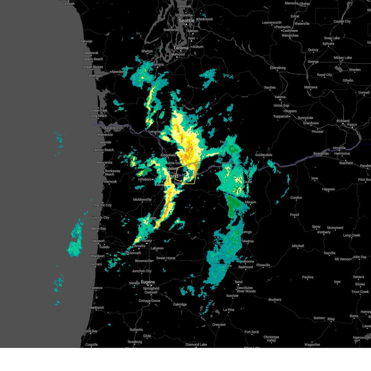
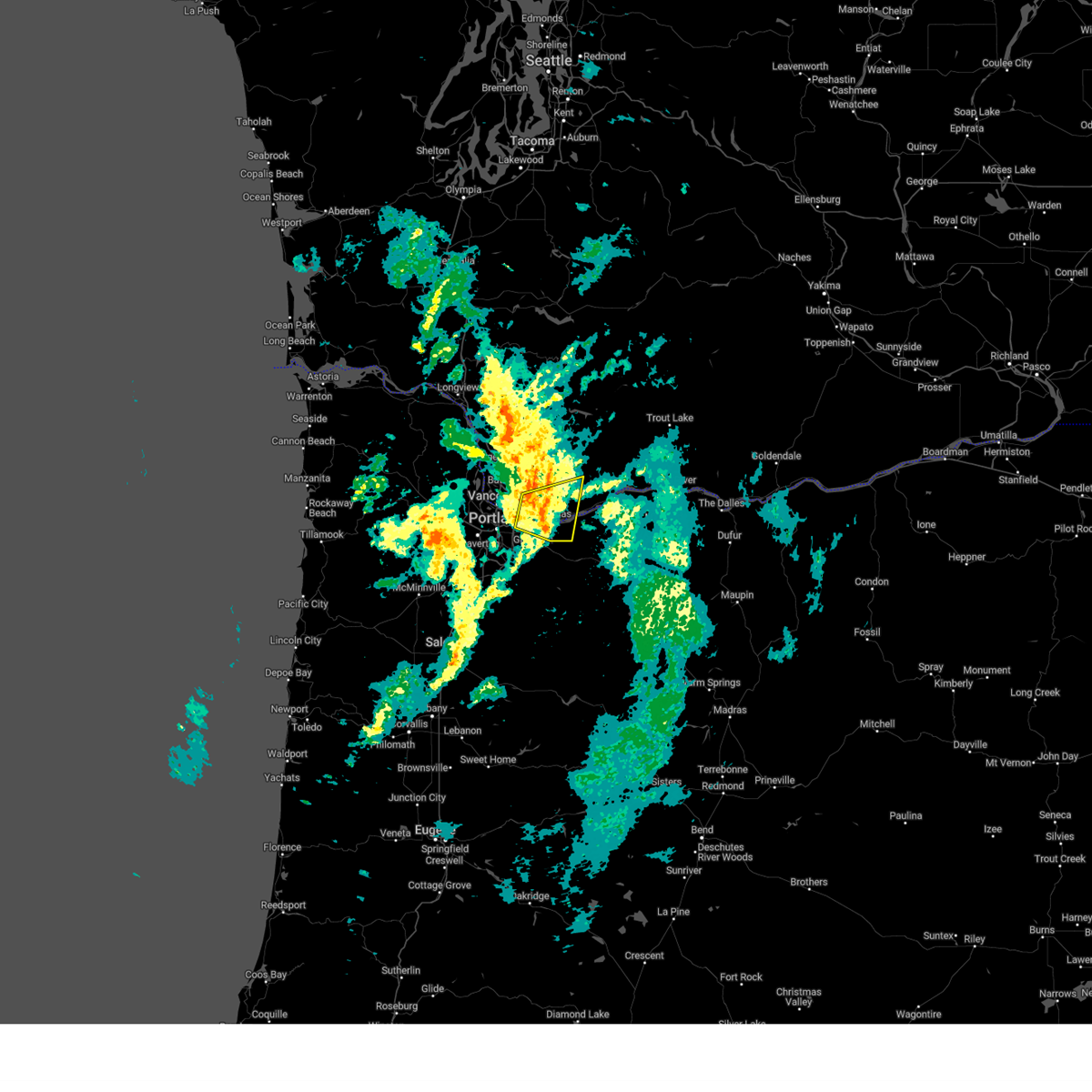
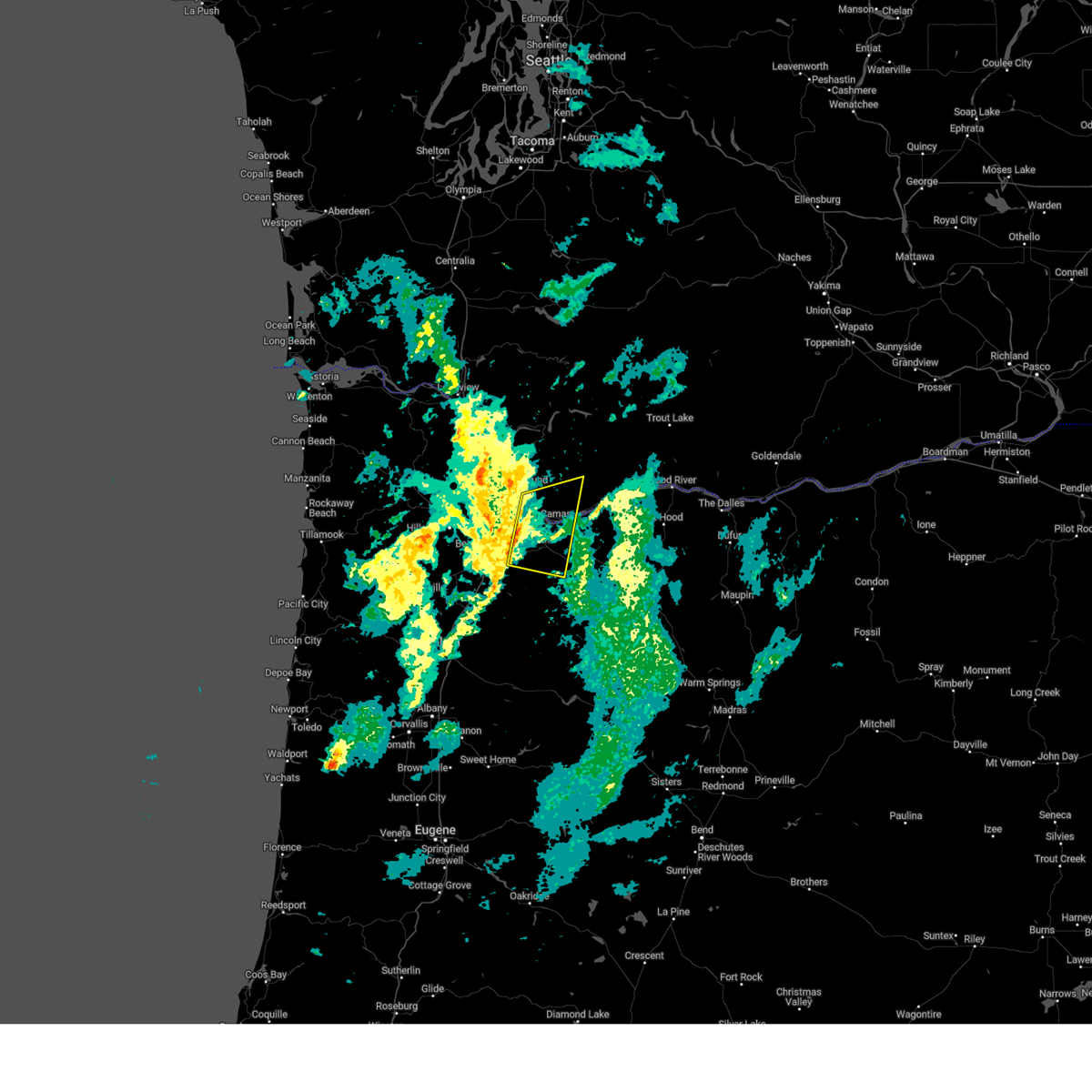
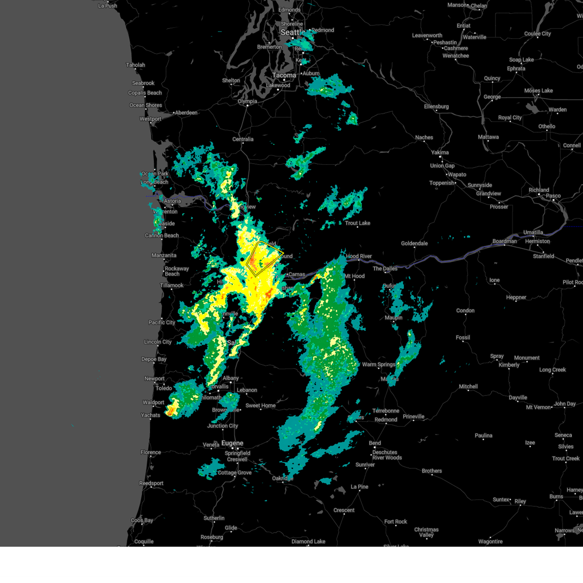
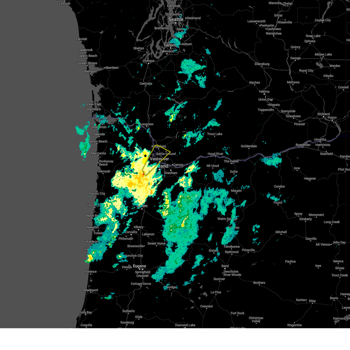
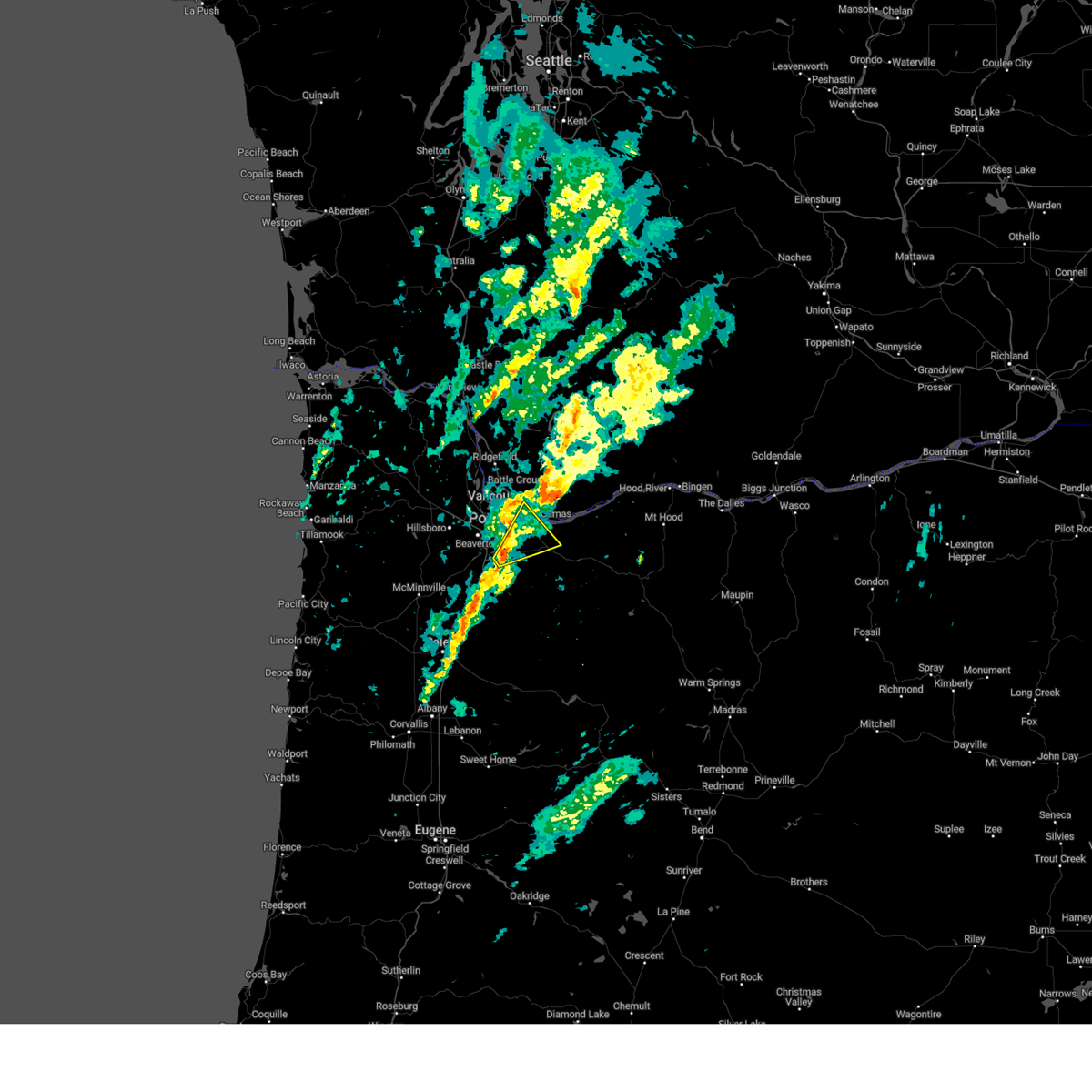
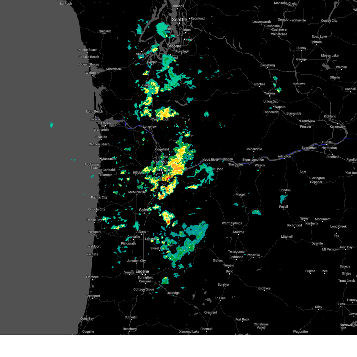
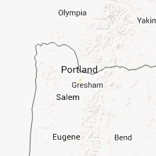
Hail Map for Portland, OR
The Portland, OR area has had 0 reports of on-the-ground hail by trained spotters, and has been under severe weather warnings 9 times during the past 12 months. Doppler radar has detected hail at or near Portland, OR on 1 occasion.
| Name: | Portland, OR |
| Where Located: | 0.3 miles SSW of Portland, OR |
| Map: | Google Map for Portland, OR |
| Population: | 583776 |
| Housing Units: | 265439 |
| More Info: | Search Google for Portland, OR |
5
The Top Recent Hail Date for Portland, OR is Monday, June 16, 2014 (1st out of 1)
Hail and Wind Damage Spotted near Portland, OR
| Date / Time | Report Details |
|---|---|
| 2/24/2025 4:51 PM PST |
 The storms which prompted the warning have moved out of the warned area and have weakened a bit in strength. therefore, the warning will be allowed to expire. The storms which prompted the warning have moved out of the warned area and have weakened a bit in strength. therefore, the warning will be allowed to expire.
|
| 2/24/2025 4:38 PM PST |
 At 437 pm pst, severe thunderstorms were located along a line extending from near washougal to 6 miles east of oregon city, moving east at 30 mph (radar indicated). Hazards include 60 mph wind gusts. Expect damage to roofs, siding, and trees. downed trees and power outages possible. locations impacted include, prindle, rooster rock state park, proebstel, cape horn, washougal, larch mountain, rockwood, fairview, gresham, wood village, hazelwood, latourell, troutdale, parkrose, government island, corbett, bridal veil, lacamas lake, mill plain, and camas. in washington this includes state route 14 between mile markers 7 and 28. this includes the following highways in oregon, interstate 84 between mile markers 10 and 29. u. s. Highway 26 east of portland near mile marker 15. At 437 pm pst, severe thunderstorms were located along a line extending from near washougal to 6 miles east of oregon city, moving east at 30 mph (radar indicated). Hazards include 60 mph wind gusts. Expect damage to roofs, siding, and trees. downed trees and power outages possible. locations impacted include, prindle, rooster rock state park, proebstel, cape horn, washougal, larch mountain, rockwood, fairview, gresham, wood village, hazelwood, latourell, troutdale, parkrose, government island, corbett, bridal veil, lacamas lake, mill plain, and camas. in washington this includes state route 14 between mile markers 7 and 28. this includes the following highways in oregon, interstate 84 between mile markers 10 and 29. u. s. Highway 26 east of portland near mile marker 15.
|
| 2/24/2025 4:38 PM PST |
 the severe thunderstorm warning has been cancelled and is no longer in effect the severe thunderstorm warning has been cancelled and is no longer in effect
|
| 2/24/2025 4:24 PM PST |
 Svrpqr the national weather service in portland has issued a * severe thunderstorm warning for, northwestern clackamas county in northwestern oregon, south central multnomah county in northwestern oregon, southeastern clark county in southwestern washington, southwestern skamania county in southwestern washington, * until 500 pm pst. * at 423 pm pst, severe thunderstorms were located along a line extending from mill plain to gladstone, moving east at 30 mph (radar indicated). Hazards include 60 mph wind gusts. Expect damage to roofs, siding, and trees. Downed trees and power outages possible. Svrpqr the national weather service in portland has issued a * severe thunderstorm warning for, northwestern clackamas county in northwestern oregon, south central multnomah county in northwestern oregon, southeastern clark county in southwestern washington, southwestern skamania county in southwestern washington, * until 500 pm pst. * at 423 pm pst, severe thunderstorms were located along a line extending from mill plain to gladstone, moving east at 30 mph (radar indicated). Hazards include 60 mph wind gusts. Expect damage to roofs, siding, and trees. Downed trees and power outages possible.
|
| 2/24/2025 4:19 PM PST |
 the severe thunderstorm warning has been cancelled and is no longer in effect the severe thunderstorm warning has been cancelled and is no longer in effect
|
| 2/24/2025 4:19 PM PST |
 At 419 pm pst, severe thunderstorms were located along a line extending from ridgefield to near lake shore, moving northeast at 60 mph (radar indicated). Hazards include 60 mph wind gusts. Expect damage to roofs, siding, and trees. locations impacted include, brush prairie, mount vista, salmon creek, cherry grove, vancouver lake, barberton, felida, hazel dell north, lake shore, battle ground, dollar corner, meadow glade, clark county events center, ridgefield, sauvie island, hazel dell south, walnut grove, venersborg, five corners, and minnehaha. this includes the following highways in washington, interstate 5 between mile markers 3 and 17. interstate 205 between mile markers 34 and 37. state route 503 between mile markers 4 and 9. in oregon this includes u. s. Highway 30 west of portland between mile markers 8 and 18. At 419 pm pst, severe thunderstorms were located along a line extending from ridgefield to near lake shore, moving northeast at 60 mph (radar indicated). Hazards include 60 mph wind gusts. Expect damage to roofs, siding, and trees. locations impacted include, brush prairie, mount vista, salmon creek, cherry grove, vancouver lake, barberton, felida, hazel dell north, lake shore, battle ground, dollar corner, meadow glade, clark county events center, ridgefield, sauvie island, hazel dell south, walnut grove, venersborg, five corners, and minnehaha. this includes the following highways in washington, interstate 5 between mile markers 3 and 17. interstate 205 between mile markers 34 and 37. state route 503 between mile markers 4 and 9. in oregon this includes u. s. Highway 30 west of portland between mile markers 8 and 18.
|
| 2/24/2025 4:02 PM PST |
 Svrpqr the national weather service in portland has issued a * severe thunderstorm warning for, southeastern columbia county in northwestern oregon, northwestern multnomah county in northwestern oregon, southeastern washington county in northwestern oregon, southwestern clark county in southwestern washington, * until 430 pm pst. * at 400 pm pst, severe thunderstorms were located along a line extending from near hillsboro to 6 miles west of beaverton, moving northeast at 60 mph (radar indicated). Hazards include 60 mph wind gusts. Expect damage to roofs, siding, and trees. Power outages possible. Svrpqr the national weather service in portland has issued a * severe thunderstorm warning for, southeastern columbia county in northwestern oregon, northwestern multnomah county in northwestern oregon, southeastern washington county in northwestern oregon, southwestern clark county in southwestern washington, * until 430 pm pst. * at 400 pm pst, severe thunderstorms were located along a line extending from near hillsboro to 6 miles west of beaverton, moving northeast at 60 mph (radar indicated). Hazards include 60 mph wind gusts. Expect damage to roofs, siding, and trees. Power outages possible.
|
| 8/17/2024 5:29 PM PDT |
 The storms which prompted the warning have weakened below severe limits, and no longer pose an immediate threat to life or property. therefore, the warning will be allowed to expire. a severe thunderstorm watch remains in effect until 900 pm pdt for northwestern oregon, and southwestern washington. The storms which prompted the warning have weakened below severe limits, and no longer pose an immediate threat to life or property. therefore, the warning will be allowed to expire. a severe thunderstorm watch remains in effect until 900 pm pdt for northwestern oregon, and southwestern washington.
|
| 8/17/2024 5:04 PM PDT |
 Svrpqr the national weather service in portland has issued a * severe thunderstorm warning for, north central clackamas county in northwestern oregon, west central hood river county in northwestern oregon, southeastern multnomah county in northwestern oregon, southeastern clark county in southwestern washington, southwestern skamania county in southwestern washington, * until 530 pm pdt. * at 503 pm pdt, severe thunderstorms were located along a line extending from 6 miles west of lolo pass to near estacada, moving north at 40 mph (trained weather spotters). Hazards include 60 mph wind gusts and quarter size hail. Hail damage to vehicles is expected. Expect wind damage to roofs, siding, and trees. Svrpqr the national weather service in portland has issued a * severe thunderstorm warning for, north central clackamas county in northwestern oregon, west central hood river county in northwestern oregon, southeastern multnomah county in northwestern oregon, southeastern clark county in southwestern washington, southwestern skamania county in southwestern washington, * until 530 pm pdt. * at 503 pm pdt, severe thunderstorms were located along a line extending from 6 miles west of lolo pass to near estacada, moving north at 40 mph (trained weather spotters). Hazards include 60 mph wind gusts and quarter size hail. Hail damage to vehicles is expected. Expect wind damage to roofs, siding, and trees.
|
| 10/16/2023 4:07 PM PDT |
 At 406 pm pdt, a severe thunderstorm was located over jennings lodge, or near oregon city, moving northeast at 20 mph (radar indicated). Hazards include 60 mph wind gusts. expect damage to roofs, siding, and trees At 406 pm pdt, a severe thunderstorm was located over jennings lodge, or near oregon city, moving northeast at 20 mph (radar indicated). Hazards include 60 mph wind gusts. expect damage to roofs, siding, and trees
|
| 6/18/2023 4:53 PM PDT |
 At 451 pm pdt, a severe thunderstorm was located over sunnyside, moving east at 15 mph (radar indicated. at 430 pm, penny sized hail was reported in sellwood). Hazards include quarter size hail. Damage to vehicles is expected. locations impacted include, milwaukie, gladstone, oatfield, clackamas, happy valley, damascus, johnson city, sunnyside and oak grove. in oregon this includes interstate 205 between mile markers 12 and 18. hail threat, observed max hail size, 1. 00 in wind threat, radar indicated max wind gust, <50 mph. At 451 pm pdt, a severe thunderstorm was located over sunnyside, moving east at 15 mph (radar indicated. at 430 pm, penny sized hail was reported in sellwood). Hazards include quarter size hail. Damage to vehicles is expected. locations impacted include, milwaukie, gladstone, oatfield, clackamas, happy valley, damascus, johnson city, sunnyside and oak grove. in oregon this includes interstate 205 between mile markers 12 and 18. hail threat, observed max hail size, 1. 00 in wind threat, radar indicated max wind gust, <50 mph.
|
| 6/18/2023 4:39 PM PDT |
 At 437 pm pdt, a severe thunderstorm was located over milwaukie, moving east at 15 mph (radar indicated). Hazards include quarter size hail. damage to vehicles is expected At 437 pm pdt, a severe thunderstorm was located over milwaukie, moving east at 15 mph (radar indicated). Hazards include quarter size hail. damage to vehicles is expected
|
| 4/30/2022 6:15 PM PDT | Received a video of what appears to be a brief gustnado that formed near the edge of a nearby strong shower and caused some damage to a baseball field located at cook p in washington county OR, 8.6 miles NNE of Portland, OR |
| 12/11/2021 11:49 AM PST | Down tree branch (est 3 inch in diameter) with a portion of a fence dow in multnomah county OR, 9.3 miles W of Portland, OR |
| 12/11/2021 11:00 AM PST | 4 inch doug fir fallen branc in multnomah county OR, 7.8 miles W of Portland, OR |
| 12/11/2021 10:45 AM PST | Downed tree around 6+ inches in diamete in multnomah county OR, 5 miles NE of Portland, OR |
| 12/11/2021 5:30 AM PST | Tree down - diameter around 6+ inche in multnomah county OR, 3.9 miles SSW of Portland, OR |
| 11/6/2021 10:45 AM PDT | *** 1 fatal... 1 inj *** portland police/oregonian report a large tree branch fell on an encampment that led to one injury and one fatalit in multnomah county OR, 7.7 miles WSW of Portland, OR |
| 10/24/2021 1:02 PM PDT |
 At 102 pm pdt, severe thunderstorms were located along a line extending from near kalama to near ridgefield to lake shore, moving northeast at 45 mph (radar indicated). Hazards include 60 mph wind gusts. expect damage to roofs, siding, and trees At 102 pm pdt, severe thunderstorms were located along a line extending from near kalama to near ridgefield to lake shore, moving northeast at 45 mph (radar indicated). Hazards include 60 mph wind gusts. expect damage to roofs, siding, and trees
|
| 9/28/2019 4:09 PM PDT | Nws storm survey found straight-line wind damage of approximately 45 to 55 mph winds near halsey and ne 75th and near tillamook and ne 78th. in addition similar straigh in multnomah county OR, 4.2 miles WSW of Portland, OR |
| 9/8/2019 6:46 PM PDT |
 At 645 pm pdt, a severe thunderstorm capable of producing a tornado was located 5 miles north of rockcreek, moving east at 15 mph (weather spotters reported funnel cloud). Hazards include tornado. Flying debris will be dangerous to those caught without shelter. mobile homes will be damaged or destroyed. damage to roofs, windows, and vehicles will occur. tree damage is likely. this tornadic thunderstorm will remain over mainly rural areas of western multnomah county. in oregon this includes u. s. Highway 30 west of portland between mile markers 9 and 12. At 645 pm pdt, a severe thunderstorm capable of producing a tornado was located 5 miles north of rockcreek, moving east at 15 mph (weather spotters reported funnel cloud). Hazards include tornado. Flying debris will be dangerous to those caught without shelter. mobile homes will be damaged or destroyed. damage to roofs, windows, and vehicles will occur. tree damage is likely. this tornadic thunderstorm will remain over mainly rural areas of western multnomah county. in oregon this includes u. s. Highway 30 west of portland between mile markers 9 and 12.
|
| 9/8/2019 6:45 PM PDT | Strong thunderstorm brought gusty winds and a possible tornado to plumpers pumpkin patch near cornelius pass. damage reported to solar panels...a corn maze...and a 25 x in multnomah county OR, 11.2 miles SE of Portland, OR |
| 3/13/2016 2:30 PM PDT | Tree downed by winds blocked sw barnes rd in multnomah county OR, 1.6 miles ENE of Portland, OR |
| 5/18/2014 4:01 PM PDT | Large oak tree 2-3 ft diameter fell on two cars in downtown portland off of 900 sw kin in multnomah county OR, 0.8 miles S of Portland, OR |
Hail Maps for Portland, OR
Connect with Interactive Hail Maps