

Hail Map Berwick, PA July 26, 2012
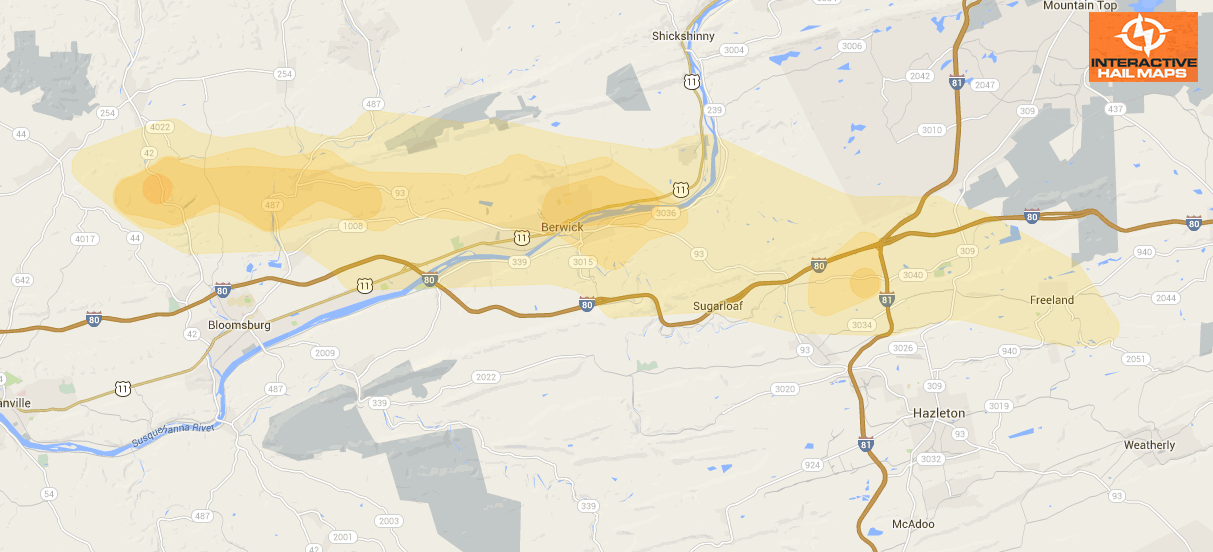
Here is a map for a hail storm that hit Berwick, PA on July 26, 2012. The green marker is a 1.00″ hail report. Use Interactive Hail Maps to pinpoint hail locations live. Find the smaller hail storms others are missing. Subscribe to Interactive Hail Maps to receive unlimited hail maps nationwide.
Cities Most Affected by Hail Storms of 7/26/2012
| Hail Size | Demographics of Zip Codes Affected | ||||||
|---|---|---|---|---|---|---|---|
| City | Count | Average | Largest | Pop Density | House Value | Income | Age |
| Dayton, OH | 1 | 2.00 | 2.00 | 973 | $98k | $37.5k | 40.6 |
| Vandalia, OH | 1 | 2.00 | 2.00 | 691 | $117k | $45.6k | 41.9 |
| Birnamwood, WI | 1 | 1.75 | 1.75 | 25 | $70k | $39.9k | 40.7 |
| Red Oak, IA | 1 | 1.75 | 1.75 | 41 | $61k | $33.0k | 43.9 |
| Alma, AR | 1 | 1.75 | 1.75 | 144 | $81k | $33.9k | 36.7 |
| Howe, OK | 1 | 1.75 | 1.75 | 38 | $54k | $28.3k | 37.8 |

Connect with Interactive Hail Maps