

Hail Map Northern Suburbs of Louisville, KY July 24, 2012
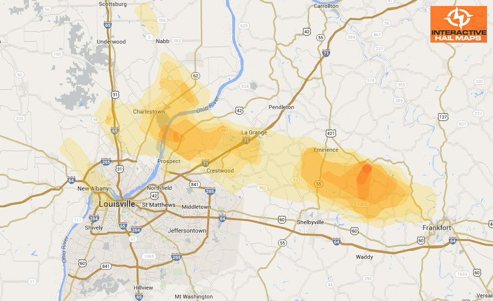
Here is the hail map of the hail storm that hit just north of Louisville, KY on July 24, 2012. There were several reports of hail ranging from 1.00″ to 1.75″. Use Interactive Hail Maps to pinpoint hail nationwide and zoom all the way to street view to see neighborhoods affected.
Cities Most Affected by Hail Storms of 7/24/2012
| Hail Size | Demographics of Zip Codes Affected | ||||||
|---|---|---|---|---|---|---|---|
| City | Count | Average | Largest | Pop Density | House Value | Income | Age |
| La Grange, KY | 1 | 1.75 | 1.75 | 294 | $140k | $54.9k | 38.5 |
| Scituate, MA | 1 | 1.75 | 1.75 | 1101 | $276k | $71.1k | 44.9 |
| Goshen, KY | 1 | 1.75 | 1.75 | 177 | $156k | $78.1k | 38.6 |

Connect with Interactive Hail Maps