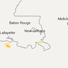
Hail Map for Wednesday, April 13, 2016

Number of Impacted Households on 4/13/2016
0
Impacted by 1" or Larger Hail
0
Impacted by 1.75" or Larger Hail
0
Impacted by 2.5" or Larger Hail
Square Miles of Populated Area Impacted on 4/13/2016
0
Impacted by 1" or Larger Hail
0
Impacted by 1.75" or Larger Hail
0
Impacted by 2.5" or Larger Hail
Regions Impacted by Hail on 4/13/2016
Cities Most Affected by Hail Storms of 4/13/2016
| Hail Size | Demographics of Zip Codes Affected | ||||||
|---|---|---|---|---|---|---|---|
| City | Count | Average | Largest | Pop Density | House Value | Income | Age |
Hail and Wind Damage Spotted on 4/13/2016
Filter by Report Type:Hail ReportsWind Reports
States Impacted
LouisianaLouisiana
| Local Time | Report Details |
|---|---|
| 10:01 AM CDT | 4 utility poles knocked down and a fema trailer blown over in west pointe a la hache. probable tornad in plaquemines county LA, 31.3 miles SSE of New Orleans, LA |
| 11:06 AM CDT | 50 knot/58 mph wind gust measured at pilots station east at southwest pass /pstl1 in plaquemines county LA, 81.2 miles SSE of New Orleans, LA |


Connect with Interactive Hail Maps