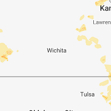
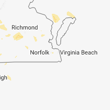
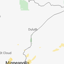
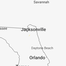
Hail Map for Thursday, August 30, 2018

Number of Impacted Households on 8/30/2018
0
Impacted by 1" or Larger Hail
0
Impacted by 1.75" or Larger Hail
0
Impacted by 2.5" or Larger Hail
Square Miles of Populated Area Impacted on 8/30/2018
0
Impacted by 1" or Larger Hail
0
Impacted by 1.75" or Larger Hail
0
Impacted by 2.5" or Larger Hail
Regions Impacted by Hail on 8/30/2018
Cities Most Affected by Hail Storms of 8/30/2018
| Hail Size | Demographics of Zip Codes Affected | ||||||
|---|---|---|---|---|---|---|---|
| City | Count | Average | Largest | Pop Density | House Value | Income | Age |
| Clever, MO | 2 | 1.75 | 1.75 | 105 | $83k | $34.1k | 33.8 |
Hail and Wind Damage Spotted on 8/30/2018
Filter by Report Type:Hail ReportsWind Reports
States Impacted
Missouri, Florida, North Carolina, Tennessee, Virginia, Oklahoma, Georgia, Arkansas, Minnesota, Kansas, Wisconsin, IowaMissouri
| Local Time | Report Details |
|---|---|
| 7:25 AM CDT | Golf Ball sized hail reported near Clever, MO, 18 miles SSW of Springfield, MO, corrects time on previous hail report from 4 s boaz. report of golf ball size hail in hootontown by a bus driver. time estimated based on radar. |
| 7:37 AM CDT | Golf Ball sized hail reported near Clever, MO, 18 miles SSW of Springfield, MO, report of golf ball size hail in hootontown by a bus driver. |
| 10:55 AM CDT | Quarter sized hail reported near Springfield, MO, 3.3 miles NNE of Springfield, MO, 1 inch hail reported 4 nne of springfield. between chestnut and mm hwy exit on i44. |
Florida
| Local Time | Report Details |
|---|---|
| 2:29 PM EDT | 911 call center reported a roadway blocked by a downed tree at 7578 county road 121. time estimated by rada in nassau county FL, 22 miles W of Jacksonville, FL |
| 3:02 PM EDT | 911 call center reported a tree fell on a power line and caused a small fire at 43000 thomas creek road. time estimated by rada in nassau county FL, 15.5 miles NW of Jacksonville, FL |
North Carolina
| Local Time | Report Details |
|---|---|
| 3:00 PM EDT | 911 call center reported a few trees down in waynesvill in haywood county NC, 50.5 miles NNW of Greenville, SC |
| 3:00 PM EDT | County official reported trees and powerlines down on hazelwood av in haywood county NC, 50.8 miles NNW of Greenville, SC |
| 3:00 PM EDT | County official reported trees down on pine d in haywood county NC, 51 miles NNW of Greenville, SC |
| 3:00 PM EDT | County official reported trees down on elysinia av in haywood county NC, 50.4 miles NNW of Greenville, SC |
| 3:07 PM EDT | 911 call center reported trees down to the south of burnsville. time estimated from rada in yancey county NC, 50.6 miles S of Bristol, TN |
| 4:02 PM EDT | Quarter sized hail reported near Lansing, NC, 37.3 miles E of Bristol, TN |
| 5:42 PM EDT | Emergency mngr reported multiple trees down and minor damage to a trailer on brent haigler rd. time estimated from rada in union county NC, 17 miles ESE of Charlotte, NC |
| 5:54 PM EDT | Tree down on traphill rd. time radar estimate in wilkes county NC, 65.8 miles ESE of Bristol, TN |
| 5:55 PM EDT | Tree down on maple grove church road. time estimated by rada in wilkes county NC, 66.3 miles ESE of Bristol, TN |
| 6:18 PM EDT | Tree down on antioch church rd. time radar estimated in wilkes county NC, 66.2 miles N of Charlotte, NC |
| 10:10 PM EDT | Trained spotter reported a tree down blocking us-29. time estimated from rada in rowan county NC, 28.3 miles NNE of Charlotte, NC |
Tennessee
| Local Time | Report Details |
|---|---|
| 4:00 PM EDT | Tree fell on a house on bear hollow rd in carter county TN, 17.4 miles S of Bristol, TN |
| 4:42 PM CDT | Trees down including one on power lines near highway 70 and highway 10 in wilson county TN, 19.4 miles ENE of Nashville, TN |
| 5:25 PM CDT | A small tree was blown down and small hail was observe in davidson county TN, 11.2 miles NNE of Nashville, TN |
| 5:35 PM CDT | Power lines were blown down and a tree fell on a house in gallatin... reported by gallatin f in sumner county TN, 23.5 miles NE of Nashville, TN |
| 5:59 PM CDT | Trees down northwest of ashland cit in cheatham county TN, 21.3 miles WNW of Nashville, TN |
Virginia
| Local Time | Report Details |
|---|---|
| 4:25 PM EDT | Tree down near the intersection of blenheim road and secretarys roa in albemarle county VA, 53.5 miles WNW of Richmond, VA |
| 4:29 PM EDT | Tree down in the 2100 block of old lynchburg roa in albemarle county VA, 59 miles WNW of Richmond, VA |
| 4:34 PM EDT | Tree down in the 6100 block of blenheim roa in albemarle county VA, 52.9 miles WNW of Richmond, VA |
| 4:40 PM EDT | Tree down at the intersection of power dam road and mcgaheysville roa in rockingham county VA, 70.5 miles ESE of Elkins, WV |
| 4:40 PM EDT | Tree down on augusta ave near grotto town limi in rockingham county VA, 71.9 miles SE of Elkins, WV |
| 5:10 PM EDT | Multiple trees down along patterson mill roa in augusta county VA, 72.2 miles SE of Elkins, WV |
| 5:15 PM EDT | Tree down at the intersection of power dam road and mcgaheysville roa in rockingham county VA, 70.5 miles ESE of Elkins, WV |
| 5:15 PM EDT | Trees and fences blown down near the intersection of us-340 eastside highway and stull run lan in augusta county VA, 72.4 miles SE of Elkins, WV |
| 5:24 PM EDT | Large branch downed about the size of a wrist on hether drive in blacksburg. time radar estimate in montgomery county VA, 28.3 miles W of Roanoke, VA |
| 5:38 PM EDT | One tree dow in amherst county VA, 50.9 miles ENE of Roanoke, VA |
| 5:38 PM EDT | Tree dow in amherst county VA, 48.6 miles ENE of Roanoke, VA |
| 6:11 PM EDT | One tree dow in amherst county VA, 48.7 miles ENE of Roanoke, VA |
| 7:13 PM EDT | Two trees fallen on home in franklin county VA, 24.5 miles S of Roanoke, VA |
| 7:13 PM EDT | Trees dow in franklin county VA, 24.6 miles S of Roanoke, VA |
| 7:29 PM EDT | One tree down on well water roa in buckingham county VA, 50.1 miles WNW of Richmond, VA |
| 7:31 PM EDT | One tree down on white rock roa in buckingham county VA, 50.1 miles WNW of Richmond, VA |
| 7:34 PM EDT | One tree dow in buckingham county VA, 42.1 miles WNW of Richmond, VA |
| 7:53 PM EDT | Tree down on smith mountain rd near gretna rd in pittsylvania county VA, 28.4 miles SE of Roanoke, VA |
| 7:55 PM EDT | Two trees down on rockcreek rd near gretna rd in pittsylvania county VA, 29.7 miles SE of Roanoke, VA |
| 8:20 PM EDT | Trees down on moseley rd. just east of the powhatan/chesterfield county lin in chesterfield county VA, 7.4 miles WSW of Richmond, VA |
| 8:25 PM EDT | Trees downed at fordham rd and hull street road in chesterfiel in chesterfield county VA, 5.8 miles SE of Richmond, VA |
Oklahoma
| Local Time | Report Details |
|---|---|
| 4:58 PM CDT | Trees down on power lines at welling road and 551 road. time is radar esitmate in cherokee county OK, 47.4 miles NW of Fort Smith, AR |
| 4:58 PM CDT | Trees down on power lines on beaverson road just east of n 520 road. time is radar estimate in cherokee county OK, 48.3 miles NW of Fort Smith, AR |
| 4:58 PM CDT | Trees down on highway 51 east of hulbert. time is radar estimate in cherokee county OK, 51.2 miles ESE of Tulsa, OK |
Georgia
| Local Time | Report Details |
|---|---|
| 6:34 PM EDT | Two trees reported down at the 700 block of salem rd. one tree also brought down powerlines as it fel in fannin county GA, 57.1 miles E of Chattanooga, TN |
| 9:00 PM EDT | Power lines reported down at the intersection of hwy 52 and hwy 22 in murray county GA, 34.1 miles SE of Chattanooga, TN |
Arkansas
| Local Time | Report Details |
|---|---|
| 6:26 PM CDT | 1 inch tree limbs down one west of fort smith regional airport. time is radar estimate in sebastian county AR, 0.4 miles N of Fort Smith, AR |
| 7:30 PM CDT | Several trees were blown dow in scott county AR, 38.3 miles SSE of Fort Smith, AR |
| 8:55 PM CDT | Trees were blown dow in montgomery county AR, 43.8 miles NNE of Nashville, AR |
| 9:10 PM CDT | Trees were blown down along highway 27 south about 1/4 mile outside of norma in montgomery county AR, 36.6 miles NNE of Nashville, AR |
Minnesota
| Local Time | Report Details |
|---|---|
| 2:30 AM CDT | Half Dollar sized hail reported near Big Lake, MN, 33.8 miles NW of Minneapolis, MN, social media picture of large hail near big lake. |
Kansas
| Local Time | Report Details |
|---|---|
| 2:30 AM CDT | Quarter sized hail reported near Lancaster, KS, 50.1 miles NW of Kansas City, MO, delayed report: report on twitter of a lot of quarter or greater sized hail in lancaster. |
| 3:03 AM CDT | Quarter sized hail reported near Atchison, KS, 44.4 miles NW of Kansas City, MO, delayed report: report on twitter of quarter sized hail in atchison... ks. timing estimated by radar. |
Wisconsin
| Local Time | Report Details |
|---|---|
| 3:40 AM CDT | Ping Pong Ball sized hail reported near Deer Park, WI, 47.7 miles ENE of Minneapolis, MN |
| 3:56 AM CDT | Quarter sized hail reported near Mercer, WI, 48.1 miles NW of Rhinelander, WI |
Iowa
| Local Time | Report Details |
|---|---|
| 4:15 AM CDT | Quarter sized hail reported near Bedford, IA, 75.7 miles ESE of Omaha, NE, heavy rain also fell. 1.2 inches of rain from the thunderstorm fell in 30 minutes. |


Connect with Interactive Hail Maps