Hail Map for Friday, July 10, 2015

Number of Impacted Households on 7/10/2015
0
Impacted by 1" or Larger Hail
0
Impacted by 1.75" or Larger Hail
0
Impacted by 2.5" or Larger Hail
Square Miles of Populated Area Impacted on 7/10/2015
0
Impacted by 1" or Larger Hail
0
Impacted by 1.75" or Larger Hail
0
Impacted by 2.5" or Larger Hail
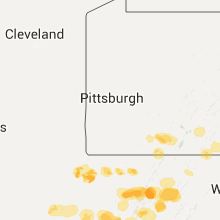
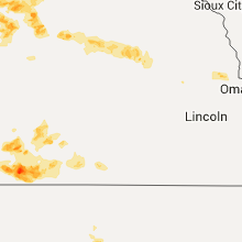
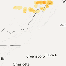
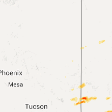
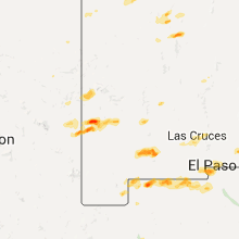
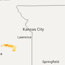
Regions Impacted by Hail on 7/10/2015
Cities Most Affected by Hail Storms of 7/10/2015
| Hail Size | Demographics of Zip Codes Affected | ||||||
|---|---|---|---|---|---|---|---|
| City | Count | Average | Largest | Pop Density | House Value | Income | Age |
| Mc Cook, NE | 1 | 1.75 | 1.75 | 21 | $63k | $32.2k | 40.9 |
| Maywood, NE | 1 | 1.75 | 1.75 | 2 | $53k | $31.5k | 43.6 |
Hail and Wind Damage Spotted on 7/10/2015
Filter by Report Type:Hail ReportsWind Reports
States Impacted
Kentucky, New Mexico, Kansas, West Virginia, Georgia, Alabama, Arizona, Florida, Washington, Texas, NebraskaKentucky
| Local Time | Report Details |
|---|---|
| 9:05 AM CDT | Large tree reported down on ky highway 1401 in breckinridge county KY, 40.6 miles WSW of Louisville, KY |
| 9:05 AM CDT | Large tree down on ky highway 1073 in breckinridge county KY, 38 miles WSW of Louisville, KY |
| 10:40 AM EDT | Trees down on 6th avenue in fort kno in hardin county KY, 14.4 miles WSW of Louisville, KY |
| 10:40 AM EDT | Large trees uprooted for several hundred yards along wilson roa in hardin county KY, 14.7 miles WSW of Louisville, KY |
| 10:50 AM EDT | Trees on railroad tracks near belmon in bullitt county KY, 8.2 miles S of Louisville, KY |
| 10:51 AM EDT | Damage to roofs and fences in shepherdsvill in bullitt county KY, 0.4 miles ENE of Louisville, KY |
| 10:51 AM EDT | Trees down along highway 6 in bullitt county KY, 2.4 miles NNE of Louisville, KY |
| 10:54 AM EDT | Trees down... and roof blown off barn. funnel cloud seen at the tim in bullitt county KY, 6.7 miles S of Louisville, KY |
| 11:09 AM EDT | Roof off a house on 31e between bardstown and coxs cree in nelson county KY, 15.7 miles ESE of Louisville, KY |
| 11:40 AM EDT | Reports of trees down across roadways around the county and city of lawrenceburg... k in anderson county KY, 45.2 miles E of Louisville, KY |
| 11:55 AM EDT | Large limbs down on highway 62 east of versailles. limb diameter 8 inches or mor in woodford county KY, 48.8 miles NW of Irvine, KY |
| 12:06 PM EDT | Power lines down - hanging about 6' above roa in franklin county KY, 53.3 miles ENE of Louisville, KY |
| 12:10 PM EDT | Tree down on a home on woodward lane. tree also took down some power line in fayette county KY, 33.7 miles NW of Irvine, KY |
| 12:10 PM EDT | Trees dow in mercer county KY, 43.2 miles W of Irvine, KY |
| 12:10 PM EDT | Numerous trees down on the north side of lexington. a power line down on newtown pike. in the 1000 block of mclean... a 9 inch branch fell on a vehicl in fayette county KY, 38.4 miles NW of Irvine, KY |
| 12:10 PM EDT | Leestown road closed due to downed electrical pole in fayette county KY, 42.7 miles NW of Irvine, KY |
| 12:11 PM EDT | Few trees down in the northern part of woodford county. tree across shore acres road. limbs down in southern part of the count in woodford county KY, 47.7 miles ENE of Louisville, KY |
| 12:13 PM EDT | Numerous trees down across the count in woodford county KY, 47.8 miles WNW of Irvine, KY |
| 12:17 PM EDT | Tree down on car on oxford r in scott county KY, 47.7 miles NW of Irvine, KY |
| 12:20 PM EDT | Trees down on catnip hill road. also trees down on mackie pik in jessamine county KY, 37 miles WNW of Irvine, KY |
| 12:45 PM EDT | Power lines down in the city of winchester. trees down out in the county in clark county KY, 22.9 miles NNW of Irvine, KY |
| 12:46 PM EDT | Ky hwy 15 at the powell/clark county line closed due to fallen trees and power lines. the road is expected to be closed for several hour in clark county KY, 15.9 miles N of Irvine, KY |
| 12:47 PM EDT | Tree and power line down in backyard of residence located on devonne drive in montgomery county KY, 24.9 miles N of Irvine, KY |
| 12:52 PM EDT | Mountain parkway eastbound between mile markers 11 and 12 closed due to fallen tree in powell county KY, 15.2 miles N of Irvine, KY |
| 12:54 PM EDT | Tree down on old winchester road and winchester roa in powell county KY, 14.5 miles N of Irvine, KY |
| 12:57 PM EDT | Tree blocking 713 at 9400 spencer road in montgomery county KY, 24.7 miles NNE of Irvine, KY |
| 1:00 PM EDT | 8-10 trees down at hope hill childrens hom in montgomery county KY, 24.7 miles NNE of Irvine, KY |
| 1:06 PM EDT | Tree down on lower hatcher creek roa in powell county KY, 13.9 miles NNE of Irvine, KY |
| 1:06 PM EDT | Tree down on upper cane creek roa in powell county KY, 16.9 miles NE of Irvine, KY |
| 1:09 PM EDT | Small tree dow in powell county KY, 13.2 miles NE of Irvine, KY |
| 1:11 PM EDT | Small tree dow in powell county KY, 12.1 miles NNE of Irvine, KY |
| 1:27 PM EDT | Tree blocking highway 772 on carpenter branc in morgan county KY, 37.8 miles ENE of Irvine, KY |
| 1:35 PM EDT | Tree fell across phone line on highway 20 in morgan county KY, 34.9 miles ENE of Irvine, KY |
| 1:41 PM EDT | Shingle damage and large limbs dow in morgan county KY, 41.2 miles ENE of Irvine, KY |
| 1:48 PM EDT | Tree downed across ky 65 in elliott county KY, 53.9 miles ENE of Irvine, KY |
| 1:51 PM EDT | Tree downed on porch in elliott county KY, 56.6 miles ENE of Irvine, KY |
| 2:10 PM EDT | One tree down in blane from non-severe wind gust... time estimated from rada in lawrence county KY, 65.6 miles ENE of Irvine, KY |
| 1:10 PM CDT | Trees down on highway 31 in hart county KY, 47.9 miles SSW of Louisville, KY |
| 2:13 PM EDT | Several trees down in the cit in taylor county KY, 48.4 miles SSE of Louisville, KY |
| 2:40 PM EDT | A six inch diameter tree limb down near highway 55... not blocking the roadwa in taylor county KY, 51.3 miles SSE of Louisville, KY |
| 2:40 PM EDT | Tree downed across copper creek and metal building turned on sid in rockcastle county KY, 29.9 miles SW of Irvine, KY |
| 3:25 PM EDT | Multiple trees down. near cherryville in lawrence county KY, 57.9 miles WSW of Charleston, WV |
| 2:30 PM CDT | A large piece of a tree was split and branches were down near the wnky studio in warren county KY, 57.8 miles NNE of Nashville, TN |
| 3:36 PM EDT | Large tree limb had fallen on bardstown road north of hodgenvill in larue county KY, 28.1 miles S of Louisville, KY |
| 3:38 PM EDT | Several trees down across the city in larue county KY, 28.8 miles S of Louisville, KY |
| 4:30 PM CDT | Downed tree blocking jones mill road near hwy 55 in clinton county KY, 85.2 miles SW of Irvine, KY |
New Mexico
| Local Time | Report Details |
|---|---|
| 1:15 PM MDT | Quarter sized hail reported near Deming, NM, 52.4 miles SE of Silver City, NM, also reports strong winds and intense rain |
| 1:23 PM MDT | Quarter sized hail reported near Deming, NM, 46.6 miles SE of Silver City, NM, emergency manager reported quarter size hail in the city of deming. |
| 1:25 PM MDT | Photo of large tree blown over in deming from kvia facebook pag in luna county NM, 46.6 miles SE of Silver City, NM |
| 1:26 PM MDT | Quarter sized hail reported near Deming, NM, 50.9 miles SE of Silver City, NM, trained spotter reported quarter size hail. |
| 1:29 PM MDT | Quarter sized hail reported near Deming, NM, 52.4 miles SE of Silver City, NM, also reports strong winds and intense rain |
| 4:15 PM MDT | Big limbs off trees in grant county NM, 26.9 miles W of Silver City, NM |
| 4:49 PM MDT | Very heavy rain - penny sized hail in dona ana county NM, 14.7 miles WNW of El Paso, TX |
Kansas
| Local Time | Report Details |
|---|---|
| 2:17 PM CDT | Semi blown over in elmdal in chase county KS, 56 miles S of Manhattan, KS |
| 2:39 PM CDT | Quarter sized hail reported near Cottonwood Falls, KS, 55.8 miles S of Manhattan, KS, pea to quarter hail. |
| 4:45 PM CDT | Estimated 60 mph winds and pea sized hail in coffey county KS, 47.4 miles NW of Chanute, KS |
| 4:46 PM CDT | Reports of minor roof damage to a building in coffey county KS, 50.8 miles NNW of Chanute, KS |
| 4:48 PM CDT | Tree uprooted and damage to a farmstead including broken windows in lyon county KS, 51.7 miles NNW of Chanute, KS |
| 4:50 PM CDT | Trees and power pole down at intersection of road 80 and road in lyon county KS, 51.8 miles NW of Chanute, KS |
West Virginia
| Local Time | Report Details |
|---|---|
| 3:30 PM EDT | Multiple 6 inch tree limbs down in yard on 6 mile road in boone city... winds estimated 60-70mph in boone county WV, 28.1 miles SSW of Charleston, WV |
Georgia
| Local Time | Report Details |
|---|---|
| 3:50 PM EDT | A johnson county official reported a few trees down in the northeast part of the count in johnson county GA, 58.2 miles SSW of Augusta, GA |
| 3:53 PM EDT | The laurens county 911 center reported one tree down along old hawkinsville roa in laurens county GA, 75.6 miles N of Douglas, GA |
| 3:58 PM EDT | 911 call center received report of trees down near hogansville rd and patillo rd...hines rd...whitesville st in the 400 block...and on interstate 185 at interstate 8 in troup county GA, 46 miles NE of Auburn, AL |
| 4:06 PM EDT | Tree down on interstate 95 northbound near mile marker 79 in liberty county GA, 23.9 miles SW of Savannah, GA |
| 4:27 PM EDT | Broadcast meteorologist received report from public of trees down in bibb and jones counties...mostly along graham road. heaviest tree damage was across jones count in bibb county GA, 76.8 miles SE of Atlanta, GA |
| 4:40 PM EDT | The twiggs county 911 center reported two trees down along bullard roa in twiggs county GA, 86.5 miles NNW of Douglas, GA |
| 5:30 PM EDT | Amateur radio operator reported a large tree limb over the road at highway 18 near lee king road and another tree down on highway 87 near mile marker 1 in monroe county GA, 56 miles SSE of Atlanta, GA |
| 6:55 PM EDT | The telfair county 911 center reported two trees down along industrial blvd and oak stree in telfair county GA, 38.2 miles N of Douglas, GA |
Alabama
| Local Time | Report Details |
|---|---|
| 3:56 PM CDT | A few sporadic trees down winds estimated around 45 mp in jefferson county AL, 4.2 miles S of Birmingham, AL |
Arizona
| Local Time | Report Details |
|---|---|
| 2:55 PM MST | Power pole down in greenlee county AZ, 47.3 miles W of Silver City, NM |
Florida
| Local Time | Report Details |
|---|---|
| 6:30 PM EDT | Tree limbs downed near 3000 sw 35th place. time is approximat in alachua county FL, 65.1 miles SW of Jacksonville, FL |
Washington
| Local Time | Report Details |
|---|---|
| 4:00 PM PDT | Picture of downed tree on twitter. time estimate in whitman county WA, 37.2 miles SSE of Spokane, WA |
Texas
| Local Time | Report Details |
|---|---|
| 5:09 PM MDT | Quarter sized hail reported near El Paso, TX, 11.2 miles NW of El Paso, TX, quarter size hail reported near canutillo high school. |
| 5:20 PM MDT | Quarter sized hail reported near El Paso, TX, 9.1 miles NNW of El Paso, TX, over 1.25 inches of rain in 20 min also |
| 5:22 PM MDT | Quarter sized hail reported near El Paso, TX, 9.4 miles NW of El Paso, TX, quarter size hail near helen of troy and resler in nw el paso. also 8 tenths of an inch of rain in 10 minutes. |
Nebraska
| Local Time | Report Details |
|---|---|
| 6:25 PM CDT | Quarter sized hail reported near Mc Cook, NE, 43.9 miles S of North Platte, NE |
| 6:45 PM CDT | Quarter sized hail reported near Valentine, NE, 15.1 miles SSW of Valentine, NE |
| 6:45 PM CDT | Storm damage reported in cherry county NE, 15.1 miles SSW of Valentine, NE |
| 7:26 PM CDT | Half Dollar sized hail reported near Curtis, NE, 46.5 miles SSE of North Platte, NE |
| 7:32 PM CDT | Storm damage reported in cherry county NE, 18.9 miles SSE of Valentine, NE |
| 7:33 PM CDT | Quarter sized hail reported near Curtis, NE, 44.7 miles SSE of North Platte, NE, also estimated winds at 40 to 50 mph. |
| 8:25 PM CDT | Golf Ball sized hail reported near Maywood, NE, 35.8 miles SSE of North Platte, NE |
| 8:39 PM CDT | Estimated 50-60 mph in hitchcock county NE, 58.5 miles N of Colby, KS |
| 8:40 PM CDT | Location...fair grounds... barn had siding and extreme roof damage... power pole down in hitchcock county NE, 58.5 miles N of Colby, KS |
| 8:59 PM CDT | Quarter sized hail reported near Mc Cook, NE, 59.8 miles NNE of Colby, KS, mostly pea sized hail but some up to quarter size. hail was increasing in size at call time. |
| 9:05 PM CDT | Quarter sized hail reported near Mc Cook, NE, 57.1 miles NNE of Colby, KS, ongoing at time of call. mix of nickel and quarter hail |
| 9:10 PM CDT | Golf Ball sized hail reported near Mc Cook, NE, 57.3 miles NNE of Colby, KS, nickel and quarter hail fell prior to the golf ball... a lot of golfball hail fell |
| 9:40 PM CDT | Quarter sized hail reported near Indianola, NE, 59.4 miles NNE of Colby, KS, hail now up to quarter size...possibly half dollar. very heavy rain and strong wind gusts. |








Connect with Interactive Hail Maps