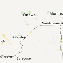
Hail Map for Monday, July 18, 2011

Number of Impacted Households on 7/18/2011
0
Impacted by 1" or Larger Hail
0
Impacted by 1.75" or Larger Hail
0
Impacted by 2.5" or Larger Hail
Square Miles of Populated Area Impacted on 7/18/2011
0
Impacted by 1" or Larger Hail
0
Impacted by 1.75" or Larger Hail
0
Impacted by 2.5" or Larger Hail
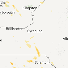
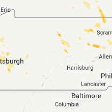
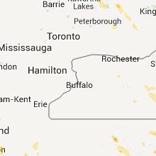
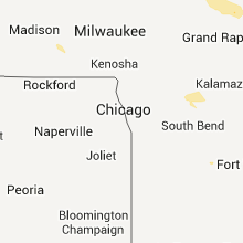
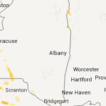
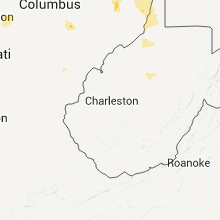
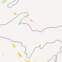
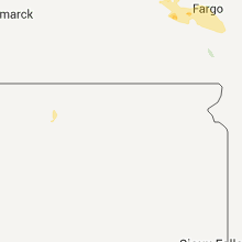
Regions Impacted by Hail on 7/18/2011
Cities Most Affected by Hail Storms of 7/18/2011
| Hail Size | Demographics of Zip Codes Affected | ||||||
|---|---|---|---|---|---|---|---|
| City | Count | Average | Largest | Pop Density | House Value | Income | Age |
| Binghamton, NY | 2 | 1.75 | 1.75 | 467 | $73k | $37.6k | 40.4 |
| Arcadia, WI | 1 | 1.75 | 1.75 | 34 | $74k | $36.7k | 37.1 |
| Hettinger, ND | 1 | 1.75 | 1.75 | 2 | $42k | $29.8k | 49.3 |
Hail and Wind Damage Spotted on 7/18/2011
Filter by Report Type:Hail ReportsWind Reports
States Impacted
Wisconsin, Massachusetts, Pennsylvania, Michigan, Ohio, Vermont, South Dakota, West Virginia, New York, North Dakota, Colorado, Montana, MinnesotaWisconsin
| Local Time | Report Details |
|---|---|
| 12:50 PM UTC | A couple of trees dow in wood county WI, 81.1 miles ENE of La Crosse, WI |
| 1:05 PM UTC | A few trees dow in portage county WI, 75.3 miles W of Green Bay, WI |
| 1:15 PM UTC | 2 ft diameter tree blown onto hous in portage county WI, 76.6 miles W of Green Bay, WI |
| 1:19 PM UTC | Numerous trees down across the cit in jackson county WI, 31.4 miles NNE of La Crosse, WI |
| 1:22 PM UTC | Also brief period of pea size hail. 0.78 inch rainfall in 30 minute in portage county WI, 75.3 miles W of Green Bay, WI |
| 1:43 PM UTC | Numerous trees down on highways k and e south of the city of waupac in waupaca county WI, 54 miles WSW of Green Bay, WI |
| 1:45 PM UTC | Tree down on a tent at twin lakes campground. no injurie in waupaca county WI, 57.5 miles WSW of Green Bay, WI |
| 2:05 PM UTC | A few big trees down which blocked a road in frankli in jackson county WI, 28.3 miles NNE of La Crosse, WI |
| 2:05 PM UTC | 18 inch diameter tree down on murphy road in jackson county WI, 32.7 miles NE of La Crosse, WI |
| 2:06 PM UTC | Golf Ball sized hail reported near Arcadia, WI, 30.6 miles N of La Crosse, WI, golf ball sized hail halfway between arcadia and blair |
| 2:18 PM UTC | Damage to bui in winnebago county WI, 32.5 miles SW of Green Bay, WI |
| 2:18 PM UTC | Update...several campler trailers flipped at campground near highways 76 and 10 by thunderstorm winds. time estimate in winnebago county WI, 32.5 miles SW of Green Bay, WI |
| 2:25 PM UTC | Near ballard and jj...power lines in trees and blown transforme in outagamie county WI, 25.6 miles SW of Green Bay, WI |
| 2:25 PM UTC | Barn and shed damaged on amber road. numerous trees down in same are in monroe county WI, 33.2 miles NE of La Crosse, WI |
| 2:30 PM UTC | Several power lines down in green bay and de pere. tree fell onto house in ashwaubenon. time estimate in brown county WI, 0.5 miles ESE of Green Bay, WI |
| 2:45 PM UTC | Numerous trees between 6 and 24 inches in diameter uprooted along amber rd. large barn shifted approx 10 inches off foundation and roof blown off at diary far in monroe county WI, 34.2 miles NE of La Crosse, WI |
| 11:05 PM UTC | 12 inch diameter tree limb down county road w. time estimate in waupaca county WI, 39.2 miles WSW of Green Bay, WI |
| 11:15 PM UTC | Quarter sized hail reported near New London, WI, 41.1 miles WSW of Green Bay, WI |
| 12:25 AM UTC | Building in brandon area sustained wind damage. sheet metal was blown through the air. time is estimated based on rada in fond du lac county WI, 55.3 miles NNE of Madison, WI |
Massachusetts
| Local Time | Report Details |
|---|---|
| 4:06 PM UTC | Tree down on a car on main street. winds estimated at 45 mph based on a report from eastern point light in glouceste in essex county MA, 70.2 miles SSW of Portland, ME |
| 9:20 PM UTC | Tree down on car on sandwich road and tree down on house on perry av in plymouth county MA, 36.1 miles E of Providence, RI |
| 9:32 PM UTC | Kayak turned over off sagamore beach with person needing to be rescued in barnstable county MA, 45.7 miles E of Providence, RI |
Pennsylvania
| Local Time | Report Details |
|---|---|
| 4:08 PM UTC | Storm damage reported in crawford county PA, 80.5 miles E of Cleveland, OH |
| 4:20 PM UTC | Trees and power lines dow in crawford county PA, 80.5 miles E of Cleveland, OH |
| 5:05 PM UTC | Large tree reported down on power-lines in venango county PA, 62.4 miles N of Pittsburgh, PA |
| 7:20 PM UTC | Trees and utility pole down in butler county PA, 26.4 miles N of Pittsburgh, PA |
| 7:30 PM UTC | Trees and power lines down in butler county PA, 25.7 miles N of Pittsburgh, PA |
| 10:08 PM UTC | Trees across road at route 437 and church road in luzerne county PA, 23 miles SSW of Scranton, PA |
| 10:20 PM UTC | Trees down in luzerne county PA, 19.5 miles W of Scranton, PA |
| 10:25 PM UTC | Several trees down in perry county PA, 51.4 miles ESE of State College, PA |
| 10:43 PM UTC | Tree down in kidder townshi in carbon county PA, 24.4 miles S of Scranton, PA |
| 10:45 PM UTC | Duquense light reported downed trees and wires in baldwin... findley... leet... liberty... port vue... and moo in allegheny county PA, 6.8 miles S of Pittsburgh, PA |
| 10:51 PM UTC | Power line down in middle paxton townshi in dauphin county PA, 61.3 miles ESE of State College, PA |
| 11:00 PM UTC | Tree down in susquehanna township in dauphin county PA, 60 miles ESE of State College, PA |
| 11:03 PM UTC | Tree down in lower paxton township in dauphin county PA, 67.5 miles ESE of State College, PA |
| 11:12 PM UTC | Tree down on house in henryville area. no injuries reporte in monroe county PA, 29.1 miles SE of Scranton, PA |
| 11:15 PM UTC | Trees down in bradford county PA, 35.9 miles WNW of Scranton, PA |
| 11:35 PM UTC | Couple of trees down on ginger hill road in washington county PA, 13 miles S of Pittsburgh, PA |
| 7:00 AM UTC | Barn damage - numerous trees down in susquehanna county PA, 32.5 miles NW of Scranton, PA |
| 7:00 AM UTC | Barn damage on state route 267. pieces of the barn blown into the road. trees and wires also down at this location. trees also down on state route 858...keech hill road in susquehanna county PA, 32.5 miles NW of Scranton, PA |
Michigan
| Local Time | Report Details |
|---|---|
| 5:36 PM UTC | Trees down in montcalm county MI, 41.4 miles NE of Grand Rapids, MI |
| 7:00 PM UTC | Wires down on marrow roa in washtenaw county MI, 48 miles SSW of Flint, MI |
| 7:12 PM UTC | Tree down across roa in washtenaw county MI, 42.2 miles S of Flint, MI |
| 7:12 PM UTC | A flag pole was bent in genesee county MI, 10.8 miles SW of Flint, MI |
| 7:16 PM UTC | Numerous trees and powerlines down throughout the are in livingston county MI, 31.1 miles SW of Flint, MI |
| 7:16 PM UTC | Tree down in yar in livingston county MI, 31.8 miles S of Flint, MI |
| 7:20 PM UTC | Large in lenawee county MI, 70.8 miles S of Flint, MI |
| 7:25 PM UTC | 28 inch tree down which took down powerlines in washtenaw county MI, 40.9 miles S of Flint, MI |
| 7:29 PM UTC | Numerous trees and powerlines down throughout the are in livingston county MI, 30.5 miles SSW of Flint, MI |
| 7:30 PM UTC | Tree branches 4 to 6 inches in diameter blown down over a 5 mile stretch. winds estimated 40 to 50 mp in lapeer county MI, 29.3 miles ENE of Flint, MI |
| 7:33 PM UTC | Dozens of trees and powerlines down across the are in monroe county MI, 73.4 miles S of Flint, MI |
| 7:33 PM UTC | Tree down 24 inches in diameter in monroe county MI, 73.6 miles SSE of Flint, MI |
| 7:34 PM UTC | Two trees blown dow in oakland county MI, 14.9 miles SSE of Flint, MI |
| 7:38 PM UTC | Dozens of trees and powerlines down across the are in monroe county MI, 75.4 miles SSE of Flint, MI |
| 7:40 PM UTC | Numerous trees and powerlines down throughout the are in livingston county MI, 33.5 miles S of Flint, MI |
| 7:45 PM UTC | Tree down on teggerdine roa in oakland county MI, 26.8 miles SSE of Flint, MI |
| 9:44 PM UTC | Mesonet site kmihasle3 recorded a 59 mph wind gust when the storms tracked throug in ingham county MI, 40.2 miles WSW of Flint, MI |
| 10:58 PM UTC | Six inch tree limb on bull run road in livingston county MI, 39.7 miles SSW of Flint, MI |
| 11:23 PM UTC | Several power lines reported down in washtenaw county MI, 51.3 miles SSW of Flint, MI |
Ohio
| Local Time | Report Details |
|---|---|
| 6:10 PM UTC | Limbs and small branches dow in sandusky county OH, 79.6 miles W of Cleveland, OH |
| 7:45 PM UTC | Power poles dow in ottawa county OH, 75.7 miles W of Cleveland, OH |
| 7:50 PM UTC | Widespread trees and limbs down from genoa to port clinton. power lines down as wel in ottawa county OH, 86.6 miles W of Cleveland, OH |
| 8:30 PM UTC | Trees and power lines down along lakeshore driv in lucas county OH, 88.7 miles ENE of Fort Wayne, IN |
| 8:41 PM UTC | Quarter sized hail reported near Mantua, OH, 28.9 miles ESE of Cleveland, OH |
| 8:43 PM UTC | Trees down in guernsey county OH, 80.2 miles W of Pittsburgh, PA |
| 8:47 PM UTC | Storm damage reported in portage county OH, 28.9 miles ESE of Cleveland, OH |
| 9:00 PM UTC | 8 inch limbs dow in seneca county OH, 80.4 miles N of Columbus, OH |
| 9:09 PM UTC | Numerous 6 inch tree limbs dow in wood county OH, 88.1 miles ENE of Fort Wayne, IN |
| 9:15 PM UTC | Tree down in rush townshi in tuscarawas county OH, 71.7 miles W of Pittsburgh, PA |
| 9:35 PM UTC | Trees down on route 558 in columbiana county OH, 47.9 miles NW of Pittsburgh, PA |
| 9:40 PM UTC | Trees down on route 517 in columbiana county OH, 46.6 miles WNW of Pittsburgh, PA |
| 9:41 PM UTC | Tree and several large limbs down in hancock county OH, 76.2 miles E of Fort Wayne, IN |
| 9:45 PM UTC | Numerous trees dow in columbiana county OH, 54.3 miles WNW of Pittsburgh, PA |
| 10:00 PM UTC | Trees dow in columbiana county OH, 39.5 miles WNW of Pittsburgh, PA |
| 10:00 PM UTC | Tree down on state route 376 in morgan county OH, 66 miles ESE of Columbus, OH |
| 10:15 PM UTC | Tree down in guernsey county OH, 81.1 miles WSW of Pittsburgh, PA |
| 10:17 PM UTC | Tree down at the junction of williams-penn road and state route 377 in morgan county OH, 66.5 miles ESE of Columbus, OH |
| 10:20 PM UTC | Tree down in guernsey county OH, 81.9 miles E of Columbus, OH |
| 10:20 PM UTC | Tree down in jefferson county OH, 34.7 miles W of Pittsburgh, PA |
| 10:45 PM UTC | Numerous large branches down in dumontvill in fairfield county OH, 23.9 miles ESE of Columbus, OH |
| 12:10 AM UTC | Trees dow in hocking county OH, 44.5 miles SSE of Columbus, OH |
| 12:44 AM UTC | Trees down 1 mile south of the junction of state route 93 north and state route 56 in vinton county OH, 62.6 miles SSE of Columbus, OH |
| 1:00 AM UTC | Trees and power lines down. enclosed work trailer flipped over and blown partially into the road on scott stree in henry county OH, 55 miles ENE of Fort Wayne, IN |
| 1:01 AM UTC | 9 utility poles snapped off 4-10 ft above ground near cr p and cr 1 in henry county OH, 56.1 miles ENE of Fort Wayne, IN |
Vermont
| Local Time | Report Details |
|---|---|
| 8:53 PM UTC | Quarter sized hail reported near Vergennes, VT, 21.2 miles S of Burlington, VT, dime to quarter size hail from 4...53 to 5...00pm |
| 8:55 PM UTC | Quarter sized hail reported near Waltham, VT, 23.2 miles S of Burlington, VT, large branch down |
| 8:58 PM UTC | 0.72 inches in 20 minutes in addison county VT, 22.6 miles S of Burlington, VT |
South Dakota
| Local Time | Report Details |
|---|---|
| 9:05 PM UTC | Quarter sized hail reported near Buffalo, SD, 99.4 miles N of Rapid City, SD |
| 10:25 PM UTC | Ping Pong Ball sized hail reported near Reva, SD, 97.5 miles N of Rapid City, SD |
| 10:35 PM UTC | Storm damage reported in perkins county SD, 93 miles N of Rapid City, SD |
| 10:55 PM UTC | Half Dollar sized hail reported near Prairie City, SD, 102.2 miles NNE of Rapid City, SD |
West Virginia
| Local Time | Report Details |
|---|---|
| 10:50 PM UTC | Tree down on sandbag r in brooke county WV, 29.4 miles WSW of Pittsburgh, PA |
New York
| Local Time | Report Details |
|---|---|
| 12:30 AM UTC | Trees down on route 90 in cortland county NY, 28.3 miles S of Syracuse, NY |
| 12:30 AM UTC | Trees down in cortland county NY, 29.2 miles S of Syracuse, NY |
| 1:30 AM UTC | Numerous trees and power lines down near east maine road in broome county NY, 53.3 miles S of Syracuse, NY |
| 1:30 AM UTC | Power lines down east maine road near commerical drive in broome county NY, 56.7 miles NNW of Scranton, PA |
| 1:30 AM UTC | Quarter sized hail reported near Chenango, NY, 56.7 miles NNW of Scranton, PA, near bartel road |
| 1:30 AM UTC | Half Dollar sized hail reported near Maine, NY, 57.8 miles NNW of Scranton, PA, nws employee collected and measured the hail |
| 1:30 AM UTC | Golf Ball sized hail reported near Conklin, NY, 43.3 miles NNW of Scranton, PA, brady hill road and saddlemeyer road |
| 1:34 AM UTC | Asos measured peak wind in broome county NY, 57.8 miles NNW of Scranton, PA |
| 1:35 AM UTC | Trees and power lines down along airport road in broome county NY, 54.3 miles NNW of Scranton, PA |
| 1:45 AM UTC | Trees and power lines down along airport road in broome county NY, 54.3 miles NNW of Scranton, PA |
| 1:51 AM UTC | Quarter sized hail reported near Briarcliff Manor, NY, 31.9 miles NNE of Brooklyn, NY, hail observed on taconic parkway |
| 1:58 AM UTC | Tree down at robie road and velie road in steuben county NY, 74.4 miles SW of Syracuse, NY |
| 2:00 AM UTC | Golf Ball sized hail reported near Conklin, NY, 43.3 miles NNW of Scranton, PA, brady hill road and saddlemeyer road |
| 2:01 AM UTC | Tree and wires down at intersection of babbit road and church stree in westchester county NY, 39.3 miles NNE of Brooklyn, NY |
| 5:20 AM UTC | Many trees down on perry city roa in tompkins county NY, 45 miles SSW of Syracuse, NY |
| 5:36 AM UTC | Telephone pole down in tioga county NY, 59.9 miles SSW of Syracuse, NY |
| 5:50 AM UTC | Telephone pole down in tioga county NY, 57.4 miles S of Syracuse, NY |
North Dakota
| Local Time | Report Details |
|---|---|
| 12:57 AM UTC | Golf Ball sized hail reported near Nekoosa, ND, 86.2 miles SW of Bismarck, ND, golfball sized hail lasted for about 2-3 minutes. |
| 1:30 AM UTC | Quarter sized hail reported near Selfridge, ND, 77.7 miles SW of Bismarck, ND, hail lasted a few minutes. |
| 7:40 AM UTC | Quarter sized hail reported near Ayr, ND, 29.7 miles WNW of Fargo, ND |
| 8:15 AM UTC | Quarter sized hail reported near Tower City, ND, 45.9 miles WNW of Fargo, ND, hail ranging from dime to quarter in size. |
| 8:20 AM UTC | A few large tree limbs were blown dow in cass county ND, 25.6 miles W of Fargo, ND |
| 9:00 AM UTC | Storm damage reported in cass county ND, 20.3 miles W of Fargo, ND |
| 9:08 AM UTC | Storm damage reported in cass county ND, 20.3 miles W of Fargo, ND |
| 9:35 AM UTC | Sections of yard fencing were blown down between 36th and 40th avenues south. numerous 3-5 inch branches were broken dow in cass county ND, 6.4 miles WSW of Fargo, ND |
| 9:42 AM UTC | Shed doors blew off. report that wind speeds rivaled previous severe wind even in cass county ND, 5.5 miles SSW of Fargo, ND |
Colorado
| Local Time | Report Details |
|---|---|
| 2:56 AM UTC | Thunderstorm wind gust estimated at 60-70 mph causing mobile home to shake in montezuma county CO, 45.7 miles NW of Farmington, NM |
Montana
| Local Time | Report Details |
|---|---|
| 4:00 AM UTC | Strong winds tipped over a piece of farm machiner in valley county MT, 3.8 miles W of Glasgow, MT |
| 4:10 AM UTC | Trees and powerlines are down near tampico. winds ripped the roof off of a lean-to she in valley county MT, 11.1 miles NW of Glasgow, MT |
| 4:30 AM UTC | Winds estimated to be near 60 mph. wind damaged an open front shed by removing 50 feet of the roo in valley county MT, 11.4 miles N of Glasgow, MT |
Minnesota
| Local Time | Report Details |
|---|---|
| 9:47 AM UTC | Storm damage reported in clay county MN, 3.9 miles E of Fargo, ND |
| 10:50 AM UTC | Trees down blocking hwy 5 in becker county MN, 41.3 miles E of Fargo, ND |
| 11:40 AM UTC | Many trees down in town. a few estimated to be of a diameter of 12 inches. strong winds lasted until 7 a in otter tail county MN, 60.6 miles ESE of Fargo, ND |
| 11:44 AM UTC | 8-12 inch diameter apple tree broke into two in becker county MN, 52.3 miles E of Fargo, ND |














Connect with Interactive Hail Maps