Hail Map for Monday, July 31, 2023

Number of Impacted Households on 7/31/2023
0
Impacted by 1" or Larger Hail
0
Impacted by 1.75" or Larger Hail
0
Impacted by 2.5" or Larger Hail
Square Miles of Populated Area Impacted on 7/31/2023
0
Impacted by 1" or Larger Hail
0
Impacted by 1.75" or Larger Hail
0
Impacted by 2.5" or Larger Hail
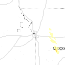
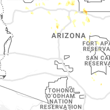
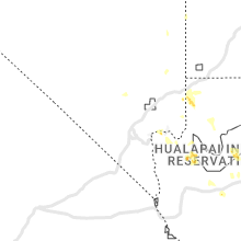
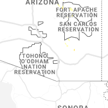
Regions Impacted by Hail on 7/31/2023
Cities Most Affected by Hail Storms of 7/31/2023
| Hail Size | Demographics of Zip Codes Affected | ||||||
|---|---|---|---|---|---|---|---|
| City | Count | Average | Largest | Pop Density | House Value | Income | Age |
Hail and Wind Damage Spotted on 7/31/2023
Filter by Report Type:Hail ReportsWind Reports
States Impacted
South Carolina, Florida, North Carolina, Louisiana, Arizona, Colorado, Wyoming, North Dakota, MissouriSouth Carolina
| Local Time | Report Details |
|---|---|
| 9:48 AM EDT | A dorchester county emergency manager reported a tree down along the 100 block of rebecca roa in dorchester county SC, 34.6 miles W of Charleston, SC |
| 9:45 PM EDT | Colleton county emergency management reported a tree down along the 2100 block of buckhead roa in colleton county SC, 49.6 miles W of Charleston, SC |
| 9:45 PM EDT | A dorchester county emergency manager reported a tree down along the 300 block of friendship roa in dorchester county SC, 35.8 miles W of Charleston, SC |
| 9:48 PM EDT | A dorchester county emergency manager reported a tree down along the 100 block of rebecca roa in dorchester county SC, 34.6 miles W of Charleston, SC |
| 9:48 PM EDT | A dorchester county emergency manager reported a tree down along the 200 block of cross creek roa in dorchester county SC, 36.3 miles W of Charleston, SC |
| 9:51 PM EDT | A dorchester county emergency manager reported a tree down on a house along the 100 block of davis terrac in dorchester county SC, 32.9 miles W of Charleston, SC |
| 9:52 PM EDT | A dorchester county emergency manager reported a tree and power lines down along the 100 block of quaker stree in dorchester county SC, 32.9 miles W of Charleston, SC |
| 9:52 PM EDT | A dorchester county emergency manager reported a tree down along the 5200 block of east jim bilton boulevar in dorchester county SC, 31.7 miles W of Charleston, SC |
| 9:52 PM EDT | A dorchester county emergency manager reported a tree down on a house along the 100 block of st james roa in dorchester county SC, 31.7 miles W of Charleston, SC |
| 9:56 PM EDT | A dorchester county emergency manager reported power lines down along the 1000 block of highway 1 in dorchester county SC, 32.5 miles W of Charleston, SC |
| 9:59 PM EDT | Colleton county emergency management reported a tree down along the 1700 block of george warren driv in colleton county SC, 49.2 miles WSW of Charleston, SC |
| 10:04 PM EDT | Colleton county emergency management reported a tree down along the 500 block of hydrick roa in colleton county SC, 49.7 miles WSW of Charleston, SC |
| 10:14 PM EDT | Colleton county emergency management reported power pole damage blocking both lanes along the 8900 block of bells highwa in colleton county SC, 49.4 miles WSW of Charleston, SC |
| 10:19 PM EDT | Colleton county emergency management reported a tree down along 19500 block of augusta highwa in colleton county SC, 31.1 miles WSW of Charleston, SC |
| 10:19 PM EDT | Colleton county emergency management reported a tree down along the 100 block of doctors creek roa in colleton county SC, 45.2 miles WSW of Charleston, SC |
| 10:25 PM EDT | Colleton county emergency management reported a tree down along the 2600 block of wesley grove roa in colleton county SC, 32.3 miles WSW of Charleston, SC |
| 10:25 PM EDT | Colleton county emergency management reported a tree down near the intersection of wesley grove road and finlay lan in colleton county SC, 32.5 miles WSW of Charleston, SC |
| 10:36 PM EDT | Colleton county emergency management reported a tree down along the 8800 block... 7000 block and 6700 block of charleston highway due to thunderstorm outflo in colleton county SC, 41 miles SW of Charleston, SC |
| 10:43 PM EDT | Colleton county emergency management reported a tree down along the 13100 block and 12000 block of charleston highway due to thunderstorm outflo in colleton county SC, 38.9 miles SW of Charleston, SC |
Florida
| Local Time | Report Details |
|---|---|
| 1:06 PM EDT | Snapped tree near se 139th ln shared on social media. time estimated by rada in marion county FL, 54 miles NW of Orlando, FL |
| 1:25 PM EDT | Two trees down across us 129 and nw 160 s in levy county FL, 88.6 miles SW of Jacksonville, FL |
| 3:10 PM EDT | Tree down near sw county rd 18. time of damage estimated by rada in bradford county FL, 43.8 miles SW of Jacksonville, FL |
| 3:20 PM EDT | The city of kissimmee has reported roof damage to a local store in association with a strong thunderstorm this afternoon. time has been estimated via rada in osceola county FL, 15.8 miles S of Orlando, FL |
| 3:25 PM EDT | Former nws employee/ hurricane specialist reports a tree down on highway 40... about a half mile west of the st. johns river. tree was estimated to be 8 inches in diame in lake county FL, 43.8 miles NNW of Orlando, FL |
North Carolina
| Local Time | Report Details |
|---|---|
| 2:16 PM EDT | Tree down in the roadway near the intersection of hwy nc-22 and farm life school roa in moore county NC, 56 miles SW of Raleigh, NC |
| 2:25 PM EDT | Power outage of around 600 customers was called by fallen trees damaging equipment around whispering pine in moore county NC, 55.1 miles SW of Raleigh, NC |
| 2:28 PM EDT | Power outage of around 1...000 customers caused by fallen trees damaging equipment around southern pine in moore county NC, 59.3 miles SW of Raleigh, NC |
| 2:30 PM EDT | Several reports of down trees and/or powerlines from the 911 call center... largely centered from carthage... whispering pines through southern pines. report will be up in moore county NC, 54.1 miles SW of Raleigh, NC |
| 3:01 PM EDT | Tree down along midway road in rockingham... nc. time estimated by rada in richmond county NC, 63.2 miles ESE of Charlotte, NC |
| 5:18 PM EDT | A tree was blown down onto north stokes road near lawsonvill in stokes county NC, 58.4 miles SSW of Roanoke, VA |
Louisiana
| Local Time | Report Details |
|---|---|
| 3:59 PM CDT | Tree down across byfaul avenue in baker on social media via news outle in east baton rouge county LA, 57.9 miles ENE of Lafayette, LA |
| 4:25 PM CDT | Report from mping: trees uprooted or snapped; roof blown of in east baton rouge county LA, 56.5 miles ENE of Lafayette, LA |
| 4:30 PM CDT | Corrects previous tstm wnd dmg report from 1 nw westminster. report from mping: trees uprooted or snapped; roof blown of in east baton rouge county LA, 56.5 miles ENE of Lafayette, LA |
| 4:30 PM CDT | *** 1 inj *** unknown structure collapse at 84 lumber relayed via social media... seriously injuring one perso in east baton rouge county LA, 57.4 miles ENE of Lafayette, LA |
| 4:30 PM CDT | Tree on a house in broadmoor are in east baton rouge county LA, 58.4 miles ENE of Lafayette, LA |
| 4:30 PM CDT | Tree down in old goodwood subdivision of baton roug in east baton rouge county LA, 56.3 miles ENE of Lafayette, LA |
| 4:30 PM CDT | Large tree fell on home with 3 people inside. no injuries reporte in east baton rouge county LA, 57.2 miles ENE of Lafayette, LA |
| 4:35 PM CDT | Tree down on the corner of forest drive and sholar driv in east baton rouge county LA, 56.5 miles ENE of Lafayette, LA |
| 4:35 PM CDT | Tree downed on powerline in jefferson terrace subdivision in baton roug in east baton rouge county LA, 57.9 miles ENE of Lafayette, LA |
| 4:40 PM CDT | Few snapped trees... one uprooted tree... and minor metal damage at br proud news studi in east baton rouge county LA, 55.9 miles ENE of Lafayette, LA |
| 4:40 PM CDT | Patio roof blown off in oak hills subdivision of baton rouge. relayed via social medi in east baton rouge county LA, 56.2 miles E of Lafayette, LA |
| 4:45 PM CDT | Tree down near intersection of highland road and know hill drive. relayed via social medi in east baton rouge county LA, 55.1 miles E of Lafayette, LA |
| 5:15 PM CDT | Image of large tree branches from a hard wood tree broken from trun in lafayette county LA, 1.4 miles S of Lafayette, LA |
| 6:45 PM CDT | Reported large tree limbs dow in jefferson davis county LA, 46.7 miles ENE of Beaumont, TX |
Arizona
| Local Time | Report Details |
|---|---|
| 3:00 PM MST | Quarter sized hail reported near Prescott, AZ, 64.5 miles SW of Flagstaff, AZ, spotter showed an photo of a mixture of dime... nickel and quarter sized hail. |
| 5:56 PM MST | Asos station ktus tucson international airpor in pima county AZ, 6.4 miles S of Tucson, AZ |
| 7:35 PM MST | Corrects previous tstm wnd gst report from 3 wsw marana. awos station kavq marana regional airpor in pima county AZ, 19.1 miles NW of Tucson, AZ |
| 7:35 PM MST | Corrects previous tstm wnd gst report from 3 wsw marana. awos station kavq marana regional airpor in pima county AZ, 19.1 miles NW of Tucson, AZ |
Colorado
| Local Time | Report Details |
|---|---|
| 6:46 PM MDT | Quarter sized hail reported near Nunn, CO, 57.9 miles SE of Laramie, WY, report from mping: quarter (1.00 in.). |
| 6:57 PM MDT | Mesonet station gw2494 elizabet in elbert county CO, 31.3 miles SE of Denver, CO |
| 6:57 PM MDT | Mesonet station co167 036e04190rws1rhs - 1.7 mi w of in boulder county CO, 19 miles NNW of Denver, CO |
| 7:55 PM MDT | Half Dollar sized hail reported near Kiowa, CO, 33.5 miles SE of Denver, CO |
| 8:00 PM MDT | Half Dollar sized hail reported near Fort Collins, CO, 55.2 miles SSE of Laramie, WY, report from mping. |
| 8:06 PM MDT | Quarter sized hail reported near Colorado Springs, CO, 43 miles NNW of Pueblo, CO |
| 8:09 PM MDT | Quarter sized hail reported near Colorado Springs, CO, 42.1 miles NNW of Pueblo, CO |
| 8:10 PM MDT | Half Dollar sized hail reported near Colorado Springs, CO, 44 miles N of Pueblo, CO, report from mping: half dollar (1.25 in.). |
| 8:13 PM MDT | Half Dollar sized hail reported near Colorado Springs, CO, 43.6 miles NNW of Pueblo, CO |
| 8:14 PM MDT | Quarter sized hail reported near Elbert, CO, 51.4 miles SSE of Denver, CO |
| 8:15 PM MDT | Quarter sized hail reported near Colorado Springs, CO, 44.8 miles NNW of Pueblo, CO |
| 8:16 PM MDT | Quarter sized hail reported near Colorado Springs, CO, 44.2 miles NNW of Pueblo, CO |
| 8:17 PM MDT | Quarter sized hail reported near Colorado Springs, CO, 46.8 miles N of Pueblo, CO |
| 8:20 PM MDT | Quarter sized hail reported near Colorado Springs, CO, 45.3 miles N of Pueblo, CO |
| 8:20 PM MDT | Half Dollar sized hail reported near Colorado Springs, CO, 46.7 miles N of Pueblo, CO, report from mping: half dollar (1.25 in.). |
| 8:23 PM MDT | Quarter sized hail reported near Colorado Springs, CO, 44.4 miles NNW of Pueblo, CO |
| 8:24 PM MDT | Quarter sized hail reported near Colorado Springs, CO, 46.2 miles NNW of Pueblo, CO, report from mping: quarter (1.00 in.). |
| 8:24 PM MDT | Quarter sized hail reported near Colorado Springs, CO, 46.1 miles N of Pueblo, CO |
| 8:25 PM MDT | Ping Pong Ball sized hail reported near Colorado Springs, CO, 45.4 miles N of Pueblo, CO |
| 8:42 PM MDT | Quarter sized hail reported near Colorado Springs, CO, 48.9 miles N of Pueblo, CO, report from mping: quarter (1.00 in.). |
| 8:45 PM MDT | Quarter sized hail reported near Manitou Springs, CO, 43.3 miles NNW of Pueblo, CO |
| 8:49 PM MDT | Quarter sized hail reported near Manitou Springs, CO, 43.1 miles NNW of Pueblo, CO, report from mping: quarter (1.00 in.). |
| 8:56 PM MDT | Quarter sized hail reported near Colorado Springs, CO, 46.9 miles N of Pueblo, CO |
| 8:58 PM MDT | Quarter sized hail reported near Colorado Springs, CO, 50 miles N of Pueblo, CO |
| 9:30 PM MDT | Quarter sized hail reported near Elbert, CO, 48.3 miles SSE of Denver, CO |
Wyoming
| Local Time | Report Details |
|---|---|
| 7:22 PM MDT | Mesonet station wy1 8.4 s sibley peak (wydot in platte county WY, 74.8 miles ESE of Casper, WY |
North Dakota
| Local Time | Report Details |
|---|---|
| 8:21 PM MDT | Ping Pong Ball sized hail reported near Bowman, ND, 121.8 miles E of Miles City, MT, nickel and dime size hail still occurring 8 minutes after ping pong ball size hail was observed. |
Missouri
| Local Time | Report Details |
|---|---|
| 2:45 AM CDT | Tree and powerline damage southeast of cole camp close to the morgan county lin in benton county MO, 57.9 miles SW of Columbia, MO |











Connect with Interactive Hail Maps