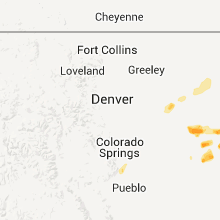
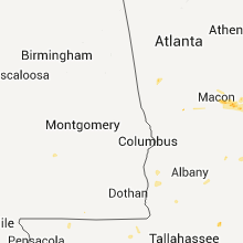
Hail Map for Saturday, July 9, 2011

Number of Impacted Households on 7/9/2011
0
Impacted by 1" or Larger Hail
0
Impacted by 1.75" or Larger Hail
0
Impacted by 2.5" or Larger Hail
Square Miles of Populated Area Impacted on 7/9/2011
0
Impacted by 1" or Larger Hail
0
Impacted by 1.75" or Larger Hail
0
Impacted by 2.5" or Larger Hail
Regions Impacted by Hail on 7/9/2011
Cities Most Affected by Hail Storms of 7/9/2011
| Hail Size | Demographics of Zip Codes Affected | ||||||
|---|---|---|---|---|---|---|---|
| City | Count | Average | Largest | Pop Density | House Value | Income | Age |
| Tolstoy, SD | 1 | 1.75 | 1.75 | 1 | $33k | $23.3k | 52.0 |
| Kennebec, SD | 1 | 1.75 | 1.75 | 0 | $42k | $37.8k | 44.6 |
| Onaka, SD | 1 | 1.75 | 1.75 | 1 | $12k | $32.1k | 50.0 |
| Gettysburg, SD | 1 | 1.75 | 1.75 | 3 | $45k | $31.2k | 49.2 |
| Flagler, CO | 1 | 1.75 | 1.75 | 1 | $74k | $30.4k | 46.7 |
| Hoven, SD | 1 | 1.75 | 1.75 | 1 | $44k | $28.9k | 50.5 |
Hail and Wind Damage Spotted on 7/9/2011
Filter by Report Type:Hail ReportsWind Reports
States Impacted
South Carolina, New Mexico, Georgia, Arizona, Utah, Colorado, South Dakota, Kansas, Minnesota, IowaSouth Carolina
| Local Time | Report Details |
|---|---|
| 5:20 PM UTC | Kchs asos reported a peak thunderstorm wind gust of 51 knot in charleston county SC, 20.5 miles S of Charleston, SC |
| 7:37 PM UTC | Savannah river site reported numerous trees down across the site. time estimated from rada in barnwell county SC, 26.4 miles SE of Augusta, GA |
| 8:54 PM UTC | Trees down along hwy 45 in jamestow in berkeley county SC, 18.7 miles ENE of Charleston, SC |
| 9:00 PM UTC | Report of a tree down on a power line. time estimated by radar in colleton county SC, 50.9 miles WSW of Charleston, SC |
| 9:36 PM UTC | A large 40 foot tall tree is down at the corner of wescott blvd and patriot blvd. time is estimated based on rada in dorchester county SC, 18.1 miles SSW of Charleston, SC |
| 10:07 PM UTC | Two palm trees and a pine tree blown dow in charleston county SC, 27.4 miles S of Charleston, SC |
New Mexico
| Local Time | Report Details |
|---|---|
| 7:03 PM UTC | Krtn aso in colfax county NM, 63.6 miles ENE of Taos, NM |
| 7:46 PM UTC | Krtn aso in colfax county NM, 63.6 miles ENE of Taos, NM |
| 11:23 PM UTC | Kgnt aso in cibola county NM, 71.1 miles W of Albuquerque, NM |
| 5:19 AM UTC | Kcao aso in union county NM, 94.3 miles NNE of Tucumcari, NM |
Georgia
| Local Time | Report Details |
|---|---|
| 8:53 PM UTC | One tree down on a powerline on eatonton highwa in jones county GA, 67.8 miles SE of Atlanta, GA |
| 9:31 PM UTC | Fire department reported one tree down and several large limbs down on power lines across the garden city are in chatham county GA, 4.8 miles WNW of Savannah, GA |
| 9:38 PM UTC | Lines down on earnest stree in bibb county GA, 75.8 miles SSE of Atlanta, GA |
| 9:50 PM UTC | One tree fell on phone and cable line in coweta county GA, 35.2 miles SW of Atlanta, GA |
| 9:52 PM UTC | Two trees dow in coweta county GA, 44.1 miles SW of Atlanta, GA |
| 9:52 PM UTC | One tree down on tucker and peak roa in bibb county GA, 76.8 miles SE of Atlanta, GA |
| 9:54 PM UTC | Power line down at eastin road and sandy creek roa in fayette county GA, 20.2 miles SSW of Atlanta, GA |
Arizona
| Local Time | Report Details |
|---|---|
| 9:55 PM UTC | Several power poles down on la canada dr between sahuarita road and duval mine roa in pima county AZ, 20.2 miles S of Tucson, AZ |
| 9:55 PM UTC | Several large branches down. estimated winds of 60 mp in pima county AZ, 20.9 miles S of Tucson, AZ |
| 1:40 AM UTC | Thunderstorm winds resulted in docks breaking loose and fuel lines being pulled apart at the temple bar marina. the marina was closed sunday as a resul in mohave county AZ, 46.9 miles ESE of Las Vegas, NV |
Utah
| Local Time | Report Details |
|---|---|
| 10:00 PM UTC | West salt flats s in tooele county UT, 95.5 miles NE of Ely, NV |
| 10:40 PM UTC | Wig mountain s in tooele county UT, 68.8 miles WSW of Salt Lake City, UT |
| 11:25 PM UTC | Diddle in tooele county UT, 67 miles W of Salt Lake City, UT |
| 11:30 PM UTC | Locomotive springs s in box elder county UT, 82 miles NW of Salt Lake City, UT |
| 12:40 AM UTC | A large barn was knocked down and several trees were reported down across the are in cache county UT, 80.2 miles N of Salt Lake City, UT |
Colorado
| Local Time | Report Details |
|---|---|
| 10:20 PM UTC | Golf Ball sized hail reported near Flagler, CO, 52.9 miles SSW of Yuma, CO, hail lasted 10 minutes. strong winds estimated to 60 mph. |
| 11:55 PM UTC | Half Dollar sized hail reported near Seibert, CO, 65.9 miles S of Yuma, CO |
| 11:55 PM UTC | Quarter sized hail reported near Seibert, CO, 65.9 miles S of Yuma, CO |
| 12:00 AM UTC | Quarter sized hail reported near Vona, CO, 68.2 miles S of Yuma, CO |
| 12:20 AM UTC | Also reported golf ball size hail at same locatio in kit carson county CO, 72.8 miles SSE of Yuma, CO |
| 2:24 AM UTC | Storm damage reported in yuma county CO, 0.9 miles W of Yuma, CO |
South Dakota
| Local Time | Report Details |
|---|---|
| 12:00 AM UTC | Golf Ball sized hail reported near Kennebec, SD, 35.1 miles SE of Pierre, SD, damage to a field |
| 1:45 AM UTC | Golf Ball sized hail reported near Hoven, SD, 57.3 miles NNE of Pierre, SD |
| 2:16 AM UTC | Golf Ball sized hail reported near Tolstoy, SD, 58.3 miles WSW of Aberdeen, SD, also receiving about 55 mph winds |
| 2:20 AM UTC | Golf Ball sized hail reported near Onaka, SD, 55.7 miles WSW of Aberdeen, SD |
| 2:42 AM UTC | Half Dollar sized hail reported near Roscoe, SD, 48.5 miles W of Aberdeen, SD |
| 2:47 AM UTC | Ping Pong Ball sized hail reported near Roscoe, SD, 50 miles W of Aberdeen, SD |
| 3:05 AM UTC | Golf Ball sized hail reported near Gettysburg, SD, 53.7 miles NNE of Pierre, SD, hail damaged corn and wheat |
| 3:30 AM UTC | Quarter sized hail reported near Roscoe, SD, 39.4 miles WNW of Aberdeen, SD |
| 5:15 AM UTC | Medium to large branches down. hail of unknown size but no hail damage note in miner county SD, 44.9 miles WNW of Sioux Falls, SD |
| 5:40 AM UTC | Wind tipped boats on lake madison in lake county SD, 32.3 miles NNW of Sioux Falls, SD |
| 5:45 AM UTC | Trees down in lake county SD, 27.3 miles NNW of Sioux Falls, SD |
Kansas
| Local Time | Report Details |
|---|---|
| 12:05 AM UTC | Quarter sized hail reported near Lakin, KS, 31.2 miles WNW of Garden City, KS |
| 1:06 AM UTC | Two weather vanes were blown off separate barn roofs. also several small live limbs were in pratt county KS, 86.9 miles W of Wichita, KS |
| 1:20 AM UTC | Storm damage reported in sherman county KS, 38.4 miles WSW of Colby, KS |
| 1:20 AM UTC | Half Dollar sized hail reported near Pratt, KS, 77 miles W of Wichita, KS, the hail was almost covering the ground white. |
| 1:20 AM UTC | Half Dollar sized hail reported near Pratt, KS, 85.2 miles NNE of Woodward, OK, the hail was almost covering the ground white. most of the hail was pea-size or smaller. |
| 1:35 AM UTC | Estimated 80 to 90 mph wind. quarter sized hail also reporte in sherman county KS, 37.7 miles WSW of Colby, KS |
| 4:46 AM UTC | An experienced storm spottered estimated a 70 mph wind gust in far eastern rush count in rush county KS, 28.6 miles SSE of Hays, KS |
Minnesota
| Local Time | Report Details |
|---|---|
| 8:10 AM UTC | Large branches in nobles county MN, 54 miles E of Sioux Falls, SD |
| 10:20 AM UTC | Several large trees and power lines dow in dakota county MN, 22.1 miles S of Minneapolis, MN |
Iowa
| Local Time | Report Details |
|---|---|
| 11:35 AM UTC | Numerous 1 to 4 inch diameter branches down in town and extending 4 to 5 miles northeas in clay county IA, 23 miles NNE of Storm Lake, IA |


Connect with Interactive Hail Maps