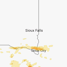
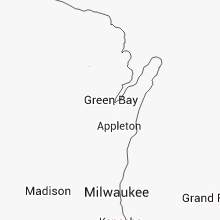
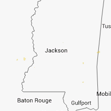
Hail Map for Saturday, June 28, 2014

Number of Impacted Households on 6/28/2014
0
Impacted by 1" or Larger Hail
0
Impacted by 1.75" or Larger Hail
0
Impacted by 2.5" or Larger Hail
Square Miles of Populated Area Impacted on 6/28/2014
0
Impacted by 1" or Larger Hail
0
Impacted by 1.75" or Larger Hail
0
Impacted by 2.5" or Larger Hail
Regions Impacted by Hail on 6/28/2014
Cities Most Affected by Hail Storms of 6/28/2014
| Hail Size | Demographics of Zip Codes Affected | ||||||
|---|---|---|---|---|---|---|---|
| City | Count | Average | Largest | Pop Density | House Value | Income | Age |
| Goodland, KS | 1 | 3.00 | 3.00 | 9 | $65k | $33.1k | 41.5 |
| Wewahitchka, FL | 1 | 1.75 | 1.75 | 22 | $64k | $27.4k | 39.4 |
| Norfolk, NE | 1 | 1.75 | 1.75 | 163 | $84k | $36.2k | 36.2 |
Hail and Wind Damage Spotted on 6/28/2014
Filter by Report Type:Hail ReportsWind Reports
States Impacted
Oklahoma, Kansas, Wisconsin, Michigan, Missouri, Ohio, Mississippi, Florida, Louisiana, Arkansas, South Dakota, Minnesota, Illinois, Iowa, NebraskaOklahoma
| Local Time | Report Details |
|---|---|
| 7:58 AM CDT | Storm damage reported in harper county OK, 14.2 miles N of Woodward, OK |
| 8:15 AM CDT | Storm damage reported in woodward county OK, 25.3 miles NE of Woodward, OK |
| 8:40 AM CDT | Storm damage reported in woods county OK, 37.5 miles ENE of Woodward, OK |
| 8:55 AM CDT | Storm damage reported in woods county OK, 42.3 miles ENE of Woodward, OK |
| 9:00 AM CDT | Storm damage reported in woods county OK, 44.2 miles ENE of Woodward, OK |
| 9:35 AM CDT | Storm damage reported in alfalfa county OK, 61.5 miles ENE of Woodward, OK |
| 10:00 AM CDT | Reported at great salt plains park offic in alfalfa county OK, 73.3 miles ENE of Woodward, OK |
| 10:25 AM CDT | Storm damage reported in major county OK, 64.1 miles E of Woodward, OK |
| 10:45 AM CDT | Storm damage reported in grant county OK, 74.7 miles SSW of Wichita, KS |
| 11:20 AM CDT | Storm damage reported in kay county OK, 61.2 miles S of Wichita, KS |
| 11:25 AM CDT | Awning covering gas pumps blown away at the i-35 / state hwy 11 interchang in kay county OK, 61.2 miles S of Wichita, KS |
| 11:30 AM CDT | Numerous tree limbs up to five inches in diameter snapped of tree in kay county OK, 61.2 miles S of Wichita, KS |
| 2:38 PM CDT | Debris blow 100 yards. fence blown dow in tulsa county OK, 11.5 miles NE of Tulsa, OK |
| 2:45 PM CDT | Storm damage reported in rogers county OK, 15.2 miles ENE of Tulsa, OK |
| 3:24 PM CDT | Early reports of homes damaged and power lines down. additional details to be provided late in mayes county OK, 45.1 miles ENE of Tulsa, OK |
| 3:50 PM CDT | Large tree down in delaware county OK, 64.3 miles ENE of Tulsa, OK |
Kansas
| Local Time | Report Details |
|---|---|
| 11:50 AM CDT | Emeregency manager reports a 2.5 foot diameter limb was down as well as a 3 foot diamater maple tree with rotted roots lying over in a yard in crestwood acres near madi in cowley county KS, 45.6 miles SSE of Wichita, KS |
| 3:10 PM CDT | Public report of 4 to 5 inch limbs down in bourbon county KS, 28.8 miles ENE of Chanute, KS |
| 1:37 AM MDT | Tea Cup sized hail reported near Goodland, KS, 46.8 miles WSW of Colby, KS, hail broke windows. received via social media. |
| 1:37 AM MDT | Half Dollar sized hail reported near Goodland, KS, 46.8 miles WSW of Colby, KS, received via social media. |
| 1:59 AM MDT | Quarter sized hail reported near Goodland, KS, 35.8 miles W of Colby, KS |
| 2:00 AM MDT | Quarter sized hail reported near Goodland, KS, 35.8 miles W of Colby, KS, nickel to quarter size hail at 15th and caldwell. |
| 2:01 AM MDT | Half Dollar sized hail reported near Goodland, KS, 35.8 miles W of Colby, KS, at nws office. |
| 2:03 AM MDT | Ping Pong Ball sized hail reported near Goodland, KS, 35.8 miles W of Colby, KS, mostly quarter size. one stone measured 1 1/2 inch in diameter. |
Wisconsin
| Local Time | Report Details |
|---|---|
| 12:35 PM CDT | 65th and morgan. 1 large tree snapped in half. 1 large oak tree completely uproote in milwaukee county WI, 71.1 miles E of Madison, WI |
| 8:47 PM CDT | Large 2 foot diameter tree down on garage roo in la crosse county WI, 10.5 miles NE of La Crosse, WI |
| 8:50 PM CDT | Trees down near the intersection of green bay and east ave. report received via twitte in la crosse county WI, 0.9 miles S of La Crosse, WI |
| 8:50 PM CDT | Many branches down ranging up to 6 inches. significant street flooding cass and madison street are in la crosse county WI, 1.6 miles NE of La Crosse, WI |
| 8:52 PM CDT | 2 inch diameter green tree limbs blown 100 ft. transformer blown. esitmated wind gust of 60 mp in la crosse county WI, 5.6 miles NNE of La Crosse, WI |
| 8:54 PM CDT | 2 1 to 1.5 foot diameter trees blown down on mohican trail roa in la crosse county WI, 8.3 miles N of La Crosse, WI |
| 8:54 PM CDT | At least a gust to 60 mp in la crosse county WI, 8.1 miles N of La Crosse, WI |
| 8:55 PM CDT | 15 year old tree dow in la crosse county WI, 10.2 miles N of La Crosse, WI |
Michigan
| Local Time | Report Details |
|---|---|
| 2:17 PM EDT | Report of trees down into power lines on us-12 in coldwater. time estimated from rada in branch county MI, 59.9 miles N of Fort Wayne, IN |
| 4:01 PM EDT | Michigan state police called in some small trees that were down along gun lake road. exact size is unknown at the time but trees were small enough to be physically remo in barry county MI, 26 miles SSE of Grand Rapids, MI |
| 4:16 PM EDT | Barry co. central dispatch stated that they received additional reports of trees down along gun lake road. power outages are also ongoing west of hastings...north of th in barry county MI, 26.3 miles SE of Grand Rapids, MI |
Missouri
| Local Time | Report Details |
|---|---|
| 2:47 PM CDT | Numerous trees limbs and power lines reported down... by social medi in jackson county MO, 20.7 miles E of Kansas City, MO |
| 4:30 PM CDT | *** 2 inj *** trees and limbs down at elk springs road and elk river. two minor injuries from flying debris due to wind near shady beach campgroun in mcdonald county MO, 78.4 miles WSW of Springfield, MO |
| 4:38 PM CDT | *** 2 inj *** winds blew down some fireworks tents. two minor injuries. some trees were also blown down in the count in newton county MO, 64 miles WSW of Springfield, MO |
| 4:58 PM CDT | Winds blew out windows and blew off a porc in newton county MO, 47.1 miles WSW of Springfield, MO |
| 7:00 PM CDT | Tree downed a powerline in versaille in morgan county MO, 45.2 miles SW of Columbia, MO |
| 7:28 PM CDT | Shingles blown off of roof...small limbs down in moniteau county MO, 25.6 miles SSW of Columbia, MO |
Ohio
| Local Time | Report Details |
|---|---|
| 4:10 PM EDT | Small tree limbs broken off trees in franklin county OH, 10.8 miles E of Columbus, OH |
Mississippi
| Local Time | Report Details |
|---|---|
| 3:15 PM CDT | Law enforcement reports trees and power lines down as well as minor roof damage to a house in the community of state line. relayed by greene county emergency manage in wayne county MS, 57.5 miles NNW of Mobile, AL |
| 4:18 PM CDT | Report of a tree down in the st. marys community and a house damaged in harmon in clarke county MS, 84.8 miles ESE of Jackson, MS |
| 4:33 PM CDT | Reports of trees down scattered through the count in jasper county MS, 70 miles E of Jackson, MS |
| 4:52 PM CDT | Report of a tree on a powerline in chunk in newton county MS, 73.2 miles E of Jackson, MS |
| 5:30 PM CDT | Report of a tree down on trip talbert roa in lauderdale county MS, 66.7 miles S of Starkville, MS |
| 5:58 PM CDT | Report of a tree down on old highway 45 in scoob in kemper county MS, 47.9 miles SSE of Starkville, MS |
Florida
| Local Time | Report Details |
|---|---|
| 4:24 PM EDT | Asos at pgd reported a wind gust of 51 knot in charlotte county FL, 50.3 miles SE of Bradenton, FL |
| 5:03 PM CDT | Golf Ball sized hail reported near Wewahitchka, FL, 59.2 miles WSW of Tallahassee, FL, golf ball sized hail reported by law enforcement. |
Louisiana
| Local Time | Report Details |
|---|---|
| 4:10 PM CDT | Power lines down on good hope road in west monroe. report from broadcast media via faceboo in ouachita county LA, 23 miles SW of Bastrop, LA |
| 4:15 PM CDT | Power lines down in spearsville. report from broadcast media via faceboo in union county LA, 41.4 miles WNW of Bastrop, LA |
| 4:35 PM CDT | Report of 5 trees down in log cabin. also a flag pole and trampoline were blown over. report relayed via social medi in morehouse county LA, 0.6 miles SSE of Bastrop, LA |
| 6:30 PM CDT | Report of a tree down on front street in winnsbor in franklin county LA, 44.1 miles SSE of Bastrop, LA |
Arkansas
| Local Time | Report Details |
|---|---|
| 4:25 PM CDT | Trees down on and in the vicinity of mount union road. limbs down as well. time is radar estimate in union county AR, 50.6 miles WNW of Bastrop, LA |
| 5:00 PM CDT | Numerous trees and power lines downed across the central and western portions of the county in ashley county AR, 24.4 miles N of Bastrop, LA |
| 5:26 PM CDT | Tree down across county road 62 north of hampto in calhoun county AR, 66.3 miles NNW of Bastrop, LA |
| 2:08 AM CDT | *** 1 inj *** several tents were destroyed...equipment damaged...and one person was injured by flying debris at fort roots in north little rock. the damaging winds were in pulaski county AR, 3 miles NNE of Little Rock, AR |
| 2:30 AM CDT | A tree fell on a house near rodney parham and mississippi avenu in pulaski county AR, 7.8 miles W of Little Rock, AR |
South Dakota
| Local Time | Report Details |
|---|---|
| 5:24 PM CDT | Storm damage reported in hughes county SD, 1.5 miles E of Pierre, SD |
| 5:45 PM CDT | Strong winds between 60-65 mph with no apparent damage... also had 1.80 inches of rain but no flooding in hughes county SD, 6.1 miles ENE of Pierre, SD |
Minnesota
| Local Time | Report Details |
|---|---|
| 5:55 PM CDT | Uproot of 1 pine tree...several branches down. small portion of roof ripped off a steel building. estimated gusts 50-60 mph. dodge center airport...located 1 mile south in dodge county MN, 63.5 miles NNE of Mason City, IA |
Illinois
| Local Time | Report Details |
|---|---|
| 6:17 PM CDT | Quarter sized hail reported near Beecher, IL, 37.1 miles S of Chicago, IL |
Iowa
| Local Time | Report Details |
|---|---|
| 6:42 PM CDT | Reports of trees down with roof damage to a home on south side of town. time estimated from rada in tama county IA, 43 miles WNW of Cedar Rapids, IA |
Nebraska
| Local Time | Report Details |
|---|---|
| 6:45 PM CDT | Golf Ball sized hail reported near Norfolk, NE, 66.9 miles ESE of Oneill, NE |
| 7:50 PM CDT | Quarter sized hail reported near Clarkson, NE, 68.9 miles WNW of Omaha, NE |
| 8:07 PM CDT | Quarter sized hail reported near Howells, NE, 63.5 miles WNW of Omaha, NE |
| 9:06 PM CDT | Quarter sized hail reported near North Bend, NE, 46.4 miles WNW of Omaha, NE, also 45-55 mph winds and 0.40 of rainfall. |
| 10:42 PM CDT | Quarter sized hail reported near Omaha, NE, 11.2 miles NW of Omaha, NE |
| 3:44 AM CDT | Quarter sized hail reported near Niobrara, NE, 48.5 miles ENE of Oneill, NE |


Connect with Interactive Hail Maps