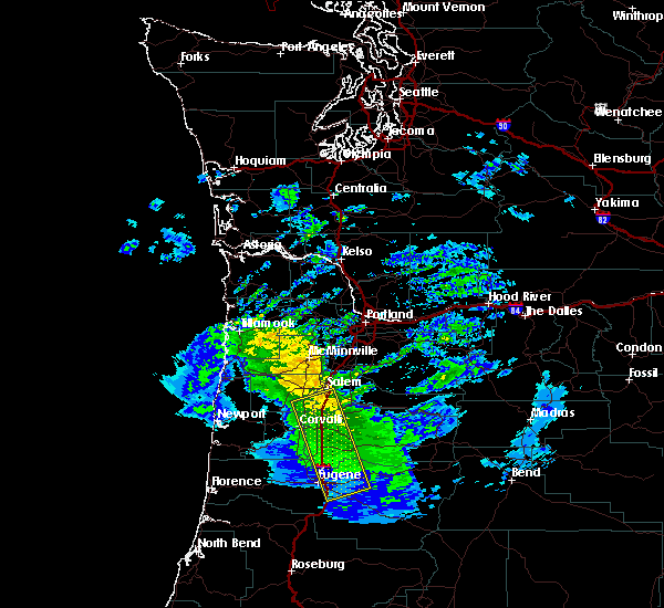
Hail Map for Adair Village, OR

The Adair Village, OR area has had 0 reports of on-the-ground hail by trained spotters, and has been under severe weather warnings 0 times during the past 12 months. Doppler radar has detected hail at or near Adair Village, OR on 1 occasion.

Name: Adair Village, OR
Where Located: 43.6 miles N of Eugene, OR
Map: Google Map for Adair Village, OR
Population: 840
Housing Units: 293
More Info: Search Google for Adair Village, OR

Hail and Wind Damage Spotted near Adair Village, OR

Date / Time Report Details
1/16/2016 11:28 AM PST The severe thunderstorm warning for northeastern benton, north central lane, western linn, southwestern marion and southeastern polk counties will expire at 1130 am pst, the storms which prompted the warning have weakened below severe limits and exited the warned area. therefore the warning will be allowed to expire.
1/16/2016 11:19 AM PST Radar Image for Severe Thunderstorms near Adair Village, OR at 1/16/2016 11:22 AM PST At 1116 am pst, the line of severe thunderstorms appear to be weakening, though have a history of producing damaging winds in excess of 60 mph. these storms were located along a line extending from near turner to walterville, moving east at 45 mph. locations impacted include, eugene, salem, corvallis, albany, springfield, lebanon, independence, creswell, jefferson, turner, brownsville, walterville, south lebanon, north springfield, marcola, four corners, marion, millersburg, tangent and coburg.
1/16/2016 11:00 AM PST Radar Image for Severe Thunderstorms near Adair Village, OR at 1/16/2016 11:04 AM PST At 1058 am pst, national weather service observing equipment indicated a line of severe thunderstorms producing damaging winds in excess of 60 mph. these storms were located along a line extending from 7 miles south of monmouth to near creswell, and moving northeast at 45 mph.

Hail Maps for Adair Village, OR