

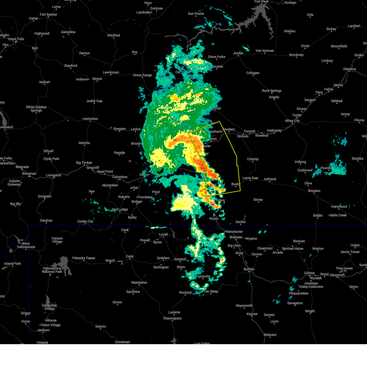
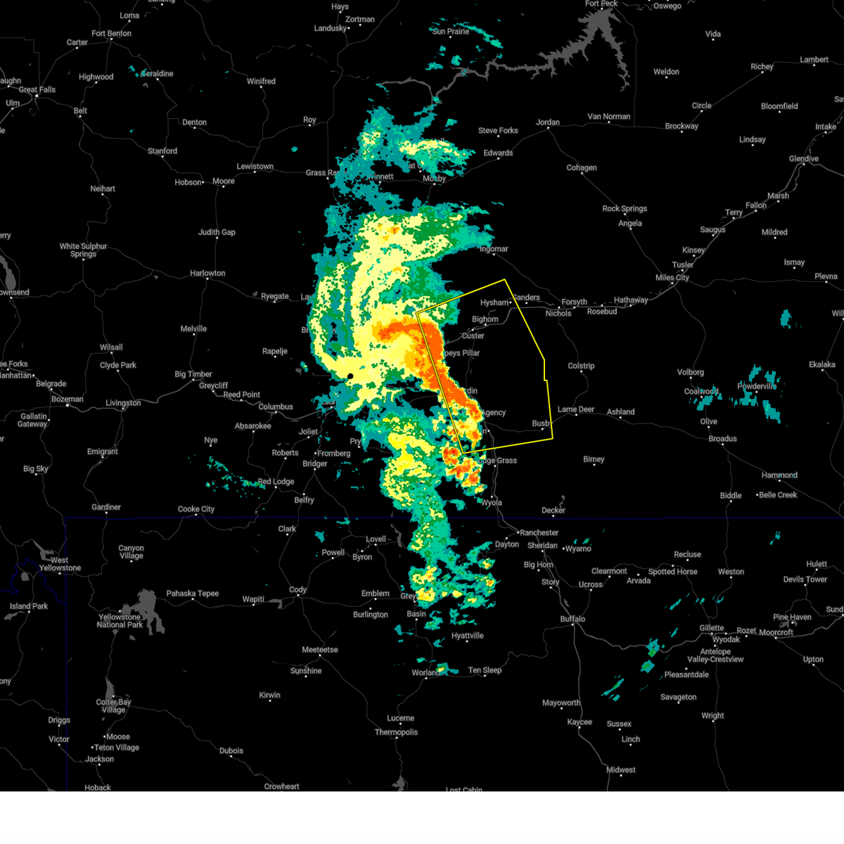
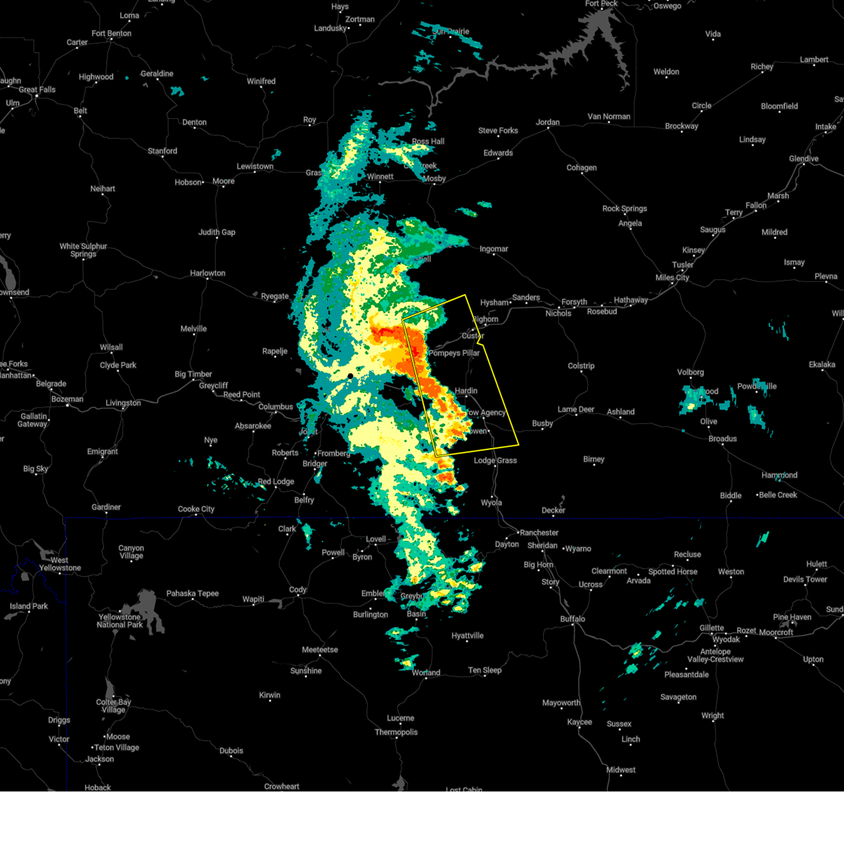
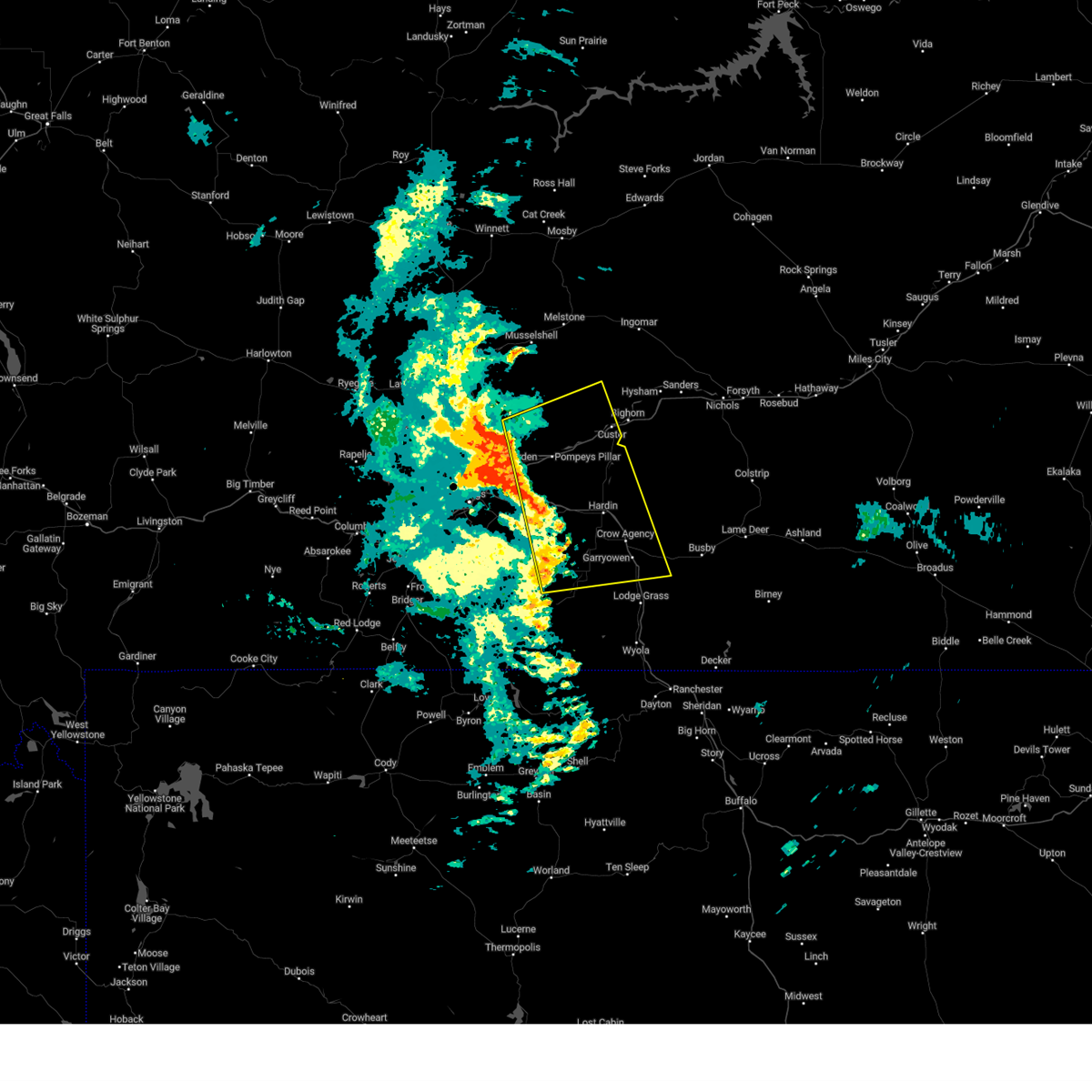
Hail Map for Custer, MT
The Custer, MT area has had 7 reports of on-the-ground hail by trained spotters, and has been under severe weather warnings 6 times during the past 12 months. Doppler radar has detected hail at or near Custer, MT on 25 occasions, including 2 occasions during the past year.
| Name: | Custer, MT |
| Where Located: | 51.6 miles ENE of Billings, MT |
| Map: | Google Map for Custer, MT |
| Population: | 159 |
| Housing Units: | 81 |
| More Info: | Search Google for Custer, MT |
5
The Top Recent Hail Date for Custer, MT is Thursday, June 27, 2024 (1st out of 25)

Hail and Wind Damage Spotted near Custer, MT
| Date / Time | Report Details |
|---|---|
| 8/4/2024 9:04 PM MDT |
 At 904 pm mdt, severe thunderstorms were located along a line extending from 8 miles north of custer to 17 miles northeast of hardin to 11 miles southeast of crow agency, moving east at 40 mph (radar indicated). Hazards include 60 mph wind gusts. Expect damage to roofs, siding, and trees. Locations impacted include, hysham, custer, crow agency, busby, bighorn, northern cheyenne indian reservation, and crow indian reservation. At 904 pm mdt, severe thunderstorms were located along a line extending from 8 miles north of custer to 17 miles northeast of hardin to 11 miles southeast of crow agency, moving east at 40 mph (radar indicated). Hazards include 60 mph wind gusts. Expect damage to roofs, siding, and trees. Locations impacted include, hysham, custer, crow agency, busby, bighorn, northern cheyenne indian reservation, and crow indian reservation.
|
| 8/4/2024 8:41 PM MDT |
 Svrbyz the national weather service in billings has issued a * severe thunderstorm warning for, north central big horn county in south central montana, northeastern yellowstone county in south central montana, treasure county in southeastern montana, * until 930 pm mdt. * at 840 pm mdt, severe thunderstorms were located along a line extending from 17 miles west of custer to 6 miles north of hardin to 11 miles southwest of crow agency, moving east at 40 mph (radar indicated). Hazards include 60 mph wind gusts. expect damage to roofs, siding, and trees Svrbyz the national weather service in billings has issued a * severe thunderstorm warning for, north central big horn county in south central montana, northeastern yellowstone county in south central montana, treasure county in southeastern montana, * until 930 pm mdt. * at 840 pm mdt, severe thunderstorms were located along a line extending from 17 miles west of custer to 6 miles north of hardin to 11 miles southwest of crow agency, moving east at 40 mph (radar indicated). Hazards include 60 mph wind gusts. expect damage to roofs, siding, and trees
|
| 8/4/2024 8:27 PM MDT |
 At 825 pm mdt, severe thunderstorms were located along a line extending from 16 miles northeast of ballantine to 15 miles northeast of fort smith, moving east at 45 mph (radar indicated). Hazards include 60 mph wind gusts. Expect damage to roofs, siding, and trees. locations impacted include, hardin, custer, crow agency, pompeys pillar, st. Xavier, and crow indian reservation. At 825 pm mdt, severe thunderstorms were located along a line extending from 16 miles northeast of ballantine to 15 miles northeast of fort smith, moving east at 45 mph (radar indicated). Hazards include 60 mph wind gusts. Expect damage to roofs, siding, and trees. locations impacted include, hardin, custer, crow agency, pompeys pillar, st. Xavier, and crow indian reservation.
|
| 8/4/2024 8:12 PM MDT |
 Svrbyz the national weather service in billings has issued a * severe thunderstorm warning for, central big horn county in south central montana, eastern yellowstone county in south central montana, * until 845 pm mdt. * at 810 pm mdt, severe thunderstorms were located along a line extending from 10 miles north of worden to 9 miles north of fort smith, moving east at 40 mph (radar indicated). Hazards include 60 mph wind gusts. expect damage to roofs, siding, and trees Svrbyz the national weather service in billings has issued a * severe thunderstorm warning for, central big horn county in south central montana, eastern yellowstone county in south central montana, * until 845 pm mdt. * at 810 pm mdt, severe thunderstorms were located along a line extending from 10 miles north of worden to 9 miles north of fort smith, moving east at 40 mph (radar indicated). Hazards include 60 mph wind gusts. expect damage to roofs, siding, and trees
|
| 6/27/2024 2:25 PM MDT |
 At 223 pm mdt, a severe thunderstorm was located near custer, or 20 miles west of hysham, moving east at 45 mph (radar indicated). Hazards include 60 mph wind gusts and quarter size hail. Hail damage to vehicles is expected. expect wind damage to roofs, siding, and trees. locations impacted include, hysham, custer, and bighorn. motorists on i-94 around custer, bighorn, and hysham should prepare for rapidly changing conditions. This warning does not include the city of billings. At 223 pm mdt, a severe thunderstorm was located near custer, or 20 miles west of hysham, moving east at 45 mph (radar indicated). Hazards include 60 mph wind gusts and quarter size hail. Hail damage to vehicles is expected. expect wind damage to roofs, siding, and trees. locations impacted include, hysham, custer, and bighorn. motorists on i-94 around custer, bighorn, and hysham should prepare for rapidly changing conditions. This warning does not include the city of billings.
|
| 6/27/2024 2:15 PM MDT | Golf Ball sized hail reported 0.3 miles WSW of Custer, MT |
| 6/27/2024 2:07 PM MDT |
 Svrbyz the national weather service in billings has issued a * severe thunderstorm warning for, northeastern yellowstone county in south central montana, treasure county in southeastern montana, * until 300 pm mdt. * at 207 pm mdt, a severe thunderstorm was located 15 miles west of custer, or 32 miles west of hysham, moving east at 45 mph (radar indicated). Hazards include 60 mph wind gusts and quarter size hail. Hail damage to vehicles is expected. Expect wind damage to roofs, siding, and trees. Svrbyz the national weather service in billings has issued a * severe thunderstorm warning for, northeastern yellowstone county in south central montana, treasure county in southeastern montana, * until 300 pm mdt. * at 207 pm mdt, a severe thunderstorm was located 15 miles west of custer, or 32 miles west of hysham, moving east at 45 mph (radar indicated). Hazards include 60 mph wind gusts and quarter size hail. Hail damage to vehicles is expected. Expect wind damage to roofs, siding, and trees.
|
| 8/21/2023 11:08 PM MDT |
 At 1105 pm mdt, a severe thunderstorm was located near custer, or 17 miles southwest of hysham, moving northeast at 55 mph (radar indicated. at 10:20 pm, billings airport weather station reported a gust of 59 mph). Hazards include 70 mph wind gusts. Expect considerable tree damage. Damage is likely to mobile homes, roofs, and outbuildings. At 1105 pm mdt, a severe thunderstorm was located near custer, or 17 miles southwest of hysham, moving northeast at 55 mph (radar indicated. at 10:20 pm, billings airport weather station reported a gust of 59 mph). Hazards include 70 mph wind gusts. Expect considerable tree damage. Damage is likely to mobile homes, roofs, and outbuildings.
|
| 7/5/2022 3:57 AM MDT |
 At 356 am mdt, a severe thunderstorm was located 14 miles southeast of custer, or 20 miles south of hysham, moving east at 35 mph (radar indicated). Hazards include 60 mph wind gusts and quarter size hail. Hail damage to vehicles is expected. expect wind damage to roofs, siding, and trees. locations impacted include, custer and bighorn. hail threat, radar indicated max hail size, 1. 00 in wind threat, radar indicated max wind gust, 60 mph. At 356 am mdt, a severe thunderstorm was located 14 miles southeast of custer, or 20 miles south of hysham, moving east at 35 mph (radar indicated). Hazards include 60 mph wind gusts and quarter size hail. Hail damage to vehicles is expected. expect wind damage to roofs, siding, and trees. locations impacted include, custer and bighorn. hail threat, radar indicated max hail size, 1. 00 in wind threat, radar indicated max wind gust, 60 mph.
|
| 7/5/2022 3:38 AM MDT |
 At 338 am mdt, a severe thunderstorm was located 13 miles south of custer, or 14 miles north of hardin, moving east at 40 mph (radar indicated). Hazards include 60 mph wind gusts and quarter size hail. Hail damage to vehicles is expected. expect wind damage to roofs, siding, and trees. this severe thunderstorm will remain over mainly rural areas of north central big horn, east central yellowstone and southeastern treasure counties, including the following locations, bighorn. this replaces the warning previously in effect for this area. hail threat, radar indicated max hail size, 1. 00 in wind threat, radar indicated max wind gust, 60 mph. At 338 am mdt, a severe thunderstorm was located 13 miles south of custer, or 14 miles north of hardin, moving east at 40 mph (radar indicated). Hazards include 60 mph wind gusts and quarter size hail. Hail damage to vehicles is expected. expect wind damage to roofs, siding, and trees. this severe thunderstorm will remain over mainly rural areas of north central big horn, east central yellowstone and southeastern treasure counties, including the following locations, bighorn. this replaces the warning previously in effect for this area. hail threat, radar indicated max hail size, 1. 00 in wind threat, radar indicated max wind gust, 60 mph.
|
| 7/5/2022 3:21 AM MDT |
 At 321 am mdt, a severe thunderstorm was located 13 miles southwest of custer, or 17 miles north of hardin, moving east at 35 mph (radar indicated). Hazards include ping pong ball size hail and 60 mph wind gusts. People and animals outdoors will be injured. expect hail damage to roofs, siding, windows, and vehicles. expect wind damage to roofs, siding, and trees. locations impacted include, custer and pompeys pillar. this warning does not include the city of billings. hail threat, observed max hail size, 1. 50 in wind threat, radar indicated max wind gust, 60 mph. At 321 am mdt, a severe thunderstorm was located 13 miles southwest of custer, or 17 miles north of hardin, moving east at 35 mph (radar indicated). Hazards include ping pong ball size hail and 60 mph wind gusts. People and animals outdoors will be injured. expect hail damage to roofs, siding, windows, and vehicles. expect wind damage to roofs, siding, and trees. locations impacted include, custer and pompeys pillar. this warning does not include the city of billings. hail threat, observed max hail size, 1. 50 in wind threat, radar indicated max wind gust, 60 mph.
|
| 7/5/2022 3:03 AM MDT |
 At 302 am mdt, a severe thunderstorm was located 7 miles east of ballantine, or 23 miles northwest of hardin, moving east at 40 mph (radar indicated. this storm has a history of producing up to 2 inch diameter hail just north of billings). Hazards include ping pong ball size hail and 60 mph wind gusts. People and animals outdoors will be injured. expect hail damage to roofs, siding, windows, and vehicles. expect wind damage to roofs, siding, and trees. this severe thunderstorm will remain over mainly rural areas of north central big horn and east central yellowstone counties, including the following locations, pompeys pillar. this warning does not include the city of billings. hail threat, observed max hail size, 1. 50 in wind threat, radar indicated max wind gust, 60 mph. At 302 am mdt, a severe thunderstorm was located 7 miles east of ballantine, or 23 miles northwest of hardin, moving east at 40 mph (radar indicated. this storm has a history of producing up to 2 inch diameter hail just north of billings). Hazards include ping pong ball size hail and 60 mph wind gusts. People and animals outdoors will be injured. expect hail damage to roofs, siding, windows, and vehicles. expect wind damage to roofs, siding, and trees. this severe thunderstorm will remain over mainly rural areas of north central big horn and east central yellowstone counties, including the following locations, pompeys pillar. this warning does not include the city of billings. hail threat, observed max hail size, 1. 50 in wind threat, radar indicated max wind gust, 60 mph.
|
| 7/5/2022 2:41 AM MDT |
 At 240 am mdt, a severe thunderstorm was located over huntley, or 16 miles northeast of billings, moving east at 35 mph (radar indicated. quarter size hail was reported in the billings heights with this storm). Hazards include ping pong ball size hail and 60 mph wind gusts. People and animals outdoors will be injured. expect hail damage to roofs, siding, windows, and vehicles. expect wind damage to roofs, siding, and trees. this severe thunderstorm will be near, ballantine and worden around 250 am mdt. other locations impacted by this severe thunderstorm include pompeys pillar. this warning does not include the city of billings. this replaces the warning previously in effect for this area. hail threat, radar indicated max hail size, 1. 50 in wind threat, radar indicated max wind gust, 60 mph. At 240 am mdt, a severe thunderstorm was located over huntley, or 16 miles northeast of billings, moving east at 35 mph (radar indicated. quarter size hail was reported in the billings heights with this storm). Hazards include ping pong ball size hail and 60 mph wind gusts. People and animals outdoors will be injured. expect hail damage to roofs, siding, windows, and vehicles. expect wind damage to roofs, siding, and trees. this severe thunderstorm will be near, ballantine and worden around 250 am mdt. other locations impacted by this severe thunderstorm include pompeys pillar. this warning does not include the city of billings. this replaces the warning previously in effect for this area. hail threat, radar indicated max hail size, 1. 50 in wind threat, radar indicated max wind gust, 60 mph.
|
| 7/3/2022 7:26 PM MDT |
 The severe thunderstorm warning for north central big horn and east central yellowstone counties will expire at 730 pm mdt, the storm which prompted the warning has moved out of the area. therefore, the warning will be allowed to expire. a severe thunderstorm watch remains in effect until 1100 pm mdt for south central and southeastern montana. remember, a severe thunderstorm warning still remains in effect for big horn county. The severe thunderstorm warning for north central big horn and east central yellowstone counties will expire at 730 pm mdt, the storm which prompted the warning has moved out of the area. therefore, the warning will be allowed to expire. a severe thunderstorm watch remains in effect until 1100 pm mdt for south central and southeastern montana. remember, a severe thunderstorm warning still remains in effect for big horn county.
|
| 7/3/2022 7:08 PM MDT | Quarter sized hail reported 12.4 miles N of Custer, MT, marble to quarter size hail with 50-60 mph winds. |
| 7/3/2022 6:56 PM MDT |
 At 655 pm mdt, a severe thunderstorm was located 10 miles northeast of ballantine, or 28 miles northwest of hardin, moving east at 30 mph (radar indicated). Hazards include 70 mph wind gusts and ping pong ball size hail. People and animals outdoors will be injured. expect hail damage to roofs, siding, windows, and vehicles. expect considerable tree damage. wind damage is also likely to mobile homes, roofs, and outbuildings. locations impacted include, custer and pompeys pillar. thunderstorm damage threat, considerable hail threat, radar indicated max hail size, 1. 50 in wind threat, radar indicated max wind gust, 70 mph. At 655 pm mdt, a severe thunderstorm was located 10 miles northeast of ballantine, or 28 miles northwest of hardin, moving east at 30 mph (radar indicated). Hazards include 70 mph wind gusts and ping pong ball size hail. People and animals outdoors will be injured. expect hail damage to roofs, siding, windows, and vehicles. expect considerable tree damage. wind damage is also likely to mobile homes, roofs, and outbuildings. locations impacted include, custer and pompeys pillar. thunderstorm damage threat, considerable hail threat, radar indicated max hail size, 1. 50 in wind threat, radar indicated max wind gust, 70 mph.
|
| 7/3/2022 6:30 PM MDT |
 At 630 pm mdt, two severe thunderstorms were located near worden, or 19 miles northeast of billings, moving east at 30 mph (radar indicated). Hazards include golf ball size hail and 70 mph wind gusts. People and animals outdoors will be injured. expect hail damage to roofs, siding, windows, and vehicles. expect considerable tree damage. Wind damage is also likely to mobile homes, roofs, and outbuildings. At 630 pm mdt, two severe thunderstorms were located near worden, or 19 miles northeast of billings, moving east at 30 mph (radar indicated). Hazards include golf ball size hail and 70 mph wind gusts. People and animals outdoors will be injured. expect hail damage to roofs, siding, windows, and vehicles. expect considerable tree damage. Wind damage is also likely to mobile homes, roofs, and outbuildings.
|
| 7/7/2021 8:05 PM MDT |
 At 803 pm mdt, severe thunderstorms were located along a line extending from 18 miles south of melstone to 9 miles south of custer to hardin to near fort smith, moving east at 40 mph (radar indicated). Hazards include 70 mph wind gusts. Expect considerable tree damage. damage is likely to mobile homes, roofs, and outbuildings. locations impacted include, hardin, custer, fort smith, crow agency, pompeys pillar, st. xavier, bighorn lake, bighorn and crow indian reservation. This warning does not include the city of billings. At 803 pm mdt, severe thunderstorms were located along a line extending from 18 miles south of melstone to 9 miles south of custer to hardin to near fort smith, moving east at 40 mph (radar indicated). Hazards include 70 mph wind gusts. Expect considerable tree damage. damage is likely to mobile homes, roofs, and outbuildings. locations impacted include, hardin, custer, fort smith, crow agency, pompeys pillar, st. xavier, bighorn lake, bighorn and crow indian reservation. This warning does not include the city of billings.
|
| 7/7/2021 7:49 PM MDT |
 At 747 pm mdt, severe thunderstorms were located along a line extending from 13 miles northwest of melstone to 14 miles southwest of custer to 11 miles west of hardin to near fort smith, moving east at 50 mph (radar indicated). Hazards include 70 mph wind gusts. Expect considerable tree damage. damage is likely to mobile homes, roofs, and outbuildings. locations impacted include, hardin, custer, melstone, huntley, worden, fort smith, crow agency, ballantine, musselshell, pompeys pillar, bighorn, st. xavier, bighorn lake and crow indian reservation. This warning no longer includes the city of billings. At 747 pm mdt, severe thunderstorms were located along a line extending from 13 miles northwest of melstone to 14 miles southwest of custer to 11 miles west of hardin to near fort smith, moving east at 50 mph (radar indicated). Hazards include 70 mph wind gusts. Expect considerable tree damage. damage is likely to mobile homes, roofs, and outbuildings. locations impacted include, hardin, custer, melstone, huntley, worden, fort smith, crow agency, ballantine, musselshell, pompeys pillar, bighorn, st. xavier, bighorn lake and crow indian reservation. This warning no longer includes the city of billings.
|
| 7/7/2021 7:24 PM MDT |
 At 723 pm mdt, severe thunderstorms were located along a line extending from 12 miles southwest of flatwillow to near worden to 8 miles southeast of lockwood to 8 miles south of pryor, moving east at 40 mph (radar indicated. at 710 pm a gust of 73 mph was reported at the billings airport). Hazards include 75 mph wind gusts. Expect considerable tree damage. Damage is likely to mobile homes, roofs, and outbuildings. At 723 pm mdt, severe thunderstorms were located along a line extending from 12 miles southwest of flatwillow to near worden to 8 miles southeast of lockwood to 8 miles south of pryor, moving east at 40 mph (radar indicated. at 710 pm a gust of 73 mph was reported at the billings airport). Hazards include 75 mph wind gusts. Expect considerable tree damage. Damage is likely to mobile homes, roofs, and outbuildings.
|
| 7/6/2021 7:00 PM MDT | Golf Ball sized hail reported 12.1 miles WNW of Custer, MT, windows broken |
| 7/6/2021 6:42 PM MDT |
 At 641 pm mdt, a severe thunderstorm was located 10 miles east of custer, or 13 miles southwest of hysham, moving southeast at 40 mph (trained weather spotters). Hazards include golf ball size hail and 60 mph wind gusts. People and animals outdoors will be injured. expect hail damage to roofs, siding, windows, and vehicles. expect wind damage to roofs, siding, and trees. locations impacted include, colstrip, custer and bighorn. golfball size hail was reported 13 miles sw of hysham with this storm. This warning does not include the city of billings. At 641 pm mdt, a severe thunderstorm was located 10 miles east of custer, or 13 miles southwest of hysham, moving southeast at 40 mph (trained weather spotters). Hazards include golf ball size hail and 60 mph wind gusts. People and animals outdoors will be injured. expect hail damage to roofs, siding, windows, and vehicles. expect wind damage to roofs, siding, and trees. locations impacted include, colstrip, custer and bighorn. golfball size hail was reported 13 miles sw of hysham with this storm. This warning does not include the city of billings.
|
| 7/6/2021 6:28 PM MDT |
 At 628 pm mdt, a severe thunderstorm was located near custer, or 13 miles southwest of hysham, moving southeast at 40 mph (radar indicated). Hazards include 60 mph wind gusts and half dollar size hail. Hail damage to vehicles is expected. Expect wind damage to roofs, siding, and trees. At 628 pm mdt, a severe thunderstorm was located near custer, or 13 miles southwest of hysham, moving southeast at 40 mph (radar indicated). Hazards include 60 mph wind gusts and half dollar size hail. Hail damage to vehicles is expected. Expect wind damage to roofs, siding, and trees.
|
| 7/7/2020 5:41 PM MDT |
 At 539 pm mdt, severe thunderstorms were located along a line extending from 18 miles south of edwards to hardin, moving east at 40 mph (radar indicated). Hazards include 70 mph wind gusts and quarter size hail. Hail damage to vehicles is expected. expect considerable tree damage. Wind damage is also likely to mobile homes, roofs, and outbuildings. At 539 pm mdt, severe thunderstorms were located along a line extending from 18 miles south of edwards to hardin, moving east at 40 mph (radar indicated). Hazards include 70 mph wind gusts and quarter size hail. Hail damage to vehicles is expected. expect considerable tree damage. Wind damage is also likely to mobile homes, roofs, and outbuildings.
|
| 7/7/2020 5:28 PM MDT |
 At 526 pm mdt, a severe thunderstorm was located 15 miles east of ballantine, or 21 miles northwest of hardin, moving east at 40 mph (radar indicated). Hazards include ping pong ball size hail and 60 mph wind gusts. People and animals outdoors will be injured. expect hail damage to roofs, siding, windows, and vehicles. expect wind damage to roofs, siding, and trees. locations impacted include, custer and pompeys pillar. the main storm will remain north of hardin, however strong wind gusts may push into the hardin area with gusts of 50 to 60 mph. This warning does not include the city of billings. At 526 pm mdt, a severe thunderstorm was located 15 miles east of ballantine, or 21 miles northwest of hardin, moving east at 40 mph (radar indicated). Hazards include ping pong ball size hail and 60 mph wind gusts. People and animals outdoors will be injured. expect hail damage to roofs, siding, windows, and vehicles. expect wind damage to roofs, siding, and trees. locations impacted include, custer and pompeys pillar. the main storm will remain north of hardin, however strong wind gusts may push into the hardin area with gusts of 50 to 60 mph. This warning does not include the city of billings.
|
| 7/7/2020 5:07 PM MDT |
 At 506 pm mdt, a severe thunderstorm was located over worden, or 21 miles northeast of billings, moving northeast at 40 mph (radar indicated. at 505 pm quarter size hail was reported near worden and shepherd). Hazards include 60 mph wind gusts and half dollar size hail. Hail damage to vehicles is expected. Expect wind damage to roofs, siding, and trees. At 506 pm mdt, a severe thunderstorm was located over worden, or 21 miles northeast of billings, moving northeast at 40 mph (radar indicated. at 505 pm quarter size hail was reported near worden and shepherd). Hazards include 60 mph wind gusts and half dollar size hail. Hail damage to vehicles is expected. Expect wind damage to roofs, siding, and trees.
|
| 8/11/2019 8:16 PM MDT |
 At 814 pm mdt, severe thunderstorms were located along a line extending from 17 miles southwest of cohagen to 11 miles west of crow agency, moving east at 30 mph. another severe thunderstorm was located 5 miles east of busby, moving east at 20 mph (radar indicated. these storms have a history of producing large hail and damaging winds). Hazards include 70 mph wind gusts and ping pong ball size hail. People and animals outdoors will be injured. expect hail damage to roofs, siding, windows, and vehicles. expect considerable tree damage. wind damage is also likely to mobile homes, roofs, and outbuildings. Locations impacted include, hardin, colstrip, forsyth, hysham, custer, lame deer, busby, crow agency, rosebud, bighorn, ingomar, cartersville, birney village, vananda, muddy cluster, northern cheyenne indian reservation and crow indian reservation. At 814 pm mdt, severe thunderstorms were located along a line extending from 17 miles southwest of cohagen to 11 miles west of crow agency, moving east at 30 mph. another severe thunderstorm was located 5 miles east of busby, moving east at 20 mph (radar indicated. these storms have a history of producing large hail and damaging winds). Hazards include 70 mph wind gusts and ping pong ball size hail. People and animals outdoors will be injured. expect hail damage to roofs, siding, windows, and vehicles. expect considerable tree damage. wind damage is also likely to mobile homes, roofs, and outbuildings. Locations impacted include, hardin, colstrip, forsyth, hysham, custer, lame deer, busby, crow agency, rosebud, bighorn, ingomar, cartersville, birney village, vananda, muddy cluster, northern cheyenne indian reservation and crow indian reservation.
|
| 8/11/2019 8:02 PM MDT |
 At 801 pm mdt, severe thunderstorms were located along a line extending from 20 miles southwest of cohagen to 13 miles southwest of hardin, moving east at 30 mph. another severe thunderstorm was located near busby, moving north at 25 mph (radar indicated). Hazards include golf ball size hail and 70 mph wind gusts. People and animals outdoors will be injured. expect hail damage to roofs, siding, windows, and vehicles. expect considerable tree damage. Wind damage is also likely to mobile homes, roofs, and outbuildings. At 801 pm mdt, severe thunderstorms were located along a line extending from 20 miles southwest of cohagen to 13 miles southwest of hardin, moving east at 30 mph. another severe thunderstorm was located near busby, moving north at 25 mph (radar indicated). Hazards include golf ball size hail and 70 mph wind gusts. People and animals outdoors will be injured. expect hail damage to roofs, siding, windows, and vehicles. expect considerable tree damage. Wind damage is also likely to mobile homes, roofs, and outbuildings.
|
| 8/11/2019 7:40 PM MDT |
 At 738 pm mdt, a severe thunderstorm was located near ballantine, or 23 miles east of billings, moving east at 40 mph (radar indicated. this storm has a history of producing larger than golf ball hail and wind gusts over 70 mph in the billings area). Hazards include two inch hail and 70 mph wind gusts. People and animals outdoors will be injured. expect hail damage to roofs, siding, windows, and vehicles. expect considerable tree damage. wind damage is also likely to mobile homes, roofs, and outbuildings. locations impacted include, hardin, custer, shepherd, huntley, worden, crow agency, ballantine, pompeys pillar, st. Xavier and crow indian reservation. At 738 pm mdt, a severe thunderstorm was located near ballantine, or 23 miles east of billings, moving east at 40 mph (radar indicated. this storm has a history of producing larger than golf ball hail and wind gusts over 70 mph in the billings area). Hazards include two inch hail and 70 mph wind gusts. People and animals outdoors will be injured. expect hail damage to roofs, siding, windows, and vehicles. expect considerable tree damage. wind damage is also likely to mobile homes, roofs, and outbuildings. locations impacted include, hardin, custer, shepherd, huntley, worden, crow agency, ballantine, pompeys pillar, st. Xavier and crow indian reservation.
|
| 8/11/2019 7:25 PM MDT |
 At 723 pm mdt, a severe thunderstorm was located over huntley, or 13 miles northeast of billings, moving east at 40 mph (radar indicated. this storm has a history of producing golf ball size hail and wind gusts over 70 mph in the billings area). Hazards include golf ball size hail and 70 mph wind gusts. People and animals outdoors will be injured. expect hail damage to roofs, siding, windows, and vehicles. expect considerable tree damage. Wind damage is also likely to mobile homes, roofs, and outbuildings. At 723 pm mdt, a severe thunderstorm was located over huntley, or 13 miles northeast of billings, moving east at 40 mph (radar indicated. this storm has a history of producing golf ball size hail and wind gusts over 70 mph in the billings area). Hazards include golf ball size hail and 70 mph wind gusts. People and animals outdoors will be injured. expect hail damage to roofs, siding, windows, and vehicles. expect considerable tree damage. Wind damage is also likely to mobile homes, roofs, and outbuildings.
|
| 7/24/2019 7:27 PM MDT |
 The severe thunderstorm warning for east central yellowstone county will expire at 730 pm mdt, the storm which prompted the warning has weakened below severe limits, and no longer poses an immediate threat to life or property. therefore, the warning will be allowed to expire. The severe thunderstorm warning for east central yellowstone county will expire at 730 pm mdt, the storm which prompted the warning has weakened below severe limits, and no longer poses an immediate threat to life or property. therefore, the warning will be allowed to expire.
|
| 7/24/2019 7:13 PM MDT |
 At 712 pm mdt, a severe thunderstorm was located 10 miles west of custer, or 26 miles west of hysham, moving east at 30 mph (radar indicated). Hazards include 60 mph wind gusts and quarter size hail. Hail damage to vehicles is expected. expect wind damage to roofs, siding, and trees. locations impacted include, custer. This warning does not include the city of billings. At 712 pm mdt, a severe thunderstorm was located 10 miles west of custer, or 26 miles west of hysham, moving east at 30 mph (radar indicated). Hazards include 60 mph wind gusts and quarter size hail. Hail damage to vehicles is expected. expect wind damage to roofs, siding, and trees. locations impacted include, custer. This warning does not include the city of billings.
|
| 7/24/2019 6:49 PM MDT |
 At 649 pm mdt, a severe thunderstorm was located 18 miles northeast of worden, or 30 miles southeast of roundup, moving east at 25 mph (radar indicated). Hazards include 60 mph wind gusts and quarter size hail. Hail damage to vehicles is expected. Expect wind damage to roofs, siding, and trees. At 649 pm mdt, a severe thunderstorm was located 18 miles northeast of worden, or 30 miles southeast of roundup, moving east at 25 mph (radar indicated). Hazards include 60 mph wind gusts and quarter size hail. Hail damage to vehicles is expected. Expect wind damage to roofs, siding, and trees.
|
| 7/14/2019 7:26 PM MDT |
 At 724 pm mdt, a severe thunderstorm was located near ballantine, or 18 miles northeast of billings, moving east at 40 mph (radar indicated). Hazards include 60 mph wind gusts and half dollar size hail. Hail damage to vehicles is expected. expect wind damage to roofs, siding, and trees. rainfall, torrential rain is possible with these storms. amateur radio operators reported water covering main street near the metra in bilings. This severe thunderstorm will remain over mainly rural areas of central yellowstone county, including the following locations, pompeys pillar. At 724 pm mdt, a severe thunderstorm was located near ballantine, or 18 miles northeast of billings, moving east at 40 mph (radar indicated). Hazards include 60 mph wind gusts and half dollar size hail. Hail damage to vehicles is expected. expect wind damage to roofs, siding, and trees. rainfall, torrential rain is possible with these storms. amateur radio operators reported water covering main street near the metra in bilings. This severe thunderstorm will remain over mainly rural areas of central yellowstone county, including the following locations, pompeys pillar.
|
| 7/14/2019 7:11 PM MDT |
 At 710 pm mdt, a severe thunderstorm was located near lockwood, or 8 miles northeast of billings, moving east at 40 mph (radar indicated). Hazards include 60 mph wind gusts and half dollar size hail. Hail damage to vehicles is expected. expect wind damage to roofs, siding, and trees. this severe thunderstorm will be near, huntley around 715 pm mdt. ballantine and worden around 730 pm mdt. custer around 815 pm mdt. other locations impacted by this severe thunderstorm include pompeys pillar. this warning does not include the city of billings. This replaces the warning previously in effect for this area. At 710 pm mdt, a severe thunderstorm was located near lockwood, or 8 miles northeast of billings, moving east at 40 mph (radar indicated). Hazards include 60 mph wind gusts and half dollar size hail. Hail damage to vehicles is expected. expect wind damage to roofs, siding, and trees. this severe thunderstorm will be near, huntley around 715 pm mdt. ballantine and worden around 730 pm mdt. custer around 815 pm mdt. other locations impacted by this severe thunderstorm include pompeys pillar. this warning does not include the city of billings. This replaces the warning previously in effect for this area.
|
| 6/30/2019 5:39 PM MDT |
 At 538 pm mdt, a severe thunderstorm was located near custer, or 23 miles southwest of hysham, moving north at 15 mph (radar indicated). Hazards include 60 mph wind gusts, half dollar size hail, and heavy rain. Hail damage to vehicles is expected. Expect wind damage to roofs, siding, and trees. At 538 pm mdt, a severe thunderstorm was located near custer, or 23 miles southwest of hysham, moving north at 15 mph (radar indicated). Hazards include 60 mph wind gusts, half dollar size hail, and heavy rain. Hail damage to vehicles is expected. Expect wind damage to roofs, siding, and trees.
|
| 7/2/2018 8:04 PM MDT |
 At 803 pm mdt, a severe thunderstorm was located near custer, or 19 miles southwest of hysham, moving east at 35 mph (radar indicated). Hazards include ping pong ball size hail and 60 mph wind gusts. People and animals outdoors will be injured. expect hail damage to roofs, siding, windows, and vehicles. expect wind damage to roofs, siding, and trees. locations impacted include, custer and bighorn. This warning does not include the city of billings. At 803 pm mdt, a severe thunderstorm was located near custer, or 19 miles southwest of hysham, moving east at 35 mph (radar indicated). Hazards include ping pong ball size hail and 60 mph wind gusts. People and animals outdoors will be injured. expect hail damage to roofs, siding, windows, and vehicles. expect wind damage to roofs, siding, and trees. locations impacted include, custer and bighorn. This warning does not include the city of billings.
|
| 7/2/2018 7:48 PM MDT |
 At 747 pm mdt, a severe thunderstorm was located 11 miles west of custer, or 28 miles west of hysham, moving east at 35 mph (radar indicated). Hazards include 60 mph wind gusts and half dollar size hail. Hail damage to vehicles is expected. expect wind damage to roofs, siding, and trees. locations impacted include, custer and bighorn. This warning does not include the city of billings. At 747 pm mdt, a severe thunderstorm was located 11 miles west of custer, or 28 miles west of hysham, moving east at 35 mph (radar indicated). Hazards include 60 mph wind gusts and half dollar size hail. Hail damage to vehicles is expected. expect wind damage to roofs, siding, and trees. locations impacted include, custer and bighorn. This warning does not include the city of billings.
|
| 7/2/2018 7:25 PM MDT |
 At 724 pm mdt, a severe thunderstorm was located 12 miles northeast of worden, or 31 miles northeast of billings, moving east at 35 mph (radar indicated). Hazards include 60 mph wind gusts and half dollar size hail. Hail damage to vehicles is expected. Expect wind damage to roofs, siding, and trees. At 724 pm mdt, a severe thunderstorm was located 12 miles northeast of worden, or 31 miles northeast of billings, moving east at 35 mph (radar indicated). Hazards include 60 mph wind gusts and half dollar size hail. Hail damage to vehicles is expected. Expect wind damage to roofs, siding, and trees.
|
| 6/7/2018 5:08 PM MDT | Quarter sized hail reported 0.3 miles WSW of Custer, MT |
| 5/23/2018 6:12 PM MDT |
 At 611 pm mdt, a severe thunderstorm was located near custer, or 15 miles southwest of hysham, moving north northeast at 30 mph (radar indicated). Hazards include 60 mph wind gusts and quarter size hail. Hail damage to vehicles is expected. Expect wind damage to roofs, siding, and trees. At 611 pm mdt, a severe thunderstorm was located near custer, or 15 miles southwest of hysham, moving north northeast at 30 mph (radar indicated). Hazards include 60 mph wind gusts and quarter size hail. Hail damage to vehicles is expected. Expect wind damage to roofs, siding, and trees.
|
| 5/23/2018 5:09 PM MDT |
 At 427 pm mdt, a severe thunderstorm was located 10 miles northeast of ballantine, or 27 miles northwest of hardin, moving northeast at 15 mph (radar indicated). Hazards include 60 mph wind gusts and quarter size hail. Hail damage to vehicles is expected. Expect wind damage to roofs, siding, and trees. At 427 pm mdt, a severe thunderstorm was located 10 miles northeast of ballantine, or 27 miles northwest of hardin, moving northeast at 15 mph (radar indicated). Hazards include 60 mph wind gusts and quarter size hail. Hail damage to vehicles is expected. Expect wind damage to roofs, siding, and trees.
|
| 5/23/2018 4:29 PM MDT |
 At 427 pm mdt, a severe thunderstorm was located 10 miles northeast of ballantine, or 27 miles northwest of hardin, moving northeast at 15 mph (radar indicated). Hazards include 60 mph wind gusts and quarter size hail. Hail damage to vehicles is expected. Expect wind damage to roofs, siding, and trees. At 427 pm mdt, a severe thunderstorm was located 10 miles northeast of ballantine, or 27 miles northwest of hardin, moving northeast at 15 mph (radar indicated). Hazards include 60 mph wind gusts and quarter size hail. Hail damage to vehicles is expected. Expect wind damage to roofs, siding, and trees.
|
| 5/7/2018 3:00 PM MDT |
 At 259 pm mdt, a severe thunderstorm was located 7 miles southwest of custer, or 20 miles north of hardin, moving east at 15 mph (radar indicated). Hazards include 60 mph wind gusts and quarter size hail. Hail damage to vehicles is expected. Expect wind damage to roofs, siding, and trees. At 259 pm mdt, a severe thunderstorm was located 7 miles southwest of custer, or 20 miles north of hardin, moving east at 15 mph (radar indicated). Hazards include 60 mph wind gusts and quarter size hail. Hail damage to vehicles is expected. Expect wind damage to roofs, siding, and trees.
|
| 5/7/2018 2:29 PM MDT |
 At 229 pm mdt, a severe thunderstorm was located 12 miles north of custer, or 18 miles west of hysham, moving east at 15 mph (radar indicated). Hazards include 60 mph wind gusts and quarter size hail. Hail damage to vehicles is expected. expect wind damage to roofs, siding, and trees. Locations impacted include, custer and bighorn. At 229 pm mdt, a severe thunderstorm was located 12 miles north of custer, or 18 miles west of hysham, moving east at 15 mph (radar indicated). Hazards include 60 mph wind gusts and quarter size hail. Hail damage to vehicles is expected. expect wind damage to roofs, siding, and trees. Locations impacted include, custer and bighorn.
|
| 5/7/2018 2:04 PM MDT |
 At 203 pm mdt, a severe thunderstorm was located 16 miles northwest of custer, or 26 miles west of hysham, moving east at 15 mph (radar indicated). Hazards include 60 mph wind gusts and quarter size hail. Hail damage to vehicles is expected. Expect wind damage to roofs, siding, and trees. At 203 pm mdt, a severe thunderstorm was located 16 miles northwest of custer, or 26 miles west of hysham, moving east at 15 mph (radar indicated). Hazards include 60 mph wind gusts and quarter size hail. Hail damage to vehicles is expected. Expect wind damage to roofs, siding, and trees.
|
| 8/1/2017 10:00 PM MDT |
 At 959 pm mdt, a severe thunderstorm was located 11 miles west of custer, or 26 miles north of hardin, moving southeast at 20 mph (radar indicated). Hazards include 60 mph wind gusts and quarter size hail. Hail damage to vehicles is expected. Expect wind damage to roofs, siding, and trees. At 959 pm mdt, a severe thunderstorm was located 11 miles west of custer, or 26 miles north of hardin, moving southeast at 20 mph (radar indicated). Hazards include 60 mph wind gusts and quarter size hail. Hail damage to vehicles is expected. Expect wind damage to roofs, siding, and trees.
|
| 7/6/2017 6:19 PM MDT |
 At 616 pm mdt, severe thunderstorm wind gusts were located along a line extending from 9 miles east of melstone to near hardin to 7 miles southwest of fort smith, moving east at 40 mph (radar indicated). Hazards include 60 mph wind gusts. Expect damage to roofs, siding, and trees. a severe thunderstorm was also located near saint xavier moving east at 20 mph. this storm was producing quarter size hail in addition to damaging wind gusts. locations impacted include, hardin, hysham, custer, melstone, fort smith, crow agency, st. Xavier, bighorn, ingomar, pompeys pillar and crow indian reservation. At 616 pm mdt, severe thunderstorm wind gusts were located along a line extending from 9 miles east of melstone to near hardin to 7 miles southwest of fort smith, moving east at 40 mph (radar indicated). Hazards include 60 mph wind gusts. Expect damage to roofs, siding, and trees. a severe thunderstorm was also located near saint xavier moving east at 20 mph. this storm was producing quarter size hail in addition to damaging wind gusts. locations impacted include, hardin, hysham, custer, melstone, fort smith, crow agency, st. Xavier, bighorn, ingomar, pompeys pillar and crow indian reservation.
|
| 7/6/2017 5:59 PM MDT |
 At 556 pm mdt, severe thunderstorm wind gusts were located along a line extending from melstone to 12 miles west of hardin to 12 miles southeast of pryor, moving east at 45 mph (radar indicated. gusts to 60 mph were reported in the billings area as this activity moved through). Hazards include 55 to 65 mph wind gusts. Expect damage to roofs, siding, and trees. locations impacted include, hardin, hysham, custer, melstone, pryor, worden, fort smith, crow agency, ballantine, musselshell, pompeys pillar, bighorn, ingomar, st. xavier and crow indian reservation. This does not include the city of billings. At 556 pm mdt, severe thunderstorm wind gusts were located along a line extending from melstone to 12 miles west of hardin to 12 miles southeast of pryor, moving east at 45 mph (radar indicated. gusts to 60 mph were reported in the billings area as this activity moved through). Hazards include 55 to 65 mph wind gusts. Expect damage to roofs, siding, and trees. locations impacted include, hardin, hysham, custer, melstone, pryor, worden, fort smith, crow agency, ballantine, musselshell, pompeys pillar, bighorn, ingomar, st. xavier and crow indian reservation. This does not include the city of billings.
|
| 7/6/2017 5:43 PM MDT |
 At 541 pm mdt, a line of severe thunderstorm winds was located from 14 miles west of melstone to 11 miles south of ballantine to 8 miles southwest of pryor, moving east at 45 mph (radar indicated. damaging wind gusts to 60 mph have been reported with these storms in the billings area). Hazards include 55 to 65 mph wind gusts. expect damage to roofs, siding, and trees At 541 pm mdt, a line of severe thunderstorm winds was located from 14 miles west of melstone to 11 miles south of ballantine to 8 miles southwest of pryor, moving east at 45 mph (radar indicated. damaging wind gusts to 60 mph have been reported with these storms in the billings area). Hazards include 55 to 65 mph wind gusts. expect damage to roofs, siding, and trees
|
| 7/27/2016 3:28 PM MDT |
 At 327 pm mdt, a severe thunderstorm was located 10 miles northeast of ballantine, moving southeast at 30 mph (radar indicated). Hazards include 60 mph wind gusts and quarter size hail. Hail damage to vehicles is expected. expect wind damage to roofs, siding, and trees. locations impacted include, custer, worden, ballantine and pompeys pillar. This warning does not include the city of billings. At 327 pm mdt, a severe thunderstorm was located 10 miles northeast of ballantine, moving southeast at 30 mph (radar indicated). Hazards include 60 mph wind gusts and quarter size hail. Hail damage to vehicles is expected. expect wind damage to roofs, siding, and trees. locations impacted include, custer, worden, ballantine and pompeys pillar. This warning does not include the city of billings.
|
| 7/27/2016 3:01 PM MDT |
 At 300 pm mdt, a severe thunderstorm was located 16 miles north of worden, moving southeast at 35 mph (radar indicated). Hazards include 60 mph wind gusts and quarter size hail. Hail damage to vehicles is expected. Expect wind damage to roofs, siding, and trees. At 300 pm mdt, a severe thunderstorm was located 16 miles north of worden, moving southeast at 35 mph (radar indicated). Hazards include 60 mph wind gusts and quarter size hail. Hail damage to vehicles is expected. Expect wind damage to roofs, siding, and trees.
|
| 7/15/2016 9:41 PM MDT |
 At 939 pm mdt, severe thunderstorms were located along a line extending from 9 miles southwest of custer to 8 miles west of lodge grass, moving east at 35 mph (trained weather spotters). Hazards include 60 mph wind gusts and nickel size hail. Expect frequent deadly lightning. heavy downpours and wind damage to trees and fences. locations impacted include, hardin, custer, lodge grass, worden, ballantine, lockwood, crow agency, shepherd, busby, huntley, st. Xavier, kirby, pompeys pillar, crow indian reservation and northern cheyenne indian reservation. At 939 pm mdt, severe thunderstorms were located along a line extending from 9 miles southwest of custer to 8 miles west of lodge grass, moving east at 35 mph (trained weather spotters). Hazards include 60 mph wind gusts and nickel size hail. Expect frequent deadly lightning. heavy downpours and wind damage to trees and fences. locations impacted include, hardin, custer, lodge grass, worden, ballantine, lockwood, crow agency, shepherd, busby, huntley, st. Xavier, kirby, pompeys pillar, crow indian reservation and northern cheyenne indian reservation.
|
| 7/15/2016 9:04 PM MDT |
 At 900 pm mdt, severe thunderstorms were located along a line extending from 7 miles north of worden to 9 miles northwest of fort smith, moving east at 35 mph (trained weather spotters). Hazards include 60 mph wind gusts and nickel size hail. Deadly lightning. wind damage to trees and fences. Street flooding and ponding of water on roads. At 900 pm mdt, severe thunderstorms were located along a line extending from 7 miles north of worden to 9 miles northwest of fort smith, moving east at 35 mph (trained weather spotters). Hazards include 60 mph wind gusts and nickel size hail. Deadly lightning. wind damage to trees and fences. Street flooding and ponding of water on roads.
|
| 6/9/2016 6:57 PM MDT |
 At 653 pm mdt, a cluster of severe thunderstorms were located across eastern musselshell county, northeast yellowstone county, treasure county, northern rosebud county (spotter reported and radar indicated). Hazards include golf ball size hail and 60 mph wind gusts. People and animals outdoors will be injured. expect hail damage to roofs, siding, windows, and vehicles. Expect wind damage to roofs, siding, and trees. At 653 pm mdt, a cluster of severe thunderstorms were located across eastern musselshell county, northeast yellowstone county, treasure county, northern rosebud county (spotter reported and radar indicated). Hazards include golf ball size hail and 60 mph wind gusts. People and animals outdoors will be injured. expect hail damage to roofs, siding, windows, and vehicles. Expect wind damage to roofs, siding, and trees.
|
| 5/25/2016 8:04 PM MDT |
 At 804 pm mdt, severe thunderstorms were located along a line extending from 12 miles northwest of worden to billings, moving east at 30 mph (public). Hazards include 60 mph wind gusts and quarter size hail. Hail damage to vehicles is expected. Expect wind damage to roofs, siding, and trees. At 804 pm mdt, severe thunderstorms were located along a line extending from 12 miles northwest of worden to billings, moving east at 30 mph (public). Hazards include 60 mph wind gusts and quarter size hail. Hail damage to vehicles is expected. Expect wind damage to roofs, siding, and trees.
|
| 8/5/2015 7:57 PM MDT | The severe thunderstorm warning for east central yellowstone and north central big horn counties will expire at 800 pm mdt, the storms which prompted the warning have moved out of the area. therefore the warning will be allowed to expire. |
| 8/5/2015 7:27 PM MDT |
 At 724 pm mdt, severe thunderstorms were located along a line extending from 16 miles northwest of custer to just west of hardin, moving east at 35 mph (radar indicated). Hazards include 60 mph wind gusts and penny size hail. Expect wind damage to roofs. siding and trees. locations impacted include, hardin, custer and pompeys pillar. these storms are moving along i-94 from pompeys pillar to custer, and i-90 near hardin. These storms have a history of producing 60 to 70 mph winds. At 724 pm mdt, severe thunderstorms were located along a line extending from 16 miles northwest of custer to just west of hardin, moving east at 35 mph (radar indicated). Hazards include 60 mph wind gusts and penny size hail. Expect wind damage to roofs. siding and trees. locations impacted include, hardin, custer and pompeys pillar. these storms are moving along i-94 from pompeys pillar to custer, and i-90 near hardin. These storms have a history of producing 60 to 70 mph winds.
|
| 8/5/2015 6:58 PM MDT |
 At 655 pm mdt, severe thunderstorms were located along a line extending from 9 miles northwest of worden to 20 miles north of fort smith, moving northeast at 45 mph (radar indicated. these storms have a history of producing 60 to 70 mph winds). Hazards include 65 mph wind gusts and penny size hail. Hail damage to vehicles is expected. Expect wind damage to roofs, siding and trees. At 655 pm mdt, severe thunderstorms were located along a line extending from 9 miles northwest of worden to 20 miles north of fort smith, moving northeast at 45 mph (radar indicated. these storms have a history of producing 60 to 70 mph winds). Hazards include 65 mph wind gusts and penny size hail. Hail damage to vehicles is expected. Expect wind damage to roofs, siding and trees.
|
| 5/16/2015 6:30 PM MDT | Golf Ball sized hail reported 8 miles NNE of Custer, MT |
| 7/8/2013 5:45 PM MDT | Estimated 70 to 70 mph winds with dime sized hai in treasure county MT, 12.1 miles WNW of Custer, MT |
| 7/8/2013 5:35 PM MDT | Quarter sized hail reported 2.2 miles SE of Custer, MT |
| 5/26/2013 9:05 PM MDT | Golf Ball sized hail reported 2.9 miles SSE of Custer, MT, reported 1.25 inches of rain from this storm. |
Hail Maps for Custer, MT


Connect with Interactive Hail Maps