

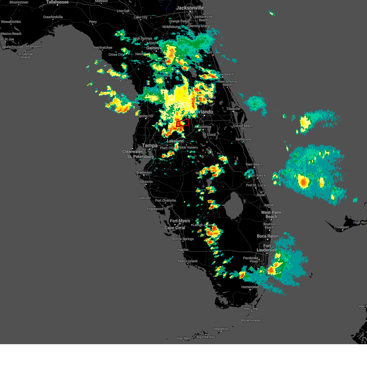
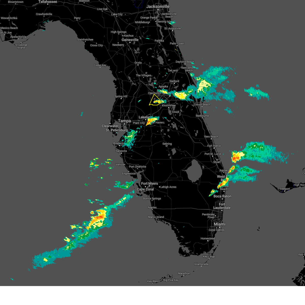
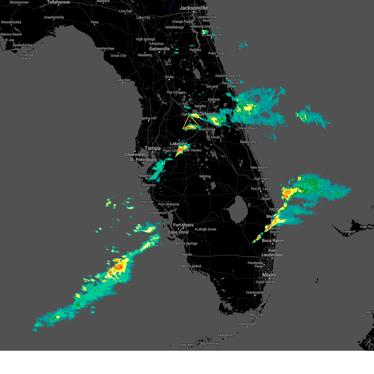
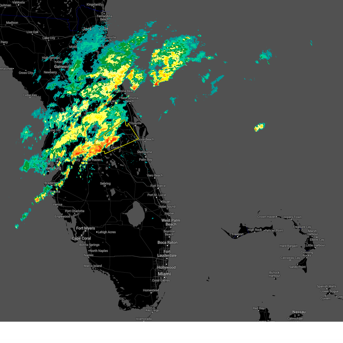
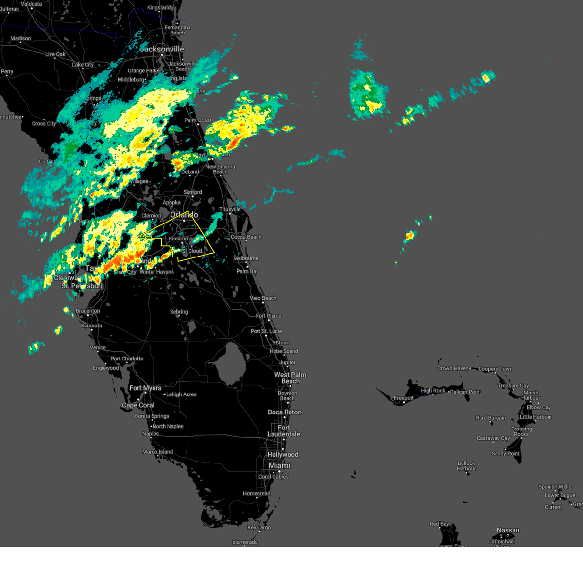
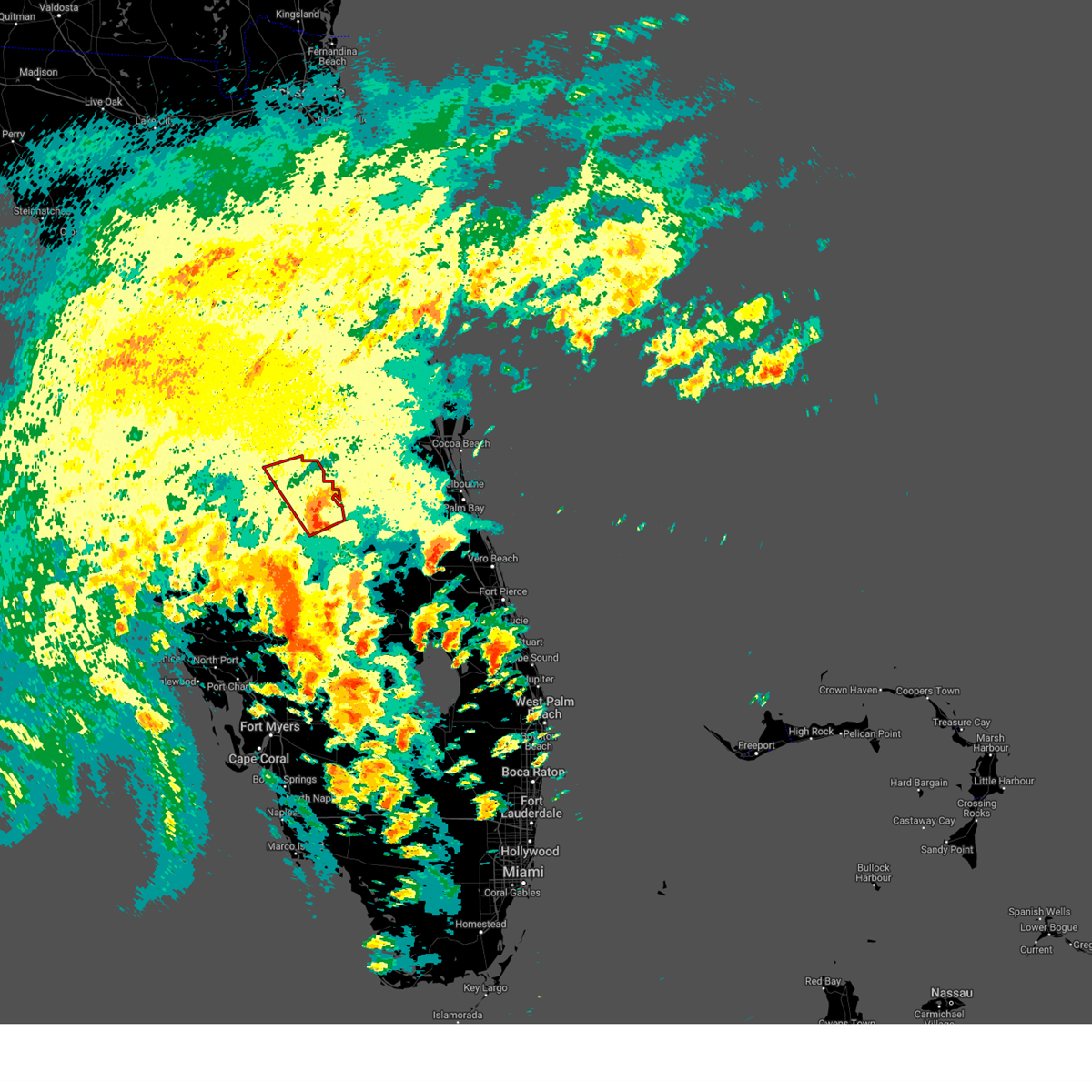
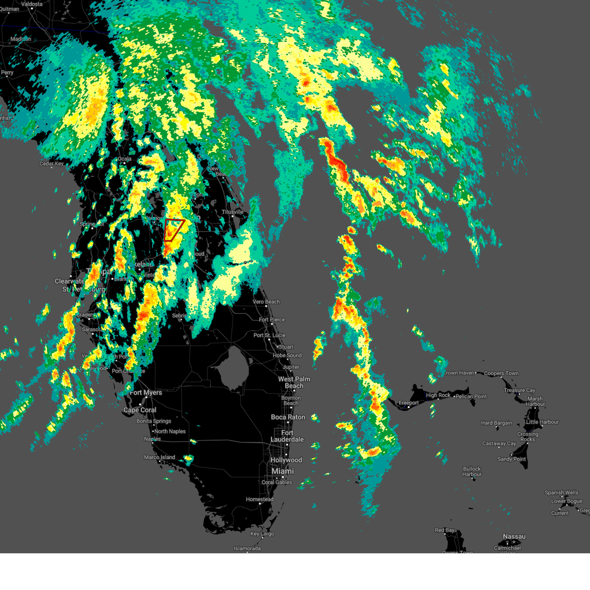
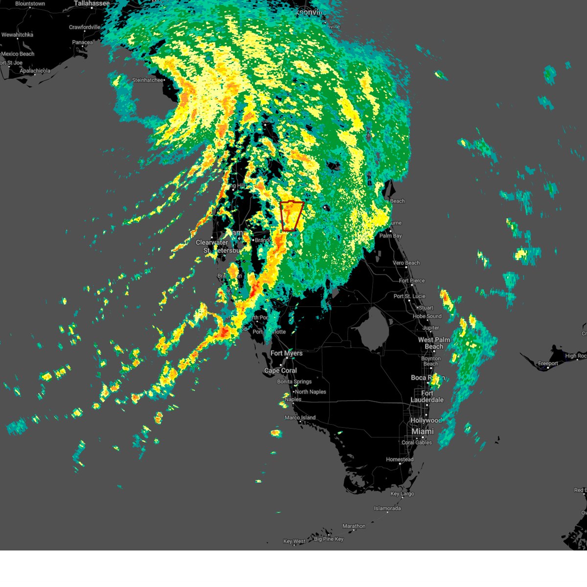
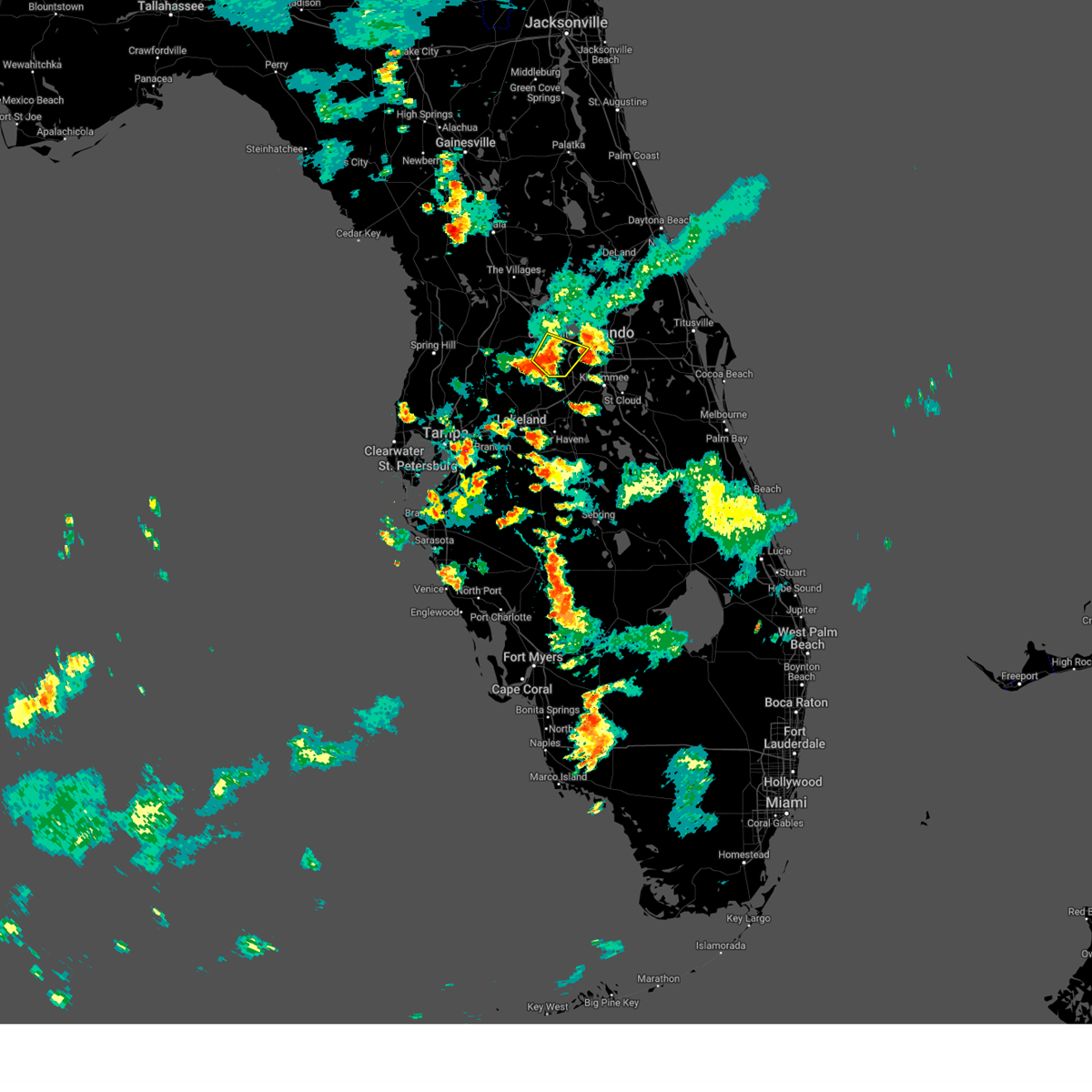
Hail Map for Four Corners, FL
The Four Corners, FL area has had 0 reports of on-the-ground hail by trained spotters, and has been under severe weather warnings 22 times during the past 12 months. Doppler radar has detected hail at or near Four Corners, FL on 99 occasions, including 7 occasions during the past year.
| Name: | Four Corners, FL |
| Where Located: | 21.1 miles SW of Orlando, FL |
| Map: | Google Map for Four Corners, FL |
| Population: | 26116 |
| Housing Units: | 26531 |
| More Info: | Search Google for Four Corners, FL |
1
The Top Recent Hail Date for Four Corners, FL is Thursday, June 6, 2024 (22nd out of 99)

Hail and Wind Damage Spotted near Four Corners, FL
| Date / Time | Report Details |
|---|---|
| 3/30/2025 5:15 PM EDT | the tornado warning has been cancelled and is no longer in effect |
| 3/30/2025 5:11 PM EDT | At 511 pm edt, a severe thunderstorm capable of producing a tornado was located near lake louisa, or 11 miles west of bay lake, moving east at 20 mph (radar indicated rotation). Hazards include tornado. Flying debris will be dangerous to those caught without shelter. mobile homes will be damaged or destroyed. damage to roofs, windows, and vehicles will occur. tree damage is likely. This tornadic thunderstorm will remain over mainly rural areas of south central lake county. |
| 3/30/2025 4:58 PM EDT |
 Tormlb the national weather service in melbourne has issued a * tornado warning for, southwestern lake county in east central florida, * until 530 pm edt. * at 458 pm edt, a severe thunderstorm capable of producing a tornado was located 9 miles southwest of lake louisa, or 12 miles south of groveland, moving east at 10 mph (radar indicated rotation). Hazards include tornado. Flying debris will be dangerous to those caught without shelter. mobile homes will be damaged or destroyed. damage to roofs, windows, and vehicles will occur. tree damage is likely. This tornadic thunderstorm will remain over mainly rural areas of southwestern lake county. Tormlb the national weather service in melbourne has issued a * tornado warning for, southwestern lake county in east central florida, * until 530 pm edt. * at 458 pm edt, a severe thunderstorm capable of producing a tornado was located 9 miles southwest of lake louisa, or 12 miles south of groveland, moving east at 10 mph (radar indicated rotation). Hazards include tornado. Flying debris will be dangerous to those caught without shelter. mobile homes will be damaged or destroyed. damage to roofs, windows, and vehicles will occur. tree damage is likely. This tornadic thunderstorm will remain over mainly rural areas of southwestern lake county.
|
| 3/16/2025 8:32 PM EDT |
 the severe thunderstorm warning has been cancelled and is no longer in effect the severe thunderstorm warning has been cancelled and is no longer in effect
|
| 3/16/2025 8:19 PM EDT |
 Svrmlb the national weather service in melbourne has issued a * severe thunderstorm warning for, south central lake county in east central florida, western orange county in east central florida, * until 845 pm edt. * at 819 pm edt, a severe thunderstorm was located 10 miles west of four corners, or 14 miles west of bay lake, moving northeast at 30 mph (radar indicated). Hazards include 60 mph wind gusts. expect damage to roofs, siding, and trees Svrmlb the national weather service in melbourne has issued a * severe thunderstorm warning for, south central lake county in east central florida, western orange county in east central florida, * until 845 pm edt. * at 819 pm edt, a severe thunderstorm was located 10 miles west of four corners, or 14 miles west of bay lake, moving northeast at 30 mph (radar indicated). Hazards include 60 mph wind gusts. expect damage to roofs, siding, and trees
|
| 1/19/2025 12:42 PM EST |
 Svrmlb the national weather service in melbourne has issued a * severe thunderstorm warning for, southeastern seminole county in east central florida, west central brevard county in east central florida, southern orange county in east central florida, northern osceola county in east central florida, * until 130 pm est. * at 1242 pm est, a severe thunderstorm was located over campbell, or near west lake toho, moving northeast at 55 mph (radar indicated). Hazards include 60 mph wind gusts. expect damage to roofs, siding, and trees Svrmlb the national weather service in melbourne has issued a * severe thunderstorm warning for, southeastern seminole county in east central florida, west central brevard county in east central florida, southern orange county in east central florida, northern osceola county in east central florida, * until 130 pm est. * at 1242 pm est, a severe thunderstorm was located over campbell, or near west lake toho, moving northeast at 55 mph (radar indicated). Hazards include 60 mph wind gusts. expect damage to roofs, siding, and trees
|
| 1/19/2025 12:01 PM EST |
 Svrmlb the national weather service in melbourne has issued a * severe thunderstorm warning for, southwestern lake county in east central florida, southwestern orange county in east central florida, northern osceola county in east central florida, * until 1245 pm est. * at 1201 pm est, a severe thunderstorm was located 7 miles north of auburndale, moving northeast at 45 mph (radar indicated). Hazards include 60 mph wind gusts and penny size hail. expect damage to roofs, siding, and trees Svrmlb the national weather service in melbourne has issued a * severe thunderstorm warning for, southwestern lake county in east central florida, southwestern orange county in east central florida, northern osceola county in east central florida, * until 1245 pm est. * at 1201 pm est, a severe thunderstorm was located 7 miles north of auburndale, moving northeast at 45 mph (radar indicated). Hazards include 60 mph wind gusts and penny size hail. expect damage to roofs, siding, and trees
|
| 10/9/2024 3:52 PM EDT |
 the tornado warning has been cancelled and is no longer in effect the tornado warning has been cancelled and is no longer in effect
|
| 10/9/2024 3:38 PM EDT |
 Tortbw the national weather service in ruskin has issued a * tornado warning for, central polk county in central florida, * until 430 pm edt. * at 338 pm edt, a severe thunderstorm capable of producing a tornado was located 8 miles north of avon park, moving north at 55 mph (radar indicated rotation). Hazards include tornado. Flying debris will be dangerous to those caught without shelter. mobile homes will be damaged or destroyed. damage to roofs, windows, and vehicles will occur. tree damage is likely. this dangerous storm will be near, lake wales around 345 pm edt. winter haven around 355 pm edt. haines city around 400 pm edt. Other locations impacted by this tornadic thunderstorm include highland park, crooked lake park, poinciana, cypress gardens, dundee, lake wales municipal airport, babson park, frostproof, lake hamilton, and waverly. Tortbw the national weather service in ruskin has issued a * tornado warning for, central polk county in central florida, * until 430 pm edt. * at 338 pm edt, a severe thunderstorm capable of producing a tornado was located 8 miles north of avon park, moving north at 55 mph (radar indicated rotation). Hazards include tornado. Flying debris will be dangerous to those caught without shelter. mobile homes will be damaged or destroyed. damage to roofs, windows, and vehicles will occur. tree damage is likely. this dangerous storm will be near, lake wales around 345 pm edt. winter haven around 355 pm edt. haines city around 400 pm edt. Other locations impacted by this tornadic thunderstorm include highland park, crooked lake park, poinciana, cypress gardens, dundee, lake wales municipal airport, babson park, frostproof, lake hamilton, and waverly.
|
| 10/9/2024 2:33 PM EDT |
 At 233 pm edt, a severe thunderstorm capable of producing a tornado was located over winter haven, moving northwest at 25 mph (radar indicated rotation). Hazards include tornado. Flying debris will be dangerous to those caught without shelter. mobile homes will be damaged or destroyed. damage to roofs, windows, and vehicles will occur. tree damage is likely. this dangerous storm will be near, winter haven and auburndale around 240 pm edt. Other locations impacted by this tornadic thunderstorm include lake hamilton, polk city, inwood, poinciana, loughman, davenport, lake alfred, cypress gardens, winter haven airport, and dundee. At 233 pm edt, a severe thunderstorm capable of producing a tornado was located over winter haven, moving northwest at 25 mph (radar indicated rotation). Hazards include tornado. Flying debris will be dangerous to those caught without shelter. mobile homes will be damaged or destroyed. damage to roofs, windows, and vehicles will occur. tree damage is likely. this dangerous storm will be near, winter haven and auburndale around 240 pm edt. Other locations impacted by this tornadic thunderstorm include lake hamilton, polk city, inwood, poinciana, loughman, davenport, lake alfred, cypress gardens, winter haven airport, and dundee.
|
| 10/9/2024 2:03 PM EDT |
 Tortbw the national weather service in ruskin has issued a * tornado warning for, central polk county in central florida, * until 245 pm edt. * at 202 pm edt, a severe thunderstorm capable of producing a tornado was located near lake wales, moving northwest at 25 mph (radar indicated rotation). Hazards include tornado. Flying debris will be dangerous to those caught without shelter. mobile homes will be damaged or destroyed. damage to roofs, windows, and vehicles will occur. tree damage is likely. this dangerous storm will be near, winter haven, haines city, and lake wales around 210 pm edt. Other locations impacted by this tornadic thunderstorm include highland park, crooked lake park, inwood, poinciana, cypress gardens, dundee, winter haven airport, lake wales municipal airport, lake hamilton, and polk city. Tortbw the national weather service in ruskin has issued a * tornado warning for, central polk county in central florida, * until 245 pm edt. * at 202 pm edt, a severe thunderstorm capable of producing a tornado was located near lake wales, moving northwest at 25 mph (radar indicated rotation). Hazards include tornado. Flying debris will be dangerous to those caught without shelter. mobile homes will be damaged or destroyed. damage to roofs, windows, and vehicles will occur. tree damage is likely. this dangerous storm will be near, winter haven, haines city, and lake wales around 210 pm edt. Other locations impacted by this tornadic thunderstorm include highland park, crooked lake park, inwood, poinciana, cypress gardens, dundee, winter haven airport, lake wales municipal airport, lake hamilton, and polk city.
|
| 8/5/2024 9:08 AM EDT |
 The storm which prompted the warning has weakened below severe limits, and no longer appears capable of producing a tornado. therefore, the warning will be allowed to expire. a tornado watch remains in effect until 400 pm edt for east central florida. The storm which prompted the warning has weakened below severe limits, and no longer appears capable of producing a tornado. therefore, the warning will be allowed to expire. a tornado watch remains in effect until 400 pm edt for east central florida.
|
| 8/5/2024 8:55 AM EDT |
 Tormlb the national weather service in melbourne has issued a * tornado warning for, southwestern orange county in east central florida, * until 915 am edt. * at 855 am edt, a severe thunderstorm capable of producing a tornado was located over bay lake, moving north at 35 mph (radar indicated rotation). Hazards include tornado. Flying debris will be dangerous to those caught without shelter. mobile homes will be damaged or destroyed. damage to roofs, windows, and vehicles will occur. tree damage is likely. this dangerous storm will be near, orlando, ocoee, and winter garden around 900 am edt. pine hills and orlovista around 910 am edt. Other locations impacted by this tornadic thunderstorm include lake butler. Tormlb the national weather service in melbourne has issued a * tornado warning for, southwestern orange county in east central florida, * until 915 am edt. * at 855 am edt, a severe thunderstorm capable of producing a tornado was located over bay lake, moving north at 35 mph (radar indicated rotation). Hazards include tornado. Flying debris will be dangerous to those caught without shelter. mobile homes will be damaged or destroyed. damage to roofs, windows, and vehicles will occur. tree damage is likely. this dangerous storm will be near, orlando, ocoee, and winter garden around 900 am edt. pine hills and orlovista around 910 am edt. Other locations impacted by this tornadic thunderstorm include lake butler.
|
| 8/5/2024 8:03 AM EDT |
 Tortbw the national weather service in ruskin has issued a * tornado warning for, north central polk county in central florida, * until 830 am edt. * at 803 am edt, a severe thunderstorm capable of producing a tornado was located over jan phyl village, or near auburndale, moving northeast at 40 mph (radar indicated rotation). Hazards include tornado. Flying debris will be dangerous to those caught without shelter. mobile homes will be damaged or destroyed. damage to roofs, windows, and vehicles will occur. tree damage is likely. this dangerous storm will be near, winter haven, haines city, auburndale, and fussels corner around 810 am edt. Other locations impacted by this tornadic thunderstorm include davenport, lake alfred, winter haven airport, polk city, inwood, and eagle lake. Tortbw the national weather service in ruskin has issued a * tornado warning for, north central polk county in central florida, * until 830 am edt. * at 803 am edt, a severe thunderstorm capable of producing a tornado was located over jan phyl village, or near auburndale, moving northeast at 40 mph (radar indicated rotation). Hazards include tornado. Flying debris will be dangerous to those caught without shelter. mobile homes will be damaged or destroyed. damage to roofs, windows, and vehicles will occur. tree damage is likely. this dangerous storm will be near, winter haven, haines city, auburndale, and fussels corner around 810 am edt. Other locations impacted by this tornadic thunderstorm include davenport, lake alfred, winter haven airport, polk city, inwood, and eagle lake.
|
| 8/5/2024 6:15 AM EDT |
 the tornado warning has been cancelled and is no longer in effect the tornado warning has been cancelled and is no longer in effect
|
| 8/5/2024 6:01 AM EDT |
 Tortbw the national weather service in ruskin has issued a * tornado warning for, northwestern polk county in central florida, * until 630 am edt. * at 601 am edt, a severe thunderstorm capable of producing a tornado was located over fussels corner, or near auburndale, moving north at 45 mph (radar indicated rotation). Hazards include tornado. Flying debris will be dangerous to those caught without shelter. mobile homes will be damaged or destroyed. damage to roofs, windows, and vehicles will occur. tree damage is likely. this dangerous storm will be near, lakeland and auburndale around 605 am edt. Other locations impacted by this tornadic thunderstorm include withla, polk city, and rockridge. Tortbw the national weather service in ruskin has issued a * tornado warning for, northwestern polk county in central florida, * until 630 am edt. * at 601 am edt, a severe thunderstorm capable of producing a tornado was located over fussels corner, or near auburndale, moving north at 45 mph (radar indicated rotation). Hazards include tornado. Flying debris will be dangerous to those caught without shelter. mobile homes will be damaged or destroyed. damage to roofs, windows, and vehicles will occur. tree damage is likely. this dangerous storm will be near, lakeland and auburndale around 605 am edt. Other locations impacted by this tornadic thunderstorm include withla, polk city, and rockridge.
|
| 7/30/2024 6:19 PM EDT |
 the severe thunderstorm warning has been cancelled and is no longer in effect the severe thunderstorm warning has been cancelled and is no longer in effect
|
| 7/30/2024 6:06 PM EDT | Svrmlb the national weather service in melbourne has issued a * severe thunderstorm warning for, south central lake county in east central florida, west central orange county in east central florida, * until 630 pm edt. * at 605 pm edt, a severe thunderstorm was located over lake louisa, or 8 miles southeast of groveland, moving southeast at 10 mph (radar indicated). Hazards include 60 mph wind gusts and quarter size hail. Hail damage to vehicles is expected. Expect wind damage to roofs, siding, and trees. |
| 5/14/2024 12:36 PM EDT |
 At 1236 pm edt, severe thunderstorms were located along a line extending from lake mary to windermere to near bay lake to 6 miles north of auburndale, moving east at 35 mph (radar indicated). Hazards include 60 mph wind gusts and penny size hail. Expect damage to roofs, siding, and trees. Locations impacted include, orlando, sanford, apopka, altamonte springs, and ocoee. At 1236 pm edt, severe thunderstorms were located along a line extending from lake mary to windermere to near bay lake to 6 miles north of auburndale, moving east at 35 mph (radar indicated). Hazards include 60 mph wind gusts and penny size hail. Expect damage to roofs, siding, and trees. Locations impacted include, orlando, sanford, apopka, altamonte springs, and ocoee.
|
| 5/14/2024 12:12 PM EDT |
 Svrmlb the national weather service in melbourne has issued a * severe thunderstorm warning for, southwestern seminole county in east central florida, southwestern lake county in east central florida, western orange county in east central florida, northwestern osceola county in east central florida, * until 1245 pm edt. * at 1211 pm edt, severe thunderstorms were located along a line extending from near zellwood to near groveland to 12 miles southwest of lake louisa to 8 miles southeast of zephyrhills south, moving east at 35 mph (radar indicated). Hazards include 60 mph wind gusts and penny size hail. expect damage to roofs, siding, and trees Svrmlb the national weather service in melbourne has issued a * severe thunderstorm warning for, southwestern seminole county in east central florida, southwestern lake county in east central florida, western orange county in east central florida, northwestern osceola county in east central florida, * until 1245 pm edt. * at 1211 pm edt, severe thunderstorms were located along a line extending from near zellwood to near groveland to 12 miles southwest of lake louisa to 8 miles southeast of zephyrhills south, moving east at 35 mph (radar indicated). Hazards include 60 mph wind gusts and penny size hail. expect damage to roofs, siding, and trees
|
| 5/13/2024 4:27 PM EDT |
 At 426 pm edt, a severe thunderstorm was located near auburndale, moving northeast at 15 mph (radar indicated). Hazards include ping pong ball size hail and 60 mph wind gusts. People and animals outdoors will be injured. expect hail damage to roofs, siding, windows, and vehicles. expect wind damage to roofs, siding, and trees. Locations impacted include, winter haven, haines city, lake alfred, davenport, and loughman. At 426 pm edt, a severe thunderstorm was located near auburndale, moving northeast at 15 mph (radar indicated). Hazards include ping pong ball size hail and 60 mph wind gusts. People and animals outdoors will be injured. expect hail damage to roofs, siding, windows, and vehicles. expect wind damage to roofs, siding, and trees. Locations impacted include, winter haven, haines city, lake alfred, davenport, and loughman.
|
| 5/13/2024 4:19 PM EDT |
 Svrtbw the national weather service in ruskin has issued a * severe thunderstorm warning for, north central polk county in central florida, * until 500 pm edt. * at 419 pm edt, a severe thunderstorm was located near auburndale, moving northeast at 15 mph (radar indicated). Hazards include 60 mph wind gusts and quarter size hail. Hail damage to vehicles is expected. Expect wind damage to roofs, siding, and trees. Svrtbw the national weather service in ruskin has issued a * severe thunderstorm warning for, north central polk county in central florida, * until 500 pm edt. * at 419 pm edt, a severe thunderstorm was located near auburndale, moving northeast at 15 mph (radar indicated). Hazards include 60 mph wind gusts and quarter size hail. Hail damage to vehicles is expected. Expect wind damage to roofs, siding, and trees.
|
| 1/9/2024 5:55 PM EST |
 The national weather service in melbourne has issued a * severe thunderstorm warning for. seminole county in east central florida. orange county in east central florida. central volusia county in east central florida. northwestern osceola county in east central florida. Until 645 pm est. The national weather service in melbourne has issued a * severe thunderstorm warning for. seminole county in east central florida. orange county in east central florida. central volusia county in east central florida. northwestern osceola county in east central florida. Until 645 pm est.
|
| 1/9/2024 5:44 PM EST |
 At 543 pm est, severe thunderstorms were located along a line extending from near flagler beach to orange city to ocoee, moving northeast at 70 mph (radar indicated). Hazards include 60 mph wind gusts. Expect damage to roofs, siding, and trees. Locations impacted include, orlando, deltona, daytona beach, kissimmee, and port orange. At 543 pm est, severe thunderstorms were located along a line extending from near flagler beach to orange city to ocoee, moving northeast at 70 mph (radar indicated). Hazards include 60 mph wind gusts. Expect damage to roofs, siding, and trees. Locations impacted include, orlando, deltona, daytona beach, kissimmee, and port orange.
|
| 1/9/2024 5:21 PM EST |
 The national weather service in melbourne has issued a * severe thunderstorm warning for. seminole county in east central florida. central lake county in east central florida. orange county in east central florida. Volusia county in east central florida. The national weather service in melbourne has issued a * severe thunderstorm warning for. seminole county in east central florida. central lake county in east central florida. orange county in east central florida. Volusia county in east central florida.
|
| 1/9/2024 5:07 PM EST |
 At 506 pm est, severe thunderstorms were located along a line extending from near pierson to mid florida lakes to 12 miles southwest of lake louisa, moving northeast at 70 mph (radar indicated). Hazards include 60 mph wind gusts. Expect damage to roofs, siding, and trees. Locations impacted include, apopka, ocoee, winter garden, leesburg, and eustis. At 506 pm est, severe thunderstorms were located along a line extending from near pierson to mid florida lakes to 12 miles southwest of lake louisa, moving northeast at 70 mph (radar indicated). Hazards include 60 mph wind gusts. Expect damage to roofs, siding, and trees. Locations impacted include, apopka, ocoee, winter garden, leesburg, and eustis.
|
| 1/9/2024 4:46 PM EST |
 At 446 pm est, severe thunderstorms were located along a line extending from lake george to near leesburg to 6 miles east of dade city, moving northeast at 65 mph (radar indicated). Hazards include 60 mph wind gusts. expect damage to roofs, siding, and trees At 446 pm est, severe thunderstorms were located along a line extending from lake george to near leesburg to 6 miles east of dade city, moving northeast at 65 mph (radar indicated). Hazards include 60 mph wind gusts. expect damage to roofs, siding, and trees
|
| 9/11/2023 9:53 PM EDT |
 At 952 pm edt, a severe thunderstorm was located near champions gate, or 8 miles northwest of haines city, and is nearly stationary (radar indicated). Hazards include 60 mph wind gusts and quarter size hail. Hail damage to vehicles is expected. Expect wind damage to roofs, siding, and trees. At 952 pm edt, a severe thunderstorm was located near champions gate, or 8 miles northwest of haines city, and is nearly stationary (radar indicated). Hazards include 60 mph wind gusts and quarter size hail. Hail damage to vehicles is expected. Expect wind damage to roofs, siding, and trees.
|
| 9/8/2023 2:09 PM EDT |
 The severe thunderstorm warning for north central polk county will expire at 215 pm edt, the storm which prompted the warning has weakened below severe limits, and no longer poses an immediate threat to life or property. therefore, the warning will be allowed to expire. however, gusty winds are still possible with this thunderstorm. The severe thunderstorm warning for north central polk county will expire at 215 pm edt, the storm which prompted the warning has weakened below severe limits, and no longer poses an immediate threat to life or property. therefore, the warning will be allowed to expire. however, gusty winds are still possible with this thunderstorm.
|
| 9/8/2023 1:54 PM EDT |
 At 154 pm edt, a severe thunderstorm was located over haines city, moving northeast at 20 mph (radar indicated). Hazards include 60 mph wind gusts and penny size hail. expect damage to roofs, siding, and trees At 154 pm edt, a severe thunderstorm was located over haines city, moving northeast at 20 mph (radar indicated). Hazards include 60 mph wind gusts and penny size hail. expect damage to roofs, siding, and trees
|
| 6/22/2023 2:15 PM EDT |
 At 215 pm edt, severe thunderstorms were located along a line extending from near auburndale to near winter haven to 6 miles southeast of jan phyl village, moving northeast at 30 mph (radar indicated). Hazards include 70 mph wind gusts. Expect considerable tree damage. damage is likely to mobile homes, roofs, and outbuildings. locations impacted include, lakeland, poinciana, winter haven, haines city, lake wales, auburndale, lake alfred, dundee, davenport, and eagle lake. thunderstorm damage threat, considerable hail threat, radar indicated max hail size, <. 75 in wind threat, radar indicated max wind gust, 70 mph. At 215 pm edt, severe thunderstorms were located along a line extending from near auburndale to near winter haven to 6 miles southeast of jan phyl village, moving northeast at 30 mph (radar indicated). Hazards include 70 mph wind gusts. Expect considerable tree damage. damage is likely to mobile homes, roofs, and outbuildings. locations impacted include, lakeland, poinciana, winter haven, haines city, lake wales, auburndale, lake alfred, dundee, davenport, and eagle lake. thunderstorm damage threat, considerable hail threat, radar indicated max hail size, <. 75 in wind threat, radar indicated max wind gust, 70 mph.
|
| 6/22/2023 2:00 PM EDT |
 At 200 pm edt, severe thunderstorms were located along a line extending from fussels corner to jan phyl village to near bartow, moving northeast at 30 mph (radar indicated). Hazards include 60 mph wind gusts. expect damage to roofs, siding, and trees At 200 pm edt, severe thunderstorms were located along a line extending from fussels corner to jan phyl village to near bartow, moving northeast at 30 mph (radar indicated). Hazards include 60 mph wind gusts. expect damage to roofs, siding, and trees
|
| 6/19/2023 8:58 PM EDT |
 At 858 pm edt, a severe thunderstorm was located near winter haven, moving east at 15 mph (radar indicated). Hazards include 60 mph wind gusts and quarter size hail. Hail damage to vehicles is expected. expect wind damage to roofs, siding, and trees. locations impacted include, winter haven, haines city, lake wales, auburndale, lake alfred, dundee, davenport, eagle lake, lake hamilton, and inwood. hail threat, radar indicated max hail size, 1. 00 in wind threat, radar indicated max wind gust, 60 mph. At 858 pm edt, a severe thunderstorm was located near winter haven, moving east at 15 mph (radar indicated). Hazards include 60 mph wind gusts and quarter size hail. Hail damage to vehicles is expected. expect wind damage to roofs, siding, and trees. locations impacted include, winter haven, haines city, lake wales, auburndale, lake alfred, dundee, davenport, eagle lake, lake hamilton, and inwood. hail threat, radar indicated max hail size, 1. 00 in wind threat, radar indicated max wind gust, 60 mph.
|
| 6/19/2023 8:33 PM EDT |
 At 832 pm edt, a severe thunderstorm was located over jan phyl village, or near auburndale, moving east at 15 mph (radar indicated). Hazards include 60 mph wind gusts and quarter size hail. Hail damage to vehicles is expected. Expect wind damage to roofs, siding, and trees. At 832 pm edt, a severe thunderstorm was located over jan phyl village, or near auburndale, moving east at 15 mph (radar indicated). Hazards include 60 mph wind gusts and quarter size hail. Hail damage to vehicles is expected. Expect wind damage to roofs, siding, and trees.
|
| 6/17/2023 11:13 AM EDT |
 At 1112 am edt, a strong to severe thunderstorm was located over ferndale, to near clermont moving southeast at 30 mph (radar indicated). Hazards include 60 mph wind gusts and penny size hail. Expect damage to roofs, siding, and trees. locations impacted include, apopka, ocoee, winter garden, eustis and tavares. hail threat, radar indicated max hail size, 0. 75 in wind threat, radar indicated max wind gust, 60 mph. At 1112 am edt, a strong to severe thunderstorm was located over ferndale, to near clermont moving southeast at 30 mph (radar indicated). Hazards include 60 mph wind gusts and penny size hail. Expect damage to roofs, siding, and trees. locations impacted include, apopka, ocoee, winter garden, eustis and tavares. hail threat, radar indicated max hail size, 0. 75 in wind threat, radar indicated max wind gust, 60 mph.
|
| 6/17/2023 11:02 AM EDT |
 At 1102 am edt, a severe thunderstorm was located near howey-in-the-hills, moving southeast at 30 mph (radar indicated). Hazards include 60 mph wind gusts and penny size hail. expect damage to roofs, siding, and trees At 1102 am edt, a severe thunderstorm was located near howey-in-the-hills, moving southeast at 30 mph (radar indicated). Hazards include 60 mph wind gusts and penny size hail. expect damage to roofs, siding, and trees
|
| 4/26/2023 7:57 PM EDT |
 At 756 pm edt, a severe thunderstorm was located 11 miles west of four corners, or 13 miles north of auburndale, moving southeast at 15 mph (radar indicated). Hazards include quarter size hail. damage to vehicles is expected At 756 pm edt, a severe thunderstorm was located 11 miles west of four corners, or 13 miles north of auburndale, moving southeast at 15 mph (radar indicated). Hazards include quarter size hail. damage to vehicles is expected
|
| 4/26/2023 7:36 PM EDT |
 At 736 pm edt, a severe thunderstorm was located 12 miles southwest of lake louisa, or 15 miles south of groveland, moving southeast at 15 mph (radar indicated). Hazards include quarter size hail. damage to vehicles is expected At 736 pm edt, a severe thunderstorm was located 12 miles southwest of lake louisa, or 15 miles south of groveland, moving southeast at 15 mph (radar indicated). Hazards include quarter size hail. damage to vehicles is expected
|
| 4/25/2023 5:41 PM EDT |
 The severe thunderstorm warning for north central polk county will expire at 545 pm edt, the storm which prompted the warning has moved out of the area. therefore, the warning will be allowed to expire. however, small hail is still possible with this thunderstorm. remember, a severe thunderstorm warning still remains in effect for northeastern polk county until 615 pm edt. The severe thunderstorm warning for north central polk county will expire at 545 pm edt, the storm which prompted the warning has moved out of the area. therefore, the warning will be allowed to expire. however, small hail is still possible with this thunderstorm. remember, a severe thunderstorm warning still remains in effect for northeastern polk county until 615 pm edt.
|
| 4/25/2023 5:40 PM EDT |
 The severe thunderstorm warning for southern lake, southwestern orange and portions of northwestern osceola counties will expire at 545 pm edt, the storm which prompted the warning has moved out of the area. therefore, the warning will be allowed to expire. however gusty winds and heavy rain are still possible with this thunderstorm. remember, a severe thunderstorm warning still remains in effect for northwest osceola county until 615 pm. The severe thunderstorm warning for southern lake, southwestern orange and portions of northwestern osceola counties will expire at 545 pm edt, the storm which prompted the warning has moved out of the area. therefore, the warning will be allowed to expire. however gusty winds and heavy rain are still possible with this thunderstorm. remember, a severe thunderstorm warning still remains in effect for northwest osceola county until 615 pm.
|
| 4/25/2023 5:36 PM EDT |
 At 536 pm edt, a severe thunderstorm was located near poinciana, or near haines city, moving southeast at 25 mph (radar indicated). Hazards include ping pong ball size hail and 60 mph wind gusts. People and animals outdoors will be injured. expect hail damage to roofs, siding, windows, and vehicles. Expect wind damage to roofs, siding, and trees. At 536 pm edt, a severe thunderstorm was located near poinciana, or near haines city, moving southeast at 25 mph (radar indicated). Hazards include ping pong ball size hail and 60 mph wind gusts. People and animals outdoors will be injured. expect hail damage to roofs, siding, windows, and vehicles. Expect wind damage to roofs, siding, and trees.
|
| 4/25/2023 5:15 PM EDT |
 At 514 pm edt, a severe thunderstorm was located near four corners, or near bay lake, moving southeast at 25 mph (radar indicated). Hazards include golf ball size hail and 60 mph wind gusts. People and animals outdoors will be injured. expect hail damage to roofs, siding, windows, and vehicles. expect wind damage to roofs, siding, and trees. Locations impacted include, kissimmee, lake buena vista, celebration, intercession city and four corners. At 514 pm edt, a severe thunderstorm was located near four corners, or near bay lake, moving southeast at 25 mph (radar indicated). Hazards include golf ball size hail and 60 mph wind gusts. People and animals outdoors will be injured. expect hail damage to roofs, siding, windows, and vehicles. expect wind damage to roofs, siding, and trees. Locations impacted include, kissimmee, lake buena vista, celebration, intercession city and four corners.
|
| 4/25/2023 5:12 PM EDT |
 At 511 pm edt, a severe thunderstorm was located over four corners, or near bay lake, moving southeast at 25 mph (radar indicated). Hazards include 60 mph wind gusts and half dollar size hail. Hail damage to vehicles is expected. Expect wind damage to roofs, siding, and trees. At 511 pm edt, a severe thunderstorm was located over four corners, or near bay lake, moving southeast at 25 mph (radar indicated). Hazards include 60 mph wind gusts and half dollar size hail. Hail damage to vehicles is expected. Expect wind damage to roofs, siding, and trees.
|
| 4/25/2023 5:03 PM EDT |
 At 503 pm edt, a severe thunderstorm was located near lake louisa, or 7 miles west of bay lake, moving southeast at 25 mph (radar indicated). Hazards include golf ball size hail and 60 mph wind gusts. People and animals outdoors will be injured. expect hail damage to roofs, siding, windows, and vehicles. Expect wind damage to roofs, siding, and trees. At 503 pm edt, a severe thunderstorm was located near lake louisa, or 7 miles west of bay lake, moving southeast at 25 mph (radar indicated). Hazards include golf ball size hail and 60 mph wind gusts. People and animals outdoors will be injured. expect hail damage to roofs, siding, windows, and vehicles. Expect wind damage to roofs, siding, and trees.
|
| 4/25/2023 4:54 PM EDT |
 At 454 pm edt, a severe thunderstorm was located over lake louisa, or 8 miles southeast of groveland, moving southeast at 25 mph (radar indicated). Hazards include golf ball size hail and 60 mph wind gusts. People and animals outdoors will be injured. expect hail damage to roofs, siding, windows, and vehicles. Expect wind damage to roofs, siding, and trees. At 454 pm edt, a severe thunderstorm was located over lake louisa, or 8 miles southeast of groveland, moving southeast at 25 mph (radar indicated). Hazards include golf ball size hail and 60 mph wind gusts. People and animals outdoors will be injured. expect hail damage to roofs, siding, windows, and vehicles. Expect wind damage to roofs, siding, and trees.
|
| 4/25/2023 4:35 PM EDT |
 At 435 pm edt, a severe thunderstorm was located over groveland, moving southeast at 25 mph. this is a destructive storm for mascotte and groveland (radar indicated). Hazards include baseball size hail and 60 mph wind gusts. People and animals outdoors will be severely injured. Expect shattered windows, extensive damage to roofs, siding, and vehicles. At 435 pm edt, a severe thunderstorm was located over groveland, moving southeast at 25 mph. this is a destructive storm for mascotte and groveland (radar indicated). Hazards include baseball size hail and 60 mph wind gusts. People and animals outdoors will be severely injured. Expect shattered windows, extensive damage to roofs, siding, and vehicles.
|
| 12/15/2022 12:10 PM EST |
 The severe thunderstorm warning for southwestern lake county will expire at 1215 pm est, the storm which prompted the warning has weakened below severe limits, and no longer poses an immediate threat to life or property. therefore, the warning will be allowed to expire. however gusty winds and heavy rain are still possible with this thunderstorm. a tornado watch remains in effect until 400 pm est for east central florida. to report severe weather, contact your nearest law enforcement agency. they will relay your report to the national weather service melbourne. The severe thunderstorm warning for southwestern lake county will expire at 1215 pm est, the storm which prompted the warning has weakened below severe limits, and no longer poses an immediate threat to life or property. therefore, the warning will be allowed to expire. however gusty winds and heavy rain are still possible with this thunderstorm. a tornado watch remains in effect until 400 pm est for east central florida. to report severe weather, contact your nearest law enforcement agency. they will relay your report to the national weather service melbourne.
|
| 12/15/2022 11:53 AM EST |
 At 1153 am est, a severe thunderstorm was located near howey-in-the-hills, moving northeast at 35 mph (radar indicated). Hazards include 60 mph wind gusts. Expect damage to roofs, siding, and trees. Locations impacted include, leesburg, eustis, tavares, mount dora and groveland. At 1153 am est, a severe thunderstorm was located near howey-in-the-hills, moving northeast at 35 mph (radar indicated). Hazards include 60 mph wind gusts. Expect damage to roofs, siding, and trees. Locations impacted include, leesburg, eustis, tavares, mount dora and groveland.
|
| 12/15/2022 11:31 AM EST |
 At 1131 am est, a severe thunderstorm was located near mascotte, moving northeast at 40 mph (radar indicated). Hazards include 60 mph wind gusts. expect damage to roofs, siding, and trees At 1131 am est, a severe thunderstorm was located near mascotte, moving northeast at 40 mph (radar indicated). Hazards include 60 mph wind gusts. expect damage to roofs, siding, and trees
|
| 9/12/2022 5:56 PM EDT |
 At 555 pm edt, a severe thunderstorm was located 6 miles south of lake louisa, moving east at 15 mph (radar indicated). Hazards include 60 mph wind gusts. expect damage to roofs, siding, and trees At 555 pm edt, a severe thunderstorm was located 6 miles south of lake louisa, moving east at 15 mph (radar indicated). Hazards include 60 mph wind gusts. expect damage to roofs, siding, and trees
|
| 8/20/2022 6:42 PM EDT |
 The severe thunderstorm warning for southwestern orange county will expire at 645 pm edt, the storm which prompted the warning has weakened below severe limits, and no longer poses an immediate threat to life or property. therefore, the warning will be allowed to expire. however small hail and gusty winds are still possible with this thunderstorm. to report severe weather, contact your nearest law enforcement agency. they will relay your report to the national weather service melbourne. The severe thunderstorm warning for southwestern orange county will expire at 645 pm edt, the storm which prompted the warning has weakened below severe limits, and no longer poses an immediate threat to life or property. therefore, the warning will be allowed to expire. however small hail and gusty winds are still possible with this thunderstorm. to report severe weather, contact your nearest law enforcement agency. they will relay your report to the national weather service melbourne.
|
| 8/20/2022 6:29 PM EDT |
 At 628 pm edt, a severe thunderstorm was located over horizon west, or near bay lake, moving southwest at 15 mph (radar indicated). Hazards include 60 mph wind gusts and penny size hail. Expect damage to roofs, siding, and trees. locations impacted include, ocoee, winter garden, windermere, bay lake and oakland. hail threat, radar indicated max hail size, 0. 75 in wind threat, radar indicated max wind gust, 60 mph. At 628 pm edt, a severe thunderstorm was located over horizon west, or near bay lake, moving southwest at 15 mph (radar indicated). Hazards include 60 mph wind gusts and penny size hail. Expect damage to roofs, siding, and trees. locations impacted include, ocoee, winter garden, windermere, bay lake and oakland. hail threat, radar indicated max hail size, 0. 75 in wind threat, radar indicated max wind gust, 60 mph.
|
| 8/20/2022 6:18 PM EDT |
 At 618 pm edt, a severe thunderstorm was located over windermere, moving southwest at 10 mph (radar indicated). Hazards include 60 mph wind gusts and penny size hail. expect damage to roofs, siding, and trees At 618 pm edt, a severe thunderstorm was located over windermere, moving southwest at 10 mph (radar indicated). Hazards include 60 mph wind gusts and penny size hail. expect damage to roofs, siding, and trees
|
| 8/2/2022 7:07 PM EDT |
 The severe thunderstorm warning for southwestern orange and northwestern osceola counties will expire at 715 pm edt, the severe thunderstorm which prompted the warning has weakened. therefore, the warning will be allowed to expire. however, excessive lightning, heavy rain, and gusty winds are still possible with this thunderstorm. The severe thunderstorm warning for southwestern orange and northwestern osceola counties will expire at 715 pm edt, the severe thunderstorm which prompted the warning has weakened. therefore, the warning will be allowed to expire. however, excessive lightning, heavy rain, and gusty winds are still possible with this thunderstorm.
|
| 8/2/2022 6:54 PM EDT |
 At 653 pm edt, a severe thunderstorm was located over bay lake, moving north at 5 mph (radar indicated. at 639 pm, broadcast media relayed report of dime sized hail near four corners). Hazards include 60 mph wind gusts and quarter size hail. Hail damage to vehicles is expected. expect wind damage to roofs, siding, and trees. locations impacted include, bay lake, celebration, intercession city, four corners and doctor phillips. hail threat, observed max hail size, 1. 00 in wind threat, radar indicated max wind gust, 60 mph. At 653 pm edt, a severe thunderstorm was located over bay lake, moving north at 5 mph (radar indicated. at 639 pm, broadcast media relayed report of dime sized hail near four corners). Hazards include 60 mph wind gusts and quarter size hail. Hail damage to vehicles is expected. expect wind damage to roofs, siding, and trees. locations impacted include, bay lake, celebration, intercession city, four corners and doctor phillips. hail threat, observed max hail size, 1. 00 in wind threat, radar indicated max wind gust, 60 mph.
|
| 8/2/2022 6:40 PM EDT |
 At 640 pm edt, severe thunderstorms were located along a line extending from near four corners to champions gate, moving north at 5 mph (radar indicated). Hazards include quarter size hail. damage to vehicles is expected At 640 pm edt, severe thunderstorms were located along a line extending from near four corners to champions gate, moving north at 5 mph (radar indicated). Hazards include quarter size hail. damage to vehicles is expected
|
| 8/2/2022 6:31 PM EDT |
 At 630 pm edt, a severe thunderstorm was located near bay lake, moving northeast at 10 mph (radar indicated). Hazards include 60 mph wind gusts and quarter size hail. Hail damage to vehicles is expected. Expect wind damage to roofs, siding, and trees. At 630 pm edt, a severe thunderstorm was located near bay lake, moving northeast at 10 mph (radar indicated). Hazards include 60 mph wind gusts and quarter size hail. Hail damage to vehicles is expected. Expect wind damage to roofs, siding, and trees.
|
| 8/1/2022 9:12 PM EDT |
 At 911 pm edt, a severe thunderstorm was located near horizon west, or near bay lake, and is nearly stationary (radar indicated). Hazards include 60 mph wind gusts and quarter size hail. Hail damage to vehicles is expected. expect wind damage to roofs, siding, and trees. locations impacted include, windermere, bay lake, horizon west, bay hill and lake buena vista. hail threat, radar indicated max hail size, 1. 00 in wind threat, radar indicated max wind gust, 60 mph. At 911 pm edt, a severe thunderstorm was located near horizon west, or near bay lake, and is nearly stationary (radar indicated). Hazards include 60 mph wind gusts and quarter size hail. Hail damage to vehicles is expected. expect wind damage to roofs, siding, and trees. locations impacted include, windermere, bay lake, horizon west, bay hill and lake buena vista. hail threat, radar indicated max hail size, 1. 00 in wind threat, radar indicated max wind gust, 60 mph.
|
| 8/1/2022 8:59 PM EDT |
 At 858 pm edt, a severe thunderstorm was located over horizon west, or near bay lake, and is nearly stationary (radar indicated). Hazards include 60 mph wind gusts and quarter size hail. Hail damage to vehicles is expected. expect wind damage to roofs, siding, and trees. locations impacted include, winter garden, windermere, bay lake, horizon west and bay hill. hail threat, radar indicated max hail size, 1. 00 in wind threat, radar indicated max wind gust, 60 mph. At 858 pm edt, a severe thunderstorm was located over horizon west, or near bay lake, and is nearly stationary (radar indicated). Hazards include 60 mph wind gusts and quarter size hail. Hail damage to vehicles is expected. expect wind damage to roofs, siding, and trees. locations impacted include, winter garden, windermere, bay lake, horizon west and bay hill. hail threat, radar indicated max hail size, 1. 00 in wind threat, radar indicated max wind gust, 60 mph.
|
| 8/1/2022 8:52 PM EDT |
 At 852 pm edt, a severe thunderstorm was located over horizon west, or near bay lake, and is nearly stationary (radar indicated). Hazards include 60 mph wind gusts and nickel size hail. expect damage to roofs, siding, and trees At 852 pm edt, a severe thunderstorm was located over horizon west, or near bay lake, and is nearly stationary (radar indicated). Hazards include 60 mph wind gusts and nickel size hail. expect damage to roofs, siding, and trees
|
| 7/14/2022 6:34 PM EDT |
 At 634 pm edt, a severe thunderstorm was located over horizon west, or near bay lake, moving northwest at 15 mph (radar indicated). Hazards include 60 mph wind gusts and penny size hail. Expect damage to roofs, siding, and trees. locations impacted include, orlando, apopka, ocoee, winter garden and windermere. hail threat, radar indicated max hail size, 0. 75 in wind threat, radar indicated max wind gust, 60 mph. At 634 pm edt, a severe thunderstorm was located over horizon west, or near bay lake, moving northwest at 15 mph (radar indicated). Hazards include 60 mph wind gusts and penny size hail. Expect damage to roofs, siding, and trees. locations impacted include, orlando, apopka, ocoee, winter garden and windermere. hail threat, radar indicated max hail size, 0. 75 in wind threat, radar indicated max wind gust, 60 mph.
|
| 7/14/2022 6:20 PM EDT |
 At 620 pm edt, a severe thunderstorm was located over bay lake, moving northwest at 10 mph (radar indicated). Hazards include 60 mph wind gusts and quarter size hail. Hail damage to vehicles is expected. Expect wind damage to roofs, siding, and trees. At 620 pm edt, a severe thunderstorm was located over bay lake, moving northwest at 10 mph (radar indicated). Hazards include 60 mph wind gusts and quarter size hail. Hail damage to vehicles is expected. Expect wind damage to roofs, siding, and trees.
|
| 6/18/2022 2:53 PM EDT |
 The severe thunderstorm warning for north central polk county will expire at 300 pm edt, the storm which prompted the warning has weakened below severe limits, and no longer poses an immediate threat to life or property. therefore, the warning will be allowed to expire. however small hail and gusty winds are still possible with this thunderstorm. a severe thunderstorm watch remains in effect until 800 pm edt for central florida. The severe thunderstorm warning for north central polk county will expire at 300 pm edt, the storm which prompted the warning has weakened below severe limits, and no longer poses an immediate threat to life or property. therefore, the warning will be allowed to expire. however small hail and gusty winds are still possible with this thunderstorm. a severe thunderstorm watch remains in effect until 800 pm edt for central florida.
|
| 6/18/2022 2:40 PM EDT |
 At 240 pm edt, a severe thunderstorm was located near champions gate, or near haines city, moving southeast at 20 mph (radar indicated). Hazards include 60 mph wind gusts and quarter size hail. Hail damage to vehicles is expected. expect wind damage to roofs, siding, and trees. locations impacted include, poinciana, haines city, lake alfred, davenport, lake hamilton and loughman. hail threat, radar indicated max hail size, 1. 00 in wind threat, radar indicated max wind gust, 60 mph. At 240 pm edt, a severe thunderstorm was located near champions gate, or near haines city, moving southeast at 20 mph (radar indicated). Hazards include 60 mph wind gusts and quarter size hail. Hail damage to vehicles is expected. expect wind damage to roofs, siding, and trees. locations impacted include, poinciana, haines city, lake alfred, davenport, lake hamilton and loughman. hail threat, radar indicated max hail size, 1. 00 in wind threat, radar indicated max wind gust, 60 mph.
|
| 6/18/2022 2:29 PM EDT |
 At 229 pm edt, a severe thunderstorm was located near champions gate, or 9 miles northwest of haines city, moving southeast at 20 mph (radar indicated). Hazards include 60 mph wind gusts and quarter size hail. Hail damage to vehicles is expected. Expect wind damage to roofs, siding, and trees. At 229 pm edt, a severe thunderstorm was located near champions gate, or 9 miles northwest of haines city, moving southeast at 20 mph (radar indicated). Hazards include 60 mph wind gusts and quarter size hail. Hail damage to vehicles is expected. Expect wind damage to roofs, siding, and trees.
|
| 6/18/2022 2:24 PM EDT |
 The severe thunderstorm warning for southwestern lake and western orange counties will expire at 230 pm edt. the severe thunderstorm which prompted the warning has weakened. therefore, the warning will be allowed to expire. gusty winds will remain possible. A severe thunderstorm watch remains in effect until 800 pm edt for. The severe thunderstorm warning for southwestern lake and western orange counties will expire at 230 pm edt. the severe thunderstorm which prompted the warning has weakened. therefore, the warning will be allowed to expire. gusty winds will remain possible. A severe thunderstorm watch remains in effect until 800 pm edt for.
|
| 6/18/2022 2:09 PM EDT |
 At 209 pm edt, a severe thunderstorm was located near lake louisa, or 12 miles south of groveland, moving southeast at 25 mph (radar indicated). Hazards include 60 mph wind gusts and penny size hail. Expect damage to roofs, siding, and trees. locations impacted include, bay lake, clermont and lake louisa. hail threat, radar indicated max hail size, 0. 75 in wind threat, radar indicated max wind gust, 60 mph. At 209 pm edt, a severe thunderstorm was located near lake louisa, or 12 miles south of groveland, moving southeast at 25 mph (radar indicated). Hazards include 60 mph wind gusts and penny size hail. Expect damage to roofs, siding, and trees. locations impacted include, bay lake, clermont and lake louisa. hail threat, radar indicated max hail size, 0. 75 in wind threat, radar indicated max wind gust, 60 mph.
|
| 6/18/2022 2:07 PM EDT |
 At 207 pm edt, a severe thunderstorm was located near horizon west, or near winter garden, moving southeast at 15 mph (radar indicated). Hazards include 60 mph wind gusts and penny size hail. expect damage to roofs, siding, and trees At 207 pm edt, a severe thunderstorm was located near horizon west, or near winter garden, moving southeast at 15 mph (radar indicated). Hazards include 60 mph wind gusts and penny size hail. expect damage to roofs, siding, and trees
|
| 6/18/2022 1:54 PM EDT |
 At 153 pm edt, a severe thunderstorm was located near groveland, moving southeast at 25 mph (radar indicated). Hazards include 60 mph wind gusts and penny size hail. expect damage to roofs, siding, and trees At 153 pm edt, a severe thunderstorm was located near groveland, moving southeast at 25 mph (radar indicated). Hazards include 60 mph wind gusts and penny size hail. expect damage to roofs, siding, and trees
|
| 5/29/2022 7:28 PM EDT |
 At 728 pm edt, a severe thunderstorm was located over intercession city, moving southwest at 20 mph (radar indicated). Hazards include 60 mph wind gusts and quarter size hail. Hail damage to vehicles is expected. Expect wind damage to roofs, siding, and trees. At 728 pm edt, a severe thunderstorm was located over intercession city, moving southwest at 20 mph (radar indicated). Hazards include 60 mph wind gusts and quarter size hail. Hail damage to vehicles is expected. Expect wind damage to roofs, siding, and trees.
|
| 5/29/2022 7:04 PM EDT |
 At 704 pm edt, a severe thunderstorm was located over celebration, moving southwest at 15 mph (radar indicated). Hazards include 60 mph wind gusts and quarter size hail. Hail damage to vehicles is expected. expect wind damage to roofs, siding, and trees. locations impacted include, kissimmee, bay lake, celebration, intercession city and four corners. hail threat, radar indicated max hail size, 1. 00 in wind threat, radar indicated max wind gust, 60 mph. At 704 pm edt, a severe thunderstorm was located over celebration, moving southwest at 15 mph (radar indicated). Hazards include 60 mph wind gusts and quarter size hail. Hail damage to vehicles is expected. expect wind damage to roofs, siding, and trees. locations impacted include, kissimmee, bay lake, celebration, intercession city and four corners. hail threat, radar indicated max hail size, 1. 00 in wind threat, radar indicated max wind gust, 60 mph.
|
| 5/29/2022 6:40 PM EDT |
 At 639 pm edt, a severe thunderstorm was located over sea world, or near oak ridge, moving southwest at 15 mph (radar indicated). Hazards include 60 mph wind gusts and quarter size hail. Hail damage to vehicles is expected. Expect wind damage to roofs, siding, and trees. At 639 pm edt, a severe thunderstorm was located over sea world, or near oak ridge, moving southwest at 15 mph (radar indicated). Hazards include 60 mph wind gusts and quarter size hail. Hail damage to vehicles is expected. Expect wind damage to roofs, siding, and trees.
|
| 5/15/2022 8:09 PM EDT |
 The severe thunderstorm warning for north central polk county will expire at 815 pm edt, the storm which prompted the warning has moved out of the area. therefore, the warning will be allowed to expire. The severe thunderstorm warning for north central polk county will expire at 815 pm edt, the storm which prompted the warning has moved out of the area. therefore, the warning will be allowed to expire.
|
| 5/15/2022 7:45 PM EDT |
 At 745 pm edt, a severe thunderstorm was located near champions gate, or near intercession city, moving northeast at 10 mph (radar indicated). Hazards include 60 mph wind gusts and quarter size hail. Hail damage to vehicles is expected. Expect wind damage to roofs, siding, and trees. At 745 pm edt, a severe thunderstorm was located near champions gate, or near intercession city, moving northeast at 10 mph (radar indicated). Hazards include 60 mph wind gusts and quarter size hail. Hail damage to vehicles is expected. Expect wind damage to roofs, siding, and trees.
|
| 4/7/2022 12:42 PM EDT |
 The severe thunderstorm warning for seminole, western orange and northwestern osceola counties will expire at 1245 pm edt, the storms which prompted the warning have weakened below severe limits, and no longer pose an immediate threat to life or property. therefore, the warning will be allowed to expire. however gusty winds are still possible with these thunderstorms. The severe thunderstorm warning for seminole, western orange and northwestern osceola counties will expire at 1245 pm edt, the storms which prompted the warning have weakened below severe limits, and no longer pose an immediate threat to life or property. therefore, the warning will be allowed to expire. however gusty winds are still possible with these thunderstorms.
|
| 4/7/2022 12:30 PM EDT |
 At 1230 pm edt, severe thunderstorms were located along a line extending from apopka to lockhart to orlovista to near bay lake to 9 miles north of auburndale, moving east at 45 mph (radar indicated). Hazards include 60 mph wind gusts and penny size hail. Expect damage to roofs, siding, and trees. locations impacted include, orlando, kissimmee, sanford, apopka and altamonte springs. hail threat, radar indicated max hail size, 0. 75 in wind threat, radar indicated max wind gust, 60 mph. At 1230 pm edt, severe thunderstorms were located along a line extending from apopka to lockhart to orlovista to near bay lake to 9 miles north of auburndale, moving east at 45 mph (radar indicated). Hazards include 60 mph wind gusts and penny size hail. Expect damage to roofs, siding, and trees. locations impacted include, orlando, kissimmee, sanford, apopka and altamonte springs. hail threat, radar indicated max hail size, 0. 75 in wind threat, radar indicated max wind gust, 60 mph.
|
| 4/7/2022 12:22 PM EDT |
 At 1222 pm edt, severe thunderstorms were located along a line extending from near zellwood to near winter garden to ocoee to near bay lake to 9 miles north of combee settlement, moving east at 45 mph (radar indicated). Hazards include 60 mph wind gusts and penny size hail. Expect damage to roofs, siding, and trees. locations impacted include, orlando, kissimmee, sanford, apopka and altamonte springs. hail threat, radar indicated max hail size, 0. 75 in wind threat, radar indicated max wind gust, 60 mph. At 1222 pm edt, severe thunderstorms were located along a line extending from near zellwood to near winter garden to ocoee to near bay lake to 9 miles north of combee settlement, moving east at 45 mph (radar indicated). Hazards include 60 mph wind gusts and penny size hail. Expect damage to roofs, siding, and trees. locations impacted include, orlando, kissimmee, sanford, apopka and altamonte springs. hail threat, radar indicated max hail size, 0. 75 in wind threat, radar indicated max wind gust, 60 mph.
|
| 4/7/2022 12:13 PM EDT |
 At 1212 pm edt, severe thunderstorms were located along a line extending from near ferndale to near lake apopka to near oakland to near four corners to 9 miles northwest of combee settlement, moving east at 45 mph (radar indicated). Hazards include 60 mph wind gusts and penny size hail. expect damage to roofs, siding, and trees At 1212 pm edt, severe thunderstorms were located along a line extending from near ferndale to near lake apopka to near oakland to near four corners to 9 miles northwest of combee settlement, moving east at 45 mph (radar indicated). Hazards include 60 mph wind gusts and penny size hail. expect damage to roofs, siding, and trees
|
| 4/7/2022 12:08 PM EDT |
 At 1208 pm edt, severe thunderstorms were located along a line extending from near ferndale to near lake apopka to near oakland to 9 miles northwest of lakeland, moving east at 45 mph (radar indicated). Hazards include 60 mph wind gusts and penny size hail. Expect damage to roofs, siding, and trees. locations impacted include, apopka, ocoee, winter garden, groveland and mascotte. hail threat, radar indicated max hail size, 0. 75 in wind threat, radar indicated max wind gust, 60 mph. At 1208 pm edt, severe thunderstorms were located along a line extending from near ferndale to near lake apopka to near oakland to 9 miles northwest of lakeland, moving east at 45 mph (radar indicated). Hazards include 60 mph wind gusts and penny size hail. Expect damage to roofs, siding, and trees. locations impacted include, apopka, ocoee, winter garden, groveland and mascotte. hail threat, radar indicated max hail size, 0. 75 in wind threat, radar indicated max wind gust, 60 mph.
|
| 4/7/2022 11:57 AM EDT |
 At 1152 am edt, severe thunderstorms were located along a line extending from near mascotte to groveland to hillsborough river state park, moving east at 45 mph (radar indicated). Hazards include 60 mph wind gusts and penny size hail. expect damage to roofs, siding, and trees At 1152 am edt, severe thunderstorms were located along a line extending from near mascotte to groveland to hillsborough river state park, moving east at 45 mph (radar indicated). Hazards include 60 mph wind gusts and penny size hail. expect damage to roofs, siding, and trees
|
| 3/12/2022 10:44 AM EST |
 At 1044 am est, severe thunderstorms were located along a line extending from narcoossee to near winter haven to near wauchula to 9 miles southwest of myakka river state park, moving east at 40 mph (radar indicated). Hazards include 60 mph wind gusts. Expect damage to roofs, siding, and trees. locations impacted include, poinciana, winter haven, haines city, bartow, lake wales, auburndale, fort meade, lake alfred, wauchula and crooked lake park. hail threat, radar indicated max hail size, <. 75 in wind threat, radar indicated max wind gust, 60 mph. At 1044 am est, severe thunderstorms were located along a line extending from narcoossee to near winter haven to near wauchula to 9 miles southwest of myakka river state park, moving east at 40 mph (radar indicated). Hazards include 60 mph wind gusts. Expect damage to roofs, siding, and trees. locations impacted include, poinciana, winter haven, haines city, bartow, lake wales, auburndale, fort meade, lake alfred, wauchula and crooked lake park. hail threat, radar indicated max hail size, <. 75 in wind threat, radar indicated max wind gust, 60 mph.
|
| 3/12/2022 10:15 AM EST |
 At 1015 am est, severe thunderstorms were located along a line extending from near bethune beach to maytown to near champions gate, moving east at 60 mph (radar indicated). Hazards include 60 mph wind gusts and penny size hail. expect damage to roofs, siding, and trees At 1015 am est, severe thunderstorms were located along a line extending from near bethune beach to maytown to near champions gate, moving east at 60 mph (radar indicated). Hazards include 60 mph wind gusts and penny size hail. expect damage to roofs, siding, and trees
|
| 3/12/2022 10:11 AM EST |
 At 1011 am est, severe thunderstorms were located along a line extending from near four corners to near lakeland to 11 miles east of parrish to 16 miles southwest of south sarasota, moving east at 40 mph (radar indicated). Hazards include 60 mph wind gusts. expect damage to roofs, siding, and trees At 1011 am est, severe thunderstorms were located along a line extending from near four corners to near lakeland to 11 miles east of parrish to 16 miles southwest of south sarasota, moving east at 40 mph (radar indicated). Hazards include 60 mph wind gusts. expect damage to roofs, siding, and trees
|
| 3/12/2022 10:02 AM EST |
 At 1002 am est, a severe thunderstorm was located near four corners, or 9 miles southwest of bay lake, moving east at 70 mph (radar indicated). Hazards include 60 mph wind gusts and penny size hail. expect damage to roofs, siding, and trees At 1002 am est, a severe thunderstorm was located near four corners, or 9 miles southwest of bay lake, moving east at 70 mph (radar indicated). Hazards include 60 mph wind gusts and penny size hail. expect damage to roofs, siding, and trees
|
| 3/12/2022 9:49 AM EST |
 At 948 am est, severe thunderstorms were located along a line extending from near ormond beach to altamonte springs to near lake louisa, moving east at 35 mph (radar indicated). Hazards include 60 mph wind gusts and penny size hail. Expect damage to roofs, siding, and trees. Locations impacted include, orlando, deltona, daytona beach, port orange and sanford. At 948 am est, severe thunderstorms were located along a line extending from near ormond beach to altamonte springs to near lake louisa, moving east at 35 mph (radar indicated). Hazards include 60 mph wind gusts and penny size hail. Expect damage to roofs, siding, and trees. Locations impacted include, orlando, deltona, daytona beach, port orange and sanford.
|
| 3/12/2022 9:30 AM EST |
 At 930 am est, severe thunderstorms were located along a line extending from 6 miles northeast of ormond-by-the-sea to near ocoee to 9 miles southwest of lake louisa, moving east at 60 mph (radar indicated). Hazards include 60 mph wind gusts and penny size hail. expect damage to roofs, siding, and trees At 930 am est, severe thunderstorms were located along a line extending from 6 miles northeast of ormond-by-the-sea to near ocoee to 9 miles southwest of lake louisa, moving east at 60 mph (radar indicated). Hazards include 60 mph wind gusts and penny size hail. expect damage to roofs, siding, and trees
|
| 3/12/2022 9:26 AM EST |
 At 925 am est, severe thunderstorms were located along a line extending from near groveland to near zephyrhills west to egypt lake-leto to near fort desoto park to 23 miles southwest of anna maria, moving east at 35 mph (radar indicated). Hazards include 60 mph wind gusts. expect damage to roofs, siding, and trees At 925 am est, severe thunderstorms were located along a line extending from near groveland to near zephyrhills west to egypt lake-leto to near fort desoto park to 23 miles southwest of anna maria, moving east at 35 mph (radar indicated). Hazards include 60 mph wind gusts. expect damage to roofs, siding, and trees
|
| 3/12/2022 8:43 AM EST |
 At 842 am est, severe thunderstorms were located along a line extending from near lake george to near lady lake and into sumter county, moving east at 55 mph (radar indicated). Hazards include 60 mph wind gusts and penny size hail. expect damage to roofs, siding, and trees At 842 am est, severe thunderstorms were located along a line extending from near lake george to near lady lake and into sumter county, moving east at 55 mph (radar indicated). Hazards include 60 mph wind gusts and penny size hail. expect damage to roofs, siding, and trees
|
| 1/16/2022 8:01 AM EST |
 At 801 am est, a severe thunderstorm capable of producing a tornado was located over lake louisa, or 8 miles southwest of winter garden, moving northeast at 40 mph (radar indicated rotation). Hazards include tornado. Flying debris will be dangerous to those caught without shelter. mobile homes will be damaged or destroyed. damage to roofs, windows, and vehicles will occur. tree damage is likely. this dangerous storm will be near, winter garden and windermere around 810 am est. apopka, ocoee and orlovista around 820 am est. lockhart and pine hills around 830 am est. Other locations impacted by this tornadic thunderstorm include lake butler. At 801 am est, a severe thunderstorm capable of producing a tornado was located over lake louisa, or 8 miles southwest of winter garden, moving northeast at 40 mph (radar indicated rotation). Hazards include tornado. Flying debris will be dangerous to those caught without shelter. mobile homes will be damaged or destroyed. damage to roofs, windows, and vehicles will occur. tree damage is likely. this dangerous storm will be near, winter garden and windermere around 810 am est. apopka, ocoee and orlovista around 820 am est. lockhart and pine hills around 830 am est. Other locations impacted by this tornadic thunderstorm include lake butler.
|
| 7/8/2021 1:26 PM EDT |
 The severe thunderstorm warning for southwestern orange county will expire at 130 pm edt, the storm which prompted the warning has weakened below severe limits, and no longer poses an immediate threat to life or property. therefore, the warning will be allowed to expire. however gusty winds, cloud to ground lightning and heavy rain are still possible with this thunderstorm. The severe thunderstorm warning for southwestern orange county will expire at 130 pm edt, the storm which prompted the warning has weakened below severe limits, and no longer poses an immediate threat to life or property. therefore, the warning will be allowed to expire. however gusty winds, cloud to ground lightning and heavy rain are still possible with this thunderstorm.
|
| 7/8/2021 1:22 PM EDT |
 At 120 pm edt, a severe thunderstorm was located over bay lake, moving east at 25 mph (radar indicated). Hazards include 60 mph wind gusts. Expect damage to roofs, siding, and trees. Locations impacted include, bay lake, lake buena vista, orlando, and windermere. At 120 pm edt, a severe thunderstorm was located over bay lake, moving east at 25 mph (radar indicated). Hazards include 60 mph wind gusts. Expect damage to roofs, siding, and trees. Locations impacted include, bay lake, lake buena vista, orlando, and windermere.
|
| 7/8/2021 1:04 PM EDT |
 At 102 pm edt, a severe thunderstorm was located near lake louisa, or 7 miles west of bay lake, moving east at 25 mph (radar indicated). Hazards include 60 mph wind gusts. expect damage to roofs, siding, and trees At 102 pm edt, a severe thunderstorm was located near lake louisa, or 7 miles west of bay lake, moving east at 25 mph (radar indicated). Hazards include 60 mph wind gusts. expect damage to roofs, siding, and trees
|
| 4/11/2021 12:23 PM EDT |
 At 1223 pm edt, a severe thunderstorm was located over four corners, or near celebration, moving east at 60 mph (radar indicated). Hazards include 70 mph wind gusts and penny size hail. Expect considerable tree damage. Damage is likely to mobile homes, roofs, and outbuildings. At 1223 pm edt, a severe thunderstorm was located over four corners, or near celebration, moving east at 60 mph (radar indicated). Hazards include 70 mph wind gusts and penny size hail. Expect considerable tree damage. Damage is likely to mobile homes, roofs, and outbuildings.
|
| 9/29/2020 4:49 PM EDT |
 At 448 pm edt, a severe thunderstorm was located near winter haven, moving northeast at 45 mph (radar indicated). Hazards include 60 mph wind gusts. expect damage to roofs, siding, and trees At 448 pm edt, a severe thunderstorm was located near winter haven, moving northeast at 45 mph (radar indicated). Hazards include 60 mph wind gusts. expect damage to roofs, siding, and trees
|
| 8/10/2020 7:52 PM EDT |
 At 752 pm edt, a severe thunderstorm was located near lake louisa, or 11 miles west of bay lake, moving southwest at 15 mph (radar indicated). Hazards include 60 mph wind gusts and quarter size hail. Hail damage to vehicles is expected. Expect wind damage to roofs, siding, and trees. At 752 pm edt, a severe thunderstorm was located near lake louisa, or 11 miles west of bay lake, moving southwest at 15 mph (radar indicated). Hazards include 60 mph wind gusts and quarter size hail. Hail damage to vehicles is expected. Expect wind damage to roofs, siding, and trees.
|
| 6/24/2020 7:54 PM EDT |
 At 753 pm edt, a severe thunderstorm was located over four corners, moving northeast at 15 mph (radar indicated). Hazards include 60 mph wind gusts and quarter size hail. Hail damage to vehicles is expected. Expect wind damage to roofs, siding, and trees. At 753 pm edt, a severe thunderstorm was located over four corners, moving northeast at 15 mph (radar indicated). Hazards include 60 mph wind gusts and quarter size hail. Hail damage to vehicles is expected. Expect wind damage to roofs, siding, and trees.
|
| 6/6/2020 5:29 PM EDT |
 At 529 pm edt, a severe thunderstorm capable of producing a tornado was located near champions gate, or 9 miles northwest of haines city, moving north at 25 mph (radar indicated rotation). Hazards include tornado. Flying debris will be dangerous to those caught without shelter. mobile homes will be damaged or destroyed. damage to roofs, windows, and vehicles will occur. tree damage is likely. This tornadic thunderstorm will remain over mainly rural areas of northern polk county. At 529 pm edt, a severe thunderstorm capable of producing a tornado was located near champions gate, or 9 miles northwest of haines city, moving north at 25 mph (radar indicated rotation). Hazards include tornado. Flying debris will be dangerous to those caught without shelter. mobile homes will be damaged or destroyed. damage to roofs, windows, and vehicles will occur. tree damage is likely. This tornadic thunderstorm will remain over mainly rural areas of northern polk county.
|
| 5/22/2020 6:31 PM EDT |
 At 629 pm edt, a severe thunderstorm was located over u.s. highway 27 near lake louisa, moving northwest at 10 mph (radar indicated). Hazards include 60 mph wind gusts and quarter size hail. Hail damage to vehicles is expected. expect wind damage to roofs, siding, and trees. Locations impacted include, clermont and lake louisa. At 629 pm edt, a severe thunderstorm was located over u.s. highway 27 near lake louisa, moving northwest at 10 mph (radar indicated). Hazards include 60 mph wind gusts and quarter size hail. Hail damage to vehicles is expected. expect wind damage to roofs, siding, and trees. Locations impacted include, clermont and lake louisa.
|
| 5/22/2020 6:23 PM EDT |
 At 623 pm edt, a severe thunderstorm was located near four corners, or near bay lake, moving west-northwest at 15 mph (radar indicated). Hazards include quarter size hail. damage to vehicles is expected At 623 pm edt, a severe thunderstorm was located near four corners, or near bay lake, moving west-northwest at 15 mph (radar indicated). Hazards include quarter size hail. damage to vehicles is expected
|
| 4/20/2020 1:34 PM EDT |
 At 132 pm edt, a severe thunderstorm cluster was located near harmony, and back towards the osceola county and polk county border, moving east at 35 mph (radar indicated). Hazards include 60 mph wind gusts and penny size hail. Expect damage to roofs, siding, and trees. Locations impacted include, kissimmee, saint cloud, celebration, holopaw and west lake toho. At 132 pm edt, a severe thunderstorm cluster was located near harmony, and back towards the osceola county and polk county border, moving east at 35 mph (radar indicated). Hazards include 60 mph wind gusts and penny size hail. Expect damage to roofs, siding, and trees. Locations impacted include, kissimmee, saint cloud, celebration, holopaw and west lake toho.
|
| 4/20/2020 1:11 PM EDT |
 At 111 pm edt, severe thunderstorms were located along a line extending from near poinciana to 7 miles southeast of haines city to near plant city, moving east at 35 mph (radar indicated). Hazards include 60 mph wind gusts and nickel size hail. expect damage to roofs, siding, and trees At 111 pm edt, severe thunderstorms were located along a line extending from near poinciana to 7 miles southeast of haines city to near plant city, moving east at 35 mph (radar indicated). Hazards include 60 mph wind gusts and nickel size hail. expect damage to roofs, siding, and trees
|
| 4/20/2020 1:05 PM EDT |
 At 104 pm edt, a severe thunderstorm was located over poinciana, or near intercession city, moving east at 40 to 45 mph (radar indicated). Hazards include 60 mph wind gusts and penny size hail. expect damage to roofs, siding, and trees At 104 pm edt, a severe thunderstorm was located over poinciana, or near intercession city, moving east at 40 to 45 mph (radar indicated). Hazards include 60 mph wind gusts and penny size hail. expect damage to roofs, siding, and trees
|
| 4/20/2020 12:41 PM EDT |
 At 1240 pm edt, severe thunderstorms were located along a line extending from 10 miles southwest of four corners to combee settlement to 6 miles west of plant city, moving east at 40 mph (radar indicated). Hazards include 60 mph wind gusts and nickel size hail. expect damage to roofs, siding, and trees At 1240 pm edt, severe thunderstorms were located along a line extending from 10 miles southwest of four corners to combee settlement to 6 miles west of plant city, moving east at 40 mph (radar indicated). Hazards include 60 mph wind gusts and nickel size hail. expect damage to roofs, siding, and trees
|
| 4/20/2020 12:09 PM EDT |
 The national weather service in ruskin has issued a * severe thunderstorm warning for. southeastern sumter county in central florida. southeastern pasco county in west central florida. northeastern pinellas county in west central florida. Northwestern polk county in central florida. The national weather service in ruskin has issued a * severe thunderstorm warning for. southeastern sumter county in central florida. southeastern pasco county in west central florida. northeastern pinellas county in west central florida. Northwestern polk county in central florida.
|
| 2/7/2020 12:20 AM EST |
 At 1219 am est, severe thunderstorms were located along a line extending from hunters creek to 6 miles west of north port, moving east at 50 mph (radar indicated). Hazards include 60 mph wind gusts. Expect damage to roofs, siding, and trees. Locations impacted include, winter haven, haines city, bartow, lake wales, sebring, avon park, arcadia, wauchula, ona, southeast arcadia, myakka city, jan phyl village, poinciana, sweetwater, fort meade, lake alfred, crooked lake park, dundee, frostproof and bowling green. At 1219 am est, severe thunderstorms were located along a line extending from hunters creek to 6 miles west of north port, moving east at 50 mph (radar indicated). Hazards include 60 mph wind gusts. Expect damage to roofs, siding, and trees. Locations impacted include, winter haven, haines city, bartow, lake wales, sebring, avon park, arcadia, wauchula, ona, southeast arcadia, myakka city, jan phyl village, poinciana, sweetwater, fort meade, lake alfred, crooked lake park, dundee, frostproof and bowling green.
|
| 2/7/2020 12:00 AM EST |
 At 1157 pm est, severe thunderstorms were located along a line extending from 9 miles northeast of deleon springs to near debary to near lake apopka to near four corners, moving east at 55 mph. severe storms will cross the attractions area shortly, and are expected to produce damaging wind gusts!! take shelter in a sturdy building now!! (radar indicated). Hazards include 70 mph wind gusts. Expect considerable tree damage. damage is likely to mobile homes, roofs, and outbuildings. Locations impacted include, orlando, deltona, daytona beach, sanford and apopka. At 1157 pm est, severe thunderstorms were located along a line extending from 9 miles northeast of deleon springs to near debary to near lake apopka to near four corners, moving east at 55 mph. severe storms will cross the attractions area shortly, and are expected to produce damaging wind gusts!! take shelter in a sturdy building now!! (radar indicated). Hazards include 70 mph wind gusts. Expect considerable tree damage. damage is likely to mobile homes, roofs, and outbuildings. Locations impacted include, orlando, deltona, daytona beach, sanford and apopka.
|
| 2/6/2020 11:50 PM EST |
 At 1149 pm est, a severe thunderstorm was located near four corners, or 12 miles west of celebration, moving east at 40 to 50 mph (radar indicated). Hazards include 70 mph wind gusts. Expect considerable tree damage. Damage is likely to mobile homes, roofs, and outbuildings. At 1149 pm est, a severe thunderstorm was located near four corners, or 12 miles west of celebration, moving east at 40 to 50 mph (radar indicated). Hazards include 70 mph wind gusts. Expect considerable tree damage. Damage is likely to mobile homes, roofs, and outbuildings.
|
| 2/6/2020 11:46 PM EST |
 At 1146 pm est, severe thunderstorms were located along a line extending from 6 miles northeast of barberville to 10 miles southwest of lake louisa, moving east at 50 mph (radar indicated). Hazards include 70 mph wind gusts. Expect considerable tree damage. damage is likely to mobile homes, roofs, and outbuildings. Locations impacted include, orlando, deltona, daytona beach, sanford and apopka. At 1146 pm est, severe thunderstorms were located along a line extending from 6 miles northeast of barberville to 10 miles southwest of lake louisa, moving east at 50 mph (radar indicated). Hazards include 70 mph wind gusts. Expect considerable tree damage. damage is likely to mobile homes, roofs, and outbuildings. Locations impacted include, orlando, deltona, daytona beach, sanford and apopka.
|
| 2/6/2020 11:44 PM EST |
 At 1144 pm est, severe thunderstorms were located along a line extending from 9 miles west of four corners to 18 miles southwest of gulf gate estates, moving east at 50 mph (radar indicated). Hazards include 60 mph wind gusts. expect damage to roofs, siding, and trees At 1144 pm est, severe thunderstorms were located along a line extending from 9 miles west of four corners to 18 miles southwest of gulf gate estates, moving east at 50 mph (radar indicated). Hazards include 60 mph wind gusts. expect damage to roofs, siding, and trees
|
| 2/6/2020 11:18 PM EST |
 At 1117 pm est, severe thunderstorms were located along a line extending from near pierson to 9 miles west of four corners, moving east at 50 mph (radar indicated). Hazards include 70 mph wind gusts. Expect considerable tree damage. Damage is likely to mobile homes, roofs, and outbuildings. At 1117 pm est, severe thunderstorms were located along a line extending from near pierson to 9 miles west of four corners, moving east at 50 mph (radar indicated). Hazards include 70 mph wind gusts. Expect considerable tree damage. Damage is likely to mobile homes, roofs, and outbuildings.
|
| 2/6/2020 10:50 PM EST |
 At 1049 pm est, severe thunderstorms were located along a line extending from 9 miles northeast of inverness to near land o lakes to 25 miles southwest of anna maria, moving east at 35 mph (radar indicated). Hazards include 60 mph wind gusts. expect damage to roofs, siding, and trees At 1049 pm est, severe thunderstorms were located along a line extending from 9 miles northeast of inverness to near land o lakes to 25 miles southwest of anna maria, moving east at 35 mph (radar indicated). Hazards include 60 mph wind gusts. expect damage to roofs, siding, and trees
|
| 2/6/2020 10:39 PM EST |
 At 1038 pm est, severe thunderstorms were located along a line extending from near fruitland to near dade city, moving east at 60 mph (radar indicated). Hazards include 70 mph wind gusts. Expect considerable tree damage. Damage is likely to mobile homes, roofs, and outbuildings. At 1038 pm est, severe thunderstorms were located along a line extending from near fruitland to near dade city, moving east at 60 mph (radar indicated). Hazards include 70 mph wind gusts. Expect considerable tree damage. Damage is likely to mobile homes, roofs, and outbuildings.
|
| 7/19/2019 6:37 PM EDT |
 The severe thunderstorm warning for south central lake and west central orange counties will expire at 645 pm edt, the storm which prompted the warning has weakened below severe limits, and no longer poses an immediate threat to life or property. therefore, the warning will be allowed to expire. however gusty winds, frequent lightning, and heavy rain are still possible with this thunderstorm. The severe thunderstorm warning for south central lake and west central orange counties will expire at 645 pm edt, the storm which prompted the warning has weakened below severe limits, and no longer poses an immediate threat to life or property. therefore, the warning will be allowed to expire. however gusty winds, frequent lightning, and heavy rain are still possible with this thunderstorm.
|
| 7/19/2019 6:22 PM EDT |
 At 621 pm edt, a severe thunderstorm was located over oakland, or over winter garden, moving southwest at 10 mph. several reports have come in around the winter garden area of quarter to half dollar size hail (trained weather spotters). Hazards include 60 mph wind gusts and half dollar size hail. Hail damage to vehicles is expected. expect wind damage to roofs, siding, and trees. Locations impacted include, ocoee, winter garden, windermere, bay lake and clermont. At 621 pm edt, a severe thunderstorm was located over oakland, or over winter garden, moving southwest at 10 mph. several reports have come in around the winter garden area of quarter to half dollar size hail (trained weather spotters). Hazards include 60 mph wind gusts and half dollar size hail. Hail damage to vehicles is expected. expect wind damage to roofs, siding, and trees. Locations impacted include, ocoee, winter garden, windermere, bay lake and clermont.
|
| 7/19/2019 6:06 PM EDT |
 At 606 pm edt, a severe thunderstorm was located over winter garden, moving southwest at 5 mph (radar indicated). Hazards include 60 mph wind gusts and quarter size hail. Hail damage to vehicles is expected. Expect wind damage to roofs, siding, and trees. At 606 pm edt, a severe thunderstorm was located over winter garden, moving southwest at 5 mph (radar indicated). Hazards include 60 mph wind gusts and quarter size hail. Hail damage to vehicles is expected. Expect wind damage to roofs, siding, and trees.
|
| 7/18/2019 4:27 PM EDT |
 The severe thunderstorm warning for south central lake and southwestern orange counties will expire at 430 pm edt, the storm which prompted the warning has weakened below severe limits, and no longer poses an immediate threat to life or property. therefore, the warning will be allowed to expire. however gusty winds, lightning, and heavy rain are still possible with this thunderstorm. The severe thunderstorm warning for south central lake and southwestern orange counties will expire at 430 pm edt, the storm which prompted the warning has weakened below severe limits, and no longer poses an immediate threat to life or property. therefore, the warning will be allowed to expire. however gusty winds, lightning, and heavy rain are still possible with this thunderstorm.
|
| 7/18/2019 4:01 PM EDT |
 The national weather service in melbourne has issued a * severe thunderstorm warning for. south central lake county in east central florida. southwestern orange county in east central florida. until 430 pm edt. At 400 pm edt, a severe thunderstorm was located over horizon west,. The national weather service in melbourne has issued a * severe thunderstorm warning for. south central lake county in east central florida. southwestern orange county in east central florida. until 430 pm edt. At 400 pm edt, a severe thunderstorm was located over horizon west,.
|
| 6/25/2019 7:06 PM EDT |
 At 706 pm edt, a severe thunderstorm was located over bay lake, moving southeast at 25 mph (radar indicated). Hazards include 60 mph wind gusts. expect damage to roofs, siding, and trees At 706 pm edt, a severe thunderstorm was located over bay lake, moving southeast at 25 mph (radar indicated). Hazards include 60 mph wind gusts. expect damage to roofs, siding, and trees
|
| 6/19/2019 5:55 PM EDT |
 The severe thunderstorm warning for southwestern orange and northwestern osceola counties will expire at 600 pm edt, the storm which prompted the warning has weakened below severe limits, and is exiting the warned area. therefore, the warning will be allowed to expire. however strong gusty winds and heavy rain are still possible with this thunderstorm. The severe thunderstorm warning for southwestern orange and northwestern osceola counties will expire at 600 pm edt, the storm which prompted the warning has weakened below severe limits, and is exiting the warned area. therefore, the warning will be allowed to expire. however strong gusty winds and heavy rain are still possible with this thunderstorm.
|
| 6/19/2019 5:18 PM EDT |
 At 518 pm edt, a severe thunderstorm capable of producing a tornado was located over bay lake, moving east at 40 mph (radar indicated rotation). Hazards include tornado. Flying debris will be dangerous to those caught without shelter. mobile homes will be damaged or destroyed. damage to roofs, windows, and vehicles will occur. tree damage is likely. this dangerous storm will be near, sea world, hunters creek and wet n wild water park around 530 pm edt. orlando around 540 pm edt. Other locations impacted by this tornadic thunderstorm include magic kingdom. At 518 pm edt, a severe thunderstorm capable of producing a tornado was located over bay lake, moving east at 40 mph (radar indicated rotation). Hazards include tornado. Flying debris will be dangerous to those caught without shelter. mobile homes will be damaged or destroyed. damage to roofs, windows, and vehicles will occur. tree damage is likely. this dangerous storm will be near, sea world, hunters creek and wet n wild water park around 530 pm edt. orlando around 540 pm edt. Other locations impacted by this tornadic thunderstorm include magic kingdom.
|
| 6/19/2019 5:13 PM EDT |
 At 513 pm edt, a severe thunderstorm was located over four corners, or near bay lake, moving east at 40 mph (radar indicated). Hazards include 60 mph wind gusts. expect damage to roofs, siding, and trees At 513 pm edt, a severe thunderstorm was located over four corners, or near bay lake, moving east at 40 mph (radar indicated). Hazards include 60 mph wind gusts. expect damage to roofs, siding, and trees
|
| 6/19/2019 3:39 PM EDT |
 At 338 pm edt, a severe thunderstorm was located near auburndale, moving northeast at 45 mph (radar indicated). Hazards include 60 mph wind gusts. expect damage to roofs, siding, and trees At 338 pm edt, a severe thunderstorm was located near auburndale, moving northeast at 45 mph (radar indicated). Hazards include 60 mph wind gusts. expect damage to roofs, siding, and trees
|
| 6/19/2019 3:13 PM EDT |
 At 313 pm edt, a severe thunderstorm was located over celebration, moving northeast at 15 mph (radar indicated). Hazards include 60 mph wind gusts. expect damage to roofs, siding, and trees At 313 pm edt, a severe thunderstorm was located over celebration, moving northeast at 15 mph (radar indicated). Hazards include 60 mph wind gusts. expect damage to roofs, siding, and trees
|
| 6/12/2019 1:06 PM EDT |
 At 105 pm edt, a severe thunderstorm was located over intercession city, moving northeast at 30 mph (radar indicated). Hazards include 60 mph wind gusts. expect damage to roofs, siding, and trees At 105 pm edt, a severe thunderstorm was located over intercession city, moving northeast at 30 mph (radar indicated). Hazards include 60 mph wind gusts. expect damage to roofs, siding, and trees
|
| 5/14/2019 12:39 PM EDT |
 At 1238 pm edt, a severe thunderstorm was located over four corners, or near bay lake, moving east at 25 mph (radar indicated). Hazards include 60 mph wind gusts and penny size hail. expect damage to roofs, siding, and trees At 1238 pm edt, a severe thunderstorm was located over four corners, or near bay lake, moving east at 25 mph (radar indicated). Hazards include 60 mph wind gusts and penny size hail. expect damage to roofs, siding, and trees
|
| 5/5/2019 2:40 PM EDT |
 At 229 pm edt, severe thunderstorms were located along a line extending from near orlando international airport to 10 miles northwest of kissimmee prarie preserve, moving east at 55 mph (radar indicated). Hazards include 60 mph wind gusts. Expect damage to roofs, siding, and trees. Locations impacted include, winter haven, haines city, lake wales, poinciana, crooked lake park, dundee, davenport, lake hamilton, hillcrest heights, highland park, lake wales municipal airport, babson park, waverly, loughman and cypress gardens. At 229 pm edt, severe thunderstorms were located along a line extending from near orlando international airport to 10 miles northwest of kissimmee prarie preserve, moving east at 55 mph (radar indicated). Hazards include 60 mph wind gusts. Expect damage to roofs, siding, and trees. Locations impacted include, winter haven, haines city, lake wales, poinciana, crooked lake park, dundee, davenport, lake hamilton, hillcrest heights, highland park, lake wales municipal airport, babson park, waverly, loughman and cypress gardens.
|
| 5/5/2019 2:30 PM EDT |
 At 229 pm edt, severe thunderstorms were located along a line extending from near orlando international airport to 10 miles northwest of kissimmee prarie preserve, moving east at 55 mph (radar indicated). Hazards include 60 mph wind gusts. Expect damage to roofs, siding, and trees. Locations impacted include, winter haven, haines city, lake wales, poinciana, crooked lake park, dundee, davenport, lake hamilton, hillcrest heights, highland park, lake wales municipal airport, babson park, waverly, loughman and cypress gardens. At 229 pm edt, severe thunderstorms were located along a line extending from near orlando international airport to 10 miles northwest of kissimmee prarie preserve, moving east at 55 mph (radar indicated). Hazards include 60 mph wind gusts. Expect damage to roofs, siding, and trees. Locations impacted include, winter haven, haines city, lake wales, poinciana, crooked lake park, dundee, davenport, lake hamilton, hillcrest heights, highland park, lake wales municipal airport, babson park, waverly, loughman and cypress gardens.
|
| 5/5/2019 2:18 PM EDT |
 At 218 pm edt, severe thunderstorms were located along a line extending from wet n wild water park to 10 miles northeast of avon park, moving east at 55 mph (radar indicated). Hazards include 60 mph wind gusts. Expect damage to roofs, siding, and trees. Locations impacted include, winter haven, haines city, lake wales, auburndale, poinciana, lake alfred, crooked lake park, dundee, davenport, eagle lake, lake hamilton, hillcrest heights, highland park, alturas, lake wales municipal airport, cypress gardens, winter haven airport, babson park, bartow municipal airport and wahneta. At 218 pm edt, severe thunderstorms were located along a line extending from wet n wild water park to 10 miles northeast of avon park, moving east at 55 mph (radar indicated). Hazards include 60 mph wind gusts. Expect damage to roofs, siding, and trees. Locations impacted include, winter haven, haines city, lake wales, auburndale, poinciana, lake alfred, crooked lake park, dundee, davenport, eagle lake, lake hamilton, hillcrest heights, highland park, alturas, lake wales municipal airport, cypress gardens, winter haven airport, babson park, bartow municipal airport and wahneta.
|
| 5/5/2019 2:14 PM EDT |
 At 213 pm edt, severe thunderstorms were located along a line extending from near zellwood to near winter haven, moving east at 50 mph (radar indicated). Hazards include 60 mph wind gusts and nickel size hail. expect damage to roofs, siding, and trees At 213 pm edt, severe thunderstorms were located along a line extending from near zellwood to near winter haven, moving east at 50 mph (radar indicated). Hazards include 60 mph wind gusts and nickel size hail. expect damage to roofs, siding, and trees
|
| 5/5/2019 2:03 PM EDT |
 At 203 pm edt, severe thunderstorms were located along a line extending from near lisbon to near clermont, moving northeast at 40 mph (radar indicated). Hazards include 60 mph wind gusts and penny size hail. Expect damage to roofs, siding, and trees. Locations impacted include, leesburg, eustis, tavares, lady lake and mount dora. At 203 pm edt, severe thunderstorms were located along a line extending from near lisbon to near clermont, moving northeast at 40 mph (radar indicated). Hazards include 60 mph wind gusts and penny size hail. Expect damage to roofs, siding, and trees. Locations impacted include, leesburg, eustis, tavares, lady lake and mount dora.
|
| 5/5/2019 1:59 PM EDT |
 At 159 pm edt, severe thunderstorms were located along a line extending from near lake louisa to 10 miles northeast of wauchula, moving east at 55 mph (radar indicated). Hazards include 60 mph wind gusts. expect damage to roofs, siding, and trees At 159 pm edt, severe thunderstorms were located along a line extending from near lake louisa to 10 miles northeast of wauchula, moving east at 55 mph (radar indicated). Hazards include 60 mph wind gusts. expect damage to roofs, siding, and trees
|
| 5/5/2019 1:45 PM EDT |
 At 145 pm edt, severe thunderstorms were located along a line extending from lake griffin to 10 miles east of dade city, moving northeast at 45 mph (radar indicated). Hazards include 60 mph wind gusts and nickel size hail. expect damage to roofs, siding, and trees At 145 pm edt, severe thunderstorms were located along a line extending from lake griffin to 10 miles east of dade city, moving northeast at 45 mph (radar indicated). Hazards include 60 mph wind gusts and nickel size hail. expect damage to roofs, siding, and trees
|
| 4/19/2019 3:29 PM EDT |
 At 329 pm edt, severe thunderstorms were located along a line extending from near intercession city to 9 miles northwest of arcadia to 34 miles west of pine island, moving northeast at 60 mph (radar indicated). Hazards include 60 mph wind gusts. expect damage to roofs, siding, and trees At 329 pm edt, severe thunderstorms were located along a line extending from near intercession city to 9 miles northwest of arcadia to 34 miles west of pine island, moving northeast at 60 mph (radar indicated). Hazards include 60 mph wind gusts. expect damage to roofs, siding, and trees
|
| 4/19/2019 3:23 PM EDT |
 The severe thunderstorm warning for northwestern hardee, eastern manatee, western polk, southeastern hillsborough and sarasota counties will expire at 330 pm edt, the storms which prompted the warning have moved out of the area. therefore, the warning will be allowed to expire. additional warnings may be required. a severe thunderstorm watch remains in effect until 1000 pm edt for central and west central florida. The severe thunderstorm warning for northwestern hardee, eastern manatee, western polk, southeastern hillsborough and sarasota counties will expire at 330 pm edt, the storms which prompted the warning have moved out of the area. therefore, the warning will be allowed to expire. additional warnings may be required. a severe thunderstorm watch remains in effect until 1000 pm edt for central and west central florida.
|
| 4/19/2019 2:56 PM EDT |
 At 256 pm edt, severe thunderstorms were located along a line extending from 8 miles south of lake louisa to 25 miles south of gulf gate estates, moving northeast at 50 mph (radar indicated). Hazards include 60 mph wind gusts. Expect damage to roofs, siding, and trees. Locations impacted include, lakeland, north port, sarasota, plant city, winter haven, haines city, bartow, auburndale, fish hawk, south gate ridge, lake sarasota, southgate, gulf gate estates, the meadows, medulla, south sarasota, kensington park, lakewood ranch, fussels corner and sarasota springs. At 256 pm edt, severe thunderstorms were located along a line extending from 8 miles south of lake louisa to 25 miles south of gulf gate estates, moving northeast at 50 mph (radar indicated). Hazards include 60 mph wind gusts. Expect damage to roofs, siding, and trees. Locations impacted include, lakeland, north port, sarasota, plant city, winter haven, haines city, bartow, auburndale, fish hawk, south gate ridge, lake sarasota, southgate, gulf gate estates, the meadows, medulla, south sarasota, kensington park, lakewood ranch, fussels corner and sarasota springs.
|
| 4/19/2019 2:13 PM EDT |
 At 212 pm edt, severe thunderstorms were located along a line extending from zephyrhills west to 34 miles southwest of gulf gate estates, moving northeast at 65 mph (radar indicated). Hazards include 60 mph wind gusts. expect damage to roofs, siding, and trees At 212 pm edt, severe thunderstorms were located along a line extending from zephyrhills west to 34 miles southwest of gulf gate estates, moving northeast at 65 mph (radar indicated). Hazards include 60 mph wind gusts. expect damage to roofs, siding, and trees
|
| 4/19/2019 1:51 PM EDT |
 At 149 pm edt, severe thunderstorms were located along a line extending from lake george to eustis to near mascotte, moving northeast at 60 mph (radar indicated). Hazards include 60 mph wind gusts. Expect damage to roofs, siding, and trees. Locations impacted include, apopka, ocoee, winter garden, leesburg and eustis. At 149 pm edt, severe thunderstorms were located along a line extending from lake george to eustis to near mascotte, moving northeast at 60 mph (radar indicated). Hazards include 60 mph wind gusts. Expect damage to roofs, siding, and trees. Locations impacted include, apopka, ocoee, winter garden, leesburg and eustis.
|
| 4/19/2019 1:30 PM EDT |
 At 128 pm edt, severe thunderstorms were located along a line extending from ocala south to tarrytown in southern sumter county, moving northeast at 60 mph (radar indicated). Hazards include 60 mph wind gusts. expect damage to roofs, siding, and trees At 128 pm edt, severe thunderstorms were located along a line extending from ocala south to tarrytown in southern sumter county, moving northeast at 60 mph (radar indicated). Hazards include 60 mph wind gusts. expect damage to roofs, siding, and trees
|
| 1/24/2019 5:34 AM EST |
 At 533 am est, severe thunderstorms were located along a line extending from near altoona to fruitland park to near mascotte to 9 miles east of dade city, moving east-northeast at 55 mph (radar indicated). Hazards include 60 mph wind gusts. expect damage to roofs, siding, and trees At 533 am est, severe thunderstorms were located along a line extending from near altoona to fruitland park to near mascotte to 9 miles east of dade city, moving east-northeast at 55 mph (radar indicated). Hazards include 60 mph wind gusts. expect damage to roofs, siding, and trees
|
| 12/20/2018 9:25 AM EST |
 At 924 am est, severe thunderstorms capable of producing both tornadoes and straight line wind damage were located over celebration, moving northeast at 50 mph (radar indicated rotation). Hazards include tornado. Flying debris will be dangerous to those caught without shelter. mobile homes will be damaged or destroyed. damage to roofs, windows, and vehicles will occur. tree damage is likely. these dangerous storms will be near, sea world around 930 am est. oak ridge, universal studios and wet n wild water park around 940 am est. college park, conway and belle isle around 950 am est. winter park around 1000 am est. Other locations impacted by this tornadic thunderstorm include edgewood. At 924 am est, severe thunderstorms capable of producing both tornadoes and straight line wind damage were located over celebration, moving northeast at 50 mph (radar indicated rotation). Hazards include tornado. Flying debris will be dangerous to those caught without shelter. mobile homes will be damaged or destroyed. damage to roofs, windows, and vehicles will occur. tree damage is likely. these dangerous storms will be near, sea world around 930 am est. oak ridge, universal studios and wet n wild water park around 940 am est. college park, conway and belle isle around 950 am est. winter park around 1000 am est. Other locations impacted by this tornadic thunderstorm include edgewood.
|
| 12/9/2018 11:09 AM EST |
 At 1108 am est, a severe thunderstorm was located over four corners, moving northeast at 30 mph (radar indicated). Hazards include 60 mph wind gusts. expect damage to roofs, siding, and trees At 1108 am est, a severe thunderstorm was located over four corners, moving northeast at 30 mph (radar indicated). Hazards include 60 mph wind gusts. expect damage to roofs, siding, and trees
|
| 11/2/2018 4:50 PM EDT |
 At 449 pm edt, a severe thunderstorm capable of producing a tornado was located 4 miles west of windermere, moving east at 45 mph (radar indicated rotation). Hazards include tornado. Flying debris will be dangerous to those caught without shelter. mobile homes will be damaged or destroyed. damage to roofs, windows, and vehicles will occur. tree damage is likely. this dangerous storm will be near, ocoee, winter garden and windermere around 455 pm edt. oak ridge, orlovista and universal studios around 500 pm edt. Other locations impacted by this tornadic thunderstorm include minneola. At 449 pm edt, a severe thunderstorm capable of producing a tornado was located 4 miles west of windermere, moving east at 45 mph (radar indicated rotation). Hazards include tornado. Flying debris will be dangerous to those caught without shelter. mobile homes will be damaged or destroyed. damage to roofs, windows, and vehicles will occur. tree damage is likely. this dangerous storm will be near, ocoee, winter garden and windermere around 455 pm edt. oak ridge, orlovista and universal studios around 500 pm edt. Other locations impacted by this tornadic thunderstorm include minneola.
|
| 11/2/2018 4:45 PM EDT |
 At 443 pm edt, severe thunderstorms capable of producing both tornadoes and extensive straight line wind damage were located near 8 miles west of horizon west moving east at 45 mph. an additional tornado was developing near little lake harris (radar indicated rotation). Hazards include tornado. Flying debris will be dangerous to those caught without shelter. mobile homes will be damaged or destroyed. damage to roofs, windows, and vehicles will occur. tree damage is likely. these dangerous storms will be near, ocoee, winter garden and windermere around 450 pm edt. oak ridge, orlovista and universal studios around 500 pm edt. Other locations impacted by this tornadic thunderstorm include minneola. At 443 pm edt, severe thunderstorms capable of producing both tornadoes and extensive straight line wind damage were located near 8 miles west of horizon west moving east at 45 mph. an additional tornado was developing near little lake harris (radar indicated rotation). Hazards include tornado. Flying debris will be dangerous to those caught without shelter. mobile homes will be damaged or destroyed. damage to roofs, windows, and vehicles will occur. tree damage is likely. these dangerous storms will be near, ocoee, winter garden and windermere around 450 pm edt. oak ridge, orlovista and universal studios around 500 pm edt. Other locations impacted by this tornadic thunderstorm include minneola.
|
| 11/2/2018 4:28 PM EDT |
 At 427 pm edt, severe thunderstorms were located along a line extending from 10 miles southwest of lake louisa to near auburndale to 10 miles northwest of wauchula, moving east at 45 mph (radar indicated). Hazards include 60 mph wind gusts. expect damage to roofs, siding, and trees At 427 pm edt, severe thunderstorms were located along a line extending from 10 miles southwest of lake louisa to near auburndale to 10 miles northwest of wauchula, moving east at 45 mph (radar indicated). Hazards include 60 mph wind gusts. expect damage to roofs, siding, and trees
|
| 11/2/2018 3:54 PM EDT |
 At 353 pm edt, a severe thunderstorm was located near dade city, moving east at 45 mph (radar indicated). Hazards include 60 mph wind gusts. expect damage to roofs, siding, and trees At 353 pm edt, a severe thunderstorm was located near dade city, moving east at 45 mph (radar indicated). Hazards include 60 mph wind gusts. expect damage to roofs, siding, and trees
|
| 11/2/2018 3:47 PM EDT |
 At 347 pm edt, severe thunderstorms were located along a line extending from near hill n dale to dade city to near hillsborough river state park, moving northeast at 50 mph (radar indicated). Hazards include 60 mph wind gusts and quarter size hail. Hail damage to vehicles is expected. Expect wind damage to roofs, siding, and trees. At 347 pm edt, severe thunderstorms were located along a line extending from near hill n dale to dade city to near hillsborough river state park, moving northeast at 50 mph (radar indicated). Hazards include 60 mph wind gusts and quarter size hail. Hail damage to vehicles is expected. Expect wind damage to roofs, siding, and trees.
|
| 9/3/2018 1:33 PM EDT |
 At 133 pm edt, a severe thunderstorm was located over intercession city, moving west at 40 mph (radar indicated). Hazards include 60 mph wind gusts. Expect damage to roofs, siding, and trees. Locations impacted include, kissimmee, bay lake, intercession city, celebration and poinciana. At 133 pm edt, a severe thunderstorm was located over intercession city, moving west at 40 mph (radar indicated). Hazards include 60 mph wind gusts. Expect damage to roofs, siding, and trees. Locations impacted include, kissimmee, bay lake, intercession city, celebration and poinciana.
|
| 9/3/2018 1:24 PM EDT |
 At 124 pm edt, a severe thunderstorm was located over west lake toho, moving west at 40 mph (radar indicated). Hazards include 60 mph wind gusts. Expect damage to roofs, siding, and trees. Locations impacted include, kissimmee, saint cloud, bay lake, intercession city and celebration. At 124 pm edt, a severe thunderstorm was located over west lake toho, moving west at 40 mph (radar indicated). Hazards include 60 mph wind gusts. Expect damage to roofs, siding, and trees. Locations impacted include, kissimmee, saint cloud, bay lake, intercession city and celebration.
|
| 9/3/2018 1:15 PM EDT |
 At 115 pm edt, a severe thunderstorm was located near saint cloud, moving west at 40 mph (radar indicated). Hazards include 60 mph wind gusts. expect damage to roofs, siding, and trees At 115 pm edt, a severe thunderstorm was located near saint cloud, moving west at 40 mph (radar indicated). Hazards include 60 mph wind gusts. expect damage to roofs, siding, and trees
|
| 8/28/2018 3:35 PM EDT |
 The severe thunderstorm warning for southwestern orange county will expire at 345 pm edt, the storm which prompted the warning has weakened below severe limits, and no longer poses an immediate threat to life or property. therefore, the warning will be allowed to expire. however gusty winds and heavy rain are still possible with this thunderstorm. The severe thunderstorm warning for southwestern orange county will expire at 345 pm edt, the storm which prompted the warning has weakened below severe limits, and no longer poses an immediate threat to life or property. therefore, the warning will be allowed to expire. however gusty winds and heavy rain are still possible with this thunderstorm.
|
| 8/28/2018 3:22 PM EDT |
 At 322 pm edt, a severe thunderstorm was located over bay lake, moving west at 15 mph (radar indicated). Hazards include 60 mph wind gusts. expect damage to roofs, siding, and trees At 322 pm edt, a severe thunderstorm was located over bay lake, moving west at 15 mph (radar indicated). Hazards include 60 mph wind gusts. expect damage to roofs, siding, and trees
|
| 6/8/2018 4:24 PM EDT |
 The severe thunderstorm warning for south central lake and southwestern orange counties will expire at 430 pm edt, the storm which prompted the warning has weakened below severe limits, and no longer poses an immediate threat to life or property. therefore, the warning will be allowed to expire. however gusty winds and heavy rain are still possible with this thunderstorm. The severe thunderstorm warning for south central lake and southwestern orange counties will expire at 430 pm edt, the storm which prompted the warning has weakened below severe limits, and no longer poses an immediate threat to life or property. therefore, the warning will be allowed to expire. however gusty winds and heavy rain are still possible with this thunderstorm.
|
| 6/8/2018 4:07 PM EDT |
 At 407 pm edt, a severe thunderstorm was located over lake louisa, or 9 miles northwest of bay lake, moving east at 25 mph (radar indicated). Hazards include 60 mph wind gusts and penny size hail. Expect damage to roofs, siding, and trees. Locations impacted include, ocoee, winter garden, windermere, bay lake and clermont. At 407 pm edt, a severe thunderstorm was located over lake louisa, or 9 miles northwest of bay lake, moving east at 25 mph (radar indicated). Hazards include 60 mph wind gusts and penny size hail. Expect damage to roofs, siding, and trees. Locations impacted include, ocoee, winter garden, windermere, bay lake and clermont.
|
| 6/8/2018 3:56 PM EDT |
 At 356 pm edt, a severe thunderstorm was located near lake louisa, or 8 miles southeast of groveland, moving east at 25 mph (radar indicated). Hazards include 60 mph wind gusts and quarter size hail. Hail damage to vehicles is expected. Expect wind damage to roofs, siding, and trees. At 356 pm edt, a severe thunderstorm was located near lake louisa, or 8 miles southeast of groveland, moving east at 25 mph (radar indicated). Hazards include 60 mph wind gusts and quarter size hail. Hail damage to vehicles is expected. Expect wind damage to roofs, siding, and trees.
|
| 4/10/2018 11:31 AM EDT |
 At 1130 am edt, a severe thunderstorm was located near sea world, or near bay lake, moving east at 20 mph (radar indicated). Hazards include 60 mph wind gusts and quarter size hail. Hail damage to vehicles is expected. expect wind damage to roofs, siding, and trees. Locations impacted include, orlando, kissimmee, bay lake, celebration and intercession city. At 1130 am edt, a severe thunderstorm was located near sea world, or near bay lake, moving east at 20 mph (radar indicated). Hazards include 60 mph wind gusts and quarter size hail. Hail damage to vehicles is expected. expect wind damage to roofs, siding, and trees. Locations impacted include, orlando, kissimmee, bay lake, celebration and intercession city.
|
| 4/10/2018 11:16 AM EDT |
 At 1115 am edt, a severe thunderstorm was located over bay lake, moving east at 20 mph (radar indicated). Hazards include 60 mph wind gusts and quarter size hail. Hail damage to vehicles is expected. Expect wind damage to roofs, siding, and trees. At 1115 am edt, a severe thunderstorm was located over bay lake, moving east at 20 mph (radar indicated). Hazards include 60 mph wind gusts and quarter size hail. Hail damage to vehicles is expected. Expect wind damage to roofs, siding, and trees.
|
| 3/20/2018 1:57 PM EDT |
 The national weather service in melbourne has issued a * tornado warning for. southwestern lake county in east central florida. southwestern orange county in east central florida. Until 230 pm edt * at 156 pm edt, a severe thunderstorm capable of producing a tornado. The national weather service in melbourne has issued a * tornado warning for. southwestern lake county in east central florida. southwestern orange county in east central florida. Until 230 pm edt * at 156 pm edt, a severe thunderstorm capable of producing a tornado.
|
| 3/20/2018 1:39 PM EDT |
 At 137 pm edt, a severe thunderstorm was located 11 miles southwest of mascotte, moving east at 45 mph (radar indicated). Hazards include 60 mph wind gusts and quarter size hail. Hail damage to vehicles is expected. Expect wind damage to roofs, siding, and trees. At 137 pm edt, a severe thunderstorm was located 11 miles southwest of mascotte, moving east at 45 mph (radar indicated). Hazards include 60 mph wind gusts and quarter size hail. Hail damage to vehicles is expected. Expect wind damage to roofs, siding, and trees.
|
| 9/10/2017 6:39 PM EDT |
 At 638 pm edt, a severe thunderstorm capable of producing a tornado was located over lake nona, or near orlando international airport, moving west at 55 mph (radar indicated rotation). Hazards include tornado. Flying debris will be dangerous to those caught without shelter. mobile homes will be damaged or destroyed. damage to roofs, windows, and vehicles will occur. Tree damage is likely. At 638 pm edt, a severe thunderstorm capable of producing a tornado was located over lake nona, or near orlando international airport, moving west at 55 mph (radar indicated rotation). Hazards include tornado. Flying debris will be dangerous to those caught without shelter. mobile homes will be damaged or destroyed. damage to roofs, windows, and vehicles will occur. Tree damage is likely.
|
| 9/10/2017 11:04 AM EDT |
 At 1103 am edt, a severe thunderstorm capable of producing a tornado was located near champions gate, or 9 miles northwest of haines city, moving west at 35 mph (radar indicated rotation). Hazards include tornado. Flying debris will be dangerous to those caught without shelter. mobile homes will be damaged or destroyed. damage to roofs, windows, and vehicles will occur. tree damage is likely. This tornadic thunderstorm will remain over mainly rural areas of north central polk county, including the following locations: polk city. At 1103 am edt, a severe thunderstorm capable of producing a tornado was located near champions gate, or 9 miles northwest of haines city, moving west at 35 mph (radar indicated rotation). Hazards include tornado. Flying debris will be dangerous to those caught without shelter. mobile homes will be damaged or destroyed. damage to roofs, windows, and vehicles will occur. tree damage is likely. This tornadic thunderstorm will remain over mainly rural areas of north central polk county, including the following locations: polk city.
|
| 9/10/2017 10:52 AM EDT |
 The tornado warning for northwestern osceola county will expire at 1100 am edt, the storm which prompted the warning has moved out of the area. therefore the warning will be allowed to expire. however strong winds and heavy rain will occur through tonight associated with hurricane irma. a tornado watch remains in effect until noon edt for east central florida. The tornado warning for northwestern osceola county will expire at 1100 am edt, the storm which prompted the warning has moved out of the area. therefore the warning will be allowed to expire. however strong winds and heavy rain will occur through tonight associated with hurricane irma. a tornado watch remains in effect until noon edt for east central florida.
|
| 9/10/2017 10:45 AM EDT |
 At 1045 am edt, a severe thunderstorm capable of producing a tornado was located near intercession city, moving west at 35 mph (radar indicated rotation). Hazards include tornado. Flying debris will be dangerous to those caught without shelter. mobile homes will be damaged or destroyed. damage to roofs, windows, and vehicles will occur. tree damage is likely. this dangerous storm will be near, haines city around 1100 am edt. Other locations impacted by this tornadic thunderstorm include davenport, polk city, loughman and lake alfred. At 1045 am edt, a severe thunderstorm capable of producing a tornado was located near intercession city, moving west at 35 mph (radar indicated rotation). Hazards include tornado. Flying debris will be dangerous to those caught without shelter. mobile homes will be damaged or destroyed. damage to roofs, windows, and vehicles will occur. tree damage is likely. this dangerous storm will be near, haines city around 1100 am edt. Other locations impacted by this tornadic thunderstorm include davenport, polk city, loughman and lake alfred.
|
| 9/10/2017 10:28 AM EDT |
 At 1028 am edt, a severe thunderstorm capable of producing a tornado was located over west lake toho, moving west at 35 mph (radar indicated rotation). Hazards include tornado. Flying debris will be dangerous to those caught without shelter. mobile homes will be damaged or destroyed. damage to roofs, windows, and vehicles will occur. tree damage is likely. this dangerous storm will be near, west lake toho around 1030 am edt. intercession city and campbell around 1040 am edt. celebration and champions gate around 1050 am edt. Other locations impacted by this tornadic thunderstorm include kissimmee airport. At 1028 am edt, a severe thunderstorm capable of producing a tornado was located over west lake toho, moving west at 35 mph (radar indicated rotation). Hazards include tornado. Flying debris will be dangerous to those caught without shelter. mobile homes will be damaged or destroyed. damage to roofs, windows, and vehicles will occur. tree damage is likely. this dangerous storm will be near, west lake toho around 1030 am edt. intercession city and campbell around 1040 am edt. celebration and champions gate around 1050 am edt. Other locations impacted by this tornadic thunderstorm include kissimmee airport.
|
| 7/21/2017 2:25 PM EDT |
 At 225 pm edt, a severe thunderstorm was located over intercession city, moving northeast at 10 mph (radar indicated). Hazards include 60 mph wind gusts and quarter size hail. Hail damage to vehicles is expected. expect wind damage to roofs, siding, and trees. Locations impacted include, kissimmee, bay lake, celebration, intercession city and buena ventura lakes. At 225 pm edt, a severe thunderstorm was located over intercession city, moving northeast at 10 mph (radar indicated). Hazards include 60 mph wind gusts and quarter size hail. Hail damage to vehicles is expected. expect wind damage to roofs, siding, and trees. Locations impacted include, kissimmee, bay lake, celebration, intercession city and buena ventura lakes.
|
| 7/21/2017 2:12 PM EDT |
 At 212 pm edt, a severe thunderstorm was located near champions gate, or near intercession city, moving northeast at 15 mph (radar indicated). Hazards include 60 mph wind gusts and quarter size hail. Hail damage to vehicles is expected. Expect wind damage to roofs, siding, and trees. At 212 pm edt, a severe thunderstorm was located near champions gate, or near intercession city, moving northeast at 15 mph (radar indicated). Hazards include 60 mph wind gusts and quarter size hail. Hail damage to vehicles is expected. Expect wind damage to roofs, siding, and trees.
|
| 6/30/2017 5:43 PM EDT |
 At 542 pm edt, a severe thunderstorm was located over bay lake, moving northwest at 5 mph (radar indicated). Hazards include 60 mph wind gusts and quarter size hail. Hail damage to vehicles is expected. expect wind damage to roofs, siding, and trees. Locations impacted include, winter garden, windermere, bay lake, oakland and bay hill. At 542 pm edt, a severe thunderstorm was located over bay lake, moving northwest at 5 mph (radar indicated). Hazards include 60 mph wind gusts and quarter size hail. Hail damage to vehicles is expected. expect wind damage to roofs, siding, and trees. Locations impacted include, winter garden, windermere, bay lake, oakland and bay hill.
|
| 6/30/2017 5:21 PM EDT |
 At 521 pm edt, a severe thunderstorm was located over celebration, moving northwest at 5 mph (radar indicated). Hazards include 60 mph wind gusts and quarter size hail. Hail damage to vehicles is expected. Expect wind damage to roofs, siding, and trees. At 521 pm edt, a severe thunderstorm was located over celebration, moving northwest at 5 mph (radar indicated). Hazards include 60 mph wind gusts and quarter size hail. Hail damage to vehicles is expected. Expect wind damage to roofs, siding, and trees.
|
| 5/24/2017 3:28 PM EDT |
 At 328 pm edt, a severe thunderstorm was located over four corners, or near celebration, moving northeast at 55 mph (radar indicated). Hazards include 60 mph wind gusts. expect damage to roofs, siding, and trees At 328 pm edt, a severe thunderstorm was located over four corners, or near celebration, moving northeast at 55 mph (radar indicated). Hazards include 60 mph wind gusts. expect damage to roofs, siding, and trees
|
| 1/22/2017 7:31 PM EST |
 At 731 pm est, a severe thunderstorm was located 7 miles north of auburndale, moving northeast at 55 mph (radar indicated). Hazards include 60 mph wind gusts. Expect damage to roofs, siding, and trees. locations impacted include, auburndale, lake alfred, davenport, polk city and loughman. A tornado watch remains in effect until 1000 pm est for central florida. At 731 pm est, a severe thunderstorm was located 7 miles north of auburndale, moving northeast at 55 mph (radar indicated). Hazards include 60 mph wind gusts. Expect damage to roofs, siding, and trees. locations impacted include, auburndale, lake alfred, davenport, polk city and loughman. A tornado watch remains in effect until 1000 pm est for central florida.
|
| 1/22/2017 7:21 PM EST |
 At 720 pm est, a severe thunderstorm was located near champions gate, or 10 miles northwest of haines city, moving northeast at 55 mph. another severe storm was located southwest of plant city along interstate 4, and was also moving northeastward rapidly (radar indicated). Hazards include 60 mph wind gusts. expect damage to roofs, siding, and trees At 720 pm est, a severe thunderstorm was located near champions gate, or 10 miles northwest of haines city, moving northeast at 55 mph. another severe storm was located southwest of plant city along interstate 4, and was also moving northeastward rapidly (radar indicated). Hazards include 60 mph wind gusts. expect damage to roofs, siding, and trees
|
| 1/22/2017 7:00 PM EST |
 At 658 pm est, severe thunderstorms were located over bay hill, near bay lake, and near maitland, moving east at 55 mph (radar indicated). Hazards include 70 mph wind gusts and quarter size hail. Hail damage to vehicles is expected. expect considerable tree damage. Wind damage is also likely to mobile homes, roofs, and outbuildings. At 658 pm est, severe thunderstorms were located over bay hill, near bay lake, and near maitland, moving east at 55 mph (radar indicated). Hazards include 70 mph wind gusts and quarter size hail. Hail damage to vehicles is expected. expect considerable tree damage. Wind damage is also likely to mobile homes, roofs, and outbuildings.
|
| 9/2/2016 5:36 AM EDT |
 At 535 am edt, a severe thunderstorm was located over four corners, moving east at 55 mph (radar indicated). Hazards include 60 mph wind gusts. Expect damage to roofs. siding. And trees. At 535 am edt, a severe thunderstorm was located over four corners, moving east at 55 mph (radar indicated). Hazards include 60 mph wind gusts. Expect damage to roofs. siding. And trees.
|
| 9/1/2016 8:34 PM EDT |
 At 833 pm edt, a severe thunderstorm capable of producing a tornado was located near horizon west, or 7 miles northwest of bay lake, moving north at 30 mph (radar indicated rotation). Hazards include tornado. Flying debris will be dangerous to those caught without shelter. mobile homes will be damaged or destroyed. damage to roofs, windows, and vehicles will occur. tree damage is likely. this dangerous storm will be near, clermont and oakland around 850 pm edt. ferndale and lake apopka around 900 pm edt. Other locations impacted by this tornadic thunderstorm include astatula. At 833 pm edt, a severe thunderstorm capable of producing a tornado was located near horizon west, or 7 miles northwest of bay lake, moving north at 30 mph (radar indicated rotation). Hazards include tornado. Flying debris will be dangerous to those caught without shelter. mobile homes will be damaged or destroyed. damage to roofs, windows, and vehicles will occur. tree damage is likely. this dangerous storm will be near, clermont and oakland around 850 pm edt. ferndale and lake apopka around 900 pm edt. Other locations impacted by this tornadic thunderstorm include astatula.
|
| 9/1/2016 3:25 PM EDT |
 The severe thunderstorm warning for southwestern orange and south central lake counties will expire at 330 pm edt, the storm which prompted the warning has weakened below severe limits, and no longer pose an immediate threat to life or property. therefore, the warning will be allowed to expire. a tornado watch remains in effect until 1100 pm edt for east central florida. The severe thunderstorm warning for southwestern orange and south central lake counties will expire at 330 pm edt, the storm which prompted the warning has weakened below severe limits, and no longer pose an immediate threat to life or property. therefore, the warning will be allowed to expire. a tornado watch remains in effect until 1100 pm edt for east central florida.
|
| 9/1/2016 3:05 PM EDT |
 At 305 pm edt, a severe thunderstorm was located over bay lake, moving north at 45 mph (radar indicated). Hazards include 60 mph wind gusts. Expect damage to roofs. siding. And trees. At 305 pm edt, a severe thunderstorm was located over bay lake, moving north at 45 mph (radar indicated). Hazards include 60 mph wind gusts. Expect damage to roofs. siding. And trees.
|
| 9/1/2016 2:53 PM EDT |
 The severe thunderstorm warning for west central orange and south central lake counties will expire at 300 pm edt, the storm which prompted the warning has moved out of the area. therefore, the warning will be allowed to expire. a tornado watch remains in effect until 1100 pm edt for east central florida. The severe thunderstorm warning for west central orange and south central lake counties will expire at 300 pm edt, the storm which prompted the warning has moved out of the area. therefore, the warning will be allowed to expire. a tornado watch remains in effect until 1100 pm edt for east central florida.
|
| 9/1/2016 2:10 PM EDT |
 At 209 pm edt, a severe thunderstorm was located 7 miles west of four corners, or 12 miles west of bay lake, moving north at 30 mph (radar indicated). Hazards include 60 mph wind gusts. Expect damage to roofs. siding. And trees. At 209 pm edt, a severe thunderstorm was located 7 miles west of four corners, or 12 miles west of bay lake, moving north at 30 mph (radar indicated). Hazards include 60 mph wind gusts. Expect damage to roofs. siding. And trees.
|
| 8/14/2016 3:03 PM EDT |
 At 303 pm edt, severe thunderstorms were located along a line extending from near lake apopka to clermont to 7 miles southwest of lake louisa, moving northwest at 20 mph (radar indicated). Hazards include 60 mph wind gusts. Expect damage to roofs. siding. And trees. At 303 pm edt, severe thunderstorms were located along a line extending from near lake apopka to clermont to 7 miles southwest of lake louisa, moving northwest at 20 mph (radar indicated). Hazards include 60 mph wind gusts. Expect damage to roofs. siding. And trees.
|
| 7/29/2016 3:02 PM EDT |
 At 301 pm edt, a severe thunderstorm was located near lake louisa, or 8 miles west of bay lake, moving northeast at 5 mph (radar indicated). Hazards include 60 mph wind gusts and penny size hail. Expect damage to roofs. siding. And trees. At 301 pm edt, a severe thunderstorm was located near lake louisa, or 8 miles west of bay lake, moving northeast at 5 mph (radar indicated). Hazards include 60 mph wind gusts and penny size hail. Expect damage to roofs. siding. And trees.
|
| 7/14/2016 5:32 PM EDT |
 At 532 pm edt, a severe thunderstorm was located near saint cloud, moving northwest at 10 mph (radar indicated). Hazards include 60 mph wind gusts and quarter size hail. Hail damage to vehicles is expected. Expect wind damage to roofs, siding, and trees. At 532 pm edt, a severe thunderstorm was located near saint cloud, moving northwest at 10 mph (radar indicated). Hazards include 60 mph wind gusts and quarter size hail. Hail damage to vehicles is expected. Expect wind damage to roofs, siding, and trees.
|
| 7/12/2016 8:09 PM EDT |
 The severe thunderstorm warning for southwestern lake county will expire at 815 pm edt, the storm which prompted the warning has weakened below severe limits, and no longer poses an immediate threat to life or property. therefore, the warning will be allowed to expire. however heavy rain and deadly lightning strikes are still possible with this thunderstorm. The severe thunderstorm warning for southwestern lake county will expire at 815 pm edt, the storm which prompted the warning has weakened below severe limits, and no longer poses an immediate threat to life or property. therefore, the warning will be allowed to expire. however heavy rain and deadly lightning strikes are still possible with this thunderstorm.
|
| 7/12/2016 7:35 PM EDT |
 At 735 pm edt, a severe thunderstorm was located near lake louisa, or 9 miles south of groveland, moving west at 10 to 15 mph (radar indicated). Hazards include 60 mph wind gusts and quarter size hail. Hail damage to vehicles is expected. Expect wind damage to roofs, siding, and trees. At 735 pm edt, a severe thunderstorm was located near lake louisa, or 9 miles south of groveland, moving west at 10 to 15 mph (radar indicated). Hazards include 60 mph wind gusts and quarter size hail. Hail damage to vehicles is expected. Expect wind damage to roofs, siding, and trees.
|
| 6/1/2016 8:21 PM EDT |
 The severe thunderstorm warning for southwestern orange and northwestern osceola counties will expire at 830 pm edt, the storm which prompted the warning has weakened below severe limits, and no longer pose an immediate threat to life or property. therefore the warning will be allowed to expire. The severe thunderstorm warning for southwestern orange and northwestern osceola counties will expire at 830 pm edt, the storm which prompted the warning has weakened below severe limits, and no longer pose an immediate threat to life or property. therefore the warning will be allowed to expire.
|
| 6/1/2016 8:12 PM EDT |
 At 810 pm edt, a severe thunderstorm was located over intercession city, moving southwest at 10 mph (public reported wind damage at 5820 irlo bronson memorial highway in celebration). Hazards include 60 mph wind gusts and quarter size hail. Hail damage to vehicles is expected. expect wind damage to roofs, siding, and trees. Locations impacted include, orlando, kissimmee, bay lake, buena ventura lakes and intercession city. At 810 pm edt, a severe thunderstorm was located over intercession city, moving southwest at 10 mph (public reported wind damage at 5820 irlo bronson memorial highway in celebration). Hazards include 60 mph wind gusts and quarter size hail. Hail damage to vehicles is expected. expect wind damage to roofs, siding, and trees. Locations impacted include, orlando, kissimmee, bay lake, buena ventura lakes and intercession city.
|
| 6/1/2016 7:52 PM EDT |
 At 750 pm edt, a severe thunderstorm was located over hunters creek, or near kissimmee, moving southwest at 10 mph (public reported nickle size hail in the vicinity of sea world). Hazards include 60 mph wind gusts and quarter size hail. Hail damage to vehicles is expected. expect wind damage to roofs, siding, and trees. Locations impacted include, orlando, kissimmee, bay lake, buena ventura lakes and intercession city. At 750 pm edt, a severe thunderstorm was located over hunters creek, or near kissimmee, moving southwest at 10 mph (public reported nickle size hail in the vicinity of sea world). Hazards include 60 mph wind gusts and quarter size hail. Hail damage to vehicles is expected. expect wind damage to roofs, siding, and trees. Locations impacted include, orlando, kissimmee, bay lake, buena ventura lakes and intercession city.
|
| 6/1/2016 7:27 PM EDT |
 At 727 pm edt, a severe thunderstorm was located over hunters creek, or near oak ridge, moving southwest at 10 mph (radar indicated). Hazards include 60 mph wind gusts and quarter size hail. Hail damage to vehicles is expected. Expect wind damage to roofs, siding, and trees. At 727 pm edt, a severe thunderstorm was located over hunters creek, or near oak ridge, moving southwest at 10 mph (radar indicated). Hazards include 60 mph wind gusts and quarter size hail. Hail damage to vehicles is expected. Expect wind damage to roofs, siding, and trees.
|
| 5/4/2016 6:11 AM EDT |
 At 610 am edt, a severe thunderstorm was located over horizon west, or near windermere, moving east at 25 mph (radar indicated). Hazards include 60 mph wind gusts and quarter size hail. Hail damage to vehicles is expected. expect wind damage to roofs, siding, and trees. Locations impacted include, orlando, ocoee, winter garden, winter park and windermere. At 610 am edt, a severe thunderstorm was located over horizon west, or near windermere, moving east at 25 mph (radar indicated). Hazards include 60 mph wind gusts and quarter size hail. Hail damage to vehicles is expected. expect wind damage to roofs, siding, and trees. Locations impacted include, orlando, ocoee, winter garden, winter park and windermere.
|
| 5/4/2016 5:52 AM EDT |
 At 552 am edt, a severe thunderstorm was located near lake louisa, or 7 miles southwest of winter garden, moving east at 30 mph (radar indicated). Hazards include 60 mph wind gusts and quarter size hail. Hail damage to vehicles is expected. Expect wind damage to roofs, siding, and trees. At 552 am edt, a severe thunderstorm was located near lake louisa, or 7 miles southwest of winter garden, moving east at 30 mph (radar indicated). Hazards include 60 mph wind gusts and quarter size hail. Hail damage to vehicles is expected. Expect wind damage to roofs, siding, and trees.
|
| 4/14/2016 6:41 PM EDT |
 At 640 pm edt, a severe thunderstorm was located over intercession city, moving east at 25 mph (radar indicated). Hazards include 60 mph wind gusts and quarter size hail. Hail damage to vehicles is expected. Expect wind damage to roofs, siding, and trees. At 640 pm edt, a severe thunderstorm was located over intercession city, moving east at 25 mph (radar indicated). Hazards include 60 mph wind gusts and quarter size hail. Hail damage to vehicles is expected. Expect wind damage to roofs, siding, and trees.
|
| 4/14/2016 6:35 PM EDT |
 At 634 pm edt, a severe thunderstorm was located near haines city, moving east at 30 mph (radar indicated). Hazards include 60 mph wind gusts and quarter size hail. Hail damage to vehicles is expected. Expect wind damage to roofs, siding, and trees. At 634 pm edt, a severe thunderstorm was located near haines city, moving east at 30 mph (radar indicated). Hazards include 60 mph wind gusts and quarter size hail. Hail damage to vehicles is expected. Expect wind damage to roofs, siding, and trees.
|
| 4/14/2016 6:05 PM EDT |
 At 605 pm edt, a severe thunderstorm was located near four corners, or 9 miles west of celebration, moving east at 25 to 30 mph (radar indicated). Hazards include 60 mph wind gusts and quarter size hail. Hail damage to vehicles is expected. Expect wind damage to roofs, siding, and trees. At 605 pm edt, a severe thunderstorm was located near four corners, or 9 miles west of celebration, moving east at 25 to 30 mph (radar indicated). Hazards include 60 mph wind gusts and quarter size hail. Hail damage to vehicles is expected. Expect wind damage to roofs, siding, and trees.
|
| 4/14/2016 6:01 PM EDT |
 At 600 pm edt, a severe thunderstorm was located 10 miles west of four corners, or 15 miles southwest of bay lake, moving east at 40 mph (radar indicated). Hazards include 60 mph wind gusts and half dollar size hail. Hail damage to vehicles is expected. expect wind damage to roofs, siding, and trees. Locations impacted include, davenport and loughman. At 600 pm edt, a severe thunderstorm was located 10 miles west of four corners, or 15 miles southwest of bay lake, moving east at 40 mph (radar indicated). Hazards include 60 mph wind gusts and half dollar size hail. Hail damage to vehicles is expected. expect wind damage to roofs, siding, and trees. Locations impacted include, davenport and loughman.
|
| 4/14/2016 5:49 PM EDT |
 At 549 pm edt, a severe thunderstorm was located 10 miles west of four corners, or 15 miles north of auburndale, moving east at 20 mph (radar indicated). Hazards include 60 mph wind gusts and quarter size hail. Hail damage to vehicles is expected. Expect wind damage to roofs, siding, and trees. At 549 pm edt, a severe thunderstorm was located 10 miles west of four corners, or 15 miles north of auburndale, moving east at 20 mph (radar indicated). Hazards include 60 mph wind gusts and quarter size hail. Hail damage to vehicles is expected. Expect wind damage to roofs, siding, and trees.
|
| 3/26/2016 6:06 PM EDT |
 At 605 pm edt, a severe thunderstorm was located over poinciana, or near west lake toho, moving east at 30 mph (radar indicated). Hazards include 60 mph wind gusts and quarter size hail. Hail damage to vehicles is expected. expect wind damage to roofs, siding, and trees. Locations impacted include, kissimmee, bay lake, buena ventura lakes, intercession city and celebration. At 605 pm edt, a severe thunderstorm was located over poinciana, or near west lake toho, moving east at 30 mph (radar indicated). Hazards include 60 mph wind gusts and quarter size hail. Hail damage to vehicles is expected. expect wind damage to roofs, siding, and trees. Locations impacted include, kissimmee, bay lake, buena ventura lakes, intercession city and celebration.
|
| 3/26/2016 5:58 PM EDT |
 At 557 pm edt, a severe thunderstorm was located over champions gate, or near celebration, moving northeast at 25 mph (radar indicated). Hazards include 60 mph wind gusts and quarter size hail. Hail damage to vehicles is expected. expect wind damage to roofs, siding, and trees. Locations impacted include, davenport and loughman. At 557 pm edt, a severe thunderstorm was located over champions gate, or near celebration, moving northeast at 25 mph (radar indicated). Hazards include 60 mph wind gusts and quarter size hail. Hail damage to vehicles is expected. expect wind damage to roofs, siding, and trees. Locations impacted include, davenport and loughman.
|
| 3/26/2016 5:43 PM EDT |
 At 542 pm edt, a severe thunderstorm was located near champions gate, or 11 miles northwest of haines city, moving northeast at 25 mph (radar indicated). Hazards include 60 mph wind gusts and quarter size hail. Hail damage to vehicles is expected. Expect wind damage to roofs, siding, and trees. At 542 pm edt, a severe thunderstorm was located near champions gate, or 11 miles northwest of haines city, moving northeast at 25 mph (radar indicated). Hazards include 60 mph wind gusts and quarter size hail. Hail damage to vehicles is expected. Expect wind damage to roofs, siding, and trees.
|
| 3/26/2016 5:42 PM EDT |
 At 542 pm edt, a severe thunderstorm was located near champions gate, or 9 miles southwest of celebration, moving east at 25 mph (radar indicated). Hazards include 60 mph wind gusts and quarter size hail. Hail damage to vehicles is expected. Expect wind damage to roofs, siding, and trees. At 542 pm edt, a severe thunderstorm was located near champions gate, or 9 miles southwest of celebration, moving east at 25 mph (radar indicated). Hazards include 60 mph wind gusts and quarter size hail. Hail damage to vehicles is expected. Expect wind damage to roofs, siding, and trees.
|
| 1/15/2016 11:52 AM EST |
 The severe thunderstorm warning for orange, seminole and northwestern osceola counties will expire at 1200 pm est, the storm which prompted the warning has moved out of the area. therefore the warning will be allowed to expire. however gusty winds are still possible this afternoon. to report severe weather, contact your nearest law enforcement agency. they will relay your report to the national weather service melbourne. The severe thunderstorm warning for orange, seminole and northwestern osceola counties will expire at 1200 pm est, the storm which prompted the warning has moved out of the area. therefore the warning will be allowed to expire. however gusty winds are still possible this afternoon. to report severe weather, contact your nearest law enforcement agency. they will relay your report to the national weather service melbourne.
|
| 1/15/2016 10:54 AM EST |
 At 1053 am est, a severe thunderstorm was located near horizon west, moving east at 30 mph (radar indicated). Hazards include 60 mph wind gusts. Expect damage to roofs. Siding and trees. At 1053 am est, a severe thunderstorm was located near horizon west, moving east at 30 mph (radar indicated). Hazards include 60 mph wind gusts. Expect damage to roofs. Siding and trees.
|
| 7/5/2015 5:47 PM EDT |
 At 543 pm edt, doppler radar continued to indicate strong to severe thunderstorms capable of producing quarter size hail and damaging winds in excess of 60 mph. these storms were located near ocoee and windermere, moving east at 10 mph. penny-sized hail was reported by the public around 535 pm edt in vicinity of ocoee. other locations impacted include, apopka, winter garden, bay lake, and places near the attractions area. At 543 pm edt, doppler radar continued to indicate strong to severe thunderstorms capable of producing quarter size hail and damaging winds in excess of 60 mph. these storms were located near ocoee and windermere, moving east at 10 mph. penny-sized hail was reported by the public around 535 pm edt in vicinity of ocoee. other locations impacted include, apopka, winter garden, bay lake, and places near the attractions area.
|
| 7/5/2015 5:24 PM EDT |
 At 522 pm edt, doppler radar indicated severe thunderstorms capable of producing quarter size hail and damaging winds in excess of 60 mph. these storms were located near apopka and zellwood, and moving east at 10 mph. * other locations impacted include, ocoee, winter garden, windermere, bay lake, .and places near the attractions area. At 522 pm edt, doppler radar indicated severe thunderstorms capable of producing quarter size hail and damaging winds in excess of 60 mph. these storms were located near apopka and zellwood, and moving east at 10 mph. * other locations impacted include, ocoee, winter garden, windermere, bay lake, .and places near the attractions area.
|
| 7/3/2015 7:34 PM EDT |
 At 732 pm edt, doppler radar indicated a severe thunderstorm capable of producing quarter size hail and damaging winds in excess of 60 mph. this cluster of storms was located near lake louisa, clermont and minneola. storm movement is erratic due to merge of various cells. there does appear to be growth of this activity from near clermont northward. locations impacted include, winter garden, windermere, bay lake, clermont and oakland. At 732 pm edt, doppler radar indicated a severe thunderstorm capable of producing quarter size hail and damaging winds in excess of 60 mph. this cluster of storms was located near lake louisa, clermont and minneola. storm movement is erratic due to merge of various cells. there does appear to be growth of this activity from near clermont northward. locations impacted include, winter garden, windermere, bay lake, clermont and oakland.
|
| 7/3/2015 7:10 PM EDT |
 At 710 pm edt, doppler radar indicated a severe thunderstorm capable of producing damaging winds in excess of 60 mph. this storm was located near horizon west, or near winter garden, and moving west at 5 mph. nickel size hail may also accompany the damaging winds. At 710 pm edt, doppler radar indicated a severe thunderstorm capable of producing damaging winds in excess of 60 mph. this storm was located near horizon west, or near winter garden, and moving west at 5 mph. nickel size hail may also accompany the damaging winds.
|
| 7/3/2015 7:08 PM EDT |
 The severe thunderstorm warning for northwestern polk county will expire at 715 pm edt, the storms which prompted the warning have weakened below severe limits, and no longer poses an immediate threat to life or property. therefore the warning will be allowed to expire. however small. The severe thunderstorm warning for northwestern polk county will expire at 715 pm edt, the storms which prompted the warning have weakened below severe limits, and no longer poses an immediate threat to life or property. therefore the warning will be allowed to expire. however small.
|
| 7/3/2015 6:35 PM EDT |
 At 634 pm edt, doppler radar indicated a line of severe thunderstorms capable of producing quarter size hail and damaging winds in excess of 60 mph. these storms were located along a line extending from 6 miles northwest of haines city to near jan phyl village, and moving northeast at 15 mph. At 634 pm edt, doppler radar indicated a line of severe thunderstorms capable of producing quarter size hail and damaging winds in excess of 60 mph. these storms were located along a line extending from 6 miles northwest of haines city to near jan phyl village, and moving northeast at 15 mph.
|
| 6/24/2015 4:58 PM EDT |
 At 457 pm edt, doppler radar indicated a severe thunderstorm capable of producing quarter size hail and damaging winds in excess of 60 mph. this storm was located 9 miles north of auburndale, and moving northeast at 15 mph. At 457 pm edt, doppler radar indicated a severe thunderstorm capable of producing quarter size hail and damaging winds in excess of 60 mph. this storm was located 9 miles north of auburndale, and moving northeast at 15 mph.
|
| 6/1/2015 6:38 PM EDT | The severe thunderstorm warning for southern lake, southwestern orange and northwestern osceola counties will expire at 645 pm edt, the storm which prompted the warning has weakened below severe limits, and no longer poses an immediate threat to life or property. therefore the warning will be allowed to expire. however gusty winds and heavy rain are still possible with this thunderstorm. |
| 6/1/2015 6:08 PM EDT | At 607 pm edt, doppler radar indicated a severe thunderstorm capable of producing quarter size hail and damaging winds in excess of 60 mph. this storm was located over horizon west, or near windermere, and moving southeast at 20 mph. |
| 6/1/2015 5:49 PM EDT | At 548 pm edt, doppler radar indicated a severe thunderstorm capable of producing large hail up to ping pong ball size and damaging winds in excess of 60 mph. this storm was located over oakland, or near winter garden, moving south at 10 mph. quarter sized hail was reported with this storm in oakland around 540 pm. locations impacted include, oakland, clermont, winter garden, windermere and bay lake. |
| 6/1/2015 5:32 PM EDT | At 531 pm edt, doppler radar indicated a severe thunderstorm capable of producing quarter size hail and damaging winds in excess of 60 mph. this storm was located over oakland, or near winter garden, and moving southeast at 10 mph. |
| 6/24/2012 10:50 PM EDT | About two blocks of damage in indian ridge subdivision near indian river trail north in kissimmee. one awning ripped from home. three adjacent homes with significant da in osceola county FL, 3.9 miles NW of Four Corners, FL |
Hail Maps for Four Corners, FL
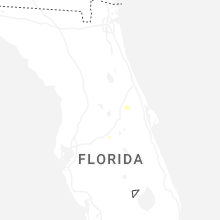


Connect with Interactive Hail Maps