| 7/14/2024 2:36 PM MST |
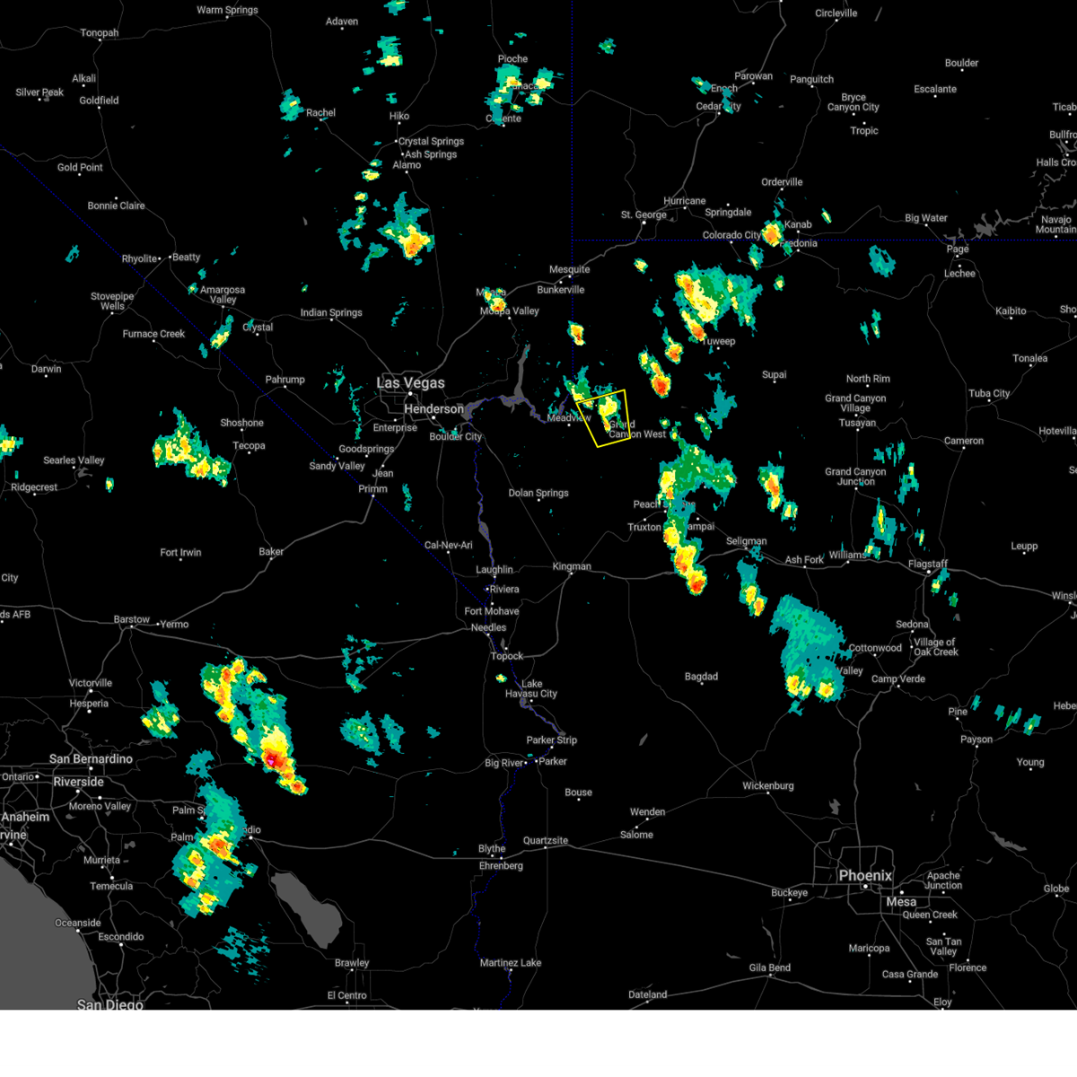 the severe thunderstorm warning has been cancelled and is no longer in effect the severe thunderstorm warning has been cancelled and is no longer in effect
|
| 7/14/2024 2:14 PM MST |
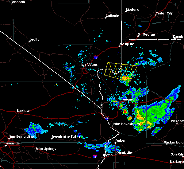
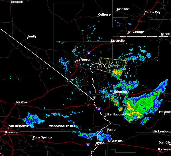
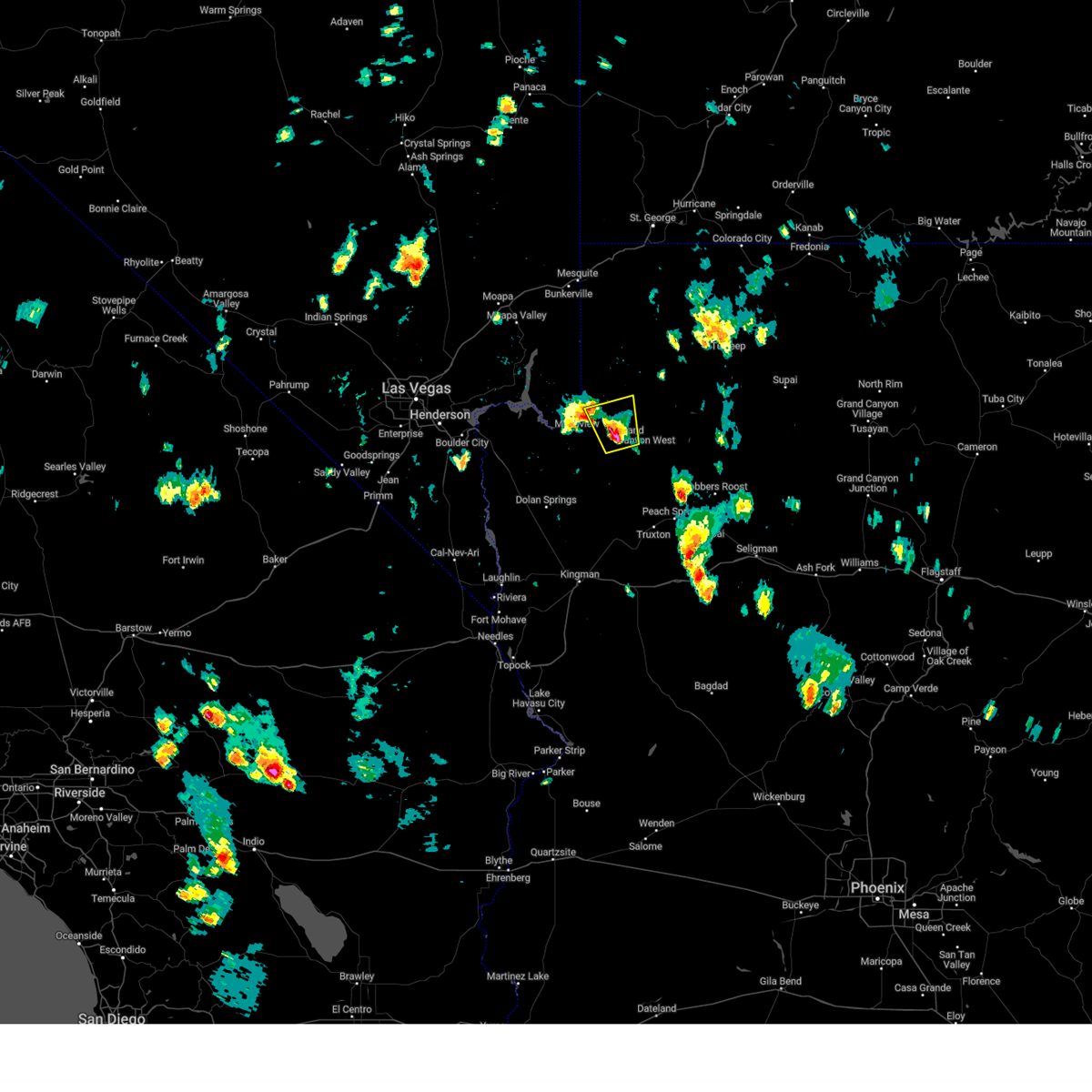 Svrvef the national weather service in las vegas has issued a * severe thunderstorm warning for, northern mohave county in northwestern arizona, * until 300 pm mst. * at 214 pm mst, a severe thunderstorm was located over grand canyon skywalk, or 52 miles southeast of overton, moving north at 10 mph (radar indicated). Hazards include 60 mph wind gusts and quarter size hail. Hail damage to vehicles is expected. Expect wind damage to roofs and trees. Svrvef the national weather service in las vegas has issued a * severe thunderstorm warning for, northern mohave county in northwestern arizona, * until 300 pm mst. * at 214 pm mst, a severe thunderstorm was located over grand canyon skywalk, or 52 miles southeast of overton, moving north at 10 mph (radar indicated). Hazards include 60 mph wind gusts and quarter size hail. Hail damage to vehicles is expected. Expect wind damage to roofs and trees.
|
| 7/13/2024 4:53 PM MST |
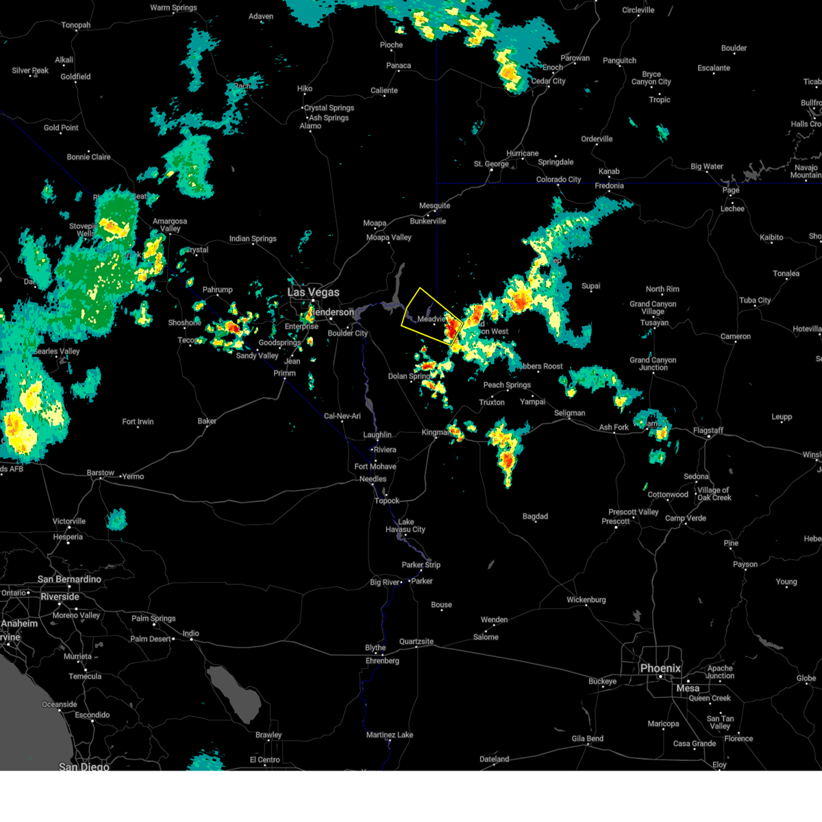 Svrvef the national weather service in las vegas has issued a * severe thunderstorm warning for, west central mohave county in northwestern arizona, eastern clark county in southern nevada, * until 600 pm pdt/600 pm mst/. * at 453 pm pdt/453 pm mst/, a severe thunderstorm was located near meadview, or 47 miles southeast of overton, moving northwest at 25 mph (radar indicated). Hazards include 60 mph wind gusts. expect damage to roofs and trees Svrvef the national weather service in las vegas has issued a * severe thunderstorm warning for, west central mohave county in northwestern arizona, eastern clark county in southern nevada, * until 600 pm pdt/600 pm mst/. * at 453 pm pdt/453 pm mst/, a severe thunderstorm was located near meadview, or 47 miles southeast of overton, moving northwest at 25 mph (radar indicated). Hazards include 60 mph wind gusts. expect damage to roofs and trees
|
| 8/23/2023 3:26 PM MST |
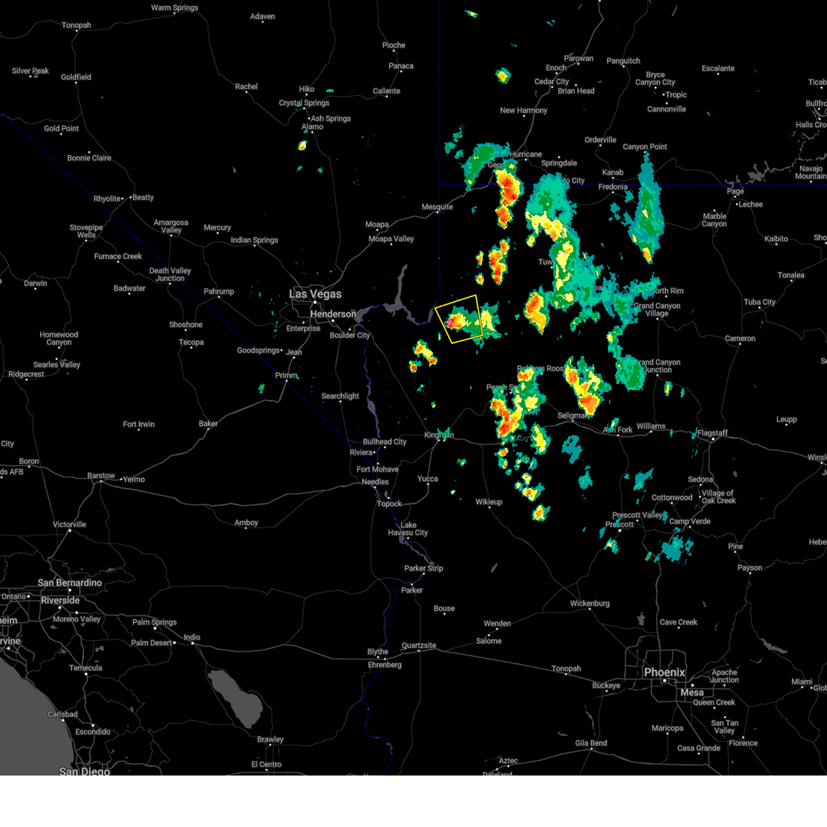 The severe thunderstorm warning for central mohave county will expire at 330 pm mst, the storm which prompted the warning has weakened below severe limits, and has exited the warned area. therefore, the warning will be allowed to expire. however heavy rain is still possible with this thunderstorm. The severe thunderstorm warning for central mohave county will expire at 330 pm mst, the storm which prompted the warning has weakened below severe limits, and has exited the warned area. therefore, the warning will be allowed to expire. however heavy rain is still possible with this thunderstorm.
|
| 8/23/2023 3:10 PM MST |
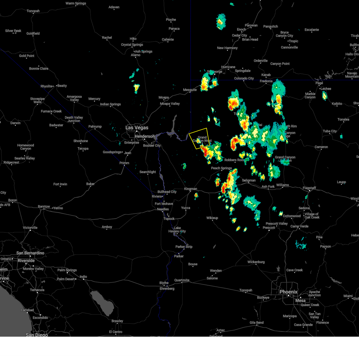 At 310 pm mst, a severe thunderstorm was located over grand canyon skywalk, or 50 miles southeast of overton, moving north at 25 mph (radar indicated). Hazards include 60 mph wind gusts and quarter size hail. Hail damage to vehicles is expected. expect wind damage to roofs and trees. locations impacted include, grand canyon skywalk and south cove. this includes diamond bar road between mile markers 10 and 20. hail threat, radar indicated max hail size, 1. 00 in wind threat, radar indicated max wind gust, 60 mph. At 310 pm mst, a severe thunderstorm was located over grand canyon skywalk, or 50 miles southeast of overton, moving north at 25 mph (radar indicated). Hazards include 60 mph wind gusts and quarter size hail. Hail damage to vehicles is expected. expect wind damage to roofs and trees. locations impacted include, grand canyon skywalk and south cove. this includes diamond bar road between mile markers 10 and 20. hail threat, radar indicated max hail size, 1. 00 in wind threat, radar indicated max wind gust, 60 mph.
|
| 8/23/2023 2:43 PM MST |
 At 242 pm mst, a severe thunderstorm was located 11 miles south of grand canyon skywalk, or 45 miles north of kingman, moving north at 25 mph (radar indicated). Hazards include 60 mph wind gusts and quarter size hail. Hail damage to vehicles is expected. Expect wind damage to roofs and trees. At 242 pm mst, a severe thunderstorm was located 11 miles south of grand canyon skywalk, or 45 miles north of kingman, moving north at 25 mph (radar indicated). Hazards include 60 mph wind gusts and quarter size hail. Hail damage to vehicles is expected. Expect wind damage to roofs and trees.
|
| 8/13/2023 12:23 PM MST |
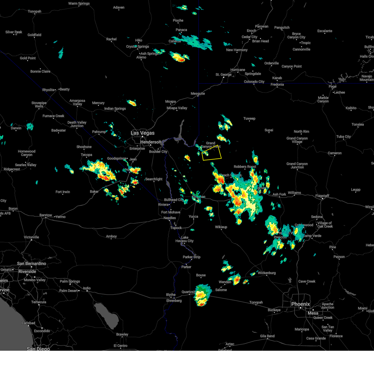 The severe thunderstorm warning for central mohave county will expire at 1230 pm mst, the storm which prompted the warning has weakened below severe limits, and has exited the warned area. therefore, the warning will be allowed to expire. The severe thunderstorm warning for central mohave county will expire at 1230 pm mst, the storm which prompted the warning has weakened below severe limits, and has exited the warned area. therefore, the warning will be allowed to expire.
|
| 8/13/2023 11:47 AM MST |
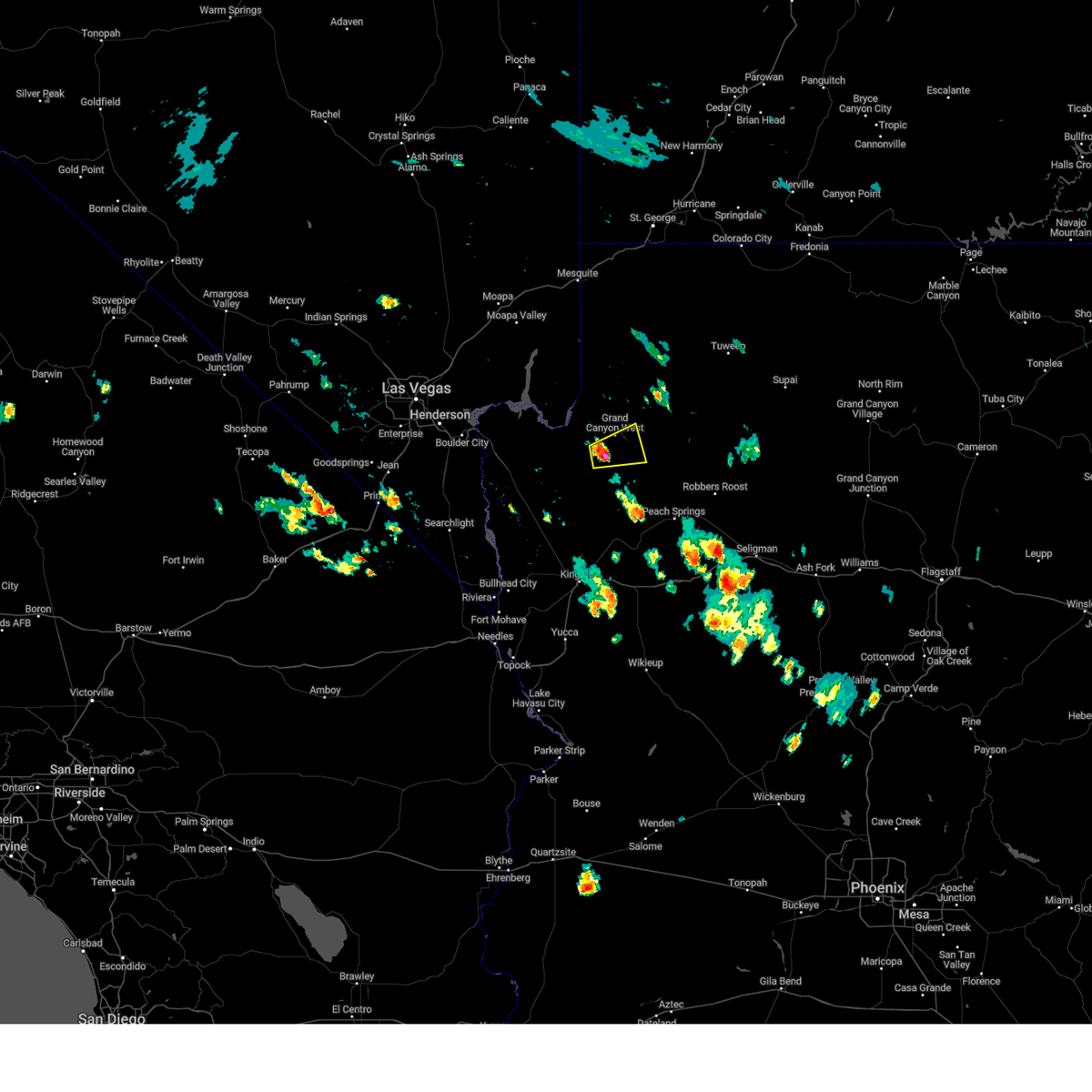 At 1144 am mst, a severe thunderstorm was located 7 miles east of grand canyon ranch, or 46 miles north of kingman, moving east at 10 mph (radar indicated). Hazards include 60 mph wind gusts and quarter size hail. Hail damage to vehicles is expected. expect wind damage to roofs and trees. this severe thunderstorm will remain over mainly rural areas of central mohave county, including grand canyon west. this includes diamond bar road between mile markers 8 and 20 and buck and doe rd. precautionary/preparedness actions, for your protection move to an interior room on the lowest floor of a building. hail threat, radar indicated max hail size, 1. 00 in wind threat, radar indicated max wind gust, 60 mph. At 1144 am mst, a severe thunderstorm was located 7 miles east of grand canyon ranch, or 46 miles north of kingman, moving east at 10 mph (radar indicated). Hazards include 60 mph wind gusts and quarter size hail. Hail damage to vehicles is expected. expect wind damage to roofs and trees. this severe thunderstorm will remain over mainly rural areas of central mohave county, including grand canyon west. this includes diamond bar road between mile markers 8 and 20 and buck and doe rd. precautionary/preparedness actions, for your protection move to an interior room on the lowest floor of a building. hail threat, radar indicated max hail size, 1. 00 in wind threat, radar indicated max wind gust, 60 mph.
|
| 7/31/2023 2:55 PM MST |
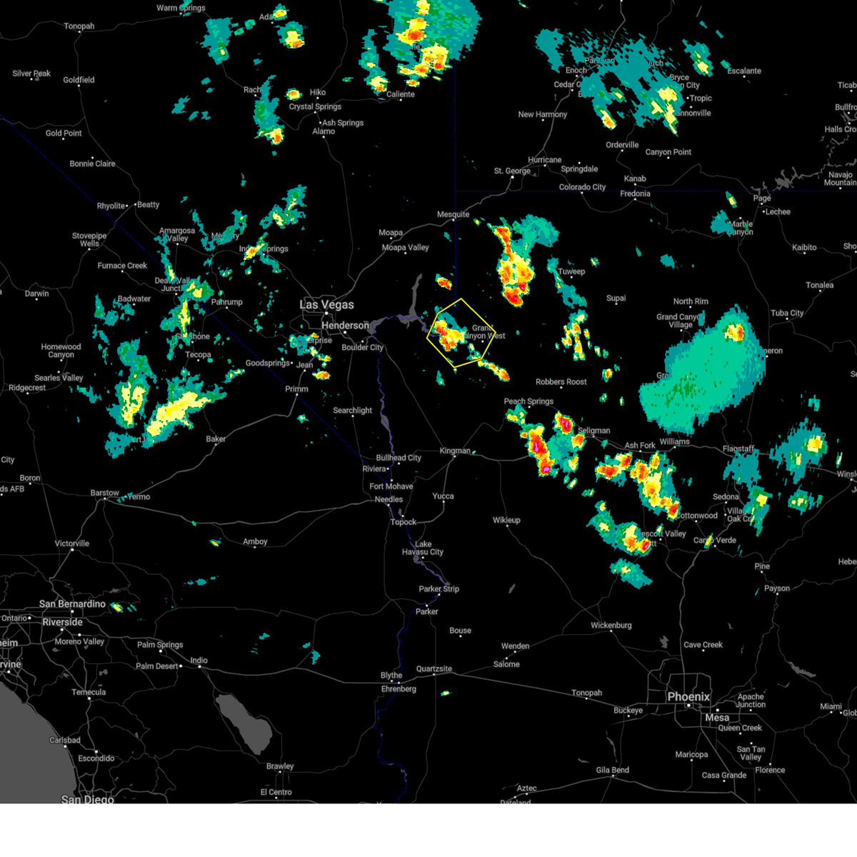 The severe thunderstorm warning for west central mohave and eastern clark counties will expire at 300 pm pdt/300 pm mst/, the storm which prompted the warning has weakened below severe limits, and no longer poses an immediate threat to life or property. therefore, the warning will be allowed to expire. however gusty winds to 40 mph are still possible with this thunderstorm. boaters should take caution and be prepared for thunderstorms risks on the waters. The severe thunderstorm warning for west central mohave and eastern clark counties will expire at 300 pm pdt/300 pm mst/, the storm which prompted the warning has weakened below severe limits, and no longer poses an immediate threat to life or property. therefore, the warning will be allowed to expire. however gusty winds to 40 mph are still possible with this thunderstorm. boaters should take caution and be prepared for thunderstorms risks on the waters.
|
| 7/31/2023 2:55 PM MST |
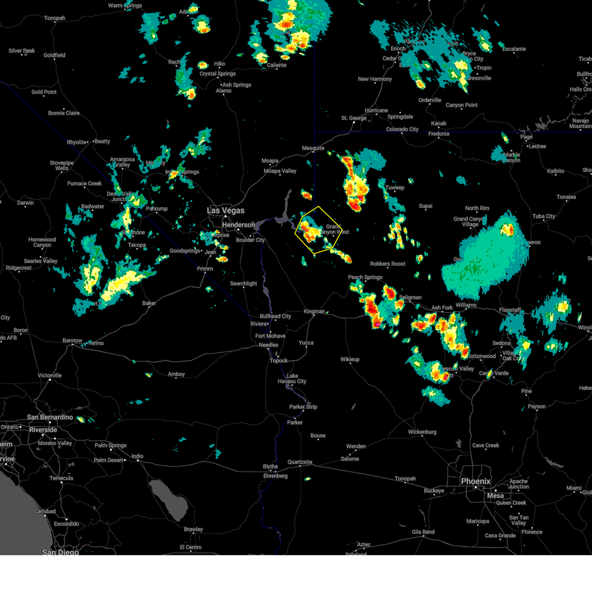 The severe thunderstorm warning for west central mohave and eastern clark counties will expire at 300 pm pdt/300 pm mst/, the storm which prompted the warning has weakened below severe limits, and no longer poses an immediate threat to life or property. therefore, the warning will be allowed to expire. however gusty winds to 40 mph are still possible with this thunderstorm. boaters should take caution and be prepared for thunderstorms risks on the waters. The severe thunderstorm warning for west central mohave and eastern clark counties will expire at 300 pm pdt/300 pm mst/, the storm which prompted the warning has weakened below severe limits, and no longer poses an immediate threat to life or property. therefore, the warning will be allowed to expire. however gusty winds to 40 mph are still possible with this thunderstorm. boaters should take caution and be prepared for thunderstorms risks on the waters.
|
| 7/31/2023 2:28 PM MST |
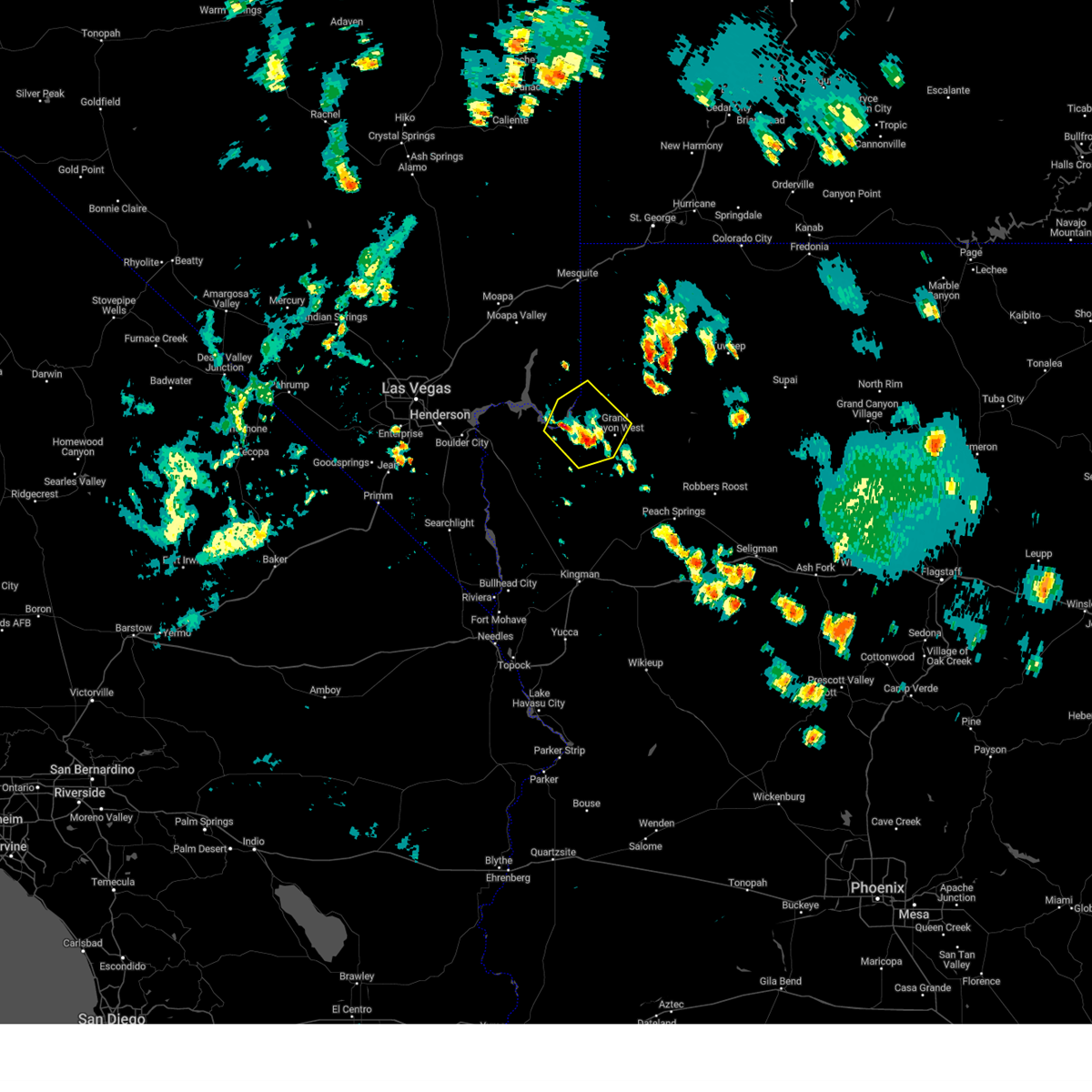 At 227 pm pdt/227 pm mst/, a severe thunderstorm was located near meadview, or 42 miles southeast of overton, moving northwest at 5 mph (radar indicated). Hazards include 40 to 60 mph wind gusts. Expect damage to roofs and trees. locations impacted include, grand canyon skywalk, grand canyon ranch, south cove, lake mead national recreation area and meadview. this includes the following roads, diamond bar road between mile markers 1 and 20. pierce ferry road between mile markers 27 and 44. hail threat, radar indicated max hail size, <. 75 in wind threat, radar indicated max wind gust, 60 mph. At 227 pm pdt/227 pm mst/, a severe thunderstorm was located near meadview, or 42 miles southeast of overton, moving northwest at 5 mph (radar indicated). Hazards include 40 to 60 mph wind gusts. Expect damage to roofs and trees. locations impacted include, grand canyon skywalk, grand canyon ranch, south cove, lake mead national recreation area and meadview. this includes the following roads, diamond bar road between mile markers 1 and 20. pierce ferry road between mile markers 27 and 44. hail threat, radar indicated max hail size, <. 75 in wind threat, radar indicated max wind gust, 60 mph.
|
| 7/31/2023 2:28 PM MST |
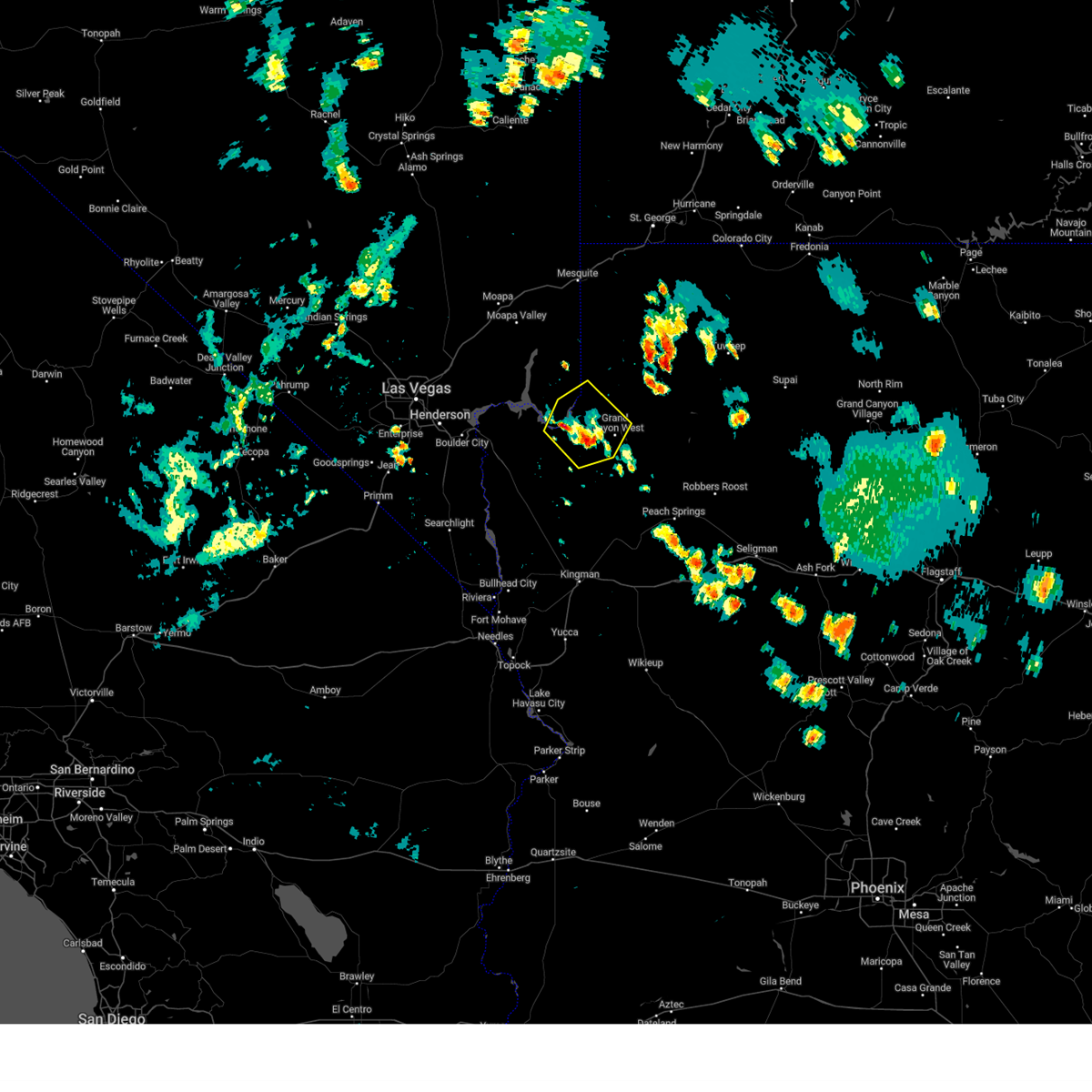 At 227 pm pdt/227 pm mst/, a severe thunderstorm was located near meadview, or 42 miles southeast of overton, moving northwest at 5 mph (radar indicated). Hazards include 40 to 60 mph wind gusts. Expect damage to roofs and trees. locations impacted include, grand canyon skywalk, grand canyon ranch, south cove, lake mead national recreation area and meadview. this includes the following roads, diamond bar road between mile markers 1 and 20. pierce ferry road between mile markers 27 and 44. hail threat, radar indicated max hail size, <. 75 in wind threat, radar indicated max wind gust, 60 mph. At 227 pm pdt/227 pm mst/, a severe thunderstorm was located near meadview, or 42 miles southeast of overton, moving northwest at 5 mph (radar indicated). Hazards include 40 to 60 mph wind gusts. Expect damage to roofs and trees. locations impacted include, grand canyon skywalk, grand canyon ranch, south cove, lake mead national recreation area and meadview. this includes the following roads, diamond bar road between mile markers 1 and 20. pierce ferry road between mile markers 27 and 44. hail threat, radar indicated max hail size, <. 75 in wind threat, radar indicated max wind gust, 60 mph.
|
| 7/31/2023 1:59 PM MST |
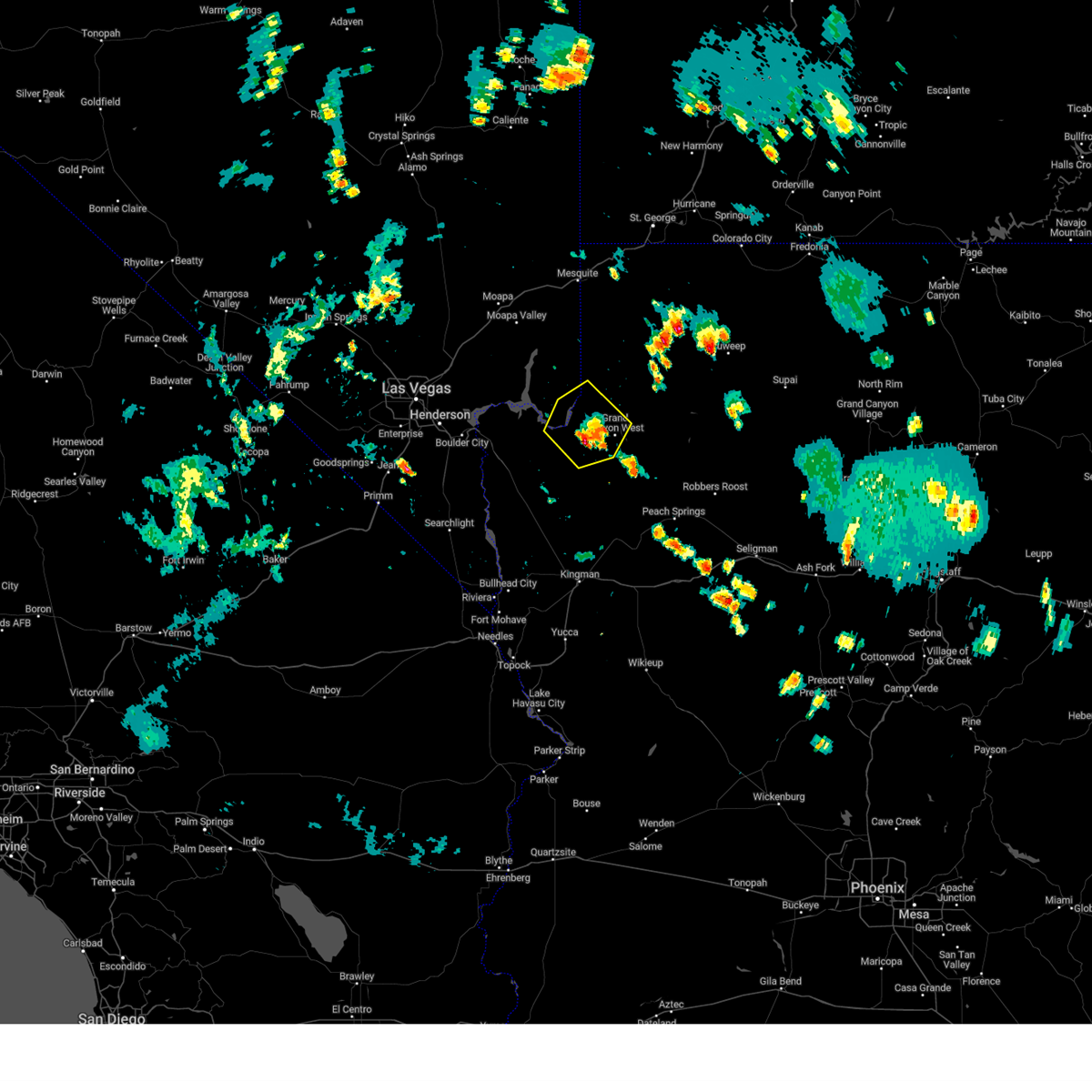 At 157 pm pdt/157 pm mst/, a severe thunderstorm was located near meadview, or 45 miles southeast of overton, moving northwest at 5 mph (radar indicated). Hazards include 60 mph wind gusts. expect damage to roofs and trees At 157 pm pdt/157 pm mst/, a severe thunderstorm was located near meadview, or 45 miles southeast of overton, moving northwest at 5 mph (radar indicated). Hazards include 60 mph wind gusts. expect damage to roofs and trees
|
| 7/31/2023 1:59 PM MST |
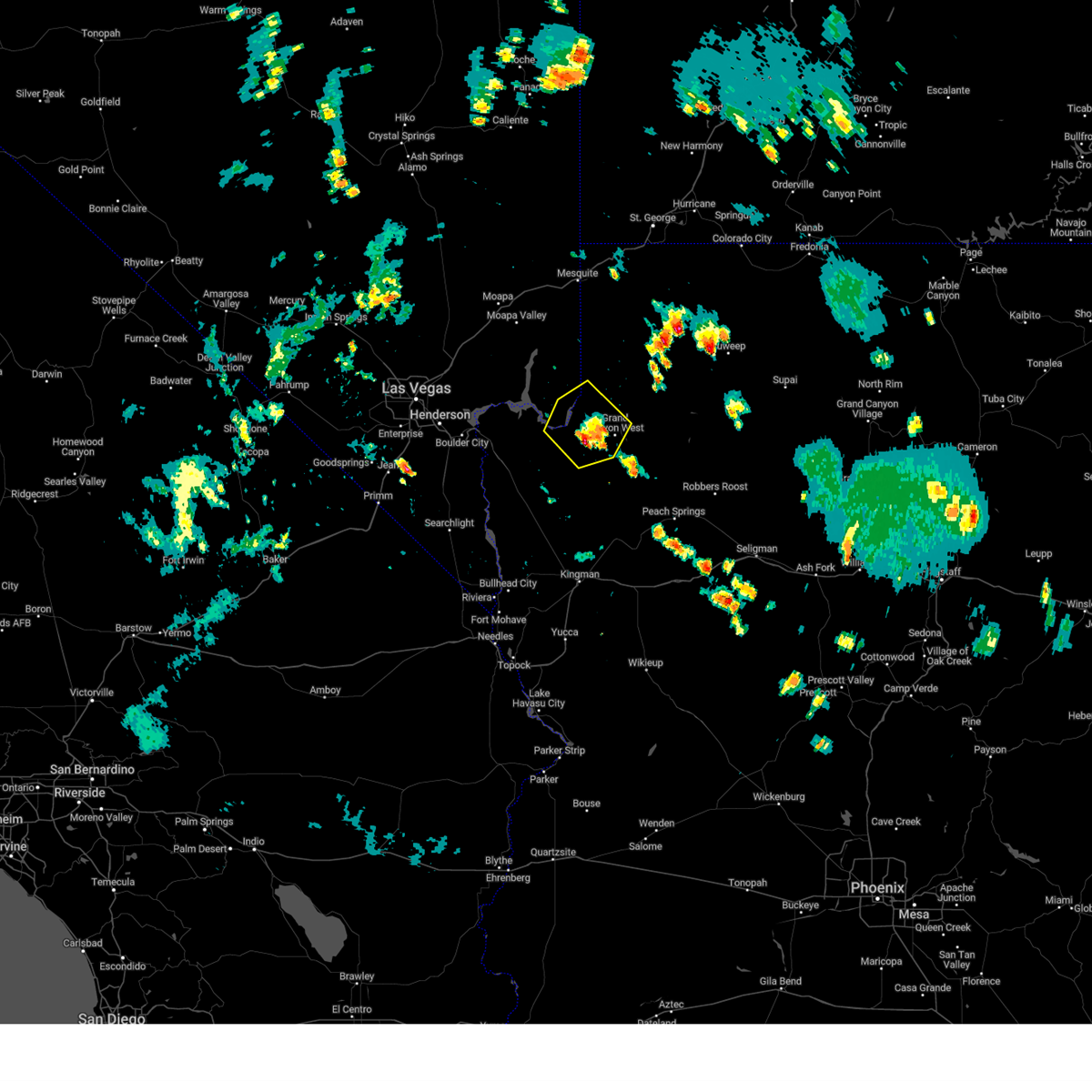 At 157 pm pdt/157 pm mst/, a severe thunderstorm was located near meadview, or 45 miles southeast of overton, moving northwest at 5 mph (radar indicated). Hazards include 60 mph wind gusts. expect damage to roofs and trees At 157 pm pdt/157 pm mst/, a severe thunderstorm was located near meadview, or 45 miles southeast of overton, moving northwest at 5 mph (radar indicated). Hazards include 60 mph wind gusts. expect damage to roofs and trees
|
| 7/25/2023 4:26 PM MST |
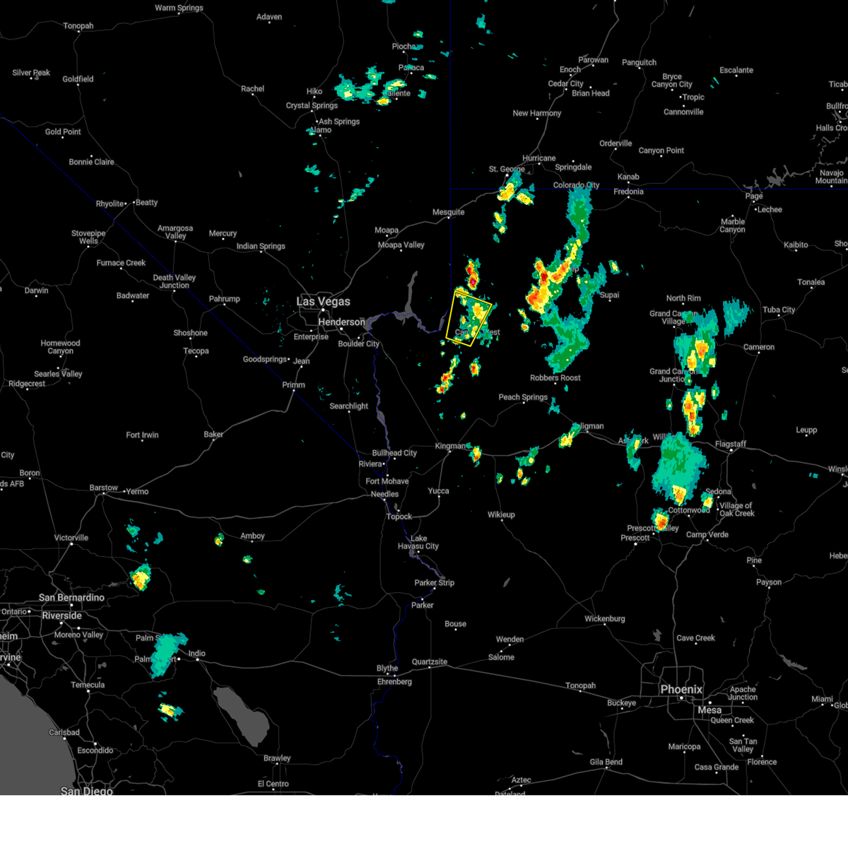 The severe thunderstorm warning for central mohave county will expire at 430 pm mst, the storm which prompted the warning has weakened below severe limits, and has exited the warned area. therefore, the warning will be allowed to expire. however gusty winds are still possible with this thunderstorm. The severe thunderstorm warning for central mohave county will expire at 430 pm mst, the storm which prompted the warning has weakened below severe limits, and has exited the warned area. therefore, the warning will be allowed to expire. however gusty winds are still possible with this thunderstorm.
|
| 7/25/2023 4:13 PM MST |
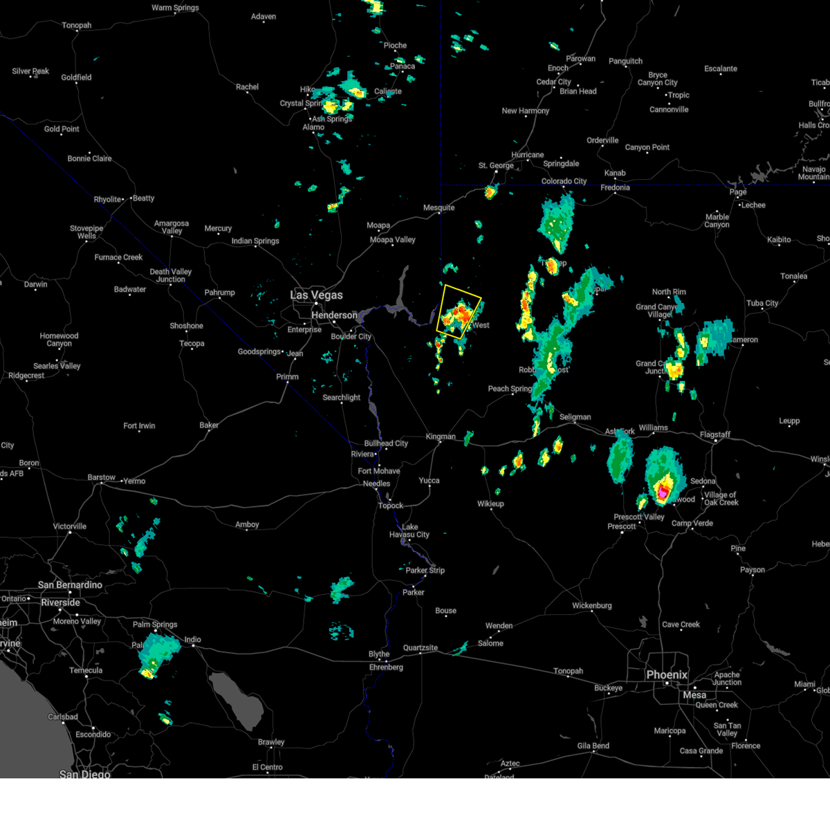 At 412 pm mst, a severe thunderstorm was located 8 miles east of south cove, or 41 miles southeast of overton, moving north at 10 mph (radar indicated). Hazards include 60 mph wind gusts and quarter size hail. Hail damage to vehicles is expected. expect wind damage to roofs and trees. locations impacted include, meadview and lake mead national recreation area. this includes the following roads, diamond bar road between mile markers 14 and 16. pierce ferry road between mile markers 39 and 44. hail threat, radar indicated max hail size, 1. 00 in wind threat, radar indicated max wind gust, 60 mph. At 412 pm mst, a severe thunderstorm was located 8 miles east of south cove, or 41 miles southeast of overton, moving north at 10 mph (radar indicated). Hazards include 60 mph wind gusts and quarter size hail. Hail damage to vehicles is expected. expect wind damage to roofs and trees. locations impacted include, meadview and lake mead national recreation area. this includes the following roads, diamond bar road between mile markers 14 and 16. pierce ferry road between mile markers 39 and 44. hail threat, radar indicated max hail size, 1. 00 in wind threat, radar indicated max wind gust, 60 mph.
|
| 7/25/2023 3:46 PM MST |
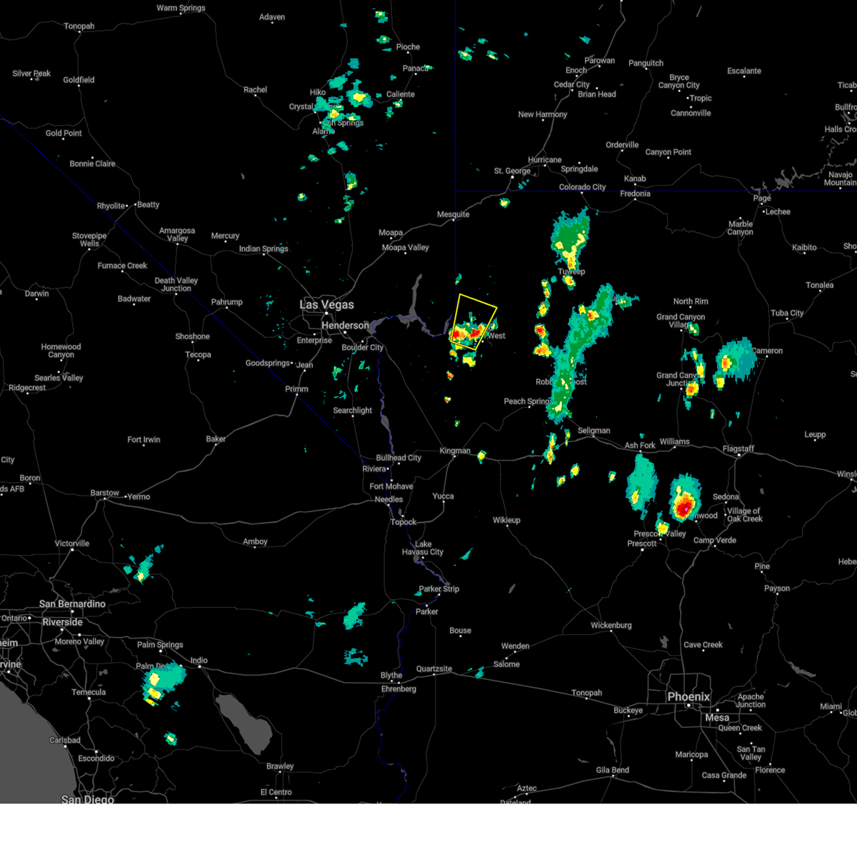 At 345 pm mst, a severe thunderstorm was located near meadview, or 44 miles southeast of overton, moving north at 10 mph (radar indicated). Hazards include 60 mph wind gusts and quarter size hail. Hail damage to vehicles is expected. Expect wind damage to roofs and trees. At 345 pm mst, a severe thunderstorm was located near meadview, or 44 miles southeast of overton, moving north at 10 mph (radar indicated). Hazards include 60 mph wind gusts and quarter size hail. Hail damage to vehicles is expected. Expect wind damage to roofs and trees.
|
| 8/21/2022 7:29 PM MST |
At 728 pm pdt/728 pm mst/, a line of severe thunderstorm was located from near willow beach to peach springs, moving south at 30 mph (radar indicated). Hazards include 60 mph wind gusts and quarter size hail. Hail damage to vehicles is expected. expect wind damage to roofs and trees. locations impacted include, henderson, boulder city, las vegas bay, lake las vegas, boulder beach, grand canyon skywalk, diamond creek campground, railroad pass, boulder beach campground, las vegas bay campground, pierce ferry and antares roads, callville bay, meadview, hoover dam, grand canyon ranch, callville bay campground, lake mead national recreation area, temple bar campground, south cove and dolan springs. hail threat, radar indicated max hail size, 1. 00 in wind threat, observed max wind gust, 60 mph.
|
| 8/21/2022 6:57 PM MST |
The severe thunderstorm warning for northern mohave and northeastern clark counties will expire at 700 pm pdt/700 pm mst/, this severe thunderstorm warning has been replaced with a new warning. therefore, this warning will be allowed to expire.
|
| 8/21/2022 6:57 PM MST |
The severe thunderstorm warning for northern mohave and northeastern clark counties will expire at 700 pm pdt/700 pm mst/, this severe thunderstorm warning has been replaced with a new warning. therefore, this warning will be allowed to expire.
|
| 8/21/2022 6:52 PM MST |
At 651 pm pdt/651 pm mst/, a severe thunderstorm was located 11 miles west of temple bar campground, or 18 miles east of boulder city, moving south at 20 mph (radar indicated). Hazards include 70 mph wind gusts. Expect considerable tree damage. Damage is likely to mobile homes, roofs, and outbuildings.
|
| 8/21/2022 6:08 PM MST |
At 604 pm pdt/604 pm mst/, a severe thunderstorm was located near apex and the i-15 in northeast clark county, moving south at 20 mph. a wind sensor located along the i-15 and highway 93 has reported a 70 mph wind gust (radar indicated). Hazards include 70 mph wind gusts. Expect considerable tree damage. damage is likely to mobile homes, roofs, and outbuildings. locations impacted include, henderson, north las vegas, mesquite, boulder city, nellis afb, the motor speedway, las vegas bay, lake las vegas, overton, moapa town, east las vegas, moapa valley, echo bay, grand canyon skywalk, sr 168 mile marker 21, boulder beach campground, las vegas bay campground, meadview, hoover dam and bunkerville. this includes interstate 15 in nevada between mile markers 60 and 116. thunderstorm damage threat, considerable hail threat, radar indicated max hail size, <. 75 in wind threat, radar indicated max wind gust, 70 mph.
|
|
|
| 8/21/2022 5:56 PM MST |
At 555 pm pdt/555 pm mst/, a severe thunderstorm was located near las vegas bay campground, or near the motor speedway, moving south at 20 mph (radar indicated). Hazards include 60 mph wind gusts. expect damage to roofs and trees
|
| 8/21/2022 5:56 PM MST |
At 555 pm pdt/555 pm mst/, a severe thunderstorm was located near las vegas bay campground, or near the motor speedway, moving south at 20 mph (radar indicated). Hazards include 60 mph wind gusts. expect damage to roofs and trees
|
| 8/4/2022 5:36 PM MST |
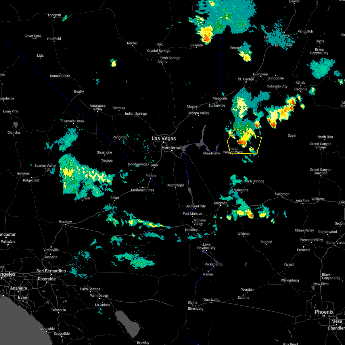 The severe thunderstorm warning for central mohave county will expire at 545 pm mst, the storm which prompted the warning has weakened below severe limits, and no longer poses an immediate threat to life or property. therefore, the warning will be allowed to expire. however gusty winds are still possible with this thunderstorm. The severe thunderstorm warning for central mohave county will expire at 545 pm mst, the storm which prompted the warning has weakened below severe limits, and no longer poses an immediate threat to life or property. therefore, the warning will be allowed to expire. however gusty winds are still possible with this thunderstorm.
|
| 8/4/2022 5:18 PM MST |
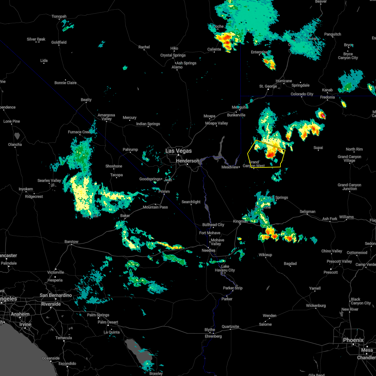 At 517 pm mst, a severe thunderstorm was located 15 miles northeast of grand canyon skywalk, or 53 miles south of littlefield, moving west at 20 mph (radar indicated). Hazards include 60 mph wind gusts and quarter size hail. Hail damage to vehicles is expected. expect wind damage to roofs and trees. locations impacted include, grand canyon skywalk. hail threat, radar indicated max hail size, 1. 00 in wind threat, radar indicated max wind gust, 60 mph. At 517 pm mst, a severe thunderstorm was located 15 miles northeast of grand canyon skywalk, or 53 miles south of littlefield, moving west at 20 mph (radar indicated). Hazards include 60 mph wind gusts and quarter size hail. Hail damage to vehicles is expected. expect wind damage to roofs and trees. locations impacted include, grand canyon skywalk. hail threat, radar indicated max hail size, 1. 00 in wind threat, radar indicated max wind gust, 60 mph.
|
| 8/4/2022 4:55 PM MST |
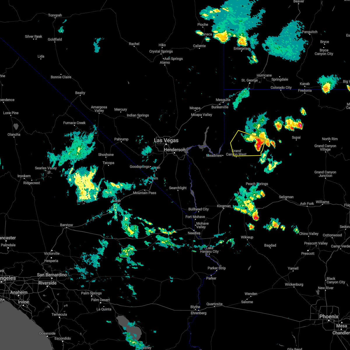 At 454 pm mst, a severe thunderstorm was located 15 miles southwest of bar ten ranch, or 57 miles southeast of littlefield, moving west at 20 mph (radar indicated). Hazards include 60 mph wind gusts and quarter size hail. Hail damage to vehicles is expected. Expect wind damage to roofs and trees. At 454 pm mst, a severe thunderstorm was located 15 miles southwest of bar ten ranch, or 57 miles southeast of littlefield, moving west at 20 mph (radar indicated). Hazards include 60 mph wind gusts and quarter size hail. Hail damage to vehicles is expected. Expect wind damage to roofs and trees.
|
| 7/29/2022 7:39 PM MST |
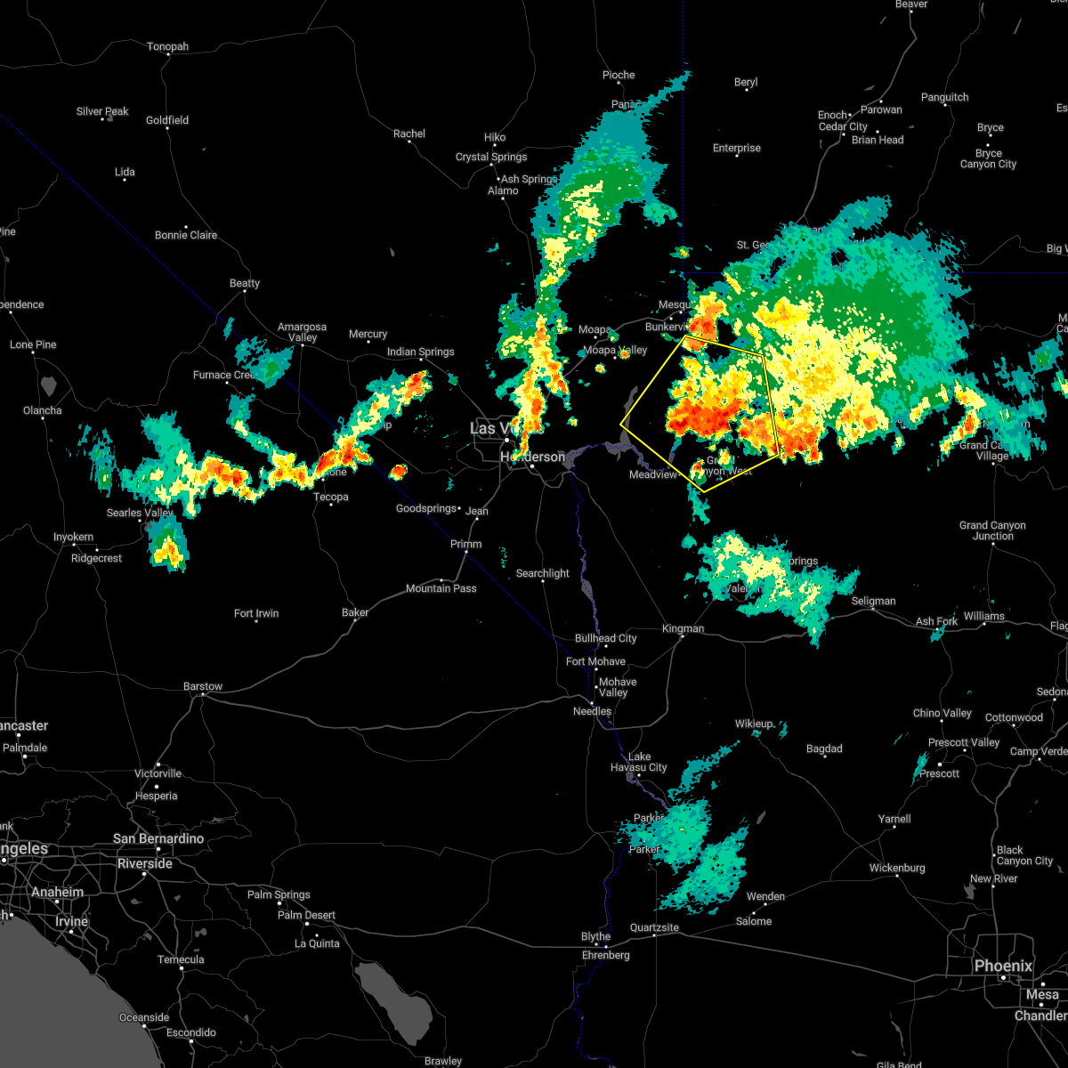 The severe thunderstorm warning for north central mohave and east central clark counties will expire at 745 pm pdt/745 pm mst/, the storm which prompted the warning has moved out towards lake mead. therefore, the warning will be allowed to expire. The severe thunderstorm warning for north central mohave and east central clark counties will expire at 745 pm pdt/745 pm mst/, the storm which prompted the warning has moved out towards lake mead. therefore, the warning will be allowed to expire.
|
| 7/29/2022 7:39 PM MST |
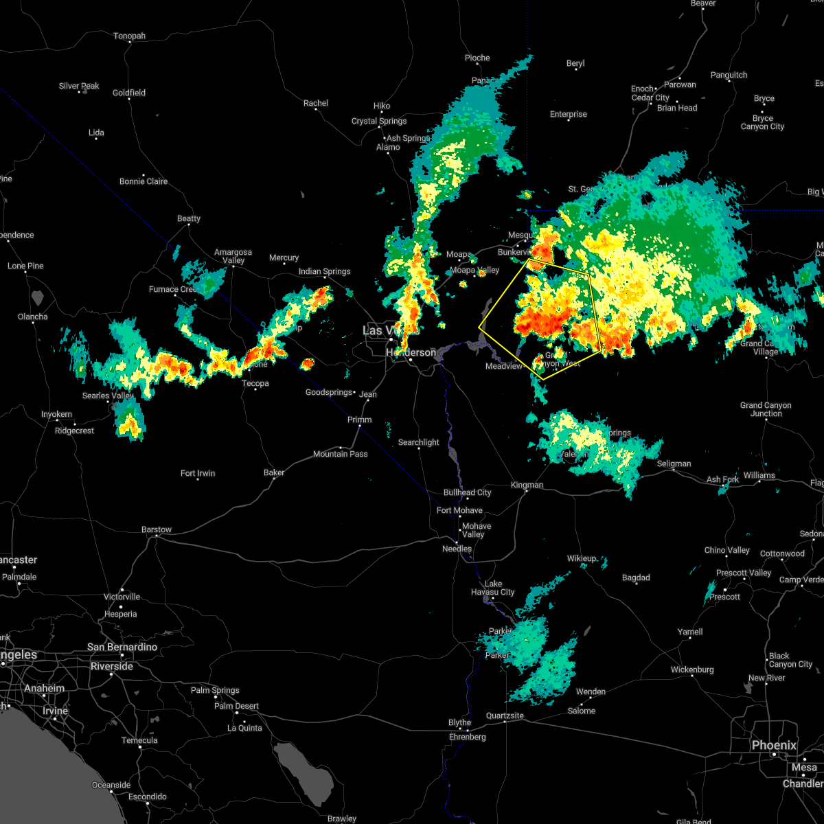 The severe thunderstorm warning for north central mohave and east central clark counties will expire at 745 pm pdt/745 pm mst/, the storm which prompted the warning has moved out towards lake mead. therefore, the warning will be allowed to expire. The severe thunderstorm warning for north central mohave and east central clark counties will expire at 745 pm pdt/745 pm mst/, the storm which prompted the warning has moved out towards lake mead. therefore, the warning will be allowed to expire.
|
| 7/29/2022 7:12 PM MST |
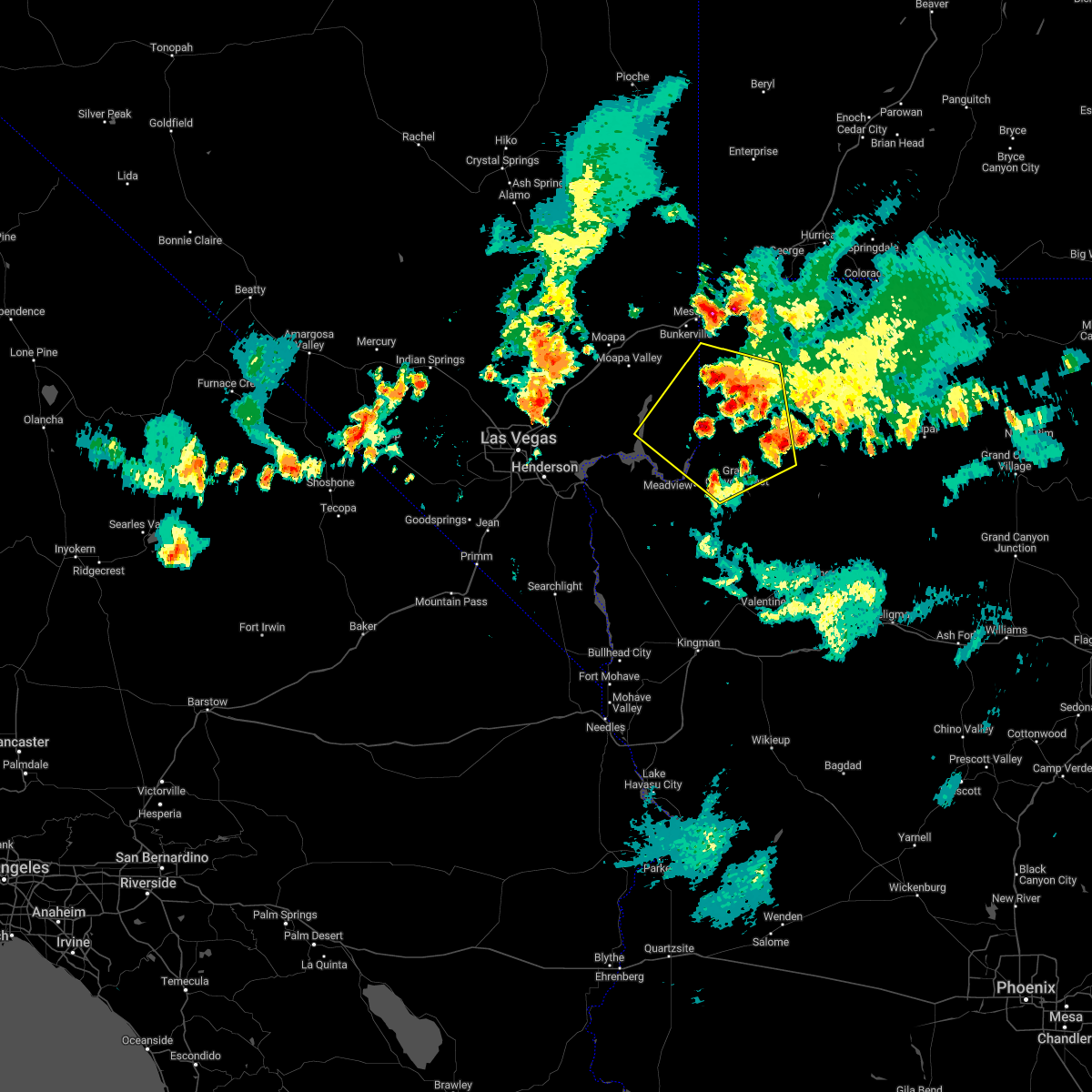 At 712 pm pdt/712 pm mst/, a severe thunderstorm was located 26 miles northeast of south cove, or 31 miles southeast of mesquite, moving south at 15 mph (radar indicated). Hazards include 60 mph wind gusts. Expect damage to roofs and trees. locations impacted include, grand canyon skywalk, south cove and lake mead national recreation area. hail threat, radar indicated max hail size, <. 75 in wind threat, radar indicated max wind gust, 60 mph. At 712 pm pdt/712 pm mst/, a severe thunderstorm was located 26 miles northeast of south cove, or 31 miles southeast of mesquite, moving south at 15 mph (radar indicated). Hazards include 60 mph wind gusts. Expect damage to roofs and trees. locations impacted include, grand canyon skywalk, south cove and lake mead national recreation area. hail threat, radar indicated max hail size, <. 75 in wind threat, radar indicated max wind gust, 60 mph.
|
| 7/29/2022 7:12 PM MST |
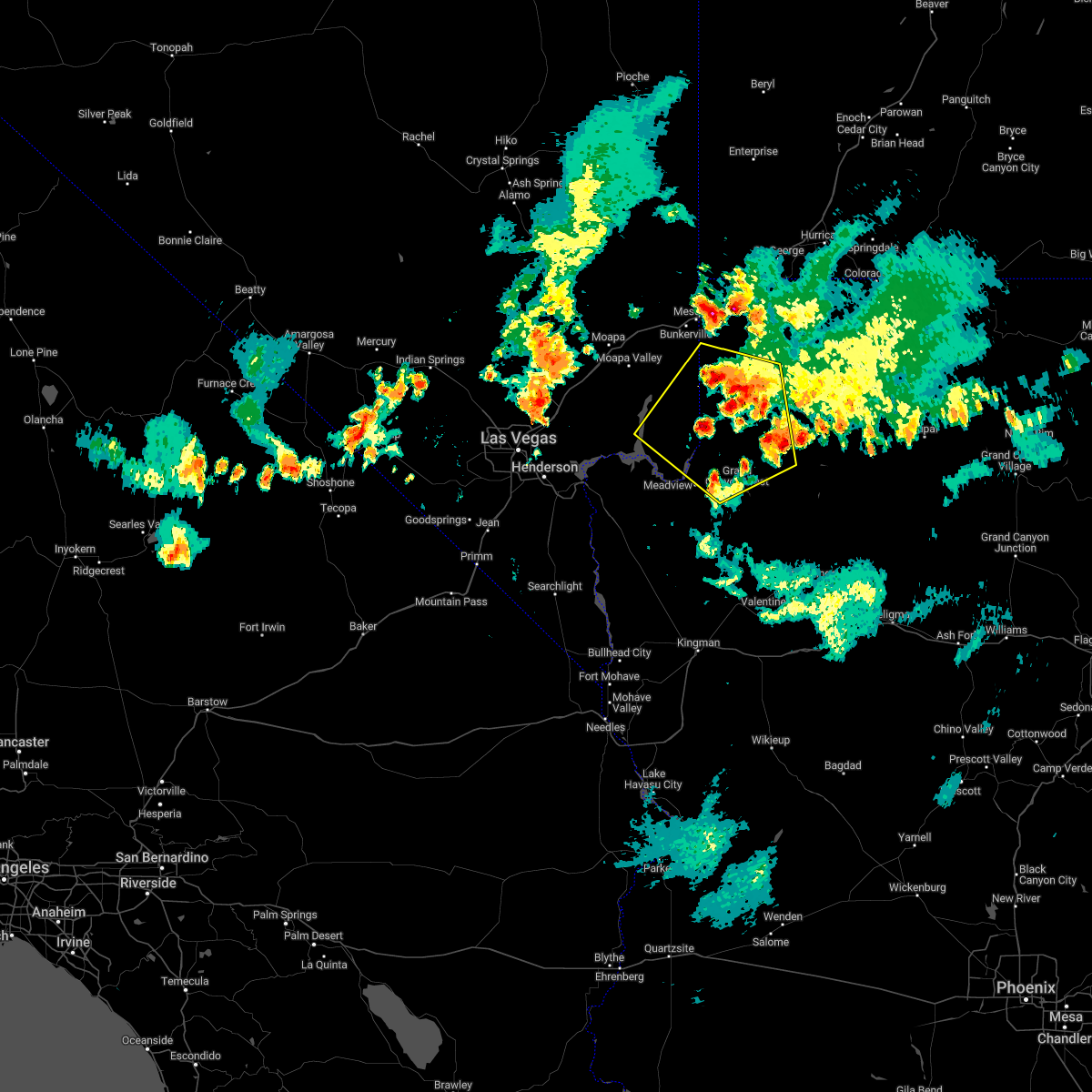 At 712 pm pdt/712 pm mst/, a severe thunderstorm was located 26 miles northeast of south cove, or 31 miles southeast of mesquite, moving south at 15 mph (radar indicated). Hazards include 60 mph wind gusts. Expect damage to roofs and trees. locations impacted include, grand canyon skywalk, south cove and lake mead national recreation area. hail threat, radar indicated max hail size, <. 75 in wind threat, radar indicated max wind gust, 60 mph. At 712 pm pdt/712 pm mst/, a severe thunderstorm was located 26 miles northeast of south cove, or 31 miles southeast of mesquite, moving south at 15 mph (radar indicated). Hazards include 60 mph wind gusts. Expect damage to roofs and trees. locations impacted include, grand canyon skywalk, south cove and lake mead national recreation area. hail threat, radar indicated max hail size, <. 75 in wind threat, radar indicated max wind gust, 60 mph.
|
| 7/29/2022 6:48 PM MST |
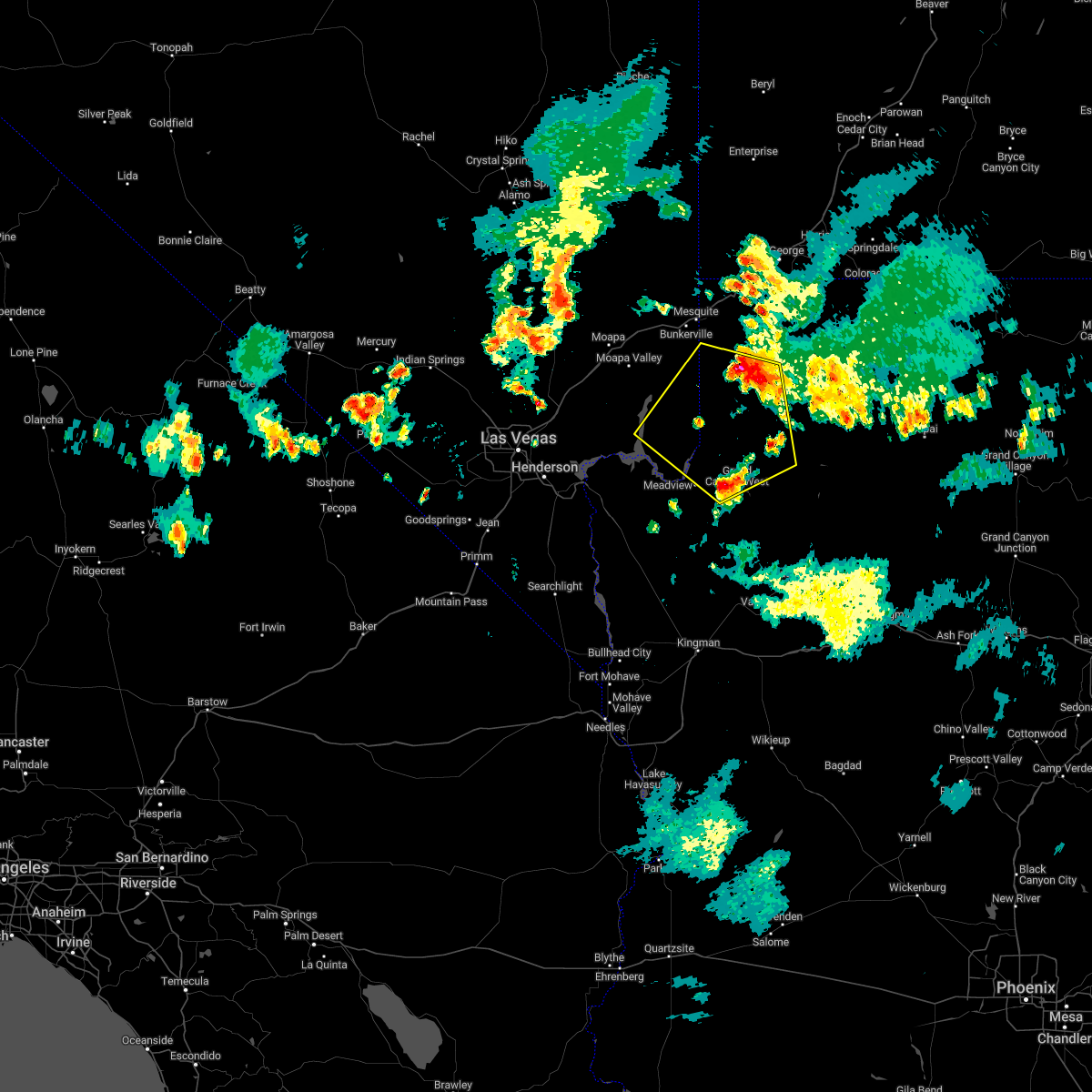 At 647 pm pdt/647 pm mst/, a severe thunderstorm was located 26 miles southeast of bunkerville, or 26 miles south of littlefield, moving south at 15 mph (radar indicated). Hazards include 60 mph wind gusts. expect damage to roofs and trees At 647 pm pdt/647 pm mst/, a severe thunderstorm was located 26 miles southeast of bunkerville, or 26 miles south of littlefield, moving south at 15 mph (radar indicated). Hazards include 60 mph wind gusts. expect damage to roofs and trees
|
| 7/29/2022 6:48 PM MST |
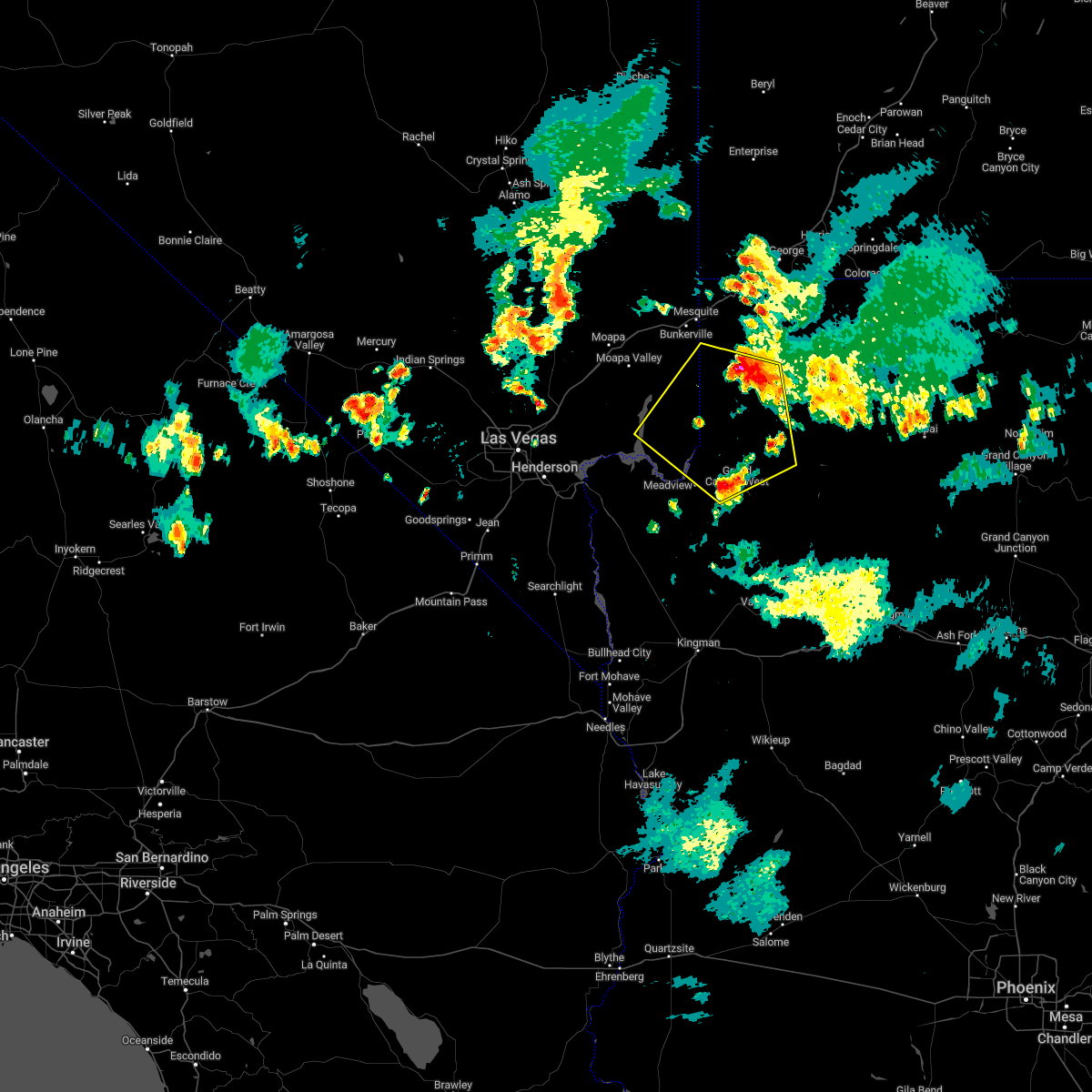 At 647 pm pdt/647 pm mst/, a severe thunderstorm was located 26 miles southeast of bunkerville, or 26 miles south of littlefield, moving south at 15 mph (radar indicated). Hazards include 60 mph wind gusts. expect damage to roofs and trees At 647 pm pdt/647 pm mst/, a severe thunderstorm was located 26 miles southeast of bunkerville, or 26 miles south of littlefield, moving south at 15 mph (radar indicated). Hazards include 60 mph wind gusts. expect damage to roofs and trees
|
| 10/5/2021 12:41 PM PDT |
 At 1240 pm pdt/1240 pm mst/, a severe thunderstorm was located over lake mead national recreation area, moving north at 25 mph (radar indicated). Hazards include 60 mph wind gusts. expect damage to roofs and trees At 1240 pm pdt/1240 pm mst/, a severe thunderstorm was located over lake mead national recreation area, moving north at 25 mph (radar indicated). Hazards include 60 mph wind gusts. expect damage to roofs and trees
|
| 10/5/2021 12:41 PM PDT |
 At 1240 pm pdt/1240 pm mst/, a severe thunderstorm was located over lake mead national recreation area, moving north at 25 mph (radar indicated). Hazards include 60 mph wind gusts. expect damage to roofs and trees At 1240 pm pdt/1240 pm mst/, a severe thunderstorm was located over lake mead national recreation area, moving north at 25 mph (radar indicated). Hazards include 60 mph wind gusts. expect damage to roofs and trees
|
| 10/5/2021 12:22 PM PDT |
 At 1214 pm pdt/1214 pm mst/, doppler radar continued to indicate a line of thunderstorms with severe winds moving into the lake mead national recreation area. anyone in the path of these storms should take cover and get off of the lake until the threat has ended (radar indicated). Hazards include 70 mph wind gusts. Expect considerable tree damage. damage is likely to mobile homes, roofs, and outbuildings. locations impacted include, boulder city, las vegas bay, overton, moapa valley, echo bay, grand canyon skywalk, boulder beach campground, las vegas bay campground, pierce ferry and antares roads, meadview, hoover dam, temple bar campground, south cove, logandale, boulder beach, echo bay campground, callville bay, grand canyon ranch, valley of fire and callville bay campground. thunderstorm damage threat, considerable hail threat, radar indicated max hail size, <. 75 in wind threat, radar indicated max wind gust, 70 mph. At 1214 pm pdt/1214 pm mst/, doppler radar continued to indicate a line of thunderstorms with severe winds moving into the lake mead national recreation area. anyone in the path of these storms should take cover and get off of the lake until the threat has ended (radar indicated). Hazards include 70 mph wind gusts. Expect considerable tree damage. damage is likely to mobile homes, roofs, and outbuildings. locations impacted include, boulder city, las vegas bay, overton, moapa valley, echo bay, grand canyon skywalk, boulder beach campground, las vegas bay campground, pierce ferry and antares roads, meadview, hoover dam, temple bar campground, south cove, logandale, boulder beach, echo bay campground, callville bay, grand canyon ranch, valley of fire and callville bay campground. thunderstorm damage threat, considerable hail threat, radar indicated max hail size, <. 75 in wind threat, radar indicated max wind gust, 70 mph.
|
| 10/5/2021 12:22 PM PDT |
 At 1214 pm pdt/1214 pm mst/, doppler radar continued to indicate a line of thunderstorms with severe winds moving into the lake mead national recreation area. anyone in the path of these storms should take cover and get off of the lake until the threat has ended (radar indicated). Hazards include 70 mph wind gusts. Expect considerable tree damage. damage is likely to mobile homes, roofs, and outbuildings. locations impacted include, boulder city, las vegas bay, overton, moapa valley, echo bay, grand canyon skywalk, boulder beach campground, las vegas bay campground, pierce ferry and antares roads, meadview, hoover dam, temple bar campground, south cove, logandale, boulder beach, echo bay campground, callville bay, grand canyon ranch, valley of fire and callville bay campground. thunderstorm damage threat, considerable hail threat, radar indicated max hail size, <. 75 in wind threat, radar indicated max wind gust, 70 mph. At 1214 pm pdt/1214 pm mst/, doppler radar continued to indicate a line of thunderstorms with severe winds moving into the lake mead national recreation area. anyone in the path of these storms should take cover and get off of the lake until the threat has ended (radar indicated). Hazards include 70 mph wind gusts. Expect considerable tree damage. damage is likely to mobile homes, roofs, and outbuildings. locations impacted include, boulder city, las vegas bay, overton, moapa valley, echo bay, grand canyon skywalk, boulder beach campground, las vegas bay campground, pierce ferry and antares roads, meadview, hoover dam, temple bar campground, south cove, logandale, boulder beach, echo bay campground, callville bay, grand canyon ranch, valley of fire and callville bay campground. thunderstorm damage threat, considerable hail threat, radar indicated max hail size, <. 75 in wind threat, radar indicated max wind gust, 70 mph.
|
| 10/5/2021 11:42 AM PDT |
 At 1139 am pdt/1139 am mst/, a line of severe thunderstorms were located 13 miles southwest of lake mead national recreation area, or 25 miles east of boulder city, moving north at 45 mph (radar indicated). Hazards include 70 mph wind gusts. Expect considerable tree damage. Damage is likely to mobile homes, roofs, and outbuildings. At 1139 am pdt/1139 am mst/, a line of severe thunderstorms were located 13 miles southwest of lake mead national recreation area, or 25 miles east of boulder city, moving north at 45 mph (radar indicated). Hazards include 70 mph wind gusts. Expect considerable tree damage. Damage is likely to mobile homes, roofs, and outbuildings.
|
| 10/5/2021 11:42 AM PDT |
 At 1139 am pdt/1139 am mst/, a line of severe thunderstorms were located 13 miles southwest of lake mead national recreation area, or 25 miles east of boulder city, moving north at 45 mph (radar indicated). Hazards include 70 mph wind gusts. Expect considerable tree damage. Damage is likely to mobile homes, roofs, and outbuildings. At 1139 am pdt/1139 am mst/, a line of severe thunderstorms were located 13 miles southwest of lake mead national recreation area, or 25 miles east of boulder city, moving north at 45 mph (radar indicated). Hazards include 70 mph wind gusts. Expect considerable tree damage. Damage is likely to mobile homes, roofs, and outbuildings.
|
| 10/5/2021 11:01 AM MST |
 At 1101 am mst, severe thunderstorms were located along a line extending from near diamond m ranch to 11 miles west of chloride, moving northeast at 30 mph. at 1051 am, 68 mph wind gusts were recorded at kingman airport (radar indicated). Hazards include 70 mph wind gusts. Expect considerable tree damage. damage is likely to mobile homes, roofs, and outbuildings. locations impacted include, kingman, windy point campground, grand canyon skywalk, diamond creek campground, pierce ferry and antares roads, diamond m ranch, blake ranch road, golden valley, dw ranch road, packsaddle campground, chloride, grand canyon ranch, new kingman-butler, valentine, dolan springs, lake mead national recreation area and peach springs. this includes interstate 40 in arizona between mile markers 45 and 93. thunderstorm damage threat, considerable hail threat, radar indicated max hail size, <. 75 in wind threat, radar indicated max wind gust, 70 mph. At 1101 am mst, severe thunderstorms were located along a line extending from near diamond m ranch to 11 miles west of chloride, moving northeast at 30 mph. at 1051 am, 68 mph wind gusts were recorded at kingman airport (radar indicated). Hazards include 70 mph wind gusts. Expect considerable tree damage. damage is likely to mobile homes, roofs, and outbuildings. locations impacted include, kingman, windy point campground, grand canyon skywalk, diamond creek campground, pierce ferry and antares roads, diamond m ranch, blake ranch road, golden valley, dw ranch road, packsaddle campground, chloride, grand canyon ranch, new kingman-butler, valentine, dolan springs, lake mead national recreation area and peach springs. this includes interstate 40 in arizona between mile markers 45 and 93. thunderstorm damage threat, considerable hail threat, radar indicated max hail size, <. 75 in wind threat, radar indicated max wind gust, 70 mph.
|
| 10/5/2021 10:55 AM MST |
 At 1054 am mst, severe thunderstorms were located along a line extending from near diamond m ranch to 12 miles northeast of katherine landing, moving northeast at 30 mph. strong winds exceeding 50 mph have been reported near kingman (radar indicated). Hazards include 60 mph wind gusts. expect damage to roofs and trees At 1054 am mst, severe thunderstorms were located along a line extending from near diamond m ranch to 12 miles northeast of katherine landing, moving northeast at 30 mph. strong winds exceeding 50 mph have been reported near kingman (radar indicated). Hazards include 60 mph wind gusts. expect damage to roofs and trees
|
| 7/25/2021 2:53 PM PDT |
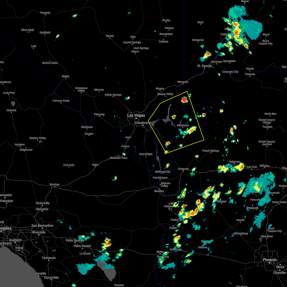 At 252 pm pdt/252 pm mst/, a severe thunderstorm was located 10 miles northwest of south cove, or 24 miles southeast of overton, moving southwest at 40 mph (radar indicated). Hazards include 60 mph wind gusts and quarter size hail. Hail damage to vehicles is expected. Expect wind damage to roofs and trees. At 252 pm pdt/252 pm mst/, a severe thunderstorm was located 10 miles northwest of south cove, or 24 miles southeast of overton, moving southwest at 40 mph (radar indicated). Hazards include 60 mph wind gusts and quarter size hail. Hail damage to vehicles is expected. Expect wind damage to roofs and trees.
|
| 7/25/2021 2:53 PM PDT |
 At 252 pm pdt/252 pm mst/, a severe thunderstorm was located 10 miles northwest of south cove, or 24 miles southeast of overton, moving southwest at 40 mph (radar indicated). Hazards include 60 mph wind gusts and quarter size hail. Hail damage to vehicles is expected. Expect wind damage to roofs and trees. At 252 pm pdt/252 pm mst/, a severe thunderstorm was located 10 miles northwest of south cove, or 24 miles southeast of overton, moving southwest at 40 mph (radar indicated). Hazards include 60 mph wind gusts and quarter size hail. Hail damage to vehicles is expected. Expect wind damage to roofs and trees.
|
| 7/23/2021 10:58 PM MST |
 The severe thunderstorm warning for central mohave county will expire at 1100 pm mst, the storms which prompted the warning have weakened below severe limits, and no longer pose an immediate threat to life or property. therefore, the warning will be allowed to expire. however gusty winds up to 50 mph and brief heavy rain are still possible with these thunderstorms. The severe thunderstorm warning for central mohave county will expire at 1100 pm mst, the storms which prompted the warning have weakened below severe limits, and no longer pose an immediate threat to life or property. therefore, the warning will be allowed to expire. however gusty winds up to 50 mph and brief heavy rain are still possible with these thunderstorms.
|
| 7/23/2021 10:18 PM MST |
 At 1017 pm mst, severe thunderstorms were located along a line extending from near meadview to 19 miles north of valentine to 13 miles south of diamond creek campground, moving southwest at 40 mph (radar indicated). Hazards include 60 mph wind gusts. expect damage to roofs and trees At 1017 pm mst, severe thunderstorms were located along a line extending from near meadview to 19 miles north of valentine to 13 miles south of diamond creek campground, moving southwest at 40 mph (radar indicated). Hazards include 60 mph wind gusts. expect damage to roofs and trees
|
| 7/23/2021 9:52 PM MST |
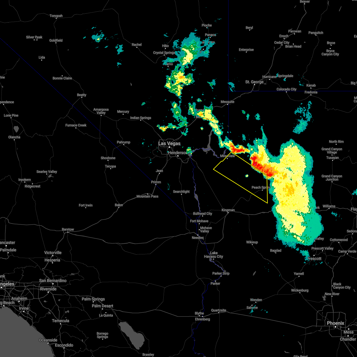 At 949 pm mst, severe thunderstorms were located along a line extending from 7 miles east of south cove to near diamond creek campground, moving southwest at 15 mph (radar indicated). Hazards include 60 mph wind gusts. expect damage to roofs and trees and possible blowing dust due to high winds At 949 pm mst, severe thunderstorms were located along a line extending from 7 miles east of south cove to near diamond creek campground, moving southwest at 15 mph (radar indicated). Hazards include 60 mph wind gusts. expect damage to roofs and trees and possible blowing dust due to high winds
|
| 8/2/2018 1:58 PM MST |
 At 157 pm mst, a severe thunderstorm was located 7 miles east of south cove, or 40 miles southeast of overton, moving northeast at 10 mph (radar indicated). Hazards include 60 mph wind gusts. Expect damage to roofs and trees. Locations impacted include, grand canyon skywalk, south cove, meadview and lake mead national recreation area. At 157 pm mst, a severe thunderstorm was located 7 miles east of south cove, or 40 miles southeast of overton, moving northeast at 10 mph (radar indicated). Hazards include 60 mph wind gusts. Expect damage to roofs and trees. Locations impacted include, grand canyon skywalk, south cove, meadview and lake mead national recreation area.
|
|
|
| 8/2/2018 1:37 PM MST |
 At 137 pm mst, a severe thunderstorm was located near south cove, or 39 miles southeast of overton, moving northeast at 15 mph (radar indicated). Hazards include 60 mph wind gusts. expect damage to roofs and trees At 137 pm mst, a severe thunderstorm was located near south cove, or 39 miles southeast of overton, moving northeast at 15 mph (radar indicated). Hazards include 60 mph wind gusts. expect damage to roofs and trees
|
| 7/10/2018 5:39 PM MST |
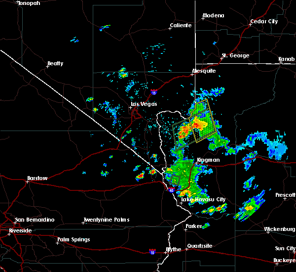 The severe thunderstorm warning for central mohave county will expire at 545 pm mst, the storms which prompted the warning are now likely producing extremely heavy rain instead of high winds, so the severe thunderstorm warning will be allowed to expire. a flash flood warning remains in effect for the diamond bar road area until 815 pm mst. The severe thunderstorm warning for central mohave county will expire at 545 pm mst, the storms which prompted the warning are now likely producing extremely heavy rain instead of high winds, so the severe thunderstorm warning will be allowed to expire. a flash flood warning remains in effect for the diamond bar road area until 815 pm mst.
|
| 7/10/2018 5:14 PM MST |
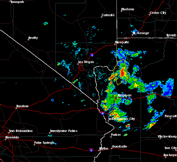 At 513 pm mst, severe thunderstorms were located along a line extending from 9 miles northeast of south cove to 12 miles southeast of grand canyon ranch, moving southwest at 15 mph. the strongest storm was over the road to the grand canyon skywalk (radar indicated). Hazards include 60 mph wind gusts. Expect damage to roofs and trees. Locations impacted include, grand canyon skywalk, grand canyon ranch, south cove, meadview and lake mead national recreation area. At 513 pm mst, severe thunderstorms were located along a line extending from 9 miles northeast of south cove to 12 miles southeast of grand canyon ranch, moving southwest at 15 mph. the strongest storm was over the road to the grand canyon skywalk (radar indicated). Hazards include 60 mph wind gusts. Expect damage to roofs and trees. Locations impacted include, grand canyon skywalk, grand canyon ranch, south cove, meadview and lake mead national recreation area.
|
| 7/10/2018 4:56 PM MST |
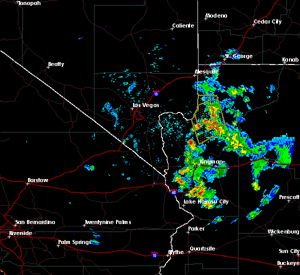 The severe thunderstorm warning for north central mohave county will expire at 500 pm mst, this warning has been replaced with a new severe thunderstorm warning, which is valid until 545 pm mst. The severe thunderstorm warning for north central mohave county will expire at 500 pm mst, this warning has been replaced with a new severe thunderstorm warning, which is valid until 545 pm mst.
|
| 7/10/2018 4:54 PM MST |
 At 453 pm mst, severe thunderstorms were located along a line extending from 13 miles northeast of south cove to 13 miles east of grand canyon ranch, moving southwest at 15 mph (radar indicated). Hazards include 60 mph wind gusts. expect damage to roofs and trees At 453 pm mst, severe thunderstorms were located along a line extending from 13 miles northeast of south cove to 13 miles east of grand canyon ranch, moving southwest at 15 mph (radar indicated). Hazards include 60 mph wind gusts. expect damage to roofs and trees
|
| 7/10/2018 4:31 PM MST |
 At 431 pm mst, severe thunderstorms were located along a line extending from 22 miles northeast of south cove to near grand canyon skywalk, moving west at 15 mph (radar indicated). Hazards include 60 mph wind gusts. Expect damage to roofs and trees. Locations impacted include, grand canyon skywalk, south cove and lake mead national recreation area. At 431 pm mst, severe thunderstorms were located along a line extending from 22 miles northeast of south cove to near grand canyon skywalk, moving west at 15 mph (radar indicated). Hazards include 60 mph wind gusts. Expect damage to roofs and trees. Locations impacted include, grand canyon skywalk, south cove and lake mead national recreation area.
|
| 7/10/2018 4:17 PM MST |
 At 416 pm mst, severe thunderstorms were located along a line extending from 25 miles northeast of south cove to 8 miles east of grand canyon skywalk, moving west at 25 mph (radar indicated). Hazards include 60 mph wind gusts. expect damage to roofs and trees At 416 pm mst, severe thunderstorms were located along a line extending from 25 miles northeast of south cove to 8 miles east of grand canyon skywalk, moving west at 25 mph (radar indicated). Hazards include 60 mph wind gusts. expect damage to roofs and trees
|
| 7/11/2017 4:51 PM MST |
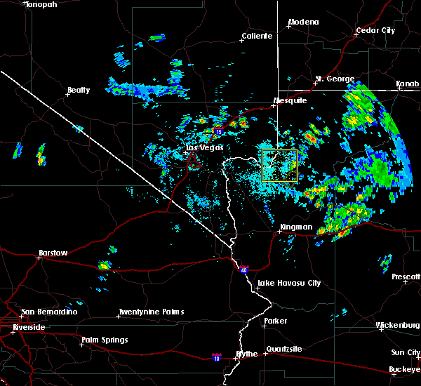 The severe thunderstorm warning for central mohave and eastern clark counties will expire at 500 pm pdt/500 pm mst/, the storm which prompted the warning has weakened below severe limits, and has exited the warned area. therefore, the warning will be allowed to expire. however gusty winds are still possible with this thunderstorm in the eastern portions of the lake mead national recreation area. The severe thunderstorm warning for central mohave and eastern clark counties will expire at 500 pm pdt/500 pm mst/, the storm which prompted the warning has weakened below severe limits, and has exited the warned area. therefore, the warning will be allowed to expire. however gusty winds are still possible with this thunderstorm in the eastern portions of the lake mead national recreation area.
|
| 7/11/2017 4:51 PM MST |
 The severe thunderstorm warning for central mohave and eastern clark counties will expire at 500 pm pdt/500 pm mst/, the storm which prompted the warning has weakened below severe limits, and has exited the warned area. therefore, the warning will be allowed to expire. however gusty winds are still possible with this thunderstorm in the eastern portions of the lake mead national recreation area. The severe thunderstorm warning for central mohave and eastern clark counties will expire at 500 pm pdt/500 pm mst/, the storm which prompted the warning has weakened below severe limits, and has exited the warned area. therefore, the warning will be allowed to expire. however gusty winds are still possible with this thunderstorm in the eastern portions of the lake mead national recreation area.
|
| 7/11/2017 4:37 PM MST |
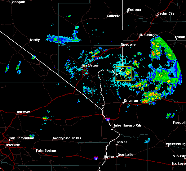 At 435 pm pdt/435 pm mst/, a severe thunderstorm was located near south cove, or 40 miles southeast of overton, and is moving northeast at 10 mph (radar indicated). Hazards include 60 mph wind gusts. Expect damage to roofs, siding, and trees. locations impacted include, south cove, pearce ferry airport, pearce ferry boat launch. Grand canyon skywalk, grand canyon ranch, meadview and lake mead national recreation area. At 435 pm pdt/435 pm mst/, a severe thunderstorm was located near south cove, or 40 miles southeast of overton, and is moving northeast at 10 mph (radar indicated). Hazards include 60 mph wind gusts. Expect damage to roofs, siding, and trees. locations impacted include, south cove, pearce ferry airport, pearce ferry boat launch. Grand canyon skywalk, grand canyon ranch, meadview and lake mead national recreation area.
|
| 7/11/2017 4:37 PM MST |
 At 435 pm pdt/435 pm mst/, a severe thunderstorm was located near south cove, or 40 miles southeast of overton, and is moving northeast at 10 mph (radar indicated). Hazards include 60 mph wind gusts. Expect damage to roofs, siding, and trees. locations impacted include, south cove, pearce ferry airport, pearce ferry boat launch. Grand canyon skywalk, grand canyon ranch, meadview and lake mead national recreation area. At 435 pm pdt/435 pm mst/, a severe thunderstorm was located near south cove, or 40 miles southeast of overton, and is moving northeast at 10 mph (radar indicated). Hazards include 60 mph wind gusts. Expect damage to roofs, siding, and trees. locations impacted include, south cove, pearce ferry airport, pearce ferry boat launch. Grand canyon skywalk, grand canyon ranch, meadview and lake mead national recreation area.
|
| 7/11/2017 4:08 PM MST |
 At 407 pm pdt/407 pm mst/, a severe thunderstorm was located near meadview, or 39 miles southeast of overton, and is nearly stationary (radar indicated). Hazards include 60 mph wind gusts and quarter size hail. Hail damage to vehicles is expected. Expect wind damage to roofs, siding, and trees. At 407 pm pdt/407 pm mst/, a severe thunderstorm was located near meadview, or 39 miles southeast of overton, and is nearly stationary (radar indicated). Hazards include 60 mph wind gusts and quarter size hail. Hail damage to vehicles is expected. Expect wind damage to roofs, siding, and trees.
|
| 7/11/2017 4:08 PM MST |
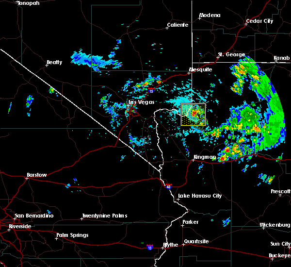 At 407 pm pdt/407 pm mst/, a severe thunderstorm was located near meadview, or 39 miles southeast of overton, and is nearly stationary (radar indicated). Hazards include 60 mph wind gusts and quarter size hail. Hail damage to vehicles is expected. Expect wind damage to roofs, siding, and trees. At 407 pm pdt/407 pm mst/, a severe thunderstorm was located near meadview, or 39 miles southeast of overton, and is nearly stationary (radar indicated). Hazards include 60 mph wind gusts and quarter size hail. Hail damage to vehicles is expected. Expect wind damage to roofs, siding, and trees.
|
| 9/22/2016 5:22 PM MST |
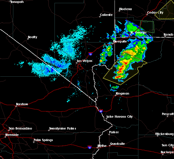 The severe thunderstorm warning for central mohave county will expire at 530 pm mst, the storm which prompted the warning has weakened below severe limits, and no longer poses an immediate threat to life or property. therefore the warning will be allowed to expire. The severe thunderstorm warning for central mohave county will expire at 530 pm mst, the storm which prompted the warning has weakened below severe limits, and no longer poses an immediate threat to life or property. therefore the warning will be allowed to expire.
|
| 9/22/2016 5:07 PM MST |
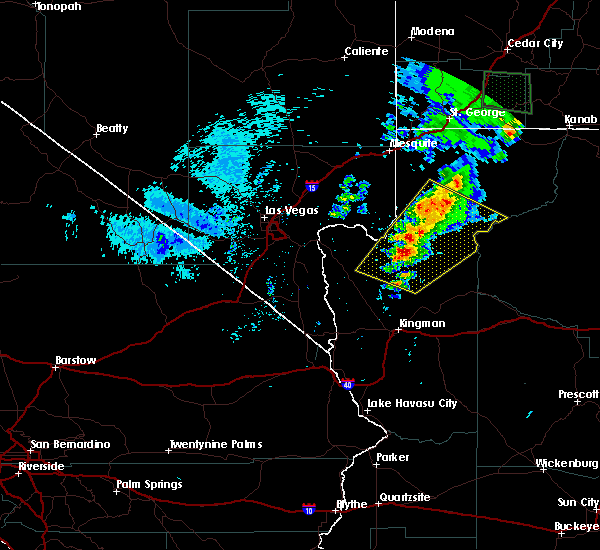 At 507 pm mst, doppler radar indicated a severe thunderstorm capable of producing quarter size hail and damaging winds in excess of 60 mph. this storm was located 15 miles north of grand canyon skywalk, or 42 miles southeast of mesquite, moving northeast at 50 mph. locations impacted include, grand canyon skywalk, pierce ferry and antares roads, meadview, bar ten ranch, grand canyon ranch, south cove and dolan springs. At 507 pm mst, doppler radar indicated a severe thunderstorm capable of producing quarter size hail and damaging winds in excess of 60 mph. this storm was located 15 miles north of grand canyon skywalk, or 42 miles southeast of mesquite, moving northeast at 50 mph. locations impacted include, grand canyon skywalk, pierce ferry and antares roads, meadview, bar ten ranch, grand canyon ranch, south cove and dolan springs.
|
| 9/22/2016 4:45 PM MST |
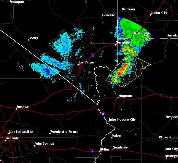 At 445 pm mst, doppler radar indicated a severe thunderstorm capable of producing quarter size hail and damaging winds in excess of 60 mph. this storm was located near grand canyon ranch, or 47 miles east of boulder city, and moving northeast at 50 mph. At 445 pm mst, doppler radar indicated a severe thunderstorm capable of producing quarter size hail and damaging winds in excess of 60 mph. this storm was located near grand canyon ranch, or 47 miles east of boulder city, and moving northeast at 50 mph.
|
| 9/22/2016 4:23 PM MST |
 The severe thunderstorm warning for northwestern mohave and northeastern clark counties will expire at 430 pm pdt/430 pm mst/, the storms which prompted the warning have weakened. therefore the warning will be allowed to expire. The severe thunderstorm warning for northwestern mohave and northeastern clark counties will expire at 430 pm pdt/430 pm mst/, the storms which prompted the warning have weakened. therefore the warning will be allowed to expire.
|
| 9/22/2016 4:23 PM MST |
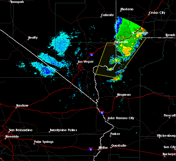 The severe thunderstorm warning for northwestern mohave and northeastern clark counties will expire at 430 pm pdt/430 pm mst/, the storms which prompted the warning have weakened. therefore the warning will be allowed to expire. The severe thunderstorm warning for northwestern mohave and northeastern clark counties will expire at 430 pm pdt/430 pm mst/, the storms which prompted the warning have weakened. therefore the warning will be allowed to expire.
|
| 9/22/2016 3:49 PM MST |
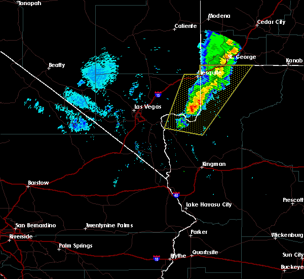 At 348 pm pdt/348 pm mst/, doppler radar indicated severe thunderstorms capable of producing quarter size hail and damaging winds in excess of 60 mph. these storms were located along a line extending from near virgin river campground to near temple bar campground, moving northeast at 30 mph. locations impacted include, mesquite, beaver dam, littlefield, virgin river gorge, moapa valley, temple bar campground, meadview, echo bay, bunkerville, grand canyon ranch, overton beach, virgin river campground, south cove, echo bay campground, valley of fire and temple bar. At 348 pm pdt/348 pm mst/, doppler radar indicated severe thunderstorms capable of producing quarter size hail and damaging winds in excess of 60 mph. these storms were located along a line extending from near virgin river campground to near temple bar campground, moving northeast at 30 mph. locations impacted include, mesquite, beaver dam, littlefield, virgin river gorge, moapa valley, temple bar campground, meadview, echo bay, bunkerville, grand canyon ranch, overton beach, virgin river campground, south cove, echo bay campground, valley of fire and temple bar.
|
| 9/22/2016 3:49 PM MST |
 At 348 pm pdt/348 pm mst/, doppler radar indicated severe thunderstorms capable of producing quarter size hail and damaging winds in excess of 60 mph. these storms were located along a line extending from near virgin river campground to near temple bar campground, moving northeast at 30 mph. locations impacted include, mesquite, beaver dam, littlefield, virgin river gorge, moapa valley, temple bar campground, meadview, echo bay, bunkerville, grand canyon ranch, overton beach, virgin river campground, south cove, echo bay campground, valley of fire and temple bar. At 348 pm pdt/348 pm mst/, doppler radar indicated severe thunderstorms capable of producing quarter size hail and damaging winds in excess of 60 mph. these storms were located along a line extending from near virgin river campground to near temple bar campground, moving northeast at 30 mph. locations impacted include, mesquite, beaver dam, littlefield, virgin river gorge, moapa valley, temple bar campground, meadview, echo bay, bunkerville, grand canyon ranch, overton beach, virgin river campground, south cove, echo bay campground, valley of fire and temple bar.
|
| 9/22/2016 3:25 PM MST |
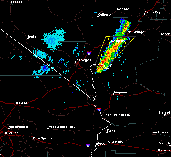 At 324 pm pdt/324 pm mst/, doppler radar indicated a line of severe thunderstorms capable of producing quarter size hail and damaging winds in excess of 60 mph. these storms were located along a line extending from near virgin river gorge to 8 miles west of temple bar campground, and moving northeast at 25 mph. At 324 pm pdt/324 pm mst/, doppler radar indicated a line of severe thunderstorms capable of producing quarter size hail and damaging winds in excess of 60 mph. these storms were located along a line extending from near virgin river gorge to 8 miles west of temple bar campground, and moving northeast at 25 mph.
|
| 9/22/2016 3:25 PM MST |
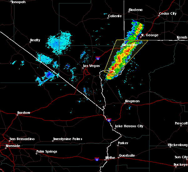 At 324 pm pdt/324 pm mst/, doppler radar indicated a line of severe thunderstorms capable of producing quarter size hail and damaging winds in excess of 60 mph. these storms were located along a line extending from near virgin river gorge to 8 miles west of temple bar campground, and moving northeast at 25 mph. At 324 pm pdt/324 pm mst/, doppler radar indicated a line of severe thunderstorms capable of producing quarter size hail and damaging winds in excess of 60 mph. these storms were located along a line extending from near virgin river gorge to 8 miles west of temple bar campground, and moving northeast at 25 mph.
|
| 8/22/2016 10:05 PM PDT |
 At 1003 pm mst, doppler radar indicated a severe thunderstorm capable of producing quarter size hail and damaging winds in excess of 60 mph. this storm was located near grand canyon ranch, or 43 miles north of kingman, moving southeast at 35 mph. locations impacted include, grand canyon skywalk, pierce ferry and antares roads, temple bar campground, meadview, grand canyon ranch, south cove, dolan springs and temple bar. At 1003 pm mst, doppler radar indicated a severe thunderstorm capable of producing quarter size hail and damaging winds in excess of 60 mph. this storm was located near grand canyon ranch, or 43 miles north of kingman, moving southeast at 35 mph. locations impacted include, grand canyon skywalk, pierce ferry and antares roads, temple bar campground, meadview, grand canyon ranch, south cove, dolan springs and temple bar.
|
| 8/22/2016 9:42 PM MST |
 At 941 pm pdt/941 pm mst/, doppler radar indicated a severe thunderstorm capable of producing damaging winds in excess of 60 mph. this storm was located near meadview, or 36 miles east of boulder city, and moving southeast at 35 mph. a wind gust of 61 mph was reported on boulder island as this storm passed. At 941 pm pdt/941 pm mst/, doppler radar indicated a severe thunderstorm capable of producing damaging winds in excess of 60 mph. this storm was located near meadview, or 36 miles east of boulder city, and moving southeast at 35 mph. a wind gust of 61 mph was reported on boulder island as this storm passed.
|
| 8/22/2016 9:42 PM MST |
 At 941 pm pdt/941 pm mst/, doppler radar indicated a severe thunderstorm capable of producing damaging winds in excess of 60 mph. this storm was located near meadview, or 36 miles east of boulder city, and moving southeast at 35 mph. a wind gust of 61 mph was reported on boulder island as this storm passed. At 941 pm pdt/941 pm mst/, doppler radar indicated a severe thunderstorm capable of producing damaging winds in excess of 60 mph. this storm was located near meadview, or 36 miles east of boulder city, and moving southeast at 35 mph. a wind gust of 61 mph was reported on boulder island as this storm passed.
|
|
|
| 6/27/2016 5:02 PM MST |
 At 459 pm pdt/459 pm mst/, doppler radar indicated a severe thunderstorm producing damaging wind gusts. this storm was located near grand canyon ranch, or 49 miles southeast of overton, remaining nearly stationary. winds are spreading well away from the thunderstorm. locations impacted include, grand canyon skywalk, temple bar campground, meadview, echo bay, grand canyon ranch, south cove, echo bay campground and temple bar. At 459 pm pdt/459 pm mst/, doppler radar indicated a severe thunderstorm producing damaging wind gusts. this storm was located near grand canyon ranch, or 49 miles southeast of overton, remaining nearly stationary. winds are spreading well away from the thunderstorm. locations impacted include, grand canyon skywalk, temple bar campground, meadview, echo bay, grand canyon ranch, south cove, echo bay campground and temple bar.
|
| 6/27/2016 5:02 PM MST |
 At 459 pm pdt/459 pm mst/, doppler radar indicated a severe thunderstorm producing damaging wind gusts. this storm was located near grand canyon ranch, or 49 miles southeast of overton, remaining nearly stationary. winds are spreading well away from the thunderstorm. locations impacted include, grand canyon skywalk, temple bar campground, meadview, echo bay, grand canyon ranch, south cove, echo bay campground and temple bar. At 459 pm pdt/459 pm mst/, doppler radar indicated a severe thunderstorm producing damaging wind gusts. this storm was located near grand canyon ranch, or 49 miles southeast of overton, remaining nearly stationary. winds are spreading well away from the thunderstorm. locations impacted include, grand canyon skywalk, temple bar campground, meadview, echo bay, grand canyon ranch, south cove, echo bay campground and temple bar.
|
| 6/27/2016 4:32 PM MST |
 At 430 pm pdt/430 pm mst/, doppler radar indicated a severe thunderstorm capable of producing damaging winds. this storm was located near grand canyon ranch, or 50 miles north of kingman, and is remaing nearly stationary. At 430 pm pdt/430 pm mst/, doppler radar indicated a severe thunderstorm capable of producing damaging winds. this storm was located near grand canyon ranch, or 50 miles north of kingman, and is remaing nearly stationary.
|
| 6/27/2016 4:32 PM MST |
 At 430 pm pdt/430 pm mst/, doppler radar indicated a severe thunderstorm capable of producing damaging winds. this storm was located near grand canyon ranch, or 50 miles north of kingman, and is remaing nearly stationary. At 430 pm pdt/430 pm mst/, doppler radar indicated a severe thunderstorm capable of producing damaging winds. this storm was located near grand canyon ranch, or 50 miles north of kingman, and is remaing nearly stationary.
|
| 10/18/2015 9:45 PM MST |
 At 943 pm mst, doppler radar indicated a severe thunderstorm capable of producing quarter size hail and destructive winds in excess of 70 mph. this storm was located 16 miles east of grand canyon skywalk, or 61 miles northeast of kingman, and moving northeast at 50 mph. At 943 pm mst, doppler radar indicated a severe thunderstorm capable of producing quarter size hail and destructive winds in excess of 70 mph. this storm was located 16 miles east of grand canyon skywalk, or 61 miles northeast of kingman, and moving northeast at 50 mph.
|
| 10/18/2015 9:33 PM MST |
 At 933 pm mst, doppler radar indicated a severe thunderstorm capable of producing quarter size hail and destructive winds in excess of 70 mph. this storm was located 13 miles west of diamond creek campground, or 46 miles northeast of kingman, moving northeast at 40 mph. locations impacted include, diamond creek campground, grand canyon skywalk, toroweap campground, bar ten ranch and tuweep. At 933 pm mst, doppler radar indicated a severe thunderstorm capable of producing quarter size hail and destructive winds in excess of 70 mph. this storm was located 13 miles west of diamond creek campground, or 46 miles northeast of kingman, moving northeast at 40 mph. locations impacted include, diamond creek campground, grand canyon skywalk, toroweap campground, bar ten ranch and tuweep.
|
| 10/18/2015 9:18 PM MST |
 At 918 pm mst, doppler radar indicated a severe thunderstorm capable of producing quarter size hail and destructive winds in excess of 70 mph. this storm was located 19 miles west of diamond creek campground, or 38 miles northeast of kingman, moving northeast at 40 mph. locations impacted include, diamond creek campground, grand canyon skywalk, grand canyon ranch, toroweap campground, bar ten ranch and tuweep. At 918 pm mst, doppler radar indicated a severe thunderstorm capable of producing quarter size hail and destructive winds in excess of 70 mph. this storm was located 19 miles west of diamond creek campground, or 38 miles northeast of kingman, moving northeast at 40 mph. locations impacted include, diamond creek campground, grand canyon skywalk, grand canyon ranch, toroweap campground, bar ten ranch and tuweep.
|
| 10/18/2015 8:59 PM MST |
 At 858 pm mst, doppler radar indicated severe thunderstorms capable of producing quarter size hail and destructive winds in excess of 70 mph. this storm was located 16 miles northwest of valentine, or 28 miles northeast of kingman, and moving northeast at 40 mph. At 858 pm mst, doppler radar indicated severe thunderstorms capable of producing quarter size hail and destructive winds in excess of 70 mph. this storm was located 16 miles northwest of valentine, or 28 miles northeast of kingman, and moving northeast at 40 mph.
|
| 10/18/2015 8:46 PM MST |
 At 844 pm mst, doppler radar continues to indicate severe thunderstorms moving northeastward across central mohave county. earlier, trained weather spotters reported ping pong size hail and destructive winds in excess of 70 mph in the golden valley area. these storms are located 15 miles southwest of diamond creek campground, or 38 miles northeast of kingman, moving northeast at 55 mph. locations impacted include, grand canyon skywalk, grand canyon ranch, pierce ferry and antares roads, dolan springs, valentine and peach springs. At 844 pm mst, doppler radar continues to indicate severe thunderstorms moving northeastward across central mohave county. earlier, trained weather spotters reported ping pong size hail and destructive winds in excess of 70 mph in the golden valley area. these storms are located 15 miles southwest of diamond creek campground, or 38 miles northeast of kingman, moving northeast at 55 mph. locations impacted include, grand canyon skywalk, grand canyon ranch, pierce ferry and antares roads, dolan springs, valentine and peach springs.
|
| 10/18/2015 8:13 PM MST |
 At 812 pm mst, doppler radar indicated a severe thunderstorm capable of producing large damaging hail up to ping pong ball size and destructive winds in excess of 70 mph. this storm was located near chloride, or 11 miles north of kingman, and moving northeast at 55 mph. At 812 pm mst, doppler radar indicated a severe thunderstorm capable of producing large damaging hail up to ping pong ball size and destructive winds in excess of 70 mph. this storm was located near chloride, or 11 miles north of kingman, and moving northeast at 55 mph.
|
| 6/29/2015 5:14 PM MST |
Mesonet station meadview 21 se /tcra3/ in mohave county AZ, 13.5 miles N of Grand Canyon West, AZ
|
 the severe thunderstorm warning has been cancelled and is no longer in effect
 Svrvef the national weather service in las vegas has issued a * severe thunderstorm warning for, northern mohave county in northwestern arizona, * until 300 pm mst. * at 214 pm mst, a severe thunderstorm was located over grand canyon skywalk, or 52 miles southeast of overton, moving north at 10 mph (radar indicated). Hazards include 60 mph wind gusts and quarter size hail. Hail damage to vehicles is expected. Expect wind damage to roofs and trees.
 Svrvef the national weather service in las vegas has issued a * severe thunderstorm warning for, west central mohave county in northwestern arizona, eastern clark county in southern nevada, * until 600 pm pdt/600 pm mst/. * at 453 pm pdt/453 pm mst/, a severe thunderstorm was located near meadview, or 47 miles southeast of overton, moving northwest at 25 mph (radar indicated). Hazards include 60 mph wind gusts. expect damage to roofs and trees
 The severe thunderstorm warning for central mohave county will expire at 330 pm mst, the storm which prompted the warning has weakened below severe limits, and has exited the warned area. therefore, the warning will be allowed to expire. however heavy rain is still possible with this thunderstorm.
 At 310 pm mst, a severe thunderstorm was located over grand canyon skywalk, or 50 miles southeast of overton, moving north at 25 mph (radar indicated). Hazards include 60 mph wind gusts and quarter size hail. Hail damage to vehicles is expected. expect wind damage to roofs and trees. locations impacted include, grand canyon skywalk and south cove. this includes diamond bar road between mile markers 10 and 20. hail threat, radar indicated max hail size, 1. 00 in wind threat, radar indicated max wind gust, 60 mph.
 At 242 pm mst, a severe thunderstorm was located 11 miles south of grand canyon skywalk, or 45 miles north of kingman, moving north at 25 mph (radar indicated). Hazards include 60 mph wind gusts and quarter size hail. Hail damage to vehicles is expected. Expect wind damage to roofs and trees.
 The severe thunderstorm warning for central mohave county will expire at 1230 pm mst, the storm which prompted the warning has weakened below severe limits, and has exited the warned area. therefore, the warning will be allowed to expire.
 At 1144 am mst, a severe thunderstorm was located 7 miles east of grand canyon ranch, or 46 miles north of kingman, moving east at 10 mph (radar indicated). Hazards include 60 mph wind gusts and quarter size hail. Hail damage to vehicles is expected. expect wind damage to roofs and trees. this severe thunderstorm will remain over mainly rural areas of central mohave county, including grand canyon west. this includes diamond bar road between mile markers 8 and 20 and buck and doe rd. precautionary/preparedness actions, for your protection move to an interior room on the lowest floor of a building. hail threat, radar indicated max hail size, 1. 00 in wind threat, radar indicated max wind gust, 60 mph.
 The severe thunderstorm warning for west central mohave and eastern clark counties will expire at 300 pm pdt/300 pm mst/, the storm which prompted the warning has weakened below severe limits, and no longer poses an immediate threat to life or property. therefore, the warning will be allowed to expire. however gusty winds to 40 mph are still possible with this thunderstorm. boaters should take caution and be prepared for thunderstorms risks on the waters.
 The severe thunderstorm warning for west central mohave and eastern clark counties will expire at 300 pm pdt/300 pm mst/, the storm which prompted the warning has weakened below severe limits, and no longer poses an immediate threat to life or property. therefore, the warning will be allowed to expire. however gusty winds to 40 mph are still possible with this thunderstorm. boaters should take caution and be prepared for thunderstorms risks on the waters.
 At 227 pm pdt/227 pm mst/, a severe thunderstorm was located near meadview, or 42 miles southeast of overton, moving northwest at 5 mph (radar indicated). Hazards include 40 to 60 mph wind gusts. Expect damage to roofs and trees. locations impacted include, grand canyon skywalk, grand canyon ranch, south cove, lake mead national recreation area and meadview. this includes the following roads, diamond bar road between mile markers 1 and 20. pierce ferry road between mile markers 27 and 44. hail threat, radar indicated max hail size, <. 75 in wind threat, radar indicated max wind gust, 60 mph.
 At 227 pm pdt/227 pm mst/, a severe thunderstorm was located near meadview, or 42 miles southeast of overton, moving northwest at 5 mph (radar indicated). Hazards include 40 to 60 mph wind gusts. Expect damage to roofs and trees. locations impacted include, grand canyon skywalk, grand canyon ranch, south cove, lake mead national recreation area and meadview. this includes the following roads, diamond bar road between mile markers 1 and 20. pierce ferry road between mile markers 27 and 44. hail threat, radar indicated max hail size, <. 75 in wind threat, radar indicated max wind gust, 60 mph.
 At 157 pm pdt/157 pm mst/, a severe thunderstorm was located near meadview, or 45 miles southeast of overton, moving northwest at 5 mph (radar indicated). Hazards include 60 mph wind gusts. expect damage to roofs and trees
 At 157 pm pdt/157 pm mst/, a severe thunderstorm was located near meadview, or 45 miles southeast of overton, moving northwest at 5 mph (radar indicated). Hazards include 60 mph wind gusts. expect damage to roofs and trees
 The severe thunderstorm warning for central mohave county will expire at 430 pm mst, the storm which prompted the warning has weakened below severe limits, and has exited the warned area. therefore, the warning will be allowed to expire. however gusty winds are still possible with this thunderstorm.
 At 412 pm mst, a severe thunderstorm was located 8 miles east of south cove, or 41 miles southeast of overton, moving north at 10 mph (radar indicated). Hazards include 60 mph wind gusts and quarter size hail. Hail damage to vehicles is expected. expect wind damage to roofs and trees. locations impacted include, meadview and lake mead national recreation area. this includes the following roads, diamond bar road between mile markers 14 and 16. pierce ferry road between mile markers 39 and 44. hail threat, radar indicated max hail size, 1. 00 in wind threat, radar indicated max wind gust, 60 mph.
 At 345 pm mst, a severe thunderstorm was located near meadview, or 44 miles southeast of overton, moving north at 10 mph (radar indicated). Hazards include 60 mph wind gusts and quarter size hail. Hail damage to vehicles is expected. Expect wind damage to roofs and trees.
 The severe thunderstorm warning for central mohave county will expire at 545 pm mst, the storm which prompted the warning has weakened below severe limits, and no longer poses an immediate threat to life or property. therefore, the warning will be allowed to expire. however gusty winds are still possible with this thunderstorm.
 At 517 pm mst, a severe thunderstorm was located 15 miles northeast of grand canyon skywalk, or 53 miles south of littlefield, moving west at 20 mph (radar indicated). Hazards include 60 mph wind gusts and quarter size hail. Hail damage to vehicles is expected. expect wind damage to roofs and trees. locations impacted include, grand canyon skywalk. hail threat, radar indicated max hail size, 1. 00 in wind threat, radar indicated max wind gust, 60 mph.
 At 454 pm mst, a severe thunderstorm was located 15 miles southwest of bar ten ranch, or 57 miles southeast of littlefield, moving west at 20 mph (radar indicated). Hazards include 60 mph wind gusts and quarter size hail. Hail damage to vehicles is expected. Expect wind damage to roofs and trees.
 The severe thunderstorm warning for north central mohave and east central clark counties will expire at 745 pm pdt/745 pm mst/, the storm which prompted the warning has moved out towards lake mead. therefore, the warning will be allowed to expire.
 The severe thunderstorm warning for north central mohave and east central clark counties will expire at 745 pm pdt/745 pm mst/, the storm which prompted the warning has moved out towards lake mead. therefore, the warning will be allowed to expire.
 At 712 pm pdt/712 pm mst/, a severe thunderstorm was located 26 miles northeast of south cove, or 31 miles southeast of mesquite, moving south at 15 mph (radar indicated). Hazards include 60 mph wind gusts. Expect damage to roofs and trees. locations impacted include, grand canyon skywalk, south cove and lake mead national recreation area. hail threat, radar indicated max hail size, <. 75 in wind threat, radar indicated max wind gust, 60 mph.
 At 712 pm pdt/712 pm mst/, a severe thunderstorm was located 26 miles northeast of south cove, or 31 miles southeast of mesquite, moving south at 15 mph (radar indicated). Hazards include 60 mph wind gusts. Expect damage to roofs and trees. locations impacted include, grand canyon skywalk, south cove and lake mead national recreation area. hail threat, radar indicated max hail size, <. 75 in wind threat, radar indicated max wind gust, 60 mph.
 At 647 pm pdt/647 pm mst/, a severe thunderstorm was located 26 miles southeast of bunkerville, or 26 miles south of littlefield, moving south at 15 mph (radar indicated). Hazards include 60 mph wind gusts. expect damage to roofs and trees
 At 647 pm pdt/647 pm mst/, a severe thunderstorm was located 26 miles southeast of bunkerville, or 26 miles south of littlefield, moving south at 15 mph (radar indicated). Hazards include 60 mph wind gusts. expect damage to roofs and trees
 At 1240 pm pdt/1240 pm mst/, a severe thunderstorm was located over lake mead national recreation area, moving north at 25 mph (radar indicated). Hazards include 60 mph wind gusts. expect damage to roofs and trees
 At 1240 pm pdt/1240 pm mst/, a severe thunderstorm was located over lake mead national recreation area, moving north at 25 mph (radar indicated). Hazards include 60 mph wind gusts. expect damage to roofs and trees
 At 1214 pm pdt/1214 pm mst/, doppler radar continued to indicate a line of thunderstorms with severe winds moving into the lake mead national recreation area. anyone in the path of these storms should take cover and get off of the lake until the threat has ended (radar indicated). Hazards include 70 mph wind gusts. Expect considerable tree damage. damage is likely to mobile homes, roofs, and outbuildings. locations impacted include, boulder city, las vegas bay, overton, moapa valley, echo bay, grand canyon skywalk, boulder beach campground, las vegas bay campground, pierce ferry and antares roads, meadview, hoover dam, temple bar campground, south cove, logandale, boulder beach, echo bay campground, callville bay, grand canyon ranch, valley of fire and callville bay campground. thunderstorm damage threat, considerable hail threat, radar indicated max hail size, <. 75 in wind threat, radar indicated max wind gust, 70 mph.
 At 1214 pm pdt/1214 pm mst/, doppler radar continued to indicate a line of thunderstorms with severe winds moving into the lake mead national recreation area. anyone in the path of these storms should take cover and get off of the lake until the threat has ended (radar indicated). Hazards include 70 mph wind gusts. Expect considerable tree damage. damage is likely to mobile homes, roofs, and outbuildings. locations impacted include, boulder city, las vegas bay, overton, moapa valley, echo bay, grand canyon skywalk, boulder beach campground, las vegas bay campground, pierce ferry and antares roads, meadview, hoover dam, temple bar campground, south cove, logandale, boulder beach, echo bay campground, callville bay, grand canyon ranch, valley of fire and callville bay campground. thunderstorm damage threat, considerable hail threat, radar indicated max hail size, <. 75 in wind threat, radar indicated max wind gust, 70 mph.
 At 1139 am pdt/1139 am mst/, a line of severe thunderstorms were located 13 miles southwest of lake mead national recreation area, or 25 miles east of boulder city, moving north at 45 mph (radar indicated). Hazards include 70 mph wind gusts. Expect considerable tree damage. Damage is likely to mobile homes, roofs, and outbuildings.
 At 1139 am pdt/1139 am mst/, a line of severe thunderstorms were located 13 miles southwest of lake mead national recreation area, or 25 miles east of boulder city, moving north at 45 mph (radar indicated). Hazards include 70 mph wind gusts. Expect considerable tree damage. Damage is likely to mobile homes, roofs, and outbuildings.
 At 1101 am mst, severe thunderstorms were located along a line extending from near diamond m ranch to 11 miles west of chloride, moving northeast at 30 mph. at 1051 am, 68 mph wind gusts were recorded at kingman airport (radar indicated). Hazards include 70 mph wind gusts. Expect considerable tree damage. damage is likely to mobile homes, roofs, and outbuildings. locations impacted include, kingman, windy point campground, grand canyon skywalk, diamond creek campground, pierce ferry and antares roads, diamond m ranch, blake ranch road, golden valley, dw ranch road, packsaddle campground, chloride, grand canyon ranch, new kingman-butler, valentine, dolan springs, lake mead national recreation area and peach springs. this includes interstate 40 in arizona between mile markers 45 and 93. thunderstorm damage threat, considerable hail threat, radar indicated max hail size, <. 75 in wind threat, radar indicated max wind gust, 70 mph.
 At 1054 am mst, severe thunderstorms were located along a line extending from near diamond m ranch to 12 miles northeast of katherine landing, moving northeast at 30 mph. strong winds exceeding 50 mph have been reported near kingman (radar indicated). Hazards include 60 mph wind gusts. expect damage to roofs and trees
 At 252 pm pdt/252 pm mst/, a severe thunderstorm was located 10 miles northwest of south cove, or 24 miles southeast of overton, moving southwest at 40 mph (radar indicated). Hazards include 60 mph wind gusts and quarter size hail. Hail damage to vehicles is expected. Expect wind damage to roofs and trees.
 At 252 pm pdt/252 pm mst/, a severe thunderstorm was located 10 miles northwest of south cove, or 24 miles southeast of overton, moving southwest at 40 mph (radar indicated). Hazards include 60 mph wind gusts and quarter size hail. Hail damage to vehicles is expected. Expect wind damage to roofs and trees.
 The severe thunderstorm warning for central mohave county will expire at 1100 pm mst, the storms which prompted the warning have weakened below severe limits, and no longer pose an immediate threat to life or property. therefore, the warning will be allowed to expire. however gusty winds up to 50 mph and brief heavy rain are still possible with these thunderstorms.
 At 1017 pm mst, severe thunderstorms were located along a line extending from near meadview to 19 miles north of valentine to 13 miles south of diamond creek campground, moving southwest at 40 mph (radar indicated). Hazards include 60 mph wind gusts. expect damage to roofs and trees
 At 949 pm mst, severe thunderstorms were located along a line extending from 7 miles east of south cove to near diamond creek campground, moving southwest at 15 mph (radar indicated). Hazards include 60 mph wind gusts. expect damage to roofs and trees and possible blowing dust due to high winds
 At 157 pm mst, a severe thunderstorm was located 7 miles east of south cove, or 40 miles southeast of overton, moving northeast at 10 mph (radar indicated). Hazards include 60 mph wind gusts. Expect damage to roofs and trees. Locations impacted include, grand canyon skywalk, south cove, meadview and lake mead national recreation area.
 At 137 pm mst, a severe thunderstorm was located near south cove, or 39 miles southeast of overton, moving northeast at 15 mph (radar indicated). Hazards include 60 mph wind gusts. expect damage to roofs and trees
 The severe thunderstorm warning for central mohave county will expire at 545 pm mst, the storms which prompted the warning are now likely producing extremely heavy rain instead of high winds, so the severe thunderstorm warning will be allowed to expire. a flash flood warning remains in effect for the diamond bar road area until 815 pm mst.
 At 513 pm mst, severe thunderstorms were located along a line extending from 9 miles northeast of south cove to 12 miles southeast of grand canyon ranch, moving southwest at 15 mph. the strongest storm was over the road to the grand canyon skywalk (radar indicated). Hazards include 60 mph wind gusts. Expect damage to roofs and trees. Locations impacted include, grand canyon skywalk, grand canyon ranch, south cove, meadview and lake mead national recreation area.
 The severe thunderstorm warning for north central mohave county will expire at 500 pm mst, this warning has been replaced with a new severe thunderstorm warning, which is valid until 545 pm mst.
 At 453 pm mst, severe thunderstorms were located along a line extending from 13 miles northeast of south cove to 13 miles east of grand canyon ranch, moving southwest at 15 mph (radar indicated). Hazards include 60 mph wind gusts. expect damage to roofs and trees
 At 431 pm mst, severe thunderstorms were located along a line extending from 22 miles northeast of south cove to near grand canyon skywalk, moving west at 15 mph (radar indicated). Hazards include 60 mph wind gusts. Expect damage to roofs and trees. Locations impacted include, grand canyon skywalk, south cove and lake mead national recreation area.
 At 416 pm mst, severe thunderstorms were located along a line extending from 25 miles northeast of south cove to 8 miles east of grand canyon skywalk, moving west at 25 mph (radar indicated). Hazards include 60 mph wind gusts. expect damage to roofs and trees
 The severe thunderstorm warning for central mohave and eastern clark counties will expire at 500 pm pdt/500 pm mst/, the storm which prompted the warning has weakened below severe limits, and has exited the warned area. therefore, the warning will be allowed to expire. however gusty winds are still possible with this thunderstorm in the eastern portions of the lake mead national recreation area.
 The severe thunderstorm warning for central mohave and eastern clark counties will expire at 500 pm pdt/500 pm mst/, the storm which prompted the warning has weakened below severe limits, and has exited the warned area. therefore, the warning will be allowed to expire. however gusty winds are still possible with this thunderstorm in the eastern portions of the lake mead national recreation area.
 At 435 pm pdt/435 pm mst/, a severe thunderstorm was located near south cove, or 40 miles southeast of overton, and is moving northeast at 10 mph (radar indicated). Hazards include 60 mph wind gusts. Expect damage to roofs, siding, and trees. locations impacted include, south cove, pearce ferry airport, pearce ferry boat launch. Grand canyon skywalk, grand canyon ranch, meadview and lake mead national recreation area.
 At 435 pm pdt/435 pm mst/, a severe thunderstorm was located near south cove, or 40 miles southeast of overton, and is moving northeast at 10 mph (radar indicated). Hazards include 60 mph wind gusts. Expect damage to roofs, siding, and trees. locations impacted include, south cove, pearce ferry airport, pearce ferry boat launch. Grand canyon skywalk, grand canyon ranch, meadview and lake mead national recreation area.
 At 407 pm pdt/407 pm mst/, a severe thunderstorm was located near meadview, or 39 miles southeast of overton, and is nearly stationary (radar indicated). Hazards include 60 mph wind gusts and quarter size hail. Hail damage to vehicles is expected. Expect wind damage to roofs, siding, and trees.
 At 407 pm pdt/407 pm mst/, a severe thunderstorm was located near meadview, or 39 miles southeast of overton, and is nearly stationary (radar indicated). Hazards include 60 mph wind gusts and quarter size hail. Hail damage to vehicles is expected. Expect wind damage to roofs, siding, and trees.
 The severe thunderstorm warning for central mohave county will expire at 530 pm mst, the storm which prompted the warning has weakened below severe limits, and no longer poses an immediate threat to life or property. therefore the warning will be allowed to expire.
 At 507 pm mst, doppler radar indicated a severe thunderstorm capable of producing quarter size hail and damaging winds in excess of 60 mph. this storm was located 15 miles north of grand canyon skywalk, or 42 miles southeast of mesquite, moving northeast at 50 mph. locations impacted include, grand canyon skywalk, pierce ferry and antares roads, meadview, bar ten ranch, grand canyon ranch, south cove and dolan springs.
 At 445 pm mst, doppler radar indicated a severe thunderstorm capable of producing quarter size hail and damaging winds in excess of 60 mph. this storm was located near grand canyon ranch, or 47 miles east of boulder city, and moving northeast at 50 mph.
 The severe thunderstorm warning for northwestern mohave and northeastern clark counties will expire at 430 pm pdt/430 pm mst/, the storms which prompted the warning have weakened. therefore the warning will be allowed to expire.
 The severe thunderstorm warning for northwestern mohave and northeastern clark counties will expire at 430 pm pdt/430 pm mst/, the storms which prompted the warning have weakened. therefore the warning will be allowed to expire.
 At 348 pm pdt/348 pm mst/, doppler radar indicated severe thunderstorms capable of producing quarter size hail and damaging winds in excess of 60 mph. these storms were located along a line extending from near virgin river campground to near temple bar campground, moving northeast at 30 mph. locations impacted include, mesquite, beaver dam, littlefield, virgin river gorge, moapa valley, temple bar campground, meadview, echo bay, bunkerville, grand canyon ranch, overton beach, virgin river campground, south cove, echo bay campground, valley of fire and temple bar.
 At 348 pm pdt/348 pm mst/, doppler radar indicated severe thunderstorms capable of producing quarter size hail and damaging winds in excess of 60 mph. these storms were located along a line extending from near virgin river campground to near temple bar campground, moving northeast at 30 mph. locations impacted include, mesquite, beaver dam, littlefield, virgin river gorge, moapa valley, temple bar campground, meadview, echo bay, bunkerville, grand canyon ranch, overton beach, virgin river campground, south cove, echo bay campground, valley of fire and temple bar.
 At 324 pm pdt/324 pm mst/, doppler radar indicated a line of severe thunderstorms capable of producing quarter size hail and damaging winds in excess of 60 mph. these storms were located along a line extending from near virgin river gorge to 8 miles west of temple bar campground, and moving northeast at 25 mph.
 At 324 pm pdt/324 pm mst/, doppler radar indicated a line of severe thunderstorms capable of producing quarter size hail and damaging winds in excess of 60 mph. these storms were located along a line extending from near virgin river gorge to 8 miles west of temple bar campground, and moving northeast at 25 mph.
 At 1003 pm mst, doppler radar indicated a severe thunderstorm capable of producing quarter size hail and damaging winds in excess of 60 mph. this storm was located near grand canyon ranch, or 43 miles north of kingman, moving southeast at 35 mph. locations impacted include, grand canyon skywalk, pierce ferry and antares roads, temple bar campground, meadview, grand canyon ranch, south cove, dolan springs and temple bar.
 At 941 pm pdt/941 pm mst/, doppler radar indicated a severe thunderstorm capable of producing damaging winds in excess of 60 mph. this storm was located near meadview, or 36 miles east of boulder city, and moving southeast at 35 mph. a wind gust of 61 mph was reported on boulder island as this storm passed.
 At 941 pm pdt/941 pm mst/, doppler radar indicated a severe thunderstorm capable of producing damaging winds in excess of 60 mph. this storm was located near meadview, or 36 miles east of boulder city, and moving southeast at 35 mph. a wind gust of 61 mph was reported on boulder island as this storm passed.
 At 459 pm pdt/459 pm mst/, doppler radar indicated a severe thunderstorm producing damaging wind gusts. this storm was located near grand canyon ranch, or 49 miles southeast of overton, remaining nearly stationary. winds are spreading well away from the thunderstorm. locations impacted include, grand canyon skywalk, temple bar campground, meadview, echo bay, grand canyon ranch, south cove, echo bay campground and temple bar.
 At 459 pm pdt/459 pm mst/, doppler radar indicated a severe thunderstorm producing damaging wind gusts. this storm was located near grand canyon ranch, or 49 miles southeast of overton, remaining nearly stationary. winds are spreading well away from the thunderstorm. locations impacted include, grand canyon skywalk, temple bar campground, meadview, echo bay, grand canyon ranch, south cove, echo bay campground and temple bar.
 At 430 pm pdt/430 pm mst/, doppler radar indicated a severe thunderstorm capable of producing damaging winds. this storm was located near grand canyon ranch, or 50 miles north of kingman, and is remaing nearly stationary.
 At 430 pm pdt/430 pm mst/, doppler radar indicated a severe thunderstorm capable of producing damaging winds. this storm was located near grand canyon ranch, or 50 miles north of kingman, and is remaing nearly stationary.
 At 943 pm mst, doppler radar indicated a severe thunderstorm capable of producing quarter size hail and destructive winds in excess of 70 mph. this storm was located 16 miles east of grand canyon skywalk, or 61 miles northeast of kingman, and moving northeast at 50 mph.
 At 933 pm mst, doppler radar indicated a severe thunderstorm capable of producing quarter size hail and destructive winds in excess of 70 mph. this storm was located 13 miles west of diamond creek campground, or 46 miles northeast of kingman, moving northeast at 40 mph. locations impacted include, diamond creek campground, grand canyon skywalk, toroweap campground, bar ten ranch and tuweep.
 At 918 pm mst, doppler radar indicated a severe thunderstorm capable of producing quarter size hail and destructive winds in excess of 70 mph. this storm was located 19 miles west of diamond creek campground, or 38 miles northeast of kingman, moving northeast at 40 mph. locations impacted include, diamond creek campground, grand canyon skywalk, grand canyon ranch, toroweap campground, bar ten ranch and tuweep.
 At 858 pm mst, doppler radar indicated severe thunderstorms capable of producing quarter size hail and destructive winds in excess of 70 mph. this storm was located 16 miles northwest of valentine, or 28 miles northeast of kingman, and moving northeast at 40 mph.
 At 844 pm mst, doppler radar continues to indicate severe thunderstorms moving northeastward across central mohave county. earlier, trained weather spotters reported ping pong size hail and destructive winds in excess of 70 mph in the golden valley area. these storms are located 15 miles southwest of diamond creek campground, or 38 miles northeast of kingman, moving northeast at 55 mph. locations impacted include, grand canyon skywalk, grand canyon ranch, pierce ferry and antares roads, dolan springs, valentine and peach springs.
 At 812 pm mst, doppler radar indicated a severe thunderstorm capable of producing large damaging hail up to ping pong ball size and destructive winds in excess of 70 mph. this storm was located near chloride, or 11 miles north of kingman, and moving northeast at 55 mph.


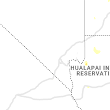


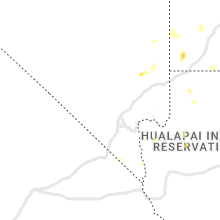


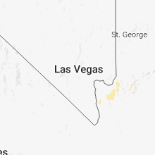











Connect with Interactive Hail Maps