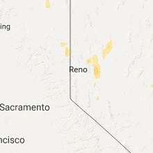
Hail Map for Hawthorne, NV
The Hawthorne, NV area has had 2 reports of on-the-ground hail by trained spotters, and has been under severe weather warnings 0 times during the past 12 months. Doppler radar has detected hail at or near Hawthorne, NV on 2 occasions.
| Name: | Hawthorne, NV |
| Where Located: | 94 miles SE of Reno, NV |
| Map: | Google Map for Hawthorne, NV |
| Population: | 3269 |
| Housing Units: | 1864 |
| More Info: | Search Google for Hawthorne, NV |
Hail and Wind Damage Spotted near Hawthorne, NV
| Date / Time | Report Details |
|---|---|
| 7/14/2024 11:56 AM PDT | Nv dot mesonet reported a wind gust to 64 mp in mineral county NV, 14 miles W of Hawthorne, NV |
| 6/3/2021 3:09 PM PDT | Measured from wlknv us-95 walker lake in mineral county NV, 10 miles ESE of Hawthorne, NV |
| 6/5/2015 3:56 PM PDT | The severe thunderstorm warning for central mineral county will expire at 400 pm pdt, the severe thunderstorm which prompted the warning has weakened. therefore the warning will be allowed to expire. |
| 6/5/2015 3:35 PM PDT | At 335 pm pdt, trained weather spotters reported a severe thunderstorm producing large damaging hail up to golf ball size. this storm was located over hawthorne, moving west at 5 mph. locations impacted include, hawthorne, hawthorne industrial airport and fletcher. |
| 6/5/2015 3:24 PM PDT | Quarter sized hail reported 0.5 miles WSW of Hawthorne, NV |
| 6/5/2015 3:14 PM PDT | At 314 pm pdt, trained weather spotters reported a severe thunderstorm producing large damaging hail up to golf ball size. this storm was located over hawthorne, moving west at 5 mph. |
| 6/5/2015 3:12 PM PDT | Golf Ball sized hail reported 0.2 miles SSE of Hawthorne, NV, from nevada department of emergency management in hawthorne. |


Connect with Interactive Hail Maps