

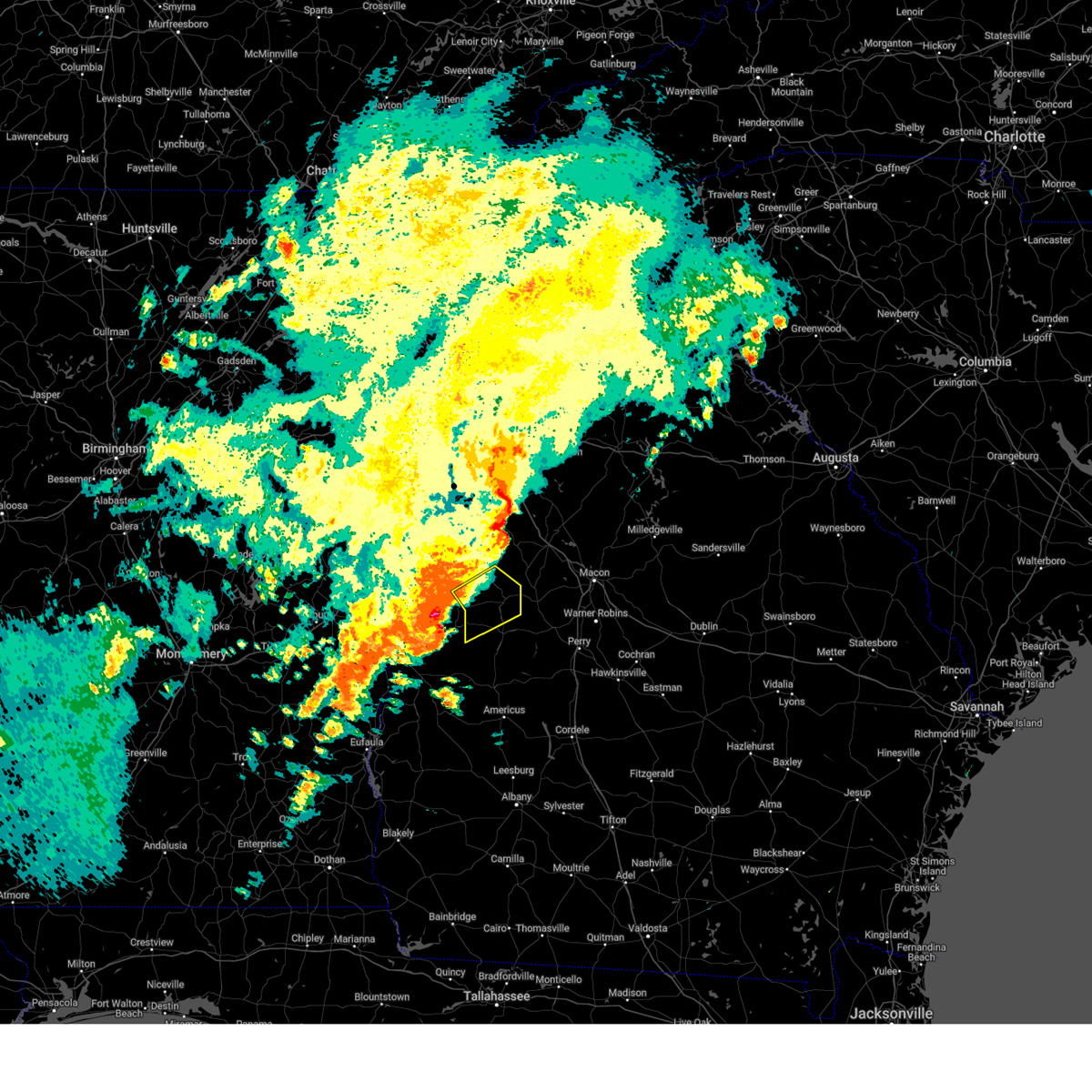
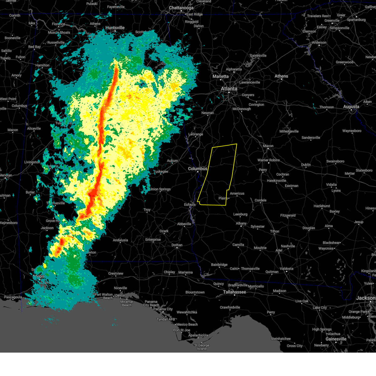
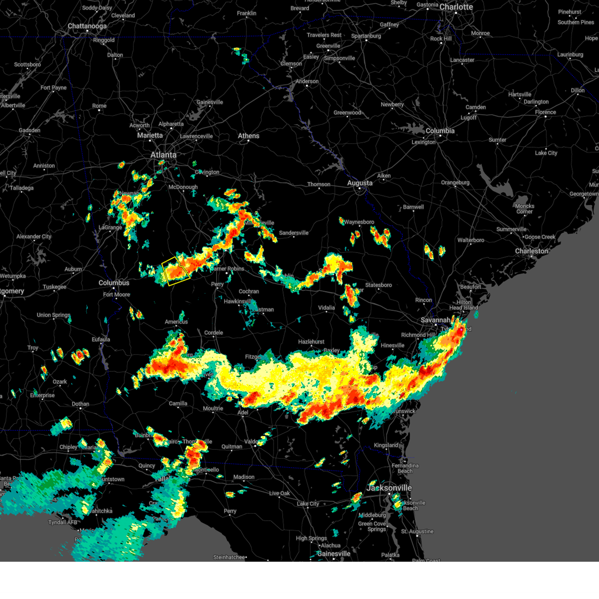
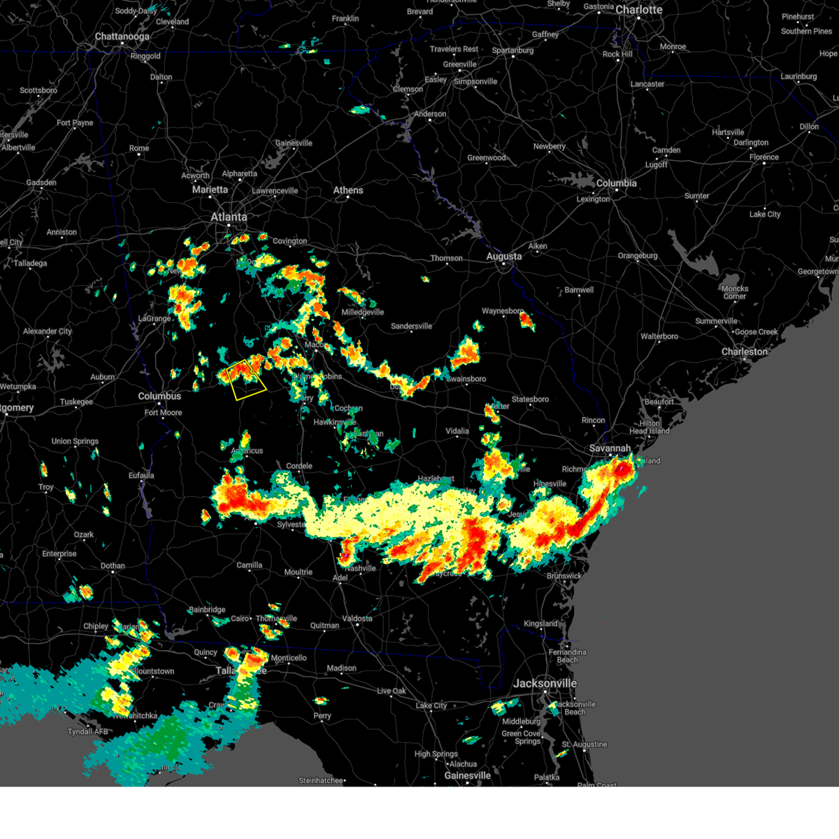
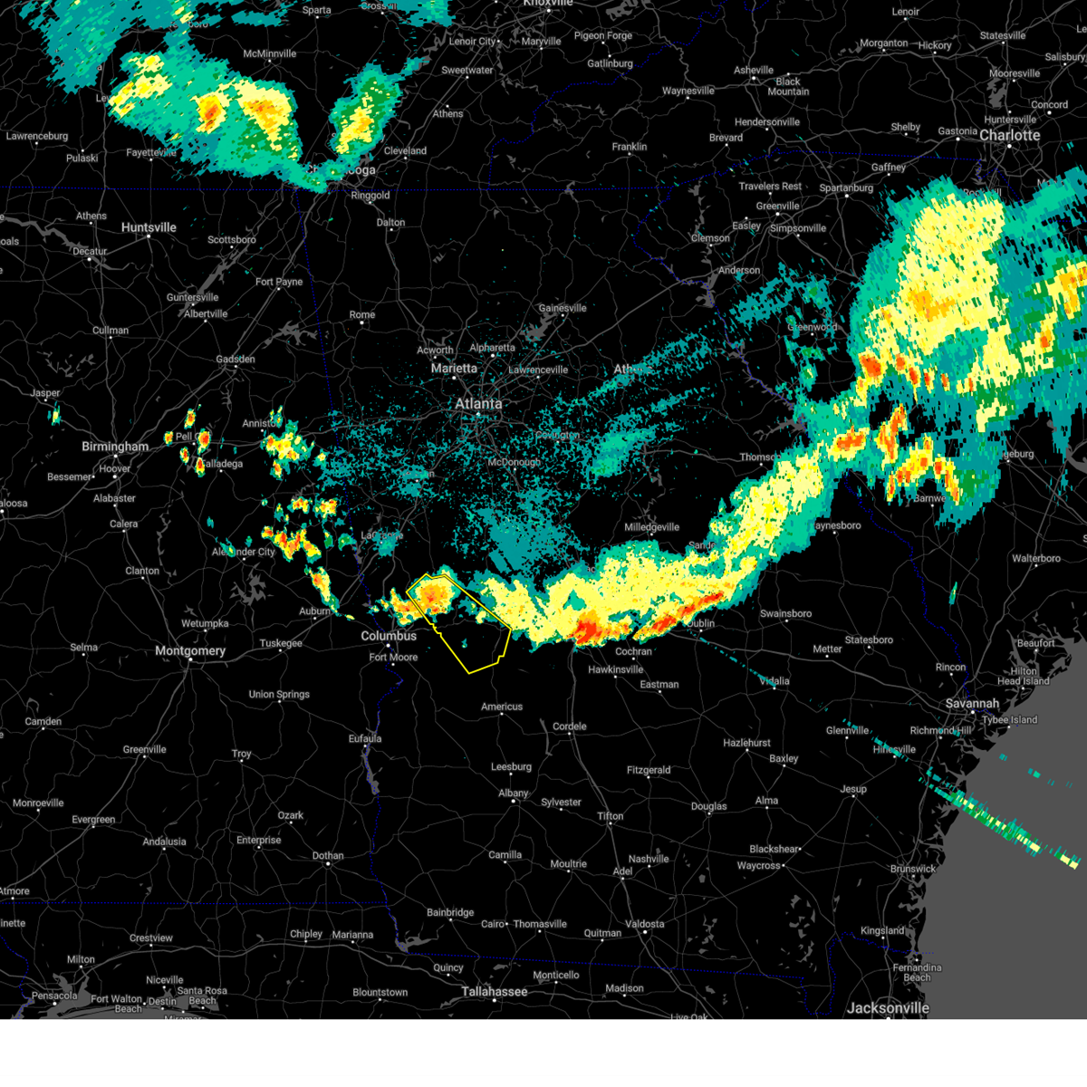
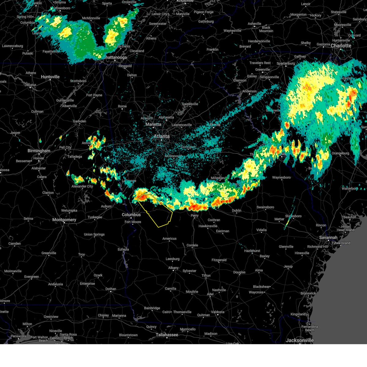
Hail Map for Howard, GA
The Howard, GA area has had 0 reports of on-the-ground hail by trained spotters, and has been under severe weather warnings 22 times during the past 12 months. Doppler radar has detected hail at or near Howard, GA on 57 occasions, including 3 occasions during the past year.
| Name: | Howard, GA |
| Where Located: | 64.4 miles E of Auburn, AL |
| Map: | Google Map for Howard, GA |
| Population: | 110 |
| Housing Units: | 56 |
| More Info: | Search Google for Howard, GA |
5
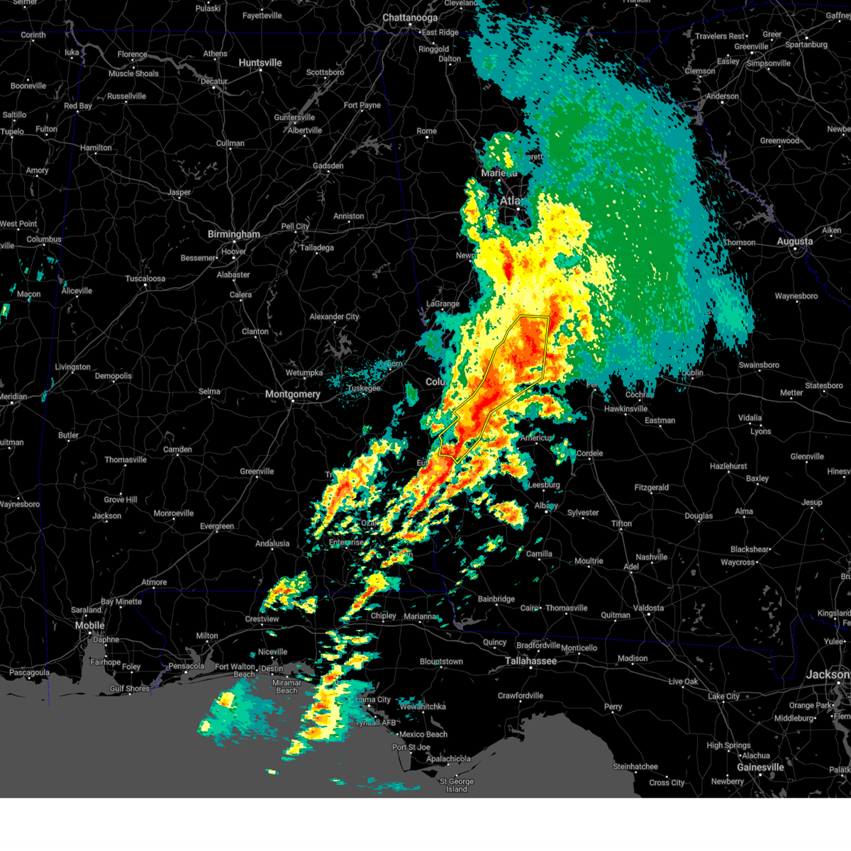
The Top Recent Hail Date for Howard, GA is Thursday, May 9, 2024 (2nd out of 57)

Hail and Wind Damage Spotted near Howard, GA
| Date / Time | Report Details |
|---|---|
| 4/6/2025 4:21 PM EDT |
 Svrffc the national weather service in peachtree city has issued a * severe thunderstorm warning for, north central marion county in west central georgia, central upson county in west central georgia, northwestern crawford county in central georgia, central talbot county in west central georgia, northwestern taylor county in west central georgia, * until 500 pm edt. * at 421 pm edt, a severe thunderstorm was located near geneva, or near talbotton, moving northeast at 35 mph (radar indicated). Hazards include 60 mph wind gusts and quarter size hail. Hail damage to vehicles is expected. Expect wind damage to roofs, siding, and trees. Svrffc the national weather service in peachtree city has issued a * severe thunderstorm warning for, north central marion county in west central georgia, central upson county in west central georgia, northwestern crawford county in central georgia, central talbot county in west central georgia, northwestern taylor county in west central georgia, * until 500 pm edt. * at 421 pm edt, a severe thunderstorm was located near geneva, or near talbotton, moving northeast at 35 mph (radar indicated). Hazards include 60 mph wind gusts and quarter size hail. Hail damage to vehicles is expected. Expect wind damage to roofs, siding, and trees.
|
| 3/16/2025 2:41 AM EDT |
 The storms which prompted the warning have weakened below severe limits, and no longer pose an immediate threat to life or property. therefore, the warning will be allowed to expire. a tornado watch remains in effect until 400 am edt for west central georgia. a tornado watch also remains in effect until 1000 am edt for central and west central georgia. The storms which prompted the warning have weakened below severe limits, and no longer pose an immediate threat to life or property. therefore, the warning will be allowed to expire. a tornado watch remains in effect until 400 am edt for west central georgia. a tornado watch also remains in effect until 1000 am edt for central and west central georgia.
|
| 3/16/2025 2:26 AM EDT |
 the severe thunderstorm warning has been cancelled and is no longer in effect the severe thunderstorm warning has been cancelled and is no longer in effect
|
| 3/16/2025 2:26 AM EDT |
 At 226 am edt, severe thunderstorms were located along a line extending from near the rock to marion estates to near florence marina state park, moving northeast at 45 mph (radar indicated). Hazards include 60 mph wind gusts. Expect damage to roofs, siding, and trees. Locations impacted include, sunset village, juniper, atwater, geneva, brooklyn, renfroe, oakland, manta, zellobee, omaha, sprewell bluff state park, cusseta, sanford, logtown, howard, sunnyside, jamestown/south fort benning, eelbeck/west fort benning, brantley, and yatesville. At 226 am edt, severe thunderstorms were located along a line extending from near the rock to marion estates to near florence marina state park, moving northeast at 45 mph (radar indicated). Hazards include 60 mph wind gusts. Expect damage to roofs, siding, and trees. Locations impacted include, sunset village, juniper, atwater, geneva, brooklyn, renfroe, oakland, manta, zellobee, omaha, sprewell bluff state park, cusseta, sanford, logtown, howard, sunnyside, jamestown/south fort benning, eelbeck/west fort benning, brantley, and yatesville.
|
| 3/16/2025 1:59 AM EDT |
 Svrffc the national weather service in peachtree city has issued a * severe thunderstorm warning for, marion county in west central georgia, southeastern meriwether county in west central georgia, muscogee county in west central georgia, chattahoochee county in west central georgia, stewart county in west central georgia, upson county in west central georgia, northwestern webster county in west central georgia, west central crawford county in central georgia, western schley county in west central georgia, talbot county in west central georgia, taylor county in west central georgia, southeastern harris county in west central georgia, * until 245 am edt. * at 159 am edt, severe thunderstorms were located along a line extending from raleigh to near eelbeck/west fort benning to lakepoint resort state park, moving east at 40 mph (radar indicated). Hazards include 60 mph wind gusts. expect damage to roofs, siding, and trees Svrffc the national weather service in peachtree city has issued a * severe thunderstorm warning for, marion county in west central georgia, southeastern meriwether county in west central georgia, muscogee county in west central georgia, chattahoochee county in west central georgia, stewart county in west central georgia, upson county in west central georgia, northwestern webster county in west central georgia, west central crawford county in central georgia, western schley county in west central georgia, talbot county in west central georgia, taylor county in west central georgia, southeastern harris county in west central georgia, * until 245 am edt. * at 159 am edt, severe thunderstorms were located along a line extending from raleigh to near eelbeck/west fort benning to lakepoint resort state park, moving east at 40 mph (radar indicated). Hazards include 60 mph wind gusts. expect damage to roofs, siding, and trees
|
| 3/5/2025 2:41 AM EST |
 The storms which prompted the warning have weakened below severe limits, and have exited the warned area. therefore, the warning will be allowed to expire. a severe thunderstorm watch remains in effect until 400 am est for west central georgia. The storms which prompted the warning have weakened below severe limits, and have exited the warned area. therefore, the warning will be allowed to expire. a severe thunderstorm watch remains in effect until 400 am est for west central georgia.
|
| 3/5/2025 2:00 AM EST |
 Svrffc the national weather service in peachtree city has issued a * severe thunderstorm warning for, marion county in west central georgia, southeastern meriwether county in west central georgia, eastern muscogee county in west central georgia, chattahoochee county in west central georgia, stewart county in west central georgia, central upson county in west central georgia, webster county in west central georgia, western schley county in west central georgia, talbot county in west central georgia, western taylor county in west central georgia, southeastern harris county in west central georgia, * until 245 am est. * at 200 am est, severe thunderstorms were located along a line extending from flint hill to eelbeck/west fort moore to near sanford, moving east at 20 mph (radar indicated). Hazards include 60 mph wind gusts. expect damage to roofs, siding, and trees Svrffc the national weather service in peachtree city has issued a * severe thunderstorm warning for, marion county in west central georgia, southeastern meriwether county in west central georgia, eastern muscogee county in west central georgia, chattahoochee county in west central georgia, stewart county in west central georgia, central upson county in west central georgia, webster county in west central georgia, western schley county in west central georgia, talbot county in west central georgia, western taylor county in west central georgia, southeastern harris county in west central georgia, * until 245 am est. * at 200 am est, severe thunderstorms were located along a line extending from flint hill to eelbeck/west fort moore to near sanford, moving east at 20 mph (radar indicated). Hazards include 60 mph wind gusts. expect damage to roofs, siding, and trees
|
| 2/16/2025 5:02 AM EST |
 Svrffc the national weather service in peachtree city has issued a * severe thunderstorm warning for, marion county in west central georgia, eastern muscogee county in west central georgia, chattahoochee county in west central georgia, northern stewart county in west central georgia, southern upson county in west central georgia, sumter county in west central georgia, southeastern harris county in west central georgia, macon county in west central georgia, webster county in west central georgia, peach county in central georgia, central crawford county in central georgia, schley county in west central georgia, talbot county in west central georgia, taylor county in west central georgia, * until 600 am est. * at 501 am est, severe thunderstorms were located along a line extending from woodland to near box springs to near jamestown/south fort moore, moving southeast at 45 mph (radar indicated). Hazards include 70 mph wind gusts. Expect considerable tree damage. Damage is likely to mobile homes, roofs, and outbuildings. Svrffc the national weather service in peachtree city has issued a * severe thunderstorm warning for, marion county in west central georgia, eastern muscogee county in west central georgia, chattahoochee county in west central georgia, northern stewart county in west central georgia, southern upson county in west central georgia, sumter county in west central georgia, southeastern harris county in west central georgia, macon county in west central georgia, webster county in west central georgia, peach county in central georgia, central crawford county in central georgia, schley county in west central georgia, talbot county in west central georgia, taylor county in west central georgia, * until 600 am est. * at 501 am est, severe thunderstorms were located along a line extending from woodland to near box springs to near jamestown/south fort moore, moving southeast at 45 mph (radar indicated). Hazards include 70 mph wind gusts. Expect considerable tree damage. Damage is likely to mobile homes, roofs, and outbuildings.
|
| 12/29/2024 4:35 AM EST |
 At 435 am est, severe thunderstorms were located along a line extending from near inman to griffin to near the rock to near howard, moving northeast at 55 mph (radar indicated). Hazards include 60 mph wind gusts. Expect damage to roofs, siding, and trees. Locations impacted include, griffin, mcdonough, fayetteville, thomaston, barnesville, jackson, forsyth, butler, zebulon, roberta, peachtree city, stockbridge, hampton, lovejoy, locust grove, reynolds, flovilla, milner, brooks, and jenkinsburg. At 435 am est, severe thunderstorms were located along a line extending from near inman to griffin to near the rock to near howard, moving northeast at 55 mph (radar indicated). Hazards include 60 mph wind gusts. Expect damage to roofs, siding, and trees. Locations impacted include, griffin, mcdonough, fayetteville, thomaston, barnesville, jackson, forsyth, butler, zebulon, roberta, peachtree city, stockbridge, hampton, lovejoy, locust grove, reynolds, flovilla, milner, brooks, and jenkinsburg.
|
| 12/29/2024 4:35 AM EST |
 the severe thunderstorm warning has been cancelled and is no longer in effect the severe thunderstorm warning has been cancelled and is no longer in effect
|
| 12/29/2024 4:02 AM EST |
 Svrffc the national weather service in peachtree city has issued a * severe thunderstorm warning for, spalding county in west central georgia, southern fayette county in north central georgia, meriwether county in west central georgia, pike county in west central georgia, monroe county in central georgia, upson county in west central georgia, southwestern butts county in central georgia, henry county in north central georgia, crawford county in central georgia, southeastern coweta county in west central georgia, southeastern clayton county in north central georgia, central talbot county in west central georgia, taylor county in west central georgia, lamar county in west central georgia, * until 500 am est. * at 401 am est, severe thunderstorms were located along a line extending from near hogansville to near woodland to near eelbeck/west fort moore, moving east at 45 mph (radar indicated). Hazards include 60 mph wind gusts. expect damage to roofs, siding, and trees Svrffc the national weather service in peachtree city has issued a * severe thunderstorm warning for, spalding county in west central georgia, southern fayette county in north central georgia, meriwether county in west central georgia, pike county in west central georgia, monroe county in central georgia, upson county in west central georgia, southwestern butts county in central georgia, henry county in north central georgia, crawford county in central georgia, southeastern coweta county in west central georgia, southeastern clayton county in north central georgia, central talbot county in west central georgia, taylor county in west central georgia, lamar county in west central georgia, * until 500 am est. * at 401 am est, severe thunderstorms were located along a line extending from near hogansville to near woodland to near eelbeck/west fort moore, moving east at 45 mph (radar indicated). Hazards include 60 mph wind gusts. expect damage to roofs, siding, and trees
|
| 12/29/2024 3:58 AM EST |
 At 357 am est, severe thunderstorms were located along a line extending from near box springs to near sand hill to near lakepoint resort state park, moving east at 35 mph (radar indicated). Hazards include 60 mph wind gusts. Expect damage to roofs, siding, and trees. Locations impacted include, lumpkin, buena vista, talbotton, cusseta, richland, junction city, geneva, fort moore, north fort moore, upatoi, brantley, seminole, florence marina state park, westville, juniper, vista terrace, brooklyn, renfroe, oakland, and manta. At 357 am est, severe thunderstorms were located along a line extending from near box springs to near sand hill to near lakepoint resort state park, moving east at 35 mph (radar indicated). Hazards include 60 mph wind gusts. Expect damage to roofs, siding, and trees. Locations impacted include, lumpkin, buena vista, talbotton, cusseta, richland, junction city, geneva, fort moore, north fort moore, upatoi, brantley, seminole, florence marina state park, westville, juniper, vista terrace, brooklyn, renfroe, oakland, and manta.
|
| 12/29/2024 3:25 AM EST |
 Svrffc the national weather service in peachtree city has issued a * severe thunderstorm warning for, marion county in west central georgia, central muscogee county in west central georgia, chattahoochee county in west central georgia, stewart county in west central georgia, northwestern webster county in west central georgia, southwestern talbot county in west central georgia, southwestern taylor county in west central georgia, * until 430 am est. * at 325 am est, severe thunderstorms were located along a line extending from ladonia sports complex to near russell county sports complex to white oak, moving east at 45 mph (radar indicated). Hazards include 60 mph wind gusts. expect damage to roofs, siding, and trees Svrffc the national weather service in peachtree city has issued a * severe thunderstorm warning for, marion county in west central georgia, central muscogee county in west central georgia, chattahoochee county in west central georgia, stewart county in west central georgia, northwestern webster county in west central georgia, southwestern talbot county in west central georgia, southwestern taylor county in west central georgia, * until 430 am est. * at 325 am est, severe thunderstorms were located along a line extending from ladonia sports complex to near russell county sports complex to white oak, moving east at 45 mph (radar indicated). Hazards include 60 mph wind gusts. expect damage to roofs, siding, and trees
|
| 7/31/2024 5:27 PM EDT |
 the severe thunderstorm warning has been cancelled and is no longer in effect the severe thunderstorm warning has been cancelled and is no longer in effect
|
| 7/31/2024 5:07 PM EDT |
 Svrffc the national weather service in peachtree city has issued a * severe thunderstorm warning for, south central upson county in west central georgia, east central talbot county in west central georgia, central taylor county in west central georgia, * until 545 pm edt. * at 507 pm edt, a severe thunderstorm was located over carsonville, or 9 miles north of butler, moving southeast at 15 mph (radar indicated). Hazards include 60 mph wind gusts and quarter size hail. Hail damage to vehicles is expected. Expect wind damage to roofs, siding, and trees. Svrffc the national weather service in peachtree city has issued a * severe thunderstorm warning for, south central upson county in west central georgia, east central talbot county in west central georgia, central taylor county in west central georgia, * until 545 pm edt. * at 507 pm edt, a severe thunderstorm was located over carsonville, or 9 miles north of butler, moving southeast at 15 mph (radar indicated). Hazards include 60 mph wind gusts and quarter size hail. Hail damage to vehicles is expected. Expect wind damage to roofs, siding, and trees.
|
| 7/30/2024 11:53 PM EDT |
 the severe thunderstorm warning has been cancelled and is no longer in effect the severe thunderstorm warning has been cancelled and is no longer in effect
|
| 7/30/2024 11:30 PM EDT |
 Svrffc the national weather service in peachtree city has issued a * severe thunderstorm warning for, northern marion county in west central georgia, northwestern schley county in west central georgia, talbot county in west central georgia, western taylor county in west central georgia, eastern harris county in west central georgia, * until 1215 am edt. * at 1129 pm edt, a severe thunderstorm was located near shiloh, or 9 miles east of hamilton, moving southeast at 35 mph (radar indicated). Hazards include 60 mph wind gusts and penny size hail. expect damage to roofs, siding, and trees Svrffc the national weather service in peachtree city has issued a * severe thunderstorm warning for, northern marion county in west central georgia, northwestern schley county in west central georgia, talbot county in west central georgia, western taylor county in west central georgia, eastern harris county in west central georgia, * until 1215 am edt. * at 1129 pm edt, a severe thunderstorm was located near shiloh, or 9 miles east of hamilton, moving southeast at 35 mph (radar indicated). Hazards include 60 mph wind gusts and penny size hail. expect damage to roofs, siding, and trees
|
| 5/27/2024 3:04 PM EDT |
 The storm which prompted the warning has moved out of the area. therefore, the warning has been allowed to expire. a severe thunderstorm watch remains in effect until 1000 pm edt for central and west central georgia. to report severe weather, contact your nearest law enforcement agency. they will relay your report to the national weather service peachtree city. The storm which prompted the warning has moved out of the area. therefore, the warning has been allowed to expire. a severe thunderstorm watch remains in effect until 1000 pm edt for central and west central georgia. to report severe weather, contact your nearest law enforcement agency. they will relay your report to the national weather service peachtree city.
|
| 5/27/2024 2:42 PM EDT |
 the severe thunderstorm warning has been cancelled and is no longer in effect the severe thunderstorm warning has been cancelled and is no longer in effect
|
| 5/27/2024 2:42 PM EDT |
 At 242 pm edt, a severe thunderstorm was located near butler, moving east at 25 mph (radar indicated). Hazards include 60 mph wind gusts and quarter size hail. Hail damage to vehicles is expected. expect wind damage to roofs, siding, and trees. Locations impacted include, butler, reynolds, howard, garden valley, wesley church, hicks, fickling mill, and potterville. At 242 pm edt, a severe thunderstorm was located near butler, moving east at 25 mph (radar indicated). Hazards include 60 mph wind gusts and quarter size hail. Hail damage to vehicles is expected. expect wind damage to roofs, siding, and trees. Locations impacted include, butler, reynolds, howard, garden valley, wesley church, hicks, fickling mill, and potterville.
|
| 5/27/2024 2:13 PM EDT |
 Svrffc the national weather service in peachtree city has issued a * severe thunderstorm warning for, northwestern macon county in west central georgia, northeastern marion county in west central georgia, southwestern crawford county in central georgia, southeastern talbot county in west central georgia, taylor county in west central georgia, * until 300 pm edt. * at 212 pm edt, a severe thunderstorm was located over junction city, or near talbotton, moving east at 25 mph (radar indicated). Hazards include 60 mph wind gusts and quarter size hail. Hail damage to vehicles is expected. Expect wind damage to roofs, siding, and trees. Svrffc the national weather service in peachtree city has issued a * severe thunderstorm warning for, northwestern macon county in west central georgia, northeastern marion county in west central georgia, southwestern crawford county in central georgia, southeastern talbot county in west central georgia, taylor county in west central georgia, * until 300 pm edt. * at 212 pm edt, a severe thunderstorm was located over junction city, or near talbotton, moving east at 25 mph (radar indicated). Hazards include 60 mph wind gusts and quarter size hail. Hail damage to vehicles is expected. Expect wind damage to roofs, siding, and trees.
|
| 5/9/2024 10:36 AM EDT |
 Svrffc the national weather service in peachtree city has issued a * severe thunderstorm warning for, southern talbot county in west central georgia, west central taylor county in west central georgia, * until 1100 am edt. * at 1036 am edt, a severe thunderstorm was located near baughville, or 9 miles southwest of talbotton, moving east at 55 mph (radar indicated). Hazards include 60 mph wind gusts and quarter size hail. Hail damage to vehicles is expected. Expect wind damage to roofs, siding, and trees. Svrffc the national weather service in peachtree city has issued a * severe thunderstorm warning for, southern talbot county in west central georgia, west central taylor county in west central georgia, * until 1100 am edt. * at 1036 am edt, a severe thunderstorm was located near baughville, or 9 miles southwest of talbotton, moving east at 55 mph (radar indicated). Hazards include 60 mph wind gusts and quarter size hail. Hail damage to vehicles is expected. Expect wind damage to roofs, siding, and trees.
|
| 4/3/2024 2:50 AM EDT |
 Svrffc the national weather service in peachtree city has issued a * severe thunderstorm warning for, northern macon county in west central georgia, northern marion county in west central georgia, southwestern bibb county in central georgia, east central chattahoochee county in west central georgia, peach county in central georgia, west central houston county in central georgia, central crawford county in central georgia, southeastern talbot county in west central georgia, taylor county in west central georgia, * until 330 am edt. * at 250 am edt, a severe thunderstorm was located over marion estates, or 11 miles south of talbotton, moving east at 65 mph (radar indicated). Hazards include 60 mph wind gusts and penny size hail. expect damage to roofs, siding, and trees Svrffc the national weather service in peachtree city has issued a * severe thunderstorm warning for, northern macon county in west central georgia, northern marion county in west central georgia, southwestern bibb county in central georgia, east central chattahoochee county in west central georgia, peach county in central georgia, west central houston county in central georgia, central crawford county in central georgia, southeastern talbot county in west central georgia, taylor county in west central georgia, * until 330 am edt. * at 250 am edt, a severe thunderstorm was located over marion estates, or 11 miles south of talbotton, moving east at 65 mph (radar indicated). Hazards include 60 mph wind gusts and penny size hail. expect damage to roofs, siding, and trees
|
| 1/9/2024 9:38 AM EST |
 At 938 am est, severe thunderstorms were located along a line extending from near wesley church to near rupert to leveretts, moving east at 55 mph (radar indicated). Hazards include 60 mph wind gusts. expect damage to roofs, siding, and trees At 938 am est, severe thunderstorms were located along a line extending from near wesley church to near rupert to leveretts, moving east at 55 mph (radar indicated). Hazards include 60 mph wind gusts. expect damage to roofs, siding, and trees
|
| 1/9/2024 9:22 AM EST |
 At 922 am est, severe thunderstorms were located along a line extending from brantley to near seminole to kimbrough, moving northeast at 70 mph (radar indicated). Hazards include 60 mph wind gusts. Expect damage to roofs, siding, and trees. locations impacted include, buena vista, butler, ellaville, preston, richland, putnam, brantley, seminole, murrays crossroads, rupert, charing, oakland, draneville, zellobee, mauk, howard, tazewell, marion estates, doyle, and church hill. hail threat, radar indicated max hail size, <. 75 in wind threat, radar indicated max wind gust, 60 mph. At 922 am est, severe thunderstorms were located along a line extending from brantley to near seminole to kimbrough, moving northeast at 70 mph (radar indicated). Hazards include 60 mph wind gusts. Expect damage to roofs, siding, and trees. locations impacted include, buena vista, butler, ellaville, preston, richland, putnam, brantley, seminole, murrays crossroads, rupert, charing, oakland, draneville, zellobee, mauk, howard, tazewell, marion estates, doyle, and church hill. hail threat, radar indicated max hail size, <. 75 in wind threat, radar indicated max wind gust, 60 mph.
|
| 1/9/2024 9:03 AM EST |
 At 903 am est, severe thunderstorms were located along a line extending from louvale to lumpkin to near springvale, moving northeast at 80 mph (radar indicated). Hazards include 60 mph wind gusts. expect damage to roofs, siding, and trees At 903 am est, severe thunderstorms were located along a line extending from louvale to lumpkin to near springvale, moving northeast at 80 mph (radar indicated). Hazards include 60 mph wind gusts. expect damage to roofs, siding, and trees
|
| 8/15/2023 4:27 PM EDT |
 At 427 pm edt, a severe thunderstorm was located near waverly hall, or 8 miles east of hamilton, moving east at 20 mph (radar indicated). Hazards include 60 mph wind gusts and nickel size hail. expect damage to roofs, siding, and trees At 427 pm edt, a severe thunderstorm was located near waverly hall, or 8 miles east of hamilton, moving east at 20 mph (radar indicated). Hazards include 60 mph wind gusts and nickel size hail. expect damage to roofs, siding, and trees
|
| 8/9/2023 11:36 PM EDT |
 At 1136 pm edt, a severe thunderstorm was located near rupert, or near butler, moving east at 20 mph (radar indicated). Hazards include quarter size hail. Damage to vehicles is expected. locations impacted include, butler, rupert, charing, howard, and mauk. hail threat, radar indicated max hail size, 1. 00 in wind threat, radar indicated max wind gust, <50 mph. At 1136 pm edt, a severe thunderstorm was located near rupert, or near butler, moving east at 20 mph (radar indicated). Hazards include quarter size hail. Damage to vehicles is expected. locations impacted include, butler, rupert, charing, howard, and mauk. hail threat, radar indicated max hail size, 1. 00 in wind threat, radar indicated max wind gust, <50 mph.
|
| 8/9/2023 11:26 PM EDT |
 At 1126 pm edt, a severe thunderstorm was located near charing, or near butler, moving east at 20 mph (radar indicated). Hazards include quarter size hail. Damage to vehicles is expected. locations impacted include, butler, rupert, charing, howard, mauk, and oakland. hail threat, radar indicated max hail size, 1. 00 in wind threat, radar indicated max wind gust, <50 mph. At 1126 pm edt, a severe thunderstorm was located near charing, or near butler, moving east at 20 mph (radar indicated). Hazards include quarter size hail. Damage to vehicles is expected. locations impacted include, butler, rupert, charing, howard, mauk, and oakland. hail threat, radar indicated max hail size, 1. 00 in wind threat, radar indicated max wind gust, <50 mph.
|
| 8/9/2023 11:06 PM EDT |
 At 1106 pm edt, a severe thunderstorm was located near mauk, or 10 miles southeast of talbotton, moving east at 20 mph (radar indicated). Hazards include quarter size hail. damage to vehicles is expected At 1106 pm edt, a severe thunderstorm was located near mauk, or 10 miles southeast of talbotton, moving east at 20 mph (radar indicated). Hazards include quarter size hail. damage to vehicles is expected
|
| 8/6/2023 4:53 PM EDT |
 At 453 pm edt, a severe thunderstorm was located over prattsburg, or 8 miles east of talbotton, moving east at 20 mph (radar indicated). Hazards include 60 mph wind gusts and quarter size hail. Hail damage to vehicles is expected. Expect wind damage to roofs, siding, and trees. At 453 pm edt, a severe thunderstorm was located over prattsburg, or 8 miles east of talbotton, moving east at 20 mph (radar indicated). Hazards include 60 mph wind gusts and quarter size hail. Hail damage to vehicles is expected. Expect wind damage to roofs, siding, and trees.
|
| 8/3/2023 6:42 PM EDT |
 At 642 pm edt, severe thunderstorms were located along a line extending from near big lazer creek wma to river view, moving southeast at 25 mph (radar indicated). Hazards include 60 mph wind gusts. expect damage to roofs, siding, and trees At 642 pm edt, severe thunderstorms were located along a line extending from near big lazer creek wma to river view, moving southeast at 25 mph (radar indicated). Hazards include 60 mph wind gusts. expect damage to roofs, siding, and trees
|
| 7/2/2023 8:13 PM EDT |
 At 813 pm edt, a severe thunderstorm was located near charing, or near butler, moving northeast at 15 mph (radar indicated). Hazards include 60 mph wind gusts. expect damage to roofs, siding, and trees At 813 pm edt, a severe thunderstorm was located near charing, or near butler, moving northeast at 15 mph (radar indicated). Hazards include 60 mph wind gusts. expect damage to roofs, siding, and trees
|
| 6/30/2023 4:13 PM EDT |
 At 413 pm edt, a severe thunderstorm was located over pleasant hill, or 8 miles north of talbotton, moving southeast at 20 mph (radar indicated). Hazards include 60 mph wind gusts and penny size hail. expect damage to roofs, siding, and trees At 413 pm edt, a severe thunderstorm was located over pleasant hill, or 8 miles north of talbotton, moving southeast at 20 mph (radar indicated). Hazards include 60 mph wind gusts and penny size hail. expect damage to roofs, siding, and trees
|
| 6/25/2023 8:18 PM EDT |
 At 818 pm edt, severe thunderstorms were located along a line extending from near junction city to near bleecker, moving south at 35 mph (radar indicated). Hazards include 60 mph wind gusts. expect damage to roofs, siding, and trees At 818 pm edt, severe thunderstorms were located along a line extending from near junction city to near bleecker, moving south at 35 mph (radar indicated). Hazards include 60 mph wind gusts. expect damage to roofs, siding, and trees
|
| 3/27/2023 1:44 AM EDT |
 At 144 am edt, a severe thunderstorm was located over bradley, or near gray, moving east at 60 mph (radar indicated). Hazards include 60 mph wind gusts. Expect damage to roofs, siding, and trees. locations impacted include, roberta, lake tobesofkee, jack brown estates, musella, knoxville, howard, lizella, salem, sandy point, horns, carsonville, wesley church and fickling mill. hail threat, radar indicated max hail size, <. 75 in wind threat, radar indicated max wind gust, 60 mph. At 144 am edt, a severe thunderstorm was located over bradley, or near gray, moving east at 60 mph (radar indicated). Hazards include 60 mph wind gusts. Expect damage to roofs, siding, and trees. locations impacted include, roberta, lake tobesofkee, jack brown estates, musella, knoxville, howard, lizella, salem, sandy point, horns, carsonville, wesley church and fickling mill. hail threat, radar indicated max hail size, <. 75 in wind threat, radar indicated max wind gust, 60 mph.
|
| 3/27/2023 1:33 AM EDT |
 At 133 am edt, severe thunderstorms were located along a line extending from mcelheneys crossroads to near lizella, moving east at 60 mph (radar indicated). Hazards include 60 mph wind gusts. Expect damage to roofs, siding, and trees. locations impacted include, roberta, culloden, lake tobesofkee, bolingbroke, jack brown estates, russellville, musella, knoxville, howard, lizella, salem, sandy point, horns, carsonville, wesley church and fickling mill. hail threat, radar indicated max hail size, <. 75 in wind threat, radar indicated max wind gust, 60 mph. At 133 am edt, severe thunderstorms were located along a line extending from mcelheneys crossroads to near lizella, moving east at 60 mph (radar indicated). Hazards include 60 mph wind gusts. Expect damage to roofs, siding, and trees. locations impacted include, roberta, culloden, lake tobesofkee, bolingbroke, jack brown estates, russellville, musella, knoxville, howard, lizella, salem, sandy point, horns, carsonville, wesley church and fickling mill. hail threat, radar indicated max hail size, <. 75 in wind threat, radar indicated max wind gust, 60 mph.
|
| 3/27/2023 1:22 AM EDT |
 At 122 am edt, severe thunderstorms were located along a line extending from near indian springs state park to sandy point, moving east at 60 mph (radar indicated). Hazards include 60 mph wind gusts. Expect damage to roofs, siding, and trees. locations impacted include, forsyth, roberta, yatesville, culloden, lake tobesofkee, russellville, howard, blount, salem, collier, horns, juliette, wesley church, fickling mill, bolingbroke, jack brown estates, dames ferry, berner, brent and musella. hail threat, radar indicated max hail size, <. 75 in wind threat, radar indicated max wind gust, 60 mph. At 122 am edt, severe thunderstorms were located along a line extending from near indian springs state park to sandy point, moving east at 60 mph (radar indicated). Hazards include 60 mph wind gusts. Expect damage to roofs, siding, and trees. locations impacted include, forsyth, roberta, yatesville, culloden, lake tobesofkee, russellville, howard, blount, salem, collier, horns, juliette, wesley church, fickling mill, bolingbroke, jack brown estates, dames ferry, berner, brent and musella. hail threat, radar indicated max hail size, <. 75 in wind threat, radar indicated max wind gust, 60 mph.
|
| 3/27/2023 1:16 AM EDT |
 At 116 am edt, severe thunderstorms were located along a line extending from near blount to near knoxville, moving east at 60 mph (radar indicated). Hazards include 60 mph wind gusts. Expect damage to roofs, siding, and trees. locations impacted include, barnesville, forsyth, roberta, yatesville, culloden, aldora, lake tobesofkee, russellville, logtown, howard, blount, liberty hill, salem, collier, horns, juliette, johnstonville, wesley church, fickling mill and bolingbroke. hail threat, radar indicated max hail size, <. 75 in wind threat, radar indicated max wind gust, 60 mph. At 116 am edt, severe thunderstorms were located along a line extending from near blount to near knoxville, moving east at 60 mph (radar indicated). Hazards include 60 mph wind gusts. Expect damage to roofs, siding, and trees. locations impacted include, barnesville, forsyth, roberta, yatesville, culloden, aldora, lake tobesofkee, russellville, logtown, howard, blount, liberty hill, salem, collier, horns, juliette, johnstonville, wesley church, fickling mill and bolingbroke. hail threat, radar indicated max hail size, <. 75 in wind threat, radar indicated max wind gust, 60 mph.
|
| 3/27/2023 12:40 AM EDT |
 At 1240 am edt, severe thunderstorms were located along a line extending from gay to near baughville, moving east at 60 mph (radar indicated). Hazards include 60 mph wind gusts. expect damage to roofs, siding, and trees At 1240 am edt, severe thunderstorms were located along a line extending from gay to near baughville, moving east at 60 mph (radar indicated). Hazards include 60 mph wind gusts. expect damage to roofs, siding, and trees
|
| 3/27/2023 12:36 AM EDT |
 At 1235 am edt, severe thunderstorms were located along a line extending from near luthersville to juniper, moving east at 65 mph (radar indicated). Hazards include 60 mph wind gusts. Expect damage to roofs, siding, and trees. locations impacted include, hamilton, talbotton, greenville, manchester, pine mountain, woodbury, luthersville, waverly hall, warm springs, woodland, junction city, geneva, lone oak, gay, pine mountain-callaway gardens, north fort benning, bibb city, upatoi, shiloh and f. d. roosevelt state park. hail threat, radar indicated max hail size, <. 75 in wind threat, radar indicated max wind gust, 60 mph. At 1235 am edt, severe thunderstorms were located along a line extending from near luthersville to juniper, moving east at 65 mph (radar indicated). Hazards include 60 mph wind gusts. Expect damage to roofs, siding, and trees. locations impacted include, hamilton, talbotton, greenville, manchester, pine mountain, woodbury, luthersville, waverly hall, warm springs, woodland, junction city, geneva, lone oak, gay, pine mountain-callaway gardens, north fort benning, bibb city, upatoi, shiloh and f. d. roosevelt state park. hail threat, radar indicated max hail size, <. 75 in wind threat, radar indicated max wind gust, 60 mph.
|
| 3/27/2023 12:22 AM EDT |
 At 1222 am edt, severe thunderstorms were located along a line extending from near harrisonville to near north fort benning, moving east at 75 mph (radar indicated). Hazards include 60 mph wind gusts. Expect damage to roofs, siding, and trees. locations impacted include, columbus, lagrange, hamilton, talbotton, greenville, manchester, hogansville, pine mountain, woodbury, luthersville, waverly hall, warm springs, woodland, junction city, geneva, lone oak, gay, pine mountain-callaway gardens, north fort benning and river view. hail threat, radar indicated max hail size, <. 75 in wind threat, radar indicated max wind gust, 60 mph. At 1222 am edt, severe thunderstorms were located along a line extending from near harrisonville to near north fort benning, moving east at 75 mph (radar indicated). Hazards include 60 mph wind gusts. Expect damage to roofs, siding, and trees. locations impacted include, columbus, lagrange, hamilton, talbotton, greenville, manchester, hogansville, pine mountain, woodbury, luthersville, waverly hall, warm springs, woodland, junction city, geneva, lone oak, gay, pine mountain-callaway gardens, north fort benning and river view. hail threat, radar indicated max hail size, <. 75 in wind threat, radar indicated max wind gust, 60 mph.
|
| 3/26/2023 11:57 PM EDT |
 At 1157 pm edt, severe thunderstorms were located along a line extending from near penton to near marvyn, moving east at 65 mph (radar indicated). Hazards include 60 mph wind gusts and penny size hail. expect damage to roofs, siding, and trees At 1157 pm edt, severe thunderstorms were located along a line extending from near penton to near marvyn, moving east at 65 mph (radar indicated). Hazards include 60 mph wind gusts and penny size hail. expect damage to roofs, siding, and trees
|
| 1/12/2023 5:39 PM EST |
 At 539 pm est, severe thunderstorms were located along a line extending from near howard to near tazewell to near zellobee, moving east at 70 mph (radar indicated). Hazards include 60 mph wind gusts. expect damage to roofs, siding, and trees At 539 pm est, severe thunderstorms were located along a line extending from near howard to near tazewell to near zellobee, moving east at 70 mph (radar indicated). Hazards include 60 mph wind gusts. expect damage to roofs, siding, and trees
|
| 1/12/2023 4:42 PM EST |
 The severe thunderstorm warning for southern meriwether, southern pike, upson, talbot, northwestern taylor, harris and southwestern lamar counties will expire at 445 pm est, the storms which prompted the warning have weakened below severe limits, and no longer pose an immediate threat to life or property. therefore, the warning will be allowed to expire. however gusty winds are still possible with these thunderstorms. a tornado watch remains in effect until 700 pm est for central and west central georgia. The severe thunderstorm warning for southern meriwether, southern pike, upson, talbot, northwestern taylor, harris and southwestern lamar counties will expire at 445 pm est, the storms which prompted the warning have weakened below severe limits, and no longer pose an immediate threat to life or property. therefore, the warning will be allowed to expire. however gusty winds are still possible with these thunderstorms. a tornado watch remains in effect until 700 pm est for central and west central georgia.
|
| 1/12/2023 4:04 PM EST |
 At 403 pm est, severe thunderstorms were located along a line extending from raleigh to near hamilton to near mountain hill, moving east at 50 mph (radar indicated). Hazards include 60 mph wind gusts. expect damage to roofs, siding, and trees At 403 pm est, severe thunderstorms were located along a line extending from raleigh to near hamilton to near mountain hill, moving east at 50 mph (radar indicated). Hazards include 60 mph wind gusts. expect damage to roofs, siding, and trees
|
| 1/3/2023 5:27 PM EST |
 At 527 pm est, a severe thunderstorm capable of producing a tornado was located over howard, or 9 miles southeast of talbotton, moving northeast at 35 mph (radar indicated rotation). Hazards include tornado. Flying debris will be dangerous to those caught without shelter. mobile homes will be damaged or destroyed. damage to roofs, windows, and vehicles will occur. Tree damage is likely. At 527 pm est, a severe thunderstorm capable of producing a tornado was located over howard, or 9 miles southeast of talbotton, moving northeast at 35 mph (radar indicated rotation). Hazards include tornado. Flying debris will be dangerous to those caught without shelter. mobile homes will be damaged or destroyed. damage to roofs, windows, and vehicles will occur. Tree damage is likely.
|
| 1/3/2023 5:23 PM EST |
 At 523 pm est, a severe thunderstorm was located over junction city, or 7 miles southeast of talbotton, moving northeast at 35 mph (radar indicated). Hazards include 60 mph wind gusts. Expect damage to roofs, siding, and trees. Locations impacted include, talbotton, junction city, howard, baldwinville, prattsburg, wesley church, po biddy crossroads and carsonville. At 523 pm est, a severe thunderstorm was located over junction city, or 7 miles southeast of talbotton, moving northeast at 35 mph (radar indicated). Hazards include 60 mph wind gusts. Expect damage to roofs, siding, and trees. Locations impacted include, talbotton, junction city, howard, baldwinville, prattsburg, wesley church, po biddy crossroads and carsonville.
|
| 1/3/2023 5:11 PM EST |
 At 511 pm est, a severe thunderstorm was located over geneva, or 9 miles south of talbotton, moving northeast at 35 mph (radar indicated). Hazards include 60 mph wind gusts. expect damage to roofs, siding, and trees At 511 pm est, a severe thunderstorm was located over geneva, or 9 miles south of talbotton, moving northeast at 35 mph (radar indicated). Hazards include 60 mph wind gusts. expect damage to roofs, siding, and trees
|
| 8/15/2022 7:25 PM EDT |
 At 725 pm edt, a severe thunderstorm was located over prattsburg, or 8 miles east of talbotton, moving southeast at 20 mph (radar indicated). Hazards include 60 mph wind gusts. Expect damage to roofs, siding, and trees. locations impacted include, howard, baldwinville, prattsburg, big lazer creek wma, carsonville, wesley church, fickling mill, po biddy crossroads and salem. hail threat, radar indicated max hail size, <. 75 in wind threat, radar indicated max wind gust, 60 mph. At 725 pm edt, a severe thunderstorm was located over prattsburg, or 8 miles east of talbotton, moving southeast at 20 mph (radar indicated). Hazards include 60 mph wind gusts. Expect damage to roofs, siding, and trees. locations impacted include, howard, baldwinville, prattsburg, big lazer creek wma, carsonville, wesley church, fickling mill, po biddy crossroads and salem. hail threat, radar indicated max hail size, <. 75 in wind threat, radar indicated max wind gust, 60 mph.
|
| 8/15/2022 6:54 PM EDT |
 At 654 pm edt, a severe thunderstorm was located near big lazer creek wma, or 8 miles southwest of thomaston, moving southeast at 25 mph (radar indicated). Hazards include 60 mph wind gusts. expect damage to roofs, siding, and trees At 654 pm edt, a severe thunderstorm was located near big lazer creek wma, or 8 miles southwest of thomaston, moving southeast at 25 mph (radar indicated). Hazards include 60 mph wind gusts. expect damage to roofs, siding, and trees
|
| 7/8/2022 3:32 PM EDT |
 At 331 pm edt, a severe thunderstorm was located over charing, or 8 miles southwest of butler, moving east at 5 mph (radar indicated). Hazards include 60 mph wind gusts and penny size hail. expect damage to roofs, siding, and trees At 331 pm edt, a severe thunderstorm was located over charing, or 8 miles southwest of butler, moving east at 5 mph (radar indicated). Hazards include 60 mph wind gusts and penny size hail. expect damage to roofs, siding, and trees
|
| 6/15/2022 7:22 PM EDT |
 At 722 pm edt, a severe thunderstorm was located over butler, moving southwest at 15 mph (radar indicated). Hazards include 60 mph wind gusts and quarter size hail. Hail damage to vehicles is expected. Expect wind damage to roofs, siding, and trees. At 722 pm edt, a severe thunderstorm was located over butler, moving southwest at 15 mph (radar indicated). Hazards include 60 mph wind gusts and quarter size hail. Hail damage to vehicles is expected. Expect wind damage to roofs, siding, and trees.
|
| 6/14/2022 1:34 PM EDT |
 At 134 pm edt, a severe thunderstorm was located over prattsburg, or 9 miles east of talbotton, and is nearly stationary (radar indicated). Hazards include 60 mph wind gusts and quarter size hail. Hail damage to vehicles is expected. Expect wind damage to roofs, siding, and trees. At 134 pm edt, a severe thunderstorm was located over prattsburg, or 9 miles east of talbotton, and is nearly stationary (radar indicated). Hazards include 60 mph wind gusts and quarter size hail. Hail damage to vehicles is expected. Expect wind damage to roofs, siding, and trees.
|
| 4/5/2022 2:51 PM EDT |
 At 251 pm edt, severe thunderstorms were located along a line extending from johnstonville to near logtown to salem, moving northeast at 45 mph (radar indicated). Hazards include 60 mph wind gusts and penny size hail. Expect damage to roofs, siding, and trees. Locations impacted include, thomaston, barnesville, butler, yatesville, the rock, lincoln park, goggins, charing, redbone crossroads, mauk, redbone, howard, logtown, salem, prattsburg, carsonville and wesley church. At 251 pm edt, severe thunderstorms were located along a line extending from johnstonville to near logtown to salem, moving northeast at 45 mph (radar indicated). Hazards include 60 mph wind gusts and penny size hail. Expect damage to roofs, siding, and trees. Locations impacted include, thomaston, barnesville, butler, yatesville, the rock, lincoln park, goggins, charing, redbone crossroads, mauk, redbone, howard, logtown, salem, prattsburg, carsonville and wesley church.
|
| 4/5/2022 2:43 PM EDT |
 At 242 pm edt, a severe thunderstorm capable of producing a tornado was located near wesley church, or near butler, moving northeast at 45 mph (radar indicated rotation). Hazards include tornado. Flying debris will be dangerous to those caught without shelter. mobile homes will be damaged or destroyed. damage to roofs, windows, and vehicles will occur. tree damage is likely. Locations impacted include, butler, carsonville, wesley church and fickling mill. At 242 pm edt, a severe thunderstorm capable of producing a tornado was located near wesley church, or near butler, moving northeast at 45 mph (radar indicated rotation). Hazards include tornado. Flying debris will be dangerous to those caught without shelter. mobile homes will be damaged or destroyed. damage to roofs, windows, and vehicles will occur. tree damage is likely. Locations impacted include, butler, carsonville, wesley church and fickling mill.
|
| 4/5/2022 2:34 PM EDT |
 At 234 pm edt, severe thunderstorms were located along a line extending from piedmont to near big lazer creek wma to near baldwinville, moving northeast at 45 mph (radar indicated). Hazards include 60 mph wind gusts and penny size hail. Expect damage to roofs, siding, and trees. Locations impacted include, thomaston, barnesville, butler, yatesville, junction city, aldora, sunset village, lincoln park, the rock, howard, logtown, sunnyside, salem, prattsburg, hannahs mill, big lazer creek wma, wesley church, goggins, baldwinville and charing. At 234 pm edt, severe thunderstorms were located along a line extending from piedmont to near big lazer creek wma to near baldwinville, moving northeast at 45 mph (radar indicated). Hazards include 60 mph wind gusts and penny size hail. Expect damage to roofs, siding, and trees. Locations impacted include, thomaston, barnesville, butler, yatesville, junction city, aldora, sunset village, lincoln park, the rock, howard, logtown, sunnyside, salem, prattsburg, hannahs mill, big lazer creek wma, wesley church, goggins, baldwinville and charing.
|
| 4/5/2022 2:32 PM EDT |
 At 232 pm edt, a confirmed large and extremely dangerous tornado was located near howard, or 9 miles west of butler, moving northeast at 45 mph. this is a particularly dangerous situation. take cover now! (radar confirmed tornado). Hazards include damaging tornado. You are in a life-threatening situation. flying debris may be deadly to those caught without shelter. mobile homes will be destroyed. considerable damage to homes, businesses, and vehicles is likely and complete destruction is possible. Locations impacted include, butler, reynolds, junction city, howard, charing, carsonville, wesley church, fickling mill, potterville and mauk. At 232 pm edt, a confirmed large and extremely dangerous tornado was located near howard, or 9 miles west of butler, moving northeast at 45 mph. this is a particularly dangerous situation. take cover now! (radar confirmed tornado). Hazards include damaging tornado. You are in a life-threatening situation. flying debris may be deadly to those caught without shelter. mobile homes will be destroyed. considerable damage to homes, businesses, and vehicles is likely and complete destruction is possible. Locations impacted include, butler, reynolds, junction city, howard, charing, carsonville, wesley church, fickling mill, potterville and mauk.
|
| 4/5/2022 2:28 PM EDT |
 At 228 pm edt, a severe thunderstorm capable of producing a tornado was located over mauk, or 11 miles west of butler, moving northeast at 50 mph (radar indicated rotation). Hazards include tornado. Flying debris will be dangerous to those caught without shelter. mobile homes will be damaged or destroyed. damage to roofs, windows, and vehicles will occur. Tree damage is likely. At 228 pm edt, a severe thunderstorm capable of producing a tornado was located over mauk, or 11 miles west of butler, moving northeast at 50 mph (radar indicated rotation). Hazards include tornado. Flying debris will be dangerous to those caught without shelter. mobile homes will be damaged or destroyed. damage to roofs, windows, and vehicles will occur. Tree damage is likely.
|
| 4/5/2022 2:20 PM EDT |
 At 220 pm edt, severe thunderstorms were located along a line extending from hannahs mill to near woodland to geneva, moving northeast at 45 mph (radar indicated). Hazards include 60 mph wind gusts and penny size hail. expect damage to roofs, siding, and trees At 220 pm edt, severe thunderstorms were located along a line extending from hannahs mill to near woodland to geneva, moving northeast at 45 mph (radar indicated). Hazards include 60 mph wind gusts and penny size hail. expect damage to roofs, siding, and trees
|
| 12/30/2021 4:28 PM EST |
 At 428 pm est, a severe thunderstorm was located over marion estates, or 12 miles north of buena vista, moving east at 30 mph (radar indicated). Hazards include 60 mph wind gusts and quarter size hail. Hail damage to vehicles is expected. Expect wind damage to roofs, siding, and trees. At 428 pm est, a severe thunderstorm was located over marion estates, or 12 miles north of buena vista, moving east at 30 mph (radar indicated). Hazards include 60 mph wind gusts and quarter size hail. Hail damage to vehicles is expected. Expect wind damage to roofs, siding, and trees.
|
| 5/4/2021 9:15 PM EDT |
 At 914 pm edt, severe thunderstorms were located along a line extending from near manchester to near junction city to buena vista to near lumpkin, moving east at 60 mph (radar indicated). Hazards include 60 mph wind gusts and quarter size hail. Hail damage to vehicles is expected. Expect wind damage to roofs, siding, and trees. At 914 pm edt, severe thunderstorms were located along a line extending from near manchester to near junction city to buena vista to near lumpkin, moving east at 60 mph (radar indicated). Hazards include 60 mph wind gusts and quarter size hail. Hail damage to vehicles is expected. Expect wind damage to roofs, siding, and trees.
|
| 6/25/2020 6:11 PM EDT |
 At 611 pm edt, a severe thunderstorm was located over geneva, or 9 miles south of talbotton, moving southeast at 25 mph (radar indicated). Hazards include 60 mph wind gusts and quarter size hail. Hail damage to vehicles is expected. Expect wind damage to roofs, siding, and trees. At 611 pm edt, a severe thunderstorm was located over geneva, or 9 miles south of talbotton, moving southeast at 25 mph (radar indicated). Hazards include 60 mph wind gusts and quarter size hail. Hail damage to vehicles is expected. Expect wind damage to roofs, siding, and trees.
|
| 6/10/2020 6:24 PM EDT |
 At 624 pm edt, severe thunderstorms were located along a line extending from salem to near butler to near rupert to near mauk, moving east at 45 mph (radar indicated). Hazards include 60 mph wind gusts. expect damage to roofs, siding, and trees At 624 pm edt, severe thunderstorms were located along a line extending from salem to near butler to near rupert to near mauk, moving east at 45 mph (radar indicated). Hazards include 60 mph wind gusts. expect damage to roofs, siding, and trees
|
| 6/10/2020 6:19 PM EDT |
 At 619 pm edt, severe thunderstorms were located along a line extending from near wesley church to near howard to near mauk, moving east at 30 mph (radar indicated). Hazards include 60 mph wind gusts. Expect damage to roofs, siding, and trees. Locations impacted include, butler, howard, rupert, charing, wesley church, carsonville and mauk. At 619 pm edt, severe thunderstorms were located along a line extending from near wesley church to near howard to near mauk, moving east at 30 mph (radar indicated). Hazards include 60 mph wind gusts. Expect damage to roofs, siding, and trees. Locations impacted include, butler, howard, rupert, charing, wesley church, carsonville and mauk.
|
| 6/10/2020 6:03 PM EDT |
 At 603 pm edt, severe thunderstorms were located along a line extending from near marion estates to near brantley, moving northeast at 35 mph (radar indicated). Hazards include 60 mph wind gusts. expect damage to roofs, siding, and trees At 603 pm edt, severe thunderstorms were located along a line extending from near marion estates to near brantley, moving northeast at 35 mph (radar indicated). Hazards include 60 mph wind gusts. expect damage to roofs, siding, and trees
|
| 6/10/2020 5:59 PM EDT |
 A severe thunderstorm warning remains in effect until 630 pm edt for northwestern marion. western upson and talbot counties. at 558 pm edt, severe thunderstorms were located along a line extending from talbotton to near geneva to marion estates, moving northeast at 40 mph. hazard. 60 mph wind gusts. A severe thunderstorm warning remains in effect until 630 pm edt for northwestern marion. western upson and talbot counties. at 558 pm edt, severe thunderstorms were located along a line extending from talbotton to near geneva to marion estates, moving northeast at 40 mph. hazard. 60 mph wind gusts.
|
| 4/13/2020 2:18 AM EDT |
 At 218 am edt, severe thunderstorms were located along a line extending from junction city to near florence marina state park, moving east at 50 mph (radar indicated). Hazards include 60 mph wind gusts. expect damage to roofs, siding, and trees At 218 am edt, severe thunderstorms were located along a line extending from junction city to near florence marina state park, moving east at 50 mph (radar indicated). Hazards include 60 mph wind gusts. expect damage to roofs, siding, and trees
|
| 2/6/2020 1:23 PM EST |
 The severe thunderstorm warning for northern marion, southeastern talbot and northwestern taylor counties will expire at 130 pm est, the storm which prompted the warning has weakened below severe limits, and no longer poses an immediate threat to life or property. therefore, the warning will be allowed to expire. however heavy rain is still possible with this thunderstorm. a tornado watch remains in effect until 800 pm est for west central georgia. The severe thunderstorm warning for northern marion, southeastern talbot and northwestern taylor counties will expire at 130 pm est, the storm which prompted the warning has weakened below severe limits, and no longer poses an immediate threat to life or property. therefore, the warning will be allowed to expire. however heavy rain is still possible with this thunderstorm. a tornado watch remains in effect until 800 pm est for west central georgia.
|
| 2/6/2020 1:00 PM EST |
 At 100 pm est, a severe thunderstorm was located over marion estates, or 12 miles north of buena vista, moving northeast at 55 mph (radar indicated). Hazards include 60 mph wind gusts. expect damage to roofs, siding, and trees At 100 pm est, a severe thunderstorm was located over marion estates, or 12 miles north of buena vista, moving northeast at 55 mph (radar indicated). Hazards include 60 mph wind gusts. expect damage to roofs, siding, and trees
|
| 2/6/2020 12:47 PM EST |
 At 1246 pm est, severe thunderstorms were located along a line extending from near orchard hill to near redbone crossroads to carsonville to near tazewell, moving east at 55 mph (radar indicated). Hazards include 60 mph wind gusts. Expect damage to roofs, siding, and trees. Locations impacted include, thomaston, buena vista, zebulon, talbotton, cusseta, meansville, junction city, geneva, sunset village, lincoln park, brantley, juniper, atwater, jamestown/south fort benning, oakland, manta, howard, tazewell, sunnyside and eelbeck/west fort benning. At 1246 pm est, severe thunderstorms were located along a line extending from near orchard hill to near redbone crossroads to carsonville to near tazewell, moving east at 55 mph (radar indicated). Hazards include 60 mph wind gusts. Expect damage to roofs, siding, and trees. Locations impacted include, thomaston, buena vista, zebulon, talbotton, cusseta, meansville, junction city, geneva, sunset village, lincoln park, brantley, juniper, atwater, jamestown/south fort benning, oakland, manta, howard, tazewell, sunnyside and eelbeck/west fort benning.
|
| 2/6/2020 12:25 PM EST |
 At 1224 pm est, severe thunderstorms were located along a line extending from near gay to near woodland to near baughville to cusseta, moving east at 55 mph (radar indicated). Hazards include 60 mph wind gusts. expect damage to roofs, siding, and trees At 1224 pm est, severe thunderstorms were located along a line extending from near gay to near woodland to near baughville to cusseta, moving east at 55 mph (radar indicated). Hazards include 60 mph wind gusts. expect damage to roofs, siding, and trees
|
| 1/11/2020 6:43 PM EST |
 At 643 pm est, a severe thunderstorm was located near butler, moving northeast at 55 mph (radar indicated). Hazards include 60 mph wind gusts. Expect damage to roofs, siding, and trees. Locations impacted include, butler, reynolds, tazewell, rupert, charing, potterville, mauk and howard. At 643 pm est, a severe thunderstorm was located near butler, moving northeast at 55 mph (radar indicated). Hazards include 60 mph wind gusts. Expect damage to roofs, siding, and trees. Locations impacted include, butler, reynolds, tazewell, rupert, charing, potterville, mauk and howard.
|
| 1/11/2020 6:34 PM EST |
 At 634 pm est, severe thunderstorms were located along a line extending from near mansfield to monticello to near round oak to near lake tobesofkee, moving northeast at 65 mph (radar indicated). Hazards include 60 mph wind gusts. Expect damage to roofs, siding, and trees. Locations impacted include, forsyth, roberta, bolingbroke, dames ferry, berner, russellville, musella, knoxville, howard, blount, sandy point, horns, juliette, wesley church, carsonville, fickling mill and plant scherer. At 634 pm est, severe thunderstorms were located along a line extending from near mansfield to monticello to near round oak to near lake tobesofkee, moving northeast at 65 mph (radar indicated). Hazards include 60 mph wind gusts. Expect damage to roofs, siding, and trees. Locations impacted include, forsyth, roberta, bolingbroke, dames ferry, berner, russellville, musella, knoxville, howard, blount, sandy point, horns, juliette, wesley church, carsonville, fickling mill and plant scherer.
|
| 1/11/2020 6:17 PM EST |
 At 617 pm est, a severe thunderstorm was located near zellobee, or 7 miles west of buena vista, moving northeast at 55 mph (radar indicated). Hazards include 60 mph wind gusts. expect damage to roofs, siding, and trees At 617 pm est, a severe thunderstorm was located near zellobee, or 7 miles west of buena vista, moving northeast at 55 mph (radar indicated). Hazards include 60 mph wind gusts. expect damage to roofs, siding, and trees
|
| 1/11/2020 6:08 PM EST |
 At 607 pm est, severe thunderstorms were located along a line extending from near east griffin to goggins to near culloden to near wesley church, moving northeast at 55 mph (radar indicated). Hazards include 60 mph wind gusts. expect damage to roofs, siding, and trees At 607 pm est, severe thunderstorms were located along a line extending from near east griffin to goggins to near culloden to near wesley church, moving northeast at 55 mph (radar indicated). Hazards include 60 mph wind gusts. expect damage to roofs, siding, and trees
|
| 1/11/2020 5:34 PM EST |
 At 533 pm est, severe thunderstorms were located along a line extending from olive branch to eelbeck/west fort benning to fort benning/lawson army air fld to near lakepoint resort state park, moving northeast at 55 mph (radar indicated). Hazards include 60 mph wind gusts. expect damage to roofs, siding, and trees At 533 pm est, severe thunderstorms were located along a line extending from olive branch to eelbeck/west fort benning to fort benning/lawson army air fld to near lakepoint resort state park, moving northeast at 55 mph (radar indicated). Hazards include 60 mph wind gusts. expect damage to roofs, siding, and trees
|
| 6/22/2019 7:44 PM EDT |
 At 744 pm edt, severe thunderstorms were located along a line extending from near meansville to near carsonville to junction city, moving southeast at 35 mph (radar indicated). Hazards include 60 mph wind gusts and quarter size hail. Hail damage to vehicles is expected. expect wind damage to roofs, siding, and trees. Locations impacted include, thomaston, barnesville, butler, zebulon, talbotton, woodland, molena, yatesville, meansville, junction city, culloden, geneva, aldora, sunset village, lincoln park, the rock, atwater, hilltop, sprewell bluff state park and howard. At 744 pm edt, severe thunderstorms were located along a line extending from near meansville to near carsonville to junction city, moving southeast at 35 mph (radar indicated). Hazards include 60 mph wind gusts and quarter size hail. Hail damage to vehicles is expected. expect wind damage to roofs, siding, and trees. Locations impacted include, thomaston, barnesville, butler, zebulon, talbotton, woodland, molena, yatesville, meansville, junction city, culloden, geneva, aldora, sunset village, lincoln park, the rock, atwater, hilltop, sprewell bluff state park and howard.
|
| 6/22/2019 7:17 PM EDT |
 At 717 pm edt, severe thunderstorms were located along a line extending from gay to near sprewell bluff state park to near waverly hall, moving southeast at 35 mph (radar indicated). Hazards include 60 mph wind gusts and quarter size hail. Hail damage to vehicles is expected. Expect wind damage to roofs, siding, and trees. At 717 pm edt, severe thunderstorms were located along a line extending from gay to near sprewell bluff state park to near waverly hall, moving southeast at 35 mph (radar indicated). Hazards include 60 mph wind gusts and quarter size hail. Hail damage to vehicles is expected. Expect wind damage to roofs, siding, and trees.
|
| 6/7/2019 4:25 PM EDT |
 At 424 pm edt, severe thunderstorms were located along a line extending from near crest to near po biddy crossroads to mauk, moving northeast at 40 mph (radar indicated). Hazards include 60 mph wind gusts. Expect damage to roofs, siding, and trees. Locations impacted include, thomaston, talbotton, manchester, woodland, junction city, sunset village, lincoln park, atwater, baldwinville, redbone crossroads, po biddy crossroads, sprewell bluff state park, crest, pleasant hill, howard, sunnyside, prattsburg, hannahs mill, big lazer creek wma and wesley church. At 424 pm edt, severe thunderstorms were located along a line extending from near crest to near po biddy crossroads to mauk, moving northeast at 40 mph (radar indicated). Hazards include 60 mph wind gusts. Expect damage to roofs, siding, and trees. Locations impacted include, thomaston, talbotton, manchester, woodland, junction city, sunset village, lincoln park, atwater, baldwinville, redbone crossroads, po biddy crossroads, sprewell bluff state park, crest, pleasant hill, howard, sunnyside, prattsburg, hannahs mill, big lazer creek wma and wesley church.
|
| 6/7/2019 4:07 PM EDT |
 At 407 pm edt, severe thunderstorms were located along a line extending from near flint hill to geneva to near brantley, moving northeast at 40 mph (radar indicated). Hazards include 60 mph wind gusts. expect damage to roofs, siding, and trees At 407 pm edt, severe thunderstorms were located along a line extending from near flint hill to geneva to near brantley, moving northeast at 40 mph (radar indicated). Hazards include 60 mph wind gusts. expect damage to roofs, siding, and trees
|
| 2/12/2019 2:23 PM EST |
 At 222 pm est, a severe thunderstorm was located near wesley church, or near butler, moving east at 45 mph (radar indicated). Hazards include 60 mph wind gusts. expect damage to roofs, siding, and trees At 222 pm est, a severe thunderstorm was located near wesley church, or near butler, moving east at 45 mph (radar indicated). Hazards include 60 mph wind gusts. expect damage to roofs, siding, and trees
|
| 2/12/2019 2:07 PM EST |
 At 207 pm est, a severe thunderstorm was located over junction city, or 7 miles southeast of talbotton, moving east at 50 mph (radar indicated). Hazards include 60 mph wind gusts. Expect damage to roofs, siding, and trees. Locations impacted include, thomaston, buena vista, butler, talbotton, woodland, junction city, geneva, lincoln park, sunset village, murrays crossroads, rupert, oakland, sprewell bluff state park, howard, logtown, tazewell, prattsburg, big lazer creek wma, wesley church and baldwinville. At 207 pm est, a severe thunderstorm was located over junction city, or 7 miles southeast of talbotton, moving east at 50 mph (radar indicated). Hazards include 60 mph wind gusts. Expect damage to roofs, siding, and trees. Locations impacted include, thomaston, buena vista, butler, talbotton, woodland, junction city, geneva, lincoln park, sunset village, murrays crossroads, rupert, oakland, sprewell bluff state park, howard, logtown, tazewell, prattsburg, big lazer creek wma, wesley church and baldwinville.
|
| 2/12/2019 1:54 PM EST |
 At 154 pm est, a severe thunderstorm was located near baughville, or 7 miles southwest of talbotton, moving east at 50 mph (radar indicated). Hazards include 60 mph wind gusts. expect damage to roofs, siding, and trees At 154 pm est, a severe thunderstorm was located near baughville, or 7 miles southwest of talbotton, moving east at 50 mph (radar indicated). Hazards include 60 mph wind gusts. expect damage to roofs, siding, and trees
|
| 11/7/2018 4:53 PM EST |
 At 453 pm est, severe thunderstorms were located along a line extending from near atwater to prattsburg to oakland, moving east at 40 mph (radar indicated). Hazards include 60 mph wind gusts. expect damage to roofs, siding, and trees At 453 pm est, severe thunderstorms were located along a line extending from near atwater to prattsburg to oakland, moving east at 40 mph (radar indicated). Hazards include 60 mph wind gusts. expect damage to roofs, siding, and trees
|
| 11/7/2018 4:49 PM EST |
 At 448 pm est, severe thunderstorms were located along a line extending from sunnyside to near baldwinville to marion estates, moving east at 55 mph (radar indicated). Hazards include 60 mph wind gusts. Expect damage to roofs, siding, and trees. Locations impacted include, thomaston, butler, reynolds, yatesville, junction city, culloden, sunset village, lincoln park, rupert, oakland, howard, logtown, sunnyside, salem, prattsburg, hannahs mill, big lazer creek wma, wesley church, fickling mill and baldwinville. At 448 pm est, severe thunderstorms were located along a line extending from sunnyside to near baldwinville to marion estates, moving east at 55 mph (radar indicated). Hazards include 60 mph wind gusts. Expect damage to roofs, siding, and trees. Locations impacted include, thomaston, butler, reynolds, yatesville, junction city, culloden, sunset village, lincoln park, rupert, oakland, howard, logtown, sunnyside, salem, prattsburg, hannahs mill, big lazer creek wma, wesley church, fickling mill and baldwinville.
|
| 11/7/2018 4:37 PM EST |
 At 436 pm est, severe thunderstorms were located along a line extending from near sprewell bluff state park to talbotton to near box springs, moving east at 60 mph (radar indicated). Hazards include 60 mph wind gusts. Expect damage to roofs, siding, and trees. Locations impacted include, thomaston, butler, talbotton, manchester, reynolds, warm springs, woodland, yatesville, junction city, culloden, geneva, sunset village, lincoln park, upatoi, juniper, rupert, baughville, flint hill, oakland and sprewell bluff state park. At 436 pm est, severe thunderstorms were located along a line extending from near sprewell bluff state park to talbotton to near box springs, moving east at 60 mph (radar indicated). Hazards include 60 mph wind gusts. Expect damage to roofs, siding, and trees. Locations impacted include, thomaston, butler, talbotton, manchester, reynolds, warm springs, woodland, yatesville, junction city, culloden, geneva, sunset village, lincoln park, upatoi, juniper, rupert, baughville, flint hill, oakland and sprewell bluff state park.
|
| 11/7/2018 4:18 PM EST |
 At 418 pm est, severe thunderstorms were located along a line extending from durand to near waverly hall to kenwood, moving east at 55 mph (radar indicated). Hazards include 60 mph wind gusts. expect damage to roofs, siding, and trees At 418 pm est, severe thunderstorms were located along a line extending from durand to near waverly hall to kenwood, moving east at 55 mph (radar indicated). Hazards include 60 mph wind gusts. expect damage to roofs, siding, and trees
|
| 7/21/2018 10:21 AM EDT |
 At 939 am edt, a severe thunderstorm was located near butler, moving southeast at 30 mph (radar indicated). Hazards include 60 mph wind gusts and quarter size hail. Hail damage to vehicles is expected. Expect wind damage to roofs, siding, and trees. At 939 am edt, a severe thunderstorm was located near butler, moving southeast at 30 mph (radar indicated). Hazards include 60 mph wind gusts and quarter size hail. Hail damage to vehicles is expected. Expect wind damage to roofs, siding, and trees.
|
| 7/21/2018 9:39 AM EDT |
 The national weather service in peachtree city has issued a * severe thunderstorm warning for. northwestern macon county in west central georgia. northern schley county in west central georgia. taylor county in west central georgia. Until 1030 am edt. The national weather service in peachtree city has issued a * severe thunderstorm warning for. northwestern macon county in west central georgia. northern schley county in west central georgia. taylor county in west central georgia. Until 1030 am edt.
|
| 6/10/2018 4:55 PM EDT |
 The severe thunderstorm warning for southeastern talbot and western taylor counties will expire at 500 pm edt, the storm which prompted the warning has weakened below severe limits, and no longer poses an immediate threat to life or property. therefore, the warning will be allowed to expire. The severe thunderstorm warning for southeastern talbot and western taylor counties will expire at 500 pm edt, the storm which prompted the warning has weakened below severe limits, and no longer poses an immediate threat to life or property. therefore, the warning will be allowed to expire.
|
| 6/10/2018 4:30 PM EDT |
 At 430 pm edt, a severe thunderstorm was located near mauk, or 9 miles west of butler, and is nearly stationary (radar indicated). Hazards include 60 mph wind gusts and quarter size hail. Hail damage to vehicles is expected. Expect wind damage to roofs, siding, and trees. At 430 pm edt, a severe thunderstorm was located near mauk, or 9 miles west of butler, and is nearly stationary (radar indicated). Hazards include 60 mph wind gusts and quarter size hail. Hail damage to vehicles is expected. Expect wind damage to roofs, siding, and trees.
|
| 6/8/2018 5:21 PM EDT |
 The severe thunderstorm warning for central taylor county will expire at 530 pm edt, the storm which prompted the warning has weakened below severe limits, and is exiting the warned area, therefore, the warning will be allowed to expire. however small hail, gusty winds and heavy rain are still possible with this thunderstorm. The severe thunderstorm warning for central taylor county will expire at 530 pm edt, the storm which prompted the warning has weakened below severe limits, and is exiting the warned area, therefore, the warning will be allowed to expire. however small hail, gusty winds and heavy rain are still possible with this thunderstorm.
|
| 6/8/2018 5:10 PM EDT |
 At 509 pm edt, a severe thunderstorm was located over butler, moving west at 15 mph (radar indicated). Hazards include 60 mph wind gusts and quarter size hail. Hail damage to vehicles is expected. expect wind damage to roofs, siding, and trees. Locations impacted include, butler, reynolds, carsonville, wesley church and fickling mill. At 509 pm edt, a severe thunderstorm was located over butler, moving west at 15 mph (radar indicated). Hazards include 60 mph wind gusts and quarter size hail. Hail damage to vehicles is expected. expect wind damage to roofs, siding, and trees. Locations impacted include, butler, reynolds, carsonville, wesley church and fickling mill.
|
| 6/8/2018 4:39 PM EDT |
 At 439 pm edt, a severe thunderstorm was located near horns, or near roberta, moving west at 5 mph (radar indicated). Hazards include 60 mph wind gusts and quarter size hail. Hail damage to vehicles is expected. Expect wind damage to roofs, siding, and trees. At 439 pm edt, a severe thunderstorm was located near horns, or near roberta, moving west at 5 mph (radar indicated). Hazards include 60 mph wind gusts and quarter size hail. Hail damage to vehicles is expected. Expect wind damage to roofs, siding, and trees.
|
| 2/7/2018 11:20 AM EST |
 At 1119 am est, a severe thunderstorm capable of producing a tornado was located near wesley church, or near butler, moving east at 45 mph (radar indicated rotation). Hazards include tornado. Flying debris will be dangerous to those caught without shelter. mobile homes will be damaged or destroyed. damage to roofs, windows, and vehicles will occur. tree damage is likely. Locations impacted include, butler, howard, wesley church and fickling mill. At 1119 am est, a severe thunderstorm capable of producing a tornado was located near wesley church, or near butler, moving east at 45 mph (radar indicated rotation). Hazards include tornado. Flying debris will be dangerous to those caught without shelter. mobile homes will be damaged or destroyed. damage to roofs, windows, and vehicles will occur. tree damage is likely. Locations impacted include, butler, howard, wesley church and fickling mill.
|
| 2/7/2018 11:03 AM EST |
 At 1103 am est, a severe thunderstorm capable of producing a tornado was located over geneva, or near talbotton, moving east at 45 mph (radar indicated rotation). Hazards include tornado. Flying debris will be dangerous to those caught without shelter. mobile homes will be damaged or destroyed. damage to roofs, windows, and vehicles will occur. Tree damage is likely. At 1103 am est, a severe thunderstorm capable of producing a tornado was located over geneva, or near talbotton, moving east at 45 mph (radar indicated rotation). Hazards include tornado. Flying debris will be dangerous to those caught without shelter. mobile homes will be damaged or destroyed. damage to roofs, windows, and vehicles will occur. Tree damage is likely.
|
| 4/27/2017 2:36 PM EDT |
 At 235 pm edt, a severe thunderstorm was located over carsonville, or 10 miles north of butler, moving northeast at 55 mph (radar indicated). Hazards include 60 mph wind gusts and nickel size hail. expect damage to roofs, siding, and trees At 235 pm edt, a severe thunderstorm was located over carsonville, or 10 miles north of butler, moving northeast at 55 mph (radar indicated). Hazards include 60 mph wind gusts and nickel size hail. expect damage to roofs, siding, and trees
|
| 4/27/2017 1:34 PM EDT |
 At 133 pm edt, a tornado producing storm was located over baldwinville, or near talbotton, moving east at 35 mph (radar confirmed tornado). Hazards include damaging tornado. Flying debris will be dangerous to those caught without shelter. mobile homes will be damaged or destroyed. damage to roofs, windows, and vehicles will occur. Tree damage is likely. At 133 pm edt, a tornado producing storm was located over baldwinville, or near talbotton, moving east at 35 mph (radar confirmed tornado). Hazards include damaging tornado. Flying debris will be dangerous to those caught without shelter. mobile homes will be damaged or destroyed. damage to roofs, windows, and vehicles will occur. Tree damage is likely.
|
| 2/7/2017 5:00 PM EST | Tree down on house and car near black creek trai in taylor county GA, 3.5 miles NNW of Howard, GA |
| 2/7/2017 4:27 PM EST |
 At 426 pm est, a severe thunderstorm was located over upatoi, or north of cusseta, moving northeast at 45 mph (radar indicated). Hazards include 60 mph wind gusts. expect damage to roofs, siding, and trees At 426 pm est, a severe thunderstorm was located over upatoi, or north of cusseta, moving northeast at 45 mph (radar indicated). Hazards include 60 mph wind gusts. expect damage to roofs, siding, and trees
|
| 1/2/2017 7:29 PM EST |
 At 728 pm est, a severe thunderstorm was located over juniper, or 13 miles south of talbotton, moving northeast at 15 mph (radar indicated). Hazards include 60 mph wind gusts and possible tornado. expect damage to roofs, siding, and trees At 728 pm est, a severe thunderstorm was located over juniper, or 13 miles south of talbotton, moving northeast at 15 mph (radar indicated). Hazards include 60 mph wind gusts and possible tornado. expect damage to roofs, siding, and trees
|
| 7/6/2016 3:17 PM EDT |
 At 317 pm edt, a severe thunderstorm was located near junction city, or 9 miles south of talbotton, moving east at 25 mph (radar indicated). Hazards include 60 mph wind gusts and penny size hail. Expect damage to roofs. siding. and trees. Other locations in the warning include but are not limited to butler, junction city, geneva, rupert, baldwinville, charing, wesley church, mauk and howard. At 317 pm edt, a severe thunderstorm was located near junction city, or 9 miles south of talbotton, moving east at 25 mph (radar indicated). Hazards include 60 mph wind gusts and penny size hail. Expect damage to roofs. siding. and trees. Other locations in the warning include but are not limited to butler, junction city, geneva, rupert, baldwinville, charing, wesley church, mauk and howard.
|
| 6/26/2016 3:25 PM EDT | 911 call center received report of 1 tree down on the county border of taylor and marion countie in taylor county GA, 7.2 miles NNE of Howard, GA |
| 4/7/2016 1:41 AM EDT |
 At 141 am edt, a severe thunderstorm was located near junction city, or 12 miles south of talbotton, moving east at 45 mph (radar indicated). Hazards include 60 mph wind gusts. Expect damage to roofs. siding. and trees. Other locations in the warning include but are not limited to junction city, geneva, upatoi, rupert, eelbeck/west fort benning, charing, oakland, marion estates, mauk, box springs, juniper and howard. At 141 am edt, a severe thunderstorm was located near junction city, or 12 miles south of talbotton, moving east at 45 mph (radar indicated). Hazards include 60 mph wind gusts. Expect damage to roofs. siding. and trees. Other locations in the warning include but are not limited to junction city, geneva, upatoi, rupert, eelbeck/west fort benning, charing, oakland, marion estates, mauk, box springs, juniper and howard.
|
| 4/7/2016 1:15 AM EDT |
 At 114 am edt, a severe thunderstorm was located near columbus, moving east at 70 mph (radar indicated). Hazards include 60 mph wind gusts. Expect damage to roofs. siding. and trees. Other locations in the warning include but are not limited to columbus, buena vista, junction city, geneva, upatoi, fort benning/lawson army air fld, bibb city, north fort benning, brantley, edgewood, rupert, eelbeck/west fort benning, kenwood, marion estates, rose hill, juniper, avondale, charing, benning park and tazewell. At 114 am edt, a severe thunderstorm was located near columbus, moving east at 70 mph (radar indicated). Hazards include 60 mph wind gusts. Expect damage to roofs. siding. and trees. Other locations in the warning include but are not limited to columbus, buena vista, junction city, geneva, upatoi, fort benning/lawson army air fld, bibb city, north fort benning, brantley, edgewood, rupert, eelbeck/west fort benning, kenwood, marion estates, rose hill, juniper, avondale, charing, benning park and tazewell.
|
| 4/7/2016 12:13 AM EDT |
 At 1212 am edt, a severe thunderstorm was located 7 miles southwest of geneva, or 12 miles northwest of buena vista, moving east at 40 mph (radar indicated). Hazards include 60 mph wind gusts and quarter size hail. Hail damage to vehicles is expected. expect wind damage to roofs, siding, and trees. Other locations in the warning include but are not limited to talbotton, junction city, geneva, upatoi, north fort benning, eelbeck/west fort benning, baldwinville, marion estates, box springs, juniper, olive branch, oakland and midland. At 1212 am edt, a severe thunderstorm was located 7 miles southwest of geneva, or 12 miles northwest of buena vista, moving east at 40 mph (radar indicated). Hazards include 60 mph wind gusts and quarter size hail. Hail damage to vehicles is expected. expect wind damage to roofs, siding, and trees. Other locations in the warning include but are not limited to talbotton, junction city, geneva, upatoi, north fort benning, eelbeck/west fort benning, baldwinville, marion estates, box springs, juniper, olive branch, oakland and midland.
|
| 4/6/2016 11:51 PM EDT |
 At 1151 pm edt, a severe thunderstorm was located near north fort benning, or 8 miles east of columbus, moving east at 40 mph (radar indicated). Hazards include 60 mph wind gusts and quarter size hail. Hail damage to vehicles is expected. expect wind damage to roofs, siding, and trees. Other locations in the warning include but are not limited to talbotton, junction city, geneva, upatoi, north fort benning, edgewood, eelbeck/west fort benning, baldwinville, kenwood, vista terrace, benning hills, marion estates, box springs, juniper, olive branch, sand hill, benning park, oakland, highland park and midland. At 1151 pm edt, a severe thunderstorm was located near north fort benning, or 8 miles east of columbus, moving east at 40 mph (radar indicated). Hazards include 60 mph wind gusts and quarter size hail. Hail damage to vehicles is expected. expect wind damage to roofs, siding, and trees. Other locations in the warning include but are not limited to talbotton, junction city, geneva, upatoi, north fort benning, edgewood, eelbeck/west fort benning, baldwinville, kenwood, vista terrace, benning hills, marion estates, box springs, juniper, olive branch, sand hill, benning park, oakland, highland park and midland.
|
| 4/1/2016 3:21 AM EDT |
 The tornado warning for northern taylor, southeastern upson and crawford counties will expire at 330 am edt, the storm which prompted the warning has weakened below severe limits, and no longer appears capable of producing a tornado. therefore the warning will be allowed to expire. however heavy rain is still possible with this thunderstorm. a tornado watch remains in effect until 500 am edt for west central georgia. to report severe weather, contact your nearest law enforcement agency. they will relay your report to the national weather service peachtree city. The tornado warning for northern taylor, southeastern upson and crawford counties will expire at 330 am edt, the storm which prompted the warning has weakened below severe limits, and no longer appears capable of producing a tornado. therefore the warning will be allowed to expire. however heavy rain is still possible with this thunderstorm. a tornado watch remains in effect until 500 am edt for west central georgia. to report severe weather, contact your nearest law enforcement agency. they will relay your report to the national weather service peachtree city.
|
| 4/1/2016 3:11 AM EDT |
 At 310 am edt, a severe thunderstorm capable of producing a tornado was located near butler, moving northeast at 45 mph (radar indicated rotation). Hazards include tornado. Flying debris will be dangerous to those caught without shelter. mobile homes will be damaged or destroyed. damage to roofs, windows, and vehicles will occur. tree damage is likely. Other locations in the warning include but are not limited to butler, roberta, horns, carsonville, wesley church, fickling mill, knoxville, sandy point, salem, musella and howard. At 310 am edt, a severe thunderstorm capable of producing a tornado was located near butler, moving northeast at 45 mph (radar indicated rotation). Hazards include tornado. Flying debris will be dangerous to those caught without shelter. mobile homes will be damaged or destroyed. damage to roofs, windows, and vehicles will occur. tree damage is likely. Other locations in the warning include but are not limited to butler, roberta, horns, carsonville, wesley church, fickling mill, knoxville, sandy point, salem, musella and howard.
|
| 4/1/2016 2:57 AM EDT |
 At 256 am edt, a severe thunderstorm capable of producing a tornado was located near junction city, or 10 miles west of butler, moving northeast at 55 mph (radar indicated rotation). Hazards include tornado. Flying debris will be dangerous to those caught without shelter. mobile homes will be damaged or destroyed. damage to roofs, windows, and vehicles will occur. Tree damage is likely. At 256 am edt, a severe thunderstorm capable of producing a tornado was located near junction city, or 10 miles west of butler, moving northeast at 55 mph (radar indicated rotation). Hazards include tornado. Flying debris will be dangerous to those caught without shelter. mobile homes will be damaged or destroyed. damage to roofs, windows, and vehicles will occur. Tree damage is likely.
|
| 8/13/2015 5:49 PM EDT |
 At 548 pm edt, a severe thunderstorm was located near butler, moving southwest at 15 mph (radar indicated). Hazards include 60 mph wind gusts and quarter size hail. Hail damage to vehicles is expected. expect wind damage to roofs, siding and trees. Other locations in the warning include but are not limited to butler, fickling mill and howard. At 548 pm edt, a severe thunderstorm was located near butler, moving southwest at 15 mph (radar indicated). Hazards include 60 mph wind gusts and quarter size hail. Hail damage to vehicles is expected. expect wind damage to roofs, siding and trees. Other locations in the warning include but are not limited to butler, fickling mill and howard.
|
| 6/21/2015 3:46 PM EDT |
 At 346 pm edt, a severe thunderstorm was located near junction city, or 10 miles west of butler, moving east at 30 mph (radar indicated). Hazards include 60 mph wind gusts and quarter size hail. Hail damage to vehicles is expected. expect wind damage to roofs, siding and trees. Other locations in the warning include but are not limited to butler, reynolds, rupert, potterville, charing, wesley church, fickling mill, mauk and howard. At 346 pm edt, a severe thunderstorm was located near junction city, or 10 miles west of butler, moving east at 30 mph (radar indicated). Hazards include 60 mph wind gusts and quarter size hail. Hail damage to vehicles is expected. expect wind damage to roofs, siding and trees. Other locations in the warning include but are not limited to butler, reynolds, rupert, potterville, charing, wesley church, fickling mill, mauk and howard.
|
| 5/31/2015 5:20 PM EDT | At 519 pm edt, a severe thunderstorm was located near butler, moving northeast at 20 mph (radar indicated). Hazards include 60 mph wind gusts and quarter size hail. Hail damage to vehicles is expected. expect wind damage to roofs, siding and trees. Other locations in the warning include but are not limited to butler, roberta, reynolds, rupert, potterville, salem, mauk, logtown, horns, carsonville, charing, wesley church, fickling mill, knoxville and howard. |
| 4/25/2015 6:10 PM EDT | At 608 pm edt, two severe thunderstorms were occurring. one centered near junction city and another over southeast parts of columbus. both were moving east-northeast at 40 mph (radar indicated). Hazards include 60 mph wind gusts and quarter size hail. Hail damage to vehicles is expected. expect wind damage to roofs, siding and trees. other locations in the warning include but are not limited to talbotton, junction city, geneva, upatoi, fort benning/lawson army air fld, north fort benning, edgewood, eelbeck/west fort benning, kenwood, marion estates, juniper, avondale, olive branch, benning park, wesley church, saint marys hills, howard, baldwinville, vista terrace and benning hills. 1. 00in. |
| 4/25/2015 6:04 PM EDT | At 604 pm edt, a severe thunderstorm was located near fort benning/lawson army air fld, or near columbus, moving northeast at 40 mph (radar indicated). Hazards include 60 mph wind gusts and quarter size hail. Hail damage to vehicles is expected. expect wind damage to roofs, siding and trees. other locations in the warning include but are not limited to talbotton, junction city, geneva, upatoi, fort benning/lawson army air fld, north fort benning, edgewood, eelbeck/west fort benning, kenwood, marion estates, juniper, avondale, olive branch, benning park, wesley church, saint marys hills, howard, baldwinville, vista terrace and benning hills. 1. 00in. |
| 4/10/2015 2:42 PM EDT | The severe thunderstorm warning for southeastern talbot and taylor counties will expire at 245 pm edt. the storm which prompted the warning has weakened below severe limits. and no longer pose an immediate threat to life or property. therefore the warning will be allowed to expire. However gusty winds to 40 mph and pea sized hail are still possible with this. |
| 4/10/2015 2:27 PM EDT | A severe thunderstorm warning remains in effect until 245 pm edt for southeastern talbot and taylor counties. at 226 pm edt. a severe thunderstorm was located near junction city. or 7 miles northwest of butler. moving east at 30 mph. hazard. 60 mph wind gusts and quarter size hail. source. Radar indicated. |
| 4/10/2015 2:06 PM EDT | The national weather service in peachtree city has issued a * severe thunderstorm warning for. southwestern peach county in central georgia. central talbot county in west central georgia. taylor county in west central georgia. Until 245 pm edt. |
| 3/31/2015 4:52 PM EDT | The national weather service in peachtree city has issued a * severe thunderstorm warning for. central upson county in west central georgia. southeastern meriwether county in west central georgia. talbot county in west central georgia. Western taylor county in west central georgia. |
Hail Maps for Howard, GA
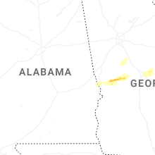


Connect with Interactive Hail Maps