| 7/30/2024 4:55 PM EDT |
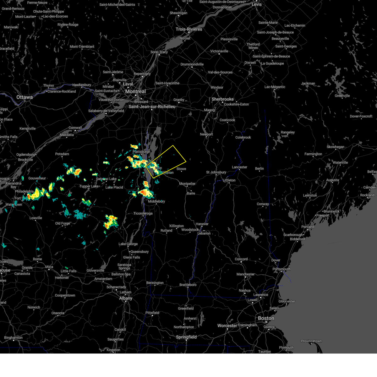 The storm which prompted the warning has moved out of the area. therefore, the warning will be allowed to expire. The storm which prompted the warning has moved out of the area. therefore, the warning will be allowed to expire.
|
| 7/30/2024 4:32 PM EDT |
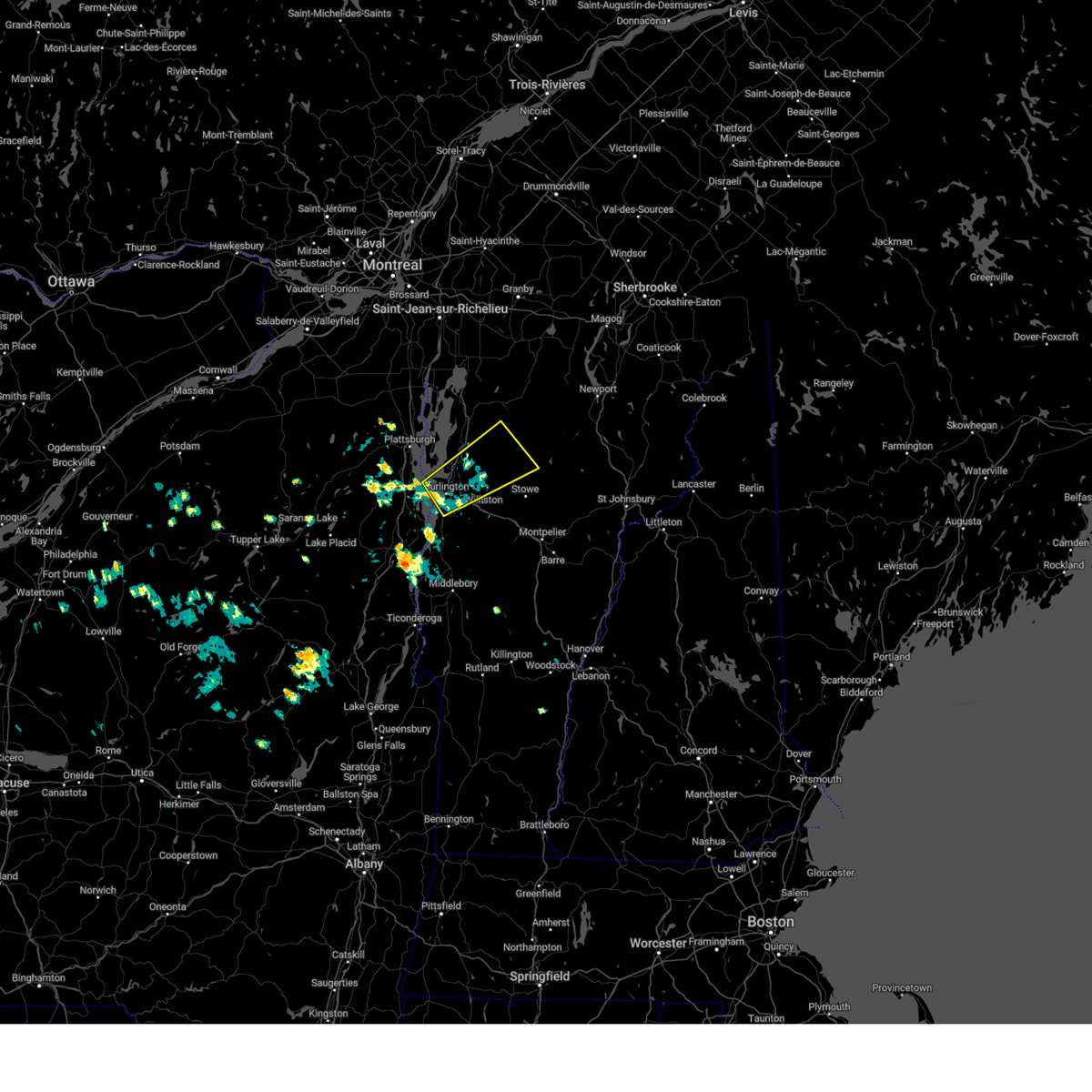 At 431 pm edt, a severe thunderstorm was located over cloverdale, moving northeast at 30 mph (public reported power outages likely due to wind damage). Hazards include 60 mph wind gusts and penny size hail. Expect damage to trees and powerlines. Locations impacted include, essex junction, south burlington, burlington international airport, burlington, johnson village, cambridge, winooski, cambridge village, westford, jeffersonville village, colchester, essex junction village, fairfax, williston, waterville, underhill, jericho, essex, jericho village, and johnson. At 431 pm edt, a severe thunderstorm was located over cloverdale, moving northeast at 30 mph (public reported power outages likely due to wind damage). Hazards include 60 mph wind gusts and penny size hail. Expect damage to trees and powerlines. Locations impacted include, essex junction, south burlington, burlington international airport, burlington, johnson village, cambridge, winooski, cambridge village, westford, jeffersonville village, colchester, essex junction village, fairfax, williston, waterville, underhill, jericho, essex, jericho village, and johnson.
|
| 7/30/2024 4:00 PM EDT |
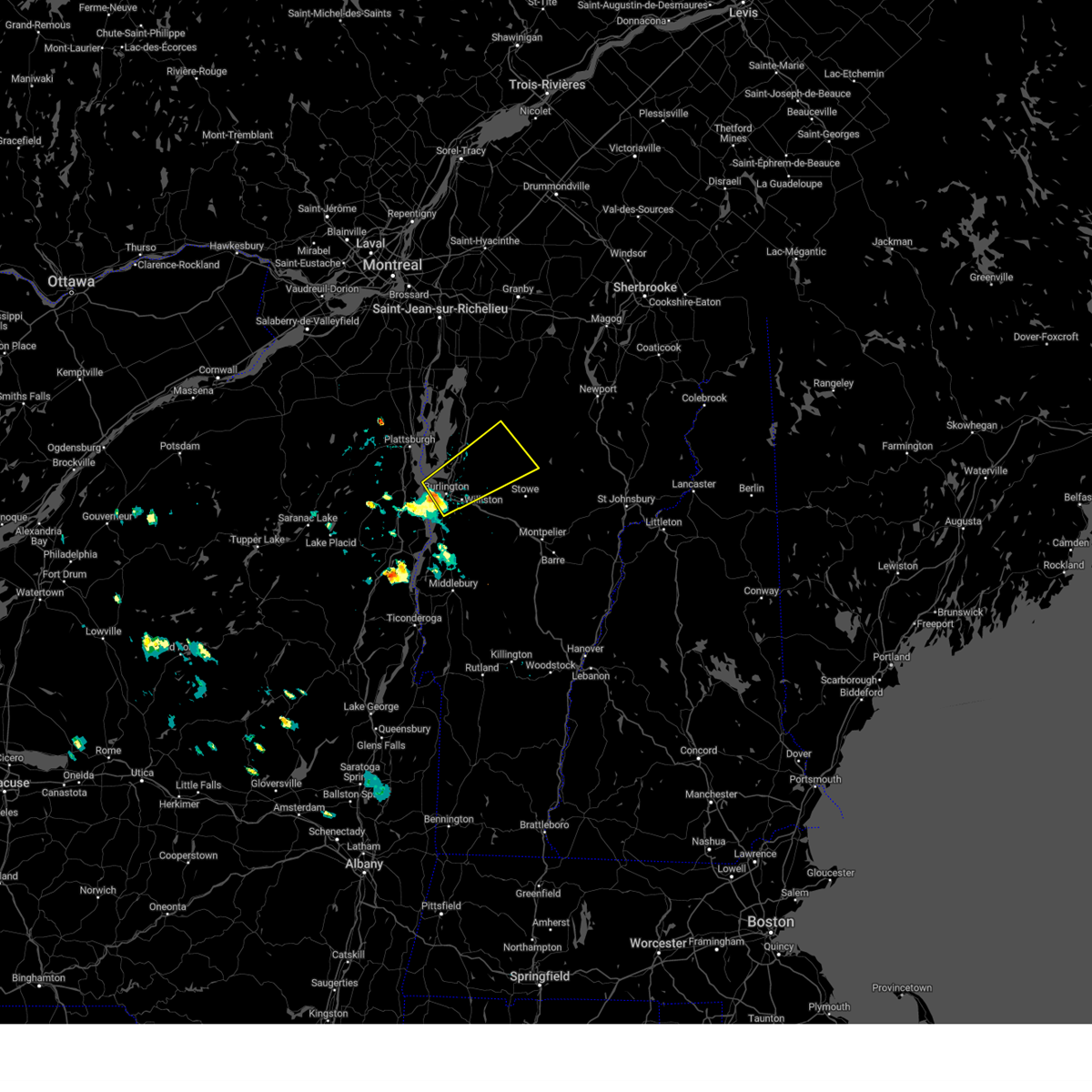 Svrbtv the national weather service in burlington has issued a * severe thunderstorm warning for, southeastern clinton county in northern new york, northeastern essex county in northern new york, northwestern lamoille county in northwestern vermont, northern chittenden county in northwestern vermont, south central franklin county in northwestern vermont, * until 500 pm edt. * at 400 pm edt, a severe thunderstorm was located over burlington, moving northeast at 30 mph (radar indicated). Hazards include 60 mph wind gusts and penny size hail. expect damage to trees and powerlines Svrbtv the national weather service in burlington has issued a * severe thunderstorm warning for, southeastern clinton county in northern new york, northeastern essex county in northern new york, northwestern lamoille county in northwestern vermont, northern chittenden county in northwestern vermont, south central franklin county in northwestern vermont, * until 500 pm edt. * at 400 pm edt, a severe thunderstorm was located over burlington, moving northeast at 30 mph (radar indicated). Hazards include 60 mph wind gusts and penny size hail. expect damage to trees and powerlines
|
| 7/10/2024 5:42 PM EDT |
The storm which prompted the warning has weakened below severe limits, and no longer poses an immediate threat to life or property. therefore, the warning will be allowed to expire. a tornado watch remains in effect until 900 pm edt for central and northwestern vermont.
|
| 7/10/2024 5:16 PM EDT |
 At 516 pm edt, a severe thunderstorm was located over south hinesburg, moving northeast at 35 mph (radar indicated). Hazards include 60 mph wind gusts. Expect damage to trees and powerlines. locations impacted include, vergennes, morrisville, johnson village, charlotte, waltham, stowe, monkton ridge, waterbury village, monkton, monkton boro, hyde park, worcester, middlesex, bolton, richmond, mt. philo state park, underhill, jericho, hinesburg, and st. George. At 516 pm edt, a severe thunderstorm was located over south hinesburg, moving northeast at 35 mph (radar indicated). Hazards include 60 mph wind gusts. Expect damage to trees and powerlines. locations impacted include, vergennes, morrisville, johnson village, charlotte, waltham, stowe, monkton ridge, waterbury village, monkton, monkton boro, hyde park, worcester, middlesex, bolton, richmond, mt. philo state park, underhill, jericho, hinesburg, and st. George.
|
| 7/10/2024 4:51 PM EDT |
 Svrbtv the national weather service in burlington has issued a * severe thunderstorm warning for, central lamoille county in northwestern vermont, north central addison county in central vermont, central chittenden county in northwestern vermont, northern washington county in central vermont, * until 545 pm edt. * at 451 pm edt, a severe thunderstorm was located over button bay, moving northeast at 30 mph (radar indicated). Hazards include 60 mph wind gusts. expect damage to trees and powerlines Svrbtv the national weather service in burlington has issued a * severe thunderstorm warning for, central lamoille county in northwestern vermont, north central addison county in central vermont, central chittenden county in northwestern vermont, northern washington county in central vermont, * until 545 pm edt. * at 451 pm edt, a severe thunderstorm was located over button bay, moving northeast at 30 mph (radar indicated). Hazards include 60 mph wind gusts. expect damage to trees and powerlines
|
| 6/23/2024 4:12 PM EDT |
 Svrbtv the national weather service in burlington has issued a * severe thunderstorm warning for, central lamoille county in northwestern vermont, southwestern orleans county in northeastern vermont, central chittenden county in northwestern vermont, northern washington county in central vermont, * until 500 pm edt. * at 412 pm edt, a severe thunderstorm was located over jericho village, moving east at 25 mph (radar indicated). Hazards include 60 mph wind gusts and penny size hail. expect damage to trees and powerlines Svrbtv the national weather service in burlington has issued a * severe thunderstorm warning for, central lamoille county in northwestern vermont, southwestern orleans county in northeastern vermont, central chittenden county in northwestern vermont, northern washington county in central vermont, * until 500 pm edt. * at 412 pm edt, a severe thunderstorm was located over jericho village, moving east at 25 mph (radar indicated). Hazards include 60 mph wind gusts and penny size hail. expect damage to trees and powerlines
|
| 5/8/2024 4:32 PM EDT |
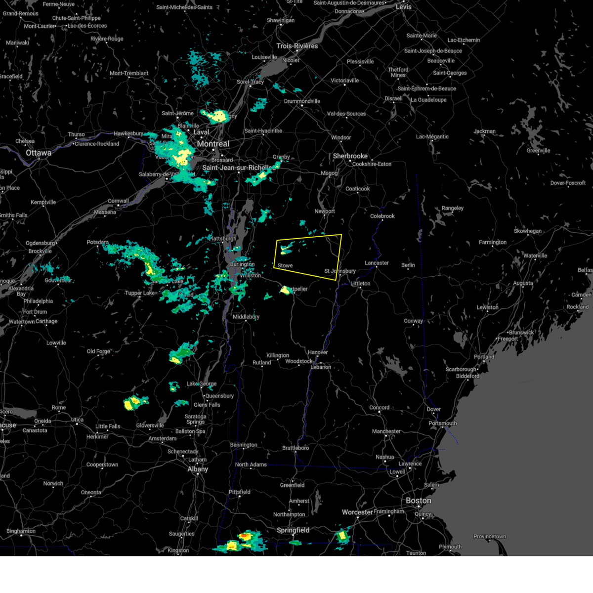 Svrbtv the national weather service in burlington has issued a * severe thunderstorm warning for, lamoille county in northwestern vermont, central caledonia county in northeastern vermont, southern orleans county in northeastern vermont, northeastern chittenden county in northwestern vermont, northeastern washington county in central vermont, southeastern franklin county in northwestern vermont, * until 515 pm edt. * at 432 pm edt, a severe thunderstorm was located over cloverdale, moving east at 35 mph (radar indicated). Hazards include 60 mph wind gusts and quarter size hail. Minor hail damage to vehicles is possible. Expect wind damage to trees and powerlines. Svrbtv the national weather service in burlington has issued a * severe thunderstorm warning for, lamoille county in northwestern vermont, central caledonia county in northeastern vermont, southern orleans county in northeastern vermont, northeastern chittenden county in northwestern vermont, northeastern washington county in central vermont, southeastern franklin county in northwestern vermont, * until 515 pm edt. * at 432 pm edt, a severe thunderstorm was located over cloverdale, moving east at 35 mph (radar indicated). Hazards include 60 mph wind gusts and quarter size hail. Minor hail damage to vehicles is possible. Expect wind damage to trees and powerlines.
|
| 9/7/2023 4:36 PM EDT |
 The severe thunderstorm warning for northeastern clinton, lamoille, northern addison, grand isle, chittenden, western washington and franklin counties will expire at 445 pm edt, the storms which prompted the warning have moved out of the warned area. therefore, the warning will be allowed to expire. The severe thunderstorm warning for northeastern clinton, lamoille, northern addison, grand isle, chittenden, western washington and franklin counties will expire at 445 pm edt, the storms which prompted the warning have moved out of the warned area. therefore, the warning will be allowed to expire.
|
| 9/7/2023 4:36 PM EDT |
 The severe thunderstorm warning for northeastern clinton, lamoille, northern addison, grand isle, chittenden, western washington and franklin counties will expire at 445 pm edt, the storms which prompted the warning have moved out of the warned area. therefore, the warning will be allowed to expire. The severe thunderstorm warning for northeastern clinton, lamoille, northern addison, grand isle, chittenden, western washington and franklin counties will expire at 445 pm edt, the storms which prompted the warning have moved out of the warned area. therefore, the warning will be allowed to expire.
|
| 9/7/2023 3:40 PM EDT |
At 340 pm edt, severe thunderstorms were located along a line extending from near shad island to jericho village to near weybridge, moving east at 25 mph (radar indicated). Hazards include 60 mph wind gusts and quarter size hail. Minor hail damage to vehicles is possible. Expect wind damage to trees and powerlines.
|
| 7/26/2023 12:35 AM EDT |
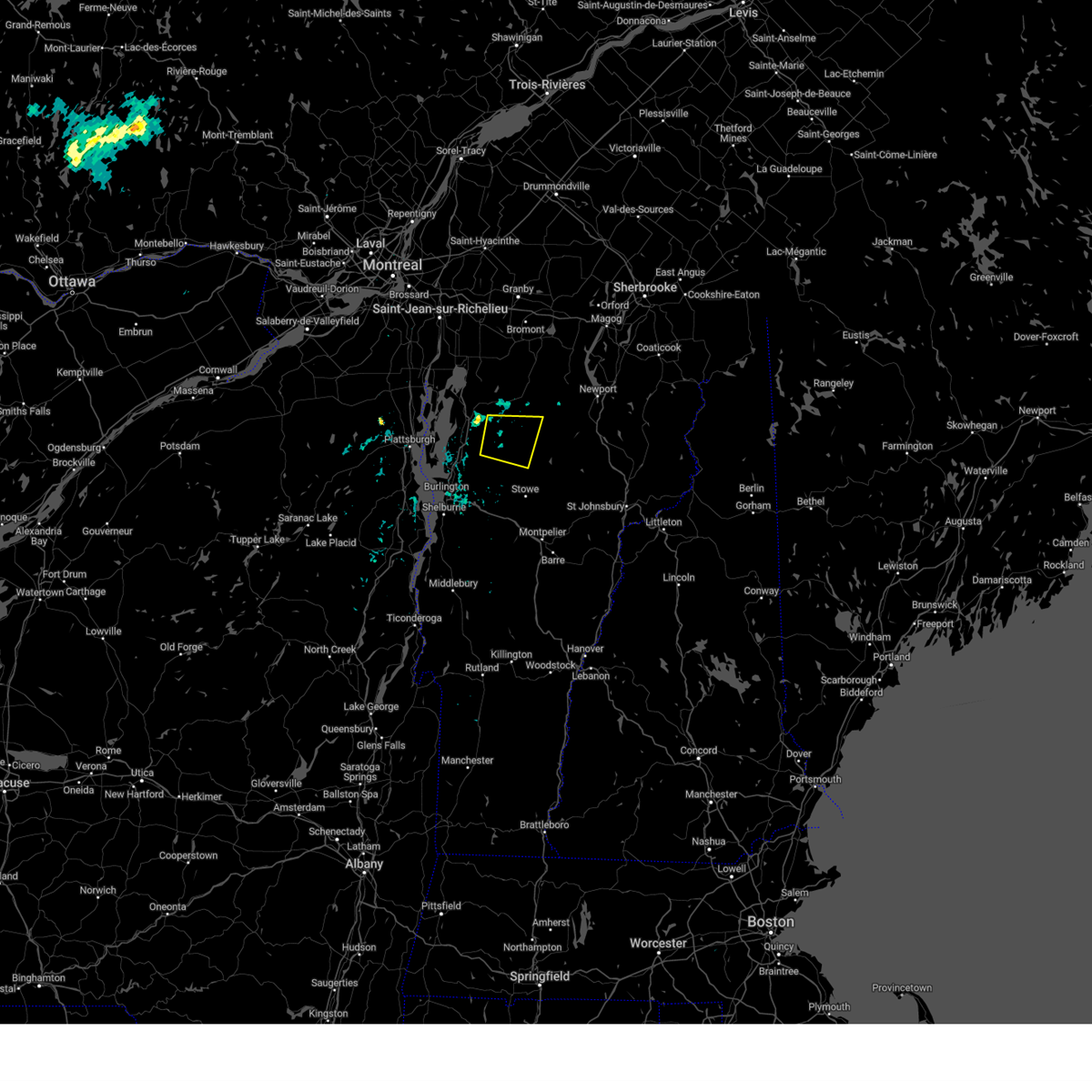 The severe thunderstorm warning for northwestern lamoille and southeastern franklin counties will expire at 1245 am edt, the storm which prompted the warning has weakened below severe limits, and no longer poses an immediate threat to life or property. therefore, the warning will be allowed to expire. however gusty winds and heavy rain are still possible with this thunderstorm. The severe thunderstorm warning for northwestern lamoille and southeastern franklin counties will expire at 1245 am edt, the storm which prompted the warning has weakened below severe limits, and no longer poses an immediate threat to life or property. therefore, the warning will be allowed to expire. however gusty winds and heavy rain are still possible with this thunderstorm.
|
| 7/26/2023 12:23 AM EDT |
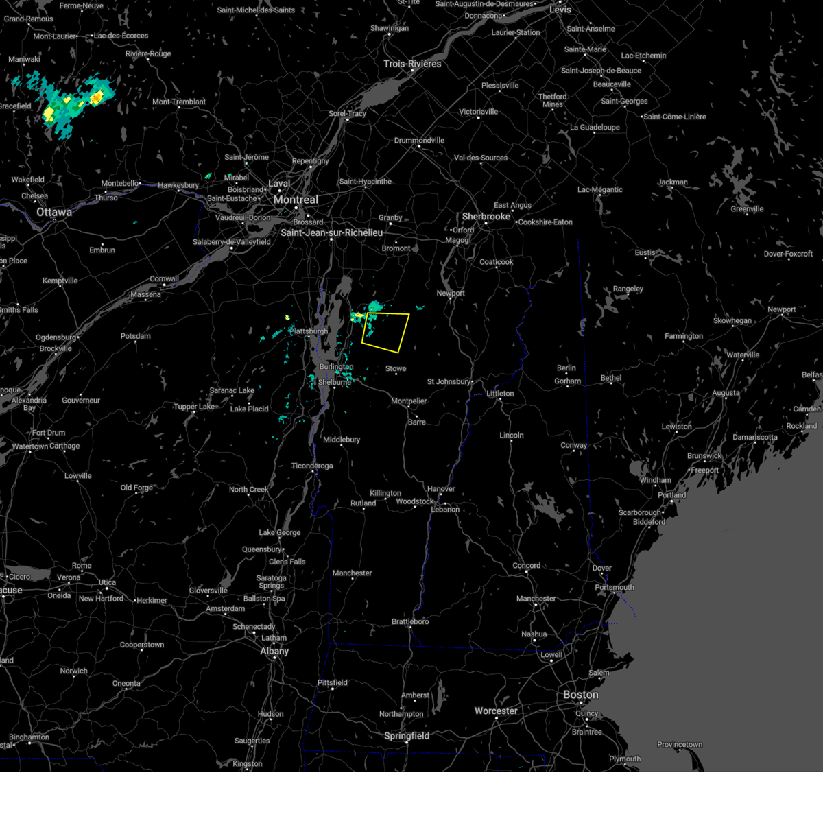 At 1223 am edt, a severe thunderstorm was located over fletcher, moving east at 15 mph (radar indicated). Hazards include 60 mph wind gusts. Expect damage to trees and powerlines. locations impacted include, johnson village, waterville, johnson, jeffersonville village, bakersfield, cambridge village, belvidere center, fletcher, fairfield, belvidere, cambridge, montgomery, fairfax, enosburg, eden, jeffersonville, east fletcher, east fairfield, binghamville, and belvidere junction. hail threat, radar indicated max hail size, <. 75 in wind threat, radar indicated max wind gust, 60 mph. At 1223 am edt, a severe thunderstorm was located over fletcher, moving east at 15 mph (radar indicated). Hazards include 60 mph wind gusts. Expect damage to trees and powerlines. locations impacted include, johnson village, waterville, johnson, jeffersonville village, bakersfield, cambridge village, belvidere center, fletcher, fairfield, belvidere, cambridge, montgomery, fairfax, enosburg, eden, jeffersonville, east fletcher, east fairfield, binghamville, and belvidere junction. hail threat, radar indicated max hail size, <. 75 in wind threat, radar indicated max wind gust, 60 mph.
|
| 7/26/2023 12:02 AM EDT |
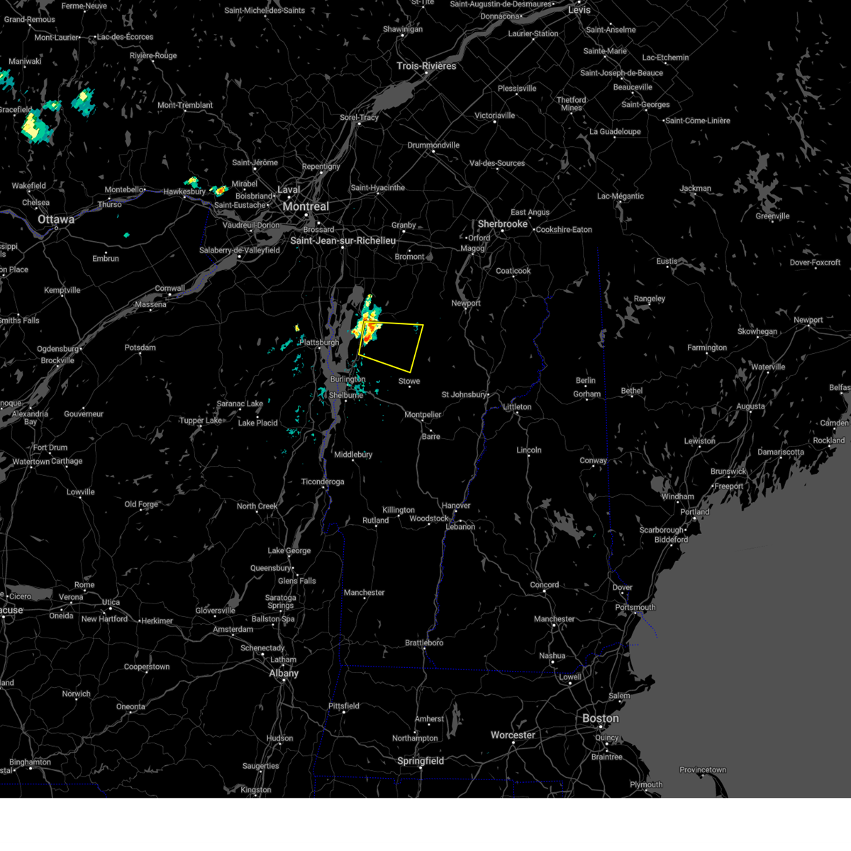 At 1202 am edt, a severe thunderstorm was located near north fairfax, moving east at 15 mph (radar indicated). Hazards include 60 mph wind gusts and quarter size hail. Minor hail damage to vehicles is possible. expect wind damage to trees and powerlines. locations impacted include, johnson village, waterville, cambridge, bakersfield, cambridge village, johnson, jeffersonville village, fairfax, belvidere center, fletcher, fairfield, belvidere, st. albans city, georgia, montgomery, morristown, westford, milton, enosburg, and st. albans town. hail threat, radar indicated max hail size, 1. 00 in wind threat, radar indicated max wind gust, 60 mph. At 1202 am edt, a severe thunderstorm was located near north fairfax, moving east at 15 mph (radar indicated). Hazards include 60 mph wind gusts and quarter size hail. Minor hail damage to vehicles is possible. expect wind damage to trees and powerlines. locations impacted include, johnson village, waterville, cambridge, bakersfield, cambridge village, johnson, jeffersonville village, fairfax, belvidere center, fletcher, fairfield, belvidere, st. albans city, georgia, montgomery, morristown, westford, milton, enosburg, and st. albans town. hail threat, radar indicated max hail size, 1. 00 in wind threat, radar indicated max wind gust, 60 mph.
|
| 7/25/2023 11:42 PM EDT |
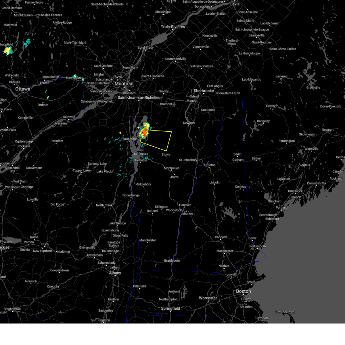 At 1141 pm edt, a severe thunderstorm was located over lime rock point, moving east at 20 mph (radar indicated). Hazards include 60 mph wind gusts and quarter size hail. Minor hail damage to vehicles is possible. Expect wind damage to trees and powerlines. At 1141 pm edt, a severe thunderstorm was located over lime rock point, moving east at 20 mph (radar indicated). Hazards include 60 mph wind gusts and quarter size hail. Minor hail damage to vehicles is possible. Expect wind damage to trees and powerlines.
|
| 1/1/0001 12:00 AM |
Power lines were reported down by the lamoille county sheriff's office in lamoille county VT, 7.7 miles SW of Johnson, VT
|
| 7/13/2023 6:33 PM EDT |
 At 633 pm edt, a severe thunderstorm was located near lowell, moving north at 20 mph (radar indicated). Hazards include 60 mph wind gusts and quarter size hail. Minor hail damage to vehicles is possible. Expect wind damage to trees and powerlines. At 633 pm edt, a severe thunderstorm was located near lowell, moving north at 20 mph (radar indicated). Hazards include 60 mph wind gusts and quarter size hail. Minor hail damage to vehicles is possible. Expect wind damage to trees and powerlines.
|
| 7/13/2023 6:22 PM EDT |
 At 618 pm edt, a severe thunderstorm was located over bolton, moving northeast at 45 mph (public reported trees down near williston with this storm). Hazards include 60 mph wind gusts and quarter size hail. Minor hail damage to vehicles is possible. expect wind damage to trees and powerlines. locations impacted include, vergennes, montpelier, morrisville, johnson village, calais, cambridge, monkton ridge, waterbury village, monkton, westford, monkton boro, williston, worcester, middlesex, hinesburg, st. george, morrisville village, woodbury, moretown, and starksboro. hail threat, radar indicated max hail size, 1. 00 in wind threat, radar indicated max wind gust, 60 mph. At 618 pm edt, a severe thunderstorm was located over bolton, moving northeast at 45 mph (public reported trees down near williston with this storm). Hazards include 60 mph wind gusts and quarter size hail. Minor hail damage to vehicles is possible. expect wind damage to trees and powerlines. locations impacted include, vergennes, montpelier, morrisville, johnson village, calais, cambridge, monkton ridge, waterbury village, monkton, westford, monkton boro, williston, worcester, middlesex, hinesburg, st. george, morrisville village, woodbury, moretown, and starksboro. hail threat, radar indicated max hail size, 1. 00 in wind threat, radar indicated max wind gust, 60 mph.
|
| 7/13/2023 5:55 PM EDT |
 At 555 pm edt, a severe thunderstorm was located over hinesburg, moving northeast at 45 mph (radar indicated). Hazards include 60 mph wind gusts and quarter size hail. Minor hail damage to vehicles is possible. Expect wind damage to trees and powerlines. At 555 pm edt, a severe thunderstorm was located over hinesburg, moving northeast at 45 mph (radar indicated). Hazards include 60 mph wind gusts and quarter size hail. Minor hail damage to vehicles is possible. Expect wind damage to trees and powerlines.
|
| 7/13/2023 5:55 PM EDT |
 At 555 pm edt, a severe thunderstorm was located over hinesburg, moving northeast at 45 mph (radar indicated). Hazards include 60 mph wind gusts and quarter size hail. Minor hail damage to vehicles is possible. Expect wind damage to trees and powerlines. At 555 pm edt, a severe thunderstorm was located over hinesburg, moving northeast at 45 mph (radar indicated). Hazards include 60 mph wind gusts and quarter size hail. Minor hail damage to vehicles is possible. Expect wind damage to trees and powerlines.
|
| 7/4/2023 5:40 PM EDT |
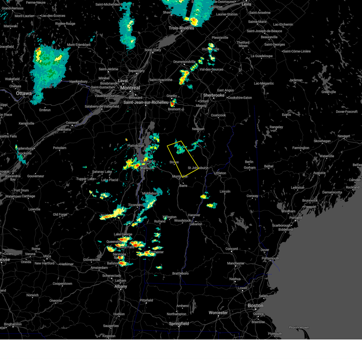 At 539 pm edt, a severe thunderstorm was located over north hyde park, moving southeast at 25 mph (radar indicated). Hazards include 60 mph wind gusts and quarter size hail. Minor hail damage to vehicles is possible. Expect wind damage to trees and powerlines. At 539 pm edt, a severe thunderstorm was located over north hyde park, moving southeast at 25 mph (radar indicated). Hazards include 60 mph wind gusts and quarter size hail. Minor hail damage to vehicles is possible. Expect wind damage to trees and powerlines.
|
| 7/21/2022 5:13 PM EDT |
 The severe thunderstorm warning for central lamoille, northern caledonia, central orleans and east central franklin counties will expire at 515 pm edt, the storm which prompted the warning has weakened below severe limits, and no longer poses an immediate threat to life or property. therefore, the warning will be allowed to expire. however small hail, gusty winds and heavy rain are still possible with this thunderstorm. a severe thunderstorm watch remains in effect until 800 pm edt for northeastern and northwestern vermont. The severe thunderstorm warning for central lamoille, northern caledonia, central orleans and east central franklin counties will expire at 515 pm edt, the storm which prompted the warning has weakened below severe limits, and no longer poses an immediate threat to life or property. therefore, the warning will be allowed to expire. however small hail, gusty winds and heavy rain are still possible with this thunderstorm. a severe thunderstorm watch remains in effect until 800 pm edt for northeastern and northwestern vermont.
|
| 7/21/2022 4:48 PM EDT |
 At 448 pm edt, a severe thunderstorm was located over albany center, moving northeast at 55 mph (radar indicated). Hazards include 60 mph wind gusts and penny size hail. Expect damage to trees and powerlines. locations impacted include, newport city, morrisville, orleans, greensboro, johnson village, newport town, eden, orleans village, glover, brownington, albany, hyde park, sutton, wolcott, coventry, barton, sheffield, brownington village, west burke village and irasburg. hail threat, radar indicated max hail size, 0. 75 in wind threat, radar indicated max wind gust, 60 mph. At 448 pm edt, a severe thunderstorm was located over albany center, moving northeast at 55 mph (radar indicated). Hazards include 60 mph wind gusts and penny size hail. Expect damage to trees and powerlines. locations impacted include, newport city, morrisville, orleans, greensboro, johnson village, newport town, eden, orleans village, glover, brownington, albany, hyde park, sutton, wolcott, coventry, barton, sheffield, brownington village, west burke village and irasburg. hail threat, radar indicated max hail size, 0. 75 in wind threat, radar indicated max wind gust, 60 mph.
|
| 7/21/2022 4:34 PM EDT |
 At 434 pm edt, a severe thunderstorm was located over north hyde park, moving northeast at 55 mph (radar indicated). Hazards include 60 mph wind gusts and penny size hail. Expect damage to trees and powerlines. locations impacted include, newport city, morrisville, orleans, greensboro, johnson village, newport town, eden, cambridge, orleans village, cambridge village, glover, brownington, albany, jeffersonville village, hyde park, sutton, wolcott, coventry, barton and sheffield. hail threat, radar indicated max hail size, 0. 75 in wind threat, radar indicated max wind gust, 60 mph. At 434 pm edt, a severe thunderstorm was located over north hyde park, moving northeast at 55 mph (radar indicated). Hazards include 60 mph wind gusts and penny size hail. Expect damage to trees and powerlines. locations impacted include, newport city, morrisville, orleans, greensboro, johnson village, newport town, eden, cambridge, orleans village, cambridge village, glover, brownington, albany, jeffersonville village, hyde park, sutton, wolcott, coventry, barton and sheffield. hail threat, radar indicated max hail size, 0. 75 in wind threat, radar indicated max wind gust, 60 mph.
|
|
|
| 7/21/2022 4:16 PM EDT |
 At 416 pm edt, a severe thunderstorm was located over underhill, moving northeast at 55 mph (radar indicated). Hazards include 60 mph wind gusts and penny size hail. expect damage to trees and powerlines At 416 pm edt, a severe thunderstorm was located over underhill, moving northeast at 55 mph (radar indicated). Hazards include 60 mph wind gusts and penny size hail. expect damage to trees and powerlines
|
| 7/21/2022 12:09 PM EDT |
 At 1209 pm edt, a severe thunderstorm was located over morrisville village, moving northeast at 30 mph (radar indicated). Hazards include 60 mph wind gusts and quarter size hail. Minor hail damage to vehicles is possible. Expect wind damage to trees and powerlines. At 1209 pm edt, a severe thunderstorm was located over morrisville village, moving northeast at 30 mph (radar indicated). Hazards include 60 mph wind gusts and quarter size hail. Minor hail damage to vehicles is possible. Expect wind damage to trees and powerlines.
|
| 7/21/2022 11:47 AM EDT |
 At 1147 am edt, a severe thunderstorm was located over milton, moving northeast at 35 mph (radar indicated). Hazards include 60 mph wind gusts and quarter size hail. Minor hail damage to vehicles is possible. Expect wind damage to trees and powerlines. At 1147 am edt, a severe thunderstorm was located over milton, moving northeast at 35 mph (radar indicated). Hazards include 60 mph wind gusts and quarter size hail. Minor hail damage to vehicles is possible. Expect wind damage to trees and powerlines.
|
| 7/21/2022 11:47 AM EDT |
 At 1147 am edt, a severe thunderstorm was located over milton, moving northeast at 35 mph (radar indicated). Hazards include 60 mph wind gusts and quarter size hail. Minor hail damage to vehicles is possible. Expect wind damage to trees and powerlines. At 1147 am edt, a severe thunderstorm was located over milton, moving northeast at 35 mph (radar indicated). Hazards include 60 mph wind gusts and quarter size hail. Minor hail damage to vehicles is possible. Expect wind damage to trees and powerlines.
|
| 5/21/2022 6:30 PM EDT |
7-10 inch diameter trees snapped in hal in lamoille county VT, 7.7 miles SW of Johnson, VT
|
| 10/16/2021 3:56 PM EDT |
 The severe thunderstorm warning for northern lamoille, western orleans, northeastern chittenden and eastern franklin counties will expire at 400 pm edt, the storms which prompted the warning have weakened below severe limits, and no longer pose an immediate threat to life or property. therefore, the warning will be allowed to expire. however gusty winds are still possible with these thunderstorms. a severe thunderstorm watch remains in effect until 700 pm edt for northwestern vermont. The severe thunderstorm warning for northern lamoille, western orleans, northeastern chittenden and eastern franklin counties will expire at 400 pm edt, the storms which prompted the warning have weakened below severe limits, and no longer pose an immediate threat to life or property. therefore, the warning will be allowed to expire. however gusty winds are still possible with these thunderstorms. a severe thunderstorm watch remains in effect until 700 pm edt for northwestern vermont.
|
| 10/16/2021 3:25 PM EDT |
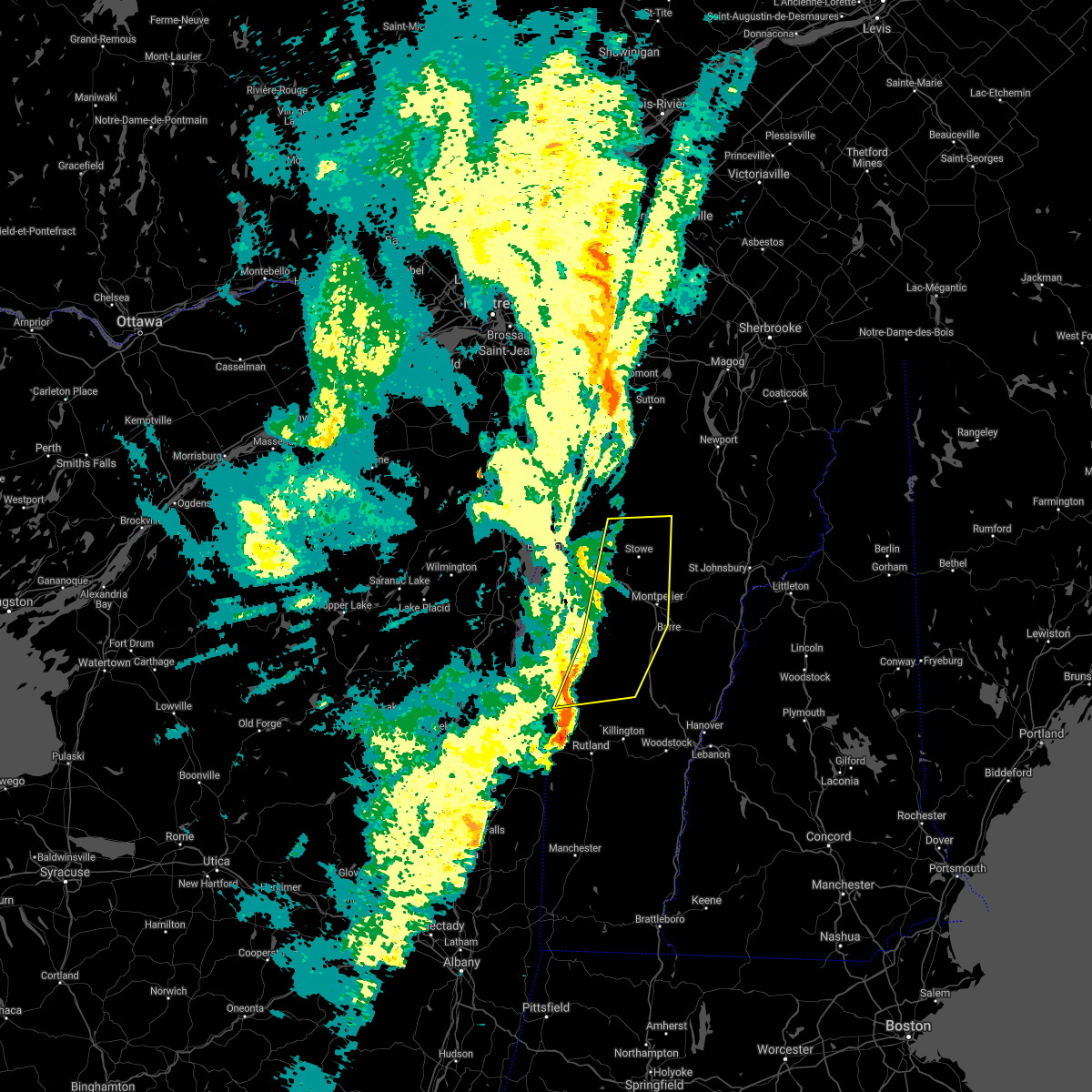 At 324 pm edt, severe thunderstorms were located along a line extending from near stowe to south lincoln to near bread loaf, moving east at 45 mph (emergency management). Hazards include 60 mph wind gusts. Expect damage to trees and powerlines. Locations impacted include, montpelier, middlebury, morrisville, braintree hill, cambridge, salisbury, waterbury village, lincoln, hyde park, worcester, middlesex, granville, hancock, ripton, morrisville village, moretown, underhill state park, leicester, e f knapp state airport and elmore. At 324 pm edt, severe thunderstorms were located along a line extending from near stowe to south lincoln to near bread loaf, moving east at 45 mph (emergency management). Hazards include 60 mph wind gusts. Expect damage to trees and powerlines. Locations impacted include, montpelier, middlebury, morrisville, braintree hill, cambridge, salisbury, waterbury village, lincoln, hyde park, worcester, middlesex, granville, hancock, ripton, morrisville village, moretown, underhill state park, leicester, e f knapp state airport and elmore.
|
| 10/16/2021 3:21 PM EDT |
 At 320 pm edt, severe thunderstorms were located along a line extending from 16 miles north of morses line to near east franklin to east sheldon, moving northeast at 60 mph (radar indicated). Hazards include 60 mph wind gusts. Expect damage to trees and powerlines. locations impacted include, enosburg falls, franklin, johnson village, jay, jay in franklin county, eden, cambridge, bakersfield, cambridge village, berkshire, montgomery center, jeffersonville village, hyde park, montgomery, troy, sheldon, belvidere center, lake carmi state park, enosburg and belvidere. hail threat, radar indicated max hail size, <. 75 in wind threat, radar indicated max wind gust, 60 mph. At 320 pm edt, severe thunderstorms were located along a line extending from 16 miles north of morses line to near east franklin to east sheldon, moving northeast at 60 mph (radar indicated). Hazards include 60 mph wind gusts. Expect damage to trees and powerlines. locations impacted include, enosburg falls, franklin, johnson village, jay, jay in franklin county, eden, cambridge, bakersfield, cambridge village, berkshire, montgomery center, jeffersonville village, hyde park, montgomery, troy, sheldon, belvidere center, lake carmi state park, enosburg and belvidere. hail threat, radar indicated max hail size, <. 75 in wind threat, radar indicated max wind gust, 60 mph.
|
| 10/16/2021 3:03 PM EDT |
 At 302 pm edt, severe thunderstorms were located along a line extending from williston to near cornwall to shoreham, moving east at 45 mph. multiple reports of trees down have been reported with these storms (emergency management). Hazards include 60 mph wind gusts. Expect damage to trees and powerlines. Locations impacted include, essex junction, middlebury, vergennes, montpelier, south burlington, morrisville, johnson village, cornwall, braintree hill, weybridge, cambridge, salisbury, monkton ridge, waterbury village, lincoln, orwell, monkton, westford, monkton boro and hyde park. At 302 pm edt, severe thunderstorms were located along a line extending from williston to near cornwall to shoreham, moving east at 45 mph. multiple reports of trees down have been reported with these storms (emergency management). Hazards include 60 mph wind gusts. Expect damage to trees and powerlines. Locations impacted include, essex junction, middlebury, vergennes, montpelier, south burlington, morrisville, johnson village, cornwall, braintree hill, weybridge, cambridge, salisbury, monkton ridge, waterbury village, lincoln, orwell, monkton, westford, monkton boro and hyde park.
|
| 10/16/2021 3:03 PM EDT |
 At 302 pm edt, severe thunderstorms were located along a line extending from williston to near cornwall to shoreham, moving east at 45 mph. multiple reports of trees down have been reported with these storms (emergency management). Hazards include 60 mph wind gusts. Expect damage to trees and powerlines. Locations impacted include, essex junction, middlebury, vergennes, montpelier, south burlington, morrisville, johnson village, cornwall, braintree hill, weybridge, cambridge, salisbury, monkton ridge, waterbury village, lincoln, orwell, monkton, westford, monkton boro and hyde park. At 302 pm edt, severe thunderstorms were located along a line extending from williston to near cornwall to shoreham, moving east at 45 mph. multiple reports of trees down have been reported with these storms (emergency management). Hazards include 60 mph wind gusts. Expect damage to trees and powerlines. Locations impacted include, essex junction, middlebury, vergennes, montpelier, south burlington, morrisville, johnson village, cornwall, braintree hill, weybridge, cambridge, salisbury, monkton ridge, waterbury village, lincoln, orwell, monkton, westford, monkton boro and hyde park.
|
| 10/16/2021 2:55 PM EDT |
 At 255 pm edt, severe thunderstorms were located along a line extending from province point to st. albans city to west milton, moving northeast at 55 mph (radar indicated). Hazards include 60 mph wind gusts. expect damage to trees and powerlines At 255 pm edt, severe thunderstorms were located along a line extending from province point to st. albans city to west milton, moving northeast at 55 mph (radar indicated). Hazards include 60 mph wind gusts. expect damage to trees and powerlines
|
| 10/16/2021 2:40 PM EDT |
 At 239 pm edt, severe thunderstorms were located along a line extending from boquet river point to ironville to near pharoah mountain, moving east at 45 mph. there have been reports of downed trees near schroon lake in association with these storms (emergency management). Hazards include 60 mph wind gusts. expect damage to trees and powerlines At 239 pm edt, severe thunderstorms were located along a line extending from boquet river point to ironville to near pharoah mountain, moving east at 45 mph. there have been reports of downed trees near schroon lake in association with these storms (emergency management). Hazards include 60 mph wind gusts. expect damage to trees and powerlines
|
| 10/16/2021 2:40 PM EDT |
 At 239 pm edt, severe thunderstorms were located along a line extending from boquet river point to ironville to near pharoah mountain, moving east at 45 mph. there have been reports of downed trees near schroon lake in association with these storms (emergency management). Hazards include 60 mph wind gusts. expect damage to trees and powerlines At 239 pm edt, severe thunderstorms were located along a line extending from boquet river point to ironville to near pharoah mountain, moving east at 45 mph. there have been reports of downed trees near schroon lake in association with these storms (emergency management). Hazards include 60 mph wind gusts. expect damage to trees and powerlines
|
| 9/8/2021 6:21 PM EDT |
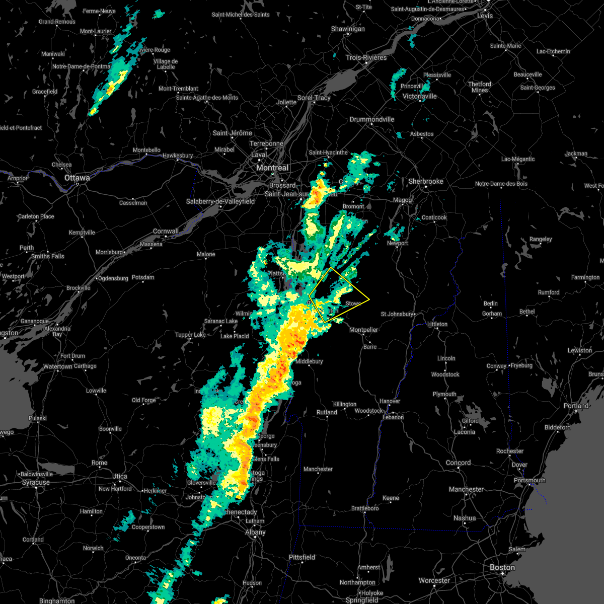 The severe thunderstorm warning for southwestern lamoille, northeastern chittenden, northwestern washington and south central franklin counties will expire at 630 pm edt, the storm which prompted the warning has weakened below severe limits, and no longer poses an immediate threat to life or property. therefore, the warning will be allowed to expire. The severe thunderstorm warning for southwestern lamoille, northeastern chittenden, northwestern washington and south central franklin counties will expire at 630 pm edt, the storm which prompted the warning has weakened below severe limits, and no longer poses an immediate threat to life or property. therefore, the warning will be allowed to expire.
|
| 9/8/2021 6:10 PM EDT |
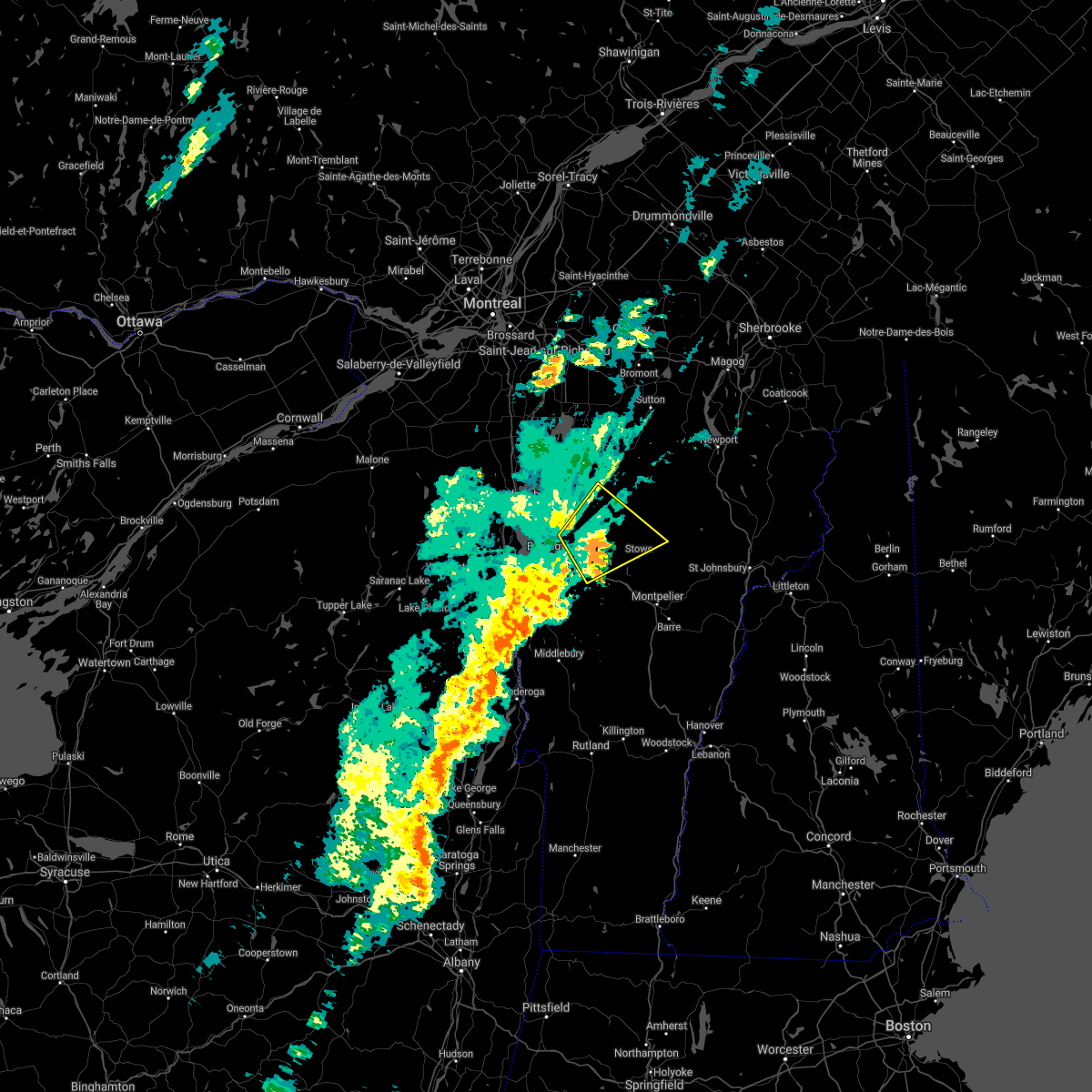 At 609 pm edt, a severe thunderstorm was located over north underhill, moving northeast at 40 mph (radar indicated). Hazards include 60 mph wind gusts and penny size hail. Expect damage to trees and powerlines. locations impacted include, essex junction, morrisville, cambridge, cambridge village, stowe, westford, jeffersonville village, fairfax, bolton, richmond, underhill, jericho, morrisville village, essex, jericho village, underhill state park, morristown, fletcher, essex junction village and johnson village. hail threat, radar indicated max hail size, 0. 75 in wind threat, radar indicated max wind gust, 60 mph. At 609 pm edt, a severe thunderstorm was located over north underhill, moving northeast at 40 mph (radar indicated). Hazards include 60 mph wind gusts and penny size hail. Expect damage to trees and powerlines. locations impacted include, essex junction, morrisville, cambridge, cambridge village, stowe, westford, jeffersonville village, fairfax, bolton, richmond, underhill, jericho, morrisville village, essex, jericho village, underhill state park, morristown, fletcher, essex junction village and johnson village. hail threat, radar indicated max hail size, 0. 75 in wind threat, radar indicated max wind gust, 60 mph.
|
| 9/8/2021 5:49 PM EDT |
 At 548 pm edt, a severe thunderstorm was located over red rock point, moving northeast at 40 mph (radar indicated). Hazards include 60 mph wind gusts. expect damage to trees and powerlines At 548 pm edt, a severe thunderstorm was located over red rock point, moving northeast at 40 mph (radar indicated). Hazards include 60 mph wind gusts. expect damage to trees and powerlines
|
| 9/8/2021 5:49 PM EDT |
 At 548 pm edt, a severe thunderstorm was located over red rock point, moving northeast at 40 mph (radar indicated). Hazards include 60 mph wind gusts. expect damage to trees and powerlines At 548 pm edt, a severe thunderstorm was located over red rock point, moving northeast at 40 mph (radar indicated). Hazards include 60 mph wind gusts. expect damage to trees and powerlines
|
| 7/20/2021 8:11 PM EDT |
 At 808 pm edt, a line of severe thunderstorms over northern and central vermont was located along a line extending from near east richford to near wolcott to ainsworth state park to near pittsfield, moving east at 30 mph (radar indicated). Hazards include 60 mph wind gusts and quarter size hail. Expect wind damage to trees and powerlines. minor hail damage to vehicles is possible. these storms have a history of producing wind damage and power outages. locations impacted include, barre, montpelier, island pond, lyndon, st. Johnsbury, middlebury, newport city, vergennes, crown point, morrisville, enosburg falls, orleans, derby center, charleston, braintree hill, glover, waterbury village, montgomery center, websterville and orwell. At 808 pm edt, a line of severe thunderstorms over northern and central vermont was located along a line extending from near east richford to near wolcott to ainsworth state park to near pittsfield, moving east at 30 mph (radar indicated). Hazards include 60 mph wind gusts and quarter size hail. Expect wind damage to trees and powerlines. minor hail damage to vehicles is possible. these storms have a history of producing wind damage and power outages. locations impacted include, barre, montpelier, island pond, lyndon, st. Johnsbury, middlebury, newport city, vergennes, crown point, morrisville, enosburg falls, orleans, derby center, charleston, braintree hill, glover, waterbury village, montgomery center, websterville and orwell.
|
| 7/20/2021 8:11 PM EDT |
 At 808 pm edt, a line of severe thunderstorms over northern and central vermont was located along a line extending from near east richford to near wolcott to ainsworth state park to near pittsfield, moving east at 30 mph (radar indicated). Hazards include 60 mph wind gusts and quarter size hail. Expect wind damage to trees and powerlines. minor hail damage to vehicles is possible. these storms have a history of producing wind damage and power outages. locations impacted include, barre, montpelier, island pond, lyndon, st. Johnsbury, middlebury, newport city, vergennes, crown point, morrisville, enosburg falls, orleans, derby center, charleston, braintree hill, glover, waterbury village, montgomery center, websterville and orwell. At 808 pm edt, a line of severe thunderstorms over northern and central vermont was located along a line extending from near east richford to near wolcott to ainsworth state park to near pittsfield, moving east at 30 mph (radar indicated). Hazards include 60 mph wind gusts and quarter size hail. Expect wind damage to trees and powerlines. minor hail damage to vehicles is possible. these storms have a history of producing wind damage and power outages. locations impacted include, barre, montpelier, island pond, lyndon, st. Johnsbury, middlebury, newport city, vergennes, crown point, morrisville, enosburg falls, orleans, derby center, charleston, braintree hill, glover, waterbury village, montgomery center, websterville and orwell.
|
| 7/20/2021 7:32 PM EDT |
 At 730 pm edt, a line of severe thunderstorms over western vermont was located along a line extending from near east franklin to stowe to east warren to mossy point, moving east at 40 mph (radar indicated). Hazards include 60 mph wind gusts and quarter size hail. Expect wind damage to trees and powerlines. minor hail damage to vehicles is possible. This line of storms has a history of producing wind damage and power outages. At 730 pm edt, a line of severe thunderstorms over western vermont was located along a line extending from near east franklin to stowe to east warren to mossy point, moving east at 40 mph (radar indicated). Hazards include 60 mph wind gusts and quarter size hail. Expect wind damage to trees and powerlines. minor hail damage to vehicles is possible. This line of storms has a history of producing wind damage and power outages.
|
| 7/20/2021 7:32 PM EDT |
 At 730 pm edt, a line of severe thunderstorms over western vermont was located along a line extending from near east franklin to stowe to east warren to mossy point, moving east at 40 mph (radar indicated). Hazards include 60 mph wind gusts and quarter size hail. Expect wind damage to trees and powerlines. minor hail damage to vehicles is possible. This line of storms has a history of producing wind damage and power outages. At 730 pm edt, a line of severe thunderstorms over western vermont was located along a line extending from near east franklin to stowe to east warren to mossy point, moving east at 40 mph (radar indicated). Hazards include 60 mph wind gusts and quarter size hail. Expect wind damage to trees and powerlines. minor hail damage to vehicles is possible. This line of storms has a history of producing wind damage and power outages.
|
| 7/20/2021 7:06 PM EDT |
 At 704 pm edt, a line of severe thunderstorms over northwest vermont and essex county new york was located along a line extending from shad island to south burlington to near chilson, new york moving east at 35 mph (radar indicated). Hazards include 60 mph wind gusts and quarter size hail. Expect wind damage to trees and powerlines. minor hail damage to vehicles is possible. Locations impacted include, essex junction, plattsburgh international airport, burlington, burlington international airport, plattsburgh, middlebury, south burlington, vergennes, peru, beekmantown, moriah, chazy, willsboro, crown point, morrisville, enosburg falls, westport, elizabethtown, champlain and waterbury village. At 704 pm edt, a line of severe thunderstorms over northwest vermont and essex county new york was located along a line extending from shad island to south burlington to near chilson, new york moving east at 35 mph (radar indicated). Hazards include 60 mph wind gusts and quarter size hail. Expect wind damage to trees and powerlines. minor hail damage to vehicles is possible. Locations impacted include, essex junction, plattsburgh international airport, burlington, burlington international airport, plattsburgh, middlebury, south burlington, vergennes, peru, beekmantown, moriah, chazy, willsboro, crown point, morrisville, enosburg falls, westport, elizabethtown, champlain and waterbury village.
|
| 7/20/2021 7:06 PM EDT |
 At 704 pm edt, a line of severe thunderstorms over northwest vermont and essex county new york was located along a line extending from shad island to south burlington to near chilson, new york moving east at 35 mph (radar indicated). Hazards include 60 mph wind gusts and quarter size hail. Expect wind damage to trees and powerlines. minor hail damage to vehicles is possible. Locations impacted include, essex junction, plattsburgh international airport, burlington, burlington international airport, plattsburgh, middlebury, south burlington, vergennes, peru, beekmantown, moriah, chazy, willsboro, crown point, morrisville, enosburg falls, westport, elizabethtown, champlain and waterbury village. At 704 pm edt, a line of severe thunderstorms over northwest vermont and essex county new york was located along a line extending from shad island to south burlington to near chilson, new york moving east at 35 mph (radar indicated). Hazards include 60 mph wind gusts and quarter size hail. Expect wind damage to trees and powerlines. minor hail damage to vehicles is possible. Locations impacted include, essex junction, plattsburgh international airport, burlington, burlington international airport, plattsburgh, middlebury, south burlington, vergennes, peru, beekmantown, moriah, chazy, willsboro, crown point, morrisville, enosburg falls, westport, elizabethtown, champlain and waterbury village.
|
| 7/20/2021 6:31 PM EDT |
 At 630 pm edt, a line of severe thunderstorms over northeast new york was located along a line extending from near perry mills to near harkness to 9 miles west of schroon falls, moving east at 40 mph (radar indicated). Hazards include 60 mph wind gusts and quarter size hail. Expect wind damage to trees and powerlines. Minor hail damage to vehicles is possible. At 630 pm edt, a line of severe thunderstorms over northeast new york was located along a line extending from near perry mills to near harkness to 9 miles west of schroon falls, moving east at 40 mph (radar indicated). Hazards include 60 mph wind gusts and quarter size hail. Expect wind damage to trees and powerlines. Minor hail damage to vehicles is possible.
|
| 7/20/2021 6:31 PM EDT |
 At 630 pm edt, a line of severe thunderstorms over northeast new york was located along a line extending from near perry mills to near harkness to 9 miles west of schroon falls, moving east at 40 mph (radar indicated). Hazards include 60 mph wind gusts and quarter size hail. Expect wind damage to trees and powerlines. Minor hail damage to vehicles is possible. At 630 pm edt, a line of severe thunderstorms over northeast new york was located along a line extending from near perry mills to near harkness to 9 miles west of schroon falls, moving east at 40 mph (radar indicated). Hazards include 60 mph wind gusts and quarter size hail. Expect wind damage to trees and powerlines. Minor hail damage to vehicles is possible.
|
|
|
| 8/11/2020 8:55 PM EDT |
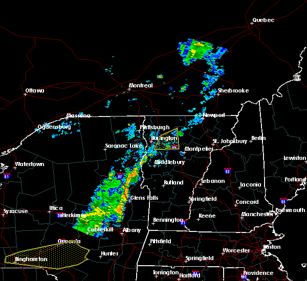 The severe thunderstorm warning for western lamoille, northeastern chittenden, northwestern washington and south central franklin counties will expire at 900 pm edt, the storm which prompted the warning has weakened below severe limits, and has exited the warned area. therefore, the warning will be allowed to expire. however gusty winds and heavy rain are still possible with this thunderstorm. The severe thunderstorm warning for western lamoille, northeastern chittenden, northwestern washington and south central franklin counties will expire at 900 pm edt, the storm which prompted the warning has weakened below severe limits, and has exited the warned area. therefore, the warning will be allowed to expire. however gusty winds and heavy rain are still possible with this thunderstorm.
|
| 8/11/2020 8:40 PM EDT |
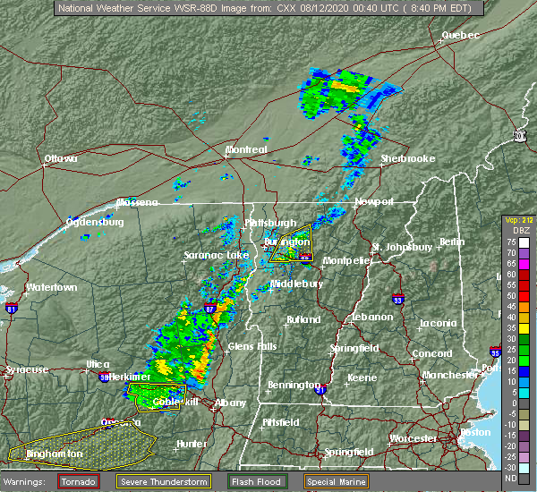 At 835 pm edt, a severe thunderstorm was located over smugglers notch, moving northeast at 25 mph (trained weather spotters reported a small tree was blow into a house in burlington at 8:03 pm and 12 inch diameter tree blown down in winooski at 8:05 pm. in addition, power outages are reported in the burlington, south burlington, and winooski areas from this severe thunderstorm this evening). Hazards include 60 mph wind gusts. Expect damage to trees and powerlines. locations impacted include, waterville, underhill, jericho, st. George, cambridge, cambridge village, stowe, essex, westford, jericho village, jeffersonville village, waterbury, underhill state park, williston, bolton, richmond, johnson, waterbury village, johnson village and belvidere. At 835 pm edt, a severe thunderstorm was located over smugglers notch, moving northeast at 25 mph (trained weather spotters reported a small tree was blow into a house in burlington at 8:03 pm and 12 inch diameter tree blown down in winooski at 8:05 pm. in addition, power outages are reported in the burlington, south burlington, and winooski areas from this severe thunderstorm this evening). Hazards include 60 mph wind gusts. Expect damage to trees and powerlines. locations impacted include, waterville, underhill, jericho, st. George, cambridge, cambridge village, stowe, essex, westford, jericho village, jeffersonville village, waterbury, underhill state park, williston, bolton, richmond, johnson, waterbury village, johnson village and belvidere.
|
| 8/11/2020 8:14 PM EDT |
 At 813 pm edt, a severe thunderstorm was located over north williston, moving east at 25 mph (radar indicated). Hazards include 60 mph wind gusts. Expect damage to trees and powerlines. locations impacted include, essex junction, burlington international airport, south burlington, burlington, cambridge, winooski, cambridge village, stowe, westford, jeffersonville village, essex junction village, williston, bolton, richmond, waterville, underhill, jericho, st. George, essex and jericho village. At 813 pm edt, a severe thunderstorm was located over north williston, moving east at 25 mph (radar indicated). Hazards include 60 mph wind gusts. Expect damage to trees and powerlines. locations impacted include, essex junction, burlington international airport, south burlington, burlington, cambridge, winooski, cambridge village, stowe, westford, jeffersonville village, essex junction village, williston, bolton, richmond, waterville, underhill, jericho, st. George, essex and jericho village.
|
| 8/11/2020 8:00 PM EDT |
 At 759 pm edt, a severe thunderstorm was located over south burlington, moving northeast at 25 mph (radar indicated). Hazards include 60 mph wind gusts and penny size hail. expect damage to trees and powerlines At 759 pm edt, a severe thunderstorm was located over south burlington, moving northeast at 25 mph (radar indicated). Hazards include 60 mph wind gusts and penny size hail. expect damage to trees and powerlines
|
| 8/11/2020 8:00 PM EDT |
 At 759 pm edt, a severe thunderstorm was located over south burlington, moving northeast at 25 mph (radar indicated). Hazards include 60 mph wind gusts and penny size hail. expect damage to trees and powerlines At 759 pm edt, a severe thunderstorm was located over south burlington, moving northeast at 25 mph (radar indicated). Hazards include 60 mph wind gusts and penny size hail. expect damage to trees and powerlines
|
| 7/8/2020 5:18 PM EDT |
 At 518 pm edt, a severe thunderstorm was located over north duxbury, moving southeast at 45 mph (radar indicated). Hazards include 60 mph wind gusts and quarter size hail. Minor hail damage to vehicles is possible. Expect wind damage to trees and powerlines. At 518 pm edt, a severe thunderstorm was located over north duxbury, moving southeast at 45 mph (radar indicated). Hazards include 60 mph wind gusts and quarter size hail. Minor hail damage to vehicles is possible. Expect wind damage to trees and powerlines.
|
| 7/8/2020 5:18 PM EDT |
 At 518 pm edt, a severe thunderstorm was located over north duxbury, moving southeast at 45 mph (radar indicated). Hazards include 60 mph wind gusts and quarter size hail. Minor hail damage to vehicles is possible. Expect wind damage to trees and powerlines. At 518 pm edt, a severe thunderstorm was located over north duxbury, moving southeast at 45 mph (radar indicated). Hazards include 60 mph wind gusts and quarter size hail. Minor hail damage to vehicles is possible. Expect wind damage to trees and powerlines.
|
| 7/8/2020 4:56 PM EDT |
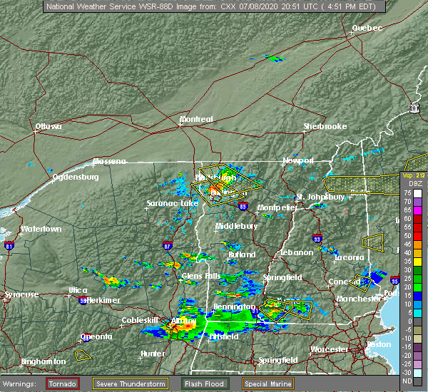 At 455 pm edt, a severe thunderstorm was located over north cambridge, moving southeast at 35 mph (radar indicated). Hazards include 70 mph wind gusts and quarter size hail. Minor hail damage to vehicles is possible. expect considerable tree damage. wind damage is also likely to mobile homes, roofs, and outbuildings. Locations impacted include, waterville, johnson village, cambridge, bakersfield, cambridge village, westford, johnson, jeffersonville village, hyde park, fairfax, georgia center, belvidere center, fletcher, fairfield, georgia, milton, belvidere, underhill, essex and eden. At 455 pm edt, a severe thunderstorm was located over north cambridge, moving southeast at 35 mph (radar indicated). Hazards include 70 mph wind gusts and quarter size hail. Minor hail damage to vehicles is possible. expect considerable tree damage. wind damage is also likely to mobile homes, roofs, and outbuildings. Locations impacted include, waterville, johnson village, cambridge, bakersfield, cambridge village, westford, johnson, jeffersonville village, hyde park, fairfax, georgia center, belvidere center, fletcher, fairfield, georgia, milton, belvidere, underhill, essex and eden.
|
| 7/8/2020 4:30 PM EDT |
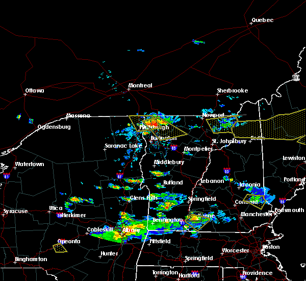 At 430 pm edt, a severe thunderstorm was located over swanton junction, moving southeast at 35 mph (radar indicated). Hazards include 60 mph wind gusts and quarter size hail. Minor hail damage to vehicles is possible. Expect wind damage to trees and powerlines. At 430 pm edt, a severe thunderstorm was located over swanton junction, moving southeast at 35 mph (radar indicated). Hazards include 60 mph wind gusts and quarter size hail. Minor hail damage to vehicles is possible. Expect wind damage to trees and powerlines.
|
| 7/8/2020 4:30 PM EDT |
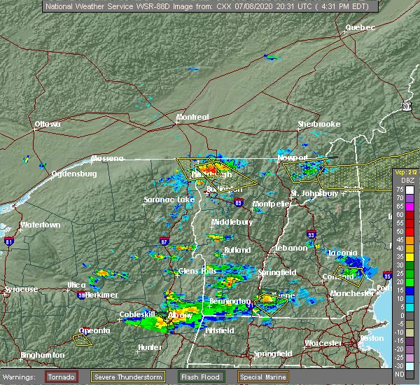 At 430 pm edt, a severe thunderstorm was located over swanton junction, moving southeast at 35 mph (radar indicated). Hazards include 60 mph wind gusts and quarter size hail. Minor hail damage to vehicles is possible. Expect wind damage to trees and powerlines. At 430 pm edt, a severe thunderstorm was located over swanton junction, moving southeast at 35 mph (radar indicated). Hazards include 60 mph wind gusts and quarter size hail. Minor hail damage to vehicles is possible. Expect wind damage to trees and powerlines.
|
| 6/20/2020 6:25 PM EDT |
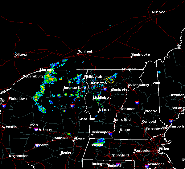 The severe thunderstorm warning for northeastern lamoille county will expire at 630 pm edt, the storm which prompted the warning has weakened below severe limits, and no longer poses an immediate threat to life or property. therefore, the warning will be allowed to expire. The severe thunderstorm warning for northeastern lamoille county will expire at 630 pm edt, the storm which prompted the warning has weakened below severe limits, and no longer poses an immediate threat to life or property. therefore, the warning will be allowed to expire.
|
| 6/20/2020 6:04 PM EDT |
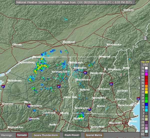 At 603 pm edt, a severe thunderstorm was located near eden, and is drifting north to northwest around 5 mph (radar indicated). Hazards include 60 mph wind gusts and penny size hail. Expect damage to trees and powerlines. Locations impacted include, johnson village, johnson, hyde park, hyde park village, eden, morrisville village, waterville, belvidere, wolcott, morristown, garfield, north hyde park, east johnson and green river reservoir. At 603 pm edt, a severe thunderstorm was located near eden, and is drifting north to northwest around 5 mph (radar indicated). Hazards include 60 mph wind gusts and penny size hail. Expect damage to trees and powerlines. Locations impacted include, johnson village, johnson, hyde park, hyde park village, eden, morrisville village, waterville, belvidere, wolcott, morristown, garfield, north hyde park, east johnson and green river reservoir.
|
| 6/20/2020 5:39 PM EDT |
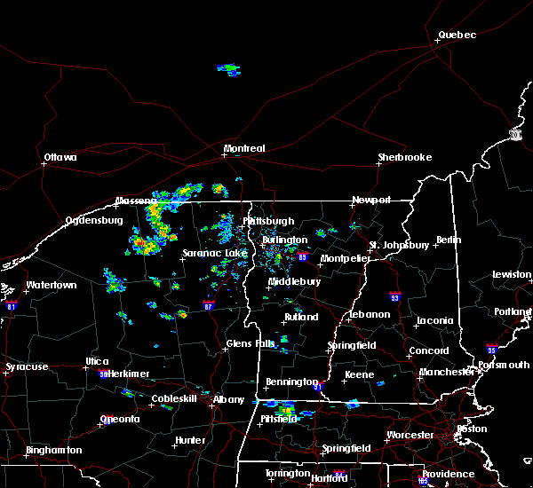 The national weather service in burlington has issued a * severe thunderstorm warning for. northeastern lamoille county in northwestern vermont. until 630 pm edt. At 538 pm edt, a severe thunderstorm was located over hyde park, and drifting northwest around 5 mph. The national weather service in burlington has issued a * severe thunderstorm warning for. northeastern lamoille county in northwestern vermont. until 630 pm edt. At 538 pm edt, a severe thunderstorm was located over hyde park, and drifting northwest around 5 mph.
|
| 5/29/2020 7:55 PM EDT |
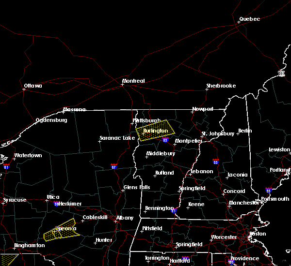 At 754 pm edt, a severe thunderstorm was located over westford, moving northeast at 50 mph (radar indicated). Hazards include 60 mph wind gusts and quarter size hail. Minor hail damage to vehicles is possible. expect wind damage to trees and powerlines. Locations impacted include, waterville, johnson village, cambridge, bakersfield, cambridge village, essex, westford, johnson, jeffersonville village, fairfax, fletcher, milton, fairfield, georgia, underhill, belvidere, enosburg, jeffersonville, east fletcher and binghamville. At 754 pm edt, a severe thunderstorm was located over westford, moving northeast at 50 mph (radar indicated). Hazards include 60 mph wind gusts and quarter size hail. Minor hail damage to vehicles is possible. expect wind damage to trees and powerlines. Locations impacted include, waterville, johnson village, cambridge, bakersfield, cambridge village, essex, westford, johnson, jeffersonville village, fairfax, fletcher, milton, fairfield, georgia, underhill, belvidere, enosburg, jeffersonville, east fletcher and binghamville.
|
| 5/29/2020 7:39 PM EDT |
 At 739 pm edt, a severe thunderstorm was located over derway island, moving northeast at 50 mph (radar indicated). Hazards include 60 mph wind gusts and quarter size hail. Minor hail damage to vehicles is possible. Expect wind damage to trees and powerlines. At 739 pm edt, a severe thunderstorm was located over derway island, moving northeast at 50 mph (radar indicated). Hazards include 60 mph wind gusts and quarter size hail. Minor hail damage to vehicles is possible. Expect wind damage to trees and powerlines.
|
| 5/29/2020 7:39 PM EDT |
 At 739 pm edt, a severe thunderstorm was located over derway island, moving northeast at 50 mph (radar indicated). Hazards include 60 mph wind gusts and quarter size hail. Minor hail damage to vehicles is possible. Expect wind damage to trees and powerlines. At 739 pm edt, a severe thunderstorm was located over derway island, moving northeast at 50 mph (radar indicated). Hazards include 60 mph wind gusts and quarter size hail. Minor hail damage to vehicles is possible. Expect wind damage to trees and powerlines.
|
| 5/29/2020 4:34 PM EDT |
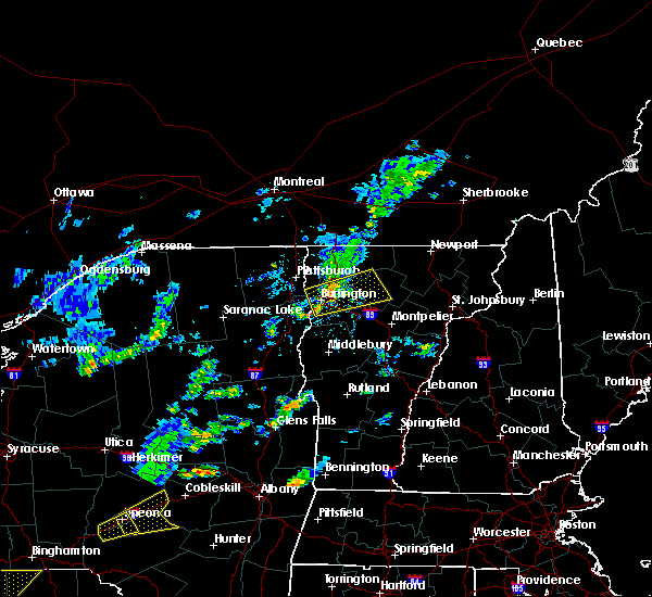 At 433 pm edt, a severe thunderstorm was located over johnson, moving east at 40 mph (radar indicated). Hazards include 60 mph wind gusts and nickel size hail. Expect damage to trees and powerlines. Locations impacted include, waterville, johnson village, underhill, cambridge, cambridge village, westford, johnson, jeffersonville village, fairfax, fletcher, hyde park village, morrisville village, bakersfield, morristown, essex, belvidere, milton, hyde park, jericho and georgia. At 433 pm edt, a severe thunderstorm was located over johnson, moving east at 40 mph (radar indicated). Hazards include 60 mph wind gusts and nickel size hail. Expect damage to trees and powerlines. Locations impacted include, waterville, johnson village, underhill, cambridge, cambridge village, westford, johnson, jeffersonville village, fairfax, fletcher, hyde park village, morrisville village, bakersfield, morristown, essex, belvidere, milton, hyde park, jericho and georgia.
|
| 5/29/2020 3:56 PM EDT |
 At 356 pm edt, a severe thunderstorm was located over winooski, moving east at 40 mph (radar indicated). Hazards include 60 mph wind gusts and nickel size hail. Expect damage to trees and powerlines. This storm has a history of wind damage. At 356 pm edt, a severe thunderstorm was located over winooski, moving east at 40 mph (radar indicated). Hazards include 60 mph wind gusts and nickel size hail. Expect damage to trees and powerlines. This storm has a history of wind damage.
|
| 5/29/2020 3:56 PM EDT |
 At 356 pm edt, a severe thunderstorm was located over winooski, moving east at 40 mph (radar indicated). Hazards include 60 mph wind gusts and nickel size hail. Expect damage to trees and powerlines. This storm has a history of wind damage. At 356 pm edt, a severe thunderstorm was located over winooski, moving east at 40 mph (radar indicated). Hazards include 60 mph wind gusts and nickel size hail. Expect damage to trees and powerlines. This storm has a history of wind damage.
|
| 3/20/2020 3:43 PM EDT |
 At 343 pm edt, severe thunderstorms were located along a line extending from bluff point to mount marcy, moving east at 65 mph (radar indicated). Hazards include 60 mph wind gusts. expect damage to trees and powerlines At 343 pm edt, severe thunderstorms were located along a line extending from bluff point to mount marcy, moving east at 65 mph (radar indicated). Hazards include 60 mph wind gusts. expect damage to trees and powerlines
|
| 3/20/2020 3:43 PM EDT |
 At 343 pm edt, severe thunderstorms were located along a line extending from bluff point to mount marcy, moving east at 65 mph (radar indicated). Hazards include 60 mph wind gusts. expect damage to trees and powerlines At 343 pm edt, severe thunderstorms were located along a line extending from bluff point to mount marcy, moving east at 65 mph (radar indicated). Hazards include 60 mph wind gusts. expect damage to trees and powerlines
|
| 7/30/2019 4:59 PM EDT |
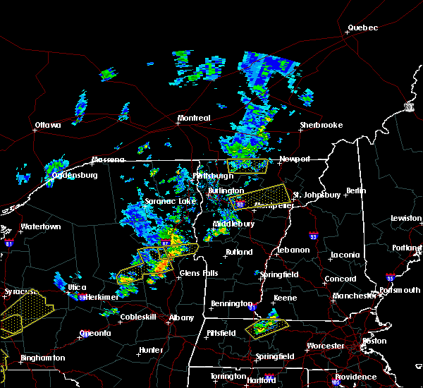 At 459 pm edt, a severe thunderstorm was located near smugglers notch, moving northeast at 35 mph (radar indicated). Hazards include 60 mph wind gusts and quarter size hail. Minor hail damage to vehicles is possible. Expect wind damage to trees and powerlines. At 459 pm edt, a severe thunderstorm was located near smugglers notch, moving northeast at 35 mph (radar indicated). Hazards include 60 mph wind gusts and quarter size hail. Minor hail damage to vehicles is possible. Expect wind damage to trees and powerlines.
|
| 7/30/2019 4:28 PM EDT |
 At 427 pm edt, severe thunderstorms were located along a line extending from 18 miles north of morses line to georgia center, moving east at 15 mph (vtrans reported 76 mph gust at north hero project in addition to several trees down with multiple power outages being reported). Hazards include 70 mph wind gusts and quarter size hail. Minor hail damage to vehicles is possible. expect considerable tree damage. wind damage is also likely to mobile homes, roofs, and outbuildings. locations impacted include, enosburg falls, franklin, johnson village, swanton village, cambridge, bakersfield, cambridge village, berkshire, highgate falls, montgomery center, jeffersonville village, montgomery, st. Albans city, fairfax, sheldon, belvidere center, georgia, lake carmi state park, enosburg and belvidere. At 427 pm edt, severe thunderstorms were located along a line extending from 18 miles north of morses line to georgia center, moving east at 15 mph (vtrans reported 76 mph gust at north hero project in addition to several trees down with multiple power outages being reported). Hazards include 70 mph wind gusts and quarter size hail. Minor hail damage to vehicles is possible. expect considerable tree damage. wind damage is also likely to mobile homes, roofs, and outbuildings. locations impacted include, enosburg falls, franklin, johnson village, swanton village, cambridge, bakersfield, cambridge village, berkshire, highgate falls, montgomery center, jeffersonville village, montgomery, st. Albans city, fairfax, sheldon, belvidere center, georgia, lake carmi state park, enosburg and belvidere.
|
| 7/30/2019 3:55 PM EDT |
 At 354 pm edt, severe thunderstorms were located along a line extending from 19 miles north of morses line to hyde point, moving east at 15 mph (highway department reported wind gust of 76 mph in association with this line of storms). Hazards include 70 mph wind gusts and quarter size hail. Minor hail damage to vehicles is possible. expect considerable tree damage. wind damage is also likely to mobile homes, roofs, and outbuildings. locations impacted include, enosburg falls, franklin, alburgh village, johnson village, cambridge, montgomery center, montgomery, st. albans city, fairfax, sheldon, belvidere center, georgia, enosburg, swanton, waterville, grand isle, st. Albans town, south alburgh, johnson and alburgh. At 354 pm edt, severe thunderstorms were located along a line extending from 19 miles north of morses line to hyde point, moving east at 15 mph (highway department reported wind gust of 76 mph in association with this line of storms). Hazards include 70 mph wind gusts and quarter size hail. Minor hail damage to vehicles is possible. expect considerable tree damage. wind damage is also likely to mobile homes, roofs, and outbuildings. locations impacted include, enosburg falls, franklin, alburgh village, johnson village, cambridge, montgomery center, montgomery, st. albans city, fairfax, sheldon, belvidere center, georgia, enosburg, swanton, waterville, grand isle, st. Albans town, south alburgh, johnson and alburgh.
|
| 7/30/2019 3:55 PM EDT |
 At 354 pm edt, severe thunderstorms were located along a line extending from 19 miles north of morses line to hyde point, moving east at 15 mph (highway department reported wind gust of 76 mph in association with this line of storms). Hazards include 70 mph wind gusts and quarter size hail. Minor hail damage to vehicles is possible. expect considerable tree damage. wind damage is also likely to mobile homes, roofs, and outbuildings. locations impacted include, enosburg falls, franklin, alburgh village, johnson village, cambridge, montgomery center, montgomery, st. albans city, fairfax, sheldon, belvidere center, georgia, enosburg, swanton, waterville, grand isle, st. Albans town, south alburgh, johnson and alburgh. At 354 pm edt, severe thunderstorms were located along a line extending from 19 miles north of morses line to hyde point, moving east at 15 mph (highway department reported wind gust of 76 mph in association with this line of storms). Hazards include 70 mph wind gusts and quarter size hail. Minor hail damage to vehicles is possible. expect considerable tree damage. wind damage is also likely to mobile homes, roofs, and outbuildings. locations impacted include, enosburg falls, franklin, alburgh village, johnson village, cambridge, montgomery center, montgomery, st. albans city, fairfax, sheldon, belvidere center, georgia, enosburg, swanton, waterville, grand isle, st. Albans town, south alburgh, johnson and alburgh.
|
|
|
| 7/30/2019 3:46 PM EDT |
 At 345 pm edt, severe thunderstorms were located along a line extending from 19 miles north of morses line to ladd bay, moving east at 15 mph (radar indicated). Hazards include 60 mph wind gusts and quarter size hail. Minor hail damage to vehicles is possible. Expect wind damage to trees and powerlines. At 345 pm edt, severe thunderstorms were located along a line extending from 19 miles north of morses line to ladd bay, moving east at 15 mph (radar indicated). Hazards include 60 mph wind gusts and quarter size hail. Minor hail damage to vehicles is possible. Expect wind damage to trees and powerlines.
|
| 7/30/2019 3:46 PM EDT |
 At 345 pm edt, severe thunderstorms were located along a line extending from 19 miles north of morses line to ladd bay, moving east at 15 mph (radar indicated). Hazards include 60 mph wind gusts and quarter size hail. Minor hail damage to vehicles is possible. Expect wind damage to trees and powerlines. At 345 pm edt, severe thunderstorms were located along a line extending from 19 miles north of morses line to ladd bay, moving east at 15 mph (radar indicated). Hazards include 60 mph wind gusts and quarter size hail. Minor hail damage to vehicles is possible. Expect wind damage to trees and powerlines.
|
| 6/29/2019 8:20 PM EDT |
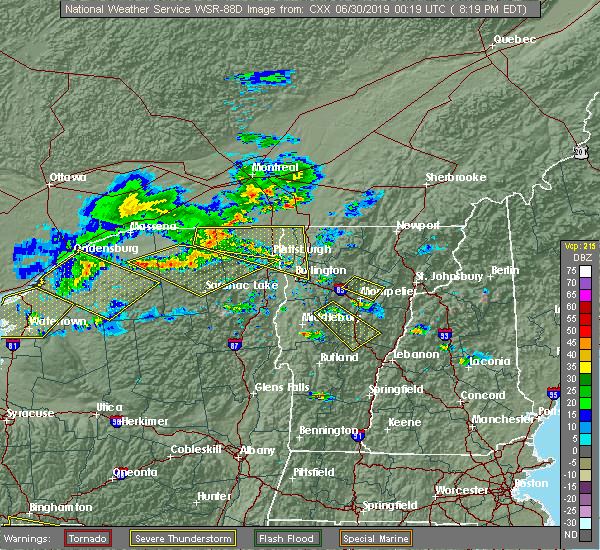 At 820 pm edt, a severe thunderstorm was located over east fairfield, moving southeast at 25 mph (radar indicated). Hazards include 60 mph wind gusts and quarter size hail. Minor hail damage to vehicles is possible. Expect wind damage to trees and powerlines. At 820 pm edt, a severe thunderstorm was located over east fairfield, moving southeast at 25 mph (radar indicated). Hazards include 60 mph wind gusts and quarter size hail. Minor hail damage to vehicles is possible. Expect wind damage to trees and powerlines.
|
| 6/26/2019 5:46 PM EDT |
 At 544 pm edt, severe thunderstorms were located along a line extending from cambridge junction to underhill to near jericho center, moving east at 45 mph (multiple sources. line of storms has knocked a tree onto vehicle in downtown burlington. additionally, a 62mph gust was measures at a ny state mesonet in essex, ny. reports from emergency management of power poles snapped and trees down in willisboro along the tree down along i-87 near lewiston). Hazards include 60 mph wind gusts and penny size hail. Expect damage to trees and powerlines. locations impacted include, essex junction, south burlington, burlington international airport, burlington, morrisville, johnson village, cambridge, winooski, monkton ridge, waterbury village, westford, monkton boro, hyde park, essex junction village, williston, worcester, middlesex, hinesburg, st. George and morrisville village. At 544 pm edt, severe thunderstorms were located along a line extending from cambridge junction to underhill to near jericho center, moving east at 45 mph (multiple sources. line of storms has knocked a tree onto vehicle in downtown burlington. additionally, a 62mph gust was measures at a ny state mesonet in essex, ny. reports from emergency management of power poles snapped and trees down in willisboro along the tree down along i-87 near lewiston). Hazards include 60 mph wind gusts and penny size hail. Expect damage to trees and powerlines. locations impacted include, essex junction, south burlington, burlington international airport, burlington, morrisville, johnson village, cambridge, winooski, monkton ridge, waterbury village, westford, monkton boro, hyde park, essex junction village, williston, worcester, middlesex, hinesburg, st. George and morrisville village.
|
| 6/26/2019 5:46 PM EDT |
 At 544 pm edt, severe thunderstorms were located along a line extending from cambridge junction to underhill to near jericho center, moving east at 45 mph (multiple sources. line of storms has knocked a tree onto vehicle in downtown burlington. additionally, a 62mph gust was measures at a ny state mesonet in essex, ny. reports from emergency management of power poles snapped and trees down in willisboro along the tree down along i-87 near lewiston). Hazards include 60 mph wind gusts and penny size hail. Expect damage to trees and powerlines. locations impacted include, essex junction, south burlington, burlington international airport, burlington, morrisville, johnson village, cambridge, winooski, monkton ridge, waterbury village, westford, monkton boro, hyde park, essex junction village, williston, worcester, middlesex, hinesburg, st. George and morrisville village. At 544 pm edt, severe thunderstorms were located along a line extending from cambridge junction to underhill to near jericho center, moving east at 45 mph (multiple sources. line of storms has knocked a tree onto vehicle in downtown burlington. additionally, a 62mph gust was measures at a ny state mesonet in essex, ny. reports from emergency management of power poles snapped and trees down in willisboro along the tree down along i-87 near lewiston). Hazards include 60 mph wind gusts and penny size hail. Expect damage to trees and powerlines. locations impacted include, essex junction, south burlington, burlington international airport, burlington, morrisville, johnson village, cambridge, winooski, monkton ridge, waterbury village, westford, monkton boro, hyde park, essex junction village, williston, worcester, middlesex, hinesburg, st. George and morrisville village.
|
| 6/26/2019 5:32 PM EDT |
 At 530 pm edt, severe thunderstorms were located along a line extending from near westford to essex to near st. george, moving east at 45 mph (new york state mesonet in essex, ny reported wind gusts of 54 knots. additionally, social media reports tree branch downed on vehicle in downtown burlington). Hazards include 60 mph wind gusts and penny size hail. Expect damage to trees and powerlines. Locations impacted include, essex junction, south burlington, burlington international airport, burlington, willsboro, morrisville, johnson village, cambridge, winooski, monkton ridge, waterbury village, westford, monkton boro, hyde park, colchester, essex junction village, williston, worcester, middlesex and belvidere center. At 530 pm edt, severe thunderstorms were located along a line extending from near westford to essex to near st. george, moving east at 45 mph (new york state mesonet in essex, ny reported wind gusts of 54 knots. additionally, social media reports tree branch downed on vehicle in downtown burlington). Hazards include 60 mph wind gusts and penny size hail. Expect damage to trees and powerlines. Locations impacted include, essex junction, south burlington, burlington international airport, burlington, willsboro, morrisville, johnson village, cambridge, winooski, monkton ridge, waterbury village, westford, monkton boro, hyde park, colchester, essex junction village, williston, worcester, middlesex and belvidere center.
|
| 6/26/2019 5:32 PM EDT |
 At 530 pm edt, severe thunderstorms were located along a line extending from near westford to essex to near st. george, moving east at 45 mph (new york state mesonet in essex, ny reported wind gusts of 54 knots. additionally, social media reports tree branch downed on vehicle in downtown burlington). Hazards include 60 mph wind gusts and penny size hail. Expect damage to trees and powerlines. Locations impacted include, essex junction, south burlington, burlington international airport, burlington, willsboro, morrisville, johnson village, cambridge, winooski, monkton ridge, waterbury village, westford, monkton boro, hyde park, colchester, essex junction village, williston, worcester, middlesex and belvidere center. At 530 pm edt, severe thunderstorms were located along a line extending from near westford to essex to near st. george, moving east at 45 mph (new york state mesonet in essex, ny reported wind gusts of 54 knots. additionally, social media reports tree branch downed on vehicle in downtown burlington). Hazards include 60 mph wind gusts and penny size hail. Expect damage to trees and powerlines. Locations impacted include, essex junction, south burlington, burlington international airport, burlington, willsboro, morrisville, johnson village, cambridge, winooski, monkton ridge, waterbury village, westford, monkton boro, hyde park, colchester, essex junction village, williston, worcester, middlesex and belvidere center.
|
| 6/26/2019 5:08 PM EDT |
 At 508 pm edt, severe thunderstorms were located along a line extending from allen point to near the four brothers to near reber, moving east at 45 mph (radar indicated). Hazards include 60 mph wind gusts and penny size hail. expect damage to trees and powerlines At 508 pm edt, severe thunderstorms were located along a line extending from allen point to near the four brothers to near reber, moving east at 45 mph (radar indicated). Hazards include 60 mph wind gusts and penny size hail. expect damage to trees and powerlines
|
| 6/26/2019 5:08 PM EDT |
 At 508 pm edt, severe thunderstorms were located along a line extending from allen point to near the four brothers to near reber, moving east at 45 mph (radar indicated). Hazards include 60 mph wind gusts and penny size hail. expect damage to trees and powerlines At 508 pm edt, severe thunderstorms were located along a line extending from allen point to near the four brothers to near reber, moving east at 45 mph (radar indicated). Hazards include 60 mph wind gusts and penny size hail. expect damage to trees and powerlines
|
| 5/4/2018 7:12 PM EDT |
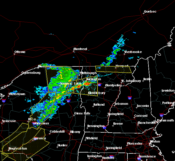 At 711 pm edt, a severe thunderstorm was located over colchester, moving east at 40 mph (radar indicated). Hazards include 60 mph wind gusts and quarter size hail. Minor hail damage to vehicles is possible. Expect wind damage to trees and powerlines. At 711 pm edt, a severe thunderstorm was located over colchester, moving east at 40 mph (radar indicated). Hazards include 60 mph wind gusts and quarter size hail. Minor hail damage to vehicles is possible. Expect wind damage to trees and powerlines.
|
| 8/22/2017 6:51 PM EDT |
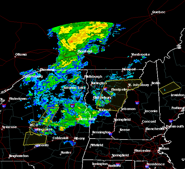 At 650 pm edt, severe thunderstorms were located along a line extending from hyde park to east brookfield to near north sherburne, moving east at 50 mph (radar indicated). Hazards include 70 mph wind gusts and penny size hail. Expect considerable tree damage. damage is likely to mobile homes, roofs, and outbuildings. locations impacted include, barre, st. Johnsbury, montpelier, white river junction, lyndon, morrisville, braintree hill, bradford, waterbury village, websterville, burke, pomfret, worcester, middlesex, marshfield, cabot village, fairlee, west burke village, sharon and washington. At 650 pm edt, severe thunderstorms were located along a line extending from hyde park to east brookfield to near north sherburne, moving east at 50 mph (radar indicated). Hazards include 70 mph wind gusts and penny size hail. Expect considerable tree damage. damage is likely to mobile homes, roofs, and outbuildings. locations impacted include, barre, st. Johnsbury, montpelier, white river junction, lyndon, morrisville, braintree hill, bradford, waterbury village, websterville, burke, pomfret, worcester, middlesex, marshfield, cabot village, fairlee, west burke village, sharon and washington.
|
| 8/22/2017 6:28 PM EDT |
 At 628 pm edt, severe thunderstorms were located along a line extending from south cambridge to near northfield to east hubbardton, moving east at 50 mph (radar indicated). Hazards include 70 mph wind gusts and penny size hail. Expect considerable tree damage. Damage is likely to mobile homes, roofs, and outbuildings. At 628 pm edt, severe thunderstorms were located along a line extending from south cambridge to near northfield to east hubbardton, moving east at 50 mph (radar indicated). Hazards include 70 mph wind gusts and penny size hail. Expect considerable tree damage. Damage is likely to mobile homes, roofs, and outbuildings.
|
| 8/22/2017 6:00 PM EDT |
 At 600 pm edt, severe thunderstorms were located along a line extending from near appletree point to twilight bay to waltham, moving northeast at 35 mph (radar indicated). Hazards include 60 mph wind gusts. expect damage to trees and powerlines At 600 pm edt, severe thunderstorms were located along a line extending from near appletree point to twilight bay to waltham, moving northeast at 35 mph (radar indicated). Hazards include 60 mph wind gusts. expect damage to trees and powerlines
|
| 8/12/2017 7:00 PM EDT |
 At 700 pm edt, severe thunderstorms were located along a line extending from cove island to near elmore state park, moving east at 40 mph (radar indicated). Hazards include 60 mph wind gusts and quarter size hail. Minor hail damage to vehicles is possible. Expect wind damage to trees and powerlines. At 700 pm edt, severe thunderstorms were located along a line extending from cove island to near elmore state park, moving east at 40 mph (radar indicated). Hazards include 60 mph wind gusts and quarter size hail. Minor hail damage to vehicles is possible. Expect wind damage to trees and powerlines.
|
| 8/12/2017 6:00 PM EDT |
 The national weather service in burlington has issued a * severe thunderstorm warning for. southwestern lamoille county in northwestern vermont. northwestern addison county in central vermont. chittenden county in northwestern vermont. Western washington county in central vermont. The national weather service in burlington has issued a * severe thunderstorm warning for. southwestern lamoille county in northwestern vermont. northwestern addison county in central vermont. chittenden county in northwestern vermont. Western washington county in central vermont.
|
| 6/19/2017 12:07 AM EDT |
 The severe thunderstorm warning for northern lamoille and southeastern franklin counties will expire at 1215 am edt, the storm which prompted the warning has weakened and will be moving out of the warned area in the next 10 minutes. therefore the warning will be allowed to expire. The severe thunderstorm warning for northern lamoille and southeastern franklin counties will expire at 1215 am edt, the storm which prompted the warning has weakened and will be moving out of the warned area in the next 10 minutes. therefore the warning will be allowed to expire.
|
| 6/18/2017 11:38 PM EDT |
 At 1138 pm edt, a severe thunderstorm was located over waterville, moving northeast at 45 mph (radar indicated). Hazards include 60 mph wind gusts. Expect damage to trees and powerlines. Locations impacted include, waterville, johnson village, cambridge, bakersfield, cambridge village, johnson, jeffersonville village, hyde park, belvidere center, fletcher, belvidere, fairfield, hyde park village, eden, enosburg falls village, enosburg, fairfax, morristown, jeffersonville and east fletcher. At 1138 pm edt, a severe thunderstorm was located over waterville, moving northeast at 45 mph (radar indicated). Hazards include 60 mph wind gusts. Expect damage to trees and powerlines. Locations impacted include, waterville, johnson village, cambridge, bakersfield, cambridge village, johnson, jeffersonville village, hyde park, belvidere center, fletcher, belvidere, fairfield, hyde park village, eden, enosburg falls village, enosburg, fairfax, morristown, jeffersonville and east fletcher.
|
| 6/18/2017 11:27 PM EDT |
 At 1126 pm edt, a severe thunderstorm was located over cloverdale, moving northeast at 45 mph (radar indicated). Hazards include 60 mph wind gusts. expect damage to trees and powerlines At 1126 pm edt, a severe thunderstorm was located over cloverdale, moving northeast at 45 mph (radar indicated). Hazards include 60 mph wind gusts. expect damage to trees and powerlines
|
| 5/31/2017 3:56 PM EDT |
 The severe thunderstorm warning for lamoille, central addison, southeastern chittenden and washington counties will expire at 400 pm edt, the storms which prompted the warning have weakened below severe limits, and no longer pose an immediate threat to life or property. therefore the warning will be allowed to expire. a severe thunderstorm watch remains in effect until 900 pm edt for central, southern, northeastern and northwestern vermont. The severe thunderstorm warning for lamoille, central addison, southeastern chittenden and washington counties will expire at 400 pm edt, the storms which prompted the warning have weakened below severe limits, and no longer pose an immediate threat to life or property. therefore the warning will be allowed to expire. a severe thunderstorm watch remains in effect until 900 pm edt for central, southern, northeastern and northwestern vermont.
|
| 5/31/2017 3:44 PM EDT |
 At 343 pm edt, a broken line of strong to locally severe thunderstorms were located along a line extending from north wolcott to northfield to near ripton, moving east at 35 mph (radar indicated). Hazards include 60 mph wind gusts and nickel size hail. Expect damage to trees and powerlines. Locations impacted include, barre, middlebury, montpelier, morrisville, johnson village, calais, weybridge, waterbury village, websterville, lincoln, hyde park, new haven, worcester, middlesex, granville, marshfield, cabot village, hancock, ripton and morrisville village. At 343 pm edt, a broken line of strong to locally severe thunderstorms were located along a line extending from north wolcott to northfield to near ripton, moving east at 35 mph (radar indicated). Hazards include 60 mph wind gusts and nickel size hail. Expect damage to trees and powerlines. Locations impacted include, barre, middlebury, montpelier, morrisville, johnson village, calais, weybridge, waterbury village, websterville, lincoln, hyde park, new haven, worcester, middlesex, granville, marshfield, cabot village, hancock, ripton and morrisville village.
|
| 5/31/2017 3:14 PM EDT |
 At 314 pm edt, severe thunderstorms were located along a line extending from near waterville to starksboro to near waltham, moving east at 35 mph (radar indicated). Hazards include 60 mph wind gusts and quarter size hail. Minor hail damage to vehicles is possible. Expect wind damage to trees and powerlines. At 314 pm edt, severe thunderstorms were located along a line extending from near waterville to starksboro to near waltham, moving east at 35 mph (radar indicated). Hazards include 60 mph wind gusts and quarter size hail. Minor hail damage to vehicles is possible. Expect wind damage to trees and powerlines.
|
| 5/18/2017 5:50 PM EDT |
 At 549 pm edt, a severe thunderstorm was located over underhill state park, moving east at 40 mph (radar indicated). Hazards include 60 mph wind gusts and quarter size hail. Minor hail damage to vehicles is possible. expect wind damage to trees and powerlines. Locations impacted include, morrisville, johnson village, eden, cambridge, cambridge village, stowe, hardwick, jeffersonville village, hyde park, wolcott, worcester, cabot village, waterville, morrisville village, woodbury, cabot, johnson, waterbury, lowell and craftsbury. At 549 pm edt, a severe thunderstorm was located over underhill state park, moving east at 40 mph (radar indicated). Hazards include 60 mph wind gusts and quarter size hail. Minor hail damage to vehicles is possible. expect wind damage to trees and powerlines. Locations impacted include, morrisville, johnson village, eden, cambridge, cambridge village, stowe, hardwick, jeffersonville village, hyde park, wolcott, worcester, cabot village, waterville, morrisville village, woodbury, cabot, johnson, waterbury, lowell and craftsbury.
|
| 5/18/2017 5:29 PM EDT |
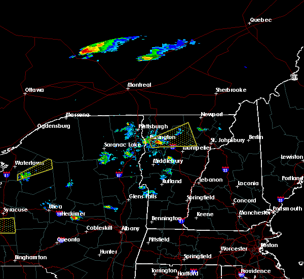 At 528 pm edt, a severe thunderstorm was located over north williston, moving east at 40 mph (radar indicated). Hazards include 60 mph wind gusts and quarter size hail. Minor hail damage to vehicles is possible. Expect wind damage to trees and powerlines. At 528 pm edt, a severe thunderstorm was located over north williston, moving east at 40 mph (radar indicated). Hazards include 60 mph wind gusts and quarter size hail. Minor hail damage to vehicles is possible. Expect wind damage to trees and powerlines.
|
| 9/11/2016 5:31 AM EDT |
 At 531 am edt, a severe thunderstorm was located over montgomery center, moving northeast at 30 mph (radar indicated). Hazards include 60 mph wind gusts. Expect damage to roofs. siding. and trees. Locations impacted include, fairfax, richford, berkshire, troy, johnson, enosburg falls, bakersfield, fletcher, montgomery, waterville, westfield, jay, cambridge, montgomery center, belvidere center, jay in franklin county, jeffersonville, north troy, enosburg center and north enosburg. At 531 am edt, a severe thunderstorm was located over montgomery center, moving northeast at 30 mph (radar indicated). Hazards include 60 mph wind gusts. Expect damage to roofs. siding. and trees. Locations impacted include, fairfax, richford, berkshire, troy, johnson, enosburg falls, bakersfield, fletcher, montgomery, waterville, westfield, jay, cambridge, montgomery center, belvidere center, jay in franklin county, jeffersonville, north troy, enosburg center and north enosburg.
|
| 9/11/2016 4:49 AM EDT |
 At 449 am edt, a severe thunderstorm was located over fairfax, moving northeast at 30 mph (radar indicated). Hazards include 60 mph wind gusts. Expect damage to roofs. siding. And trees. At 449 am edt, a severe thunderstorm was located over fairfax, moving northeast at 30 mph (radar indicated). Hazards include 60 mph wind gusts. Expect damage to roofs. siding. And trees.
|
|
|
| 8/28/2016 5:45 PM EDT |
Trees down in johnson in lamoille county VT, 0.3 miles SSE of Johnson, VT
|
| 8/28/2016 5:08 PM EDT |
Trees down on bog road in lamoille county VT, 7.9 miles S of Johnson, VT
|
| 8/28/2016 5:08 PM EDT |
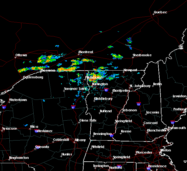 At 507 pm edt, a severe thunderstorm was located near belvidere center, moving east at 25 mph (radar indicated). Hazards include 60 mph wind gusts and quarter size hail. Hail damage to vehicles is expected. Expect wind damage to roofs, siding, and trees. At 507 pm edt, a severe thunderstorm was located near belvidere center, moving east at 25 mph (radar indicated). Hazards include 60 mph wind gusts and quarter size hail. Hail damage to vehicles is expected. Expect wind damage to roofs, siding, and trees.
|
| 7/22/2016 11:36 PM EDT |
 At 1134 pm edt, severe thunderstorms were located along a line extending from north troy to mount worcester, moving east at 35 mph (radar indicated). Hazards include 60 mph wind gusts and quarter size hail. Hail damage to vehicles is expected. expect wind damage to roofs, siding, and trees. Locations impacted include, island pond, stowe, hardwick, richford, danville, morrisville, berkshire, wolcott, troy, johnson, eden, bakersfield, concord, craftsbury, montgomery, irasburg, glover, coventry, sutton and canaan. At 1134 pm edt, severe thunderstorms were located along a line extending from north troy to mount worcester, moving east at 35 mph (radar indicated). Hazards include 60 mph wind gusts and quarter size hail. Hail damage to vehicles is expected. expect wind damage to roofs, siding, and trees. Locations impacted include, island pond, stowe, hardwick, richford, danville, morrisville, berkshire, wolcott, troy, johnson, eden, bakersfield, concord, craftsbury, montgomery, irasburg, glover, coventry, sutton and canaan.
|
| 7/22/2016 10:43 PM EDT |
 At 1041 pm edt, severe thunderstorms were located along a line extending from alburg vermont to burlington vermont, moving east at 35 to 40 mph. other strong to severe thunderstorms were located over northeast vermont moving east at 35 mph (radar indicated). Hazards include 60 mph wind gusts and quarter size hail. Hail damage to vehicles is expected. Expect wind damage to roofs, siding, and trees. At 1041 pm edt, severe thunderstorms were located along a line extending from alburg vermont to burlington vermont, moving east at 35 to 40 mph. other strong to severe thunderstorms were located over northeast vermont moving east at 35 mph (radar indicated). Hazards include 60 mph wind gusts and quarter size hail. Hail damage to vehicles is expected. Expect wind damage to roofs, siding, and trees.
|
| 7/22/2016 10:43 PM EDT |
 At 1041 pm edt, severe thunderstorms were located along a line extending from alburg vermont to burlington vermont, moving east at 35 to 40 mph. other strong to severe thunderstorms were located over northeast vermont moving east at 35 mph (radar indicated). Hazards include 60 mph wind gusts and quarter size hail. Hail damage to vehicles is expected. Expect wind damage to roofs, siding, and trees. At 1041 pm edt, severe thunderstorms were located along a line extending from alburg vermont to burlington vermont, moving east at 35 to 40 mph. other strong to severe thunderstorms were located over northeast vermont moving east at 35 mph (radar indicated). Hazards include 60 mph wind gusts and quarter size hail. Hail damage to vehicles is expected. Expect wind damage to roofs, siding, and trees.
|
| 7/22/2016 10:09 PM EDT |
 At 1008 pm edt, an area of strong to severe thunderstorms was located from east fletcher vermont westward to cumberland head new york, moving east at 30 mph (radar indicated). Hazards include 60 mph wind gusts and quarter size hail. Hail damage to vehicles is expected. expect wind damage to roofs, siding, and trees. Locations impacted include, colchester, essex junction, plattsburgh international airport, grand isle, beekmantown, jericho, fairfax, chazy, underhill, westford, south hero, johnson, fletcher, north hero, waterville, isle la motte, cambridge, underhill state park, georgia center and schuyler falls. At 1008 pm edt, an area of strong to severe thunderstorms was located from east fletcher vermont westward to cumberland head new york, moving east at 30 mph (radar indicated). Hazards include 60 mph wind gusts and quarter size hail. Hail damage to vehicles is expected. expect wind damage to roofs, siding, and trees. Locations impacted include, colchester, essex junction, plattsburgh international airport, grand isle, beekmantown, jericho, fairfax, chazy, underhill, westford, south hero, johnson, fletcher, north hero, waterville, isle la motte, cambridge, underhill state park, georgia center and schuyler falls.
|
| 7/22/2016 10:09 PM EDT |
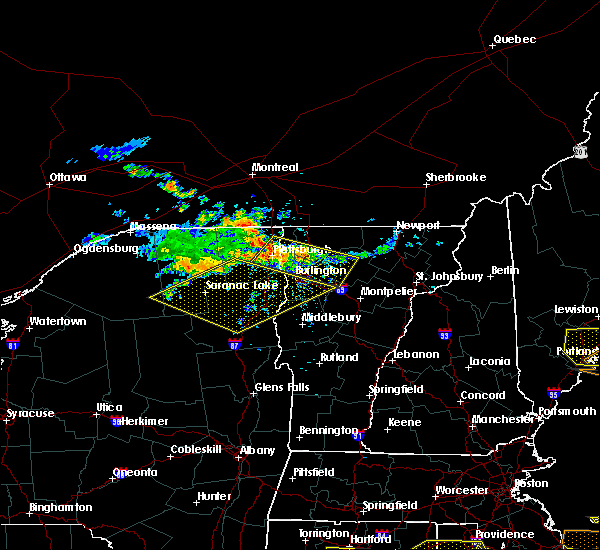 At 1008 pm edt, an area of strong to severe thunderstorms was located from east fletcher vermont westward to cumberland head new york, moving east at 30 mph (radar indicated). Hazards include 60 mph wind gusts and quarter size hail. Hail damage to vehicles is expected. expect wind damage to roofs, siding, and trees. Locations impacted include, colchester, essex junction, plattsburgh international airport, grand isle, beekmantown, jericho, fairfax, chazy, underhill, westford, south hero, johnson, fletcher, north hero, waterville, isle la motte, cambridge, underhill state park, georgia center and schuyler falls. At 1008 pm edt, an area of strong to severe thunderstorms was located from east fletcher vermont westward to cumberland head new york, moving east at 30 mph (radar indicated). Hazards include 60 mph wind gusts and quarter size hail. Hail damage to vehicles is expected. expect wind damage to roofs, siding, and trees. Locations impacted include, colchester, essex junction, plattsburgh international airport, grand isle, beekmantown, jericho, fairfax, chazy, underhill, westford, south hero, johnson, fletcher, north hero, waterville, isle la motte, cambridge, underhill state park, georgia center and schuyler falls.
|
| 7/22/2016 9:42 PM EDT |
 At 941 pm edt, a severe thunderstorm was located over allens bay in clinton county, moving east at 35 mph (radar indicated). Hazards include 60 mph wind gusts and quarter size hail. Hail damage to vehicles is expected. Expect wind damage to roofs, siding, and trees. At 941 pm edt, a severe thunderstorm was located over allens bay in clinton county, moving east at 35 mph (radar indicated). Hazards include 60 mph wind gusts and quarter size hail. Hail damage to vehicles is expected. Expect wind damage to roofs, siding, and trees.
|
| 7/22/2016 9:42 PM EDT |
 At 941 pm edt, a severe thunderstorm was located over allens bay in clinton county, moving east at 35 mph (radar indicated). Hazards include 60 mph wind gusts and quarter size hail. Hail damage to vehicles is expected. Expect wind damage to roofs, siding, and trees. At 941 pm edt, a severe thunderstorm was located over allens bay in clinton county, moving east at 35 mph (radar indicated). Hazards include 60 mph wind gusts and quarter size hail. Hail damage to vehicles is expected. Expect wind damage to roofs, siding, and trees.
|
| 7/22/2016 8:59 PM EDT |
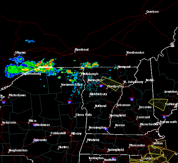 At 858 pm edt, a severe thunderstorm was located near johnson vermont in lamoille county, moving southeast at 30 mph (radar indicated). Hazards include 60 mph wind gusts. Expect damage to roofs. siding. And trees. At 858 pm edt, a severe thunderstorm was located near johnson vermont in lamoille county, moving southeast at 30 mph (radar indicated). Hazards include 60 mph wind gusts. Expect damage to roofs. siding. And trees.
|
| 7/18/2016 1:53 PM EDT |
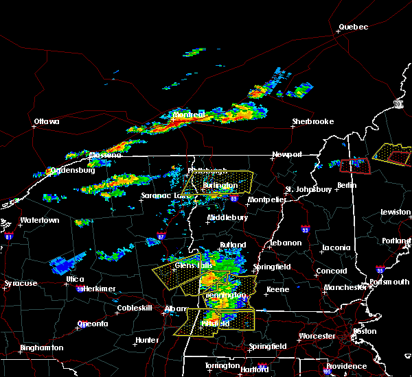 The severe thunderstorm warning for southeastern clinton, northeastern essex, lamoille, southern grand isle, northern chittenden and southwestern franklin counties will expire at 200 pm edt, the storm which prompted the warning has moved out of the area. therefore the warning will be allowed to expire. however gusty winds and heavy rain are still possible with this thunderstorm. a severe thunderstorm watch remains in effect until 800 pm edt for northern new york, and northeastern, central and northwestern vermont. The severe thunderstorm warning for southeastern clinton, northeastern essex, lamoille, southern grand isle, northern chittenden and southwestern franklin counties will expire at 200 pm edt, the storm which prompted the warning has moved out of the area. therefore the warning will be allowed to expire. however gusty winds and heavy rain are still possible with this thunderstorm. a severe thunderstorm watch remains in effect until 800 pm edt for northern new york, and northeastern, central and northwestern vermont.
|
| 7/18/2016 1:53 PM EDT |
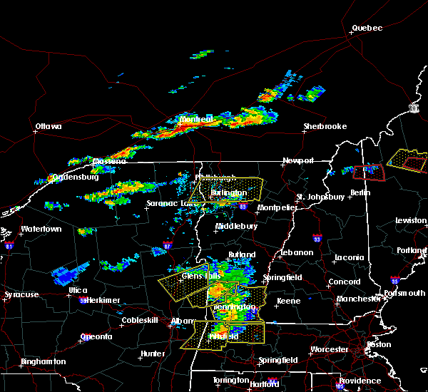 The severe thunderstorm warning for southeastern clinton, northeastern essex, lamoille, southern grand isle, northern chittenden and southwestern franklin counties will expire at 200 pm edt, the storm which prompted the warning has moved out of the area. therefore the warning will be allowed to expire. however gusty winds and heavy rain are still possible with this thunderstorm. a severe thunderstorm watch remains in effect until 800 pm edt for northern new york, and northeastern, central and northwestern vermont. The severe thunderstorm warning for southeastern clinton, northeastern essex, lamoille, southern grand isle, northern chittenden and southwestern franklin counties will expire at 200 pm edt, the storm which prompted the warning has moved out of the area. therefore the warning will be allowed to expire. however gusty winds and heavy rain are still possible with this thunderstorm. a severe thunderstorm watch remains in effect until 800 pm edt for northern new york, and northeastern, central and northwestern vermont.
|
| 7/18/2016 1:19 PM EDT |
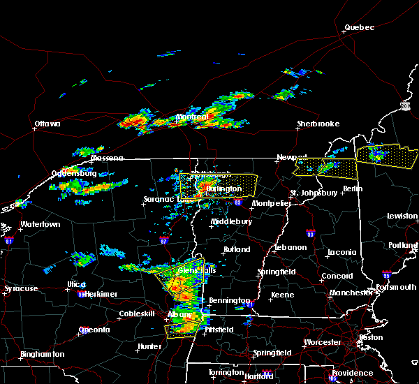 At 118 pm edt, a severe thunderstorm was located near colchester point, moving east at 55 mph (trained weather spotters reported trees downed in peru). Hazards include 60 mph wind gusts and quarter size hail. Hail damage to vehicles is expected. expect wind damage to roofs, siding, and trees. locations impacted include, south burlington, colchester, essex junction, burlington international airport, williston, winooski, grand isle, jericho, stowe, fairfax, underhill, westford, morrisville, south hero, johnson, eden, fletcher, waterville, hyde park and cambridge. At 118 pm edt, a severe thunderstorm was located near colchester point, moving east at 55 mph (trained weather spotters reported trees downed in peru). Hazards include 60 mph wind gusts and quarter size hail. Hail damage to vehicles is expected. expect wind damage to roofs, siding, and trees. locations impacted include, south burlington, colchester, essex junction, burlington international airport, williston, winooski, grand isle, jericho, stowe, fairfax, underhill, westford, morrisville, south hero, johnson, eden, fletcher, waterville, hyde park and cambridge.
|
| 7/18/2016 1:19 PM EDT |
 At 118 pm edt, a severe thunderstorm was located near colchester point, moving east at 55 mph (trained weather spotters reported trees downed in peru). Hazards include 60 mph wind gusts and quarter size hail. Hail damage to vehicles is expected. expect wind damage to roofs, siding, and trees. locations impacted include, south burlington, colchester, essex junction, burlington international airport, williston, winooski, grand isle, jericho, stowe, fairfax, underhill, westford, morrisville, south hero, johnson, eden, fletcher, waterville, hyde park and cambridge. At 118 pm edt, a severe thunderstorm was located near colchester point, moving east at 55 mph (trained weather spotters reported trees downed in peru). Hazards include 60 mph wind gusts and quarter size hail. Hail damage to vehicles is expected. expect wind damage to roofs, siding, and trees. locations impacted include, south burlington, colchester, essex junction, burlington international airport, williston, winooski, grand isle, jericho, stowe, fairfax, underhill, westford, morrisville, south hero, johnson, eden, fletcher, waterville, hyde park and cambridge.
|
| 7/18/2016 1:00 PM EDT |
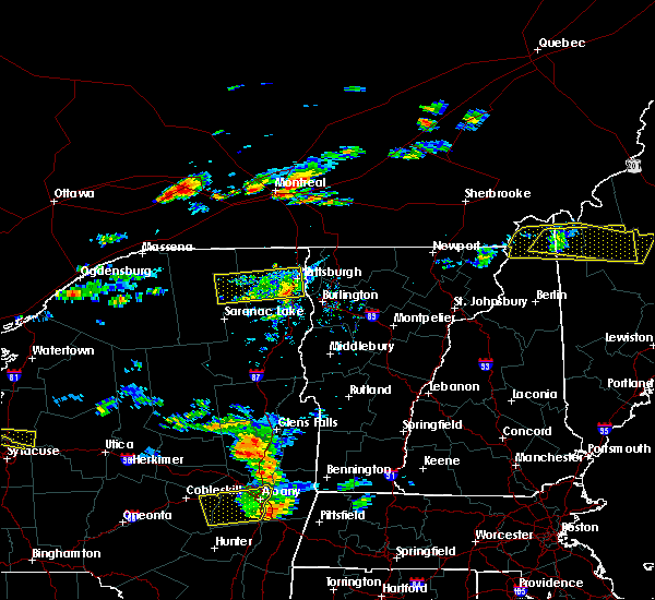 At 1259 pm edt, a severe thunderstorm was located over ausable point, moving east at 55 mph (radar indicated). Hazards include 60 mph wind gusts. Expect damage to roofs. siding. And trees. At 1259 pm edt, a severe thunderstorm was located over ausable point, moving east at 55 mph (radar indicated). Hazards include 60 mph wind gusts. Expect damage to roofs. siding. And trees.
|
| 7/18/2016 1:00 PM EDT |
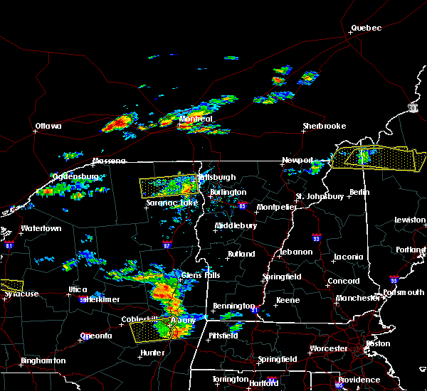 At 1259 pm edt, a severe thunderstorm was located over ausable point, moving east at 55 mph (radar indicated). Hazards include 60 mph wind gusts. Expect damage to roofs. siding. And trees. At 1259 pm edt, a severe thunderstorm was located over ausable point, moving east at 55 mph (radar indicated). Hazards include 60 mph wind gusts. Expect damage to roofs. siding. And trees.
|
| 7/7/2016 3:36 PM EDT |
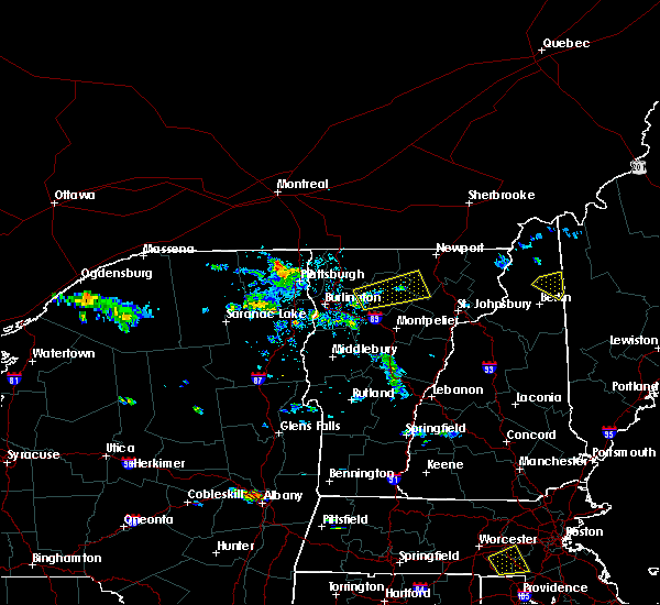 The severe thunderstorm warning for lamoille, northeastern chittenden, southwestern orleans, southern franklin and northwestern caledonia counties will expire at 345 pm edt, the storm which prompted the warning has weakened below severe limits, and no longer pose an immediate threat to life or property. therefore the warning will be allowed to expire. however heavy rain is still possible with this thunderstorm. The severe thunderstorm warning for lamoille, northeastern chittenden, southwestern orleans, southern franklin and northwestern caledonia counties will expire at 345 pm edt, the storm which prompted the warning has weakened below severe limits, and no longer pose an immediate threat to life or property. therefore the warning will be allowed to expire. however heavy rain is still possible with this thunderstorm.
|
| 7/7/2016 3:00 PM EDT |
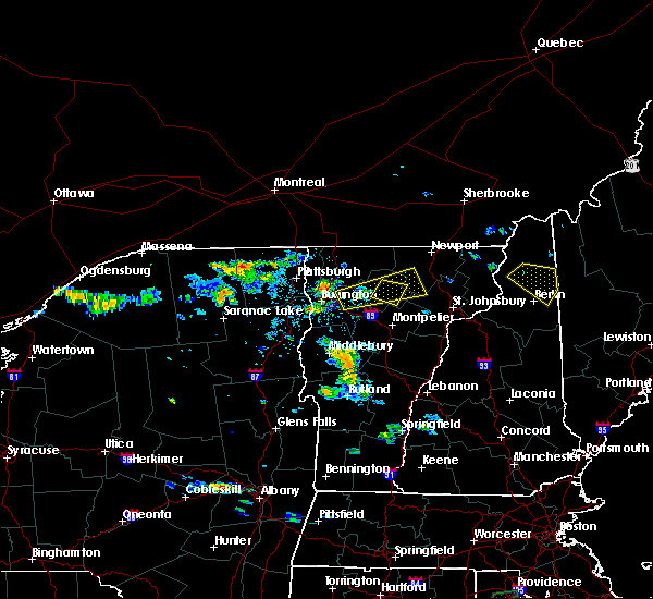 At 300 pm edt, a severe thunderstorm was located over underhill state park, moving east at 25 mph (radar indicated). Hazards include 60 mph wind gusts and quarter size hail. Hail damage to vehicles is expected. expect wind damage to roofs, siding, and trees. locations impacted include, morrisville, wolcott, johnson, eden, craftsbury, greensboro, hyde park, cambridge, albany, underhill state park, jeffersonville, albany center, north underhill, south cambridge, north wolcott, green river reservoir, cloverdale, east johnson, lake elmore and tromp point. At 300 pm edt, a severe thunderstorm was located over underhill state park, moving east at 25 mph (radar indicated). Hazards include 60 mph wind gusts and quarter size hail. Hail damage to vehicles is expected. expect wind damage to roofs, siding, and trees. locations impacted include, morrisville, wolcott, johnson, eden, craftsbury, greensboro, hyde park, cambridge, albany, underhill state park, jeffersonville, albany center, north underhill, south cambridge, north wolcott, green river reservoir, cloverdale, east johnson, lake elmore and tromp point.
|
| 7/7/2016 2:40 PM EDT |
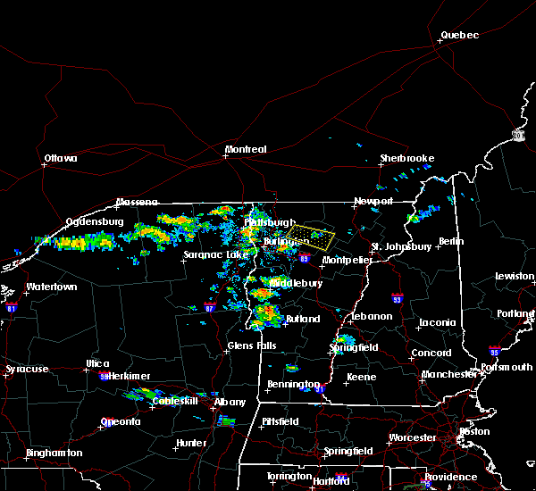 At 240 pm edt, a severe thunderstorm was located over hyde park, moving east at 30 mph (radar indicated). Hazards include quarter size hail. Damage to vehicles is expected. locations impacted include, morrisville, johnson, hyde park, garfield, east johnson, lake elmore, elmore state park, north hyde park, north wolcott, cadys falls and green river reservoir. At 240 pm edt, a severe thunderstorm was located over hyde park, moving east at 30 mph (radar indicated). Hazards include quarter size hail. Damage to vehicles is expected. locations impacted include, morrisville, johnson, hyde park, garfield, east johnson, lake elmore, elmore state park, north hyde park, north wolcott, cadys falls and green river reservoir.
|
| 7/7/2016 2:38 PM EDT |
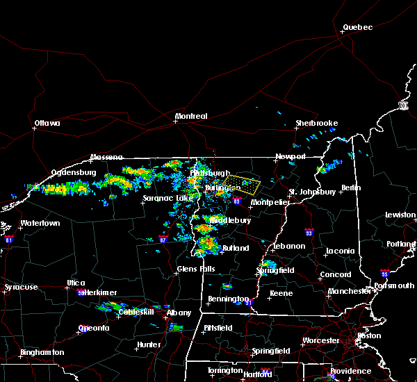 At 238 pm edt, a severe thunderstorm was located over underhill, moving east at 25 mph (radar indicated). Hazards include 60 mph wind gusts and quarter size hail. Hail damage to vehicles is expected. Expect wind damage to roofs, siding, and trees. At 238 pm edt, a severe thunderstorm was located over underhill, moving east at 25 mph (radar indicated). Hazards include 60 mph wind gusts and quarter size hail. Hail damage to vehicles is expected. Expect wind damage to roofs, siding, and trees.
|
| 7/7/2016 2:22 PM EDT |
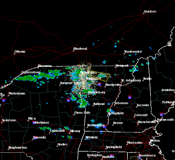 At 222 pm edt, a severe thunderstorm was located over cambridge, moving southeast at 15 mph (radar indicated). Hazards include quarter size hail. Damage to vehicles is expected. locations impacted include, morrisville, johnson, fletcher, waterville, hyde park, cambridge, jeffersonville, garfield, south cambridge, pleasant valley, binghamville, east fletcher, north hyde park, north wolcott, green river reservoir, cambridge junction, cloverdale, north cambridge, east johnson and lake elmore. At 222 pm edt, a severe thunderstorm was located over cambridge, moving southeast at 15 mph (radar indicated). Hazards include quarter size hail. Damage to vehicles is expected. locations impacted include, morrisville, johnson, fletcher, waterville, hyde park, cambridge, jeffersonville, garfield, south cambridge, pleasant valley, binghamville, east fletcher, north hyde park, north wolcott, green river reservoir, cambridge junction, cloverdale, north cambridge, east johnson and lake elmore.
|
| 7/7/2016 1:54 PM EDT |
 At 154 pm edt, a severe thunderstorm was located near fairfax, moving east at 20 mph (radar indicated). Hazards include quarter size hail. damage to vehicles is expected At 154 pm edt, a severe thunderstorm was located near fairfax, moving east at 20 mph (radar indicated). Hazards include quarter size hail. damage to vehicles is expected
|
| 6/21/2016 12:20 AM EDT |
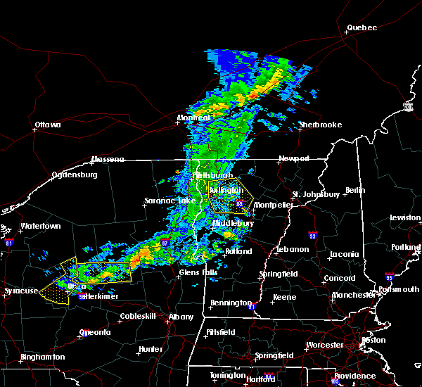 At 1220 am edt, severe thunderstorms were located along a line extending from near waterville to near montpelier to bethel, moving east at 55 mph (radar indicated). Hazards include 60 mph wind gusts. Expect damage to roofs. siding. And trees. At 1220 am edt, severe thunderstorms were located along a line extending from near waterville to near montpelier to bethel, moving east at 55 mph (radar indicated). Hazards include 60 mph wind gusts. Expect damage to roofs. siding. And trees.
|
| 8/3/2015 2:41 PM EDT |
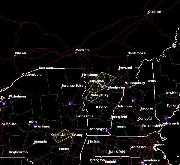 At 241 pm edt, doppler radar indicated a severe thunderstorm capable of producing quarter size hail and damaging winds in excess of 60 mph. this storm was located near underhill state park, or 11 miles east of essex junction, and moving northeast at 35 mph. * this severe thunderstorm will be near, underhill state park around 250 pm edt. cambridge around 300 pm edt. johnson and waterville around 305 pm edt. bakersfield and belvidere center around 315 pm edt. other locations impacted by this severe thunderstorm include north underhill, garfield, moscow, south cambridge, underhill center, pleasant valley, craftsbury common, east fletcher, north hyde park and north wolcott. At 241 pm edt, doppler radar indicated a severe thunderstorm capable of producing quarter size hail and damaging winds in excess of 60 mph. this storm was located near underhill state park, or 11 miles east of essex junction, and moving northeast at 35 mph. * this severe thunderstorm will be near, underhill state park around 250 pm edt. cambridge around 300 pm edt. johnson and waterville around 305 pm edt. bakersfield and belvidere center around 315 pm edt. other locations impacted by this severe thunderstorm include north underhill, garfield, moscow, south cambridge, underhill center, pleasant valley, craftsbury common, east fletcher, north hyde park and north wolcott.
|
|
|
| 5/27/2015 2:09 PM EDT |
The severe thunderstorm warning for northern lamoille, southern grand isle, northern chittenden, southwestern orleans and franklin counties will expire at 215 pm edt, the storm which prompted the warning has weakened below severe limits, and no longer poses an immediate threat to life or property. therefore the warning will be allowed to expire. however gusty winds and heavy rain are still possible with this thunderstorm.
|
| 5/27/2015 1:57 PM EDT |
At 156 pm edt, doppler radar indicated a severe thunderstorm capable of producing quarter size hail and damaging winds in excess of 60 mph. this storm was located over georgia center, moving northeast at 40 mph. locations impacted include, south burlington, colchester, essex junction, burlington international airport, winooski, fairfax, underhill, richford, sheldon, westford, fairfield, berkshire, south hero, johnson, enosburg falls, eden, bakersfield, fletcher, montgomery and lowell.
|
| 5/27/2015 1:43 PM EDT |
At 141 pm edt, doppler radar indicated a severe thunderstorm capable of producing quarter size hail and damaging winds in excess of 60 mph. this storm was located over south hero, moving northeast at 35 mph. locations impacted include, south burlington, colchester, essex junction, burlington international airport, winooski, peru, fairfax, underhill, richford, sheldon, westford, fairfield, berkshire, south hero, johnson, enosburg falls, eden, bakersfield, fletcher and montgomery.
|
| 5/27/2015 1:21 PM EDT |
At 121 pm edt, doppler radar indicated a severe thunderstorm capable of producing quarter size hail and damaging winds in excess of 60 mph. this storm was located near peru, and moving northeast at 40 mph. * locations to be impacted include, south burlington, colchester, essex junction, burlington international airport, winooski, peru, jericho, fairfax, underhill, richford, sheldon, westford, fairfield, berkshire, south hero, johnson, enosburg falls, eden, bakersfield and fletcher.
|
| 7/19/2013 7:36 PM EDT |
Trees down at johnson state college in lamoille county VT, 0.3 miles SSE of Johnson, VT
|
| 1/1/0001 12:00 AM |
Quarter sized hail reported 1 miles WNW of Johnson, VT, quarter size hail reported on collins hill road by local tv meteorologist
|
| 1/1/0001 12:00 AM |
Ping Pong Ball sized hail reported 0.3 miles SSE of Johnson, VT, 32 inch diameter tree downed by thuderstorm winds as well as one and an half inch diameter hail reported.
|
| 1/1/0001 12:00 AM |
32 inch diameter tree downed by thuderstorm winds as well as one and an half inch diameter hail reporte in lamoille county VT, 0.3 miles SSE of Johnson, VT
|
| 1/1/0001 12:00 AM |
Quarter sized hail reported 0.3 miles SSE of Johnson, VT, quarter size hail reported along route 15 in johnson
|
 The storm which prompted the warning has moved out of the area. therefore, the warning will be allowed to expire.
 At 431 pm edt, a severe thunderstorm was located over cloverdale, moving northeast at 30 mph (public reported power outages likely due to wind damage). Hazards include 60 mph wind gusts and penny size hail. Expect damage to trees and powerlines. Locations impacted include, essex junction, south burlington, burlington international airport, burlington, johnson village, cambridge, winooski, cambridge village, westford, jeffersonville village, colchester, essex junction village, fairfax, williston, waterville, underhill, jericho, essex, jericho village, and johnson.
 Svrbtv the national weather service in burlington has issued a * severe thunderstorm warning for, southeastern clinton county in northern new york, northeastern essex county in northern new york, northwestern lamoille county in northwestern vermont, northern chittenden county in northwestern vermont, south central franklin county in northwestern vermont, * until 500 pm edt. * at 400 pm edt, a severe thunderstorm was located over burlington, moving northeast at 30 mph (radar indicated). Hazards include 60 mph wind gusts and penny size hail. expect damage to trees and powerlines
 At 516 pm edt, a severe thunderstorm was located over south hinesburg, moving northeast at 35 mph (radar indicated). Hazards include 60 mph wind gusts. Expect damage to trees and powerlines. locations impacted include, vergennes, morrisville, johnson village, charlotte, waltham, stowe, monkton ridge, waterbury village, monkton, monkton boro, hyde park, worcester, middlesex, bolton, richmond, mt. philo state park, underhill, jericho, hinesburg, and st. George.
 Svrbtv the national weather service in burlington has issued a * severe thunderstorm warning for, central lamoille county in northwestern vermont, north central addison county in central vermont, central chittenden county in northwestern vermont, northern washington county in central vermont, * until 545 pm edt. * at 451 pm edt, a severe thunderstorm was located over button bay, moving northeast at 30 mph (radar indicated). Hazards include 60 mph wind gusts. expect damage to trees and powerlines
 Svrbtv the national weather service in burlington has issued a * severe thunderstorm warning for, central lamoille county in northwestern vermont, southwestern orleans county in northeastern vermont, central chittenden county in northwestern vermont, northern washington county in central vermont, * until 500 pm edt. * at 412 pm edt, a severe thunderstorm was located over jericho village, moving east at 25 mph (radar indicated). Hazards include 60 mph wind gusts and penny size hail. expect damage to trees and powerlines
 Svrbtv the national weather service in burlington has issued a * severe thunderstorm warning for, lamoille county in northwestern vermont, central caledonia county in northeastern vermont, southern orleans county in northeastern vermont, northeastern chittenden county in northwestern vermont, northeastern washington county in central vermont, southeastern franklin county in northwestern vermont, * until 515 pm edt. * at 432 pm edt, a severe thunderstorm was located over cloverdale, moving east at 35 mph (radar indicated). Hazards include 60 mph wind gusts and quarter size hail. Minor hail damage to vehicles is possible. Expect wind damage to trees and powerlines.
 The severe thunderstorm warning for northeastern clinton, lamoille, northern addison, grand isle, chittenden, western washington and franklin counties will expire at 445 pm edt, the storms which prompted the warning have moved out of the warned area. therefore, the warning will be allowed to expire.
 The severe thunderstorm warning for northeastern clinton, lamoille, northern addison, grand isle, chittenden, western washington and franklin counties will expire at 445 pm edt, the storms which prompted the warning have moved out of the warned area. therefore, the warning will be allowed to expire.
 The severe thunderstorm warning for northwestern lamoille and southeastern franklin counties will expire at 1245 am edt, the storm which prompted the warning has weakened below severe limits, and no longer poses an immediate threat to life or property. therefore, the warning will be allowed to expire. however gusty winds and heavy rain are still possible with this thunderstorm.
 At 1223 am edt, a severe thunderstorm was located over fletcher, moving east at 15 mph (radar indicated). Hazards include 60 mph wind gusts. Expect damage to trees and powerlines. locations impacted include, johnson village, waterville, johnson, jeffersonville village, bakersfield, cambridge village, belvidere center, fletcher, fairfield, belvidere, cambridge, montgomery, fairfax, enosburg, eden, jeffersonville, east fletcher, east fairfield, binghamville, and belvidere junction. hail threat, radar indicated max hail size, <. 75 in wind threat, radar indicated max wind gust, 60 mph.
 At 1202 am edt, a severe thunderstorm was located near north fairfax, moving east at 15 mph (radar indicated). Hazards include 60 mph wind gusts and quarter size hail. Minor hail damage to vehicles is possible. expect wind damage to trees and powerlines. locations impacted include, johnson village, waterville, cambridge, bakersfield, cambridge village, johnson, jeffersonville village, fairfax, belvidere center, fletcher, fairfield, belvidere, st. albans city, georgia, montgomery, morristown, westford, milton, enosburg, and st. albans town. hail threat, radar indicated max hail size, 1. 00 in wind threat, radar indicated max wind gust, 60 mph.
 At 1141 pm edt, a severe thunderstorm was located over lime rock point, moving east at 20 mph (radar indicated). Hazards include 60 mph wind gusts and quarter size hail. Minor hail damage to vehicles is possible. Expect wind damage to trees and powerlines.
 At 633 pm edt, a severe thunderstorm was located near lowell, moving north at 20 mph (radar indicated). Hazards include 60 mph wind gusts and quarter size hail. Minor hail damage to vehicles is possible. Expect wind damage to trees and powerlines.
 At 618 pm edt, a severe thunderstorm was located over bolton, moving northeast at 45 mph (public reported trees down near williston with this storm). Hazards include 60 mph wind gusts and quarter size hail. Minor hail damage to vehicles is possible. expect wind damage to trees and powerlines. locations impacted include, vergennes, montpelier, morrisville, johnson village, calais, cambridge, monkton ridge, waterbury village, monkton, westford, monkton boro, williston, worcester, middlesex, hinesburg, st. george, morrisville village, woodbury, moretown, and starksboro. hail threat, radar indicated max hail size, 1. 00 in wind threat, radar indicated max wind gust, 60 mph.
 At 555 pm edt, a severe thunderstorm was located over hinesburg, moving northeast at 45 mph (radar indicated). Hazards include 60 mph wind gusts and quarter size hail. Minor hail damage to vehicles is possible. Expect wind damage to trees and powerlines.
 At 555 pm edt, a severe thunderstorm was located over hinesburg, moving northeast at 45 mph (radar indicated). Hazards include 60 mph wind gusts and quarter size hail. Minor hail damage to vehicles is possible. Expect wind damage to trees and powerlines.
 At 539 pm edt, a severe thunderstorm was located over north hyde park, moving southeast at 25 mph (radar indicated). Hazards include 60 mph wind gusts and quarter size hail. Minor hail damage to vehicles is possible. Expect wind damage to trees and powerlines.
 The severe thunderstorm warning for central lamoille, northern caledonia, central orleans and east central franklin counties will expire at 515 pm edt, the storm which prompted the warning has weakened below severe limits, and no longer poses an immediate threat to life or property. therefore, the warning will be allowed to expire. however small hail, gusty winds and heavy rain are still possible with this thunderstorm. a severe thunderstorm watch remains in effect until 800 pm edt for northeastern and northwestern vermont.
 At 448 pm edt, a severe thunderstorm was located over albany center, moving northeast at 55 mph (radar indicated). Hazards include 60 mph wind gusts and penny size hail. Expect damage to trees and powerlines. locations impacted include, newport city, morrisville, orleans, greensboro, johnson village, newport town, eden, orleans village, glover, brownington, albany, hyde park, sutton, wolcott, coventry, barton, sheffield, brownington village, west burke village and irasburg. hail threat, radar indicated max hail size, 0. 75 in wind threat, radar indicated max wind gust, 60 mph.
 At 434 pm edt, a severe thunderstorm was located over north hyde park, moving northeast at 55 mph (radar indicated). Hazards include 60 mph wind gusts and penny size hail. Expect damage to trees and powerlines. locations impacted include, newport city, morrisville, orleans, greensboro, johnson village, newport town, eden, cambridge, orleans village, cambridge village, glover, brownington, albany, jeffersonville village, hyde park, sutton, wolcott, coventry, barton and sheffield. hail threat, radar indicated max hail size, 0. 75 in wind threat, radar indicated max wind gust, 60 mph.
 At 416 pm edt, a severe thunderstorm was located over underhill, moving northeast at 55 mph (radar indicated). Hazards include 60 mph wind gusts and penny size hail. expect damage to trees and powerlines
 At 1209 pm edt, a severe thunderstorm was located over morrisville village, moving northeast at 30 mph (radar indicated). Hazards include 60 mph wind gusts and quarter size hail. Minor hail damage to vehicles is possible. Expect wind damage to trees and powerlines.
 At 1147 am edt, a severe thunderstorm was located over milton, moving northeast at 35 mph (radar indicated). Hazards include 60 mph wind gusts and quarter size hail. Minor hail damage to vehicles is possible. Expect wind damage to trees and powerlines.
 At 1147 am edt, a severe thunderstorm was located over milton, moving northeast at 35 mph (radar indicated). Hazards include 60 mph wind gusts and quarter size hail. Minor hail damage to vehicles is possible. Expect wind damage to trees and powerlines.
 The severe thunderstorm warning for northern lamoille, western orleans, northeastern chittenden and eastern franklin counties will expire at 400 pm edt, the storms which prompted the warning have weakened below severe limits, and no longer pose an immediate threat to life or property. therefore, the warning will be allowed to expire. however gusty winds are still possible with these thunderstorms. a severe thunderstorm watch remains in effect until 700 pm edt for northwestern vermont.
 At 324 pm edt, severe thunderstorms were located along a line extending from near stowe to south lincoln to near bread loaf, moving east at 45 mph (emergency management). Hazards include 60 mph wind gusts. Expect damage to trees and powerlines. Locations impacted include, montpelier, middlebury, morrisville, braintree hill, cambridge, salisbury, waterbury village, lincoln, hyde park, worcester, middlesex, granville, hancock, ripton, morrisville village, moretown, underhill state park, leicester, e f knapp state airport and elmore.
 At 320 pm edt, severe thunderstorms were located along a line extending from 16 miles north of morses line to near east franklin to east sheldon, moving northeast at 60 mph (radar indicated). Hazards include 60 mph wind gusts. Expect damage to trees and powerlines. locations impacted include, enosburg falls, franklin, johnson village, jay, jay in franklin county, eden, cambridge, bakersfield, cambridge village, berkshire, montgomery center, jeffersonville village, hyde park, montgomery, troy, sheldon, belvidere center, lake carmi state park, enosburg and belvidere. hail threat, radar indicated max hail size, <. 75 in wind threat, radar indicated max wind gust, 60 mph.
 At 302 pm edt, severe thunderstorms were located along a line extending from williston to near cornwall to shoreham, moving east at 45 mph. multiple reports of trees down have been reported with these storms (emergency management). Hazards include 60 mph wind gusts. Expect damage to trees and powerlines. Locations impacted include, essex junction, middlebury, vergennes, montpelier, south burlington, morrisville, johnson village, cornwall, braintree hill, weybridge, cambridge, salisbury, monkton ridge, waterbury village, lincoln, orwell, monkton, westford, monkton boro and hyde park.
 At 302 pm edt, severe thunderstorms were located along a line extending from williston to near cornwall to shoreham, moving east at 45 mph. multiple reports of trees down have been reported with these storms (emergency management). Hazards include 60 mph wind gusts. Expect damage to trees and powerlines. Locations impacted include, essex junction, middlebury, vergennes, montpelier, south burlington, morrisville, johnson village, cornwall, braintree hill, weybridge, cambridge, salisbury, monkton ridge, waterbury village, lincoln, orwell, monkton, westford, monkton boro and hyde park.
 At 255 pm edt, severe thunderstorms were located along a line extending from province point to st. albans city to west milton, moving northeast at 55 mph (radar indicated). Hazards include 60 mph wind gusts. expect damage to trees and powerlines
 At 239 pm edt, severe thunderstorms were located along a line extending from boquet river point to ironville to near pharoah mountain, moving east at 45 mph. there have been reports of downed trees near schroon lake in association with these storms (emergency management). Hazards include 60 mph wind gusts. expect damage to trees and powerlines
 At 239 pm edt, severe thunderstorms were located along a line extending from boquet river point to ironville to near pharoah mountain, moving east at 45 mph. there have been reports of downed trees near schroon lake in association with these storms (emergency management). Hazards include 60 mph wind gusts. expect damage to trees and powerlines
 The severe thunderstorm warning for southwestern lamoille, northeastern chittenden, northwestern washington and south central franklin counties will expire at 630 pm edt, the storm which prompted the warning has weakened below severe limits, and no longer poses an immediate threat to life or property. therefore, the warning will be allowed to expire.
 At 609 pm edt, a severe thunderstorm was located over north underhill, moving northeast at 40 mph (radar indicated). Hazards include 60 mph wind gusts and penny size hail. Expect damage to trees and powerlines. locations impacted include, essex junction, morrisville, cambridge, cambridge village, stowe, westford, jeffersonville village, fairfax, bolton, richmond, underhill, jericho, morrisville village, essex, jericho village, underhill state park, morristown, fletcher, essex junction village and johnson village. hail threat, radar indicated max hail size, 0. 75 in wind threat, radar indicated max wind gust, 60 mph.
 At 548 pm edt, a severe thunderstorm was located over red rock point, moving northeast at 40 mph (radar indicated). Hazards include 60 mph wind gusts. expect damage to trees and powerlines
 At 548 pm edt, a severe thunderstorm was located over red rock point, moving northeast at 40 mph (radar indicated). Hazards include 60 mph wind gusts. expect damage to trees and powerlines
 At 808 pm edt, a line of severe thunderstorms over northern and central vermont was located along a line extending from near east richford to near wolcott to ainsworth state park to near pittsfield, moving east at 30 mph (radar indicated). Hazards include 60 mph wind gusts and quarter size hail. Expect wind damage to trees and powerlines. minor hail damage to vehicles is possible. these storms have a history of producing wind damage and power outages. locations impacted include, barre, montpelier, island pond, lyndon, st. Johnsbury, middlebury, newport city, vergennes, crown point, morrisville, enosburg falls, orleans, derby center, charleston, braintree hill, glover, waterbury village, montgomery center, websterville and orwell.
 At 808 pm edt, a line of severe thunderstorms over northern and central vermont was located along a line extending from near east richford to near wolcott to ainsworth state park to near pittsfield, moving east at 30 mph (radar indicated). Hazards include 60 mph wind gusts and quarter size hail. Expect wind damage to trees and powerlines. minor hail damage to vehicles is possible. these storms have a history of producing wind damage and power outages. locations impacted include, barre, montpelier, island pond, lyndon, st. Johnsbury, middlebury, newport city, vergennes, crown point, morrisville, enosburg falls, orleans, derby center, charleston, braintree hill, glover, waterbury village, montgomery center, websterville and orwell.
 At 730 pm edt, a line of severe thunderstorms over western vermont was located along a line extending from near east franklin to stowe to east warren to mossy point, moving east at 40 mph (radar indicated). Hazards include 60 mph wind gusts and quarter size hail. Expect wind damage to trees and powerlines. minor hail damage to vehicles is possible. This line of storms has a history of producing wind damage and power outages.
 At 730 pm edt, a line of severe thunderstorms over western vermont was located along a line extending from near east franklin to stowe to east warren to mossy point, moving east at 40 mph (radar indicated). Hazards include 60 mph wind gusts and quarter size hail. Expect wind damage to trees and powerlines. minor hail damage to vehicles is possible. This line of storms has a history of producing wind damage and power outages.
 At 704 pm edt, a line of severe thunderstorms over northwest vermont and essex county new york was located along a line extending from shad island to south burlington to near chilson, new york moving east at 35 mph (radar indicated). Hazards include 60 mph wind gusts and quarter size hail. Expect wind damage to trees and powerlines. minor hail damage to vehicles is possible. Locations impacted include, essex junction, plattsburgh international airport, burlington, burlington international airport, plattsburgh, middlebury, south burlington, vergennes, peru, beekmantown, moriah, chazy, willsboro, crown point, morrisville, enosburg falls, westport, elizabethtown, champlain and waterbury village.
 At 704 pm edt, a line of severe thunderstorms over northwest vermont and essex county new york was located along a line extending from shad island to south burlington to near chilson, new york moving east at 35 mph (radar indicated). Hazards include 60 mph wind gusts and quarter size hail. Expect wind damage to trees and powerlines. minor hail damage to vehicles is possible. Locations impacted include, essex junction, plattsburgh international airport, burlington, burlington international airport, plattsburgh, middlebury, south burlington, vergennes, peru, beekmantown, moriah, chazy, willsboro, crown point, morrisville, enosburg falls, westport, elizabethtown, champlain and waterbury village.
 At 630 pm edt, a line of severe thunderstorms over northeast new york was located along a line extending from near perry mills to near harkness to 9 miles west of schroon falls, moving east at 40 mph (radar indicated). Hazards include 60 mph wind gusts and quarter size hail. Expect wind damage to trees and powerlines. Minor hail damage to vehicles is possible.
 At 630 pm edt, a line of severe thunderstorms over northeast new york was located along a line extending from near perry mills to near harkness to 9 miles west of schroon falls, moving east at 40 mph (radar indicated). Hazards include 60 mph wind gusts and quarter size hail. Expect wind damage to trees and powerlines. Minor hail damage to vehicles is possible.
 The severe thunderstorm warning for western lamoille, northeastern chittenden, northwestern washington and south central franklin counties will expire at 900 pm edt, the storm which prompted the warning has weakened below severe limits, and has exited the warned area. therefore, the warning will be allowed to expire. however gusty winds and heavy rain are still possible with this thunderstorm.
 At 835 pm edt, a severe thunderstorm was located over smugglers notch, moving northeast at 25 mph (trained weather spotters reported a small tree was blow into a house in burlington at 8:03 pm and 12 inch diameter tree blown down in winooski at 8:05 pm. in addition, power outages are reported in the burlington, south burlington, and winooski areas from this severe thunderstorm this evening). Hazards include 60 mph wind gusts. Expect damage to trees and powerlines. locations impacted include, waterville, underhill, jericho, st. George, cambridge, cambridge village, stowe, essex, westford, jericho village, jeffersonville village, waterbury, underhill state park, williston, bolton, richmond, johnson, waterbury village, johnson village and belvidere.
 At 813 pm edt, a severe thunderstorm was located over north williston, moving east at 25 mph (radar indicated). Hazards include 60 mph wind gusts. Expect damage to trees and powerlines. locations impacted include, essex junction, burlington international airport, south burlington, burlington, cambridge, winooski, cambridge village, stowe, westford, jeffersonville village, essex junction village, williston, bolton, richmond, waterville, underhill, jericho, st. George, essex and jericho village.
 At 759 pm edt, a severe thunderstorm was located over south burlington, moving northeast at 25 mph (radar indicated). Hazards include 60 mph wind gusts and penny size hail. expect damage to trees and powerlines
 At 759 pm edt, a severe thunderstorm was located over south burlington, moving northeast at 25 mph (radar indicated). Hazards include 60 mph wind gusts and penny size hail. expect damage to trees and powerlines
 At 518 pm edt, a severe thunderstorm was located over north duxbury, moving southeast at 45 mph (radar indicated). Hazards include 60 mph wind gusts and quarter size hail. Minor hail damage to vehicles is possible. Expect wind damage to trees and powerlines.
 At 518 pm edt, a severe thunderstorm was located over north duxbury, moving southeast at 45 mph (radar indicated). Hazards include 60 mph wind gusts and quarter size hail. Minor hail damage to vehicles is possible. Expect wind damage to trees and powerlines.
 At 455 pm edt, a severe thunderstorm was located over north cambridge, moving southeast at 35 mph (radar indicated). Hazards include 70 mph wind gusts and quarter size hail. Minor hail damage to vehicles is possible. expect considerable tree damage. wind damage is also likely to mobile homes, roofs, and outbuildings. Locations impacted include, waterville, johnson village, cambridge, bakersfield, cambridge village, westford, johnson, jeffersonville village, hyde park, fairfax, georgia center, belvidere center, fletcher, fairfield, georgia, milton, belvidere, underhill, essex and eden.
 At 430 pm edt, a severe thunderstorm was located over swanton junction, moving southeast at 35 mph (radar indicated). Hazards include 60 mph wind gusts and quarter size hail. Minor hail damage to vehicles is possible. Expect wind damage to trees and powerlines.
 At 430 pm edt, a severe thunderstorm was located over swanton junction, moving southeast at 35 mph (radar indicated). Hazards include 60 mph wind gusts and quarter size hail. Minor hail damage to vehicles is possible. Expect wind damage to trees and powerlines.
 The severe thunderstorm warning for northeastern lamoille county will expire at 630 pm edt, the storm which prompted the warning has weakened below severe limits, and no longer poses an immediate threat to life or property. therefore, the warning will be allowed to expire.
 At 603 pm edt, a severe thunderstorm was located near eden, and is drifting north to northwest around 5 mph (radar indicated). Hazards include 60 mph wind gusts and penny size hail. Expect damage to trees and powerlines. Locations impacted include, johnson village, johnson, hyde park, hyde park village, eden, morrisville village, waterville, belvidere, wolcott, morristown, garfield, north hyde park, east johnson and green river reservoir.
 The national weather service in burlington has issued a * severe thunderstorm warning for. northeastern lamoille county in northwestern vermont. until 630 pm edt. At 538 pm edt, a severe thunderstorm was located over hyde park, and drifting northwest around 5 mph.
 At 754 pm edt, a severe thunderstorm was located over westford, moving northeast at 50 mph (radar indicated). Hazards include 60 mph wind gusts and quarter size hail. Minor hail damage to vehicles is possible. expect wind damage to trees and powerlines. Locations impacted include, waterville, johnson village, cambridge, bakersfield, cambridge village, essex, westford, johnson, jeffersonville village, fairfax, fletcher, milton, fairfield, georgia, underhill, belvidere, enosburg, jeffersonville, east fletcher and binghamville.
 At 739 pm edt, a severe thunderstorm was located over derway island, moving northeast at 50 mph (radar indicated). Hazards include 60 mph wind gusts and quarter size hail. Minor hail damage to vehicles is possible. Expect wind damage to trees and powerlines.
 At 739 pm edt, a severe thunderstorm was located over derway island, moving northeast at 50 mph (radar indicated). Hazards include 60 mph wind gusts and quarter size hail. Minor hail damage to vehicles is possible. Expect wind damage to trees and powerlines.
 At 433 pm edt, a severe thunderstorm was located over johnson, moving east at 40 mph (radar indicated). Hazards include 60 mph wind gusts and nickel size hail. Expect damage to trees and powerlines. Locations impacted include, waterville, johnson village, underhill, cambridge, cambridge village, westford, johnson, jeffersonville village, fairfax, fletcher, hyde park village, morrisville village, bakersfield, morristown, essex, belvidere, milton, hyde park, jericho and georgia.
 At 356 pm edt, a severe thunderstorm was located over winooski, moving east at 40 mph (radar indicated). Hazards include 60 mph wind gusts and nickel size hail. Expect damage to trees and powerlines. This storm has a history of wind damage.
 At 356 pm edt, a severe thunderstorm was located over winooski, moving east at 40 mph (radar indicated). Hazards include 60 mph wind gusts and nickel size hail. Expect damage to trees and powerlines. This storm has a history of wind damage.
 At 343 pm edt, severe thunderstorms were located along a line extending from bluff point to mount marcy, moving east at 65 mph (radar indicated). Hazards include 60 mph wind gusts. expect damage to trees and powerlines
 At 343 pm edt, severe thunderstorms were located along a line extending from bluff point to mount marcy, moving east at 65 mph (radar indicated). Hazards include 60 mph wind gusts. expect damage to trees and powerlines
 At 459 pm edt, a severe thunderstorm was located near smugglers notch, moving northeast at 35 mph (radar indicated). Hazards include 60 mph wind gusts and quarter size hail. Minor hail damage to vehicles is possible. Expect wind damage to trees and powerlines.
 At 427 pm edt, severe thunderstorms were located along a line extending from 18 miles north of morses line to georgia center, moving east at 15 mph (vtrans reported 76 mph gust at north hero project in addition to several trees down with multiple power outages being reported). Hazards include 70 mph wind gusts and quarter size hail. Minor hail damage to vehicles is possible. expect considerable tree damage. wind damage is also likely to mobile homes, roofs, and outbuildings. locations impacted include, enosburg falls, franklin, johnson village, swanton village, cambridge, bakersfield, cambridge village, berkshire, highgate falls, montgomery center, jeffersonville village, montgomery, st. Albans city, fairfax, sheldon, belvidere center, georgia, lake carmi state park, enosburg and belvidere.
 At 354 pm edt, severe thunderstorms were located along a line extending from 19 miles north of morses line to hyde point, moving east at 15 mph (highway department reported wind gust of 76 mph in association with this line of storms). Hazards include 70 mph wind gusts and quarter size hail. Minor hail damage to vehicles is possible. expect considerable tree damage. wind damage is also likely to mobile homes, roofs, and outbuildings. locations impacted include, enosburg falls, franklin, alburgh village, johnson village, cambridge, montgomery center, montgomery, st. albans city, fairfax, sheldon, belvidere center, georgia, enosburg, swanton, waterville, grand isle, st. Albans town, south alburgh, johnson and alburgh.
 At 354 pm edt, severe thunderstorms were located along a line extending from 19 miles north of morses line to hyde point, moving east at 15 mph (highway department reported wind gust of 76 mph in association with this line of storms). Hazards include 70 mph wind gusts and quarter size hail. Minor hail damage to vehicles is possible. expect considerable tree damage. wind damage is also likely to mobile homes, roofs, and outbuildings. locations impacted include, enosburg falls, franklin, alburgh village, johnson village, cambridge, montgomery center, montgomery, st. albans city, fairfax, sheldon, belvidere center, georgia, enosburg, swanton, waterville, grand isle, st. Albans town, south alburgh, johnson and alburgh.
 At 345 pm edt, severe thunderstorms were located along a line extending from 19 miles north of morses line to ladd bay, moving east at 15 mph (radar indicated). Hazards include 60 mph wind gusts and quarter size hail. Minor hail damage to vehicles is possible. Expect wind damage to trees and powerlines.
 At 345 pm edt, severe thunderstorms were located along a line extending from 19 miles north of morses line to ladd bay, moving east at 15 mph (radar indicated). Hazards include 60 mph wind gusts and quarter size hail. Minor hail damage to vehicles is possible. Expect wind damage to trees and powerlines.
 At 820 pm edt, a severe thunderstorm was located over east fairfield, moving southeast at 25 mph (radar indicated). Hazards include 60 mph wind gusts and quarter size hail. Minor hail damage to vehicles is possible. Expect wind damage to trees and powerlines.
 At 544 pm edt, severe thunderstorms were located along a line extending from cambridge junction to underhill to near jericho center, moving east at 45 mph (multiple sources. line of storms has knocked a tree onto vehicle in downtown burlington. additionally, a 62mph gust was measures at a ny state mesonet in essex, ny. reports from emergency management of power poles snapped and trees down in willisboro along the tree down along i-87 near lewiston). Hazards include 60 mph wind gusts and penny size hail. Expect damage to trees and powerlines. locations impacted include, essex junction, south burlington, burlington international airport, burlington, morrisville, johnson village, cambridge, winooski, monkton ridge, waterbury village, westford, monkton boro, hyde park, essex junction village, williston, worcester, middlesex, hinesburg, st. George and morrisville village.
 At 544 pm edt, severe thunderstorms were located along a line extending from cambridge junction to underhill to near jericho center, moving east at 45 mph (multiple sources. line of storms has knocked a tree onto vehicle in downtown burlington. additionally, a 62mph gust was measures at a ny state mesonet in essex, ny. reports from emergency management of power poles snapped and trees down in willisboro along the tree down along i-87 near lewiston). Hazards include 60 mph wind gusts and penny size hail. Expect damage to trees and powerlines. locations impacted include, essex junction, south burlington, burlington international airport, burlington, morrisville, johnson village, cambridge, winooski, monkton ridge, waterbury village, westford, monkton boro, hyde park, essex junction village, williston, worcester, middlesex, hinesburg, st. George and morrisville village.
 At 530 pm edt, severe thunderstorms were located along a line extending from near westford to essex to near st. george, moving east at 45 mph (new york state mesonet in essex, ny reported wind gusts of 54 knots. additionally, social media reports tree branch downed on vehicle in downtown burlington). Hazards include 60 mph wind gusts and penny size hail. Expect damage to trees and powerlines. Locations impacted include, essex junction, south burlington, burlington international airport, burlington, willsboro, morrisville, johnson village, cambridge, winooski, monkton ridge, waterbury village, westford, monkton boro, hyde park, colchester, essex junction village, williston, worcester, middlesex and belvidere center.
 At 530 pm edt, severe thunderstorms were located along a line extending from near westford to essex to near st. george, moving east at 45 mph (new york state mesonet in essex, ny reported wind gusts of 54 knots. additionally, social media reports tree branch downed on vehicle in downtown burlington). Hazards include 60 mph wind gusts and penny size hail. Expect damage to trees and powerlines. Locations impacted include, essex junction, south burlington, burlington international airport, burlington, willsboro, morrisville, johnson village, cambridge, winooski, monkton ridge, waterbury village, westford, monkton boro, hyde park, colchester, essex junction village, williston, worcester, middlesex and belvidere center.
 At 508 pm edt, severe thunderstorms were located along a line extending from allen point to near the four brothers to near reber, moving east at 45 mph (radar indicated). Hazards include 60 mph wind gusts and penny size hail. expect damage to trees and powerlines
 At 508 pm edt, severe thunderstorms were located along a line extending from allen point to near the four brothers to near reber, moving east at 45 mph (radar indicated). Hazards include 60 mph wind gusts and penny size hail. expect damage to trees and powerlines
 At 711 pm edt, a severe thunderstorm was located over colchester, moving east at 40 mph (radar indicated). Hazards include 60 mph wind gusts and quarter size hail. Minor hail damage to vehicles is possible. Expect wind damage to trees and powerlines.
 At 650 pm edt, severe thunderstorms were located along a line extending from hyde park to east brookfield to near north sherburne, moving east at 50 mph (radar indicated). Hazards include 70 mph wind gusts and penny size hail. Expect considerable tree damage. damage is likely to mobile homes, roofs, and outbuildings. locations impacted include, barre, st. Johnsbury, montpelier, white river junction, lyndon, morrisville, braintree hill, bradford, waterbury village, websterville, burke, pomfret, worcester, middlesex, marshfield, cabot village, fairlee, west burke village, sharon and washington.
 At 628 pm edt, severe thunderstorms were located along a line extending from south cambridge to near northfield to east hubbardton, moving east at 50 mph (radar indicated). Hazards include 70 mph wind gusts and penny size hail. Expect considerable tree damage. Damage is likely to mobile homes, roofs, and outbuildings.
 At 600 pm edt, severe thunderstorms were located along a line extending from near appletree point to twilight bay to waltham, moving northeast at 35 mph (radar indicated). Hazards include 60 mph wind gusts. expect damage to trees and powerlines
 At 700 pm edt, severe thunderstorms were located along a line extending from cove island to near elmore state park, moving east at 40 mph (radar indicated). Hazards include 60 mph wind gusts and quarter size hail. Minor hail damage to vehicles is possible. Expect wind damage to trees and powerlines.
 The national weather service in burlington has issued a * severe thunderstorm warning for. southwestern lamoille county in northwestern vermont. northwestern addison county in central vermont. chittenden county in northwestern vermont. Western washington county in central vermont.
 The severe thunderstorm warning for northern lamoille and southeastern franklin counties will expire at 1215 am edt, the storm which prompted the warning has weakened and will be moving out of the warned area in the next 10 minutes. therefore the warning will be allowed to expire.
 At 1138 pm edt, a severe thunderstorm was located over waterville, moving northeast at 45 mph (radar indicated). Hazards include 60 mph wind gusts. Expect damage to trees and powerlines. Locations impacted include, waterville, johnson village, cambridge, bakersfield, cambridge village, johnson, jeffersonville village, hyde park, belvidere center, fletcher, belvidere, fairfield, hyde park village, eden, enosburg falls village, enosburg, fairfax, morristown, jeffersonville and east fletcher.
 At 1126 pm edt, a severe thunderstorm was located over cloverdale, moving northeast at 45 mph (radar indicated). Hazards include 60 mph wind gusts. expect damage to trees and powerlines
 The severe thunderstorm warning for lamoille, central addison, southeastern chittenden and washington counties will expire at 400 pm edt, the storms which prompted the warning have weakened below severe limits, and no longer pose an immediate threat to life or property. therefore the warning will be allowed to expire. a severe thunderstorm watch remains in effect until 900 pm edt for central, southern, northeastern and northwestern vermont.
 At 343 pm edt, a broken line of strong to locally severe thunderstorms were located along a line extending from north wolcott to northfield to near ripton, moving east at 35 mph (radar indicated). Hazards include 60 mph wind gusts and nickel size hail. Expect damage to trees and powerlines. Locations impacted include, barre, middlebury, montpelier, morrisville, johnson village, calais, weybridge, waterbury village, websterville, lincoln, hyde park, new haven, worcester, middlesex, granville, marshfield, cabot village, hancock, ripton and morrisville village.
 At 314 pm edt, severe thunderstorms were located along a line extending from near waterville to starksboro to near waltham, moving east at 35 mph (radar indicated). Hazards include 60 mph wind gusts and quarter size hail. Minor hail damage to vehicles is possible. Expect wind damage to trees and powerlines.
 At 549 pm edt, a severe thunderstorm was located over underhill state park, moving east at 40 mph (radar indicated). Hazards include 60 mph wind gusts and quarter size hail. Minor hail damage to vehicles is possible. expect wind damage to trees and powerlines. Locations impacted include, morrisville, johnson village, eden, cambridge, cambridge village, stowe, hardwick, jeffersonville village, hyde park, wolcott, worcester, cabot village, waterville, morrisville village, woodbury, cabot, johnson, waterbury, lowell and craftsbury.
 At 528 pm edt, a severe thunderstorm was located over north williston, moving east at 40 mph (radar indicated). Hazards include 60 mph wind gusts and quarter size hail. Minor hail damage to vehicles is possible. Expect wind damage to trees and powerlines.
 At 531 am edt, a severe thunderstorm was located over montgomery center, moving northeast at 30 mph (radar indicated). Hazards include 60 mph wind gusts. Expect damage to roofs. siding. and trees. Locations impacted include, fairfax, richford, berkshire, troy, johnson, enosburg falls, bakersfield, fletcher, montgomery, waterville, westfield, jay, cambridge, montgomery center, belvidere center, jay in franklin county, jeffersonville, north troy, enosburg center and north enosburg.
 At 449 am edt, a severe thunderstorm was located over fairfax, moving northeast at 30 mph (radar indicated). Hazards include 60 mph wind gusts. Expect damage to roofs. siding. And trees.
 At 507 pm edt, a severe thunderstorm was located near belvidere center, moving east at 25 mph (radar indicated). Hazards include 60 mph wind gusts and quarter size hail. Hail damage to vehicles is expected. Expect wind damage to roofs, siding, and trees.
 At 1134 pm edt, severe thunderstorms were located along a line extending from north troy to mount worcester, moving east at 35 mph (radar indicated). Hazards include 60 mph wind gusts and quarter size hail. Hail damage to vehicles is expected. expect wind damage to roofs, siding, and trees. Locations impacted include, island pond, stowe, hardwick, richford, danville, morrisville, berkshire, wolcott, troy, johnson, eden, bakersfield, concord, craftsbury, montgomery, irasburg, glover, coventry, sutton and canaan.
 At 1041 pm edt, severe thunderstorms were located along a line extending from alburg vermont to burlington vermont, moving east at 35 to 40 mph. other strong to severe thunderstorms were located over northeast vermont moving east at 35 mph (radar indicated). Hazards include 60 mph wind gusts and quarter size hail. Hail damage to vehicles is expected. Expect wind damage to roofs, siding, and trees.
 At 1041 pm edt, severe thunderstorms were located along a line extending from alburg vermont to burlington vermont, moving east at 35 to 40 mph. other strong to severe thunderstorms were located over northeast vermont moving east at 35 mph (radar indicated). Hazards include 60 mph wind gusts and quarter size hail. Hail damage to vehicles is expected. Expect wind damage to roofs, siding, and trees.
 At 1008 pm edt, an area of strong to severe thunderstorms was located from east fletcher vermont westward to cumberland head new york, moving east at 30 mph (radar indicated). Hazards include 60 mph wind gusts and quarter size hail. Hail damage to vehicles is expected. expect wind damage to roofs, siding, and trees. Locations impacted include, colchester, essex junction, plattsburgh international airport, grand isle, beekmantown, jericho, fairfax, chazy, underhill, westford, south hero, johnson, fletcher, north hero, waterville, isle la motte, cambridge, underhill state park, georgia center and schuyler falls.
 At 1008 pm edt, an area of strong to severe thunderstorms was located from east fletcher vermont westward to cumberland head new york, moving east at 30 mph (radar indicated). Hazards include 60 mph wind gusts and quarter size hail. Hail damage to vehicles is expected. expect wind damage to roofs, siding, and trees. Locations impacted include, colchester, essex junction, plattsburgh international airport, grand isle, beekmantown, jericho, fairfax, chazy, underhill, westford, south hero, johnson, fletcher, north hero, waterville, isle la motte, cambridge, underhill state park, georgia center and schuyler falls.
 At 941 pm edt, a severe thunderstorm was located over allens bay in clinton county, moving east at 35 mph (radar indicated). Hazards include 60 mph wind gusts and quarter size hail. Hail damage to vehicles is expected. Expect wind damage to roofs, siding, and trees.
 At 941 pm edt, a severe thunderstorm was located over allens bay in clinton county, moving east at 35 mph (radar indicated). Hazards include 60 mph wind gusts and quarter size hail. Hail damage to vehicles is expected. Expect wind damage to roofs, siding, and trees.
 At 858 pm edt, a severe thunderstorm was located near johnson vermont in lamoille county, moving southeast at 30 mph (radar indicated). Hazards include 60 mph wind gusts. Expect damage to roofs. siding. And trees.
 The severe thunderstorm warning for southeastern clinton, northeastern essex, lamoille, southern grand isle, northern chittenden and southwestern franklin counties will expire at 200 pm edt, the storm which prompted the warning has moved out of the area. therefore the warning will be allowed to expire. however gusty winds and heavy rain are still possible with this thunderstorm. a severe thunderstorm watch remains in effect until 800 pm edt for northern new york, and northeastern, central and northwestern vermont.
 The severe thunderstorm warning for southeastern clinton, northeastern essex, lamoille, southern grand isle, northern chittenden and southwestern franklin counties will expire at 200 pm edt, the storm which prompted the warning has moved out of the area. therefore the warning will be allowed to expire. however gusty winds and heavy rain are still possible with this thunderstorm. a severe thunderstorm watch remains in effect until 800 pm edt for northern new york, and northeastern, central and northwestern vermont.
 At 118 pm edt, a severe thunderstorm was located near colchester point, moving east at 55 mph (trained weather spotters reported trees downed in peru). Hazards include 60 mph wind gusts and quarter size hail. Hail damage to vehicles is expected. expect wind damage to roofs, siding, and trees. locations impacted include, south burlington, colchester, essex junction, burlington international airport, williston, winooski, grand isle, jericho, stowe, fairfax, underhill, westford, morrisville, south hero, johnson, eden, fletcher, waterville, hyde park and cambridge.
 At 118 pm edt, a severe thunderstorm was located near colchester point, moving east at 55 mph (trained weather spotters reported trees downed in peru). Hazards include 60 mph wind gusts and quarter size hail. Hail damage to vehicles is expected. expect wind damage to roofs, siding, and trees. locations impacted include, south burlington, colchester, essex junction, burlington international airport, williston, winooski, grand isle, jericho, stowe, fairfax, underhill, westford, morrisville, south hero, johnson, eden, fletcher, waterville, hyde park and cambridge.
 At 1259 pm edt, a severe thunderstorm was located over ausable point, moving east at 55 mph (radar indicated). Hazards include 60 mph wind gusts. Expect damage to roofs. siding. And trees.
 At 1259 pm edt, a severe thunderstorm was located over ausable point, moving east at 55 mph (radar indicated). Hazards include 60 mph wind gusts. Expect damage to roofs. siding. And trees.
 The severe thunderstorm warning for lamoille, northeastern chittenden, southwestern orleans, southern franklin and northwestern caledonia counties will expire at 345 pm edt, the storm which prompted the warning has weakened below severe limits, and no longer pose an immediate threat to life or property. therefore the warning will be allowed to expire. however heavy rain is still possible with this thunderstorm.
 At 300 pm edt, a severe thunderstorm was located over underhill state park, moving east at 25 mph (radar indicated). Hazards include 60 mph wind gusts and quarter size hail. Hail damage to vehicles is expected. expect wind damage to roofs, siding, and trees. locations impacted include, morrisville, wolcott, johnson, eden, craftsbury, greensboro, hyde park, cambridge, albany, underhill state park, jeffersonville, albany center, north underhill, south cambridge, north wolcott, green river reservoir, cloverdale, east johnson, lake elmore and tromp point.
 At 240 pm edt, a severe thunderstorm was located over hyde park, moving east at 30 mph (radar indicated). Hazards include quarter size hail. Damage to vehicles is expected. locations impacted include, morrisville, johnson, hyde park, garfield, east johnson, lake elmore, elmore state park, north hyde park, north wolcott, cadys falls and green river reservoir.
 At 238 pm edt, a severe thunderstorm was located over underhill, moving east at 25 mph (radar indicated). Hazards include 60 mph wind gusts and quarter size hail. Hail damage to vehicles is expected. Expect wind damage to roofs, siding, and trees.
 At 222 pm edt, a severe thunderstorm was located over cambridge, moving southeast at 15 mph (radar indicated). Hazards include quarter size hail. Damage to vehicles is expected. locations impacted include, morrisville, johnson, fletcher, waterville, hyde park, cambridge, jeffersonville, garfield, south cambridge, pleasant valley, binghamville, east fletcher, north hyde park, north wolcott, green river reservoir, cambridge junction, cloverdale, north cambridge, east johnson and lake elmore.
 At 154 pm edt, a severe thunderstorm was located near fairfax, moving east at 20 mph (radar indicated). Hazards include quarter size hail. damage to vehicles is expected
 At 1220 am edt, severe thunderstorms were located along a line extending from near waterville to near montpelier to bethel, moving east at 55 mph (radar indicated). Hazards include 60 mph wind gusts. Expect damage to roofs. siding. And trees.
 At 241 pm edt, doppler radar indicated a severe thunderstorm capable of producing quarter size hail and damaging winds in excess of 60 mph. this storm was located near underhill state park, or 11 miles east of essex junction, and moving northeast at 35 mph. * this severe thunderstorm will be near, underhill state park around 250 pm edt. cambridge around 300 pm edt. johnson and waterville around 305 pm edt. bakersfield and belvidere center around 315 pm edt. other locations impacted by this severe thunderstorm include north underhill, garfield, moscow, south cambridge, underhill center, pleasant valley, craftsbury common, east fletcher, north hyde park and north wolcott.


Connect with Interactive Hail Maps