

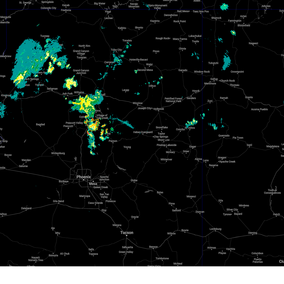
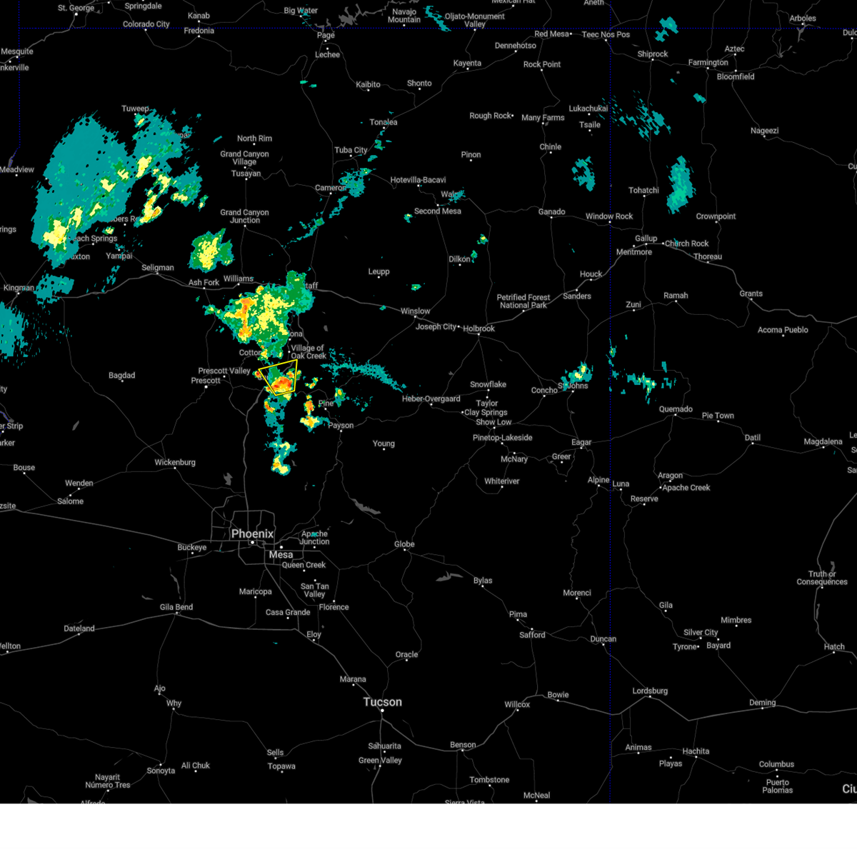
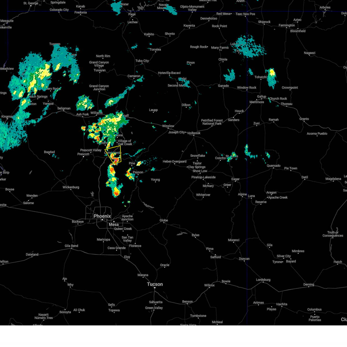
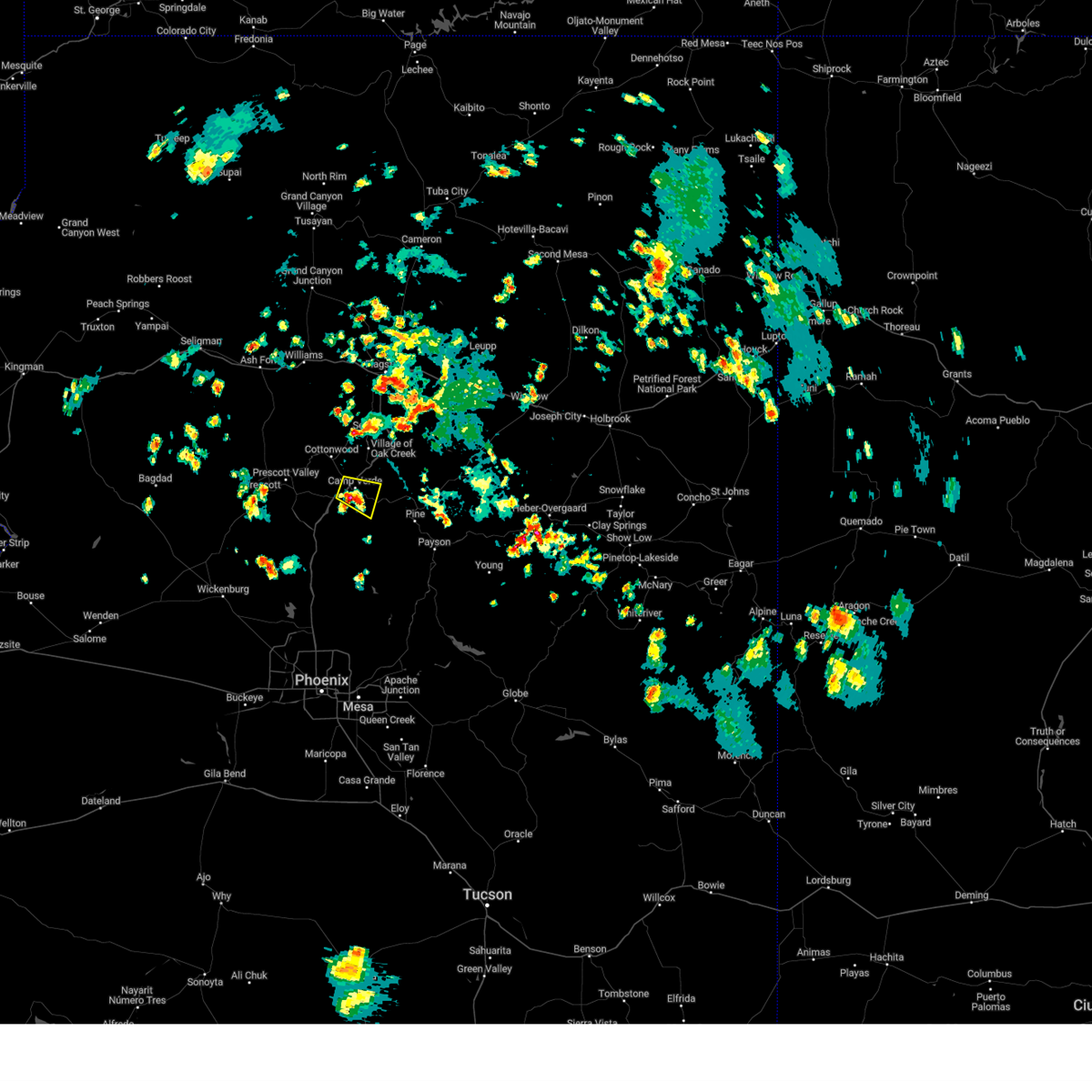
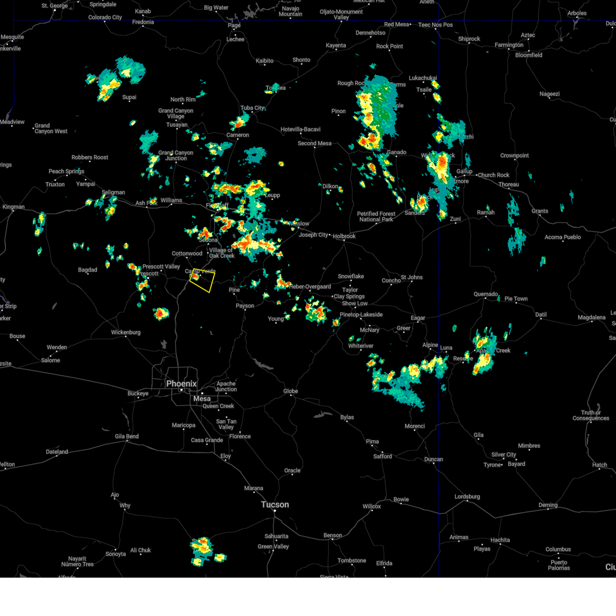
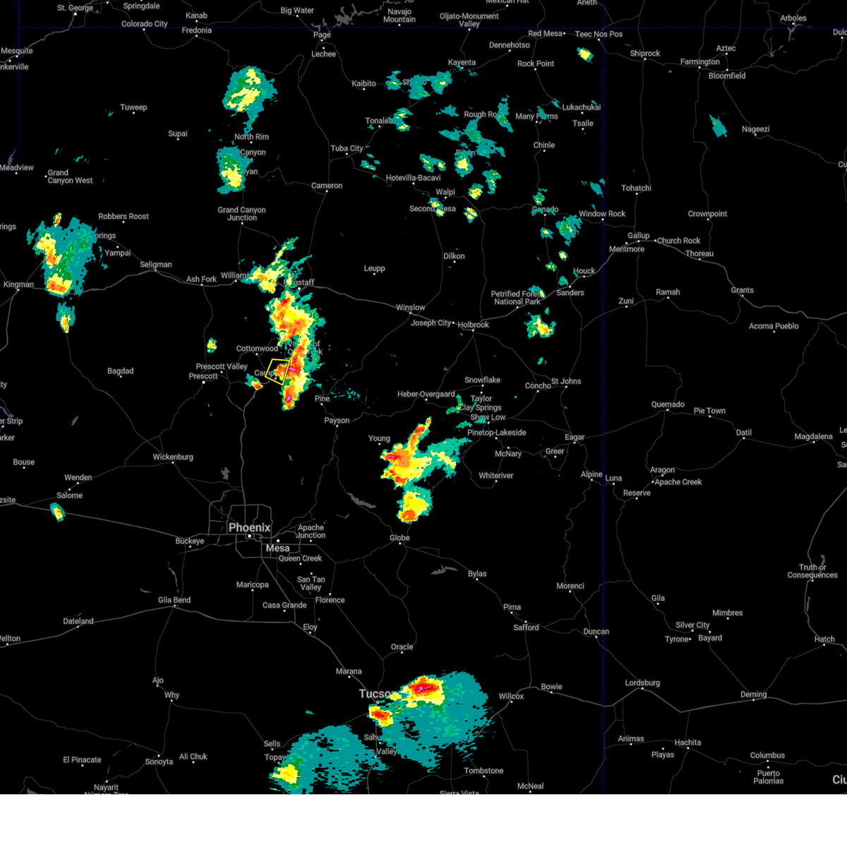
Hail Map for Lake Montezuma, AZ
The Lake Montezuma, AZ area has had 1 report of on-the-ground hail by trained spotters, and has been under severe weather warnings 9 times during the past 12 months. Doppler radar has detected hail at or near Lake Montezuma, AZ on 57 occasions, including 6 occasions during the past year.
| Name: | Lake Montezuma, AZ |
| Where Located: | 38.9 miles SSW of Flagstaff, AZ |
| Map: | Google Map for Lake Montezuma, AZ |
| Population: | 4706 |
| Housing Units: | 2334 |
| More Info: | Search Google for Lake Montezuma, AZ |
2
The Top Recent Hail Date for Lake Montezuma, AZ is Sunday, July 14, 2024 (5th out of 57)

Hail and Wind Damage Spotted near Lake Montezuma, AZ
| Date / Time | Report Details |
|---|---|
| 8/10/2024 8:32 PM MST |
 the severe thunderstorm warning has been cancelled and is no longer in effect the severe thunderstorm warning has been cancelled and is no longer in effect
|
| 8/10/2024 8:20 PM MST |
 At 819 pm mst, a severe thunderstorm was located over fort verde state historic park, or over camp verde, moving north at 20 mph (radar indicated). Hazards include 60 mph wind gusts and nickel size hail. Expect damage to roofs, siding, and trees. locations impacted include, verde lakes, camp verde, montezuma airport, beaverhead flat, wet beaver creek day use area, rockin' river ranch state park, montezuma castle national monument, mcguireville, out of africa wildlife park, fort verde state historic park, rimrock airport, mountain view estates, montezuma well, crane petroglyph heritage site, rimrock, lawrence crossing, middle verde, lake montezuma, bignotti, and cottonwood. this includes the following highways, interstate 17 between mile markers 284 and 302. state route 260 between mile markers 211 and 230. State route 179 between mile markers 299 and 301. At 819 pm mst, a severe thunderstorm was located over fort verde state historic park, or over camp verde, moving north at 20 mph (radar indicated). Hazards include 60 mph wind gusts and nickel size hail. Expect damage to roofs, siding, and trees. locations impacted include, verde lakes, camp verde, montezuma airport, beaverhead flat, wet beaver creek day use area, rockin' river ranch state park, montezuma castle national monument, mcguireville, out of africa wildlife park, fort verde state historic park, rimrock airport, mountain view estates, montezuma well, crane petroglyph heritage site, rimrock, lawrence crossing, middle verde, lake montezuma, bignotti, and cottonwood. this includes the following highways, interstate 17 between mile markers 284 and 302. state route 260 between mile markers 211 and 230. State route 179 between mile markers 299 and 301.
|
| 8/10/2024 8:05 PM MST |
 Svrfgz the national weather service in flagstaff has issued a * severe thunderstorm warning for, yavapai county in west central arizona, * until 845 pm mst. * at 804 pm mst, a severe thunderstorm was located over verde lakes, or near camp verde, moving north at 15 mph (radar indicated). Hazards include 60 mph wind gusts and quarter size hail. Hail damage to vehicles is expected. Expect wind damage to roofs, siding, and trees. Svrfgz the national weather service in flagstaff has issued a * severe thunderstorm warning for, yavapai county in west central arizona, * until 845 pm mst. * at 804 pm mst, a severe thunderstorm was located over verde lakes, or near camp verde, moving north at 15 mph (radar indicated). Hazards include 60 mph wind gusts and quarter size hail. Hail damage to vehicles is expected. Expect wind damage to roofs, siding, and trees.
|
| 7/25/2024 1:28 PM MST |
 The thunderstorm near camp verde which prompted the warning has weakened below severe limits and no longer poses an immediate threat to life or property. therefore, the warning will be allowed to expire. however, dime sized hail, gusty winds to 40 mph and very heavy rain are still possible with this thunderstorm, mainly south and southeast of camp verde. The thunderstorm near camp verde which prompted the warning has weakened below severe limits and no longer poses an immediate threat to life or property. therefore, the warning will be allowed to expire. however, dime sized hail, gusty winds to 40 mph and very heavy rain are still possible with this thunderstorm, mainly south and southeast of camp verde.
|
| 7/25/2024 1:03 PM MST |
 Svrfgz the national weather service in flagstaff has issued a * severe thunderstorm warning for, yavapai county in west central arizona, * until 130 pm mst. * at 102 pm mst, a severe thunderstorm was located over camp verde, moving east at 20 mph (radar indicated). Hazards include 60 mph wind gusts and nickel size hail. expect damage to roofs, siding, and trees Svrfgz the national weather service in flagstaff has issued a * severe thunderstorm warning for, yavapai county in west central arizona, * until 130 pm mst. * at 102 pm mst, a severe thunderstorm was located over camp verde, moving east at 20 mph (radar indicated). Hazards include 60 mph wind gusts and nickel size hail. expect damage to roofs, siding, and trees
|
| 7/17/2024 4:28 PM MST |
 The thunderstorm near camp verde that prompted the warning has weakened below severe limits and will be allowed to expire. very heavy rain and small hail is still occurring, just west and just east, of camp verde. The thunderstorm near camp verde that prompted the warning has weakened below severe limits and will be allowed to expire. very heavy rain and small hail is still occurring, just west and just east, of camp verde.
|
| 7/17/2024 4:05 PM MST |
 Svrfgz the national weather service in flagstaff has issued a * severe thunderstorm warning for, yavapai county in west central arizona, * until 430 pm mst. * at 405 pm mst, a severe thunderstorm was located over camp verde, moving south at 5 mph (radar indicated). Hazards include 60 mph wind gusts and nickel size hail. expect damage to roofs, siding, and trees Svrfgz the national weather service in flagstaff has issued a * severe thunderstorm warning for, yavapai county in west central arizona, * until 430 pm mst. * at 405 pm mst, a severe thunderstorm was located over camp verde, moving south at 5 mph (radar indicated). Hazards include 60 mph wind gusts and nickel size hail. expect damage to roofs, siding, and trees
|
| 7/14/2024 6:06 PM MST |
 the severe thunderstorm warning has been cancelled and is no longer in effect the severe thunderstorm warning has been cancelled and is no longer in effect
|
| 7/14/2024 5:38 PM MST |
 Svrfgz the national weather service in flagstaff has issued a * severe thunderstorm warning for, yavapai county in west central arizona, * until 630 pm mst. * at 537 pm mst, a severe thunderstorm was located over montezuma castle national monument, or near camp verde, moving north at 15 mph (radar indicated). Hazards include 60 mph wind gusts and quarter size hail. Hail damage to vehicles is expected. Expect wind damage to roofs, siding, and trees. Svrfgz the national weather service in flagstaff has issued a * severe thunderstorm warning for, yavapai county in west central arizona, * until 630 pm mst. * at 537 pm mst, a severe thunderstorm was located over montezuma castle national monument, or near camp verde, moving north at 15 mph (radar indicated). Hazards include 60 mph wind gusts and quarter size hail. Hail damage to vehicles is expected. Expect wind damage to roofs, siding, and trees.
|
| 8/31/2023 4:17 PM MST |
 At 415 pm mst, a severe thunderstorm was located near beaverhead flat, or 9 miles south of sedona, moving north at 10 mph (radar indicated). Hazards include 60 mph wind gusts and quarter size hail. Hail damage to vehicles is expected. expect wind damage to roofs, siding, and trees. locations impacted include, house mountain trail lookout, village of oak creek, beaverhead flat, jordan, red rock visitor center, mcguireville, lake montezuma, mormons crossing swimming hole, and bell rock. this includes the following highways, interstate 17 between mile markers 294 and 297, and near mile marker 300. state route 179 between mile markers 300 and 307. hail threat, radar indicated max hail size, 1. 00 in wind threat, radar indicated max wind gust, 60 mph. At 415 pm mst, a severe thunderstorm was located near beaverhead flat, or 9 miles south of sedona, moving north at 10 mph (radar indicated). Hazards include 60 mph wind gusts and quarter size hail. Hail damage to vehicles is expected. expect wind damage to roofs, siding, and trees. locations impacted include, house mountain trail lookout, village of oak creek, beaverhead flat, jordan, red rock visitor center, mcguireville, lake montezuma, mormons crossing swimming hole, and bell rock. this includes the following highways, interstate 17 between mile markers 294 and 297, and near mile marker 300. state route 179 between mile markers 300 and 307. hail threat, radar indicated max hail size, 1. 00 in wind threat, radar indicated max wind gust, 60 mph.
|
| 8/31/2023 3:58 PM MST |
 At 357 pm mst, a severe thunderstorm was located over beaverhead flat, or near camp verde, moving northeast at 10 mph (radar indicated). Hazards include 60 mph wind gusts and quarter size hail. Hail damage to vehicles is expected. Expect wind damage to roofs, siding, and trees. At 357 pm mst, a severe thunderstorm was located over beaverhead flat, or near camp verde, moving northeast at 10 mph (radar indicated). Hazards include 60 mph wind gusts and quarter size hail. Hail damage to vehicles is expected. Expect wind damage to roofs, siding, and trees.
|
| 7/28/2023 3:12 PM MST |
 The severe thunderstorm warning for yavapai county will expire at 315 pm mst, the storm south of camp verde which prompted the warning has weakened below severe limits, and no longer poses an immediate threat to life or property. this storm is still producing heavy rain and small hail but is no longer severe, therefore, the warning will be allowed to expire. The severe thunderstorm warning for yavapai county will expire at 315 pm mst, the storm south of camp verde which prompted the warning has weakened below severe limits, and no longer poses an immediate threat to life or property. this storm is still producing heavy rain and small hail but is no longer severe, therefore, the warning will be allowed to expire.
|
| 7/28/2023 2:47 PM MST |
 At 247 pm mst, a severe thunderstorm was located 8 miles southeast of camp verde, moving north at 5 mph (radar indicated). Hazards include 60 mph wind gusts and half dollar size hail. Hail damage to vehicles is expected. Expect wind damage to roofs, siding, and trees. At 247 pm mst, a severe thunderstorm was located 8 miles southeast of camp verde, moving north at 5 mph (radar indicated). Hazards include 60 mph wind gusts and half dollar size hail. Hail damage to vehicles is expected. Expect wind damage to roofs, siding, and trees.
|
| 7/17/2022 4:41 PM MST |
 The severe thunderstorm warning for yavapai county will expire at 445 pm mst, the storm which prompted the warning has weakened below severe limits, and has exited the warned area. therefore, the warning will be allowed to expire. however small hail, gusty winds and heavy rain are still possible with this thunderstorm. The severe thunderstorm warning for yavapai county will expire at 445 pm mst, the storm which prompted the warning has weakened below severe limits, and has exited the warned area. therefore, the warning will be allowed to expire. however small hail, gusty winds and heavy rain are still possible with this thunderstorm.
|
| 7/17/2022 4:01 PM MST |
 At 400 pm mst, a severe thunderstorm was located over montezuma castle national monument, or near camp verde, moving northwest at 15 mph (radar indicated). Hazards include 60 mph wind gusts and quarter size hail. Hail damage to vehicles is expected. Expect wind damage to roofs, siding, and trees. At 400 pm mst, a severe thunderstorm was located over montezuma castle national monument, or near camp verde, moving northwest at 15 mph (radar indicated). Hazards include 60 mph wind gusts and quarter size hail. Hail damage to vehicles is expected. Expect wind damage to roofs, siding, and trees.
|
| 6/28/2022 6:58 PM MST |
 At 657 pm mst, a severe thunderstorm was located over lake montezuma, or 7 miles northeast of camp verde, moving south at 5 mph (radar indicated). Hazards include 60 mph wind gusts and quarter size hail. Hail damage to vehicles is expected. Expect wind damage to roofs, siding, and trees. At 657 pm mst, a severe thunderstorm was located over lake montezuma, or 7 miles northeast of camp verde, moving south at 5 mph (radar indicated). Hazards include 60 mph wind gusts and quarter size hail. Hail damage to vehicles is expected. Expect wind damage to roofs, siding, and trees.
|
| 6/23/2022 6:12 PM MST |
 The severe thunderstorm warning for yavapai and coconino counties will expire at 615 pm mst, the storm which prompted the warning has weakened below severe limits, and no longer poses an immediate threat to life or property. therefore, the warning will be allowed to expire. however areas of heavy rain is still possible with thunderstorms in the area. The severe thunderstorm warning for yavapai and coconino counties will expire at 615 pm mst, the storm which prompted the warning has weakened below severe limits, and no longer poses an immediate threat to life or property. therefore, the warning will be allowed to expire. however areas of heavy rain is still possible with thunderstorms in the area.
|
| 6/23/2022 5:48 PM MST |
 At 546 pm mst, a severe thunderstorm was located near munds park, or 8 miles east of sedona, moving northeast at 45 mph (radar indicated). Hazards include 60 mph wind gusts and penny size hail. Expect damage to roofs, siding, and trees. locations impacted include, camp verde, sedona, munds park, mcguireville, village at oak creek, montezuma castle national monument, montezuma well, rimrock, middle verde, lake montezuma, cornville, wet beaver creek campground, red rock state park, v bar v visitors center and manzanita campground. hail threat, radar indicated max hail size, 0. 75 in wind threat, radar indicated max wind gust, 60 mph. At 546 pm mst, a severe thunderstorm was located near munds park, or 8 miles east of sedona, moving northeast at 45 mph (radar indicated). Hazards include 60 mph wind gusts and penny size hail. Expect damage to roofs, siding, and trees. locations impacted include, camp verde, sedona, munds park, mcguireville, village at oak creek, montezuma castle national monument, montezuma well, rimrock, middle verde, lake montezuma, cornville, wet beaver creek campground, red rock state park, v bar v visitors center and manzanita campground. hail threat, radar indicated max hail size, 0. 75 in wind threat, radar indicated max wind gust, 60 mph.
|
| 6/23/2022 5:29 PM MST |
 At 529 pm mst, a severe thunderstorm was located near village at oak creek, or 8 miles south of sedona, moving northeast at 45 mph (radar indicated). Hazards include 60 mph wind gusts and quarter size hail. Hail damage to vehicles is expected. Expect wind damage to roofs, siding, and trees. At 529 pm mst, a severe thunderstorm was located near village at oak creek, or 8 miles south of sedona, moving northeast at 45 mph (radar indicated). Hazards include 60 mph wind gusts and quarter size hail. Hail damage to vehicles is expected. Expect wind damage to roofs, siding, and trees.
|
| 8/17/2021 4:38 PM MST |
 The severe thunderstorm warning for yavapai county will expire at 445 pm mst, the storm which prompted the warning over the village of oak creek has weakened below severe limits, and no longer poses an immediate threat to life or property. therefore, the warning will be allowed to expire. however small hail, gusty winds and heavy rain are still possible with this thunderstorm. The severe thunderstorm warning for yavapai county will expire at 445 pm mst, the storm which prompted the warning over the village of oak creek has weakened below severe limits, and no longer poses an immediate threat to life or property. therefore, the warning will be allowed to expire. however small hail, gusty winds and heavy rain are still possible with this thunderstorm.
|
| 8/17/2021 4:19 PM MST |
 At 419 pm mst, a severe thunderstorm was located over village at oak creek, or near sedona, moving southeast at 10 mph (radar indicated). Hazards include 60 mph wind gusts and quarter size hail. Hail damage to vehicles is expected. Expect wind damage to roofs, siding, and trees. At 419 pm mst, a severe thunderstorm was located over village at oak creek, or near sedona, moving southeast at 10 mph (radar indicated). Hazards include 60 mph wind gusts and quarter size hail. Hail damage to vehicles is expected. Expect wind damage to roofs, siding, and trees.
|
| 7/16/2021 4:18 PM MST |
 At 417 pm mst, a severe thunderstorm was located over cornville, or 9 miles north of camp verde, and is nearly stationary (radar indicated). Hazards include 50 mph wind gusts and quarter size hail. hail damage to vehicles is expected At 417 pm mst, a severe thunderstorm was located over cornville, or 9 miles north of camp verde, and is nearly stationary (radar indicated). Hazards include 50 mph wind gusts and quarter size hail. hail damage to vehicles is expected
|
| 7/13/2021 3:27 PM MST |
 At 326 pm mst, a severe thunderstorm was located over camp verde, and is nearly stationary (radar indicated). Hazards include 60 mph wind gusts and half dollar size hail. Hail damage to vehicles is expected. Expect wind damage to roofs, siding, and trees. At 326 pm mst, a severe thunderstorm was located over camp verde, and is nearly stationary (radar indicated). Hazards include 60 mph wind gusts and half dollar size hail. Hail damage to vehicles is expected. Expect wind damage to roofs, siding, and trees.
|
| 7/9/2021 4:11 PM MST |
 At 410 pm mst, a severe thunderstorm was located over montezuma castle national monument, or just northeast of camp verde, moving southwest at 5 mph (radar indicated). Hazards include 70 mph wind gusts and quarter size hail. Hail damage to vehicles is expected. expect considerable tree damage. wind damage is also likely to mobile homes, roofs, and outbuildings. Locations impacted include, camp verde, mcguireville, montezuma well, montezuma castle national monument, rimrock, middle verde, lake montezuma and clear creek campgrounds. At 410 pm mst, a severe thunderstorm was located over montezuma castle national monument, or just northeast of camp verde, moving southwest at 5 mph (radar indicated). Hazards include 70 mph wind gusts and quarter size hail. Hail damage to vehicles is expected. expect considerable tree damage. wind damage is also likely to mobile homes, roofs, and outbuildings. Locations impacted include, camp verde, mcguireville, montezuma well, montezuma castle national monument, rimrock, middle verde, lake montezuma and clear creek campgrounds.
|
| 7/9/2021 3:50 PM MST | Golf Ball sized hail reported 1.6 miles W of Lake Montezuma, AZ, social media reports of lost livestock... chickens... and gardens as well as broken windows and roof damage. included photos of golf ball sized hail. |
| 7/9/2021 3:50 PM MST | Social media reports with pictures of blown roof and patio furniture... ac unit ripped off of roof... and broken tree limb in yavapai county AZ, 1.6 miles W of Lake Montezuma, AZ |
| 7/9/2021 3:42 PM MST |
 At 341 pm mst, a severe thunderstorm was located over lake montezuma, or 5 miles northeast of camp verde, moving southwest at 5 mph (radar indicated). Hazards include 70 mph wind gusts and ping pong ball size hail. People and animals outdoors will be injured. expect hail damage to roofs, siding, windows, and vehicles. expect considerable tree damage. Wind damage is also likely to mobile homes, roofs, and outbuildings. At 341 pm mst, a severe thunderstorm was located over lake montezuma, or 5 miles northeast of camp verde, moving southwest at 5 mph (radar indicated). Hazards include 70 mph wind gusts and ping pong ball size hail. People and animals outdoors will be injured. expect hail damage to roofs, siding, windows, and vehicles. expect considerable tree damage. Wind damage is also likely to mobile homes, roofs, and outbuildings.
|
| 6/30/2021 1:11 PM MST |
 The severe thunderstorm warning for yavapai county will expire at 115 pm mst, the storm which prompted the warning has weakened below severe limits, and no longer poses an immediate threat to life or property. therefore, the warning will be allowed to expire. however small hail, gusty winds up to 50 mph and heavy rain are still possible with this thunderstorm. The severe thunderstorm warning for yavapai county will expire at 115 pm mst, the storm which prompted the warning has weakened below severe limits, and no longer poses an immediate threat to life or property. therefore, the warning will be allowed to expire. however small hail, gusty winds up to 50 mph and heavy rain are still possible with this thunderstorm.
|
| 6/30/2021 1:02 PM MST |
 At 102 pm mst, a severe thunderstorm was located over camp verde, moving east at 5 mph (radar indicated). Hazards include 60 mph wind gusts and nickel size hail. Expect damage to roofs, siding, and trees. Locations impacted include, camp verde, middle verde, montezuma castle national monument and clear creek campgrounds. At 102 pm mst, a severe thunderstorm was located over camp verde, moving east at 5 mph (radar indicated). Hazards include 60 mph wind gusts and nickel size hail. Expect damage to roofs, siding, and trees. Locations impacted include, camp verde, middle verde, montezuma castle national monument and clear creek campgrounds.
|
| 6/30/2021 12:47 PM MST |
 At 1246 pm mst, a severe thunderstorm was located near camp verde, moving east at 5 mph (radar indicated). Hazards include 60 mph wind gusts and nickel size hail. expect damage to roofs, siding, and trees At 1246 pm mst, a severe thunderstorm was located near camp verde, moving east at 5 mph (radar indicated). Hazards include 60 mph wind gusts and nickel size hail. expect damage to roofs, siding, and trees
|
| 8/23/2020 4:10 PM MST |
 The severe thunderstorm warning for yavapai county will expire at 415 pm mst, the storm which prompted the warning has weakened below severe limits, and no longer poses an immediate threat to life or property. therefore, the warning will be allowed to expire. however gusty winds and heavy rain are still occurring with this thunderstorm. The severe thunderstorm warning for yavapai county will expire at 415 pm mst, the storm which prompted the warning has weakened below severe limits, and no longer poses an immediate threat to life or property. therefore, the warning will be allowed to expire. however gusty winds and heavy rain are still occurring with this thunderstorm.
|
| 8/23/2020 3:48 PM MST |
 At 348 pm mst, a severe thunderstorm was located near middle verde, or near camp verde, moving north at 10 mph (radar indicated). Hazards include 60 mph wind gusts and quarter size hail. Hail damage to vehicles is expected. Expect wind damage to roofs, siding, and trees. At 348 pm mst, a severe thunderstorm was located near middle verde, or near camp verde, moving north at 10 mph (radar indicated). Hazards include 60 mph wind gusts and quarter size hail. Hail damage to vehicles is expected. Expect wind damage to roofs, siding, and trees.
|
| 8/21/2020 5:22 PM MST |
 At 459 pm mst, a severe thunderstorm was located near cherry and cottonwood and is nearly stationary (radar indicated). Hazards include 60 mph wind gusts and quarter size hail. Hail damage to vehicles is expected. expect wind damage to roofs, siding, and trees. Locations impacted include, camp verde, prescott valley, clarkdale, verde village, cherry, bridgeport, cottonwood, middle verde, jerome, mingus mountain campground, playground group campground, potato patch campground and powell springs campground. At 459 pm mst, a severe thunderstorm was located near cherry and cottonwood and is nearly stationary (radar indicated). Hazards include 60 mph wind gusts and quarter size hail. Hail damage to vehicles is expected. expect wind damage to roofs, siding, and trees. Locations impacted include, camp verde, prescott valley, clarkdale, verde village, cherry, bridgeport, cottonwood, middle verde, jerome, mingus mountain campground, playground group campground, potato patch campground and powell springs campground.
|
| 8/21/2020 5:00 PM MST |
 At 459 pm mst, a severe thunderstorm was located near cherry and cottonwood and is nearly stationary (radar indicated). Hazards include 60 mph wind gusts and quarter size hail. Hail damage to vehicles is expected. expect wind damage to roofs, siding, and trees. Locations impacted include, camp verde, prescott valley, clarkdale, verde village, cherry, bridgeport, cottonwood, middle verde, jerome, mingus mountain campground, playground group campground, potato patch campground and powell springs campground. At 459 pm mst, a severe thunderstorm was located near cherry and cottonwood and is nearly stationary (radar indicated). Hazards include 60 mph wind gusts and quarter size hail. Hail damage to vehicles is expected. expect wind damage to roofs, siding, and trees. Locations impacted include, camp verde, prescott valley, clarkdale, verde village, cherry, bridgeport, cottonwood, middle verde, jerome, mingus mountain campground, playground group campground, potato patch campground and powell springs campground.
|
| 8/21/2020 4:46 PM MST |
 At 445 pm mst, a severe thunderstorm was located near cottonwood, or 15 miles northwest of camp verde, and is nearly stationary (radar indicated. this storm has a history of nickel size hail and strong winds). Hazards include 60 mph wind gusts and quarter size hail. Hail damage to vehicles is expected. Expect wind damage to roofs, siding, and trees. At 445 pm mst, a severe thunderstorm was located near cottonwood, or 15 miles northwest of camp verde, and is nearly stationary (radar indicated. this storm has a history of nickel size hail and strong winds). Hazards include 60 mph wind gusts and quarter size hail. Hail damage to vehicles is expected. Expect wind damage to roofs, siding, and trees.
|
| 9/1/2019 6:36 PM MST |
 At 635 pm mst, a severe thunderstorm was located over camp verde, moving southwest at 10 mph (radar indicated). Hazards include 60 mph wind gusts. expect damage to roofs, siding, and trees At 635 pm mst, a severe thunderstorm was located over camp verde, moving southwest at 10 mph (radar indicated). Hazards include 60 mph wind gusts. expect damage to roofs, siding, and trees
|
| 8/3/2019 3:53 PM MST |
 At 325 pm mst, a severe thunderstorm was located over montezuma well, or 7 miles northeast of camp verde, moving northeast at 20 mph (radar indicated). Hazards include 60 mph wind gusts and penny size hail. expect damage to roofs, siding, and trees At 325 pm mst, a severe thunderstorm was located over montezuma well, or 7 miles northeast of camp verde, moving northeast at 20 mph (radar indicated). Hazards include 60 mph wind gusts and penny size hail. expect damage to roofs, siding, and trees
|
| 8/3/2019 3:25 PM MST |
 At 325 pm mst, a severe thunderstorm was located over montezuma well, or 7 miles northeast of camp verde, moving northeast at 20 mph (radar indicated). Hazards include 60 mph wind gusts and penny size hail. expect damage to roofs, siding, and trees At 325 pm mst, a severe thunderstorm was located over montezuma well, or 7 miles northeast of camp verde, moving northeast at 20 mph (radar indicated). Hazards include 60 mph wind gusts and penny size hail. expect damage to roofs, siding, and trees
|
| 8/3/2019 2:30 PM MST |
 At 229 pm mst, a severe thunderstorm was located near verde village, or 12 miles northwest of camp verde, moving southeast at 10 mph (radar indicated). Hazards include 60 mph wind gusts and quarter size hail. Hail damage to vehicles is expected. Expect wind damage to roofs, siding, and trees. At 229 pm mst, a severe thunderstorm was located near verde village, or 12 miles northwest of camp verde, moving southeast at 10 mph (radar indicated). Hazards include 60 mph wind gusts and quarter size hail. Hail damage to vehicles is expected. Expect wind damage to roofs, siding, and trees.
|
| 8/2/2019 5:02 PM MST |
 At 502 pm mst, severe thunderstorms were located along a line extending from cornville to near strawberry, and are nearly stationary (radar indicated). Hazards include 60 mph wind gusts and quarter size hail. Hail damage to vehicles is expected. expect wind damage to roofs, siding, and trees. Locations impacted include, camp verde, verde village, mcguireville, montezuma well, montezuma castle national monument, rimrock, middle verde, lake montezuma, cornville, cottonwood and clear creek campgrounds. At 502 pm mst, severe thunderstorms were located along a line extending from cornville to near strawberry, and are nearly stationary (radar indicated). Hazards include 60 mph wind gusts and quarter size hail. Hail damage to vehicles is expected. expect wind damage to roofs, siding, and trees. Locations impacted include, camp verde, verde village, mcguireville, montezuma well, montezuma castle national monument, rimrock, middle verde, lake montezuma, cornville, cottonwood and clear creek campgrounds.
|
| 8/2/2019 4:50 PM MST |
 At 449 pm mst, severe thunderstorms were located along a line extending from cornville to 6 miles northeast of strawberry, moving east at 55 mph (radar indicated). Hazards include 60 mph wind gusts and quarter size hail. Hail damage to vehicles is expected. Expect wind damage to roofs, siding, and trees. At 449 pm mst, severe thunderstorms were located along a line extending from cornville to 6 miles northeast of strawberry, moving east at 55 mph (radar indicated). Hazards include 60 mph wind gusts and quarter size hail. Hail damage to vehicles is expected. Expect wind damage to roofs, siding, and trees.
|
| 5/8/2019 12:36 PM MST |
 The national weather service in flagstaff has issued a * severe thunderstorm warning for. gila county in east central arizona. yavapai county in west central arizona. coconino county in north central arizona. Until 115 pm mst. The national weather service in flagstaff has issued a * severe thunderstorm warning for. gila county in east central arizona. yavapai county in west central arizona. coconino county in north central arizona. Until 115 pm mst.
|
| 5/8/2019 12:15 PM MST |
 At 1214 pm mst, severe thunderstorms were located along a line extending from near camp verde to childs power plant, and are moving east at 30 mph (radar indicated). Hazards include golf ball size hail. People and animals outdoors will be injured. expect damage to roofs, siding, windows, and vehicles. locations impacted include, camp verde, childs power plant, montezuma castle national monument, clear creek campgrounds and tonto natural bridge state park. this includes the following highways, interstate 17 between mile markers 280 and 290. State route 260 between mile markers 216 and 239. At 1214 pm mst, severe thunderstorms were located along a line extending from near camp verde to childs power plant, and are moving east at 30 mph (radar indicated). Hazards include golf ball size hail. People and animals outdoors will be injured. expect damage to roofs, siding, windows, and vehicles. locations impacted include, camp verde, childs power plant, montezuma castle national monument, clear creek campgrounds and tonto natural bridge state park. this includes the following highways, interstate 17 between mile markers 280 and 290. State route 260 between mile markers 216 and 239.
|
| 5/8/2019 12:02 PM MST |
 At 1202 pm mst, severe thunderstorms were located along a line extending from near camp verde to childs power plant, moving east at 20 mph (radar indicated). Hazards include quarter size hail. damage to vehicles is expected At 1202 pm mst, severe thunderstorms were located along a line extending from near camp verde to childs power plant, moving east at 20 mph (radar indicated). Hazards include quarter size hail. damage to vehicles is expected
|
| 9/1/2018 5:49 AM MST |
 At 548 am mst, a severe thunderstorm was located over cornville, or 9 miles southwest of sedona, moving northeast at 15 mph (radar indicated). Hazards include quarter size hail. damage to vehicles is expected At 548 am mst, a severe thunderstorm was located over cornville, or 9 miles southwest of sedona, moving northeast at 15 mph (radar indicated). Hazards include quarter size hail. damage to vehicles is expected
|
| 8/18/2018 4:51 PM MST |
 At 449 pm mst, a severe thunderstorm was located over middle verde and camp verde, moving south at 25 mph (radar indicated). Hazards include 60 mph wind gusts and penny size hail. expect damage to roofs, siding, and trees At 449 pm mst, a severe thunderstorm was located over middle verde and camp verde, moving south at 25 mph (radar indicated). Hazards include 60 mph wind gusts and penny size hail. expect damage to roofs, siding, and trees
|
| 8/14/2018 5:43 PM MST |
 At 541 pm mst, a severe thunderstorm was located over mcguireville, moving southwest at 5 mph (trained weather spotters and radar indicated). Hazards include 50 to 60 mph wind gusts and penny to nickel size hail. Damage possible to roofs, siding, and trees. locations impacted include, montezuma castle national monument, mcguireville and lake montezuma. This includes interstate 17 between mile markers 289 and 296. At 541 pm mst, a severe thunderstorm was located over mcguireville, moving southwest at 5 mph (trained weather spotters and radar indicated). Hazards include 50 to 60 mph wind gusts and penny to nickel size hail. Damage possible to roofs, siding, and trees. locations impacted include, montezuma castle national monument, mcguireville and lake montezuma. This includes interstate 17 between mile markers 289 and 296.
|
| 8/14/2018 5:26 PM MST |
 At 525 pm mst, a severe thunderstorm was located over montezuma castle national monument, or near camp verde, moving southwest at 5 mph. interstate-17 will be impacted near mcguireville (radar indicated). Hazards include 60 mph wind gusts and half dollar size hail. Hail damage to vehicles is expected. Expect wind damage to roofs, siding, and trees. At 525 pm mst, a severe thunderstorm was located over montezuma castle national monument, or near camp verde, moving southwest at 5 mph. interstate-17 will be impacted near mcguireville (radar indicated). Hazards include 60 mph wind gusts and half dollar size hail. Hail damage to vehicles is expected. Expect wind damage to roofs, siding, and trees.
|
| 8/12/2018 8:03 PM MST |
 At 745 pm mst, a severe thunderstorm was located near clints well, or 20 miles north of payson, moving southwest at 30 mph (radar indicated). Hazards include 60 mph wind gusts. expect damage to roofs, siding, and trees At 745 pm mst, a severe thunderstorm was located near clints well, or 20 miles north of payson, moving southwest at 30 mph (radar indicated). Hazards include 60 mph wind gusts. expect damage to roofs, siding, and trees
|
| 8/12/2018 7:46 PM MST |
 The national weather service in flagstaff has issued a * severe thunderstorm warning for. gila county in east central arizona. yavapai county in west central arizona. coconino county in north central arizona. Until 830 pm mst. The national weather service in flagstaff has issued a * severe thunderstorm warning for. gila county in east central arizona. yavapai county in west central arizona. coconino county in north central arizona. Until 830 pm mst.
|
| 8/8/2018 3:07 PM MST |
 At 306 pm mst, a severe thunderstorm was located 7 miles northwest of page springs, or 8 miles west of sedona, moving southwest at 15 mph. this storm should be affecting the cottonwood area by 350 pm mst (radar indicated). Hazards include 70 mph wind gusts and quarter size hail. Hail damage to vehicles is expected. expect considerable tree damage. Wind damage is also likely to mobile homes, roofs, and outbuildings. At 306 pm mst, a severe thunderstorm was located 7 miles northwest of page springs, or 8 miles west of sedona, moving southwest at 15 mph. this storm should be affecting the cottonwood area by 350 pm mst (radar indicated). Hazards include 70 mph wind gusts and quarter size hail. Hail damage to vehicles is expected. expect considerable tree damage. Wind damage is also likely to mobile homes, roofs, and outbuildings.
|
| 7/27/2018 6:25 PM MST |
 The severe thunderstorm warning for yavapai county will expire at 630 pm mst, the storms which prompted the warning have weakened below severe limits, and no longer pose an immediate threat to life or property. therefore the warning will be allowed to expire. however heavy rain is still possible with these thunderstorms. The severe thunderstorm warning for yavapai county will expire at 630 pm mst, the storms which prompted the warning have weakened below severe limits, and no longer pose an immediate threat to life or property. therefore the warning will be allowed to expire. however heavy rain is still possible with these thunderstorms.
|
| 7/27/2018 5:47 PM MST |
 At 546 pm mst, severe thunderstorms were located along a line extending from near stoneman lake to near cherry, moving south at 20 mph (radar indicated). Hazards include 60 mph wind gusts and quarter size hail. Hail damage to vehicles is expected. Expect wind damage to roofs, siding, and trees. At 546 pm mst, severe thunderstorms were located along a line extending from near stoneman lake to near cherry, moving south at 20 mph (radar indicated). Hazards include 60 mph wind gusts and quarter size hail. Hail damage to vehicles is expected. Expect wind damage to roofs, siding, and trees.
|
| 7/27/2018 5:02 PM MST |
 At 502 pm mst, a severe thunderstorm was located near village at oak creek, or 9 miles south of sedona, moving southeast at 20 mph (radar indicated). Hazards include 60 mph wind gusts and half dollar size hail. Hail damage to vehicles is expected. Expect wind damage to roofs, siding, and trees. At 502 pm mst, a severe thunderstorm was located near village at oak creek, or 9 miles south of sedona, moving southeast at 20 mph (radar indicated). Hazards include 60 mph wind gusts and half dollar size hail. Hail damage to vehicles is expected. Expect wind damage to roofs, siding, and trees.
|
| 7/26/2018 4:23 PM MST |
 At 419 pm mst, a severe thunderstorm was located near camp verde, moving southeast at 10 mph. a station located in camp verde reported a wind gust of 72 mph (radar indicated). Hazards include 70 mph wind gusts and quarter size hail. Hail damage to vehicles is expected. expect wind damage to roofs, siding, and trees. locations impacted include, camp verde, montezuma castle national monument, middle verde, mcguireville, lake montezuma and clear creek campgrounds. this includes the following highways, interstate 17 between mile markers 282 and 296. State route 260 between mile markers 213 and 234. At 419 pm mst, a severe thunderstorm was located near camp verde, moving southeast at 10 mph. a station located in camp verde reported a wind gust of 72 mph (radar indicated). Hazards include 70 mph wind gusts and quarter size hail. Hail damage to vehicles is expected. expect wind damage to roofs, siding, and trees. locations impacted include, camp verde, montezuma castle national monument, middle verde, mcguireville, lake montezuma and clear creek campgrounds. this includes the following highways, interstate 17 between mile markers 282 and 296. State route 260 between mile markers 213 and 234.
|
| 7/26/2018 3:56 PM MST |
 At 355 pm mst, a severe thunderstorm was located near camp verde, moving southeast at 10 mph (radar indicated). Hazards include 60 mph wind gusts and quarter size hail. Hail damage to vehicles is expected. Expect wind damage to roofs, siding, and trees. At 355 pm mst, a severe thunderstorm was located near camp verde, moving southeast at 10 mph (radar indicated). Hazards include 60 mph wind gusts and quarter size hail. Hail damage to vehicles is expected. Expect wind damage to roofs, siding, and trees.
|
| 7/19/2018 5:15 PM MST |
 At 514 pm mst, a severe thunderstorm was located over camp verde, moving north at 15 mph (radar indicated). Hazards include 60 mph wind gusts and nickel size hail. expect damage to roofs, siding, and trees At 514 pm mst, a severe thunderstorm was located over camp verde, moving north at 15 mph (radar indicated). Hazards include 60 mph wind gusts and nickel size hail. expect damage to roofs, siding, and trees
|
| 7/23/2017 3:33 PM MST |
 At 332 pm mst, a severe thunderstorm was located 9 miles southeast of camp verde, moving west at 25 mph (radar indicated). Hazards include 60 mph wind gusts and quarter size hail. Hail damage to vehicles is expected. Expect wind damage to roofs, siding, and trees. At 332 pm mst, a severe thunderstorm was located 9 miles southeast of camp verde, moving west at 25 mph (radar indicated). Hazards include 60 mph wind gusts and quarter size hail. Hail damage to vehicles is expected. Expect wind damage to roofs, siding, and trees.
|
| 7/21/2017 3:02 PM MST |
 At 301 pm mst, a severe thunderstorm was located over mcguireville, or near camp verde, and is nearly stationary (radar indicated). Hazards include 60 mph wind gusts and quarter size hail. Hail damage to vehicles is expected. Expect wind damage to roofs, siding, and trees. At 301 pm mst, a severe thunderstorm was located over mcguireville, or near camp verde, and is nearly stationary (radar indicated). Hazards include 60 mph wind gusts and quarter size hail. Hail damage to vehicles is expected. Expect wind damage to roofs, siding, and trees.
|
| 7/16/2017 3:13 PM MST |
 At 312 pm mst, a severe thunderstorm was located over lake montezuma moving west at 5 mph (radar indicated). Hazards include ping pong ball size hail and 60 mph wind gusts. People and animals outdoors will be injured. expect hail damage to roofs, siding, windows, and vehicles. Expect wind damage to roofs, siding, and trees. At 312 pm mst, a severe thunderstorm was located over lake montezuma moving west at 5 mph (radar indicated). Hazards include ping pong ball size hail and 60 mph wind gusts. People and animals outdoors will be injured. expect hail damage to roofs, siding, windows, and vehicles. Expect wind damage to roofs, siding, and trees.
|
| 7/9/2017 5:47 PM MST |
 At 546 pm mst, a severe thunderstorm was located 2 miles west of camp verde, moving southeast at 15 mph (radar indicated). Hazards include 60 mph wind gusts and nickel size hail. Expect damage to roofs, siding, and trees. locations impacted include, camp verde, middle verde and montezuma castle national monument. this includes the following highways, interstate 17 between mile markers 279 and 291. State route 260 between mile markers 212 and 224. At 546 pm mst, a severe thunderstorm was located 2 miles west of camp verde, moving southeast at 15 mph (radar indicated). Hazards include 60 mph wind gusts and nickel size hail. Expect damage to roofs, siding, and trees. locations impacted include, camp verde, middle verde and montezuma castle national monument. this includes the following highways, interstate 17 between mile markers 279 and 291. State route 260 between mile markers 212 and 224.
|
| 7/9/2017 5:27 PM MST |
 At 526 pm mst, a severe thunderstorm was located near middle verde, or near camp verde, moving southeast at 15 mph (radar indicated). Hazards include 60 mph wind gusts and quarter size hail. Hail damage to vehicles is expected. Expect wind damage to roofs, siding, and trees. At 526 pm mst, a severe thunderstorm was located near middle verde, or near camp verde, moving southeast at 15 mph (radar indicated). Hazards include 60 mph wind gusts and quarter size hail. Hail damage to vehicles is expected. Expect wind damage to roofs, siding, and trees.
|
| 8/24/2016 3:15 PM MST |
 At 313 pm mst, doppler radar indicated a severe thunderstorm capable of producing quarter size hail. this storm was located near rimrock, or 11 miles southeast of sedona, moving southwest at 15 mph. locations impacted include, montezuma well, village of oak creek, rimrock, lake montezuma, montezuma castle national monument, and wet beaver creek campground. At 313 pm mst, doppler radar indicated a severe thunderstorm capable of producing quarter size hail. this storm was located near rimrock, or 11 miles southeast of sedona, moving southwest at 15 mph. locations impacted include, montezuma well, village of oak creek, rimrock, lake montezuma, montezuma castle national monument, and wet beaver creek campground.
|
| 8/24/2016 2:49 PM MST |
 At 248 pm mst, doppler radar indicated a severe thunderstorm capable of producing quarter size hail. this storm was located near stoneman lake, or 10 miles southeast of sedona, and moving southwest at 15 mph. At 248 pm mst, doppler radar indicated a severe thunderstorm capable of producing quarter size hail. this storm was located near stoneman lake, or 10 miles southeast of sedona, and moving southwest at 15 mph.
|
| 8/20/2016 2:59 PM MST |
 At 258 pm mst, doppler radar indicated a severe thunderstorm capable of producing half dollar size hail and damaging winds in excess of 60 mph. this storm was located near camp verde, and moving south at 5 mph. this will affect interstate 17. At 258 pm mst, doppler radar indicated a severe thunderstorm capable of producing half dollar size hail and damaging winds in excess of 60 mph. this storm was located near camp verde, and moving south at 5 mph. this will affect interstate 17.
|
| 7/29/2016 5:02 PM MST |
 At 459 pm mst, doppler radar indicated a severe thunderstorm capable of producing quarter size hail. a trained weather spotter one mile north of mcguireville reported winds between 60 and 70 mph. this storm was located 7 miles southeast of rimrock, or 9 miles east of camp verde, and is nearly stationary. At 459 pm mst, doppler radar indicated a severe thunderstorm capable of producing quarter size hail. a trained weather spotter one mile north of mcguireville reported winds between 60 and 70 mph. this storm was located 7 miles southeast of rimrock, or 9 miles east of camp verde, and is nearly stationary.
|
| 7/29/2016 4:52 PM MST |
 At 450 pm mst, doppler radar indicated a severe thunderstorm capable of producing quarter size hail. a trained spotter about one mile north of mcguireville reported winds between 60 and 70 mph. this storm is located over lake montezuma, or near camp verde, and is nearly stationary. locations impacted include, camp verde, lake montezuma, montezuma well, rimrock, mcguireville, middle verde, montezuma castle national monument. At 450 pm mst, doppler radar indicated a severe thunderstorm capable of producing quarter size hail. a trained spotter about one mile north of mcguireville reported winds between 60 and 70 mph. this storm is located over lake montezuma, or near camp verde, and is nearly stationary. locations impacted include, camp verde, lake montezuma, montezuma well, rimrock, mcguireville, middle verde, montezuma castle national monument.
|
| 7/29/2016 4:35 PM MST |
 At 434 pm mst, doppler radar indicated a line of severe thunderstorms capable of producing quarter size hail and damaging winds in excess of 60 mph. this storm was located over lake montezuma, or near camp verde, and is nearly stationary. At 434 pm mst, doppler radar indicated a line of severe thunderstorms capable of producing quarter size hail and damaging winds in excess of 60 mph. this storm was located over lake montezuma, or near camp verde, and is nearly stationary.
|
| 7/29/2016 4:34 PM MST | Estimated 60 to 70 mph winds and pea sized hai in yavapai county AZ, 0.7 miles S of Lake Montezuma, AZ |
| 7/29/2016 4:14 PM MST | Estimated 60 to 70 mph winds and pea sized hai in yavapai county AZ, 0.7 miles S of Lake Montezuma, AZ |
| 10/20/2015 5:54 AM MST |
 The severe thunderstorm warning for eastern yavapai county will expire at 600 am mst, the storm which prompted the warning has weakened below severe limits and exited the warned area. the storm is currently east northeast of rimrock and moving northeast at 20 mph. this storm is still capable of producing brief heavy rain with hail from 0.25 to 0.5 inches. therefore the warning will be allowed to expire. The severe thunderstorm warning for eastern yavapai county will expire at 600 am mst, the storm which prompted the warning has weakened below severe limits and exited the warned area. the storm is currently east northeast of rimrock and moving northeast at 20 mph. this storm is still capable of producing brief heavy rain with hail from 0.25 to 0.5 inches. therefore the warning will be allowed to expire.
|
| 10/20/2015 5:40 AM MST |
 At 539 am mst, doppler radar indicated a severe thunderstorm capable of producing half dollar size hail and damaging winds in excess of 60 mph. this storm was located near lake montezuma, or just northeast of camp verde, moving northeast at 20 mph. locations impacted include, camp verde, mcguireville, lake montezuma, montezuma castle national monument and clear creek campgrounds. At 539 am mst, doppler radar indicated a severe thunderstorm capable of producing half dollar size hail and damaging winds in excess of 60 mph. this storm was located near lake montezuma, or just northeast of camp verde, moving northeast at 20 mph. locations impacted include, camp verde, mcguireville, lake montezuma, montezuma castle national monument and clear creek campgrounds.
|
| 10/20/2015 5:27 AM MST |
 At 526 am mst, doppler radar indicated a severe thunderstorm capable of producing quarter size hail and damaging winds in excess of 60 mph. this storm was located near camp verde, and moving northeast at 25 mph. At 526 am mst, doppler radar indicated a severe thunderstorm capable of producing quarter size hail and damaging winds in excess of 60 mph. this storm was located near camp verde, and moving northeast at 25 mph.
|
| 8/23/2015 3:13 PM MST |
 At 313 pm mst, doppler radar indicated a severe thunderstorm capable of producing quarter size hail and damaging winds in excess of 60 mph. this storm was located near mcguireville, or 8 miles north of camp verde. this storm was nearly stationary. At 313 pm mst, doppler radar indicated a severe thunderstorm capable of producing quarter size hail and damaging winds in excess of 60 mph. this storm was located near mcguireville, or 8 miles north of camp verde. this storm was nearly stationary.
|
| 7/3/2015 6:57 PM MST | The severe thunderstorm warning for east central yavapai county will expire at 700 pm mst, the storm which prompted the warning near cornville has weakened below severe limits, and no longer poses an immediate threat to life or property. therefore the warning will be allowed to expire. however gusty winds and heavy rain are still possible with this thunderstorm. |
| 7/3/2015 6:36 PM MST |
 At 634 pm mst, doppler radar indicated a severe thunderstorm capable of producing damaging winds in excess of 60 mph. this storm was located over cornville, or near cottonwood-verde village, and moving southwest at 15 mph. At 634 pm mst, doppler radar indicated a severe thunderstorm capable of producing damaging winds in excess of 60 mph. this storm was located over cornville, or near cottonwood-verde village, and moving southwest at 15 mph.
|
Hail Maps for Lake Montezuma, AZ


Connect with Interactive Hail Maps