| 9/25/2024 4:43 PM PDT |
 the severe thunderstorm warning has been cancelled and is no longer in effect the severe thunderstorm warning has been cancelled and is no longer in effect
|
| 9/25/2024 4:43 PM PDT |
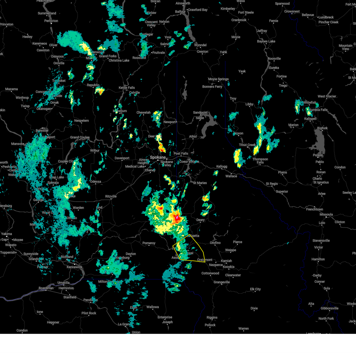
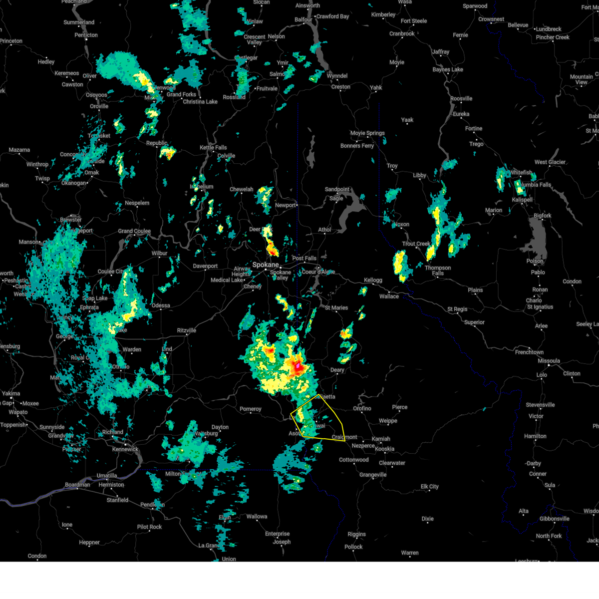
 At 442 pm pdt, a severe thunderstorm was located over lapwai, moving northeast at 30 mph (radar indicated). Hazards include 60 mph wind gusts and penny size hail. Expect damage to roofs, siding, and trees. locations impacted include, lewiston, clarkston, lapwai, genesee, juliaetta, craigmont, culdesac, west clarkston-highland, reubens, spalding, and gifford. this includes the following highways, u. s. highway 95 in idaho between mile markers 280 and 330. u. s. highway 12 in idaho between mile markers 0 and 23. u. s. highway 12 in washington between mile markers 433 and 434. u. s. Highway 195 in washington between mile markers 0 and 1. At 442 pm pdt, a severe thunderstorm was located over lapwai, moving northeast at 30 mph (radar indicated). Hazards include 60 mph wind gusts and penny size hail. Expect damage to roofs, siding, and trees. locations impacted include, lewiston, clarkston, lapwai, genesee, juliaetta, craigmont, culdesac, west clarkston-highland, reubens, spalding, and gifford. this includes the following highways, u. s. highway 95 in idaho between mile markers 280 and 330. u. s. highway 12 in idaho between mile markers 0 and 23. u. s. highway 12 in washington between mile markers 433 and 434. u. s. Highway 195 in washington between mile markers 0 and 1.
|
| 9/25/2024 3:58 PM PDT |
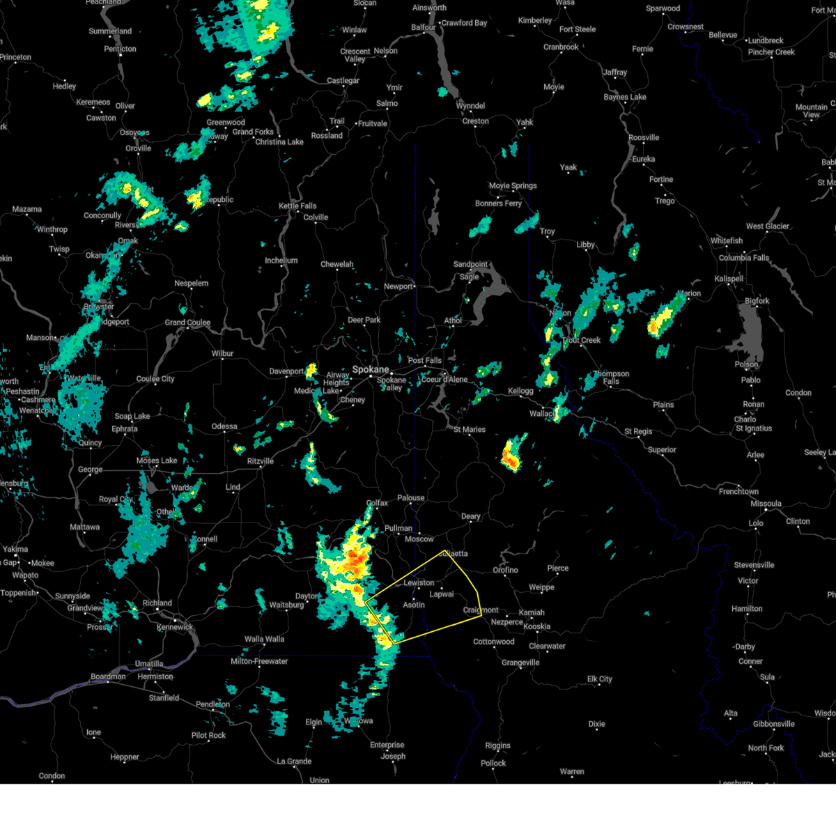
 Svrotx the national weather service in spokane has issued a * severe thunderstorm warning for, south central latah county in the panhandle of idaho, northern nez perce county in north central idaho, west central lewis county in north central idaho, east central garfield county in southeastern washington, southeastern whitman county in eastern washington, asotin county in southeastern washington, * until 500 pm pdt. * at 356 pm pdt, a severe thunderstorm was located 14 miles southwest of clarkston heights-vineland, or 16 miles southwest of clarkston, moving northeast at 35 mph (radar indicated). Hazards include 60 mph wind gusts and penny size hail. areas of blowing dust creating visibility near 1/4 mile in spots. expect damage to roofs, siding, and trees Svrotx the national weather service in spokane has issued a * severe thunderstorm warning for, south central latah county in the panhandle of idaho, northern nez perce county in north central idaho, west central lewis county in north central idaho, east central garfield county in southeastern washington, southeastern whitman county in eastern washington, asotin county in southeastern washington, * until 500 pm pdt. * at 356 pm pdt, a severe thunderstorm was located 14 miles southwest of clarkston heights-vineland, or 16 miles southwest of clarkston, moving northeast at 35 mph (radar indicated). Hazards include 60 mph wind gusts and penny size hail. areas of blowing dust creating visibility near 1/4 mile in spots. expect damage to roofs, siding, and trees
|
| 8/17/2020 6:25 PM PDT |
 At 622 pm pdt, a severe thunderstorm was located 19 miles northeast of enterprise, moving northeast at 35 mph. the thunderstorms are looking to enter nez perce county by 6:45pm. brief heavy downpours and wind gusts up to 50 mph are possible (doppler radar indicated). Hazards include 50 mph wind gusts and penny size hail. expect damage to roofs, siding, and trees At 622 pm pdt, a severe thunderstorm was located 19 miles northeast of enterprise, moving northeast at 35 mph. the thunderstorms are looking to enter nez perce county by 6:45pm. brief heavy downpours and wind gusts up to 50 mph are possible (doppler radar indicated). Hazards include 50 mph wind gusts and penny size hail. expect damage to roofs, siding, and trees
|
| 5/2/2020 5:48 PM PDT |
Report from mping: shingles blown off. tree limbs broke in nez perce county ID, 0.6 miles SE of Lapwai, ID
|
| 6/26/2019 4:21 PM PDT |
 At 420 pm pdt, severe thunderstorms were located along a line extending from near lewiston to near lapwai to near winchester, moving northeast at 20 mph (radar indicated). Hazards include 60 mph wind gusts and dime to penny size hail. Hail damage to vehicles is expected. expect wind damage to roofs, siding, and trees. Locations impacted include, lapwai, culdesac, gifford, spalding and lenore. At 420 pm pdt, severe thunderstorms were located along a line extending from near lewiston to near lapwai to near winchester, moving northeast at 20 mph (radar indicated). Hazards include 60 mph wind gusts and dime to penny size hail. Hail damage to vehicles is expected. expect wind damage to roofs, siding, and trees. Locations impacted include, lapwai, culdesac, gifford, spalding and lenore.
|
| 6/26/2019 4:18 PM PDT |
Power lines blown dow in nez perce county ID, 0.3 miles NW of Lapwai, ID
|
| 6/26/2019 4:11 PM PDT |
 At 350 pm pdt, severe thunderstorms were located along a line extending from 12 miles south of clarkston heights-vineland to 13 miles south of lewiston to 14 miles southwest of winchester, moving northeast at 60 mph (radar indicated). Hazards include 60 mph wind gusts. expect damage to roofs, siding, and trees At 350 pm pdt, severe thunderstorms were located along a line extending from 12 miles south of clarkston heights-vineland to 13 miles south of lewiston to 14 miles southwest of winchester, moving northeast at 60 mph (radar indicated). Hazards include 60 mph wind gusts. expect damage to roofs, siding, and trees
|
| 6/26/2019 4:11 PM PDT |
 At 410 pm pdt, severe thunderstorms were located along a line extending from near clarkston heights-vineland to 7 miles south of lapwai to 7 miles southwest of winchester, moving northeast at 20 mph (radar indicated). Hazards include 60 mph wind gusts and quarter size hail. Hail damage to vehicles is expected. expect wind damage to roofs, siding, and trees. Locations impacted include, lewiston, clarkston, lapwai, culdesac, clarkston heights-vineland, west clarkston-highland, asotin, colton, uniontown, spalding, waha, gifford, clarkston heights, jerry and lenore. At 410 pm pdt, severe thunderstorms were located along a line extending from near clarkston heights-vineland to 7 miles south of lapwai to 7 miles southwest of winchester, moving northeast at 20 mph (radar indicated). Hazards include 60 mph wind gusts and quarter size hail. Hail damage to vehicles is expected. expect wind damage to roofs, siding, and trees. Locations impacted include, lewiston, clarkston, lapwai, culdesac, clarkston heights-vineland, west clarkston-highland, asotin, colton, uniontown, spalding, waha, gifford, clarkston heights, jerry and lenore.
|
| 6/26/2019 3:50 PM PDT |
 At 350 pm pdt, severe thunderstorms were located along a line extending from 12 miles south of clarkston heights-vineland to 13 miles south of lewiston to 14 miles southwest of winchester, moving northeast at 60 mph (radar indicated). Hazards include 60 mph wind gusts. expect damage to roofs, siding, and trees At 350 pm pdt, severe thunderstorms were located along a line extending from 12 miles south of clarkston heights-vineland to 13 miles south of lewiston to 14 miles southwest of winchester, moving northeast at 60 mph (radar indicated). Hazards include 60 mph wind gusts. expect damage to roofs, siding, and trees
|
| 6/26/2019 3:50 PM PDT |
 At 350 pm pdt, severe thunderstorms were located along a line extending from 12 miles south of clarkston heights-vineland to 13 miles south of lewiston to 14 miles southwest of winchester, moving northeast at 60 mph (radar indicated). Hazards include 60 mph wind gusts. expect damage to roofs, siding, and trees At 350 pm pdt, severe thunderstorms were located along a line extending from 12 miles south of clarkston heights-vineland to 13 miles south of lewiston to 14 miles southwest of winchester, moving northeast at 60 mph (radar indicated). Hazards include 60 mph wind gusts. expect damage to roofs, siding, and trees
|
| 6/8/2016 3:06 PM PDT |
 At 306 pm pdt, doppler radar indicated a severe thunderstorm capable of producing quarter size hail. this storm was located near lewiston, and moving northeast at 35 mph. At 306 pm pdt, doppler radar indicated a severe thunderstorm capable of producing quarter size hail. this storm was located near lewiston, and moving northeast at 35 mph.
|
| 6/1/2015 6:12 PM PDT |
At 611 pm pdt, doppler radar indicated a line of severe thunderstorms capable of producing quarter to half dollar size hail and damaging winds to 60 mph. this storm was located near culdesac, or near lapwai, and moving northeast at 45 mph. there are multiple cells in this line capable of producing large hail.
|
| 8/12/2014 4:30 PM PDT |
Gust to 48 mph and power pole blown down. time and estimate in nez perce county ID, 3.3 miles SSE of Lapwai, ID
|
| 7/20/2012 12:48 PM PDT |
Ping Pong Ball sized hail reported 0.4 miles NE of Lapwai, ID, valley gas in lapwai reported slightly larger than ping pong ball size hail.
|
| 7/20/2012 12:48 PM PDT |
Ping Pong Ball sized hail reported 1.3 miles SSW of Lapwai, ID, nez perce tribal police reported ping pong ball size hail.
|
 the severe thunderstorm warning has been cancelled and is no longer in effect
 At 442 pm pdt, a severe thunderstorm was located over lapwai, moving northeast at 30 mph (radar indicated). Hazards include 60 mph wind gusts and penny size hail. Expect damage to roofs, siding, and trees. locations impacted include, lewiston, clarkston, lapwai, genesee, juliaetta, craigmont, culdesac, west clarkston-highland, reubens, spalding, and gifford. this includes the following highways, u. s. highway 95 in idaho between mile markers 280 and 330. u. s. highway 12 in idaho between mile markers 0 and 23. u. s. highway 12 in washington between mile markers 433 and 434. u. s. Highway 195 in washington between mile markers 0 and 1.
 Svrotx the national weather service in spokane has issued a * severe thunderstorm warning for, south central latah county in the panhandle of idaho, northern nez perce county in north central idaho, west central lewis county in north central idaho, east central garfield county in southeastern washington, southeastern whitman county in eastern washington, asotin county in southeastern washington, * until 500 pm pdt. * at 356 pm pdt, a severe thunderstorm was located 14 miles southwest of clarkston heights-vineland, or 16 miles southwest of clarkston, moving northeast at 35 mph (radar indicated). Hazards include 60 mph wind gusts and penny size hail. areas of blowing dust creating visibility near 1/4 mile in spots. expect damage to roofs, siding, and trees
 At 622 pm pdt, a severe thunderstorm was located 19 miles northeast of enterprise, moving northeast at 35 mph. the thunderstorms are looking to enter nez perce county by 6:45pm. brief heavy downpours and wind gusts up to 50 mph are possible (doppler radar indicated). Hazards include 50 mph wind gusts and penny size hail. expect damage to roofs, siding, and trees
 At 420 pm pdt, severe thunderstorms were located along a line extending from near lewiston to near lapwai to near winchester, moving northeast at 20 mph (radar indicated). Hazards include 60 mph wind gusts and dime to penny size hail. Hail damage to vehicles is expected. expect wind damage to roofs, siding, and trees. Locations impacted include, lapwai, culdesac, gifford, spalding and lenore.
 At 350 pm pdt, severe thunderstorms were located along a line extending from 12 miles south of clarkston heights-vineland to 13 miles south of lewiston to 14 miles southwest of winchester, moving northeast at 60 mph (radar indicated). Hazards include 60 mph wind gusts. expect damage to roofs, siding, and trees
 At 410 pm pdt, severe thunderstorms were located along a line extending from near clarkston heights-vineland to 7 miles south of lapwai to 7 miles southwest of winchester, moving northeast at 20 mph (radar indicated). Hazards include 60 mph wind gusts and quarter size hail. Hail damage to vehicles is expected. expect wind damage to roofs, siding, and trees. Locations impacted include, lewiston, clarkston, lapwai, culdesac, clarkston heights-vineland, west clarkston-highland, asotin, colton, uniontown, spalding, waha, gifford, clarkston heights, jerry and lenore.
 At 350 pm pdt, severe thunderstorms were located along a line extending from 12 miles south of clarkston heights-vineland to 13 miles south of lewiston to 14 miles southwest of winchester, moving northeast at 60 mph (radar indicated). Hazards include 60 mph wind gusts. expect damage to roofs, siding, and trees
 At 350 pm pdt, severe thunderstorms were located along a line extending from 12 miles south of clarkston heights-vineland to 13 miles south of lewiston to 14 miles southwest of winchester, moving northeast at 60 mph (radar indicated). Hazards include 60 mph wind gusts. expect damage to roofs, siding, and trees
 At 306 pm pdt, doppler radar indicated a severe thunderstorm capable of producing quarter size hail. this storm was located near lewiston, and moving northeast at 35 mph.


Connect with Interactive Hail Maps