

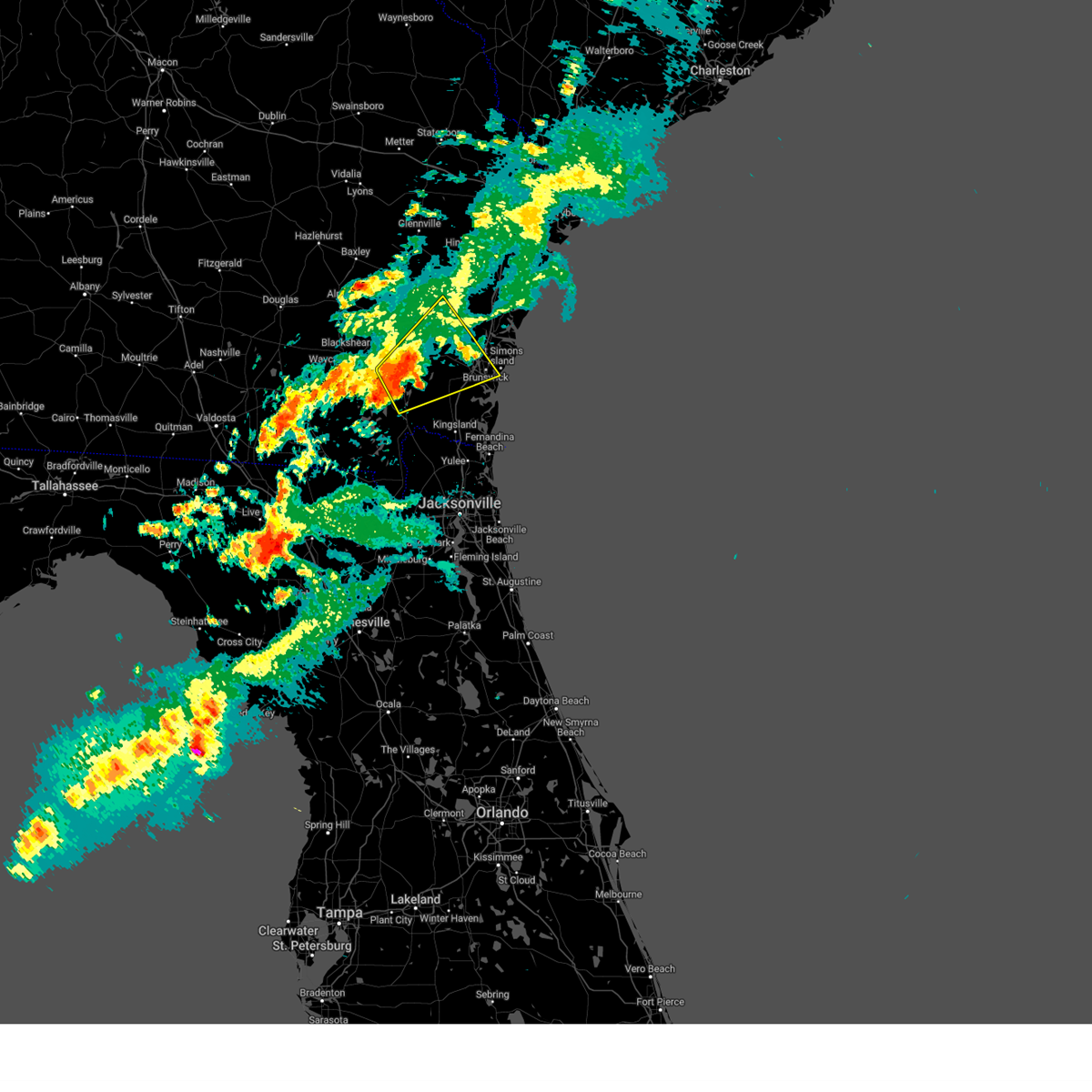
Hail Map for Nahunta, GA
The Nahunta, GA area has had 6 reports of on-the-ground hail by trained spotters, and has been under severe weather warnings 6 times during the past 12 months. Doppler radar has detected hail at or near Nahunta, GA on 44 occasions, including 2 occasions during the past year.
| Name: | Nahunta, GA |
| Where Located: | 55.1 miles ESE of Douglas, GA |
| Map: | Google Map for Nahunta, GA |
| Population: | 1053 |
| Housing Units: | 479 |
| More Info: | Search Google for Nahunta, GA |
0
The Top Recent Hail Date for Nahunta, GA is Thursday, July 18, 2024 (44th out of 44)

Hail and Wind Damage Spotted near Nahunta, GA
| Date / Time | Report Details |
|---|---|
| 3/16/2025 11:06 AM EDT | Downed trees were reported along riverside rd near thrift loop and stephen park rd. a few were reported to have fallen on powerlines. time estimated by rada in brantley county GA, 9.2 miles NNW of Nahunta, GA |
| 3/16/2025 11:06 AM EDT |
 Torjax the national weather service in jacksonville has issued a * tornado warning for, northwestern camden county in southeastern georgia, west central glynn county in southeastern georgia, eastern brantley county in southeastern georgia, * until 1130 am edt. * at 1106 am edt, a severe thunderstorm capable of producing a tornado was located near hickox, or near nahunta, moving northeast at 50 mph (radar indicated rotation). Hazards include tornado. Flying debris will be dangerous to those caught without shelter. mobile homes will be damaged or destroyed. damage to roofs, windows, and vehicles will occur. tree damage is likely. this dangerous storm will be near, waynesville around 1115 am edt. Other locations impacted by this tornadic thunderstorm include atkinson. Torjax the national weather service in jacksonville has issued a * tornado warning for, northwestern camden county in southeastern georgia, west central glynn county in southeastern georgia, eastern brantley county in southeastern georgia, * until 1130 am edt. * at 1106 am edt, a severe thunderstorm capable of producing a tornado was located near hickox, or near nahunta, moving northeast at 50 mph (radar indicated rotation). Hazards include tornado. Flying debris will be dangerous to those caught without shelter. mobile homes will be damaged or destroyed. damage to roofs, windows, and vehicles will occur. tree damage is likely. this dangerous storm will be near, waynesville around 1115 am edt. Other locations impacted by this tornadic thunderstorm include atkinson.
|
| 3/16/2025 11:04 AM EDT |
 Svrjax the national weather service in jacksonville has issued a * severe thunderstorm warning for, northwestern camden county in southeastern georgia, glynn county in southeastern georgia, east central pierce county in southeastern georgia, brantley county in southeastern georgia, southeastern wayne county in southeastern georgia, northeastern charlton county in southeastern georgia, * until 1145 am edt. * at 1104 am edt, a severe thunderstorm was located near hickox, or 7 miles south of nahunta, moving northeast at 50 mph (radar indicated). Hazards include 60 mph wind gusts and penny size hail. expect damage to roofs, siding, and trees Svrjax the national weather service in jacksonville has issued a * severe thunderstorm warning for, northwestern camden county in southeastern georgia, glynn county in southeastern georgia, east central pierce county in southeastern georgia, brantley county in southeastern georgia, southeastern wayne county in southeastern georgia, northeastern charlton county in southeastern georgia, * until 1145 am edt. * at 1104 am edt, a severe thunderstorm was located near hickox, or 7 miles south of nahunta, moving northeast at 50 mph (radar indicated). Hazards include 60 mph wind gusts and penny size hail. expect damage to roofs, siding, and trees
|
| 2/16/2025 10:00 AM EST | Tree down between raybon road and seed orchard road. time estimated by radar imager in brantley county GA, 5.1 miles W of Nahunta, GA |
| 2/16/2025 10:00 AM EST | Tree down on riverside road in hickox. time estimated based on radar imager in brantley county GA, 8.5 miles NNW of Nahunta, GA |
| 5/10/2024 8:54 AM EDT |
 Svrjax the national weather service in jacksonville has issued a * severe thunderstorm warning for, northern camden county in southeastern georgia, glynn county in southeastern georgia, southeastern brantley county in southeastern georgia, northeastern charlton county in southeastern georgia, * until 930 am edt. * at 854 am edt, severe thunderstorms were located along a line extending from near nahunta to near woodbine, moving east at 50 mph (radar indicated). Hazards include 60 mph wind gusts and penny size hail. expect damage to roofs, siding, and trees Svrjax the national weather service in jacksonville has issued a * severe thunderstorm warning for, northern camden county in southeastern georgia, glynn county in southeastern georgia, southeastern brantley county in southeastern georgia, northeastern charlton county in southeastern georgia, * until 930 am edt. * at 854 am edt, severe thunderstorms were located along a line extending from near nahunta to near woodbine, moving east at 50 mph (radar indicated). Hazards include 60 mph wind gusts and penny size hail. expect damage to roofs, siding, and trees
|
| 5/10/2024 8:50 AM EDT |
 At 849 am edt, a severe thunderstorm was located 7 miles southwest of waynesville, or 8 miles southeast of nahunta, moving east at 45 mph (radar indicated). Hazards include 60 mph wind gusts and penny size hail. Expect damage to roofs, siding, and trees. Locations impacted include, nahunta, hickox, raybon, waynesville, race pond, fort mudge, atkinson, hortense, and winokur. At 849 am edt, a severe thunderstorm was located 7 miles southwest of waynesville, or 8 miles southeast of nahunta, moving east at 45 mph (radar indicated). Hazards include 60 mph wind gusts and penny size hail. Expect damage to roofs, siding, and trees. Locations impacted include, nahunta, hickox, raybon, waynesville, race pond, fort mudge, atkinson, hortense, and winokur.
|
| 5/10/2024 8:27 AM EDT |
 Svrjax the national weather service in jacksonville has issued a * severe thunderstorm warning for, southeastern pierce county in southeastern georgia, brantley county in southeastern georgia, east central ware county in southeastern georgia, northwestern charlton county in southeastern georgia, * until 900 am edt. * at 827 am edt, a severe thunderstorm was located over fort mudge, or 10 miles west of nahunta, moving east at 45 mph (radar indicated). Hazards include 60 mph wind gusts and penny size hail. expect damage to roofs, siding, and trees Svrjax the national weather service in jacksonville has issued a * severe thunderstorm warning for, southeastern pierce county in southeastern georgia, brantley county in southeastern georgia, east central ware county in southeastern georgia, northwestern charlton county in southeastern georgia, * until 900 am edt. * at 827 am edt, a severe thunderstorm was located over fort mudge, or 10 miles west of nahunta, moving east at 45 mph (radar indicated). Hazards include 60 mph wind gusts and penny size hail. expect damage to roofs, siding, and trees
|
| 5/9/2024 3:40 PM EDT |
 Svrjax the national weather service in jacksonville has issued a * severe thunderstorm warning for, north central camden county in southeastern georgia, glynn county in southeastern georgia, pierce county in southeastern georgia, northeastern brantley county in southeastern georgia, southern wayne county in southeastern georgia, southeastern appling county in southeastern georgia, * until 500 pm edt. * at 340 pm edt, severe thunderstorms were located along a line extending from near screven to near offerman to near blackshear, moving east at 40 mph (radar indicated). Hazards include 70 mph wind gusts and quarter size hail. Hail damage to vehicles is expected. expect considerable tree damage. Wind damage is also likely to mobile homes, roofs, and outbuildings. Svrjax the national weather service in jacksonville has issued a * severe thunderstorm warning for, north central camden county in southeastern georgia, glynn county in southeastern georgia, pierce county in southeastern georgia, northeastern brantley county in southeastern georgia, southern wayne county in southeastern georgia, southeastern appling county in southeastern georgia, * until 500 pm edt. * at 340 pm edt, severe thunderstorms were located along a line extending from near screven to near offerman to near blackshear, moving east at 40 mph (radar indicated). Hazards include 70 mph wind gusts and quarter size hail. Hail damage to vehicles is expected. expect considerable tree damage. Wind damage is also likely to mobile homes, roofs, and outbuildings.
|
| 3/9/2024 1:45 PM EST | Mobile home and tree damage across the general area of long lake rd... possible tornado damage. time estimated from rada in brantley county GA, 6 miles WNW of Nahunta, GA |
| 3/9/2024 1:45 PM EST | Emergency manager reports significant structural damage to homes on matthews circle... possible tornado... possible injuries. time estimated from rada in brantley county GA, 5.7 miles WNW of Nahunta, GA |
| 3/9/2024 1:37 PM EST |
 Torjax the national weather service in jacksonville has issued a * tornado warning for, west central glynn county in southeastern georgia, east central brantley county in southeastern georgia, * until 200 pm est. * at 136 pm est, a severe thunderstorm capable of producing a tornado was located over nahunta, moving east at 30 mph (radar indicated rotation). Hazards include tornado. Flying debris will be dangerous to those caught without shelter. mobile homes will be damaged or destroyed. damage to roofs, windows, and vehicles will occur. tree damage is likely. this dangerous storm will be near, nahunta around 140 pm est. waynesville around 150 pm est. Other locations impacted by this tornadic thunderstorm include atkinson. Torjax the national weather service in jacksonville has issued a * tornado warning for, west central glynn county in southeastern georgia, east central brantley county in southeastern georgia, * until 200 pm est. * at 136 pm est, a severe thunderstorm capable of producing a tornado was located over nahunta, moving east at 30 mph (radar indicated rotation). Hazards include tornado. Flying debris will be dangerous to those caught without shelter. mobile homes will be damaged or destroyed. damage to roofs, windows, and vehicles will occur. tree damage is likely. this dangerous storm will be near, nahunta around 140 pm est. waynesville around 150 pm est. Other locations impacted by this tornadic thunderstorm include atkinson.
|
| 3/9/2024 1:28 PM EST |
 the severe thunderstorm warning has been cancelled and is no longer in effect the severe thunderstorm warning has been cancelled and is no longer in effect
|
| 3/9/2024 1:28 PM EST |
 At 127 pm est, a severe thunderstorm was located near raybon, or 7 miles northwest of nahunta, moving northeast at 30 mph (radar indicated). Hazards include 60 mph wind gusts and penny size hail. Expect damage to roofs, siding, and trees. Locations impacted include, nahunta, raybon, atkinson, and hortense. At 127 pm est, a severe thunderstorm was located near raybon, or 7 miles northwest of nahunta, moving northeast at 30 mph (radar indicated). Hazards include 60 mph wind gusts and penny size hail. Expect damage to roofs, siding, and trees. Locations impacted include, nahunta, raybon, atkinson, and hortense.
|
| 3/9/2024 1:14 PM EST |
 Svrjax the national weather service in jacksonville has issued a * severe thunderstorm warning for, southeastern pierce county in southeastern georgia, central brantley county in southeastern georgia, east central ware county in southeastern georgia, south central wayne county in southeastern georgia, * until 200 pm est. * at 114 pm est, a severe thunderstorm was located near blackshear, moving northeast at 30 mph (radar indicated). Hazards include 60 mph wind gusts and penny size hail. expect damage to roofs, siding, and trees Svrjax the national weather service in jacksonville has issued a * severe thunderstorm warning for, southeastern pierce county in southeastern georgia, central brantley county in southeastern georgia, east central ware county in southeastern georgia, south central wayne county in southeastern georgia, * until 200 pm est. * at 114 pm est, a severe thunderstorm was located near blackshear, moving northeast at 30 mph (radar indicated). Hazards include 60 mph wind gusts and penny size hail. expect damage to roofs, siding, and trees
|
| 2/4/2024 5:37 PM EST |
 The severe thunderstorm warning for southern pierce, brantley and northeastern charlton counties will expire at 545 pm est, the storm which prompted the warning has moved out of the area. therefore, the warning will be allowed to expire. however, small hail and gusty winds are still possible with this thunderstorm. The severe thunderstorm warning for southern pierce, brantley and northeastern charlton counties will expire at 545 pm est, the storm which prompted the warning has moved out of the area. therefore, the warning will be allowed to expire. however, small hail and gusty winds are still possible with this thunderstorm.
|
| 2/4/2024 4:57 PM EST |
 At 457 pm est, a severe thunderstorm was located near race pond, or 10 miles southwest of nahunta, moving north at 30 mph (radar indicated). Hazards include 60 mph wind gusts and nickel size hail. expect damage to roofs, siding, and trees At 457 pm est, a severe thunderstorm was located near race pond, or 10 miles southwest of nahunta, moving north at 30 mph (radar indicated). Hazards include 60 mph wind gusts and nickel size hail. expect damage to roofs, siding, and trees
|
| 1/9/2024 2:52 PM EST |
 The severe thunderstorm warning for northwestern nassau, camden, western glynn, brantley, southeastern ware, southeastern wayne and northeastern charlton counties will expire at 300 pm est, the storms which prompted the warning have moved out of the area. therefore, the warning will be allowed to expire. however, gusty winds are still possible with these thunderstorms. a tornado watch remains in effect until 600 pm est for northeastern florida, and southeastern georgia. The severe thunderstorm warning for northwestern nassau, camden, western glynn, brantley, southeastern ware, southeastern wayne and northeastern charlton counties will expire at 300 pm est, the storms which prompted the warning have moved out of the area. therefore, the warning will be allowed to expire. however, gusty winds are still possible with these thunderstorms. a tornado watch remains in effect until 600 pm est for northeastern florida, and southeastern georgia.
|
| 1/9/2024 2:03 PM EST |
 At 202 pm est, severe thunderstorms were located along a line extending from near race pond to 10 miles north of taylor, moving northeast at 70 mph (radar indicated). Hazards include 70 mph wind gusts and penny size hail. Expect considerable tree damage. damage is likely to mobile homes, roofs, and outbuildings. Locations impacted include, kingsland, jesup, hilliard, folkston, woodbine, nahunta, gardi, dock junction, homeland, and hickox. At 202 pm est, severe thunderstorms were located along a line extending from near race pond to 10 miles north of taylor, moving northeast at 70 mph (radar indicated). Hazards include 70 mph wind gusts and penny size hail. Expect considerable tree damage. damage is likely to mobile homes, roofs, and outbuildings. Locations impacted include, kingsland, jesup, hilliard, folkston, woodbine, nahunta, gardi, dock junction, homeland, and hickox.
|
| 1/9/2024 1:55 PM EST |
 At 155 pm est, severe thunderstorms were located along a line extending from 7 miles southeast of hickox to 9 miles southeast of fargo, moving northeast at 95 mph (radar indicated). Hazards include 70 mph wind gusts and penny size hail. Expect considerable tree damage. Damage is likely to mobile homes, roofs, and outbuildings. At 155 pm est, severe thunderstorms were located along a line extending from 7 miles southeast of hickox to 9 miles southeast of fargo, moving northeast at 95 mph (radar indicated). Hazards include 70 mph wind gusts and penny size hail. Expect considerable tree damage. Damage is likely to mobile homes, roofs, and outbuildings.
|
| 9/12/2023 7:59 PM EDT |
 At 759 pm edt, severe thunderstorms were located along a line extending from near hickox to near folkston, moving southeast at 15 mph (radar indicated). Hazards include 60 mph wind gusts. expect damage to roofs, siding, and trees At 759 pm edt, severe thunderstorms were located along a line extending from near hickox to near folkston, moving southeast at 15 mph (radar indicated). Hazards include 60 mph wind gusts. expect damage to roofs, siding, and trees
|
| 9/12/2023 7:57 PM EDT |
 The severe thunderstorm warning for eastern brantley and northeastern charlton counties will expire at 800 pm edt, this severe thunderstorm warning will expire at 800 pm edt, however severe weather is still occurring and it will be replaced by a new warning at 800 pm edt. The severe thunderstorm warning for eastern brantley and northeastern charlton counties will expire at 800 pm edt, this severe thunderstorm warning will expire at 800 pm edt, however severe weather is still occurring and it will be replaced by a new warning at 800 pm edt.
|
| 9/12/2023 7:51 PM EDT |
 At 751 pm edt, severe thunderstorms were located along a line extending from near waynesville to 7 miles north of homeland, moving southeast at 15 mph (radar indicated). Hazards include 60 mph wind gusts and penny size hail. Expect damage to roofs, siding, and trees. locations impacted include, nahunta, hickox, waynesville, atkinson, and winokur. hail threat, radar indicated max hail size, 0. 75 in wind threat, radar indicated max wind gust, 60 mph. At 751 pm edt, severe thunderstorms were located along a line extending from near waynesville to 7 miles north of homeland, moving southeast at 15 mph (radar indicated). Hazards include 60 mph wind gusts and penny size hail. Expect damage to roofs, siding, and trees. locations impacted include, nahunta, hickox, waynesville, atkinson, and winokur. hail threat, radar indicated max hail size, 0. 75 in wind threat, radar indicated max wind gust, 60 mph.
|
| 9/12/2023 7:44 PM EDT |
 At 744 pm edt, severe thunderstorms were located along a line extending from near waynesville to 7 miles north of homeland, moving southeast at 20 mph (radar indicated). Hazards include 60 mph wind gusts and penny size hail. Expect damage to roofs, siding, and trees. locations impacted include, nahunta, hickox, raybon, waynesville, atkinson, and winokur. hail threat, radar indicated max hail size, 0. 75 in wind threat, radar indicated max wind gust, 60 mph. At 744 pm edt, severe thunderstorms were located along a line extending from near waynesville to 7 miles north of homeland, moving southeast at 20 mph (radar indicated). Hazards include 60 mph wind gusts and penny size hail. Expect damage to roofs, siding, and trees. locations impacted include, nahunta, hickox, raybon, waynesville, atkinson, and winokur. hail threat, radar indicated max hail size, 0. 75 in wind threat, radar indicated max wind gust, 60 mph.
|
| 9/12/2023 7:30 PM EDT |
 At 730 pm edt, severe thunderstorms were located along a line extending from near waynesville to near race pond, moving southeast at 15 mph (radar indicated). Hazards include 60 mph wind gusts and penny size hail. Expect damage to roofs, siding, and trees. locations impacted include, nahunta, hickox, raybon, waynesville, fort mudge, atkinson, hortense, and winokur. hail threat, radar indicated max hail size, 0. 75 in wind threat, radar indicated max wind gust, 60 mph. At 730 pm edt, severe thunderstorms were located along a line extending from near waynesville to near race pond, moving southeast at 15 mph (radar indicated). Hazards include 60 mph wind gusts and penny size hail. Expect damage to roofs, siding, and trees. locations impacted include, nahunta, hickox, raybon, waynesville, fort mudge, atkinson, hortense, and winokur. hail threat, radar indicated max hail size, 0. 75 in wind threat, radar indicated max wind gust, 60 mph.
|
| 9/12/2023 7:24 PM EDT |
 At 724 pm edt, severe thunderstorms were located along a line extending from 6 miles northwest of waynesville to near race pond, moving southeast at 15 mph (radar indicated). Hazards include 60 mph wind gusts and penny size hail. expect damage to roofs, siding, and trees At 724 pm edt, severe thunderstorms were located along a line extending from 6 miles northwest of waynesville to near race pond, moving southeast at 15 mph (radar indicated). Hazards include 60 mph wind gusts and penny size hail. expect damage to roofs, siding, and trees
|
| 8/30/2023 6:31 AM EDT |
 At 631 am edt, a severe thunderstorm capable of producing a tornado was located near nahunta, moving northwest at 30 mph (radar indicated rotation). Hazards include tornado. Flying debris will be dangerous to those caught without shelter. mobile homes will be damaged or destroyed. damage to roofs, windows, and vehicles will occur. tree damage is likely. This dangerous storm will be near, blackshear around 650 am edt. At 631 am edt, a severe thunderstorm capable of producing a tornado was located near nahunta, moving northwest at 30 mph (radar indicated rotation). Hazards include tornado. Flying debris will be dangerous to those caught without shelter. mobile homes will be damaged or destroyed. damage to roofs, windows, and vehicles will occur. tree damage is likely. This dangerous storm will be near, blackshear around 650 am edt.
|
| 8/30/2023 6:26 AM EDT |
 At 626 am edt, a severe thunderstorm capable of producing a tornado was located over hickox, or near nahunta, moving northwest at 30 mph (radar indicated rotation). Hazards include tornado. Flying debris will be dangerous to those caught without shelter. mobile homes will be damaged or destroyed. damage to roofs, windows, and vehicles will occur. tree damage is likely. this dangerous storm will be near, nahunta around 630 am edt. Blackshear around 650 am edt. At 626 am edt, a severe thunderstorm capable of producing a tornado was located over hickox, or near nahunta, moving northwest at 30 mph (radar indicated rotation). Hazards include tornado. Flying debris will be dangerous to those caught without shelter. mobile homes will be damaged or destroyed. damage to roofs, windows, and vehicles will occur. tree damage is likely. this dangerous storm will be near, nahunta around 630 am edt. Blackshear around 650 am edt.
|
| 8/11/2023 11:41 PM EDT |
 At 1140 pm edt, severe thunderstorms were located along a line extending from nahunta to near hickox to race pond, moving east at 30 mph (radar indicated). Hazards include 60 mph wind gusts and penny size hail. Expect damage to roofs, siding, and trees. locations impacted include, nahunta, hickox, fort mudge, atkinson, and winokur. hail threat, radar indicated max hail size, 0. 75 in wind threat, radar indicated max wind gust, 60 mph. At 1140 pm edt, severe thunderstorms were located along a line extending from nahunta to near hickox to race pond, moving east at 30 mph (radar indicated). Hazards include 60 mph wind gusts and penny size hail. Expect damage to roofs, siding, and trees. locations impacted include, nahunta, hickox, fort mudge, atkinson, and winokur. hail threat, radar indicated max hail size, 0. 75 in wind threat, radar indicated max wind gust, 60 mph.
|
| 8/11/2023 11:28 PM EDT |
 At 1128 pm edt, severe thunderstorms were located along a line extending from near raybon to hickox to near race pond, moving east at 25 mph (radar indicated). Hazards include 60 mph wind gusts and penny size hail. expect damage to roofs, siding, and trees At 1128 pm edt, severe thunderstorms were located along a line extending from near raybon to hickox to near race pond, moving east at 25 mph (radar indicated). Hazards include 60 mph wind gusts and penny size hail. expect damage to roofs, siding, and trees
|
| 8/8/2023 7:43 PM EDT |
 At 743 pm edt, a severe thunderstorm was located near race pond, or 15 miles southwest of nahunta, moving east at 45 mph (radar indicated). Hazards include 70 mph wind gusts and quarter size hail. Hail damage to vehicles is expected. expect considerable tree damage. Wind damage is also likely to mobile homes, roofs, and outbuildings. At 743 pm edt, a severe thunderstorm was located near race pond, or 15 miles southwest of nahunta, moving east at 45 mph (radar indicated). Hazards include 70 mph wind gusts and quarter size hail. Hail damage to vehicles is expected. expect considerable tree damage. Wind damage is also likely to mobile homes, roofs, and outbuildings.
|
| 7/30/2023 7:47 PM EDT |
 At 746 pm edt, severe thunderstorms were located along a line extending from screven to near nahunta, moving southeast at 25 mph (radar indicated). Hazards include 60 mph wind gusts and nickel size hail. Expect damage to roofs, siding, and trees. locations impacted include, jesup, nahunta, patterson, gardi, screven, offerman, hickox, thalmann, everett and raybon. hail threat, radar indicated max hail size, 0. 88 in wind threat, radar indicated max wind gust, 60 mph. At 746 pm edt, severe thunderstorms were located along a line extending from screven to near nahunta, moving southeast at 25 mph (radar indicated). Hazards include 60 mph wind gusts and nickel size hail. Expect damage to roofs, siding, and trees. locations impacted include, jesup, nahunta, patterson, gardi, screven, offerman, hickox, thalmann, everett and raybon. hail threat, radar indicated max hail size, 0. 88 in wind threat, radar indicated max wind gust, 60 mph.
|
| 7/30/2023 7:27 PM EDT |
 At 727 pm edt, severe thunderstorms were located along a line extending from near odum to near raybon, moving southeast at 20 mph (radar indicated). Hazards include 60 mph wind gusts and nickel size hail. expect damage to roofs, siding, and trees At 727 pm edt, severe thunderstorms were located along a line extending from near odum to near raybon, moving southeast at 20 mph (radar indicated). Hazards include 60 mph wind gusts and nickel size hail. expect damage to roofs, siding, and trees
|
| 6/13/2023 6:40 PM EDT | Tree down on jess allen road. time estimated by rada in brantley county GA, 2.6 miles N of Nahunta, GA |
| 3/25/2023 4:10 PM EDT |
 At 410 pm edt, a severe thunderstorm was located near hickox, or near nahunta, moving east at 45 mph (radar indicated). Hazards include 60 mph wind gusts and quarter size hail. Hail damage to vehicles is expected. Expect wind damage to roofs, siding, and trees. At 410 pm edt, a severe thunderstorm was located near hickox, or near nahunta, moving east at 45 mph (radar indicated). Hazards include 60 mph wind gusts and quarter size hail. Hail damage to vehicles is expected. Expect wind damage to roofs, siding, and trees.
|
| 1/4/2023 1:30 PM EST |
 At 130 pm est, severe thunderstorms were located along a line extending from near gardi to near waynesville to 7 miles west of woodbine to 6 miles northwest of st. george, moving east at 50 mph (radar indicated). Hazards include 60 mph wind gusts and quarter size hail. Hail damage to vehicles is expected. expect wind damage to roofs, siding, and trees. Locations impacted include, kingsland, brunswick, jesup, hilliard, folkston, woodbine, callahan, nahunta, dock junction and gardi. At 130 pm est, severe thunderstorms were located along a line extending from near gardi to near waynesville to 7 miles west of woodbine to 6 miles northwest of st. george, moving east at 50 mph (radar indicated). Hazards include 60 mph wind gusts and quarter size hail. Hail damage to vehicles is expected. expect wind damage to roofs, siding, and trees. Locations impacted include, kingsland, brunswick, jesup, hilliard, folkston, woodbine, callahan, nahunta, dock junction and gardi.
|
| 1/4/2023 1:11 PM EST |
 At 110 pm est, severe thunderstorms were located along a line extending from near screven to near nahunta to race pond to 12 miles northwest of taylor, moving east at 50 mph (radar indicated). Hazards include 60 mph wind gusts and quarter size hail. Hail damage to vehicles is expected. Expect wind damage to roofs, siding, and trees. At 110 pm est, severe thunderstorms were located along a line extending from near screven to near nahunta to race pond to 12 miles northwest of taylor, moving east at 50 mph (radar indicated). Hazards include 60 mph wind gusts and quarter size hail. Hail damage to vehicles is expected. Expect wind damage to roofs, siding, and trees.
|
| 6/17/2022 11:49 PM EDT |
 At 1149 pm edt, severe thunderstorms were located along a line extending from fort mudge to 9 miles southeast of hickox to near waverly, moving southeast at 30 mph. these storms have a history of producing damage (radar indicated). Hazards include 60 mph wind gusts. Expect damage to roofs, siding, and trees. locations impacted include, brunswick, waycross, nahunta, dock junction, hickox, boggy bay, thalmann, waynesville, race pond and fort mudge. hail threat, radar indicated max hail size, <. 75 in wind threat, radar indicated max wind gust, 60 mph. At 1149 pm edt, severe thunderstorms were located along a line extending from fort mudge to 9 miles southeast of hickox to near waverly, moving southeast at 30 mph. these storms have a history of producing damage (radar indicated). Hazards include 60 mph wind gusts. Expect damage to roofs, siding, and trees. locations impacted include, brunswick, waycross, nahunta, dock junction, hickox, boggy bay, thalmann, waynesville, race pond and fort mudge. hail threat, radar indicated max hail size, <. 75 in wind threat, radar indicated max wind gust, 60 mph.
|
| 6/17/2022 11:18 PM EDT |
 At 1118 pm edt, severe thunderstorms were located along a line extending from jamestown to near nahunta to near raybon to near thalmann, moving southeast at 35 mph. these storms have a history of producing damage (radar indicated). Hazards include 60 mph wind gusts. Expect damage to roofs, siding, and trees. locations impacted include, blackshear, nahunta, patterson, offerman, thalmann, everett, raybon, waynesville, atkinson and mount pleasant. hail threat, radar indicated max hail size, <. 75 in wind threat, radar indicated max wind gust, 60 mph. At 1118 pm edt, severe thunderstorms were located along a line extending from jamestown to near nahunta to near raybon to near thalmann, moving southeast at 35 mph. these storms have a history of producing damage (radar indicated). Hazards include 60 mph wind gusts. Expect damage to roofs, siding, and trees. locations impacted include, blackshear, nahunta, patterson, offerman, thalmann, everett, raybon, waynesville, atkinson and mount pleasant. hail threat, radar indicated max hail size, <. 75 in wind threat, radar indicated max wind gust, 60 mph.
|
| 6/17/2022 11:16 PM EDT |
 At 1116 pm edt, severe thunderstorms were located along a line extending from near jamestown to near nahunta to near thalmann, moving southeast at 30 mph. these storms have a history of producing damage (radar indicated). Hazards include 60 mph wind gusts. expect damage to roofs, siding, and trees At 1116 pm edt, severe thunderstorms were located along a line extending from near jamestown to near nahunta to near thalmann, moving southeast at 30 mph. these storms have a history of producing damage (radar indicated). Hazards include 60 mph wind gusts. expect damage to roofs, siding, and trees
|
| 6/17/2022 11:15 PM EDT | Reports of multiple trees down throughout brantley county. approximate timing obtained by rada in brantley county GA, 0.4 miles WSW of Nahunta, GA |
| 6/17/2022 11:08 PM EDT |
 At 1107 pm edt, severe thunderstorms were located along a line extending from near dixie union to 6 miles southeast of patterson to near raybon to near everett, moving southeast at 40 mph. these storms have a history of producing damage (radar indicated). Hazards include 60 mph wind gusts. Expect damage to roofs, siding, and trees. locations impacted include, waycross, blackshear, nahunta, patterson, gardi, screven, offerman, pebble hill, thalmann and everett. hail threat, radar indicated max hail size, <. 75 in wind threat, radar indicated max wind gust, 60 mph. At 1107 pm edt, severe thunderstorms were located along a line extending from near dixie union to 6 miles southeast of patterson to near raybon to near everett, moving southeast at 40 mph. these storms have a history of producing damage (radar indicated). Hazards include 60 mph wind gusts. Expect damage to roofs, siding, and trees. locations impacted include, waycross, blackshear, nahunta, patterson, gardi, screven, offerman, pebble hill, thalmann and everett. hail threat, radar indicated max hail size, <. 75 in wind threat, radar indicated max wind gust, 60 mph.
|
| 6/17/2022 10:59 PM EDT |
 At 1057 pm edt, severe thunderstorms were located along a line extending from near alma to patterson to near screven to near gardi, moving southeast at 40 mph. radar indicates potential for gusts up to at least 60 mph in a swath across pierce and western wayne counties heading for brantley county (radar indicated). Hazards include 60 mph wind gusts. Expect damage to roofs, siding, and trees. locations impacted include, waycross, blackshear, nahunta, patterson, gardi, screven, offerman, pebble hill, thalmann and everett. hail threat, radar indicated max hail size, <. 75 in wind threat, radar indicated max wind gust, 60 mph. At 1057 pm edt, severe thunderstorms were located along a line extending from near alma to patterson to near screven to near gardi, moving southeast at 40 mph. radar indicates potential for gusts up to at least 60 mph in a swath across pierce and western wayne counties heading for brantley county (radar indicated). Hazards include 60 mph wind gusts. Expect damage to roofs, siding, and trees. locations impacted include, waycross, blackshear, nahunta, patterson, gardi, screven, offerman, pebble hill, thalmann and everett. hail threat, radar indicated max hail size, <. 75 in wind threat, radar indicated max wind gust, 60 mph.
|
| 6/17/2022 10:41 PM EDT |
 At 1040 pm edt, severe thunderstorms were located along a line extending from near nicholls to 7 miles north of bristol to near gardi, moving southeast at 35 mph (radar indicated). Hazards include 60 mph wind gusts. expect damage to roofs, siding, and trees At 1040 pm edt, severe thunderstorms were located along a line extending from near nicholls to 7 miles north of bristol to near gardi, moving southeast at 35 mph (radar indicated). Hazards include 60 mph wind gusts. expect damage to roofs, siding, and trees
|
| 5/3/2022 7:41 PM EDT |
 The severe thunderstorm warning for southeastern pierce, brantley and east central ware counties will expire at 745 pm edt, the storm which prompted the warning has weakened below severe limits, and no longer poses an immediate threat to life or property. therefore, the warning will be allowed to expire. however small hail, gusty winds and heavy rain are still possible with this thunderstorm. The severe thunderstorm warning for southeastern pierce, brantley and east central ware counties will expire at 745 pm edt, the storm which prompted the warning has weakened below severe limits, and no longer poses an immediate threat to life or property. therefore, the warning will be allowed to expire. however small hail, gusty winds and heavy rain are still possible with this thunderstorm.
|
| 5/3/2022 7:33 PM EDT |
 At 732 pm edt, a severe thunderstorm was located near hickox, or near nahunta, moving south at 15 mph (radar indicated). Hazards include 60 mph wind gusts and quarter size hail. Hail damage to vehicles is expected. expect wind damage to roofs, siding, and trees. locations impacted include, nahunta, hickox, braganza, raybon, fort mudge and hortense. hail threat, radar indicated max hail size, 1. 00 in wind threat, radar indicated max wind gust, 60 mph. At 732 pm edt, a severe thunderstorm was located near hickox, or near nahunta, moving south at 15 mph (radar indicated). Hazards include 60 mph wind gusts and quarter size hail. Hail damage to vehicles is expected. expect wind damage to roofs, siding, and trees. locations impacted include, nahunta, hickox, braganza, raybon, fort mudge and hortense. hail threat, radar indicated max hail size, 1. 00 in wind threat, radar indicated max wind gust, 60 mph.
|
| 5/3/2022 7:13 PM EDT |
 At 713 pm edt, a severe thunderstorm was located near raybon, or near nahunta, moving south at 15 mph (radar indicated). Hazards include golf ball size hail and 60 mph wind gusts. People and animals outdoors will be injured. expect hail damage to roofs, siding, windows, and vehicles. Expect wind damage to roofs, siding, and trees. At 713 pm edt, a severe thunderstorm was located near raybon, or near nahunta, moving south at 15 mph (radar indicated). Hazards include golf ball size hail and 60 mph wind gusts. People and animals outdoors will be injured. expect hail damage to roofs, siding, windows, and vehicles. Expect wind damage to roofs, siding, and trees.
|
| 5/3/2022 7:04 PM EDT |
 At 704 pm edt, a severe thunderstorm was located 9 miles northeast of raybon, or 12 miles northeast of nahunta, moving east at 10 mph (radar indicated). Hazards include 60 mph wind gusts and quarter size hail. Hail damage to vehicles is expected. expect wind damage to roofs, siding, and trees. Locations impacted include, nahunta, patterson, screven, raybon, waynesville, atkinson, mount pleasant, hortense and broadhurst. At 704 pm edt, a severe thunderstorm was located 9 miles northeast of raybon, or 12 miles northeast of nahunta, moving east at 10 mph (radar indicated). Hazards include 60 mph wind gusts and quarter size hail. Hail damage to vehicles is expected. expect wind damage to roofs, siding, and trees. Locations impacted include, nahunta, patterson, screven, raybon, waynesville, atkinson, mount pleasant, hortense and broadhurst.
|
| 5/3/2022 6:44 PM EDT |
 At 644 pm edt, a severe thunderstorm was located 7 miles north of raybon, or 10 miles east of patterson, moving east at 10 mph (radar indicated). Hazards include 60 mph wind gusts and quarter size hail. Hail damage to vehicles is expected. Expect wind damage to roofs, siding, and trees. At 644 pm edt, a severe thunderstorm was located 7 miles north of raybon, or 10 miles east of patterson, moving east at 10 mph (radar indicated). Hazards include 60 mph wind gusts and quarter size hail. Hail damage to vehicles is expected. Expect wind damage to roofs, siding, and trees.
|
| 3/23/2022 3:56 PM EDT |
 At 356 pm edt, a severe thunderstorm capable of producing a tornado was located near race pond, or 10 miles north of folkston, moving northeast at 30 mph (radar indicated rotation). Hazards include tornado and quarter size hail. Flying debris will be dangerous to those caught without shelter. mobile homes will be damaged or destroyed. damage to roofs, windows, and vehicles will occur. tree damage is likely. this dangerous storm will be near, hickox around 410 pm edt. waverly and waynesville around 430 pm edt. Other locations impacted by this tornadic thunderstorm include winokur and atkinson. At 356 pm edt, a severe thunderstorm capable of producing a tornado was located near race pond, or 10 miles north of folkston, moving northeast at 30 mph (radar indicated rotation). Hazards include tornado and quarter size hail. Flying debris will be dangerous to those caught without shelter. mobile homes will be damaged or destroyed. damage to roofs, windows, and vehicles will occur. tree damage is likely. this dangerous storm will be near, hickox around 410 pm edt. waverly and waynesville around 430 pm edt. Other locations impacted by this tornadic thunderstorm include winokur and atkinson.
|
| 3/23/2022 3:50 PM EDT |
 At 349 pm edt, a severe thunderstorm capable of producing a tornado was located near race pond, or 9 miles north of folkston, moving northeast at 40 mph (radar indicated rotation). Hazards include tornado. Flying debris will be dangerous to those caught without shelter. mobile homes will be damaged or destroyed. damage to roofs, windows, and vehicles will occur. tree damage is likely. this dangerous storm will be near, hickox around 405 pm edt. waverly around 420 pm edt. waynesville around 425 pm edt. Other locations impacted by this tornadic thunderstorm include winokur and atkinson. At 349 pm edt, a severe thunderstorm capable of producing a tornado was located near race pond, or 9 miles north of folkston, moving northeast at 40 mph (radar indicated rotation). Hazards include tornado. Flying debris will be dangerous to those caught without shelter. mobile homes will be damaged or destroyed. damage to roofs, windows, and vehicles will occur. tree damage is likely. this dangerous storm will be near, hickox around 405 pm edt. waverly around 420 pm edt. waynesville around 425 pm edt. Other locations impacted by this tornadic thunderstorm include winokur and atkinson.
|
| 3/19/2022 6:44 PM EDT |
 At 643 pm edt, a severe thunderstorm was located near race pond, or 15 miles northeast of stephen foster state park, moving northeast at 20 mph (radar indicated). Hazards include 60 mph wind gusts and quarter size hail. Hail damage to vehicles is expected. Expect wind damage to roofs, siding, and trees. At 643 pm edt, a severe thunderstorm was located near race pond, or 15 miles northeast of stephen foster state park, moving northeast at 20 mph (radar indicated). Hazards include 60 mph wind gusts and quarter size hail. Hail damage to vehicles is expected. Expect wind damage to roofs, siding, and trees.
|
| 3/19/2022 6:26 PM EDT |
 The severe thunderstorm warning for pierce, western brantley, northern ware and southeastern bacon counties will expire at 630 pm edt, the storm which prompted the warning has weakened below severe limits, and no longer poses an immediate threat to life or property. therefore, the warning will be allowed to expire. however small hail, gusty winds and heavy rain are still possible with this thunderstorm. The severe thunderstorm warning for pierce, western brantley, northern ware and southeastern bacon counties will expire at 630 pm edt, the storm which prompted the warning has weakened below severe limits, and no longer poses an immediate threat to life or property. therefore, the warning will be allowed to expire. however small hail, gusty winds and heavy rain are still possible with this thunderstorm.
|
| 3/19/2022 5:47 PM EDT |
 At 547 pm edt, a severe thunderstorm was located 7 miles northeast of cogdell, or 10 miles north of argyle, moving east at 40 mph (radar indicated). Hazards include 60 mph wind gusts and quarter size hail. Hail damage to vehicles is expected. Expect wind damage to roofs, siding, and trees. At 547 pm edt, a severe thunderstorm was located 7 miles northeast of cogdell, or 10 miles north of argyle, moving east at 40 mph (radar indicated). Hazards include 60 mph wind gusts and quarter size hail. Hail damage to vehicles is expected. Expect wind damage to roofs, siding, and trees.
|
| 5/12/2021 2:45 PM EDT |
 At 245 pm edt, a severe thunderstorm was located near waynesville, or 11 miles northeast of nahunta, moving east at 30 mph (radar indicated). Hazards include 60 mph wind gusts and penny size hail. Expect damage to roofs, siding, and trees. Locations impacted include, nahunta, waynesville, thalmann, atkinson and mount pleasant. At 245 pm edt, a severe thunderstorm was located near waynesville, or 11 miles northeast of nahunta, moving east at 30 mph (radar indicated). Hazards include 60 mph wind gusts and penny size hail. Expect damage to roofs, siding, and trees. Locations impacted include, nahunta, waynesville, thalmann, atkinson and mount pleasant.
|
| 5/12/2021 2:36 PM EDT |
 At 236 pm edt, a severe thunderstorm was located near raybon, or 7 miles northeast of nahunta, moving east at 30 mph (radar indicated). Hazards include 60 mph wind gusts and penny size hail. Expect damage to roofs, siding, and trees. Locations impacted include, nahunta, thalmann, raybon, waynesville, atkinson, mount pleasant and hortense. At 236 pm edt, a severe thunderstorm was located near raybon, or 7 miles northeast of nahunta, moving east at 30 mph (radar indicated). Hazards include 60 mph wind gusts and penny size hail. Expect damage to roofs, siding, and trees. Locations impacted include, nahunta, thalmann, raybon, waynesville, atkinson, mount pleasant and hortense.
|
| 5/12/2021 2:27 PM EDT |
 At 226 pm edt, a severe thunderstorm was located over raybon, or near nahunta, moving east at 35 mph (radar indicated). Hazards include 60 mph wind gusts and penny size hail. Expect damage to roofs, siding, and trees. Locations impacted include, nahunta, patterson, thalmann, raybon, waynesville, atkinson, mount pleasant, hortense and broadhurst. At 226 pm edt, a severe thunderstorm was located over raybon, or near nahunta, moving east at 35 mph (radar indicated). Hazards include 60 mph wind gusts and penny size hail. Expect damage to roofs, siding, and trees. Locations impacted include, nahunta, patterson, thalmann, raybon, waynesville, atkinson, mount pleasant, hortense and broadhurst.
|
| 5/12/2021 2:14 PM EDT |
 At 214 pm edt, a severe thunderstorm was located near blackshear, moving east at 25 mph (radar indicated). Hazards include 60 mph wind gusts and nickel size hail. expect damage to roofs, siding, and trees At 214 pm edt, a severe thunderstorm was located near blackshear, moving east at 25 mph (radar indicated). Hazards include 60 mph wind gusts and nickel size hail. expect damage to roofs, siding, and trees
|
| 4/25/2021 12:01 AM EDT |
 At 1201 am edt, a severe thunderstorm was located 7 miles east of hickox, or 7 miles southeast of nahunta, moving east at 40 mph (radar indicated). Hazards include 60 mph wind gusts and quarter size hail. possible tornado. Hail damage to vehicles is expected. Expect wind damage to roofs, siding, and trees. At 1201 am edt, a severe thunderstorm was located 7 miles east of hickox, or 7 miles southeast of nahunta, moving east at 40 mph (radar indicated). Hazards include 60 mph wind gusts and quarter size hail. possible tornado. Hail damage to vehicles is expected. Expect wind damage to roofs, siding, and trees.
|
| 4/24/2021 7:40 PM EDT |
 At 740 pm edt, a severe thunderstorm was located near jamestown, or 8 miles northwest of blackshear, moving east at 55 mph (radar indicated). Hazards include quarter size hail. damage to vehicles is expected At 740 pm edt, a severe thunderstorm was located near jamestown, or 8 miles northwest of blackshear, moving east at 55 mph (radar indicated). Hazards include quarter size hail. damage to vehicles is expected
|
| 12/24/2020 6:15 PM EST |
 At 615 pm est, severe thunderstorms were located along a line extending from cox to 6 miles northeast of waverly to near folkston, moving east at 55 mph (radar indicated). Hazards include 60 mph wind gusts. Expect damage to roofs, siding, and trees. locations impacted include, kingsland, brunswick, st. Simons island, folkston, woodbine, nahunta, dock junction, kings bay base, homeland and country club estates. At 615 pm est, severe thunderstorms were located along a line extending from cox to 6 miles northeast of waverly to near folkston, moving east at 55 mph (radar indicated). Hazards include 60 mph wind gusts. Expect damage to roofs, siding, and trees. locations impacted include, kingsland, brunswick, st. Simons island, folkston, woodbine, nahunta, dock junction, kings bay base, homeland and country club estates.
|
| 12/24/2020 6:00 PM EST |
 At 600 pm est, severe thunderstorms were located along a line extending from near ludowici to near waynesville to 9 miles southeast of stephen foster state park, moving southeast at 50 mph (radar indicated). Hazards include 60 mph wind gusts. Expect damage to roofs, siding, and trees. locations impacted include, kingsland, brunswick, st. Simons island, jesup, folkston, woodbine, nahunta, dock junction, kings bay base and stephen foster state park. At 600 pm est, severe thunderstorms were located along a line extending from near ludowici to near waynesville to 9 miles southeast of stephen foster state park, moving southeast at 50 mph (radar indicated). Hazards include 60 mph wind gusts. Expect damage to roofs, siding, and trees. locations impacted include, kingsland, brunswick, st. Simons island, jesup, folkston, woodbine, nahunta, dock junction, kings bay base and stephen foster state park.
|
| 12/24/2020 5:33 PM EST |
 At 533 pm est, severe thunderstorms were located along a line extending from 8 miles west of donald to near patterson to near stephen foster state park, moving east at 55 mph (radar indicated). Hazards include 60 mph wind gusts. expect damage to roofs, siding, and trees At 533 pm est, severe thunderstorms were located along a line extending from 8 miles west of donald to near patterson to near stephen foster state park, moving east at 55 mph (radar indicated). Hazards include 60 mph wind gusts. expect damage to roofs, siding, and trees
|
| 9/16/2020 9:22 PM EDT |
 The severe thunderstorm warning for central brantley county will expire at 930 pm edt, the storm which prompted the warning has weakened below severe limits, and no longer poses an immediate threat to life or property. therefore, the warning will be allowed to expire. however heavy rain is still possible with this thunderstorm. The severe thunderstorm warning for central brantley county will expire at 930 pm edt, the storm which prompted the warning has weakened below severe limits, and no longer poses an immediate threat to life or property. therefore, the warning will be allowed to expire. however heavy rain is still possible with this thunderstorm.
|
| 9/16/2020 9:14 PM EDT |
 At 914 pm edt, a severe thunderstorm was located over hickox, or over nahunta, moving northwest at 25 mph (radar indicated). Hazards include 60 mph wind gusts. possible tornado. Expect damage to roofs, siding, and trees. Locations impacted include, nahunta and hickox. At 914 pm edt, a severe thunderstorm was located over hickox, or over nahunta, moving northwest at 25 mph (radar indicated). Hazards include 60 mph wind gusts. possible tornado. Expect damage to roofs, siding, and trees. Locations impacted include, nahunta and hickox.
|
| 9/16/2020 8:57 PM EDT |
 At 857 pm edt, a severe thunderstorm was located near hickox, or 7 miles south of nahunta, moving north at 15 mph (radar indicated). Hazards include 60 mph wind gusts. possible tornado. expect damage to roofs, siding, and trees At 857 pm edt, a severe thunderstorm was located near hickox, or 7 miles south of nahunta, moving north at 15 mph (radar indicated). Hazards include 60 mph wind gusts. possible tornado. expect damage to roofs, siding, and trees
|
| 6/24/2020 6:15 PM EDT | Public report via social media of a tree and powerlines downed near the hooterville diner along u.s. highway 82. time of damge based on radar dat in brantley county GA, 12.3 miles W of Nahunta, GA |
| 6/19/2020 11:46 PM EDT |
 At 1146 pm edt, a severe thunderstorm was located near hickox, or near nahunta, moving south at 15 mph (radar indicated). Hazards include 60 mph wind gusts and penny size hail. Expect damage to roofs, siding, and trees. Locations impacted include, nahunta, fort mudge and hickox. At 1146 pm edt, a severe thunderstorm was located near hickox, or near nahunta, moving south at 15 mph (radar indicated). Hazards include 60 mph wind gusts and penny size hail. Expect damage to roofs, siding, and trees. Locations impacted include, nahunta, fort mudge and hickox.
|
| 6/19/2020 11:28 PM EDT |
 At 1128 pm edt, a severe thunderstorm was located over hickox, or near nahunta, moving southeast at 10 mph (radar indicated. possible tornado). Hazards include 60 mph wind gusts and penny size hail. expect damage to roofs, siding, and trees At 1128 pm edt, a severe thunderstorm was located over hickox, or near nahunta, moving southeast at 10 mph (radar indicated. possible tornado). Hazards include 60 mph wind gusts and penny size hail. expect damage to roofs, siding, and trees
|
| 6/19/2020 11:10 PM EDT |
 At 1110 pm edt, a severe thunderstorm was located near nahunta, moving southwest at 10 mph (radar indicated). Hazards include 60 mph wind gusts and penny size hail. Expect damage to roofs, siding, and trees. Locations impacted include, nahunta, hickox and raybon. At 1110 pm edt, a severe thunderstorm was located near nahunta, moving southwest at 10 mph (radar indicated). Hazards include 60 mph wind gusts and penny size hail. Expect damage to roofs, siding, and trees. Locations impacted include, nahunta, hickox and raybon.
|
| 6/19/2020 10:53 PM EDT |
 At 1053 pm edt, a severe thunderstorm was located over raybon, or near nahunta, moving south at 15 mph (radar indicated). Hazards include 60 mph wind gusts and half dollar size hail. Hail damage to vehicles is expected. Expect wind damage to roofs, siding, and trees. At 1053 pm edt, a severe thunderstorm was located over raybon, or near nahunta, moving south at 15 mph (radar indicated). Hazards include 60 mph wind gusts and half dollar size hail. Hail damage to vehicles is expected. Expect wind damage to roofs, siding, and trees.
|
| 6/19/2020 10:52 PM EDT | A couple of trees reported down on hoke road. time of event estimated by rada in brantley county GA, 3.6 miles S of Nahunta, GA |
| 6/19/2020 10:51 PM EDT |
 The tornado warning for southeastern pierce and central brantley counties will expire at 1100 pm edt, the tornado threat has diminished and the tornado warning has been cancelled. however, large hail and damaging winds remain likely and a severe thunderstorm warning remains in effect for the area. however small hail, gusty winds and heavy rain are still possible with this thunderstorm. The tornado warning for southeastern pierce and central brantley counties will expire at 1100 pm edt, the tornado threat has diminished and the tornado warning has been cancelled. however, large hail and damaging winds remain likely and a severe thunderstorm warning remains in effect for the area. however small hail, gusty winds and heavy rain are still possible with this thunderstorm.
|
| 6/19/2020 10:42 PM EDT |
 At 1041 pm edt, a severe thunderstorm capable of producing a tornado was located near raybon, or near nahunta, moving south at 15 mph (radar indicated rotation). Hazards include tornado and half dollar size hail. Flying debris will be dangerous to those caught without shelter. mobile homes will be damaged or destroyed. damage to roofs, windows, and vehicles will occur. tree damage is likely. this dangerous storm will be near, raybon around 1050 pm edt. nahunta around 1100 pm edt. Hickox around 1115 pm edt. At 1041 pm edt, a severe thunderstorm capable of producing a tornado was located near raybon, or near nahunta, moving south at 15 mph (radar indicated rotation). Hazards include tornado and half dollar size hail. Flying debris will be dangerous to those caught without shelter. mobile homes will be damaged or destroyed. damage to roofs, windows, and vehicles will occur. tree damage is likely. this dangerous storm will be near, raybon around 1050 pm edt. nahunta around 1100 pm edt. Hickox around 1115 pm edt.
|
| 6/19/2020 10:27 PM EDT |
 At 1027 pm edt, a severe thunderstorm capable of producing a tornado was located near raybon, or near patterson, moving south at 15 mph (radar indicated rotation). Hazards include tornado and ping pong ball size hail. Flying debris will be dangerous to those caught without shelter. mobile homes will be damaged or destroyed. damage to roofs, windows, and vehicles will occur. tree damage is likely. this dangerous storm will be near, raybon around 1040 pm edt. nahunta around 1050 pm edt. hickox and fort mudge around 1100 pm edt. Other locations impacted by this tornadic thunderstorm include hortense. At 1027 pm edt, a severe thunderstorm capable of producing a tornado was located near raybon, or near patterson, moving south at 15 mph (radar indicated rotation). Hazards include tornado and ping pong ball size hail. Flying debris will be dangerous to those caught without shelter. mobile homes will be damaged or destroyed. damage to roofs, windows, and vehicles will occur. tree damage is likely. this dangerous storm will be near, raybon around 1040 pm edt. nahunta around 1050 pm edt. hickox and fort mudge around 1100 pm edt. Other locations impacted by this tornadic thunderstorm include hortense.
|
| 5/21/2020 3:44 PM EDT |
 At 343 pm edt, a severe thunderstorm was located near hickox, or 8 miles southeast of nahunta, moving east at 25 mph (radar indicated). Hazards include 60 mph wind gusts and nickel size hail. Expect damage to roofs, siding, and trees. Locations impacted include, hickox. At 343 pm edt, a severe thunderstorm was located near hickox, or 8 miles southeast of nahunta, moving east at 25 mph (radar indicated). Hazards include 60 mph wind gusts and nickel size hail. Expect damage to roofs, siding, and trees. Locations impacted include, hickox.
|
| 5/21/2020 3:08 PM EDT |
 At 307 pm edt, a severe thunderstorm was located over race pond, or 15 miles northwest of folkston, moving northeast at 25 mph (radar indicated). Hazards include 60 mph wind gusts and quarter size hail. Hail damage to vehicles is expected. Expect wind damage to roofs, siding, and trees. At 307 pm edt, a severe thunderstorm was located over race pond, or 15 miles northwest of folkston, moving northeast at 25 mph (radar indicated). Hazards include 60 mph wind gusts and quarter size hail. Hail damage to vehicles is expected. Expect wind damage to roofs, siding, and trees.
|
| 4/23/2020 2:50 PM EDT | Golf Ball sized hail reported 13.2 miles WSW of Nahunta, GA, golf ball size hail along browntown road. radar estimated time. |
| 4/23/2020 2:29 PM EDT |
 At 229 pm edt, a confirmed large and extremely dangerous tornado was located near nahunta, moving east at 50 mph. this is a particularly dangerous situation. take cover now! (radar confirmed tornado). Hazards include damaging tornado. You are in a life-threatening situation. flying debris may be deadly to those caught without shelter. mobile homes will be destroyed. considerable damage to homes, businesses, and vehicles is likely and complete destruction is possible. the tornado will be near, nahunta and raybon around 235 pm edt. waynesville around 250 pm edt. thalmann around 255 pm edt. everett around 300 pm edt. Other locations impacted by this tornadic thunderstorm include atkinson, mount pleasant and hortense. At 229 pm edt, a confirmed large and extremely dangerous tornado was located near nahunta, moving east at 50 mph. this is a particularly dangerous situation. take cover now! (radar confirmed tornado). Hazards include damaging tornado. You are in a life-threatening situation. flying debris may be deadly to those caught without shelter. mobile homes will be destroyed. considerable damage to homes, businesses, and vehicles is likely and complete destruction is possible. the tornado will be near, nahunta and raybon around 235 pm edt. waynesville around 250 pm edt. thalmann around 255 pm edt. everett around 300 pm edt. Other locations impacted by this tornadic thunderstorm include atkinson, mount pleasant and hortense.
|
| 4/23/2020 2:15 PM EDT |
 At 214 pm edt, a confirmed large and extremely dangerous tornado was located near boggy bay, or near waycross, moving east at 50 mph. this is a particularly dangerous situation. take cover now! (radar confirmed tornado). Hazards include damaging tornado. You are in a life-threatening situation. flying debris may be deadly to those caught without shelter. mobile homes will be destroyed. considerable damage to homes, businesses, and vehicles is likely and complete destruction is possible. the tornado will be near, fort mudge around 220 pm edt. nahunta, raybon and hickox around 235 pm edt. waynesville around 250 pm edt. thalmann around 255 pm edt. Other locations impacted by this tornadic thunderstorm include needham, atkinson, mount pleasant and hortense. At 214 pm edt, a confirmed large and extremely dangerous tornado was located near boggy bay, or near waycross, moving east at 50 mph. this is a particularly dangerous situation. take cover now! (radar confirmed tornado). Hazards include damaging tornado. You are in a life-threatening situation. flying debris may be deadly to those caught without shelter. mobile homes will be destroyed. considerable damage to homes, businesses, and vehicles is likely and complete destruction is possible. the tornado will be near, fort mudge around 220 pm edt. nahunta, raybon and hickox around 235 pm edt. waynesville around 250 pm edt. thalmann around 255 pm edt. Other locations impacted by this tornadic thunderstorm include needham, atkinson, mount pleasant and hortense.
|
| 4/23/2020 1:34 PM EDT |
 At 134 pm edt, severe thunderstorms were located along a line extending from 7 miles northeast of willacoochee to 6 miles north of mayday, moving east at 50 mph (radar indicated). Hazards include 70 mph wind gusts and quarter size hail. Hail damage to vehicles is expected. expect considerable tree damage. Wind damage is also likely to mobile homes, roofs, and outbuildings. At 134 pm edt, severe thunderstorms were located along a line extending from 7 miles northeast of willacoochee to 6 miles north of mayday, moving east at 50 mph (radar indicated). Hazards include 70 mph wind gusts and quarter size hail. Hail damage to vehicles is expected. expect considerable tree damage. Wind damage is also likely to mobile homes, roofs, and outbuildings.
|
| 4/20/2020 4:12 AM EDT |
 The severe thunderstorm warning for northwestern camden, glynn, pierce, brantley, northeastern ware, southeastern bacon, wayne, southeastern appling and northeastern charlton counties will expire at 415 am edt, the storm which prompted the warning has moved out of the area. therefore, the warning will be allowed to expire. a tornado watch remains in effect until 1100 am edt for southeastern georgia. The severe thunderstorm warning for northwestern camden, glynn, pierce, brantley, northeastern ware, southeastern bacon, wayne, southeastern appling and northeastern charlton counties will expire at 415 am edt, the storm which prompted the warning has moved out of the area. therefore, the warning will be allowed to expire. a tornado watch remains in effect until 1100 am edt for southeastern georgia.
|
| 4/20/2020 3:35 AM EDT |
 At 334 am edt, a severe thunderstorm was located near thalmann, or 14 miles south of gardi, moving northeast at 90 mph (radar indicated). Hazards include 60 mph wind gusts and quarter size hail. Hail damage to vehicles is expected. Expect wind damage to roofs, siding, and trees. At 334 am edt, a severe thunderstorm was located near thalmann, or 14 miles south of gardi, moving northeast at 90 mph (radar indicated). Hazards include 60 mph wind gusts and quarter size hail. Hail damage to vehicles is expected. Expect wind damage to roofs, siding, and trees.
|
| 4/20/2020 3:33 AM EDT | Tree down across hwy 32 in hortens in brantley county GA, 8.7 miles SSW of Nahunta, GA |
| 4/20/2020 3:27 AM EDT | Tree down... power pole and lines down around area of raybon rd w of hwy 30 in brantley county GA, 5.4 miles SE of Nahunta, GA |
| 4/20/2020 2:59 AM EDT |
 The national weather service in jacksonville has issued a * severe thunderstorm warning for. northwestern glynn county in southeastern georgia. pierce county in southeastern georgia. southeastern atkinson county in southeastern georgia. Central brantley county in southeastern georgia. The national weather service in jacksonville has issued a * severe thunderstorm warning for. northwestern glynn county in southeastern georgia. pierce county in southeastern georgia. southeastern atkinson county in southeastern georgia. Central brantley county in southeastern georgia.
|
| 4/13/2020 9:11 AM EDT |
 The severe thunderstorm warning for northern hamilton, echols, brantley, central ware, southern clinch and northern charlton counties will expire at 915 am edt, the storms which prompted the warning have moved out of the area. remember, a severe thunderstorm warning still remains in effect for echols, southern clinch, ware, charlton, and parts of brantley counties. The severe thunderstorm warning for northern hamilton, echols, brantley, central ware, southern clinch and northern charlton counties will expire at 915 am edt, the storms which prompted the warning have moved out of the area. remember, a severe thunderstorm warning still remains in effect for echols, southern clinch, ware, charlton, and parts of brantley counties.
|
| 4/13/2020 8:54 AM EDT |
 At 854 am edt, severe thunderstorms were located along a line extending from near gardi to near fort mudge to du pont, moving northeast at 40 mph (radar indicated). Hazards include 70 mph wind gusts and quarter size hail. Hail damage to vehicles is expected. expect considerable tree damage. wind damage is also likely to mobile homes, roofs, and outbuildings. Locations impacted include, folkston, nahunta, fargo, statenville, stephen foster state park, homeland, hickox, mayday, raybon and race pond. At 854 am edt, severe thunderstorms were located along a line extending from near gardi to near fort mudge to du pont, moving northeast at 40 mph (radar indicated). Hazards include 70 mph wind gusts and quarter size hail. Hail damage to vehicles is expected. expect considerable tree damage. wind damage is also likely to mobile homes, roofs, and outbuildings. Locations impacted include, folkston, nahunta, fargo, statenville, stephen foster state park, homeland, hickox, mayday, raybon and race pond.
|
| 4/13/2020 8:28 AM EDT |
 At 828 am edt, severe thunderstorms were located along a line extending from near patterson to 9 miles south of boggy bay to near mayday, moving northeast at 40 mph (radar indicated). Hazards include 70 mph wind gusts and quarter size hail. Hail damage to vehicles is expected. expect considerable tree damage. wind damage is also likely to mobile homes, roofs, and outbuildings. Locations impacted include, waycross, folkston, homerville, nahunta, fargo, argyle, statenville, stephen foster state park, homeland and du pont. At 828 am edt, severe thunderstorms were located along a line extending from near patterson to 9 miles south of boggy bay to near mayday, moving northeast at 40 mph (radar indicated). Hazards include 70 mph wind gusts and quarter size hail. Hail damage to vehicles is expected. expect considerable tree damage. wind damage is also likely to mobile homes, roofs, and outbuildings. Locations impacted include, waycross, folkston, homerville, nahunta, fargo, argyle, statenville, stephen foster state park, homeland and du pont.
|
| 4/13/2020 8:12 AM EDT |
 At 812 am edt, severe thunderstorms were located along a line extending from near blackshear to 9 miles south of manor to near lake park, moving northeast at 40 mph (radar indicated). Hazards include 60 mph wind gusts. expect damage to roofs, siding, and trees At 812 am edt, severe thunderstorms were located along a line extending from near blackshear to 9 miles south of manor to near lake park, moving northeast at 40 mph (radar indicated). Hazards include 60 mph wind gusts. expect damage to roofs, siding, and trees
|
| 4/13/2020 8:01 AM EDT |
 At 801 am edt, severe thunderstorms were located along a line extending from 6 miles northeast of fort mudge to 7 miles southwest of i-75 at exit 16, moving east at 30 mph (radar indicated). Hazards include 60 mph wind gusts. Expect damage to roofs, siding, and trees. Locations impacted include, waycross, blackshear, homerville, nahunta, jennings, argyle, statenville, du pont, boggy bay and mayday. At 801 am edt, severe thunderstorms were located along a line extending from 6 miles northeast of fort mudge to 7 miles southwest of i-75 at exit 16, moving east at 30 mph (radar indicated). Hazards include 60 mph wind gusts. Expect damage to roofs, siding, and trees. Locations impacted include, waycross, blackshear, homerville, nahunta, jennings, argyle, statenville, du pont, boggy bay and mayday.
|
| 4/13/2020 7:52 AM EDT |
 At 752 am edt, severe thunderstorms were located along a line extending from near blackshear to 8 miles southeast of quitman, moving east at 30 mph (radar indicated). Hazards include 60 mph wind gusts. Expect damage to roofs, siding, and trees. Locations impacted include, waycross, blackshear, homerville, nahunta, jennings, argyle, statenville, du pont, boggy bay and mayday. At 752 am edt, severe thunderstorms were located along a line extending from near blackshear to 8 miles southeast of quitman, moving east at 30 mph (radar indicated). Hazards include 60 mph wind gusts. Expect damage to roofs, siding, and trees. Locations impacted include, waycross, blackshear, homerville, nahunta, jennings, argyle, statenville, du pont, boggy bay and mayday.
|
| 4/13/2020 7:20 AM EDT |
 At 719 am edt, severe thunderstorms were located along a line extending from near pebble hill to near quitman, moving east at 25 mph (radar indicated). Hazards include 60 mph wind gusts. expect damage to roofs, siding, and trees At 719 am edt, severe thunderstorms were located along a line extending from near pebble hill to near quitman, moving east at 25 mph (radar indicated). Hazards include 60 mph wind gusts. expect damage to roofs, siding, and trees
|
| 3/5/2020 4:10 PM EST |
 At 410 pm est, a severe thunderstorm was located near waverly, or 11 miles northwest of woodbine, moving east at 55 mph (radar indicated). Hazards include 60 mph wind gusts. expect damage to roofs, siding, and trees At 410 pm est, a severe thunderstorm was located near waverly, or 11 miles northwest of woodbine, moving east at 55 mph (radar indicated). Hazards include 60 mph wind gusts. expect damage to roofs, siding, and trees
|
| 2/6/2020 9:18 PM EST |
 At 918 pm est, a severe thunderstorm was located near hickox, or 7 miles southwest of nahunta, moving northeast at 60 mph (radar indicated). Hazards include 60 mph wind gusts. expect damage to roofs, siding, and trees At 918 pm est, a severe thunderstorm was located near hickox, or 7 miles southwest of nahunta, moving northeast at 60 mph (radar indicated). Hazards include 60 mph wind gusts. expect damage to roofs, siding, and trees
|
| 2/6/2020 9:13 PM EST | Amateur radio relayed a report from nahunta fire/rescue of a tree downed over a powerline in the vicinity of nahunta. power outages reported in nahunt in brantley county GA, 4.8 miles SE of Nahunta, GA |
| 2/6/2020 9:07 PM EST |
 At 907 pm est, a severe thunderstorm was located near patterson, moving northeast at 60 mph (radar indicated). Hazards include 60 mph wind gusts. expect damage to roofs, siding, and trees At 907 pm est, a severe thunderstorm was located near patterson, moving northeast at 60 mph (radar indicated). Hazards include 60 mph wind gusts. expect damage to roofs, siding, and trees
|
| 2/6/2020 8:42 PM EST |
 The severe thunderstorm warning for west central glynn, pierce, brantley, northeastern ware, southwestern wayne and northwestern charlton counties will expire at 845 pm est, the storm which prompted the warning has weakened below severe limits, and has exited the warned area. therefore, the warning will be allowed to expire. a tornado watch remains in effect until midnight est for southeastern georgia. The severe thunderstorm warning for west central glynn, pierce, brantley, northeastern ware, southwestern wayne and northwestern charlton counties will expire at 845 pm est, the storm which prompted the warning has weakened below severe limits, and has exited the warned area. therefore, the warning will be allowed to expire. a tornado watch remains in effect until midnight est for southeastern georgia.
|
| 2/6/2020 8:20 PM EST |
 At 819 pm est, a severe thunderstorm was located over blackshear, moving northeast at 55 mph. this is a very dangerous storm (radar indicated). Hazards include 80 mph wind gusts. Flying debris will be dangerous to those caught without shelter. mobile homes will be heavily damaged. expect considerable damage to roofs, windows, and vehicles. extensive tree damage and power outages are likely. Locations impacted include, waycross, blackshear, nahunta, patterson, screven, odum, offerman, hickox, boggy bay and raybon. At 819 pm est, a severe thunderstorm was located over blackshear, moving northeast at 55 mph. this is a very dangerous storm (radar indicated). Hazards include 80 mph wind gusts. Flying debris will be dangerous to those caught without shelter. mobile homes will be heavily damaged. expect considerable damage to roofs, windows, and vehicles. extensive tree damage and power outages are likely. Locations impacted include, waycross, blackshear, nahunta, patterson, screven, odum, offerman, hickox, boggy bay and raybon.
|
| 2/6/2020 7:58 PM EST |
 At 757 pm est, a severe thunderstorm was located over manor, or 7 miles east of argyle, moving northeast at 55 mph. this is a very dangerous storm (radar indicated). Hazards include 80 mph wind gusts. Flying debris will be dangerous to those caught without shelter. mobile homes will be heavily damaged. expect considerable damage to roofs, windows, and vehicles. Extensive tree damage and power outages are likely. At 757 pm est, a severe thunderstorm was located over manor, or 7 miles east of argyle, moving northeast at 55 mph. this is a very dangerous storm (radar indicated). Hazards include 80 mph wind gusts. Flying debris will be dangerous to those caught without shelter. mobile homes will be heavily damaged. expect considerable damage to roofs, windows, and vehicles. Extensive tree damage and power outages are likely.
|
| 12/17/2019 3:54 PM EST |
 The severe thunderstorm warning for northeastern brantley and southeastern wayne counties will expire at 400 pm est, the storm which prompted the warning has moved out of the area. therefore, the warning will be allowed to expire. however heavy rain is still possible with this thunderstorm. a tornado watch remains in effect until 700 pm est for southeastern georgia. The severe thunderstorm warning for northeastern brantley and southeastern wayne counties will expire at 400 pm est, the storm which prompted the warning has moved out of the area. therefore, the warning will be allowed to expire. however heavy rain is still possible with this thunderstorm. a tornado watch remains in effect until 700 pm est for southeastern georgia.
|
| 12/17/2019 3:35 PM EST |
 At 335 pm est, a severe thunderstorm was located 7 miles south of gardi, moving northeast at 45 mph (radar indicated). Hazards include 60 mph wind gusts. Expect damage to roofs, siding, and trees. Locations impacted include, nahunta, gardi, raybon, broadhurst, mount pleasant and hortense. At 335 pm est, a severe thunderstorm was located 7 miles south of gardi, moving northeast at 45 mph (radar indicated). Hazards include 60 mph wind gusts. Expect damage to roofs, siding, and trees. Locations impacted include, nahunta, gardi, raybon, broadhurst, mount pleasant and hortense.
|
| 12/17/2019 3:26 PM EST |
 At 326 pm est, a severe thunderstorm was located 8 miles southeast of screven, or 10 miles east of patterson, moving northeast at 50 mph (radar indicated). Hazards include 60 mph wind gusts. expect damage to roofs, siding, and trees At 326 pm est, a severe thunderstorm was located 8 miles southeast of screven, or 10 miles east of patterson, moving northeast at 50 mph (radar indicated). Hazards include 60 mph wind gusts. expect damage to roofs, siding, and trees
|
| 12/17/2019 3:04 PM EST |
 At 304 pm est, a severe thunderstorm was located near waycross, moving northeast at 45 mph (radar indicated). Hazards include 60 mph wind gusts. Expect damage to roofs, siding, and trees. Locations impacted include, waycross, blackshear, nahunta, patterson, offerman, hickox, boggy bay, raybon, fort mudge and jamestown. At 304 pm est, a severe thunderstorm was located near waycross, moving northeast at 45 mph (radar indicated). Hazards include 60 mph wind gusts. Expect damage to roofs, siding, and trees. Locations impacted include, waycross, blackshear, nahunta, patterson, offerman, hickox, boggy bay, raybon, fort mudge and jamestown.
|
| 12/17/2019 2:48 PM EST |
 At 248 pm est, a severe thunderstorm was located near manor, or 9 miles northeast of argyle, moving northeast at 50 mph (radar indicated). Hazards include 60 mph wind gusts. expect damage to roofs, siding, and trees At 248 pm est, a severe thunderstorm was located near manor, or 9 miles northeast of argyle, moving northeast at 50 mph (radar indicated). Hazards include 60 mph wind gusts. expect damage to roofs, siding, and trees
|
| 6/20/2019 8:07 PM EDT |
 At 807 pm edt, a severe thunderstorm was located near blackshear, moving southeast at 35 mph (radar indicated). Hazards include 60 mph wind gusts. expect damage to roofs, siding, and trees At 807 pm edt, a severe thunderstorm was located near blackshear, moving southeast at 35 mph (radar indicated). Hazards include 60 mph wind gusts. expect damage to roofs, siding, and trees
|
| 5/12/2019 3:52 PM EDT |
 The severe thunderstorm warning for northwestern camden, pierce, central brantley, north central ware and northeastern charlton counties will expire at 400 pm edt, the storms which prompted the warning have weakened below severe limits, and have exited the warned area. therefore, the warning will be allowed to expire. a severe thunderstorm watch remains in effect until 900 pm edt for southeastern georgia. The severe thunderstorm warning for northwestern camden, pierce, central brantley, north central ware and northeastern charlton counties will expire at 400 pm edt, the storms which prompted the warning have weakened below severe limits, and have exited the warned area. therefore, the warning will be allowed to expire. a severe thunderstorm watch remains in effect until 900 pm edt for southeastern georgia.
|
| 5/12/2019 3:35 PM EDT |
 At 334 pm edt, severe thunderstorms were located along a line extending from dixie union to 6 miles south of patterson to near hickox, moving east at 50 mph (radar indicated). Hazards include 60 mph wind gusts. Expect damage to roofs, siding, and trees. Locations impacted include, blackshear, nahunta, patterson, offerman, hickox, jamestown, bristol, raybon, dixie union and pebble hill. At 334 pm edt, severe thunderstorms were located along a line extending from dixie union to 6 miles south of patterson to near hickox, moving east at 50 mph (radar indicated). Hazards include 60 mph wind gusts. Expect damage to roofs, siding, and trees. Locations impacted include, blackshear, nahunta, patterson, offerman, hickox, jamestown, bristol, raybon, dixie union and pebble hill.
|
| 5/12/2019 3:25 PM EDT | A tree was downed near the intersection of white ford road and woodpecker trail. time estimated by rada in brantley county GA, 4.7 miles N of Nahunta, GA |
| 5/12/2019 3:21 PM EDT |
 At 321 pm edt, severe thunderstorms were located along a line extending from jamestown to near race pond, moving east at 40 mph (radar indicated). Hazards include 60 mph wind gusts. expect damage to roofs, siding, and trees At 321 pm edt, severe thunderstorms were located along a line extending from jamestown to near race pond, moving east at 40 mph (radar indicated). Hazards include 60 mph wind gusts. expect damage to roofs, siding, and trees
|
| 4/19/2019 12:01 PM EDT |
 At 1201 pm edt, severe thunderstorms were located along a line extending from near doctortown to homeland, moving northheast at 50 mph (radar indicated). Hazards include 70 mph wind gusts. Expect considerable tree damage. Damage is likely to mobile homes, roofs, and outbuildings. At 1201 pm edt, severe thunderstorms were located along a line extending from near doctortown to homeland, moving northheast at 50 mph (radar indicated). Hazards include 70 mph wind gusts. Expect considerable tree damage. Damage is likely to mobile homes, roofs, and outbuildings.
|
| 4/19/2019 11:50 AM EDT | Public reported a tree down on authro sloan rd. time estimated by rada in brantley county GA, 9.5 miles SSW of Nahunta, GA |
| 4/19/2019 11:12 AM EDT |
 At 1112 am edt, severe thunderstorms were located along a line extending from baxley to near stephen foster state park, moving northeast at 55 mph (radar indicated). Hazards include 70 mph wind gusts. Expect considerable tree damage. Damage is likely to mobile homes, roofs, and outbuildings. At 1112 am edt, severe thunderstorms were located along a line extending from baxley to near stephen foster state park, moving northeast at 55 mph (radar indicated). Hazards include 70 mph wind gusts. Expect considerable tree damage. Damage is likely to mobile homes, roofs, and outbuildings.
|
| 10/10/2018 5:06 PM EDT |
 At 451 pm edt, a severe thunderstorm capable of producing a tornado was located near hickox, or 9 miles southwest of nahunta, moving north at 25 mph (radar indicated rotation). Hazards include tornado. Flying debris will be dangerous to those caught without shelter. mobile homes will be damaged or destroyed. damage to roofs, windows, and vehicles will occur. tree damage is likely. This dangerous storm will be near, nahunta around 515 pm edt. At 451 pm edt, a severe thunderstorm capable of producing a tornado was located near hickox, or 9 miles southwest of nahunta, moving north at 25 mph (radar indicated rotation). Hazards include tornado. Flying debris will be dangerous to those caught without shelter. mobile homes will be damaged or destroyed. damage to roofs, windows, and vehicles will occur. tree damage is likely. This dangerous storm will be near, nahunta around 515 pm edt.
|
| 10/10/2018 5:02 PM EDT |
 At 502 pm edt, a severe thunderstorm capable of producing a tornado was located near hickox, or near nahunta, moving north at 25 mph (radar indicated rotation). Hazards include tornado. Flying debris will be dangerous to those caught without shelter. mobile homes will be damaged or destroyed. damage to roofs, windows, and vehicles will occur. tree damage is likely. This dangerous storm will be near, nahunta around 510 pm edt. At 502 pm edt, a severe thunderstorm capable of producing a tornado was located near hickox, or near nahunta, moving north at 25 mph (radar indicated rotation). Hazards include tornado. Flying debris will be dangerous to those caught without shelter. mobile homes will be damaged or destroyed. damage to roofs, windows, and vehicles will occur. tree damage is likely. This dangerous storm will be near, nahunta around 510 pm edt.
|
| 10/10/2018 4:51 PM EDT |
 At 451 pm edt, a severe thunderstorm capable of producing a tornado was located near hickox, or 9 miles southwest of nahunta, moving north at 25 mph (radar indicated rotation). Hazards include tornado. Flying debris will be dangerous to those caught without shelter. mobile homes will be damaged or destroyed. damage to roofs, windows, and vehicles will occur. tree damage is likely. This dangerous storm will be near, nahunta around 515 pm edt. At 451 pm edt, a severe thunderstorm capable of producing a tornado was located near hickox, or 9 miles southwest of nahunta, moving north at 25 mph (radar indicated rotation). Hazards include tornado. Flying debris will be dangerous to those caught without shelter. mobile homes will be damaged or destroyed. damage to roofs, windows, and vehicles will occur. tree damage is likely. This dangerous storm will be near, nahunta around 515 pm edt.
|
| 10/10/2018 4:44 PM EDT |
 At 444 pm edt, a severe thunderstorm capable of producing a tornado was located near race pond, or 12 miles southwest of nahunta, moving north at 25 mph (radar indicated rotation). Hazards include tornado. Flying debris will be dangerous to those caught without shelter. mobile homes will be damaged or destroyed. damage to roofs, windows, and vehicles will occur. tree damage is likely. this dangerous storm will be near, hickox around 500 pm edt. nahunta around 515 pm edt. Other locations impacted by this tornadic thunderstorm include winokur. At 444 pm edt, a severe thunderstorm capable of producing a tornado was located near race pond, or 12 miles southwest of nahunta, moving north at 25 mph (radar indicated rotation). Hazards include tornado. Flying debris will be dangerous to those caught without shelter. mobile homes will be damaged or destroyed. damage to roofs, windows, and vehicles will occur. tree damage is likely. this dangerous storm will be near, hickox around 500 pm edt. nahunta around 515 pm edt. Other locations impacted by this tornadic thunderstorm include winokur.
|
| 10/10/2018 4:28 PM EDT |
 A tornado warning remains in effect until 445 pm edt for central brantley and north central charlton counties. at 427 pm edt, a severe thunderstorm capable of producing a tornado was located near race pond, or 9 miles north of folkston, moving north at 40 mph. hazard. Tornado. A tornado warning remains in effect until 445 pm edt for central brantley and north central charlton counties. at 427 pm edt, a severe thunderstorm capable of producing a tornado was located near race pond, or 9 miles north of folkston, moving north at 40 mph. hazard. Tornado.
|
| 10/10/2018 4:19 PM EDT |
 At 419 pm edt, a severe thunderstorm capable of producing a tornado was located near race pond, or 7 miles northwest of folkston, moving north at 45 mph (radar indicated rotation). Hazards include tornado. Flying debris will be dangerous to those caught without shelter. mobile homes will be damaged or destroyed. damage to roofs, windows, and vehicles will occur. tree damage is likely. this dangerous storm will be near, race pond around 425 pm edt. hickox and fort mudge around 440 pm edt. nahunta and raybon around 445 pm edt. Other locations impacted by this tornadic thunderstorm include winokur. At 419 pm edt, a severe thunderstorm capable of producing a tornado was located near race pond, or 7 miles northwest of folkston, moving north at 45 mph (radar indicated rotation). Hazards include tornado. Flying debris will be dangerous to those caught without shelter. mobile homes will be damaged or destroyed. damage to roofs, windows, and vehicles will occur. tree damage is likely. this dangerous storm will be near, race pond around 425 pm edt. hickox and fort mudge around 440 pm edt. nahunta and raybon around 445 pm edt. Other locations impacted by this tornadic thunderstorm include winokur.
|
| 10/10/2018 4:10 PM EDT |
 At 410 pm edt, a severe thunderstorm capable of producing a tornado was located near homeland, or near folkston, moving north at 45 mph (radar indicated rotation). Hazards include tornado. Flying debris will be dangerous to those caught without shelter. mobile homes will be damaged or destroyed. damage to roofs, windows, and vehicles will occur. tree damage is likely. this dangerous storm will be near, race pond around 425 pm edt. hickox and fort mudge around 440 pm edt. nahunta and raybon around 445 pm edt. Other locations impacted by this tornadic thunderstorm include winokur. At 410 pm edt, a severe thunderstorm capable of producing a tornado was located near homeland, or near folkston, moving north at 45 mph (radar indicated rotation). Hazards include tornado. Flying debris will be dangerous to those caught without shelter. mobile homes will be damaged or destroyed. damage to roofs, windows, and vehicles will occur. tree damage is likely. this dangerous storm will be near, race pond around 425 pm edt. hickox and fort mudge around 440 pm edt. nahunta and raybon around 445 pm edt. Other locations impacted by this tornadic thunderstorm include winokur.
|
| 8/2/2018 4:06 PM EDT |
 At 359 pm edt, a severe thunderstorm was located near hickox, or 8 miles south of nahunta, moving north at 25 mph (radar indicated). Hazards include 60 mph wind gusts. Expect damage to roofs, siding, and trees. Locations impacted include, nahunta, hickox and winokur. At 359 pm edt, a severe thunderstorm was located near hickox, or 8 miles south of nahunta, moving north at 25 mph (radar indicated). Hazards include 60 mph wind gusts. Expect damage to roofs, siding, and trees. Locations impacted include, nahunta, hickox and winokur.
|
| 8/2/2018 4:05 PM EDT | Trees were blown down on powerlines along caney bay road between hoboken and nahunta. the time given was based on rada in brantley county GA, 6 miles NE of Nahunta, GA |
| 8/2/2018 4:00 PM EDT |
 At 352 pm edt, a severe thunderstorm was located 7 miles northeast of race pond, or 11 miles south of nahunta, moving north at 25 mph (radar indicated). Hazards include 60 mph wind gusts. expect damage to roofs, siding, and trees At 352 pm edt, a severe thunderstorm was located 7 miles northeast of race pond, or 11 miles south of nahunta, moving north at 25 mph (radar indicated). Hazards include 60 mph wind gusts. expect damage to roofs, siding, and trees
|
| 8/2/2018 3:52 PM EDT |
 At 352 pm edt, a severe thunderstorm was located 7 miles northeast of race pond, or 11 miles south of nahunta, moving north at 25 mph (radar indicated). Hazards include 60 mph wind gusts. expect damage to roofs, siding, and trees At 352 pm edt, a severe thunderstorm was located 7 miles northeast of race pond, or 11 miles south of nahunta, moving north at 25 mph (radar indicated). Hazards include 60 mph wind gusts. expect damage to roofs, siding, and trees
|
| 5/28/2018 5:22 PM EDT |
 The severe thunderstorm warning for eastern pierce, northeastern brantley and southwestern wayne counties will expire at 530 pm edt, the storm which prompted the warning has moved out of the area. therefore, the warning will be allowed to expire. however gusty winds and heavy rain are still possible with this thunderstorm. The severe thunderstorm warning for eastern pierce, northeastern brantley and southwestern wayne counties will expire at 530 pm edt, the storm which prompted the warning has moved out of the area. therefore, the warning will be allowed to expire. however gusty winds and heavy rain are still possible with this thunderstorm.
|
| 5/28/2018 5:18 PM EDT |
 At 517 pm edt, a severe thunderstorm was located near patterson, moving north at 35 mph (radar indicated). Hazards include 60 mph wind gusts. Expect damage to roofs, siding, and trees. Locations impacted include, nahunta, patterson, offerman, raybon, waynesville, atkinson and hortense. At 517 pm edt, a severe thunderstorm was located near patterson, moving north at 35 mph (radar indicated). Hazards include 60 mph wind gusts. Expect damage to roofs, siding, and trees. Locations impacted include, nahunta, patterson, offerman, raybon, waynesville, atkinson and hortense.
|
| 5/28/2018 5:08 PM EDT |
 At 508 pm edt, a severe thunderstorm was located near raybon, or near patterson, moving north at 40 mph (radar indicated). Hazards include 60 mph wind gusts. Expect damage to roofs, siding, and trees. Locations impacted include, nahunta, patterson, offerman, hickox, bristol, raybon, waynesville, atkinson and hortense. At 508 pm edt, a severe thunderstorm was located near raybon, or near patterson, moving north at 40 mph (radar indicated). Hazards include 60 mph wind gusts. Expect damage to roofs, siding, and trees. Locations impacted include, nahunta, patterson, offerman, hickox, bristol, raybon, waynesville, atkinson and hortense.
|
| 5/28/2018 5:00 PM EDT |
 At 500 pm edt, a severe thunderstorm was located near raybon, or near nahunta, moving north at 40 mph (radar indicated). Hazards include 60 mph wind gusts. expect damage to roofs, siding, and trees At 500 pm edt, a severe thunderstorm was located near raybon, or near nahunta, moving north at 40 mph (radar indicated). Hazards include 60 mph wind gusts. expect damage to roofs, siding, and trees
|
| 5/28/2018 4:53 PM EDT |
 At 452 pm edt, a severe thunderstorm was located near hickox, or near nahunta, moving north at 40 mph (radar indicated). Hazards include 60 mph wind gusts. Expect damage to roofs, siding, and trees. Locations impacted include, nahunta, hickox, waynesville, atkinson, winokur and tarboro. At 452 pm edt, a severe thunderstorm was located near hickox, or near nahunta, moving north at 40 mph (radar indicated). Hazards include 60 mph wind gusts. Expect damage to roofs, siding, and trees. Locations impacted include, nahunta, hickox, waynesville, atkinson, winokur and tarboro.
|
| 5/28/2018 4:49 PM EDT |
 At 449 pm edt, a severe thunderstorm was located near hickox, or 8 miles southeast of nahunta, moving north at 35 mph (radar indicated). Hazards include 60 mph wind gusts. Expect damage to roofs, siding, and trees. Locations impacted include, nahunta, hickox, waynesville, atkinson, winokur and tarboro. At 449 pm edt, a severe thunderstorm was located near hickox, or 8 miles southeast of nahunta, moving north at 35 mph (radar indicated). Hazards include 60 mph wind gusts. Expect damage to roofs, siding, and trees. Locations impacted include, nahunta, hickox, waynesville, atkinson, winokur and tarboro.
|
| 5/28/2018 4:35 PM EDT |
 At 434 pm edt, a severe thunderstorm was located near woodbine, moving north at 35 mph (radar indicated). Hazards include 60 mph wind gusts. Expect damage to roofs, siding, and trees. Locations impacted include, folkston, nahunta, homeland, hickox, race pond, waynesville, fort mudge, atkinson, winokur and tarboro. At 434 pm edt, a severe thunderstorm was located near woodbine, moving north at 35 mph (radar indicated). Hazards include 60 mph wind gusts. Expect damage to roofs, siding, and trees. Locations impacted include, folkston, nahunta, homeland, hickox, race pond, waynesville, fort mudge, atkinson, winokur and tarboro.
|
| 5/28/2018 4:20 PM EDT |
 At 419 pm edt, a severe thunderstorm was located over homeland, or over folkston, moving north at 40 mph (radar indicated). Hazards include 60 mph wind gusts. expect damage to roofs, siding, and trees At 419 pm edt, a severe thunderstorm was located over homeland, or over folkston, moving north at 40 mph (radar indicated). Hazards include 60 mph wind gusts. expect damage to roofs, siding, and trees
|
| 4/15/2018 12:39 PM EDT |
 The severe thunderstorm warning for western baker, columbia, eastern suwannee, southeastern hamilton, western brantley, ware, southeastern clinch and northwestern charlton counties will expire at 1245 pm edt, the storms which prompted the warning have weakened below severe limits, and no longer pose an immediate threat to life or property. therefore, the warning will be allowed to expire. however gusty winds and heavy rain are still possible with these thunderstorms. a tornado watch remains in effect until 600 pm edt for northern and northeastern florida, and southeastern georgia. The severe thunderstorm warning for western baker, columbia, eastern suwannee, southeastern hamilton, western brantley, ware, southeastern clinch and northwestern charlton counties will expire at 1245 pm edt, the storms which prompted the warning have weakened below severe limits, and no longer pose an immediate threat to life or property. therefore, the warning will be allowed to expire. however gusty winds and heavy rain are still possible with these thunderstorms. a tornado watch remains in effect until 600 pm edt for northern and northeastern florida, and southeastern georgia.
|
| 4/15/2018 12:01 PM EDT |
 At 1201 pm edt, severe thunderstorms were located along a line extending from near waycross to near fargo to 12 miles south of mayo, moving northeast at 45 mph (radar indicated). Hazards include 60 mph wind gusts. expect damage to roofs, siding, and trees At 1201 pm edt, severe thunderstorms were located along a line extending from near waycross to near fargo to 12 miles south of mayo, moving northeast at 45 mph (radar indicated). Hazards include 60 mph wind gusts. expect damage to roofs, siding, and trees
|
| 9/1/2017 5:58 PM EDT |
 At 558 pm edt, a severe thunderstorm was located near braganza, or 10 miles southeast of waycross, moving east at 20 mph (radar indicated). Hazards include 60 mph wind gusts and penny size hail. expect damage to roofs, siding, and trees At 558 pm edt, a severe thunderstorm was located near braganza, or 10 miles southeast of waycross, moving east at 20 mph (radar indicated). Hazards include 60 mph wind gusts and penny size hail. expect damage to roofs, siding, and trees
|
| 7/5/2017 7:30 PM EDT | 911 call center reported several trees down east of nahunta. time is estimated based on radar imager in brantley county GA, 4.2 miles WSW of Nahunta, GA |
| 7/5/2017 7:20 PM EDT |
 At 720 pm edt, a severe thunderstorm was located near raybon, or 7 miles northeast of nahunta, moving northeast at 15 mph (radar indicated). Hazards include 60 mph wind gusts and quarter size hail. Hail damage to vehicles is expected. Expect wind damage to roofs, siding, and trees. At 720 pm edt, a severe thunderstorm was located near raybon, or 7 miles northeast of nahunta, moving northeast at 15 mph (radar indicated). Hazards include 60 mph wind gusts and quarter size hail. Hail damage to vehicles is expected. Expect wind damage to roofs, siding, and trees.
|
| 5/23/2017 2:44 PM EDT |
 At 243 pm edt, a severe thunderstorm capable of producing a tornado was located near fort mudge, or 7 miles west of nahunta, moving northeast at 35 mph (radar indicated rotation). Hazards include tornado and quarter size hail. Flying debris will be dangerous to those caught without shelter. mobile homes will be damaged or destroyed. damage to roofs, windows, and vehicles will occur. tree damage is likely. this dangerous storm will be near, nahunta around 255 pm edt. raybon around 300 pm edt. Other locations impacted by this tornadic thunderstorm include hortense. At 243 pm edt, a severe thunderstorm capable of producing a tornado was located near fort mudge, or 7 miles west of nahunta, moving northeast at 35 mph (radar indicated rotation). Hazards include tornado and quarter size hail. Flying debris will be dangerous to those caught without shelter. mobile homes will be damaged or destroyed. damage to roofs, windows, and vehicles will occur. tree damage is likely. this dangerous storm will be near, nahunta around 255 pm edt. raybon around 300 pm edt. Other locations impacted by this tornadic thunderstorm include hortense.
|
| 4/6/2017 2:25 AM EDT | Scattered power outages across waynesville area. wind gusts estimated to 35-45 mp in brantley county GA, 11.7 miles W of Nahunta, GA |
| 4/6/2017 12:03 AM EDT |
 At 1203 am edt, a severe thunderstorm was located near raybon, or 7 miles northeast of nahunta, moving northeast at 60 mph (radar indicated). Hazards include 60 mph wind gusts and penny size hail. expect damage to roofs, siding, and trees At 1203 am edt, a severe thunderstorm was located near raybon, or 7 miles northeast of nahunta, moving northeast at 60 mph (radar indicated). Hazards include 60 mph wind gusts and penny size hail. expect damage to roofs, siding, and trees
|
| 1/22/2017 6:08 PM EST |
 At 608 pm est, severe thunderstorms were located along a line extending from screven to near fort mudge, moving northeast at 60 mph (radar indicated). Hazards include 60 mph wind gusts and penny size hail. Expect damage to roofs, siding, and trees. locations impacted include, jesup, blackshear, nahunta, patterson, gardi, screven, offerman, waynesville, braganza and raybon. A tornado watch remains in effect until 800 pm est for southeastern georgia. At 608 pm est, severe thunderstorms were located along a line extending from screven to near fort mudge, moving northeast at 60 mph (radar indicated). Hazards include 60 mph wind gusts and penny size hail. Expect damage to roofs, siding, and trees. locations impacted include, jesup, blackshear, nahunta, patterson, gardi, screven, offerman, waynesville, braganza and raybon. A tornado watch remains in effect until 800 pm est for southeastern georgia.
|
| 1/22/2017 5:45 PM EST |
 At 545 pm est, severe thunderstorms were located along a line extending from near jamestown to 11 miles south of manor, moving northeast at 60 mph (radar indicated). Hazards include 60 mph wind gusts and quarter size hail. Hail damage to vehicles is expected. Expect wind damage to roofs, siding, and trees. At 545 pm est, severe thunderstorms were located along a line extending from near jamestown to 11 miles south of manor, moving northeast at 60 mph (radar indicated). Hazards include 60 mph wind gusts and quarter size hail. Hail damage to vehicles is expected. Expect wind damage to roofs, siding, and trees.
|
| 1/22/2017 1:42 PM EST |
 The severe thunderstorm warning for northwestern glynn, east central ware, southeastern wayne, southeastern pierce and brantley counties will expire at 145 pm est, the storms which prompted the warning have moved out of the area. therefore the warning will be allowed to expire. however gusty winds are still possible with these thunderstorms. a tornado watch remains in effect until 800 pm est for southeastern georgia. The severe thunderstorm warning for northwestern glynn, east central ware, southeastern wayne, southeastern pierce and brantley counties will expire at 145 pm est, the storms which prompted the warning have moved out of the area. therefore the warning will be allowed to expire. however gusty winds are still possible with these thunderstorms. a tornado watch remains in effect until 800 pm est for southeastern georgia.
|
| 1/22/2017 1:06 PM EST |
 At 106 pm est, severe thunderstorms were located along a line extending from near blackshear to 10 miles south of braganza, moving northeast at 75 mph (radar indicated). Hazards include 60 mph wind gusts and quarter size hail. Hail damage to vehicles is expected. Expect wind damage to roofs, siding, and trees. At 106 pm est, severe thunderstorms were located along a line extending from near blackshear to 10 miles south of braganza, moving northeast at 75 mph (radar indicated). Hazards include 60 mph wind gusts and quarter size hail. Hail damage to vehicles is expected. Expect wind damage to roofs, siding, and trees.
|
| 1/22/2017 12:57 PM EST |
 At 1256 pm est, a severe thunderstorm capable of producing a tornado was located near fort mudge, or near nahunta, moving east at 65 mph (radar indicated rotation). Hazards include tornado and quarter size hail. Flying debris will be dangerous to those caught without shelter. mobile homes will be damaged or destroyed. damage to roofs, windows, and vehicles will occur. tree damage is likely. Locations impacted include, nahunta, gardi, raybon, fort mudge, broadhurst, mount pleasant and hortense. At 1256 pm est, a severe thunderstorm capable of producing a tornado was located near fort mudge, or near nahunta, moving east at 65 mph (radar indicated rotation). Hazards include tornado and quarter size hail. Flying debris will be dangerous to those caught without shelter. mobile homes will be damaged or destroyed. damage to roofs, windows, and vehicles will occur. tree damage is likely. Locations impacted include, nahunta, gardi, raybon, fort mudge, broadhurst, mount pleasant and hortense.
|
| 1/22/2017 12:53 PM EST |
 At 1253 pm est, a severe thunderstorm capable of producing a tornado was located near braganza, or near waycross, moving northeast at 55 mph (radar indicated rotation). Hazards include tornado and quarter size hail. Flying debris will be dangerous to those caught without shelter. mobile homes will be damaged or destroyed. damage to roofs, windows, and vehicles will occur. Tree damage is likely. At 1253 pm est, a severe thunderstorm capable of producing a tornado was located near braganza, or near waycross, moving northeast at 55 mph (radar indicated rotation). Hazards include tornado and quarter size hail. Flying debris will be dangerous to those caught without shelter. mobile homes will be damaged or destroyed. damage to roofs, windows, and vehicles will occur. Tree damage is likely.
|
| 1/22/2017 12:20 PM EST |
 At 1220 pm est, a severe thunderstorm capable of producing a tornado was located over fort mudge, or 11 miles southwest of nahunta, moving northeast at 65 mph (radar indicated rotation). Hazards include tornado and quarter size hail. Flying debris will be dangerous to those caught without shelter. mobile homes will be damaged or destroyed. damage to roofs, windows, and vehicles will occur. tree damage is likely. Locations impacted include, nahunta, race pond, braganza, raybon, hickox, fort mudge, boggy bay, atkinson, winokur and hortense. At 1220 pm est, a severe thunderstorm capable of producing a tornado was located over fort mudge, or 11 miles southwest of nahunta, moving northeast at 65 mph (radar indicated rotation). Hazards include tornado and quarter size hail. Flying debris will be dangerous to those caught without shelter. mobile homes will be damaged or destroyed. damage to roofs, windows, and vehicles will occur. tree damage is likely. Locations impacted include, nahunta, race pond, braganza, raybon, hickox, fort mudge, boggy bay, atkinson, winokur and hortense.
|
| 1/22/2017 12:13 PM EST |
 At 1212 pm est, a severe thunderstorm capable of producing a tornado was located near braganza, or 11 miles south of waycross, moving northeast at 65 mph (radar indicated rotation). Hazards include tornado and quarter size hail. Flying debris will be dangerous to those caught without shelter. mobile homes will be damaged or destroyed. damage to roofs, windows, and vehicles will occur. tree damage is likely. Locations impacted include, nahunta, race pond, braganza, raybon, hickox, fort mudge, boggy bay, atkinson, winokur and hortense. At 1212 pm est, a severe thunderstorm capable of producing a tornado was located near braganza, or 11 miles south of waycross, moving northeast at 65 mph (radar indicated rotation). Hazards include tornado and quarter size hail. Flying debris will be dangerous to those caught without shelter. mobile homes will be damaged or destroyed. damage to roofs, windows, and vehicles will occur. tree damage is likely. Locations impacted include, nahunta, race pond, braganza, raybon, hickox, fort mudge, boggy bay, atkinson, winokur and hortense.
|
| 1/22/2017 12:03 PM EST |
 At 1203 pm est, a severe thunderstorm capable of producing a tornado was located 11 miles northwest of stephen foster state park, moving northeast at 65 mph (radar indicated rotation). Hazards include tornado and quarter size hail. Flying debris will be dangerous to those caught without shelter. mobile homes will be damaged or destroyed. damage to roofs, windows, and vehicles will occur. tree damage is likely. this dangerous storm will be near, fort mudge and braganza around 1220 pm est. nahunta, hickox and raybon around 1230 pm est. Other locations impacted by this tornadic thunderstorm include hortense, winokur and atkinson. At 1203 pm est, a severe thunderstorm capable of producing a tornado was located 11 miles northwest of stephen foster state park, moving northeast at 65 mph (radar indicated rotation). Hazards include tornado and quarter size hail. Flying debris will be dangerous to those caught without shelter. mobile homes will be damaged or destroyed. damage to roofs, windows, and vehicles will occur. tree damage is likely. this dangerous storm will be near, fort mudge and braganza around 1220 pm est. nahunta, hickox and raybon around 1230 pm est. Other locations impacted by this tornadic thunderstorm include hortense, winokur and atkinson.
|
| 1/22/2017 11:50 AM EST |
 At 1149 am est, a severe thunderstorm capable of producing a tornado was located 9 miles southeast of argyle, moving northeast at 60 mph (radar indicated rotation). Hazards include tornado and quarter size hail. Flying debris will be dangerous to those caught without shelter. mobile homes will be damaged or destroyed. damage to roofs, windows, and vehicles will occur. Tree damage is likely. At 1149 am est, a severe thunderstorm capable of producing a tornado was located 9 miles southeast of argyle, moving northeast at 60 mph (radar indicated rotation). Hazards include tornado and quarter size hail. Flying debris will be dangerous to those caught without shelter. mobile homes will be damaged or destroyed. damage to roofs, windows, and vehicles will occur. Tree damage is likely.
|
| 1/22/2017 9:03 AM EST |
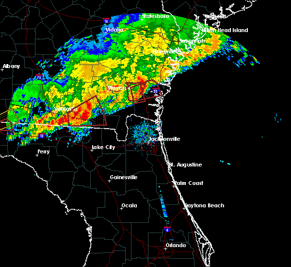 At 903 am est, a severe thunderstorm capable of producing a tornado was located near waynesville, or 10 miles east of nahunta, moving east at 35 mph (radar indicated rotation). Hazards include tornado. Flying debris will be dangerous to those caught without shelter. mobile homes will be damaged or destroyed. damage to roofs, windows, and vehicles will occur. tree damage is likely. This tornadic thunderstorm will remain over mainly rural areas of northwestern camden and eastern brantley counties, including the following locations: hortense and atkinson. At 903 am est, a severe thunderstorm capable of producing a tornado was located near waynesville, or 10 miles east of nahunta, moving east at 35 mph (radar indicated rotation). Hazards include tornado. Flying debris will be dangerous to those caught without shelter. mobile homes will be damaged or destroyed. damage to roofs, windows, and vehicles will occur. tree damage is likely. This tornadic thunderstorm will remain over mainly rural areas of northwestern camden and eastern brantley counties, including the following locations: hortense and atkinson.
|
| 1/22/2017 8:38 AM EST |
 At 838 am est, a severe thunderstorm capable of producing a tornado was located near nahunta, moving east at 40 mph (radar indicated rotation). Hazards include tornado. Flying debris will be dangerous to those caught without shelter. mobile homes will be damaged or destroyed. damage to roofs, windows, and vehicles will occur. tree damage is likely. this dangerous storm will be near, raybon around 845 am est. waynesville around 900 am est. Other locations impacted by this tornadic thunderstorm include hortense, tarboro, atkinson and winokur. At 838 am est, a severe thunderstorm capable of producing a tornado was located near nahunta, moving east at 40 mph (radar indicated rotation). Hazards include tornado. Flying debris will be dangerous to those caught without shelter. mobile homes will be damaged or destroyed. damage to roofs, windows, and vehicles will occur. tree damage is likely. this dangerous storm will be near, raybon around 845 am est. waynesville around 900 am est. Other locations impacted by this tornadic thunderstorm include hortense, tarboro, atkinson and winokur.
|
| 1/22/2017 8:30 AM EST |
 At 829 am est, a severe thunderstorm capable of producing a tornado was located over fort mudge, or 11 miles southwest of nahunta, moving east at 45 mph (radar indicated rotation). Hazards include tornado. Flying debris will be dangerous to those caught without shelter. mobile homes will be damaged or destroyed. damage to roofs, windows, and vehicles will occur. tree damage is likely. This dangerous storm will be near, nahunta and hickox around 845 am est. At 829 am est, a severe thunderstorm capable of producing a tornado was located over fort mudge, or 11 miles southwest of nahunta, moving east at 45 mph (radar indicated rotation). Hazards include tornado. Flying debris will be dangerous to those caught without shelter. mobile homes will be damaged or destroyed. damage to roofs, windows, and vehicles will occur. tree damage is likely. This dangerous storm will be near, nahunta and hickox around 845 am est.
|
| 1/22/2017 8:21 AM EST |
 At 821 am est, a severe thunderstorm capable of producing a tornado was located over braganza, or 8 miles southeast of waycross, moving east at 40 mph (radar indicated rotation). Hazards include tornado. Flying debris will be dangerous to those caught without shelter. mobile homes will be damaged or destroyed. damage to roofs, windows, and vehicles will occur. tree damage is likely. this dangerous storm will be near, fort mudge around 830 am est. Nahunta and hickox around 845 am est. At 821 am est, a severe thunderstorm capable of producing a tornado was located over braganza, or 8 miles southeast of waycross, moving east at 40 mph (radar indicated rotation). Hazards include tornado. Flying debris will be dangerous to those caught without shelter. mobile homes will be damaged or destroyed. damage to roofs, windows, and vehicles will occur. tree damage is likely. this dangerous storm will be near, fort mudge around 830 am est. Nahunta and hickox around 845 am est.
|
| 7/17/2016 5:33 PM EDT |
 At 533 pm edt, a severe thunderstorm was located over raybon, or near nahunta, moving southwest at 10 mph (radar indicated). Hazards include 60 mph wind gusts and quarter size hail. Hail damage to vehicles is expected. expect wind damage to roofs, siding, and trees. Locations impacted include, nahunta, waynesville, raybon, hickox, atkinson and hortense. At 533 pm edt, a severe thunderstorm was located over raybon, or near nahunta, moving southwest at 10 mph (radar indicated). Hazards include 60 mph wind gusts and quarter size hail. Hail damage to vehicles is expected. expect wind damage to roofs, siding, and trees. Locations impacted include, nahunta, waynesville, raybon, hickox, atkinson and hortense.
|
| 7/17/2016 5:08 PM EDT |
 At 508 pm edt, a severe thunderstorm was located near raybon, or near nahunta, moving southwest at 10 mph (radar indicated). Hazards include 60 mph wind gusts and quarter size hail. Hail damage to vehicles is expected. Expect wind damage to roofs, siding, and trees. At 508 pm edt, a severe thunderstorm was located near raybon, or near nahunta, moving southwest at 10 mph (radar indicated). Hazards include 60 mph wind gusts and quarter size hail. Hail damage to vehicles is expected. Expect wind damage to roofs, siding, and trees.
|
| 5/31/2016 7:41 PM EDT | The severe thunderstorm warning for northwestern camden, west central glynn and northeastern brantley counties will expire at 745 pm edt, the storm which prompted the warning has weakened below severe limits, and no longer pose an immediate threat to life or property. therefore the warning will be allowed to expire. however gusty winds are still possible with this thunderstorm. to report severe weather, contact your nearest law enforcement agency. they will relay your report to the national weather service jacksonville. |
| 5/31/2016 7:26 PM EDT |
 At 726 pm edt, a severe thunderstorm was located over waynesville, or 9 miles east of nahunta, moving southeast at 15 mph (radar indicated). Hazards include 60 mph wind gusts. Expect damage to roofs. siding. and trees. Locations impacted include, nahunta, waynesville, raybon, waverly and atkinson. At 726 pm edt, a severe thunderstorm was located over waynesville, or 9 miles east of nahunta, moving southeast at 15 mph (radar indicated). Hazards include 60 mph wind gusts. Expect damage to roofs. siding. and trees. Locations impacted include, nahunta, waynesville, raybon, waverly and atkinson.
|
| 5/31/2016 7:07 PM EDT |
 At 707 pm edt, a severe thunderstorm was located near waynesville, or 8 miles northeast of nahunta, moving southeast at 15 mph (radar indicated). Hazards include 60 mph wind gusts and penny size hail. Expect damage to roofs. siding. And trees. At 707 pm edt, a severe thunderstorm was located near waynesville, or 8 miles northeast of nahunta, moving southeast at 15 mph (radar indicated). Hazards include 60 mph wind gusts and penny size hail. Expect damage to roofs. siding. And trees.
|
| 4/1/2016 6:57 PM EDT | The severe thunderstorm warning for northeastern brantley and southeastern wayne counties will expire at 700 pm edt, the storms which prompted the warning have weakened below severe limits, and no longer pose an immediate threat to life or property. therefore the warning will be allowed to expire. however heavy rain is still possible with these thunderstorms. a tornado watch remains in effect until 900 pm edt for southeastern georgia. |
| 4/1/2016 6:47 PM EDT |
 At 647 pm edt, severe thunderstorms were located along a line extending from near ludowici to gardi to near hickox, moving northeast at 55 mph (radar indicated). Hazards include 60 mph wind gusts. Expect damage to roofs. siding. and trees. locations impacted include, jesup, nahunta, gardi, waynesville, doctortown, raybon, hickox, atkinson, broadhurst, mount pleasant and hortense. A tornado watch remains in effect until 900 pm edt for southeastern georgia. At 647 pm edt, severe thunderstorms were located along a line extending from near ludowici to gardi to near hickox, moving northeast at 55 mph (radar indicated). Hazards include 60 mph wind gusts. Expect damage to roofs. siding. and trees. locations impacted include, jesup, nahunta, gardi, waynesville, doctortown, raybon, hickox, atkinson, broadhurst, mount pleasant and hortense. A tornado watch remains in effect until 900 pm edt for southeastern georgia.
|
| 4/1/2016 6:27 PM EDT |
 At 626 pm edt, severe thunderstorms were located along a line extending from near odum to near offerman to near fort mudge, moving east at 45 mph (radar indicated). Hazards include 60 mph wind gusts. Expect damage to roofs. siding. and trees. locations impacted include, jesup, nahunta, patterson, gardi, screven, odum, offerman, waynesville, doctortown, raybon, fort mudge, hickox, atkinson, mount pleasant, hortense and broadhurst. A tornado watch remains in effect until 900 pm edt for southeastern georgia. At 626 pm edt, severe thunderstorms were located along a line extending from near odum to near offerman to near fort mudge, moving east at 45 mph (radar indicated). Hazards include 60 mph wind gusts. Expect damage to roofs. siding. and trees. locations impacted include, jesup, nahunta, patterson, gardi, screven, odum, offerman, waynesville, doctortown, raybon, fort mudge, hickox, atkinson, mount pleasant, hortense and broadhurst. A tornado watch remains in effect until 900 pm edt for southeastern georgia.
|
| 4/1/2016 6:09 PM EDT |
 At 608 pm edt, severe thunderstorms were located along a line extending from near surrency to near blackshear to 8 miles southwest of boggy bay, moving northeast at 50 mph (radar indicated). Hazards include 60 mph wind gusts. Expect damage to roofs. siding. And trees. At 608 pm edt, severe thunderstorms were located along a line extending from near surrency to near blackshear to 8 miles southwest of boggy bay, moving northeast at 50 mph (radar indicated). Hazards include 60 mph wind gusts. Expect damage to roofs. siding. And trees.
|
| 4/1/2016 5:25 PM EDT |
 The severe thunderstorm warning for southwestern brantley county will expire at 530 pm edt, the storm which prompted the warning has moved out of the area. therefore the warning will be allowed to expire. a tornado watch remains in effect until 900 pm edt for southeastern georgia. The severe thunderstorm warning for southwestern brantley county will expire at 530 pm edt, the storm which prompted the warning has moved out of the area. therefore the warning will be allowed to expire. a tornado watch remains in effect until 900 pm edt for southeastern georgia.
|
| 4/1/2016 5:24 PM EDT | 911 call center reports a tree fell on a powerline at the intersection of albert gibson rd and browntown r in brantley county GA, 13.2 miles WSW of Nahunta, GA |
| 4/1/2016 5:10 PM EDT |
 At 510 pm edt, a severe thunderstorm was located over hickox, or near nahunta, moving northeast at 40 mph (radar indicated). Hazards include 60 mph wind gusts. Expect damage to roofs. siding. And trees. At 510 pm edt, a severe thunderstorm was located over hickox, or near nahunta, moving northeast at 40 mph (radar indicated). Hazards include 60 mph wind gusts. Expect damage to roofs. siding. And trees.
|
| 4/1/2016 5:00 PM EDT | 911 call center reports a tree down near the intersection of caney bay rd and britt still r in brantley county GA, 4.6 miles NE of Nahunta, GA |
| 4/1/2016 4:54 PM EDT |
 At 453 pm edt, a severe thunderstorm was located near fort mudge, or 13 miles southwest of nahunta, moving east at 40 mph (radar indicated). Hazards include 60 mph wind gusts. Expect damage to roofs. siding. and trees. locations impacted include, hickox and fort mudge. A tornado watch remains in effect until 900 pm edt for southeastern georgia. At 453 pm edt, a severe thunderstorm was located near fort mudge, or 13 miles southwest of nahunta, moving east at 40 mph (radar indicated). Hazards include 60 mph wind gusts. Expect damage to roofs. siding. and trees. locations impacted include, hickox and fort mudge. A tornado watch remains in effect until 900 pm edt for southeastern georgia.
|
| 4/1/2016 4:40 PM EDT |
 At 440 pm edt, a severe thunderstorm was located 8 miles south of braganza, or 13 miles south of waycross, moving northeast at 40 mph (radar indicated). Hazards include 60 mph wind gusts. Expect damage to roofs. siding. And trees. At 440 pm edt, a severe thunderstorm was located 8 miles south of braganza, or 13 miles south of waycross, moving northeast at 40 mph (radar indicated). Hazards include 60 mph wind gusts. Expect damage to roofs. siding. And trees.
|
| 8/22/2015 9:01 PM EDT |
 At 901 pm edt, doppler radar indicated a severe thunderstorm capable of producing quarter size hail and damaging winds in excess of 60 mph. this storm was located over fort mudge, or 11 miles southeast of blackshear, and moving southwest at 25 mph. At 901 pm edt, doppler radar indicated a severe thunderstorm capable of producing quarter size hail and damaging winds in excess of 60 mph. this storm was located over fort mudge, or 11 miles southeast of blackshear, and moving southwest at 25 mph.
|
| 8/22/2015 8:13 PM EDT |
 At 812 pm edt, doppler radar indicated severe thunderstorms capable of producing quarter size hail and damaging winds in excess of 60 mph. this storm was located near thalmann, or 12 miles south of gardi, and moving south at 25 mph. At 812 pm edt, doppler radar indicated severe thunderstorms capable of producing quarter size hail and damaging winds in excess of 60 mph. this storm was located near thalmann, or 12 miles south of gardi, and moving south at 25 mph.
|
| 8/17/2015 3:50 PM EDT |
 At 349 pm edt, doppler radar indicated a severe thunderstorm capable of producing damaging winds in excess of 60 mph. this storm was located near waverly, or 10 miles northwest of woodbine, and moving northeast at 15 mph. At 349 pm edt, doppler radar indicated a severe thunderstorm capable of producing damaging winds in excess of 60 mph. this storm was located near waverly, or 10 miles northwest of woodbine, and moving northeast at 15 mph.
|
| 7/14/2015 6:11 PM EDT |
 The severe thunderstorm warning for southeastern brantley, southwestern glynn, northwestern camden and northeastern charlton counties will expire at 615 pm edt, the storm which prompted the warning has weakened below severe limits, and no longer poses an immediate threat to life or property. therefore the warning will be allowed to expire. however gusty winds are still possible with this thunderstorm. The severe thunderstorm warning for southeastern brantley, southwestern glynn, northwestern camden and northeastern charlton counties will expire at 615 pm edt, the storm which prompted the warning has weakened below severe limits, and no longer poses an immediate threat to life or property. therefore the warning will be allowed to expire. however gusty winds are still possible with this thunderstorm.
|
| 7/14/2015 6:02 PM EDT |
 At 602 pm edt, doppler radar indicated a severe thunderstorm capable of producing quarter size hail and damaging winds in excess of 60 mph. this storm was located near dock junction, moving east at 25 mph. locations impacted include, brunswick, woodbine, nahunta, waynesville, waverly, hickox, atkinson, tarboro, winokur and colesburg. At 602 pm edt, doppler radar indicated a severe thunderstorm capable of producing quarter size hail and damaging winds in excess of 60 mph. this storm was located near dock junction, moving east at 25 mph. locations impacted include, brunswick, woodbine, nahunta, waynesville, waverly, hickox, atkinson, tarboro, winokur and colesburg.
|
| 7/14/2015 5:30 PM EDT | The law enforcement received reports of trees down in the nahunta are in brantley county GA, 0.4 miles WSW of Nahunta, GA |
| 7/14/2015 5:30 PM EDT |
 At 530 pm edt, doppler radar indicated a severe thunderstorm capable of producing quarter size hail and damaging winds in excess of 60 mph. this storm was located near hickox, or 7 miles south of nahunta, and moving southeast at 25 mph. At 530 pm edt, doppler radar indicated a severe thunderstorm capable of producing quarter size hail and damaging winds in excess of 60 mph. this storm was located near hickox, or 7 miles south of nahunta, and moving southeast at 25 mph.
|
| 7/2/2015 6:02 PM EDT |
 At 601 pm edt, doppler radar indicated a line of severe thunderstorms capable of producing damaging winds in excess of 60 mph. these storms were located along a line extending from 9 miles northeast of alma to near fort mudge to 9 miles west of stephen foster state park, moving east at 30 mph. locations impacted include, blackshear, nahunta, patterson, screven, offerman, race pond, bristol, braganza, raybon, fort mudge, hickox, boggy bay, hortense and new lacy. At 601 pm edt, doppler radar indicated a line of severe thunderstorms capable of producing damaging winds in excess of 60 mph. these storms were located along a line extending from 9 miles northeast of alma to near fort mudge to 9 miles west of stephen foster state park, moving east at 30 mph. locations impacted include, blackshear, nahunta, patterson, screven, offerman, race pond, bristol, braganza, raybon, fort mudge, hickox, boggy bay, hortense and new lacy.
|
| 7/2/2015 5:38 PM EDT |
 At 538 pm edt, doppler radar indicated a line of severe thunderstorms capable of producing damaging winds in excess of 60 mph. these storms were located along a line extending from 8 miles north of alma to near sunnyside to 11 miles southeast of homerville, and moving east at 30 mph. At 538 pm edt, doppler radar indicated a line of severe thunderstorms capable of producing damaging winds in excess of 60 mph. these storms were located along a line extending from 8 miles north of alma to near sunnyside to 11 miles southeast of homerville, and moving east at 30 mph.
|
| 6/18/2015 6:10 PM EDT | The sheriffs reported trees down along u.s. highway 301 near nahunta. the time given was based on rada in brantley county GA, 2.6 miles N of Nahunta, GA |
| 6/12/2015 5:55 PM EDT |
 At 555 pm edt, doppler radar indicated a severe thunderstorm capable of producing destructive winds in excess of 70 mph. this storm was located 7 miles north of raybon, or 11 miles north of nahunta, and moving east at 40 mph. penny size hail may also accompany the damaging winds. At 555 pm edt, doppler radar indicated a severe thunderstorm capable of producing destructive winds in excess of 70 mph. this storm was located 7 miles north of raybon, or 11 miles north of nahunta, and moving east at 40 mph. penny size hail may also accompany the damaging winds.
|
| 6/3/2015 7:31 PM EDT | At 731 pm edt, doppler radar indicated a line of severe thunderstorms capable of producing quarter size hail and damaging winds in excess of 60 mph. these storms were located along a line extending from near waynesville to near hickox, and moving southeast at 15 mph. |
| 6/3/2015 6:31 PM EDT | At 630 pm edt, doppler radar indicated a line of severe thunderstorms capable of producing damaging winds in excess of 60 mph. these storms were located along a line extending from near patterson to 6 miles west of cox, moving southeast at 10 mph. nickel size hail may also accompany the damaging winds. locations impacted include, nahunta, patterson, waynesville, everett, thalmann, raybon, hickox, atkinson, mount pleasant and hortense. |
| 6/3/2015 6:16 PM EDT | At 615 pm edt, doppler radar indicated a line of severe thunderstorms capable of producing destructive winds in excess of 70 mph. these storms were located along a line extending from near patterson to 6 miles east of gardi, and moving southeast at 10 mph. nickel size hail may also accompany the damaging winds. |
| 6/3/2015 3:43 PM EDT | The severe thunderstorm warning for central brantley, northwestern camden and northeastern charlton counties will expire at 345 pm edt, the storm which prompted the warning has weakened below severe limits, and no longer poses an immediate threat to life or property. therefore the warning will be allowed to expire. however small. |
| 6/3/2015 3:15 PM EDT | At 315 pm edt, doppler radar indicated a severe thunderstorm capable of producing quarter size hail and damaging winds in excess of 60 mph. this storm was located 7 miles southeast of hickox, or 11 miles south of nahunta, and moving north at 10 mph. |
| 4/25/2015 9:16 PM EDT | At 916 pm edt, doppler radar indicated a line of severe thunderstorms capable of producing quarter size hail and damaging winds in excess of 60 mph. these storms were located along a line extending from near donald to near jesup to 7 miles southeast of homerville, and moving east at 70 mph. |
| 4/19/2015 3:07 PM EDT | At 306 pm edt, doppler radar indicated a line of severe thunderstorms capable of producing damaging winds in excess of 60 mph. these storms were located along a line extending from near offerman to near screven to nahunta, moving east at 15 mph. nickel size hail may also accompany the damaging winds. locations impacted include, nahunta, screven, raybon, hickox and hortense. a tornado watch remains in effect until 800 pm edt for southeastern georgia. |
| 4/19/2015 2:52 PM EDT | At 252 pm edt, doppler radar indicated a line of severe thunderstorms capable of producing damaging winds in excess of 60 mph. these storms were located along a line extending from near bristol to patterson to near fort mudge, and moving east at 10 mph. nickel size hail may also accompany the damaging winds. |
| 4/13/2015 4:55 PM EDT | The national weather service in jacksonville has issued a * severe thunderstorm warning for. north central brantley county in southeastern georgia. southeastern pierce county in southeastern georgia. south central wayne county in southeastern georgia. Until 530 pm edt. |
| 9/2/2014 3:11 PM EDT | Tree down on road near hwy 3 in brantley county GA, 9.9 miles SSW of Nahunta, GA |
| 6/24/2014 6:18 PM EDT | Widespread trees and power lines were blown down across the nahunta are in brantley county GA, 0.4 miles WSW of Nahunta, GA |
| 6/24/2014 6:10 PM EDT | Trees and power lines were blown down across hortens in brantley county GA, 8.6 miles S of Nahunta, GA |
| 6/10/2014 7:30 PM EDT | Brantley county 911 dispatch reports numerous trees downed in the central and western half of the county...particularly around nahunt in brantley county GA, 0.4 miles WSW of Nahunta, GA |
| 6/10/2014 7:05 PM EDT | Quarter sized hail reported 4 miles NNE of Nahunta, GA, brantley county 911 dispatch relayed a report of quarter sized hail and numerous trees downed by thunderstorm wind gusts in the hickox area. time of damage based on rad |
| 5/25/2014 3:43 PM EDT | Quarter sized hail reported 7 miles NNW of Nahunta, GA, local news station showed a viewer video of quarter size hail near hickox. |
| 5/25/2014 3:05 PM EDT | Quarter sized hail reported 8.6 miles S of Nahunta, GA, reported by ham operator. |
| 9/5/2013 5:10 PM EDT | Tree down blocking the road across highway 301. time of event based on rada in brantley county GA, 0.4 miles WSW of Nahunta, GA |
| 8/14/2013 6:50 PM EDT | Tree was reported down at the intersection of knox road and ham roa in brantley county GA, 5.4 miles WNW of Nahunta, GA |
| 5/19/2013 7:16 PM EDT | Central dispatch reported a tree down on a house and a car as well as a tree across the road near raybon road west and oak grove road in nahunt in brantley county GA, 4.4 miles SSE of Nahunta, GA |
| 5/19/2013 7:00 PM EDT | Central dispatch reported some structural damage to outbuildings in the hortense are in brantley county GA, 8.6 miles S of Nahunta, GA |
| 7/1/2012 10:45 PM EDT | The call center reported trees and powerlines down. the time given was based on rada in brantley county GA, 0.4 miles WSW of Nahunta, GA |
| 5/22/2012 9:45 PM EDT | Quarter sized hail reported 7.9 miles NW of Nahunta, GA, quarter size hail was reported in the riverside area of southeast brantley county. |
| 1/1/0001 12:00 AM | The 911 call center received 2 reports of trees down that were blocking canney bay and jess allen roads. the time given was based on rada in brantley county GA, 4.2 miles NNE of Nahunta, GA |
| 1/1/0001 12:00 AM | Approximately one hundred trees were reported down in the hortense area...many were large oak trees. one mobile home was destroyed. two mobile homes were damaged. signi in brantley county GA, 8.6 miles S of Nahunta, GA |
| 1/1/0001 12:00 AM | A power pole reported down in waynesvill in brantley county GA, 11.7 miles W of Nahunta, GA |
| 1/1/0001 12:00 AM | The waverly minit mart passed along a report from a customer who had large trees down on property with minor damage to home off county road 17 in brantley county GA, 12.2 miles W of Nahunta, GA |
| 1/1/0001 12:00 AM | Trees and powerline reported down near browntown road. time of event based on rada in brantley county GA, 12.3 miles WSW of Nahunta, GA |
| 1/1/0001 12:00 AM | Emergency management reported several trees down across northeastern brantley county. time is estimated from rada in brantley county GA, 13.4 miles SW of Nahunta, GA |
| 1/1/0001 12:00 AM | Ema reported trees down at riverside rock road in nahunta. time is estimated based on radar imager in brantley county GA, 0.9 miles SSW of Nahunta, GA |
| 1/1/0001 12:00 AM | Large tree down near hwy 82 and cr110 in brantley county GA, 9.9 miles W of Nahunta, GA |
| 1/1/0001 12:00 AM | Trees reported down by emergency management between waynesville and browntow in brantley county GA, 11.8 miles W of Nahunta, GA |
| 1/1/0001 12:00 AM | Quarter sized hail reported 13.4 miles WSW of Nahunta, GA, the public reported quarter size hail that lasted for 15 minutes. the hail covered the ground and knocked down a lot of tree limbs. |
| 1/1/0001 12:00 AM | Numerous trees were reported down in hortense...including 2 large oak trees down on church roa in brantley county GA, 8.6 miles S of Nahunta, GA |
Hail Maps for Nahunta, GA


Connect with Interactive Hail Maps