

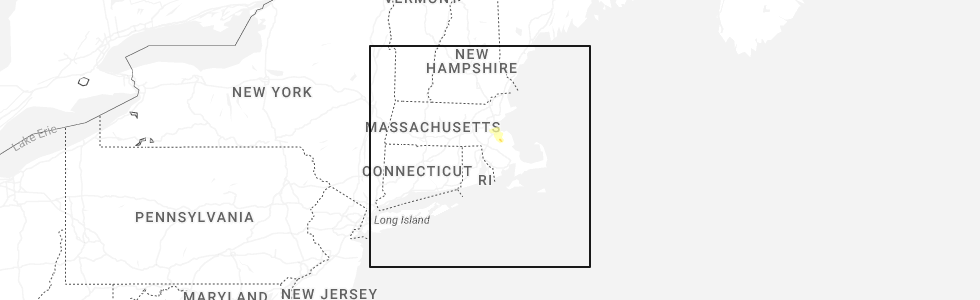
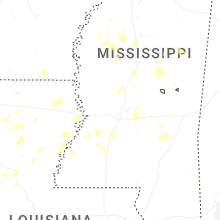
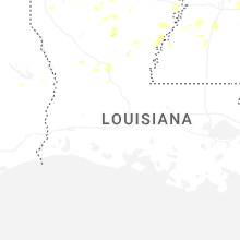
Hail Map for Thursday, August 14, 2025
Number of Impacted Households on 8/14/2025
0
Impacted by 1" or Larger Hail
0
Impacted by 1.75" or Larger Hail
0
Impacted by 2.5" or Larger Hail
Square Miles of Populated Area Impacted on 8/14/2025
0
Impacted by 1" or Larger Hail
0
Impacted by 1.75" or Larger Hail
0
Impacted by 2.5" or Larger Hail
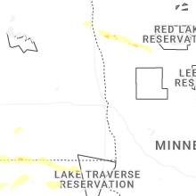
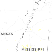
Cities Most Affected by Hail Storms of 8/14/2025
| Hail Size | Demographics of Zip Codes Affected | ||||||
|---|---|---|---|---|---|---|---|
| City | Count | Average | Largest | Pop Density | House Value | Income | Age |
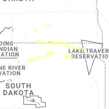
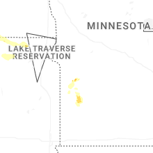
| Minneota, MN | 1 | 1.75 | 1.75 | 14 | $64k | $37.2k | 43.1 |
Hail and Wind Damage Spotted on 8/14/2025
Filter by Report Type:Hail ReportsWind Reports
States Impacted
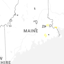
Maine, North Carolina, Virginia, Louisiana, Utah, New Hampshire, Minnesota, Mississippi, Idaho, Wyoming, Massachusetts, Colorado, South DakotaMaine
| Local Time | Report Details |
|---|---|
| 2:25 PM EDT | Fire department reported large tree down blocking intersection of high st and rt. 35 in hollis. time estimated by rada in york county ME, 17.7 miles W of Portland, ME |
| 4:29 PM EDT | Tree and powerlines down across a road in princeton. time estimated by rada in washington county ME, 65.5 miles ENE of Bangor, ME |
| 4:29 PM EDT | Corrects previous tstm wnd dmg report from princeton. washington county emergency management reports multiple trees down on route 1 in princeton. time estimated based o in washington county ME, 65.1 miles ENE of Bangor, ME |
| 5:20 PM EDT | A spotter reported trees down in calais. time estimated by rada in washington county ME, 78.1 miles ENE of Bangor, ME |
| 5:25 PM EDT | Social media report of numerous pine trees down on route 1 near calais. time estimated based on rada in washington county ME, 75.8 miles ENE of Bangor, ME |
| 5:29 PM EDT | Washington county emergency management reports multiple trees down on route 1 in princeton. time estimated based on rada in washington county ME, 65.1 miles ENE of Bangor, ME |
North Carolina
| Local Time | Report Details |
|---|---|
| 2:50 PM EDT | Tree down on randy lan in surry county NC, 66 miles SSW of Roanoke, VA |
Virginia
| Local Time | Report Details |
|---|---|
| 3:15 PM EDT | One tree down across maplewood avenu in henry county VA, 36.7 miles S of Roanoke, VA |
| 3:27 PM EDT | Several trees down on the 800 block of mt. atlas roa in rockbridge county VA, 51.8 miles NE of Roanoke, VA |
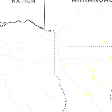
Louisiana
| Local Time | Report Details |
|---|---|
| 3:00 PM CDT | A tree was blown down across a power line along highway 154 near branch loop roa in bienville county LA, 36.7 miles ESE of Shreveport, LA |
Utah
| Local Time | Report Details |
|---|---|
| 2:43 PM MDT | Asos station kpuc price-carbon cnty rgnl arp in carbon county UT, 3.5 miles ENE of Price, UT |
| 3:15 PM MDT | Mesonet station bflat bonneville salt flat in tooele county UT, 101.7 miles E of Elko, NV |
| 3:27 PM MDT | Semi blower on i-80 mile marker 8. time estimated from rada in tooele county UT, 97.7 miles E of Elko, NV |
| 3:30 PM MDT | Mesonet station bflat bonneville salt flats. peak gust over prior 30 mi in tooele county UT, 101.7 miles E of Elko, NV |
| 4:11 PM MDT | Mesonet station ur308 2.5 nw luci in box elder county UT, 86 miles SSE of Twin Falls, ID |
| 4:40 PM MDT | Mesonet station dpg24 w of wildca in tooele county UT, 85.9 miles WSW of Salt Lake City, UT |
New Hampshire
| Local Time | Report Details |
|---|---|
| 4:44 PM EDT | Personal weather station knhnewha17 gusted to 58 mp in rockingham county NH, 46.9 miles SSW of Portland, ME |
| 4:50 PM EDT | Tree snapped in half and downed near watsons ln on mill rd partially blocking traffic. time estimated by rada in rockingham county NH, 56.8 miles SSW of Portland, ME |
| 4:55 PM EDT | Delayed report...off-duty firefighter observed winds blow down a tree onto a home on the 70-block of kings hwy. no injuries. time estimated by rada in rockingham county NH, 57.3 miles SSW of Portland, ME |
Minnesota
| Local Time | Report Details |
|---|---|
| 3:46 PM CDT | Half Dollar sized hail reported near Dawson, MN, 13.1 miles WNW of Montevideo, MN, spotter also estimated wind gusts of 60 mph. |
| 6:04 PM CDT | Golf Ball sized hail reported near Minneota, MN, 27.4 miles SSW of Montevideo, MN, report and photo via social media. time estimated by radar. |
| 6:48 PM CDT | Half Dollar sized hail reported near Marshall, MN, 34.3 miles SSW of Montevideo, MN, quarter to half dollar sized hail... along with moderate to heavy rain. |
| 10:21 PM CDT | Quarter sized hail reported near Euclid, MN, 71.2 miles SSW of Roseau, MN, hailing at time of the report. estimated size. |
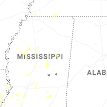
Mississippi
| Local Time | Report Details |
|---|---|
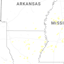
| 4:35 PM CDT | Trees downed on brooks ave... rhonda dr... and leesburg rd. a window was blown out at pelahatchie city hal in rankin county MS, 22.3 miles E of Jackson, MS |
Idaho
| Local Time | Report Details |
|---|---|
| 4:15 PM MDT | Mesonet station 3004 d4 juniper interchange i-8 in oneida county ID, 81.5 miles ESE of Twin Falls, ID |
| 5:30 PM MDT | Mesonet station blu blue dom in clark county ID, 56.4 miles NW of Idaho Falls, ID |
| 7:50 PM MDT | Mesonet station pc624 alpon eas in bear lake county ID, 99.1 miles SSE of Idaho Falls, ID |
Wyoming
| Local Time | Report Details |
|---|---|
| 4:20 PM MDT | Mesonet station pc462 irma lak in park county WY, 102.6 miles NNW of Riverton, WY |
| 4:46 PM MDT | Mesonet station krec red canyon - south pas in fremont county WY, 30.3 miles SSW of Riverton, WY |
| 5:00 PM MDT | Mesonet station pc457 hidden dom in washakie county WY, 76.7 miles NNE of Riverton, WY |
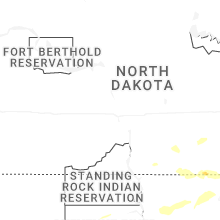
| 9:32 PM MDT | Storm damage reported in weston county WY, 44.7 miles W of Rapid City, SD |
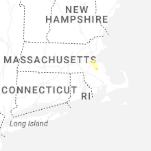
Massachusetts
| Local Time | Report Details |
|---|---|
| 7:00 PM EDT | Tree and wires down on south street. relayed by amateur radi in norfolk county MA, 22.7 miles NNE of Providence, RI |
| 7:14 PM EDT | In stoughton tree and wires down in area of kenmore roa in norfolk county MA, 26.8 miles NE of Providence, RI |
| 7:20 PM EDT | Tree down on house in howe circle. relayed by amateur radi in norfolk county MA, 29.8 miles NE of Providence, RI |
| 7:24 PM EDT | Tree down across road area of pratt stree in norfolk county MA, 28.5 miles NE of Providence, RI |
| 7:26 PM EDT | Ping Pong Ball sized hail reported near Rockland, MA, 33 miles NE of Providence, RI |
| 7:39 PM EDT | In whitman two trees down in area of auburn stree in plymouth county MA, 30.1 miles NE of Providence, RI |
Colorado
| Local Time | Report Details |
|---|---|
| 5:05 PM MDT | Quarter sized hail reported near Limon, CO, 69.9 miles NE of Pueblo, CO, off duty nws employee reported hail up to quarter size. time and location estimated by radar. |
| 5:43 PM MDT | Wl-prospect valley2.52n in weld county CO, 40.9 miles NE of Denver, CO |
| 9:15 PM MDT | Associated with likely heatburs in kit carson county CO, 59.3 miles SSW of Yuma, CO |
South Dakota
| Local Time | Report Details |
|---|---|
| 11:26 PM MDT | Storm damage reported in pennington county SD, 37.1 miles ESE of Rapid City, SD |
| 11:28 PM MDT | Storm damage reported in pennington county SD, 36.4 miles E of Rapid City, SD |
| 11:30 PM MDT | Storm damage reported in pennington county SD, 38.9 miles E of Rapid City, SD |
| 11:38 PM MDT | Storm damage reported in pennington county SD, 36.4 miles E of Rapid City, SD |
| 12:23 AM MDT | Storm damage reported in jackson county SD, 72.3 miles ESE of Rapid City, SD |
| 12:32 AM MDT | Storm damage reported in meade county SD, 69.3 miles ENE of Rapid City, SD |
| 6:35 AM CDT | Thunderstorm wind gust measurement from a personal weather statio in marshall county SD, 36.9 miles NE of Aberdeen, SD |
Connect with Interactive Hail Maps