

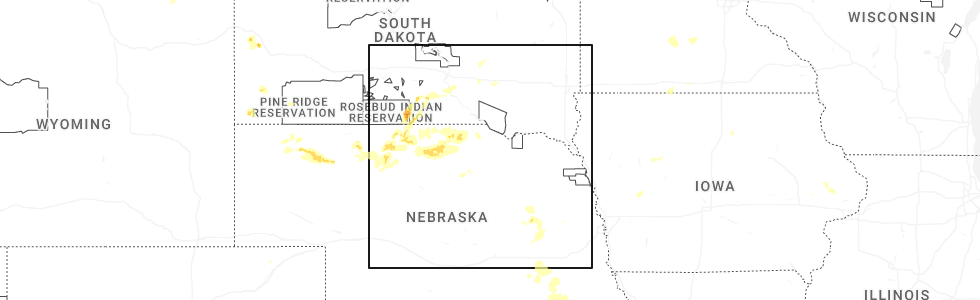
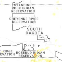
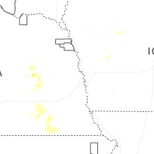
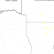
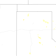
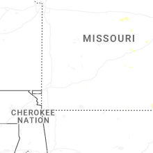
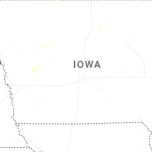
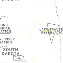
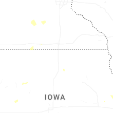
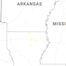
Hail Map for Sunday, August 17, 2025
Number of Impacted Households on 8/17/2025
0
Impacted by 1" or Larger Hail
0
Impacted by 1.75" or Larger Hail
0
Impacted by 2.5" or Larger Hail
Square Miles of Populated Area Impacted on 8/17/2025
0
Impacted by 1" or Larger Hail
0
Impacted by 1.75" or Larger Hail
0
Impacted by 2.5" or Larger Hail

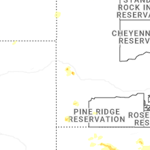
Cities Most Affected by Hail Storms of 8/17/2025
| Hail Size | Demographics of Zip Codes Affected | ||||||
|---|---|---|---|---|---|---|---|
| City | Count | Average | Largest | Pop Density | House Value | Income | Age |
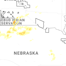
| Ainsworth, NE | 1 | 1.75 | 1.75 | 3 | $46k | $29.3k | 48.1 |
Hail and Wind Damage Spotted on 8/17/2025
Filter by Report Type:Hail ReportsWind Reports
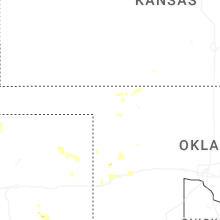
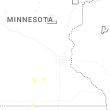
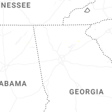
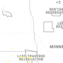
States Impacted
South Dakota, Pennsylvania, Tennessee, Maine, Maryland, Arkansas, Oklahoma, Missouri, Texas, Mississippi, Montana, Louisiana, Kansas, NebraskaSouth Dakota
| Local Time | Report Details |
|---|---|
| 7:14 AM CDT | Asos station kabr aberdeen rgnl a in brown county SD, 3.3 miles E of Aberdeen, SD |
| 7:23 AM CDT | Asos station kabr aberdeen rgnl a in brown county SD, 3.3 miles E of Aberdeen, SD |
| 1:39 PM MDT | Quarter sized hail reported near Hot Springs, SD, 38.2 miles SSW of Rapid City, SD |
| 3:52 PM MDT | Quarter sized hail reported near Deadwood, SD, 22.4 miles WNW of Rapid City, SD |
| 9:30 PM CDT | Storm damage reported in tripp county SD, 48.9 miles NE of Valentine, NE |
Pennsylvania
| Local Time | Report Details |
|---|---|
| 1:25 PM EDT | Report of multiple trees down and snapped in backyard along baughman lane. time estimated based on rada in westmoreland county PA, 21 miles ESE of Pittsburgh, PA |
| 1:36 PM EDT | Several trees down in greensbur in westmoreland county PA, 25.2 miles ESE of Pittsburgh, PA |
| 1:45 PM EDT | Several trees down in unity townshi in westmoreland county PA, 30.2 miles ESE of Pittsburgh, PA |
| 1:47 PM EDT | Klbe airpor in westmoreland county PA, 33.1 miles ESE of Pittsburgh, PA |
| 2:35 PM EDT | Report of over 20 trees down within parking lot area of fallingwater. time estimated based on rada in fayette county PA, 45.9 miles SE of Pittsburgh, PA |
| 2:37 PM EDT | Report of tree on vehicle along holland hill road. time estimated based on rada in fayette county PA, 46.9 miles SSE of Pittsburgh, PA |
| 2:37 PM EDT | Report of tree down onto vehicle along mill run road. time estimated based on rada in fayette county PA, 47.6 miles SE of Pittsburgh, PA |
| 2:37 PM EDT | Tree down on glades pike near log house r in somerset county PA, 63.2 miles ESE of Pittsburgh, PA |
| 2:48 PM EDT | Report of tree down on sugar loaf road. time estimated based on rada in fayette county PA, 53.4 miles SE of Pittsburgh, PA |
| 2:49 PM EDT | Report of tree down on powerlines over mae west road. time estimated based on rada in fayette county PA, 54.3 miles SE of Pittsburgh, PA |
| 4:35 PM EDT | Trees down near frogtown road and marticville roa in lancaster county PA, 46.9 miles NNE of Baltimore, MD |
| 5:13 PM EDT | Trees down near deaver road and lancaster pik in lancaster county PA, 44.2 miles NNE of Baltimore, MD |
| 5:40 PM EDT | Wires down throughout wrightsdal in lancaster county PA, 40.8 miles NE of Baltimore, MD |
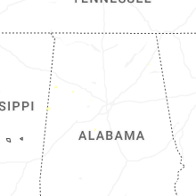
Tennessee
| Local Time | Report Details |
|---|---|
| 1:55 PM CDT | Delayed report. a rotten tree fell onto a mobile home. a couple other branches fell... one causing a power pole to lean. time of report based on rada in clay county TN, 75.3 miles ENE of Nashville, TN |
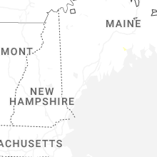
Maine
| Local Time | Report Details |
|---|---|
| 3:11 PM EDT | Fire department reports 1 tree down which took down some wires. time estimated by rada in penobscot county ME, 10.1 miles NE of Bangor, ME |
| 4:04 PM EDT | Tree down on powerlines on pitcher rd. time estimated by rada in waldo county ME, 29.7 miles SSW of Bangor, ME |
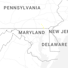
Maryland
| Local Time | Report Details |
|---|---|
| 3:37 PM EDT | Tree down at 901 michigan ave in allegany county MD, 76.7 miles NE of Elkins, WV |
| 3:37 PM EDT | Tree down near intersection of amherst ave and ore st in allegany county MD, 78.1 miles NE of Elkins, WV |
| 3:37 PM EDT | Tree down at 859 valley st in allegany county MD, 77.6 miles NE of Elkins, WV |
| 3:40 PM EDT | Allegany county 911 reported three downed trees in the cumberland are in allegany county MD, 76.7 miles NE of Elkins, WV |
| 5:42 PM EDT | Multiple trees downed onto us-1 in rising sun. additional trees were noted downed along the side of the road on the northbound side. corrected for tim in cecil county MD, 37.3 miles NE of Baltimore, MD |
| 6:00 PM EDT | Reports of multiple trees downed along us-222 north of conowingo to the pa state lin in cecil county MD, 36.7 miles NE of Baltimore, MD |
| 6:00 PM EDT | Quarter sized hail reported near Conowingo, MD, 36 miles NE of Baltimore, MD, trained spotter reports hail around quarter size... possibly slightly larger... in conowingo along us-222. |
| 6:35 PM EDT | Multiple trees downed onto us-1 in rising sun. additional trees were noted downed along the side of the road on the northbound sid in cecil county MD, 37.3 miles NE of Baltimore, MD |
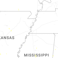
Arkansas
| Local Time | Report Details |
|---|---|
| 2:41 PM CDT | Large tree limbs down near the town of center hill. winds estimated by spotter of at least 60 mp in white county AR, 42 miles NNE of Little Rock, AR |
| 3:00 PM CDT | A few power poles were snapped in the vicinity of garner... utilized archived radar velocity to time even in white county AR, 38.9 miles NE of Little Rock, AR |
| 3:01 PM CDT | Watched tree fall live at i-57 and exit 42 (main street) via arkansas department of transportation camer in white county AR, 43.8 miles NE of Little Rock, AR |
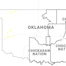
Oklahoma
| Local Time | Report Details |
|---|---|
| 2:55 PM CDT | A power pole and two large trees blown down near sulphur hills golf course. spotter network report. time estimated from rada in murray county OK, 49.5 miles W of Atoka, OK |
| 6:55 PM CDT | Buffalo mesone in harper county OK, 30.4 miles NNW of Woodward, OK |
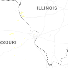
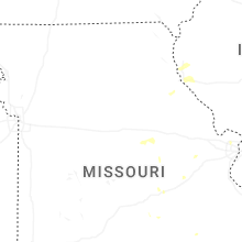
Missouri
| Local Time | Report Details |
|---|---|
| 4:21 PM CDT | Asos station kuno west plains aso in howell county MO, 55.9 miles SSW of Salem, MO |
| 4:47 PM CDT | Multiple trees dow in pulaski county MO, 32.3 miles WNW of Salem, MO |
| 4:55 PM CDT | Numerous limbs 12-18 inches in diameter and a few trees down in an area from grand ave to jefferson ave... north of 5th stree in franklin county MO, 45.2 miles W of Saint Louis, MO |
| 5:52 PM CDT | Storm damage reported in st. louis county MO, 12 miles NW of Saint Louis, MO |
| 7:13 PM CDT | Numerous power outage in texas county MO, 19.3 miles WSW of Salem, MO |
Texas
| Local Time | Report Details |
|---|---|
| 4:30 PM CDT | West texas mesone in lubbock county TX, 6.5 miles SSW of Lubbock, TX |
| 4:45 PM CDT | Report of a downed power pole blocking traffi in lubbock county TX, 3.5 miles SW of Lubbock, TX |
| 4:57 PM CDT | West texas mesone in lubbock county TX, 2.6 miles WNW of Lubbock, TX |
| 5:23 PM CDT | West texas mesonet. there was also a report of trees and fences blown down in turke in hall county TX, 41.2 miles W of Childress, TX |
| 5:23 PM CDT | West texas mesonet. there was also a report of zero mile visibility from wind-driven... torrential rainfall on the west loo in lubbock county TX, 5.1 miles WSW of Lubbock, TX |
| 5:23 PM CDT | Slack report and image of significant roof damage to an apartment complex... with roofs torn off the buildings. late report. time estimated by rada in lubbock county TX, 5.3 miles SW of Lubbock, TX |
| 5:39 PM CDT | Slack report of trees and fences blown down in turkey. west texas mesonet measured a 61 mph gust prior to the time of the received repor in hall county TX, 38.9 miles W of Childress, TX |
| 5:45 PM CDT | Damage to a fence of a residence was reported on social medi in tom green county TX, 82 miles SSW of Abilene, TX |
| 6:10 PM CDT | Report of roughly 60 mph wind gusts from a downburst that damaged part of a fence lin in tom green county TX, 84.1 miles SSW of Abilene, TX |
| 6:30 PM CDT | Fence line damage reported from downburst winds... estimated around 60 mp in tom green county TX, 84.7 miles SSW of Abilene, TX |
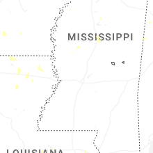
Mississippi
| Local Time | Report Details |
|---|---|
| 5:29 PM CDT | A 12-inch diameter tree was downed onto new hope road. dime sized hail was also observed in the are in montgomery county MS, 53.7 miles W of Starkville, MS |
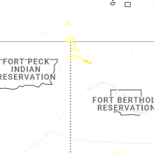
Montana
| Local Time | Report Details |
|---|---|
| 5:09 PM MDT | Ambient weather station. sustained winds of 47 mph at the time of observatio in fergus county MT, 82 miles ESE of Great Falls, MT |
| 5:30 PM MDT | Estimated wind gusts near 60 mph. apple tree took a hi in fergus county MT, 87.5 miles S of Havre, MT |
| 5:55 PM MDT | Storm damage reported in fergus county MT, 95.7 miles NNW of Billings, MT |
| 6:10 PM MDT | Crazy raws - elev 7321 fee in park county MT, 45.7 miles NE of Bozeman, MT |
| 6:25 PM MDT | 59 mph thunderstorm wind gust at roy e hydrome in fergus county MT, 93.2 miles SSE of Havre, MT |
| 6:25 PM MDT | War horse nw hydromet site from the montana climate office mesone in petroleum county MT, 94.4 miles N of Billings, MT |
| 6:30 PM MDT | War horse nw hydromet site from the montana climate office mesone in petroleum county MT, 94.4 miles N of Billings, MT |
| 6:45 PM MDT | Winnett dot sit in petroleum county MT, 85 miles N of Billings, MT |
| 6:55 PM MDT | Mosby nw hydromet site from the montana climate office mesone in petroleum county MT, 90.2 miles NNE of Billings, MT |
| 7:00 PM MDT | Dovetail hydromet site from the montana climate office mesone in petroleum county MT, 94.3 miles SW of Glasgow, MT |
| 8:45 PM MDT | Angela agrimet statio in rosebud county MT, 40.7 miles WNW of Miles City, MT |
| 10:05 PM MDT | Asos station kmls miles cit in custer county MT, 2.2 miles NW of Miles City, MT |
| 10:15 PM MDT | Tree downed into powerlin in custer county MT, 0.5 miles S of Miles City, MT |
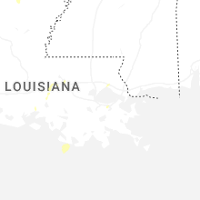
Louisiana
| Local Time | Report Details |
|---|---|
| 6:20 PM CDT | A skirting was blown off of a mobile home in the conway community. large tree limbs were snapped as well. report via social medi in union county LA, 28.7 miles WNW of Bastrop, LA |
| 6:33 PM CDT | A tree top was snapped and fell across jimmy johnson road just north of highway 1 in union county LA, 32.9 miles WNW of Bastrop, LA |
| 6:35 PM CDT | Trees down across highway 2 east at stewart roa in union county LA, 23.1 miles W of Bastrop, LA |
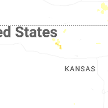
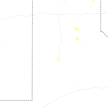
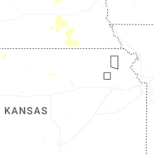
Kansas
| Local Time | Report Details |
|---|---|
| 7:30 PM CDT | Quarter sized hail reported near Stockton, KS, 36.8 miles N of Hays, KS, reported on the south end of webster dam. |
| 8:29 PM CDT | Measured by a kansas state mesonet sit in rooks county KS, 31.1 miles N of Hays, KS |
| 8:40 PM CDT | Storm damage reported in rooks county KS, 33.1 miles N of Hays, KS |
| 8:40 PM CDT | Peak gust measured by ks mesonet statio in rooks county KS, 31.1 miles N of Hays, KS |
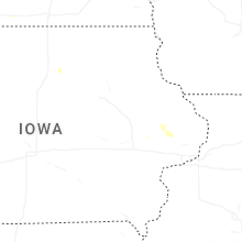
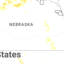
Nebraska
| Local Time | Report Details |
|---|---|
| 7:15 PM MDT | Quarter sized hail reported near Ellsworth, NE, 86.6 miles WSW of Valentine, NE, quarter size hail with 40 to 50 mph winds. |
| 9:53 PM CDT | Golf Ball sized hail reported near Ainsworth, NE, 41.7 miles ESE of Valentine, NE, golf ball sized hail in ainsworth. time estimated from radar. |
Connect with Interactive Hail Maps