

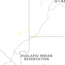
Hail Map for Monday, August 22, 2022

Number of Impacted Households on 8/22/2022
0
Impacted by 1" or Larger Hail
0
Impacted by 1.75" or Larger Hail
0
Impacted by 2.5" or Larger Hail
Square Miles of Populated Area Impacted on 8/22/2022
0
Impacted by 1" or Larger Hail
0
Impacted by 1.75" or Larger Hail
0
Impacted by 2.5" or Larger Hail


Cities Most Affected by Hail Storms of 8/22/2022
| Hail Size | Demographics of Zip Codes Affected | ||||||
|---|---|---|---|---|---|---|---|
| City | Count | Average | Largest | Pop Density | House Value | Income | Age |
| Ketchum, ID | 1 | 1.75 | 1.75 | 0 | $495k | $48.8k | 44.2 |
Hail and Wind Damage Spotted on 8/22/2022
Filter by Report Type:Hail ReportsWind Reports
North Carolina
| Local Time | Report Details |
|---|---|
| 8:00 AM EDT | Corrects previous tstm wnd gst report from 2 wnw oriental. local weatherflow site near winding creek measured 50 knot gus in pamlico county NC, 89.6 miles NE of Wilmington, NC |
Texas
| Local Time | Report Details |
|---|---|
| 10:25 AM CDT | Trees reported down and structural damage to one building in the hussy circle area; possible tornad in smith county TX, 83.1 miles W of Shreveport, LA |
| 4:56 PM CDT | Measured wind gust at del rio international airpor in val verde county TX, 1.9 miles W of Del Rio, TX |
Idaho
| Local Time | Report Details |
|---|---|
| 1:36 PM MDT | Golf Ball sized hail reported near Ketchum, ID, 85.2 miles N of Twin Falls, ID, at the sawtooth national recreation area building. time estimated via radar. |
Virginia
| Local Time | Report Details |
|---|---|
| 4:49 PM EDT | Tree down on front royal pike near bufflick roa in frederick county VA, 83.8 miles W of Baltimore, MD |
| 5:28 PM EDT | Trees blew down in the 9400 block of us-15 james madison highway... including a large pine tree that blocked all travel lane in culpeper county VA, 65.9 miles NNW of Richmond, VA |
| 5:39 PM EDT | Tree down blocking roadway near the intersection of waterford road and korea roa in culpeper county VA, 80 miles NNW of Richmond, VA |
| 7:30 PM EDT | Power lines down. time estimated from radar dat in fluvanna county VA, 37.5 miles WNW of Richmond, VA |
| 7:45 PM EDT | Tree down on route 250 in the vicinity of old fredericksburg road. time estimated from radar dat in goochland county VA, 29.7 miles NW of Richmond, VA |
| 7:55 PM EDT | The right lane and right shoulder are closed on i-64 near mm 166 in goochland county due to weather. time estimated from radar dat in goochland county VA, 17.3 miles NNW of Richmond, VA |
Pennsylvania
| Local Time | Report Details |
|---|---|
| 5:01 PM EDT | Quarter sized hail reported near Schnecksville, PA, 50.6 miles S of Scranton, PA, several reports of dime to quarter size hail in the whitehall area. |
| 5:06 PM EDT | Quarter sized hail reported near Northampton, PA, 51.9 miles S of Scranton, PA, 14 minutes of dime to quarter size hail fell. time estimated from radar. |
| 5:12 PM EDT | Quarter sized hail reported near Coplay, PA, 51.8 miles S of Scranton, PA |
| 5:15 PM EDT | Quarter sized hail reported near Catasauqua, PA, 52.6 miles S of Scranton, PA, hail ranging from dime to quarter size fell for about 14 minutes. time estimated from radar. |
| 5:40 PM EDT | Quarter sized hail reported near Bethlehem, PA, 55.8 miles SSE of Scranton, PA, hail ranging from dime to quarter size. |
| 5:48 PM EDT | Several large limbs blown down. damaged a roof of a residence. time estimated from rada in northampton county PA, 56.3 miles SSE of Scranton, PA |
| 5:55 PM EDT | Quarter sized hail reported near Easton, PA, 56.2 miles SSE of Scranton, PA, dime to quarter size hail on the south side of easton. time estimated from radar. |
| 5:55 PM EDT | Quarter sized hail reported near Easton, PA, 55.4 miles SSE of Scranton, PA, report from mping: quarter (1.00 in.) time estimated from radar. |
Utah
| Local Time | Report Details |
|---|---|
| 5:17 PM MDT | Quarter sized hail reported near Washington, UT, 5.3 miles ENE of Saint George, UT, time of report estimated. |
Nevada
| Local Time | Report Details |
|---|---|
| 4:41 PM PDT | The kane springs raws site gusted to 76 mph at approximately 441p in lincoln county NV, 62.9 miles W of Saint George, UT |
Connect with Interactive Hail Maps