

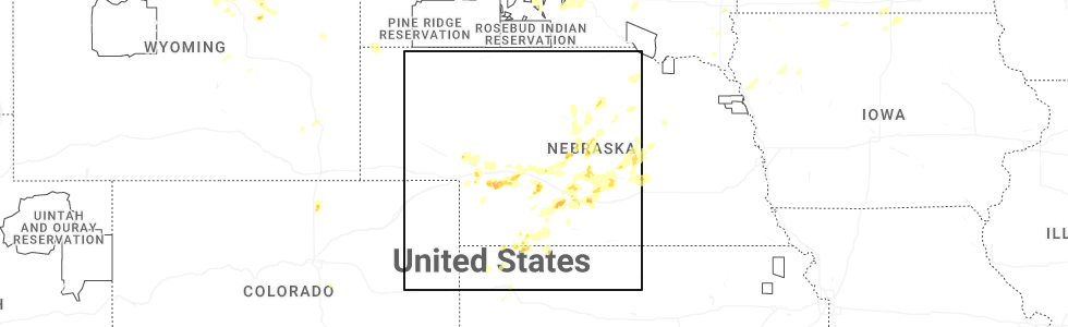
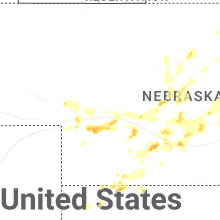
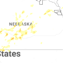
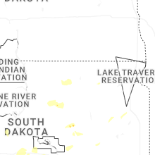
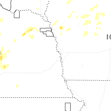
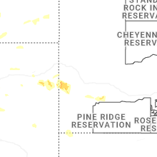
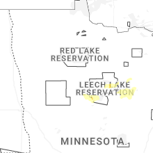
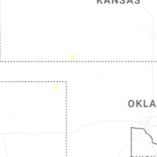
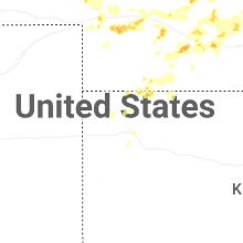
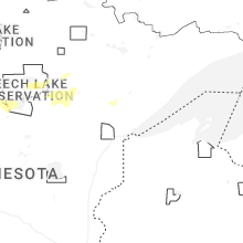
Hail Map for Wednesday, July 23, 2025
Number of Impacted Households on 7/23/2025
0
Impacted by 1" or Larger Hail
0
Impacted by 1.75" or Larger Hail
0
Impacted by 2.5" or Larger Hail
Square Miles of Populated Area Impacted on 7/23/2025
0
Impacted by 1" or Larger Hail
0
Impacted by 1.75" or Larger Hail
0
Impacted by 2.5" or Larger Hail

Cities Most Affected by Hail Storms of 7/23/2025
| Hail Size | Demographics of Zip Codes Affected | ||||||
|---|---|---|---|---|---|---|---|
| City | Count | Average | Largest | Pop Density | House Value | Income | Age |
Hail and Wind Damage Spotted on 7/23/2025
Filter by Report Type:Hail ReportsWind Reports
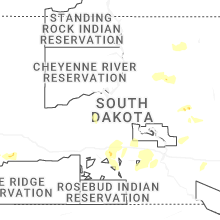
States Impacted
South Dakota, Minnesota, Nebraska, Montana, Oklahoma, Wisconsin, Kansas, Wyoming, Texas, Michigan, IowaSouth Dakota
| Local Time | Report Details |
|---|---|
| 7:10 AM CDT | Mesonet station lrms2 lowry 2s (sd mesonet in walworth county SD, 65.5 miles NNE of Pierre, SD |
| 7:15 AM CDT | Storm damage reported in aurora county SD, 85.7 miles N of Oneill, NE |
| 7:17 AM CDT | Several 3-4 inch diameter tree branches down in tow in aurora county SD, 86.9 miles N of Oneill, NE |
| 7:23 AM CDT | Via personal weather statio in aurora county SD, 87.3 miles W of Sioux Falls, SD |
| 7:40 AM CDT | Mesonet station kbms2 kennebec 6sse (sd mesonet in lyman county SD, 45.9 miles SE of Pierre, SD |
| 7:45 AM CDT | Mesonet station hmms2 highmore 23n (sd mesonet in hyde county SD, 57.4 miles NE of Pierre, SD |
| 8:00 AM CDT | Mesonet station lbms2 lower brule 2wnw (sd mesonet in lyman county SD, 41.8 miles ESE of Pierre, SD |
| 8:00 AM CDT | Spotter also reports 1 inch of rain in 15 minute in lyman county SD, 35 miles SE of Pierre, SD |
| 8:05 AM CDT | Mesonet station lbms2 lower brule 2wnw (sd mesonet in lyman county SD, 41.8 miles ESE of Pierre, SD |
| 8:12 AM CDT | Mesonet station 289 lees corner (sddot in buffalo county SD, 54.4 miles ESE of Pierre, SD |
| 8:13 AM CDT | Mesonet station 315 cresbard (sddot in faulk county SD, 31.9 miles SW of Aberdeen, SD |
| 8:25 AM CDT | Mesonet station 4 sse canning sdsu sit in hughes county SD, 17.5 miles E of Pierre, SD |
| 8:25 AM CDT | Mesonet station 173 craven (sddot in edmunds county SD, 21.5 miles W of Aberdeen, SD |
| 8:30 AM CDT | Mesonet station 173 craven (sddot in edmunds county SD, 21.5 miles W of Aberdeen, SD |
| 8:48 AM CDT | Mesonet station 312 ree heights (sddot in hand county SD, 58 miles ENE of Pierre, SD |
| 9:00 AM CDT | Roof blown off outbuilding. time estimated from rada in beadle county SD, 72.6 miles S of Aberdeen, SD |
| 9:03 AM CDT | Mesonet station 164 sd rwis wolse in beadle county SD, 69 miles S of Aberdeen, SD |
| 9:03 AM CDT | Asos station khon huron regional airpor in beadle county SD, 74.9 miles S of Aberdeen, SD |
| 9:06 AM CDT | Mesonet station 164 sd rwis wolse in beadle county SD, 69 miles S of Aberdeen, SD |
| 9:11 AM CDT | 64 mph gust recorded at a personal weather statio in beadle county SD, 76.2 miles S of Aberdeen, SD |
| 9:11 AM CDT | Asos station khon huron regional airport. gusted again to 82 mph at 9:18 a in beadle county SD, 74.9 miles S of Aberdeen, SD |
| 9:13 AM CDT | Mesonet station 215 polo 17 w jct sd47/sd26 (sddot in hyde county SD, 52.7 miles ENE of Pierre, SD |
| 9:15 AM CDT | Large tree down in huron near the intersection of 7th st. and dakota av in beadle county SD, 77.1 miles S of Aberdeen, SD |
| 9:18 AM CDT | About 20 trees downed at golf course. time estimated based on khon asos observatio in beadle county SD, 75 miles S of Aberdeen, SD |
| 9:20 AM CDT | Images of trees broken at the trunk sent via social media. time estimated based on radar and other nearby damage report in clark county SD, 70.7 miles SE of Aberdeen, SD |
| 9:21 AM CDT | 71 mph gust recorded at a personal weather statio in beadle county SD, 78.4 miles S of Aberdeen, SD |
| 9:23 AM CDT | Mesonet station 284 spink colony 9 sse jct sd28/sd37 (sddot in spink county SD, 58.7 miles SSE of Aberdeen, SD |
| 9:26 AM CDT | Boat capsized on dry lake due to strong wind in clark county SD, 67.9 miles SE of Aberdeen, SD |
| 9:28 AM CDT | Roof blown off of a metal shed along the south shore of lake byron. time estimated by rada in beadle county SD, 64.6 miles SSE of Aberdeen, SD |
| 9:33 AM CDT | Roof blown off post frame building. time estimated from rada in beadle county SD, 64.5 miles SSE of Aberdeen, SD |
| 9:50 AM CDT | Door torn off machine shed and other sheet metal damage to buildin in clark county SD, 63.2 miles SSE of Aberdeen, SD |
| 9:50 AM CDT | Cattle pod and grain bin damag in clark county SD, 64.6 miles SSE of Aberdeen, SD |
| 10:14 AM CDT | Personal weather statio in clark county SD, 57.9 miles SE of Aberdeen, SD |
| 5:25 PM MDT | Storm damage reported in fall river county SD, 56.1 miles SW of Rapid City, SD |
| 5:35 PM MDT | Storm damage reported in fall river county SD, 66.9 miles SW of Rapid City, SD |
| 6:37 PM CDT | Measured by personal weather statio in minnehaha county SD, 3.9 miles SE of Sioux Falls, SD |
| 5:45 PM MDT | Storm damage reported in fall river county SD, 66.9 miles SW of Rapid City, SD |
| 6:25 PM MDT | Storm damage reported in custer county SD, 28.2 miles SSE of Rapid City, SD |
| 6:26 PM MDT | Storm damage reported in custer county SD, 29.1 miles SSE of Rapid City, SD |
| 6:31 PM MDT | Storm damage reported in custer county SD, 29.1 miles SSE of Rapid City, SD |
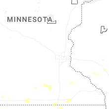
Minnesota
| Local Time | Report Details |
|---|---|
| 7:14 AM CDT | Several branches larger than 4 in diameter broken of in cass county MN, 30.6 miles SSE of Bemidji, MN |
| 7:16 AM CDT | Walker ambient weather station on first pt driv in cass county MN, 28.3 miles SSE of Bemidji, MN |
| 7:20 AM CDT | City park sustained tree and structure damage. time estimated from rada in cass county MN, 29.4 miles SSE of Bemidji, MN |
| 7:20 AM CDT | Damage to marina. time estimated from rada in cass county MN, 29.1 miles SSE of Bemidji, MN |
| 7:30 AM CDT | A dozen large trees down on highway 200 blocking at least one lane. one tree down on highway 8 just north of highway 20 in cass county MN, 41.9 miles SE of Bemidji, MN |
| 7:40 AM CDT | Mesonet station mn007 i-90 - rushmore - mp 3 in nobles county MN, 48.7 miles E of Sioux Falls, SD |
| 8:30 AM CDT | Several trees done on hummingbird drive. time estimated from rada in itasca county MN, 64.9 miles WNW of Duluth, MN |
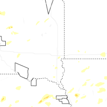
Nebraska
| Local Time | Report Details |
|---|---|
| 1:28 PM MDT | Ping Pong Ball sized hail reported near Ogallala, NE, 49.9 miles W of North Platte, NE, dispatch reports ping pong sized hail in town. |
| 1:57 PM MDT | Up sensor measured wind gusts associated with thunderstorm in keith county NE, 46 miles W of North Platte, NE |
| 3:54 PM CDT | Ping Pong Ball sized hail reported near North Platte, NE, 4.3 miles SW of North Platte, NE, ems reports ping pong ball sized hail. picture sent via nwschat. |
| 3:55 PM CDT | Quarter sized hail reported near Mc Cook, NE, 55.3 miles NNE of Colby, KS |
| 4:15 PM CDT | Quarter sized hail reported near Dickens, NE, 16 miles SW of North Platte, NE |
| 6:00 PM CDT | Pws measured wind gus in custer county NE, 60.8 miles WNW of Grand Island, NE |
| 6:34 PM CDT | Personal weather station reports gust to 72mp in buffalo county NE, 52.1 miles WSW of Grand Island, NE |
| 6:46 PM CDT | Personal weather station reports gust to 58mp in buffalo county NE, 45 miles WSW of Grand Island, NE |
| 6:54 PM CDT | Photo on facebook of power lines down north of kearney. time estimated from rada in buffalo county NE, 41 miles W of Grand Island, NE |
| 7:10 PM CDT | Quarter sized hail reported near Ravenna, NE, 33.9 miles W of Grand Island, NE, delayed social media report of hail ranging in size from peas to quarters. |
| 7:12 PM CDT | Photo from emergency manager of a destroyed shed north of ravenna. time estimated from rada in sherman county NE, 28 miles WNW of Grand Island, NE |
| 7:12 PM CDT | Emergency manager reports 70mph winds in ravenn in buffalo county NE, 30.5 miles WNW of Grand Island, NE |
| 7:16 PM CDT | Video shared on social media of a large tree branch that was broken off and had landed on top of a picku in buffalo county NE, 31.2 miles WNW of Grand Island, NE |
| 7:17 PM CDT | Boelus fire chief reports 60-70mph winds in boelu in howard county NE, 21.8 miles WNW of Grand Island, NE |
| 7:18 PM CDT | Emergency manager reports power lines down in ravenna. time estimated from rada in buffalo county NE, 30.7 miles WNW of Grand Island, NE |
| 7:19 PM CDT | Personal weather station reports gust to 59mp in buffalo county NE, 21.2 miles W of Grand Island, NE |
| 7:21 PM CDT | Personal weather station reports gust to 73mp in hall county NE, 15.9 miles WSW of Grand Island, NE |
| 7:21 PM CDT | Broadcast media reports several branches of 4 to 8 inches in diameter down in wood river. largest branches were around 10 to 12 inches in diamete in hall county NE, 15.4 miles WSW of Grand Island, NE |
| 7:22 PM CDT | 911 dispatch center reports power lines down in boelus. time estimated from rada in howard county NE, 22.6 miles WNW of Grand Island, NE |
| 7:23 PM CDT | Personal weather station reports gust to 58mp in hall county NE, 18.8 miles WSW of Grand Island, NE |
| 7:32 PM CDT | Dispatcher reported an outbuilding blown down in town. time estimated based on rada in howard county NE, 20.7 miles NNW of Grand Island, NE |
| 7:32 PM CDT | Social media report of a hackberry tree blown dow in howard county NE, 20.7 miles NNW of Grand Island, NE |
| 7:40 PM CDT | Social media report with photo of a large elm tree branch down in tow in howard county NE, 20.7 miles NNW of Grand Island, NE |
| 7:40 PM CDT | Emergency manager reported downed trees... damage to an outbuilding... and a segment of the ballfields fence was blown ove in howard county NE, 20.8 miles NNW of Grand Island, NE |
| 7:53 PM CDT | Davis weather statio in merrick county NE, 19.9 miles NE of Grand Island, NE |
| 7:54 PM CDT | Powerline down abbott/north rd and it is sparking. relayed by emergency manage in hall county NE, 4.4 miles NW of Grand Island, NE |
| 8:09 PM CDT | Emergency manager reports trees down on powerlines in fullerto in nance county NE, 35.7 miles NNE of Grand Island, NE |
| 8:40 PM CDT | Storm damage reported in boone county NE, 50.1 miles NNE of Grand Island, NE |
| 8:45 PM CDT | Trees uprooted and power lines down in st edwar in boone county NE, 51.1 miles NNE of Grand Island, NE |
| 8:57 PM CDT | Report of gusts around 60 mph on the nw side of columbus via social medi in platte county NE, 62.2 miles NE of Grand Island, NE |
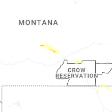
Montana
| Local Time | Report Details |
|---|---|
| 1:45 PM MDT | Quarter sized hail reported near Broadview, MT, 26.7 miles NW of Billings, MT, quarter size hail between 130 pm and 2pm. |
| 2:59 PM MDT | Personal weather statio in yellowstone county MT, 12 miles NNW of Billings, MT |
| 3:23 PM MDT | Quarter sized hail reported near Broadus, MT, 62.4 miles N of Gillette, WY |
Oklahoma
| Local Time | Report Details |
|---|---|
| 3:20 PM CDT | Storm damage reported in beaver county OK, 49.3 miles WNW of Woodward, OK |
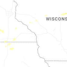
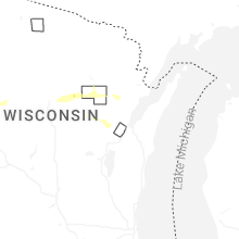
Wisconsin
| Local Time | Report Details |
|---|---|
| 4:30 PM CDT | Marathon co. dispatch reported trees and powerlines down near the intersection of county z and thornapple creek rd in the township of easton. funnel clouds were also re in marathon county WI, 44.8 miles S of Rhinelander, WI |
| 5:15 PM CDT | Trees down. time estimated by rada in menominee county WI, 39 miles NW of Green Bay, WI |
| 5:16 PM CDT | Report from menominee tribe emergency manager trees and power lines down. cause of damage will be reviewe in menominee county WI, 40.1 miles NW of Green Bay, WI |
| 5:16 PM CDT | Trees and power lines dow in portage county WI, 64.7 miles W of Green Bay, WI |
| 5:18 PM CDT | Tree on powerline. time estimated by rada in oconto county WI, 40 miles NW of Green Bay, WI |
| 5:28 PM CDT | Trees down. time estimated by rada in menominee county WI, 35.2 miles NW of Green Bay, WI |
| 5:37 PM CDT | Trees down. time estimated by rada in oconto county WI, 29.9 miles NNW of Green Bay, WI |
| 5:38 PM CDT | Tree blocking southbound lane cty ff... 1 mile north of 76 time estimated by rada in outagamie county WI, 30.6 miles W of Green Bay, WI |
| 5:40 PM CDT | Via personal weather statio in waupaca county WI, 37.1 miles W of Green Bay, WI |
| 5:50 PM CDT | Trees down just north of shiocto in outagamie county WI, 28.9 miles W of Green Bay, WI |
| 6:01 PM CDT | Siding and roof damage to several structure in outagamie county WI, 21.9 miles W of Green Bay, WI |
| 6:05 PM CDT | Train spotter reported 66 mph wind gust measured by a home weather statio in outagamie county WI, 18.5 miles W of Green Bay, WI |
| 6:05 PM CDT | Barn destroyed. time estimated by rada in outagamie county WI, 16.1 miles W of Green Bay, WI |
| 6:19 PM CDT | One tree snappe in brown county WI, 8.2 miles SW of Green Bay, WI |
| 6:21 PM CDT | One uprooted tree... one snapped tree. both about 10 inches in diameter. time estimated from rada in outagamie county WI, 20.7 miles WSW of Green Bay, WI |
| 6:24 PM CDT | Tree down hitting a wire... creating spark in door county WI, 29 miles NE of Green Bay, WI |
| 6:31 PM CDT | Dc dispatch reports tree down in the roadway vicinity of 7491 co rd h... sturgeon bay (maplewood church) time estimated by rada in door county WI, 30.8 miles ENE of Green Bay, WI |
| 6:32 PM CDT | Tree down in the roadway. time estimated by rada in door county WI, 31.3 miles ENE of Green Bay, WI |
| 6:36 PM CDT | Dc dispatch reports 4630 harbor heights ct... egg harbor tree down on lines power pole on fire time estimated by rada in door county WI, 52.1 miles NE of Green Bay, WI |
| 6:38 PM CDT | Dc dispatch reports tree down blocking both lanes 7715 alpine rd... egg harbor time estimated by rada in door county WI, 51.3 miles NE of Green Bay, WI |
| 6:40 PM CDT | Report of a tree down in the south bound lane of state highway 5 in door county WI, 41.2 miles NE of Green Bay, WI |
| 6:51 PM CDT | Report of partial tree blocking road loggerquist road at waseda farms... jacksonpor in door county WI, 54.2 miles NE of Green Bay, WI |
| 6:51 PM CDT | Two trees down near the intersection of dodge street and dorelle street in kewaunee. time estimated from rada in kewaunee county WI, 25.6 miles E of Green Bay, WI |
| 7:02 PM CDT | 50x70 pole barn destroyed at n6318 cth c... south of seymour estimated 604p in outagamie county WI, 16.1 miles W of Green Bay, WI |
Kansas
| Local Time | Report Details |
|---|---|
| 4:45 PM CDT | Personal weather station kksashla in clark county KS, 55 miles NNW of Woodward, OK |
| 6:30 PM CDT | Personal weather station kksnessc in ness county KS, 52.4 miles ENE of Garden City, KS |
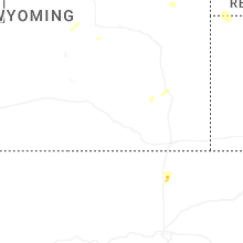
Wyoming
| Local Time | Report Details |
|---|---|
| 4:07 PM MDT | Storm damage reported in weston county WY, 57.6 miles W of Rapid City, SD |
| 4:28 PM MDT | Storm damage reported in weston county WY, 45.2 miles W of Rapid City, SD |
Texas
| Local Time | Report Details |
|---|---|
| 5:15 PM CDT | Storm damage reported in roberts county TX, 65.3 miles NE of Amarillo, TX |
| 5:29 PM CDT | Storm damage reported in hemphill county TX, 77.6 miles SW of Woodward, OK |
Michigan
| Local Time | Report Details |
|---|---|
| 8:51 PM EDT | Multiple trees reported down across various areas around frankfort... including along south shore rd. time estimated via rada in benzie county MI, 31 miles WSW of Traverse City, MI |
| 9:05 PM EDT | Multiple trees and powerlines down reported in glen arbor. time estimated via rada in leelanau county MI, 20.8 miles WNW of Traverse City, MI |
| 9:07 PM EDT | Multiple trees and powerlines down on thompsonville hwy south of us-31. time estimated via rada in benzie county MI, 18 miles WSW of Traverse City, MI |
| 9:17 PM EDT | Multiple trees and powerlines down. time estimated via rada in leelanau county MI, 19.3 miles NNW of Traverse City, MI |
| 9:25 PM EDT | County dispatch reports trees and powerlines down on hammond rd in garfield twp. also reported that trees and powerlines are down across various other portions of grand in grand traverse county MI, 3.9 miles SSE of Traverse City, MI |
| 9:33 PM EDT | Significant power outages in mesick reported by wexford co dispatc in wexford county MI, 24.6 miles S of Traverse City, MI |
| 9:50 PM EDT | Wexford county dispatch reported significant power outages in and near manto in wexford county MI, 25.8 miles SSE of Traverse City, MI |
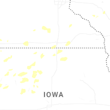
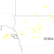
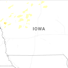
Iowa
| Local Time | Report Details |
|---|---|
| 10:10 PM CDT | Trees down in tow in hancock county IA, 39.9 miles WSW of Mason City, IA |
| 12:04 AM CDT | Measured by personal weather statio in carroll county IA, 52 miles SSE of Storm Lake, IA |
| 12:14 AM CDT | Measured by personal weather station near intersection of storms along pre-existing outflow boundar in carroll county IA, 59 miles WNW of Des Moines, IA |
| 12:36 AM CDT | Storm damage reported in guthrie county IA, 45.8 miles WNW of Des Moines, IA |
Connect with Interactive Hail Maps