

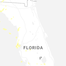
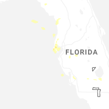
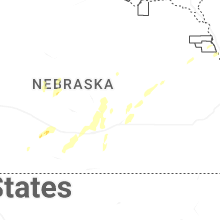
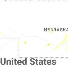
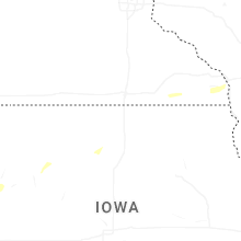
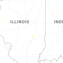
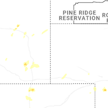
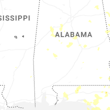
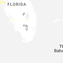
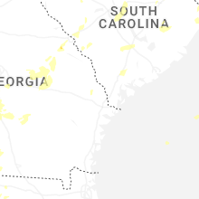
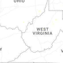
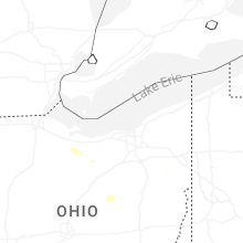
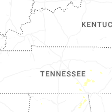
Hail Map for Wednesday, June 25, 2025

Number of Impacted Households on 6/25/2025
0
Impacted by 1" or Larger Hail
0
Impacted by 1.75" or Larger Hail
0
Impacted by 2.5" or Larger Hail
Square Miles of Populated Area Impacted on 6/25/2025
0
Impacted by 1" or Larger Hail
0
Impacted by 1.75" or Larger Hail
0
Impacted by 2.5" or Larger Hail


Cities Most Affected by Hail Storms of 6/25/2025
| Hail Size | Demographics of Zip Codes Affected | ||||||
|---|---|---|---|---|---|---|---|
| City | Count | Average | Largest | Pop Density | House Value | Income | Age |
| Clover, SC | 1 | 1.75 | 1.75 | 271 | $137k | $46.7k | 40.1 |
| Pisgah, AL | 1 | 1.75 | 1.75 | 54 | $61k | $29.5k | 40.6 |
| Yemassee, SC | 1 | 1.75 | 1.75 | 19 | $54k | $22.4k | 39.7 |
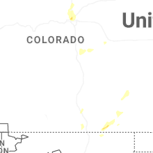
| Baker, MT | 1 | 1.75 | 1.75 | 0 | $49k | $30.7k | 42.1 |
Hail and Wind Damage Spotted on 6/25/2025
Filter by Report Type:Hail ReportsWind Reports
States Impacted
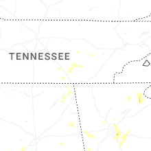
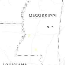
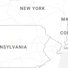
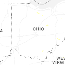
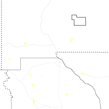
Virginia, Georgia, West Virginia, Maryland, Ohio, North Carolina, Pennsylvania, Indiana, Colorado, New Mexico, Florida, Nebraska, Alabama, Montana, Minnesota, Iowa, Illinois, South Carolina, Wyoming, Texas, Kansas, South Dakota, WisconsinVirginia
| Local Time | Report Details |
|---|---|
| 11:43 AM EDT | Tree down on stage roa in appomattox county VA, 54.3 miles E of Roanoke, VA |
| 1:03 PM EDT | Tree down onto powerlines at 1400 block of orange rd in madison county VA, 66.6 miles NNW of Richmond, VA |
| 1:17 PM EDT | Tree down near 920 wrights ln in madison county VA, 62.6 miles NNW of Richmond, VA |
| 1:31 PM EDT | The 911 call center reported a tree down near us-1. time estimated from rada in mecklenburg county VA, 62.4 miles NNE of Raleigh, NC |
| 1:45 PM EDT | Five trees were down around the 3700 block of ashville roa in fauquier county VA, 75.4 miles WSW of Baltimore, MD |
| 2:06 PM EDT | Several trees down between strasburg and toms brook v in shenandoah county VA, 77.9 miles E of Elkins, WV |
| 2:15 PM EDT | 3 inch diameter branch onto 12546 senedo rd in shenandoah county VA, 61.7 miles E of Elkins, WV |
| 2:17 PM EDT | Tree down near intersection of blantyre rd and old bust head rd in fauquier county VA, 71.3 miles WSW of Baltimore, MD |
| 2:34 PM EDT | Tree down near intersection of cliff mills rd and brown more ln in fauquier county VA, 80.4 miles WSW of Baltimore, MD |
| 2:36 PM EDT | Tree down near falling spring fall in alleghany county VA, 41.3 miles N of Roanoke, VA |
| 2:43 PM EDT | Trees down along u.s. 220 near sinking sprin in alleghany county VA, 42.7 miles N of Roanoke, VA |
| 2:47 PM EDT | Tree down at 19173 cold spring rd in rockingham county VA, 60.4 miles ESE of Elkins, WV |
| 3:00 PM EDT | Tree down onto powerlines at 3475 holsinger rd in rockingham county VA, 61.7 miles ESE of Elkins, WV |
| 3:14 PM EDT | Tree down near intersection of kratzer rd and rhones ln in rockingham county VA, 61 miles ESE of Elkins, WV |
| 3:23 PM EDT | Storm damage reported in loudoun county VA, 51.2 miles WSW of Baltimore, MD |
| 3:35 PM EDT | Tree down onto powerlines at 1110 shenandoah st in rockingham county VA, 60.8 miles ESE of Elkins, WV |
| 3:37 PM EDT | Tree down near the intersection of warsaw ave and lee hw in rockingham county VA, 61.9 miles ESE of Elkins, WV |
| 3:37 PM EDT | Tree down near intersection of green st and n dogwood dr in rockingham county VA, 61.5 miles ESE of Elkins, WV |
| 3:46 PM EDT | Tree down onto powerlines at 1224 oakwood dr in rockingham county VA, 60.8 miles SE of Elkins, WV |
| 3:48 PM EDT | Tree down at 2394 ridgedale rd in rockingham county VA, 63.9 miles SE of Elkins, WV |
| 3:50 PM EDT | Tree down near intersection of taylor spring ln and boyers rd in rockingham county VA, 64.8 miles ESE of Elkins, WV |
| 3:55 PM EDT | Tree down onto powerlines near intersection of valley branch rd and scholars rd in rockingham county VA, 63.8 miles SE of Elkins, WV |
| 3:59 PM EDT | 911 center reports a tree is blocking the southbound lanes of route 9 near harpers ferry r in loudoun county VA, 61.4 miles W of Baltimore, MD |
| 4:04 PM EDT | Roof off of a home near the intersection of stribling springs rd and free mason run r in augusta county VA, 55.5 miles SE of Elkins, WV |
| 4:05 PM EDT | 911 center reports two trees down near the intersection of quarter branch rd and lovettsville r in loudoun county VA, 53.7 miles W of Baltimore, MD |
| 4:06 PM EDT | Tree down near intersection of gardner ln and warm springs pike in rockingham county VA, 59.1 miles SE of Elkins, WV |
| 4:13 PM EDT | Vdot reports tree down onto rte 626 near midday lane. time estimated from rada in fairfax county VA, 44.8 miles SSW of Baltimore, MD |
| 6:10 PM EDT | Multiple trees knocked down within the mineola neighborhood. reports via social media. time estimated from rada in chesterfield county VA, 14.8 miles SE of Richmond, VA |
| 9:40 PM EDT | Tree down in the vicinity of swinging bridge r in campbell county VA, 55 miles ESE of Roanoke, VA |
| 10:30 PM EDT | Tree down along clays mill r in halifax county VA, 66.5 miles ESE of Roanoke, VA |
| 10:32 PM EDT | 2 trees dow in halifax county VA, 67.2 miles N of Raleigh, NC |
| 10:35 PM EDT | Tree down near the intersection of hamilton blvd and williams s in halifax county VA, 66 miles NNW of Raleigh, NC |
| 10:40 PM EDT | Tree on house causing significant damage to the house... rooms now exposed to rainwate in halifax county VA, 65.3 miles NNW of Raleigh, NC |
| 10:40 PM EDT | Power pole and wires down near police station. lost commercial powe in halifax county VA, 66.1 miles NNW of Raleigh, NC |
| 10:40 PM EDT | Tree across powerline near hospital. knocked out powe in halifax county VA, 65.5 miles NNW of Raleigh, NC |
| 10:40 PM EDT | Tree down at intersection of broad street and norwood av in halifax county VA, 65.5 miles NNW of Raleigh, NC |
| 10:41 PM EDT | Tree down on eastover driv in halifax county VA, 64.4 miles NNW of Raleigh, NC |
| 10:42 PM EDT | Tree dow in halifax county VA, 64 miles NNW of Raleigh, NC |
| 11:03 PM EDT | Tree downed by thunderstorm winds in the 100 block of stateline bridge roa in pittsylvania county VA, 53 miles SSE of Roanoke, VA |
| 11:08 PM EDT | Tree down blocking roa in halifax county VA, 58.6 miles NNW of Raleigh, NC |
| 11:12 PM EDT | Trees down near alto in halifax county VA, 57.7 miles NNW of Raleigh, NC |
| 11:58 PM EDT | Thunderstorm winds blew down a large section of fenc in appomattox county VA, 53.9 miles E of Roanoke, VA |
Georgia
| Local Time | Report Details |
|---|---|
| 12:10 PM EDT | Tree limbs on sr 26 both directions at lawton smith rd near adrian... ga. all lanes close in johnson county GA, 72.2 miles N of Douglas, GA |
| 12:15 PM EDT | Tree limbs on sr 18 both directions at balls church rd. all lanes close in twiggs county GA, 89.3 miles NNW of Douglas, GA |
| 4:22 PM EDT | Measured with rooftop anemomete in colquitt county GA, 56.2 miles NNE of Tallahassee, FL |
| 4:46 PM EDT | Quarter sized hail reported near Hartsfield, GA, 59 miles NNE of Tallahassee, FL |
| 7:00 PM EDT | Power lines reported down in cair in grady county GA, 30.6 miles N of Tallahassee, FL |
| 8:00 PM EDT | Two trees down in baker count in baker county GA, 57.7 miles NNW of Tallahassee, FL |
| 8:15 PM EDT | Several trees and power lines down in miller count in miller county GA, 57 miles NNW of Tallahassee, FL |
| 8:17 PM EDT | Quarter sized hail reported near Albany, GA, 71.6 miles N of Tallahassee, FL, report of 1 inch hail near putney. |
| 8:30 PM EDT | Quarter sized hail reported near Waco, GA, 45.6 miles W of Atlanta, GA, quarter-sized hail reported in waco. |
| 8:45 PM EDT | Tree limbs on sr 200 eastbound at waller rd. right lane blocke in early county GA, 72.7 miles NNW of Tallahassee, FL |
| 9:07 PM EDT | Reported at kaby aso in dougherty county GA, 76 miles N of Tallahassee, FL |
| 9:07 PM EDT | Tree down and blocking the roadway at westmoreland rd near smith r in white county GA, 64.5 miles NNE of Atlanta, GA |
| 9:17 PM EDT | 911 dispatch reports numerous trees and powerlines down on hwy 197 between batesville and dicks hill pkw in habersham county GA, 54.7 miles WSW of Greenville, SC |
| 9:30 PM EDT | Tree blown down on a personal property along lumpkin roa in lee county GA, 79.9 miles WNW of Douglas, GA |
| 9:35 PM EDT | Quarter sized hail reported near Leesburg, GA, 78.2 miles W of Douglas, GA, viewer report of pea to quarter size hail in lee county. |
| 10:10 PM EDT | Report from emergency management of 3 trees down in northern banks count in banks county GA, 57.6 miles WSW of Greenville, SC |
| 10:23 PM EDT | Power lines down along ben arthur r in terrell county GA, 79.5 miles SE of Auburn, AL |
| 10:59 PM EDT | Multiple trees down on south maine. time estimated from rada in screven county GA, 54.7 miles SSE of Augusta, GA |
| 10:59 PM EDT | Multiple treees down on mims road. time estimated from rada in screven county GA, 53.7 miles SSE of Augusta, GA |
| 11:29 PM EDT | Tree down on old river rd n and highway 301. time estimated from rada in bulloch county GA, 49 miles NW of Savannah, GA |
| 11:34 PM EDT | Tree down on cowboy way. time estimated from rada in bulloch county GA, 58.8 miles WNW of Savannah, GA |
| 11:36 PM EDT | Tree limbs on sr 19 both directions at durham mill rd. all lanes close in twiggs county GA, 89.7 miles NNW of Douglas, GA |
| 11:37 PM EDT | Tree down on brooklet- leefield rd at clito rd. time estimated from rada in bulloch county GA, 39.8 miles NW of Savannah, GA |
| 11:55 PM EDT | Tree down on the intersection of se broad street and lillian street. time estimated from rada in candler county GA, 59.5 miles WNW of Savannah, GA |
| 12:01 AM EDT | Tree down on burkhalter drive. time estimated by rada in evans county GA, 46.9 miles W of Savannah, GA |
| 12:01 AM EDT | Tree down on wilton threatt road. time estimated from rada in evans county GA, 53.4 miles W of Savannah, GA |
| 12:01 AM EDT | Tree down on the intersection of se broad street and lillian street. time estimated from rada in candler county GA, 59.5 miles WNW of Savannah, GA |
| 12:08 AM EDT | Tree down on burkhalter drive. time estimated by rada in evans county GA, 46.9 miles W of Savannah, GA |
| 12:08 AM EDT | Tree down on wilton threatt road. time estimated from rada in evans county GA, 53.4 miles W of Savannah, GA |
| 12:13 AM EDT | A tree was blown onto a shed on navaho roa in henry county GA, 33.1 miles SSE of Atlanta, GA |
| 1:09 AM EDT | The ham radio coordinator for upson county reports multiple trees blocking atwater rd between willingham springs rd and weems r in upson county GA, 53.6 miles S of Atlanta, GA |
| 1:15 AM EDT | Tree limbs on sr 7 northbound at thomaston st. all lanes close in lamar county GA, 50.5 miles SSE of Atlanta, GA |
West Virginia
| Local Time | Report Details |
|---|---|
| 12:28 PM EDT | Tree down onto powerlines near 200 trinity rd in hampshire county WV, 59.2 miles ENE of Elkins, WV |
| 12:32 PM EDT | Tree down on northwestern pk. just west of junction... w in hampshire county WV, 58.7 miles ENE of Elkins, WV |
| 12:54 PM EDT | Tree down onto powerlines near 9000 block of south branch river rd in hampshire county WV, 58.5 miles ENE of Elkins, WV |
| 1:07 PM EDT | Tree down onto powerlines at 4000 block of hickory corner rd in hampshire county WV, 65.3 miles ENE of Elkins, WV |
| 1:13 PM EDT | Tree down onto powerlines at 3000 capon river rd in hampshire county WV, 78 miles ENE of Elkins, WV |
| 1:30 PM EDT | Tree down onto powerlines near intersection of south fork rd and winchester ave in hardy county WV, 48 miles ENE of Elkins, WV |
| 1:30 PM EDT | Tree down onto powerlines near intersection of winchester ave and us 220 in hardy county WV, 48 miles ENE of Elkins, WV |
| 2:30 PM EDT | A tree was down on the 1200 block of st. andrews driv in berkeley county WV, 72.4 miles WNW of Baltimore, MD |
| 2:32 PM EDT | A tree was down along williamsport pike and foster driv in berkeley county WV, 71 miles WNW of Baltimore, MD |
| 2:58 PM EDT | A tree was down along apple harvest driv in berkeley county WV, 77.1 miles W of Baltimore, MD |
| 4:20 PM EDT | Tree down covering the road on route 9 in barbour county WV, 22.6 miles N of Elkins, WV |
| 4:20 PM EDT | Tree down on us-3 in lewis county WV, 37.9 miles WNW of Elkins, WV |
| 4:20 PM EDT | Tree down on power lines near the intersection of bedington rd. and miss staci d in berkeley county WV, 71.9 miles WNW of Baltimore, MD |
| 5:00 PM EDT | Tree dow in upshur county WV, 21.3 miles WNW of Elkins, WV |
| 5:00 PM EDT | Tree dow in upshur county WV, 20.9 miles W of Elkins, WV |
| 5:00 PM EDT | Tree dow in upshur county WV, 24 miles WNW of Elkins, WV |
| 6:44 PM EDT | Tree down on state route 2 in wetzel county WV, 64 miles NW of Elkins, WV |
| 6:55 PM EDT | Power outage due to tree damage reported south of teays valley r in putnam county WV, 18.2 miles WNW of Charleston, WV |
| 7:05 PM EDT | Power outage affecting 138 customers reported along browns creek rd south of us route 6 in kanawha county WV, 14.3 miles W of Charleston, WV |
| 7:50 PM EDT | A tree was reported down at the intersection of orr st. and blaine s in marion county WV, 40.7 miles NNW of Elkins, WV |
| 7:57 PM EDT | Tree down on smithtown roa in monongalia county WV, 44.6 miles N of Elkins, WV |
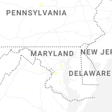
Maryland
| Local Time | Report Details |
|---|---|
| 1:47 PM EDT | Half dozen trees down near and around cockeysville m in baltimore county MD, 13.2 miles N of Baltimore, MD |
| 3:18 PM EDT | Numerous trees down near the intersection of trap run rd and blooming rose r in garrett county MD, 53.7 miles NNE of Elkins, WV |
| 3:35 PM EDT | Mdot reports tree down onto road at intersection of md-100 and md-17 in anne arundel county MD, 12.9 miles SSE of Baltimore, MD |
| 3:36 PM EDT | A couple trees were down in the severna park area... including a tree that fell onto a hous in anne arundel county MD, 14.1 miles S of Baltimore, MD |
| 3:45 PM EDT | Mdot reports tree down on md-648 baltimore annapolis blvd... blocking the roa in anne arundel county MD, 15.7 miles SSE of Baltimore, MD |
| 3:47 PM EDT | Mdot reports tree down onto md-2 at college parkway... blocking southbound lane in anne arundel county MD, 17.3 miles SSE of Baltimore, MD |
| 4:22 PM EDT | Tree down onto powerlines at cheverly ave and landover rd in prince georges county MD, 29.7 miles SSW of Baltimore, MD |
| 4:31 PM EDT | Multiple reports of multiple trees and multiple powerlines down in capitol heights area in prince georges county MD, 32.6 miles SSW of Baltimore, MD |
| 4:45 PM EDT | A wind gust of 62 mph was reported at andrews air force bas in prince georges county MD, 36.6 miles SSW of Baltimore, MD |
| 4:55 PM EDT | Mdot reports tree fell onto the inner loop at mm14 blocking three right lanes. time estimated from rada in prince georges county MD, 30.9 miles SSW of Baltimore, MD |
| 4:57 PM EDT | 60mph thunderstorm wind gust measured at andrews af in prince georges county MD, 36.6 miles SSW of Baltimore, MD |
| 5:25 PM EDT | Tree down at 5150 buena vista rd in calvert county MD, 52.5 miles S of Baltimore, MD |
| 5:30 PM EDT | Multiple trees down and a few trees down onto powerlines along rt. 231 between jibsail dr and adelina rd in calvert county MD, 53.9 miles S of Baltimore, MD |
| 5:32 PM EDT | Trees onto powerlines near intersection of adelina rd and sixes rd in calvert county MD, 54.5 miles S of Baltimore, MD |
| 5:37 PM EDT | Tree down onto powerlines near intersection of md 648 and brandywine ave in anne arundel county MD, 15.7 miles SSE of Baltimore, MD |
| 5:45 PM EDT | Multiple trees down near intersection of sixes rd and joe harris rd in calvert county MD, 54.6 miles S of Baltimore, MD |
| 5:54 PM EDT | Trees down near intersection of broomes island rd and williams wharf rd in calvert county MD, 58 miles S of Baltimore, MD |
Ohio
| Local Time | Report Details |
|---|---|
| 1:48 PM EDT | Multiple reports of wires and trees down between etna and kirkersville along us 40. time estimated from rada in licking county OH, 19.3 miles E of Columbus, OH |
| 1:54 PM EDT | Two trees downed at the intersection of ostrander road and route 25 in delaware county OH, 25.6 miles NNW of Columbus, OH |
| 2:21 PM EDT | A tree was reported down on edie hill road se just northwest of stillwate in tuscarawas county OH, 70.2 miles W of Pittsburgh, PA |
| 2:42 PM EDT | Delayed report. 2 large trees down along with multiple large branches. trampoline caused damage to one vehicle. time estimated by rada in van wert county OH, 36.9 miles SE of Fort Wayne, IN |
| 3:20 PM EDT | Several reports of downed trees in powerlines in the eastern and northeastern portions of knox count in knox county OH, 48.8 miles NE of Columbus, OH |
| 3:51 PM EDT | One tree downed on a power line on south ohio stree in shelby county OH, 65.1 miles WNW of Columbus, OH |
| 3:52 PM EDT | Numerous large trees down on the south side of sidney... including on franklin avenue and ohio avenu in shelby county OH, 65.1 miles WNW of Columbus, OH |
| 4:00 PM EDT | A tree and a number of branches were reported to be blown dow in columbiana county OH, 56.2 miles NW of Pittsburgh, PA |
| 4:49 PM EDT | Several large tree branches down near lafayette avenue in urban in champaign county OH, 40.9 miles WNW of Columbus, OH |
| 5:05 PM EDT | Several trees down across thompson township. time estimated via rada in seneca county OH, 65.1 miles WSW of Cleveland, OH |
| 5:38 PM EDT | Storm damage reported in huron county OH, 55 miles WSW of Cleveland, OH |
| 5:40 PM EDT | Estimated 60 mph wind in huron county OH, 62.8 miles WSW of Cleveland, OH |
| 5:58 PM EDT | A couple of trees were reported down at the intersection of sr26 and connor ridge r in monroe county OH, 79.5 miles SW of Pittsburgh, PA |
North Carolina
| Local Time | Report Details |
|---|---|
| 2:00 PM EDT | Trees reported down via social media reports near old ferrell roa in wake county NC, 9.2 miles E of Raleigh, NC |
| 2:10 PM EDT | Trees down near 158 bypass and frazier r in warren county NC, 54.1 miles NNE of Raleigh, NC |
| 2:30 PM EDT | Trees down along nc 4 in warren county NC, 51.5 miles NE of Raleigh, NC |
| 2:32 PM EDT | Trees down near i-85 exit 21 in vance county NC, 40.4 miles NNE of Raleigh, NC |
| 2:36 PM EDT | Numerous trees down east of youngsvill in franklin county NC, 19.4 miles NE of Raleigh, NC |
| 2:40 PM EDT | Corrects previous tstm wnd dmg report from 5 n bat cave. tree and/or utility line damage near patricia r in buncombe county NC, 51.3 miles NNE of Greenville, SC |
| 2:46 PM EDT | Trees down between essex and hollister per duke energy outage ma in halifax county NC, 51.6 miles NE of Raleigh, NC |
| 2:56 PM EDT | Trees down and resulting power outage in sampson county NC, 46 miles SSE of Raleigh, NC |
| 3:10 PM EDT | One tree dow in johnston county NC, 34.8 miles SE of Raleigh, NC |
| 3:20 PM EDT | Tree and utility line damage leading to outages. time approximat in avery county NC, 44.6 miles SSE of Bristol, TN |
| 3:20 PM EDT | Multiple trees down in goldsboro... including at least one at 707 mulberry s in wayne county NC, 44.9 miles SE of Raleigh, NC |
| 3:22 PM EDT | Tree down on power lines on 2nd s in wayne county NC, 46.2 miles SE of Raleigh, NC |
| 3:24 PM EDT | Duke energy outage for 160 customers caused by damaged equipment from fallen trees or limb in wayne county NC, 45.7 miles SE of Raleigh, NC |
| 3:30 PM EDT | Trees down southwest of clinto in sampson county NC, 55.3 miles NNW of Wilmington, NC |
| 3:30 PM EDT | Numerous trees down across northeastern nash c in nash county NC, 53 miles ENE of Raleigh, NC |
| 3:30 PM EDT | Quarter sized hail reported near Marion, NC, 52.4 miles S of Bristol, TN |
| 3:36 PM EDT | Corrects previous tstm wnd dmg report from 4 ese youngsville. numerous trees down east of youngsvill in franklin county NC, 19.4 miles NE of Raleigh, NC |
| 3:36 PM EDT | Multiple large pine trees down at 1300 tarboro r in franklin county NC, 19 miles NE of Raleigh, NC |
| 3:38 PM EDT | Outages from storm damage near paint fork r in buncombe county NC, 59.6 miles SSW of Bristol, TN |
| 3:40 PM EDT | Tree and/or utility line damage near patricia r in buncombe county NC, 51.3 miles NNE of Greenville, SC |
| 3:43 PM EDT | Downed trees and power outage in cumberland county NC, 58.7 miles S of Raleigh, NC |
| 3:50 PM EDT | Trees down on power equipmen in wake county NC, 12.8 miles ENE of Raleigh, NC |
| 3:50 PM EDT | Trees down on us-64 near nash/franklin county lin in nash county NC, 24.6 miles ENE of Raleigh, NC |
| 3:50 PM EDT | Quarter sized hail reported near Spring Hope, NC, 25.5 miles ENE of Raleigh, NC |
| 3:56 PM EDT | Trees down on nc 9 in nash county NC, 24.7 miles E of Raleigh, NC |
| 4:00 PM EDT | Trees down near hankins and yancey rd in mcdowell county NC, 60.8 miles SSE of Bristol, TN |
| 4:00 PM EDT | Quarter sized hail reported near Saint Pauls, NC, 69.1 miles SSW of Raleigh, NC, persistent quarter size hail reported near wayne-sanderson farms in st. pauls. |
| 4:00 PM EDT | Trees down on utility equipmen in buncombe county NC, 55.9 miles N of Greenville, SC |
| 4:02 PM EDT | Trees down on nc 581 near strickland r in nash county NC, 30.1 miles E of Raleigh, NC |
| 4:10 PM EDT | Tree downed on a vehicl in mcdowell county NC, 65.5 miles SSE of Bristol, TN |
| 4:14 PM EDT | Duke energy reported power outage caused by fallen trees damaging equipmen in wilson county NC, 31.2 miles E of Raleigh, NC |
| 4:16 PM EDT | Duke energy reported power outage caused by fallen trees damaging equipmen in wilson county NC, 32.2 miles E of Raleigh, NC |
| 4:24 PM EDT | Tree down blocking both lanes of n. king st.... between w. bizzel st. and hillside av in scotland county NC, 83.3 miles ESE of Charlotte, NC |
| 4:25 PM EDT | Trees downed near fortune rd and us 6 in mcdowell county NC, 62 miles WNW of Charlotte, NC |
| 4:30 PM EDT | Tree and/or utility line damage leading to outage in buncombe county NC, 52.7 miles N of Greenville, SC |
| 4:30 PM EDT | Numerous trees down in the county... including some on johns rd/us 50 in scotland county NC, 86.3 miles ESE of Charlotte, NC |
| 4:33 PM EDT | Downed trees blocking hwy 7 in mcdowell county NC, 61.9 miles NNE of Greenville, SC |
| 4:34 PM EDT | Duplin county 911 center relays report of powerlines down on church street. time estimated by rada in duplin county NC, 50 miles N of Wilmington, NC |
| 4:34 PM EDT | Tree down across johns rd.... between pond dr. and pea bridge r in scotland county NC, 87.4 miles ESE of Charlotte, NC |
| 4:45 PM EDT | Quarter sized hail reported near Bladenboro, NC, 48.2 miles WNW of Wilmington, NC, quarter size hail reported along burney road. |
| 4:45 PM EDT | Roughly 20 trees down in elizabethtown. time estimated via rada in bladen county NC, 46.3 miles NW of Wilmington, NC |
| 4:45 PM EDT | Multiple trees down in the area of mccoll rd.... hasty rd.... oakwood dr.... and sycamore l in scotland county NC, 83.4 miles ESE of Charlotte, NC |
| 4:55 PM EDT | Quarter sized hail reported near Bladenboro, NC, 48.2 miles WNW of Wilmington, NC, quarter size hail reported along burney road. (time corrected based on radar) |
| 5:00 PM EDT | Trees and/or utility lines down causing outage in rutherford county NC, 52.4 miles W of Charlotte, NC |
| 5:12 PM EDT | Trees and debris across west blvd... between turnpike rd. and us 401 and also in the area of park cir. and peden s in scotland county NC, 82.8 miles ESE of Charlotte, NC |
| 5:13 PM EDT | Tree across andrew jackson hwy... near ida mill r in scotland county NC, 79.1 miles ESE of Charlotte, NC |
| 5:14 PM EDT | Tree limbs and debris had to be removed from the road near bayfield rd. and gibson r in scotland county NC, 80.2 miles ESE of Charlotte, NC |
| 5:16 PM EDT | Quarter sized hail reported near Forest City, NC, 54.3 miles NE of Greenville, SC, report from mping: quarter (1.00 in.). |
| 5:20 PM EDT | Trees and/or utility lines down causing outage in transylvania county NC, 33.9 miles N of Greenville, SC |
| 5:30 PM EDT | Tree down on road near columbus regional in columbus county NC, 43.7 miles W of Wilmington, NC |
| 5:32 PM EDT | Quarter sized hail reported near Lawndale, NC, 47.7 miles WNW of Charlotte, NC, report from mping: quarter (1.00 in.). |
| 5:36 PM EDT | Tree down on utility equipmen in polk county NC, 31.6 miles NNE of Greenville, SC |
| 5:37 PM EDT | Utility lines downed along providence r in mecklenburg county NC, 4.2 miles SSE of Charlotte, NC |
| 5:46 PM EDT | Tree down on utility equipmen in transylvania county NC, 28.3 miles N of Greenville, SC |
| 5:52 PM EDT | Tree down on utility equipmen in henderson county NC, 29.9 miles N of Greenville, SC |
| 5:59 PM EDT | Quarter sized hail reported near Charlotte, NC, 11 miles SSE of Charlotte, NC, report from mping: quarter (1.00 in.). |
| 6:00 PM EDT | Large trees and utility lines downed along laurel park r in henderson county NC, 33.4 miles N of Greenville, SC |
| 6:15 PM EDT | Quarter sized hail reported near Cherryville, NC, 29.9 miles WNW of Charlotte, NC, relayed through facebook. |
| 6:20 PM EDT | Trees down near hwy 274 and dameron r in gaston county NC, 26.1 miles WNW of Charlotte, NC |
| 6:20 PM EDT | Tree down on house on cenco dr. time estimated from rada in cleveland county NC, 30.7 miles WNW of Charlotte, NC |
| 6:24 PM EDT | Trees down on dallas cherryville hwy & puetts chapel rd. time estimated from rada in gaston county NC, 24.4 miles WNW of Charlotte, NC |
| 6:29 PM EDT | Keqy aso in union county NC, 18.6 miles SE of Charlotte, NC |
| 6:45 PM EDT | Scattered outages due to fallen trees and/or utility lines from matthews to indian trail. time estimated from rada in union county NC, 12.4 miles SE of Charlotte, NC |
| 11:34 PM EDT | Tree down near intersection of garrett road and nc-8 in rockingham county NC, 51.7 miles S of Roanoke, VA |
| 11:43 PM EDT | Tree down on power line along glovenia stree in rockingham county NC, 54.1 miles S of Roanoke, VA |
| 11:56 PM EDT | Trees down in blanc in caswell county NC, 62 miles NW of Raleigh, NC |
| 12:19 AM EDT | Trees down in the yanceyville are in caswell county NC, 58.5 miles NW of Raleigh, NC |
| 12:23 AM EDT | Tree down on power line in rockingham county NC, 60.1 miles S of Roanoke, VA |
| 12:23 AM EDT | Tree down near intersection of case school road and nc-70 in rockingham county NC, 59.5 miles S of Roanoke, VA |
| 12:41 AM EDT | Corrects previous tstm wnd dmg report from 3 s lawsonville. tree down near intersection of green meadow loop road and grooms roa in rockingham county NC, 64.9 miles NW of Raleigh, NC |
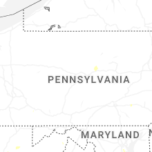
Pennsylvania
| Local Time | Report Details |
|---|---|
| 2:18 PM EDT | A couple of trees were reported down over powerlines with blown transformers. the damage occurred at the intersection of pine grove road and hillcrest driv in beaver county PA, 25.7 miles NW of Pittsburgh, PA |
| 3:09 PM EDT | A tree was reported down on mockler roa in fayette county PA, 51.5 miles SSE of Pittsburgh, PA |
| 4:55 PM EDT | A tree was reported over the road on sr 8 in washington county PA, 15.8 miles S of Pittsburgh, PA |
| 5:10 PM EDT | A tree was reported down along state route 88 in the riverview are in washington county PA, 17.6 miles SSE of Pittsburgh, PA |
| 5:22 PM EDT | There were 2 trees reported down at this locatio in westmoreland county PA, 22 miles SSE of Pittsburgh, PA |
| 5:30 PM EDT | Tree dow in schuylkill county PA, 52.9 miles SSW of Scranton, PA |
| 6:05 PM EDT | A tree was reported down along quail hill road and knocked out power to some resident in fayette county PA, 36.5 miles SE of Pittsburgh, PA |
| 6:15 PM EDT | Trees and wires down. time estimated from rada in berks county PA, 70.7 miles S of Scranton, PA |
| 6:20 PM EDT | Trees and wires down. time estimated from rada in berks county PA, 72.5 miles SSW of Scranton, PA |
| 6:25 PM EDT | Trees and wires down. time estimated from rada in berks county PA, 69 miles S of Scranton, PA |
| 6:35 PM EDT | Tree dow in clinton county PA, 45.3 miles N of State College, PA |
| 6:38 PM EDT | Trees and wires down. time estimated from rada in berks county PA, 75.8 miles S of Scranton, PA |
| 7:00 PM EDT | Tree down. time estimated from rada in montgomery county PA, 81.3 miles WSW of Brooklyn, NY |
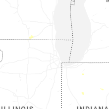
Indiana
| Local Time | Report Details |
|---|---|
| 2:19 PM EDT | About 4 to 6 trees downed throughout the county... with several near/in the connersville area. time estimated by rada in fayette county IN, 50.1 miles NW of Cincinnati, OH |
| 2:29 PM EDT | Tree downed in laurel. time estimated by rada in franklin county IN, 45.7 miles NW of Cincinnati, OH |
| 2:46 PM EDT | Tree downed near s. state road 101. time estimated by rada in franklin county IN, 36.7 miles NW of Cincinnati, OH |
| 4:33 PM EDT | Tree and powerlines dow in cass county IN, 69.8 miles NNW of Indianapolis, IN |
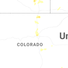
Colorado
| Local Time | Report Details |
|---|---|
| 1:30 PM MDT | Quarter sized hail reported near Calhan, CO, 52.8 miles NNE of Pueblo, CO |
| 8:09 PM MDT | Quarter sized hail reported near Longmont, CO, 26.3 miles N of Denver, CO, report from mping: quarter (1.00 in.). |
| 8:13 PM MDT | Quarter sized hail reported near Longmont, CO, 26.3 miles N of Denver, CO |
New Mexico
| Local Time | Report Details |
|---|---|
| 2:15 PM MDT | Quarter sized hail reported near Los Alamos, NM, 52.5 miles SW of Taos, NM, two different reports received of quarter size hail on the north side of los alamos. |
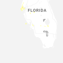
Florida
| Local Time | Report Details |
|---|---|
| 3:15 PM CDT | Tree reported down on the north side of gulf count in gulf county FL, 59.2 miles WSW of Tallahassee, FL |
| 3:30 PM CDT | Ktdr gusted to 61 mp in bay county FL, 55.1 miles ESE of Miramar Beach, FL |
| 4:45 PM EDT | Tree reported down on natural bridge rd... e of country oak in leon county FL, 10.8 miles SSE of Tallahassee, FL |
| 4:50 PM EDT | Trees reported down near deer lake w and waters meet driv in leon county FL, 12 miles NNE of Tallahassee, FL |
| 4:55 PM EDT | Ping Pong Ball sized hail reported near Tallahassee, FL, 1.4 miles ESE of Tallahassee, FL, hail of 1.5 inches was reported in indian head acres. |
| 4:55 PM EDT | Quarter sized hail reported near Tallahassee, FL, 0 miles ENE of Tallahassee, FL, 1 inch hail observed in downtown tallahassee. |
| 4:55 PM EDT | Trees and powerlines reported down across wakulla count in wakulla county FL, 18.9 miles SSW of Tallahassee, FL |
| 4:55 PM EDT | Tree reported down on structure near duncan driv in wakulla county FL, 19.1 miles SSW of Tallahassee, FL |
| 4:55 PM EDT | Tree reported down on ox bow and ox bottom r in leon county FL, 7.7 miles N of Tallahassee, FL |
| 4:55 PM EDT | Tree reported down on iamonia landing and cr1 in leon county FL, 15.9 miles NNE of Tallahassee, FL |
| 4:58 PM EDT | Half Dollar sized hail reported near Tallahassee, FL, 1.9 miles WSW of Tallahassee, FL, levy ave and engineering way. |
| 4:05 PM CDT | *** 1 inj *** a gust of wind capsized a boat in grand lagoon injuring one of the occupants. time estimated from rada in gmz735 county FL, 38.4 miles ESE of Miramar Beach, FL |
| 4:54 PM CDT | Quarter sized hail reported near Chipley, FL, 39.7 miles E of Miramar Beach, FL, report from mping: quarter (1.00 in.). |
| 4:59 PM CDT | Quarter sized hail reported near Milton, FL, 42 miles WNW of Miramar Beach, FL, emergency management reports estimate of quarter size hail in the airport road area of milton. |
| 5:59 PM EDT | Trees and powerlines reported down across gadsden count in gadsden county FL, 37.9 miles WNW of Tallahassee, FL |
| 5:06 PM CDT | Tree down near 8747 se cr6 in calhoun county FL, 48.5 miles W of Tallahassee, FL |
| 5:12 PM CDT | Tree down on anderson roa in calhoun county FL, 51.9 miles WSW of Tallahassee, FL |
| 5:23 PM CDT | Power line down along parkwood roa in calhoun county FL, 61 miles W of Tallahassee, FL |
| 5:23 PM CDT | Half Dollar sized hail reported near Marianna, FL, 63.5 miles WNW of Tallahassee, FL, at least 1.25 inch hail on i-10 at exit 136. |
| 5:35 PM CDT | Trees and powerlines reported down across jackson count in jackson county FL, 61.8 miles ENE of Miramar Beach, FL |
| 6:52 PM EDT | Quarter sized hail reported near Saint Petersburg, FL, 23.2 miles NNW of Bradenton, FL, quarted sized hail reported at 33rd ave north st petersburg. |
| 5:54 PM CDT | Trees and powerlines reported down in and around chiple in washington county FL, 55.8 miles ENE of Miramar Beach, FL |
| 6:00 PM CDT | Trees and powerlines reported down in and around caryvill in washington county FL, 42.2 miles NE of Miramar Beach, FL |
| 7:00 PM EDT | Quarter sized hail reported near North Fort Myers, FL, 37 miles N of Naples, FL, public reported quarter size hail in north ft. myers. time was estimated based on radar data. |
| 6:15 PM CDT | Trees reported down on powerlines and across roadways in and around ponce de leo in holmes county FL, 34.6 miles NE of Miramar Beach, FL |
| 6:15 PM CDT | Trees and powerlines reported down across jackson count in jackson county FL, 64.3 miles NE of Miramar Beach, FL |
| 6:27 PM CDT | Quarter sized hail reported near Crestview, FL, 32.1 miles NNW of Miramar Beach, FL, broadcast media relayed report of quarter size hail estimated near auburn... fl. time estimated by radar. |
| 6:30 PM CDT | Trees reported down on powerlines and across roadways in and around est in holmes county FL, 59.4 miles NE of Miramar Beach, FL |
| 6:30 PM CDT | Trees reported down on powerlines and across roadways in and around pittma in holmes county FL, 50.5 miles NE of Miramar Beach, FL |
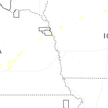
Nebraska
| Local Time | Report Details |
|---|---|
| 3:23 PM CDT | Asos station kgri grand island airpor in hall county NE, 3.3 miles NNE of Grand Island, NE |
| 3:26 PM CDT | Storm damage reported in phelps county NE, 70.4 miles WSW of Grand Island, NE |
| 3:28 PM CDT | 6 inch tree branch dow in buffalo county NE, 42.5 miles WSW of Grand Island, NE |
| 3:30 PM CDT | Tree damag in buffalo county NE, 42.3 miles WSW of Grand Island, NE |
| 3:35 PM CDT | Storm damage reported in buffalo county NE, 41.3 miles WSW of Grand Island, NE |
| 3:35 PM CDT | Storm damage reported in buffalo county NE, 40.9 miles WSW of Grand Island, NE |
| 3:55 PM CDT | Storm damage reported in buffalo county NE, 21.2 miles W of Grand Island, NE |
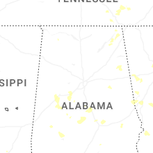
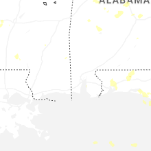
Alabama
| Local Time | Report Details |
|---|---|
| 3:32 PM CDT | A few trees were knocked down in the powell area near the county line. time estimated by rada in dekalb county AL, 48.9 miles SW of Chattanooga, TN |
| 3:32 PM CDT | A large tree was down on cr 100 blocking the road. time estimated by rada in dekalb county AL, 50.1 miles SW of Chattanooga, TN |
| 3:32 PM CDT | A tree was uprooted and landed on a carport at 383 cr 275. time estimated by rada in dekalb county AL, 51 miles SW of Chattanooga, TN |
| 3:35 PM CDT | Corrects previous tstm wnd dmg report from 3 ese section. a tree was knocked down at cr 120 at highway 35. time estimated by rada in jackson county AL, 49.1 miles SW of Chattanooga, TN |
| 3:50 PM CDT | A tree was knocked down in section are in jackson county AL, 50.3 miles SW of Chattanooga, TN |
| 3:52 PM CDT | A tree was knocked down at cr 120 at highway 3 in jackson county AL, 49.1 miles SW of Chattanooga, TN |
| 4:03 PM CDT | Multiple trees down on cr 409... 120... 100 and 430. a tree was knocked down on a home on cr 43 in jackson county AL, 50.1 miles SW of Chattanooga, TN |
| 4:35 PM CDT | Golf Ball sized hail reported near Pisgah, AL, 39.8 miles SW of Chattanooga, TN, golf ball sized hail was reported in pisgah. |
| 4:36 PM CDT | A tree was knocked down at 4105 al highway 117 blocking both lanes. time estimated by rada in jackson county AL, 29.7 miles SW of Chattanooga, TN |
| 4:45 PM CDT | Quarter sized hail reported near Pisgah, AL, 35.4 miles SW of Chattanooga, TN, quarter sized hail reported in rosalie. |
| 4:50 PM CDT | A large tree was down in the road at cr 711 at highway 11 in jackson county AL, 29.7 miles SW of Chattanooga, TN |
| 5:10 PM CDT | A parked truck trailer was overturned at 43340 u.s. highway 72 in stevenso in jackson county AL, 30.6 miles WSW of Chattanooga, TN |
| 5:10 PM CDT | A power pole was knocked down on 2nd street near old mt carme in jackson county AL, 31.2 miles WSW of Chattanooga, TN |
| 6:18 PM CDT | Numerous trees and power lines down near the community of black... including near old esto rd and w v armstrong r in geneva county AL, 58.4 miles NE of Miramar Beach, FL |
| 6:22 PM CDT | Brookley field asos reports thunderstorm wind gust of 58mp in mobile county AL, 4 miles SSW of Mobile, AL |
| 6:30 PM CDT | Power lines down near county road 16 and kelly r in geneva county AL, 60.5 miles NE of Miramar Beach, FL |
| 7:03 PM CDT | Tree reported down in enterpris in coffee county AL, 71.2 miles NNE of Miramar Beach, FL |
| 7:03 PM CDT | Multiple trees reported down in southern coffee count in coffee county AL, 66.1 miles NNE of Miramar Beach, FL |
| 7:11 PM CDT | Ham radio operator relays report of power outages scattered throughout covington county along with several tree limbs taken down and powerlines taken down. trees report in covington county AL, 51.5 miles N of Miramar Beach, FL |
| 7:19 PM CDT | Trees down near the intersection of county road 415 and 420 in coffee county... relayed by nws mobile via covington county e in coffee county AL, 68.4 miles N of Miramar Beach, FL |
| 7:49 PM CDT | Tree down along highway 5 in houston county AL, 78.6 miles NW of Tallahassee, FL |
| 8:34 PM CDT | Report of tree on a vehicle on county road 1 in dale county AL, 85.3 miles NE of Miramar Beach, FL |
| 8:36 PM CDT | Tree down on county road 5 in dale county AL, 84.6 miles NE of Miramar Beach, FL |
| 8:42 PM CDT | Power lines down on dale county road #4 in dale county AL, 76.5 miles NE of Miramar Beach, FL |
| 9:05 PM CDT | Numerous trees and power lines down throughout coffee count in coffee county AL, 73.9 miles NNE of Miramar Beach, FL |
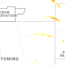
Montana
| Local Time | Report Details |
|---|---|
| 2:45 PM MDT | Quarter sized hail reported near Circle, MT, 67.6 miles SE of Glasgow, MT, hail up to the size of quarters and wind gusts up to 30 mph. |
| 5:24 PM MDT | Quarter sized hail reported near Baker, MT, 75.3 miles ESE of Miles City, MT |
| 5:34 PM MDT | Golf Ball sized hail reported near Baker, MT, 83 miles ESE of Miles City, MT |
| 6:00 PM MDT | Mesonet station ricmt rice ridg in teton county MT, 55.6 miles NW of Great Falls, MT |
Minnesota
| Local Time | Report Details |
|---|---|
| 4:00 PM CDT | Storm damage reported in fillmore county MN, 51.1 miles NE of Mason City, IA |
| 5:52 PM CDT | Utility pole down on main street near the post office. crews on scen in houston county MN, 6.1 miles SW of La Crosse, WI |
Iowa
| Local Time | Report Details |
|---|---|
| 4:05 PM CDT | Large tree limb down on the roa in scott county IA, 62.5 miles ESE of Cedar Rapids, IA |
| 4:29 PM CDT | Pws measured gust with damage nearby suggesting 70 - 80 mph downburs in clinton county IA, 48.8 miles E of Cedar Rapids, IA |
| 4:31 PM CDT | Pictures of a roof panel off a farm structure and the total destruction of detached garage. estimated 70-80 mph wind in clinton county IA, 50.6 miles E of Cedar Rapids, IA |
| 4:41 PM CDT | Large trees down in tow in clinton county IA, 53.9 miles E of Cedar Rapids, IA |
| 4:42 PM CDT | Pws measured a 60 mph gust. wires also reported down in grand moun in clinton county IA, 55.2 miles ESE of Cedar Rapids, IA |
| 5:08 PM CDT | Multiple trees down in the city of clinton blocking road in clinton county IA, 76.5 miles E of Cedar Rapids, IA |
| 5:10 PM CDT | Corrects previous tstm wnd dmg report from 2 w fulton. healthy tree branch down... e 10 inches in diamete in clinton county IA, 76.8 miles E of Cedar Rapids, IA |
| 5:28 PM CDT | Healthy tree branch down... e 10 inches in diamete in clinton county IA, 76.8 miles E of Cedar Rapids, IA |
| 5:45 PM CDT | Peak gust reported by clarion awo in wright county IA, 39.9 miles SW of Mason City, IA |
Illinois
| Local Time | Report Details |
|---|---|
| 4:09 PM CDT | Large tree branch dow in henry county IL, 67.7 miles NW of Peoria, IL |
| 4:14 PM CDT | Large trees dow in henry county IL, 66.2 miles NNW of Peoria, IL |
| 4:26 PM CDT | Damage to campers and a large branch down on a truc in rock island county IL, 67.5 miles NNW of Peoria, IL |
| 5:09 PM CDT | Tree branches and trees down in tow in whiteside county IL, 78.4 miles E of Cedar Rapids, IA |
| 5:53 PM CDT | Estimated 80 mph tstorm wind gusts from suspected microburst. several large trees down or uproote in shelby county IL, 14.4 miles SW of Mattoon, IL |
| 7:01 PM CDT | Video shared by local broadcast media showing several trees snapped in south beloit off prairie hill road. time estimated by rada in winnebago county IL, 45.8 miles SSE of Madison, WI |
| 7:02 PM CDT | 7 to 8 inch diameter tree uproote in winnebago county IL, 45.4 miles SSE of Madison, WI |
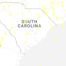
South Carolina
| Local Time | Report Details |
|---|---|
| 5:25 PM EDT | Tree down in hamer... sc in dillon county SC, 80.9 miles WNW of Wilmington, NC |
| 5:39 PM EDT | Tree down on sc-9 near covington rd in marlboro county SC, 80.9 miles ESE of Charlotte, NC |
| 5:48 PM EDT | Two trees down in separate locations in landrum. time estimated from rada in spartanburg county SC, 33.4 miles NE of Greenville, SC |
| 5:50 PM EDT | Tree down. time estimated from rada in spartanburg county SC, 27.7 miles NE of Greenville, SC |
| 6:00 PM EDT | Sc highway patrol reports tree down on green sea rd near church rd. time estimated via rada in horry county SC, 58.4 miles W of Wilmington, NC |
| 6:05 PM EDT | Report of tree down on mechanicsville hgwy near greenfield rd in darlington county SC, 82.4 miles SE of Charlotte, NC |
| 6:10 PM EDT | Lancaster dispatch reported trees down at barberville rd at harrisburg rd. time estimated by rada in lancaster county SC, 13.5 miles S of Charlotte, NC |
| 6:10 PM EDT | A smattering of downed trees and powerlines between east gaffney and cherokee fall in cherokee county SC, 44.8 miles WSW of Charlotte, NC |
| 6:15 PM EDT | Sc highway patrol reports tree down on macedonia dr between heritage rd and red bluff rd. time estimated via rada in horry county SC, 55.7 miles WSW of Wilmington, NC |
| 6:15 PM EDT | Approx 2000 outages due to fallen trees and utility lines from tigerville south to greenville. time ranged from 600 to 630 p in greenville county SC, 11.6 miles ENE of Greenville, SC |
| 6:20 PM EDT | Tree down across aviation parkwa in spartanburg county SC, 21.9 miles E of Greenville, SC |
| 6:24 PM EDT | Sc highway patrol reports tree down on us-701 and sc-22 in horry county SC, 65.2 miles WSW of Wilmington, NC |
| 6:25 PM EDT | Tree down on road at hartsville hwy and bethlehem rd. time estimated via rada in darlington county SC, 74 miles SE of Charlotte, NC |
| 6:29 PM EDT | Tree down on chestnut st in darlington in darlington county SC, 75.8 miles N of Charleston, SC |
| 6:40 PM EDT | Tree down on elm st in conway... near 16th ave. time estimated via rada in horry county SC, 69.2 miles WSW of Wilmington, NC |
| 6:41 PM EDT | Golf Ball sized hail reported near Clover, SC, 19.7 miles WSW of Charlotte, NC, golf ball hail at ridge rd and glenn rd. time estimated from radar. |
| 6:42 PM EDT | Trees down on roof of home near ridge rd at glenn rd. time based on rada in york county SC, 19.7 miles WSW of Charlotte, NC |
| 6:50 PM EDT | Spotter reports trees down and power outages in florence... sc in florence county SC, 69.1 miles N of Charleston, SC |
| 6:51 PM EDT | Sc highway patrol reports tree down on forest lake dr between s stanley dr and s knollwood rd in florence county SC, 67.1 miles N of Charleston, SC |
| 6:55 PM EDT | Trees downed along regent pkw in york county SC, 10.9 miles SSW of Charlotte, NC |
| 6:55 PM EDT | Lancaster county dispatch reported trees down on camp creek rd at mockingbird rd. time estimated by rada in lancaster county SC, 32.2 miles SSE of Charlotte, NC |
| 7:00 PM EDT | Approx 3000 outages around spartanburg due to tree and utility line damage. event time is based on rada in spartanburg county SC, 38.4 miles ENE of Greenville, SC |
| 7:00 PM EDT | Large down in the roadway... 3600 block of old pee dee road in hemingway. time estimated via radar in georgetown county SC, 55.7 miles NE of Charleston, SC |
| 7:00 PM EDT | Quarter sized hail reported near Simpsonville, SC, 19.5 miles ESE of Greenville, SC, quarter-sized hail near intersection of cheyenne dr. and capewood rd. time estimated from radar. |
| 7:15 PM EDT | Tree down in roadway. rose hill and antwine drive in georgetow in georgetown county SC, 45 miles NE of Charleston, SC |
| 7:15 PM EDT | Tree down on sc-51 near hemingway lane. time estimated via radar. a car crashed into the tree a short time later - no injurie in georgetown county SC, 42.8 miles NE of Charleston, SC |
| 7:20 PM EDT | *** 1 inj *** large tree down on roadway. kings river road at knight circle in pawleys island. tree struck a pedestrian who was running on the bike path... who was then in georgetown county SC, 53.9 miles ENE of Charleston, SC |
| 7:20 PM EDT | Outages near old richburg rd due to fallen trees and/or utility line in chester county SC, 37.1 miles SSW of Charlotte, NC |
| 7:20 PM EDT | Lancaster county dispatch reported trees down on gold mine hwy at estridge ave. time estimated by rada in lancaster county SC, 45.1 miles SSE of Charlotte, NC |
| 7:30 PM EDT | Fairfield county dispatch reports tree down on dave jenkins rd near blair. time estimated by rada in fairfield county SC, 55.6 miles SSW of Charlotte, NC |
| 7:36 PM EDT | Tree down on utility equipmen in greenwood county SC, 35.8 miles SE of Greenville, SC |
| 7:42 PM EDT | Scdps website reported a tree down on us-321 near the intersection of airport road. time estimated by rada in fairfield county SC, 56.4 miles SSW of Charlotte, NC |
| 7:43 PM EDT | Scdps website reported a tree in roadway near the intersection of bethel church road and sanford drive. time estimated by rada in sumter county SC, 48.8 miles NNW of Charleston, SC |
| 7:43 PM EDT | Trees down and a medal roof blown off barn. 176 adger road. possible tornad in fairfield county SC, 56.9 miles SSW of Charlotte, NC |
| 7:45 PM EDT | Tree down on roadway at us-17a and sc-41. a car crashed into the tree a short time later - no injurie in georgetown county SC, 23.8 miles ENE of Charleston, SC |
| 7:46 PM EDT | Scdps website reported a tree down on i-95 near exit 132. time estimated by rada in clarendon county SC, 46.1 miles N of Charleston, SC |
| 7:48 PM EDT | Scdps website reported a tree down on i-95 over the black river swamp. time estimated by rada in clarendon county SC, 44.2 miles N of Charleston, SC |
| 7:48 PM EDT | Sc dps reports tree down over cecil mcfadden rd near gabl in clarendon county SC, 43.3 miles N of Charleston, SC |
| 8:10 PM EDT | Columbia fire dept reported a collapsed structure. time estimated by rada in richland county SC, 68.8 miles NE of Augusta, GA |
| 8:10 PM EDT | Kershaw county fire reported multiple trees down in the elgin area. time estimated by rada in kershaw county SC, 71.9 miles S of Charlotte, NC |
| 8:11 PM EDT | Richland county em reported a tree down on a power line with nearby trees on fire off adams rd. time estimated by rada in richland county SC, 70.8 miles S of Charlotte, NC |
| 8:13 PM EDT | Tree down across roadway on russellville r in berkeley county SC, 14.8 miles NNE of Charleston, SC |
| 8:13 PM EDT | Tree down on heaven dr. time estimated from rada in berkeley county SC, 14.2 miles NNE of Charleston, SC |
| 8:16 PM EDT | Scdps reported trees down on heins rd. time estimated by rada in richland county SC, 69.1 miles S of Charlotte, NC |
| 8:18 PM EDT | Tree down on mail route rd. time estimated from rada in berkeley county SC, 10.2 miles ENE of Charleston, SC |
| 8:19 PM EDT | Trees down at whetstone rd and cassidy ridge r in oconee county SC, 30.7 miles W of Greenville, SC |
| 8:21 PM EDT | Tree down across the road on bethera and boggy swamp r in berkeley county SC, 11.9 miles E of Charleston, SC |
| 8:21 PM EDT | Richland county em reported a tree on a power line causing a brush fire. time estimated by rada in richland county SC, 74.1 miles S of Charlotte, NC |
| 8:30 PM EDT | Pinopolis gusted to 62 mp in berkeley county SC, 4 miles NNW of Charleston, SC |
| 8:30 PM EDT | Scdps reported trees down on muller road near persimmon fork rd. time estimated by rada in richland county SC, 69.9 miles S of Charlotte, NC |
| 8:30 PM EDT | Powerlines down on roadway on land bridge r in oconee county SC, 31.8 miles W of Greenville, SC |
| 8:30 PM EDT | Several trees reported down from moncks corner to st. stephen. time estimated from rada in berkeley county SC, 7.1 miles NNE of Charleston, SC |
| 8:35 PM EDT | Tree down on unoccupied vehicle near promise ln. time estimated from rada in berkeley county SC, 3.9 miles W of Charleston, SC |
| 8:37 PM EDT | Scdps reported trees down on north wingard rd at western lane. time estimated by rada in richland county SC, 63.1 miles NE of Augusta, GA |
| 8:43 PM EDT | Tree down on sprig ct. time estimated from rada in charleston county SC, 15.2 miles SSW of Charleston, SC |
| 8:43 PM EDT | Ema reports several trees down between cainhoy and huger. time estimated from rada in berkeley county SC, 16.9 miles SE of Charleston, SC |
| 8:43 PM EDT | Trees down at s radio station rd and pruitt r in oconee county SC, 25.3 miles WSW of Greenville, SC |
| 8:44 PM EDT | Scdps reported trees down on amicks ferry rd at ballentine lane. time estimated by rada in lexington county SC, 54.5 miles NE of Augusta, GA |
| 8:47 PM EDT | Lexington county communications center reported a large tree blocking the roadway on fairview road near ranch road. time estimated by rada in lexington county SC, 37.9 miles NE of Augusta, GA |
| 8:49 PM EDT | Scdps reported trees down on mill stream rd near hope ferry rd. time estimated by rada in lexington county SC, 58.6 miles NE of Augusta, GA |
| 8:52 PM EDT | Lexington county communications center reported power line or power poles down near this address. time estimated by rada in lexington county SC, 60.9 miles NE of Augusta, GA |
| 8:55 PM EDT | Charleston harbor pilot office reported a wind gust of 50 kt (58 mph in amz330 county SC, 29.9 miles S of Charleston, SC |
| 8:58 PM EDT | Scdps reported trees down on patricia drive. time estimated by rada in richland county SC, 69.1 miles ENE of Augusta, GA |
| 9:00 PM EDT | Scdps reported trees down on bluff rd near sims rd. time estimated by rada in richland county SC, 64 miles NW of Charleston, SC |
| 9:01 PM EDT | Tree down on long point rd. time estimated from rada in charleston county SC, 27 miles SSE of Charleston, SC |
| 9:03 PM EDT | Trees down at w cherry rd and evening shade r in oconee county SC, 19.3 miles SW of Greenville, SC |
| 9:03 PM EDT | Scdps website reported a tree down on old swamp road near the intersection of old state highway. time estimated by rada in calhoun county SC, 63.7 miles ENE of Augusta, GA |
| 9:05 PM EDT | Amateur radio spotter reports trees down blocking wannaridge rd as well as stabler farm rd. time estimated by rada in calhoun county SC, 62.8 miles NW of Charleston, SC |
| 9:05 PM EDT | Sc dps reports tree down on swansea rd near the intersection of hwy 178. time estimated by rada in lexington county SC, 47.5 miles ENE of Augusta, GA |
| 9:07 PM EDT | Scdps website reported a tree down on us-178 near the intersection of whetstone road. time estimated by rada in lexington county SC, 47.5 miles ENE of Augusta, GA |
| 9:14 PM EDT | Sc dps reports tree on i-20 near pineview estates. time estimated by rada in aiken county SC, 5 miles N of Augusta, GA |
| 9:26 PM EDT | Quarter sized hail reported near Ridge Spring, SC, 22.6 miles NE of Augusta, GA |
| 9:30 PM EDT | Quarter sized hail reported near North Augusta, SC, 4.1 miles NNE of Augusta, GA, media reports quarter size hail from multiple viewers in belvedere and north augusta. |
| 9:40 PM EDT | Emergency manager reported a tree down on larry stree in charleston county SC, 20.4 miles S of Charleston, SC |
| 9:40 PM EDT | Emergency manager reported a tree down on nautical chart driv in charleston county SC, 27.1 miles S of Charleston, SC |
| 9:40 PM EDT | Emergency manager reported a tree down on the intersection of bayview farms blvd and fort johnson r in charleston county SC, 32.5 miles S of Charleston, SC |
| 9:40 PM EDT | Emergency manager reported a tree down on the 216 exit ramp of i-26 in charleston county SC, 23.9 miles S of Charleston, SC |
| 9:42 PM EDT | Emergency manager reported a tree and power line down on the 3600 block of mount carmel road. one lane of the road was blocke in colleton county SC, 42.6 miles WSW of Charleston, SC |
| 9:45 PM EDT | Scdps website reported a tree down on binnicker bridge road near the intersection of good hope road. time estimated by rada in orangeburg county SC, 52.8 miles E of Augusta, GA |
| 9:52 PM EDT | Emergency manager reported a tree down on the block of 1500 wichman street. it's blocking both lane in colleton county SC, 41.9 miles WSW of Charleston, SC |
| 9:57 PM EDT | Quarter sized hail reported near Langley, SC, 7.8 miles ENE of Augusta, GA |
| 10:01 PM EDT | Emergency manager reported at tree down at the intersection of azalea patch road and bethel road. it's blocking both lane in colleton county SC, 49 miles WSW of Charleston, SC |
| 10:10 PM EDT | Emergency manager reported a tree down and power lines down on the block of 5400 cross swamp road. both lanes were blocke in colleton county SC, 57.1 miles WSW of Charleston, SC |
| 10:14 PM EDT | Tree down on 10000 combahee rd. time estimated from rada in colleton county SC, 51.3 miles NNE of Savannah, GA |
| 10:14 PM EDT | Emergency manager reported a tree down on the 2000 block of mewville road. it's blocking both lane in colleton county SC, 51.7 miles WSW of Charleston, SC |
| 10:15 PM EDT | Tree down on black creek rd. time estimated from rada in colleton county SC, 50.2 miles SW of Charleston, SC |
| 10:20 PM EDT | Golf Ball sized hail reported near Yemassee, SC, 51.2 miles WSW of Charleston, SC, emergency manager reported golf ball sized hail (1.75 inches) on 1400 block of mewville road. |
| 10:27 PM EDT | Tree down on residence at pentgage ct. time estimated from rada in colleton county SC, 49.6 miles NNE of Savannah, GA |
| 10:39 PM EDT | Emergency manager reported at tree down on the 11500 block of hendersonville highway. it is blocking both lane in colleton county SC, 50.2 miles NNE of Savannah, GA |
| 10:51 PM EDT | Emergency manager reported a tree down on public landing lan in colleton county SC, 45.7 miles NNE of Savannah, GA |
| 10:53 PM EDT | Emergency manager reported a tree down on the block of 15800 hendersonville highway. it's blocking both lane in colleton county SC, 46.4 miles NNE of Savannah, GA |
| 10:56 PM EDT | Emergency manager reported a tree down on the block of 1500 wichman street. it's blocking both lane in colleton county SC, 41.9 miles WSW of Charleston, SC |
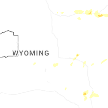
Wyoming
| Local Time | Report Details |
|---|---|
| 3:25 PM MDT | Quarter sized hail reported near Gillette, WY, 8.1 miles WNW of Gillette, WY, dime to quarter hail. |
| 4:06 PM MDT | Quarter sized hail reported near Gillette, WY, 9.6 miles SSE of Gillette, WY |
| 5:23 PM MDT | Quarter sized hail reported near Upton, WY, 47.5 miles E of Gillette, WY |
Texas
| Local Time | Report Details |
|---|---|
| 5:01 PM CDT | Em relayed a report of two power poles snapped on cr 4105 to the northeast of ector. time estimated by rada in fannin county TX, 57.4 miles S of Atoka, OK |
Kansas
| Local Time | Report Details |
|---|---|
| 5:02 PM CDT | Up846 reported the gus in gove county KS, 48.5 miles WNW of Hays, KS |
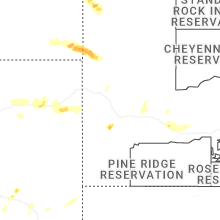
South Dakota
| Local Time | Report Details |
|---|---|
| 4:40 PM MDT | Half Dollar sized hail reported near Rapid City, SD, 16.6 miles WSW of Rapid City, SD |
| 5:35 PM MDT | Two semis were overturned on i-90 at mile markers 114 & 11 in pennington county SD, 57.5 miles E of Rapid City, SD |
| 5:57 PM MDT | Storm damage reported in butte county SD, 61.7 miles NNW of Rapid City, SD |
| 6:32 PM MDT | Ping Pong Ball sized hail reported near Buffalo, SD, 106.6 miles ESE of Miles City, MT |
| 7:30 PM MDT | Storm damage reported in harding county SD, 106 miles N of Rapid City, SD |
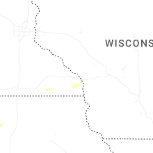
Wisconsin
| Local Time | Report Details |
|---|---|
| 7:20 PM CDT | Multiple trees downe in vernon county WI, 22.4 miles S of La Crosse, WI |
| 7:22 PM CDT | Dispatch center reports multiple trees and power lines down in la prairie township. time estimated from rada in rock county WI, 37.8 miles SE of Madison, WI |
Connect with Interactive Hail Maps