

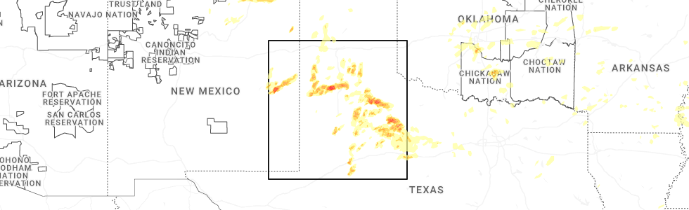
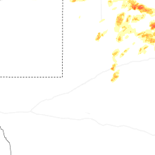
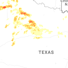
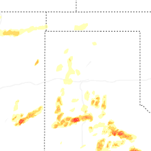
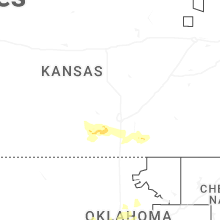
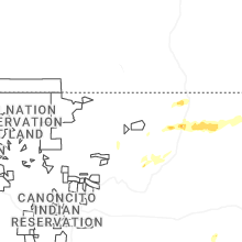
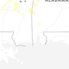
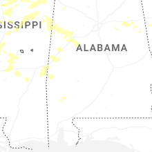
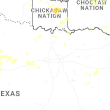
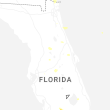
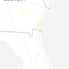
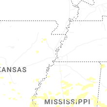
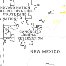
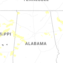
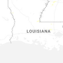
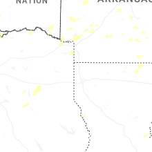
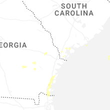
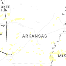
Hail Map for Sunday, May 25, 2025
Number of Impacted Households on 5/25/2025
0
Impacted by 1" or Larger Hail
0
Impacted by 1.75" or Larger Hail
0
Impacted by 2.5" or Larger Hail
Square Miles of Populated Area Impacted on 5/25/2025
0
Impacted by 1" or Larger Hail
0
Impacted by 1.75" or Larger Hail
0
Impacted by 2.5" or Larger Hail


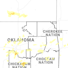

Cities Most Affected by Hail Storms of 5/25/2025
| Hail Size | Demographics of Zip Codes Affected | ||||||
|---|---|---|---|---|---|---|---|
| City | Count | Average | Largest | Pop Density | House Value | Income | Age |
| Afton, TX | 16 | 3.86 | 6.00 | 0 | $22k | $19.7k | 52.6 |
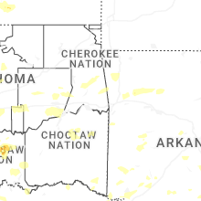
| Norman, OK | 4 | 2.44 | 3.00 | 767 | $124k | $46.7k | 28.5 |
| Roaring Springs, TX | 4 | 2.19 | 2.50 | 1 | $25k | $27.1k | 51.3 |
| Plainview, TX | 2 | 2.50 | 3.00 | 68 | $57k | $31.5k | 31.2 |
| Olton, TX | 2 | 2.25 | 2.50 | 2 | $37k | $27.1k | 35.0 |
| Stamford, TX | 2 | 1.75 | 1.75 | 20 | $32k | $25.6k | 45.2 |
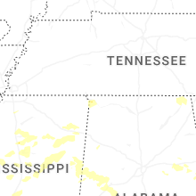
| Meridian, MS | 1 | 1.75 | 1.75 | 95 | $58k | $24.4k | 36.4 |
| Aspermont, TX | 1 | 1.75 | 1.75 | 1 | $31k | $27.0k | 46.1 |
| Big Spring, TX | 1 | 1.75 | 1.75 | 32 | $39k | $30.5k | 38.4 |
| Spur, TX | 1 | 1.75 | 1.75 | 4 | $22k | $27.8k | 40.6 |
| Blanchard, OK | 1 | 1.75 | 1.75 | 89 | $83k | $41.2k | 37.7 |
Hail and Wind Damage Spotted on 5/25/2025
Filter by Report Type:Hail ReportsWind Reports
States Impacted
Kansas, Tennessee, Georgia, Florida, Texas, Oklahoma, Alabama, Mississippi, New Mexico, ArkansasKansas
| Local Time | Report Details |
|---|---|
| 7:16 AM CDT | Trees were reported down along with 10-inch diameter limbs broken within the city. delayed report. time estimated via rada in kingman county KS, 32.3 miles WSW of Wichita, KS |
Tennessee
| Local Time | Report Details |
|---|---|
| 12:35 PM CDT | Roof damage at arlington elementary schoo in shelby county TN, 23.5 miles ENE of Memphis, TN |
| 12:37 PM CDT | Trees uprooted and fences down off of perkins in southeast memphi in shelby county TN, 10.5 miles SE of Memphis, TN |
| 12:58 PM CDT | Numerous trees down in somerville and to the southeast of tow in fayette county TN, 41.1 miles E of Memphis, TN |
| 1:30 PM CDT | An entire roof was lying across highway 200 near broadway road south. unsure of the origin of the roof. also had trees down in lexington are in henderson county TN, 34.8 miles S of Mc Kenzie, TN |
| 2:10 PM CDT | Trained spotter reports tree down on hwy-13 south near the linden co-op. time estimate in perry county TN, 53.1 miles SE of Mc Kenzie, TN |
| 2:21 PM CDT | Wayne county dispatch reports multiple trees down in the northern part of the county. time estimate in wayne county TN, 36.1 miles N of Florence, AL |
| 2:53 PM CDT | Lawrence county emergency manager reports a tree down on tn-242 near union hill road. time estimate in lawrence county TN, 36.4 miles NNE of Florence, AL |
| 2:53 PM CDT | Emergency manager reports tree down on van... with occupants trapped inside. time estimate in lawrence county TN, 36.4 miles NNE of Florence, AL |
| 2:54 PM CDT | Photo from lawrence county ema of a tree on a house. time estimated from rada in lawrence county TN, 36.1 miles NNE of Florence, AL |
| 2:55 PM CDT | Large tree uprooted near high avenue and groh stree in lawrence county TN, 36.4 miles NNE of Florence, AL |
| 3:12 PM CDT | Multiple trees reported down in the northern part of giles count in giles county TN, 54.9 miles NE of Florence, AL |
| 3:24 PM CDT | A couple trees down and a few power outages reported mainly on the south and southwest outskirts of lewisbur in marshall county TN, 49.5 miles S of Nashville, TN |
| 3:35 PM CDT | Lincoln county 911 call center reported a power pole down at 307 guant st in petersburg t in lincoln county TN, 59.7 miles S of Nashville, TN |
| 3:50 PM CDT | Tspotter report of trees down near mt. herman road and hawthorne hill road - southern bedford c in bedford county TN, 57.8 miles SSE of Nashville, TN |
| 3:55 PM CDT | Moore county ema reported a tree uprooted along main street in lynchburg t in moore county TN, 62.7 miles WNW of Chattanooga, TN |
| 3:55 PM CDT | Large tree reported down near new herman road and george reagor roa in bedford county TN, 58.6 miles SSE of Nashville, TN |
| 4:10 PM CDT | Tree down on woodbury highway in mancheste in coffee county TN, 54.1 miles NW of Chattanooga, TN |
| 4:13 PM CDT | Ham operator reported a tree down on a house at 2394 penile hill rd in franklin county t in franklin county TN, 44.7 miles WNW of Chattanooga, TN |
| 4:14 PM CDT | Ema reported tree down on powerlines along little hurricane creek rd in winchester t in franklin county TN, 51.1 miles WNW of Chattanooga, TN |
| 4:55 PM CDT | Reports of power outages and presumed trees dow in marion county TN, 18.2 miles W of Chattanooga, TN |
| 4:55 PM CDT | Reports of widespread trees down across the count in marion county TN, 18.2 miles W of Chattanooga, TN |
| 6:30 PM EDT | Report of a tree down in hamilton county. location unknown. time approximated by rada in hamilton county TN, 0.2 miles N of Chattanooga, TN |
Georgia
| Local Time | Report Details |
|---|---|
| 2:17 PM EDT | Tree down at the intersection of oglethorpe avenue and drayton stree in chatham county GA, 0.1 miles SE of Savannah, GA |
| 2:45 PM EDT | Social media reports a tree down at waite drive near the intersection of government roa in chatham county GA, 6.7 miles SSE of Savannah, GA |
| 6:10 PM EDT | Multiple trees down along 700 block of dugan loop in dade count in dade county GA, 11.7 miles SW of Chattanooga, TN |
| 6:12 PM EDT | Tree down near intersection of morganville ridge rd and hwy 1 in dade county GA, 10.8 miles SW of Chattanooga, TN |
| 6:22 PM EDT | Tree down at intersection of lafayette road and harker rd in fort oglethorp in catoosa county GA, 7.9 miles SSE of Chattanooga, TN |
| 6:37 PM EDT | Tree down on ringgold road nea in walker county GA, 22.8 miles S of Chattanooga, TN |
| 6:38 PM EDT | Tree in roadway near intersection of glen kelly rd and lafayette rd just south of fort oglethorp in catoosa county GA, 7.9 miles SSE of Chattanooga, TN |
| 6:40 PM EDT | Tree down near intersection of trion teloga rd and bankey ln (bankey farm rd in chattooga county GA, 35 miles S of Chattanooga, TN |
| 6:40 PM EDT | Multiple trees down along and near intersection of mountain view rd and spring creek rd in trio in chattooga county GA, 33.6 miles S of Chattanooga, TN |
| 6:40 PM EDT | Numerous reports of tree damage in and around city of trion. sunrise circle and sunset lane... tree down with powerlines. davis rd with multiple trees and powerlines do in chattooga county GA, 34.9 miles S of Chattanooga, TN |
| 6:40 PM EDT | Tree blocking roadway near intersection of roberts st and james s in chattooga county GA, 39.2 miles S of Chattanooga, TN |
| 6:45 PM EDT | Tree blocking road along 100 block of apple blossom lan in chattooga county GA, 37.7 miles S of Chattanooga, TN |
| 6:48 PM EDT | Several trees down along 7600 block of gore subligna rd with car trapped underneath. no injurie in chattooga county GA, 34.9 miles S of Chattanooga, TN |
| 6:48 PM EDT | Emergency manager has several reports of tree across roadway near quarles rd and mill creek rd s in whitfield county GA, 24.3 miles SE of Chattanooga, TN |
| 6:55 PM EDT | Tree in roadway along 2700 block of south riverbend roa in whitfield county GA, 32.7 miles SE of Chattanooga, TN |
| 6:55 PM EDT | Powerlines down along 3000 block of five springs r in whitfield county GA, 30.2 miles SE of Chattanooga, TN |
| 7:08 PM EDT | Large tree down blocking roadway at hwy 255s and couch r in murray county GA, 38.3 miles SE of Chattanooga, TN |
| 7:22 PM EDT | Trees down blocking i-75 n two miles south of buc-ee in gordon county GA, 48.5 miles SSE of Chattanooga, TN |
| 7:28 PM EDT | Several large trees uprooted... trampoline flipped ove in gordon county GA, 46.3 miles SSE of Chattanooga, TN |
| 7:50 PM EDT | Trees down at spring place road and crowe springs r in bartow county GA, 45 miles NNW of Atlanta, GA |
| 8:13 PM EDT | Two trees down on structures off brittley park lan in cherokee county GA, 28.1 miles NNW of Atlanta, GA |
| 8:13 PM EDT | Tree down at cresthaven walk and wellesley crest driv in cherokee county GA, 27.6 miles NNW of Atlanta, GA |
| 9:22 PM EDT | Tree down at indian trail and corn crib loo in douglas county GA, 24.7 miles W of Atlanta, GA |
| 9:22 PM EDT | Tree down at mann rd and brewer r in douglas county GA, 25.8 miles W of Atlanta, GA |
Florida
| Local Time | Report Details |
|---|---|
| 3:00 PM EDT | St. johns county fr reports several power lines and trees down in butler beach. no structure damage or power outages were reporte in st. johns county FL, 44.2 miles SSE of Jacksonville, FL |
| 3:25 PM EDT | Lifeguard stand destroyed near butler beach. a video of a funnel cloud was also shared in the area. time estimate in amz454 county FL, 44.2 miles SSE of Jacksonville, FL |
| 4:10 PM EDT | Quarter sized hail reported near Jacksonville, FL, 10.6 miles NNE of Jacksonville, FL, video via social media of hail of nickel to quarter size near first coast high school. time estimated via time of video and radar. |
Texas
| Local Time | Report Details |
|---|---|
| 2:07 PM CDT | Quarter sized hail reported near Matador, TX, 45.4 miles WSW of Childress, TX, report from mping: quarter (1.00 in.). |
| 2:08 PM CDT | Ping Pong Ball sized hail reported near Matador, TX, 45.8 miles WSW of Childress, TX, report from mping: ping pong ball (1.50 in.). |
| 2:11 PM CDT | Ping Pong Ball sized hail reported near Matador, TX, 48.3 miles WSW of Childress, TX |
| 2:28 PM CDT | Quarter sized hail reported near Matador, TX, 44 miles WSW of Childress, TX |
| 3:04 PM CDT | Hen Egg sized hail reported near , , 53.9 miles SW of Childress, TX, corrects previous hail report from 6 ene dougherty. icechip report. |
| 3:04 PM CDT | Tea Cup sized hail reported near , , 53.4 miles SW of Childress, TX, report from mping: tea cup (3.00 in.). |
| 3:05 PM CDT | Hen Egg sized hail reported near , , 53.4 miles SW of Childress, TX, report from mping: hen egg (2.00 in.). |
| 3:10 PM CDT | Hen Egg sized hail reported near , , 54.3 miles SW of Childress, TX, icechip report. |
| 3:10 PM CDT | Quarter sized hail reported near , , 51.6 miles SW of Childress, TX |
| 3:11 PM CDT | Hen Egg sized hail reported near , , 53.9 miles SW of Childress, TX, report from mping: hen egg (2.00 in.). |
| 3:24 PM CDT | Hen Egg sized hail reported near , , 53.9 miles SW of Childress, TX, icechip report. |
| 3:43 PM CDT | Baseball sized hail reported near , , 53.7 miles ENE of Lubbock, TX, report from mping: baseball (2.75 in.). |
| 3:47 PM CDT | Hen Egg sized hail reported near Roaring Springs, TX, 55.2 miles ENE of Lubbock, TX, report from mping: hen egg (2.00 in.). |
| 3:49 PM CDT | Tennis Ball sized hail reported near Roaring Springs, TX, 54.7 miles ENE of Lubbock, TX, icechip report. |
| 3:49 PM CDT | Tennis Ball sized hail reported near Roaring Springs, TX, 55.2 miles ENE of Lubbock, TX, report from mping: tennis ball (2.50 in.). |
| 4:02 PM CDT | Quarter sized hail reported near Matador, TX, 52.9 miles SW of Childress, TX, report from mping: quarter (1.00 in.). |
| 4:04 PM CDT | Ping Pong Ball sized hail reported near Matador, TX, 52.9 miles SW of Childress, TX, report from mping: ping pong ball (1.50 in.). |
| 4:09 PM CDT | Ping Pong Ball sized hail reported near Matador, TX, 52 miles SW of Childress, TX, icechip report. |
| 4:15 PM CDT | Ping Pong Ball sized hail reported near Matador, TX, 44 miles SW of Childress, TX |
| 4:26 PM CDT | Ping Pong Ball sized hail reported near Roaring Springs, TX, 53 miles SW of Childress, TX, icechip report. |
| 4:32 PM CDT | Golf Ball sized hail reported near Roaring Springs, TX, 52.1 miles SW of Childress, TX |
| 4:38 PM CDT | Softball sized hail reported near Afton, TX, 57.3 miles SW of Childress, TX, partially melted hailstone about the size of a ballcap. time estimated from radar. |
| 4:40 PM CDT | Hen Egg sized hail reported near Afton, TX, 55.2 miles SW of Childress, TX, icechip report. hail found on roadside after storm. time estimated from radar. |
| 4:40 PM CDT | Grapefruit sized hail reported near Afton, TX, 56.8 miles SW of Childress, TX, icechip report. hail found on roadside after storm. time estimated from radar. |
| 4:45 PM CDT | Grapefruit sized hail reported near Afton, TX, 57.9 miles SW of Childress, TX, corrects time of previous hail report from afton. report from mping: grapefruit (4.00 in.). |
| 4:46 PM CDT | Golf Ball sized hail reported near Afton, TX, 56.8 miles SW of Childress, TX, report from mping: golf ball (1.75 in.). |
| 4:49 PM CDT | Softball sized hail reported near Afton, TX, 55.5 miles SW of Childress, TX, corrects time of previous hail report from 2 nne afton. social media picture. |
| 4:50 PM CDT | Tea Cup sized hail reported near Afton, TX, 56.8 miles SW of Childress, TX, report from mping: baseball+ (3.25 in.). |
| 4:52 PM CDT | Tea Cup sized hail reported near Afton, TX, 56.5 miles SW of Childress, TX, report from mping: baseball++ (3.50 in.). |
| 4:52 PM CDT | Softball sized hail reported near Afton, TX, 57.3 miles SW of Childress, TX, icechip report. hail found on roadside after storm. time estimated from radar. |
| 4:56 PM CDT | Grapefruit sized hail reported near Afton, TX, 56.2 miles SW of Childress, TX, report from mping: grapefruit (4.00 in.). |
| 5:04 PM CDT | Hen Egg sized hail reported near Afton, TX, 55.2 miles SW of Childress, TX, icechip report. |
| 5:07 PM CDT | Softball sized hail reported near Afton, TX, 57.3 miles SW of Childress, TX, icechip report. |
| 5:09 PM CDT | Softball sized hail reported near Afton, TX, 57.3 miles SW of Childress, TX, social media picture. |
| 5:12 PM CDT | Grapefruit sized hail reported near Afton, TX, 56.8 miles SW of Childress, TX, icechip report. |
| 5:17 PM CDT | Quarter sized hail reported near Dickens, TX, 48.8 miles SSW of Childress, TX, gr2 report. |
| 5:24 PM CDT | Grapefruit sized hail reported near Afton, TX, 57.9 miles SW of Childress, TX, report from mping: grapefruit (4.00 in.). |
| 5:58 PM CDT | Softball sized hail reported near Afton, TX, 55.5 miles SW of Childress, TX, social media picture. |
| 5:59 PM CDT | Storm damage reported in stonewall county TX, 56.4 miles NNW of Abilene, TX |
| 6:04 PM CDT | Storm damage reported in stonewall county TX, 56.4 miles NNW of Abilene, TX |
| 6:04 PM CDT | Power poles broken along us-83. time and location estimated from rada in king county TX, 50.9 miles S of Childress, TX |
| 6:13 PM CDT | Golf Ball sized hail reported near Big Spring, TX, 55.2 miles ENE of Odessa, TX |
| 6:17 PM CDT | Ping Pong Ball sized hail reported near Big Spring, TX, 57.7 miles ENE of Odessa, TX |
| 6:19 PM CDT | Golf Ball sized hail reported near Aspermont, TX, 54 miles NNW of Abilene, TX, report from mping: golf ball (1.75 in.). |
| 6:21 PM CDT | Report of multiple downed powerline in king county TX, 46.7 miles S of Childress, TX |
| 6:28 PM CDT | Quarter sized hail reported near Silverton, TX, 52.7 miles SSE of Amarillo, TX |
| 6:35 PM CDT | Ping Pong Ball sized hail reported near Silverton, TX, 58 miles SSE of Amarillo, TX, social media picture. |
| 6:40 PM CDT | Ping Pong Ball sized hail reported near Tulia, TX, 48.1 miles SSE of Amarillo, TX, report from mping: ping pong ball (1.50 in.). |
| 6:53 PM CDT | Quarter sized hail reported near Rule, TX, 51.9 miles N of Abilene, TX, report from mping: quarter (1.00 in.). |
| 7:11 PM CDT | Ping Pong Ball sized hail reported near Rule, TX, 52.2 miles NNW of Abilene, TX, report from mping: ping pong ball (1.50 in.). |
| 7:15 PM CDT | Quarter sized hail reported near Big Spring, TX, 58.6 miles ENE of Odessa, TX |
| 7:18 PM CDT | Half Dollar sized hail reported near Old Glory, TX, 49.6 miles NNW of Abilene, TX, report from mping: half dollar (1.25 in.). |
| 7:27 PM CDT | Ping Pong Ball sized hail reported near Rule, TX, 44.3 miles NNW of Abilene, TX, report from mping: ping pong ball (1.50 in.). |
| 7:43 PM CDT | Storm damage reported in lamb county TX, 43 miles NW of Lubbock, TX |
| 7:54 PM CDT | Golf Ball sized hail reported near Stamford, TX, 41.7 miles N of Abilene, TX |
| 8:06 PM CDT | Quarter sized hail reported near Stamford, TX, 38.7 miles N of Abilene, TX, report from mping: quarter (1.00 in.). |
| 8:23 PM CDT | Golf Ball sized hail reported near Spur, TX, 45.7 miles ESE of Lubbock, TX |
| 8:30 PM CDT | Tennis Ball sized hail reported near Olton, TX, 43.7 miles NNW of Lubbock, TX, viewer gave report to media. |
| 8:32 PM CDT | Storm damage reported in lamb county TX, 37.5 miles NNW of Lubbock, TX |
| 8:35 PM CDT | Quarter sized hail reported near Stamford, TX, 37.6 miles N of Abilene, TX, report from mping: quarter (1.00 in.). |
| 8:35 PM CDT | Hen Egg sized hail reported near Plainview, TX, 39.9 miles N of Lubbock, TX, report from mping: hen egg (2.00 in.). |
| 8:35 PM CDT | Hen Egg sized hail reported near Olton, TX, 41.8 miles NNW of Lubbock, TX, corrects location of previous hail report from 9 e olton. |
| 8:41 PM CDT | Golf Ball sized hail reported near Stamford, TX, 37.6 miles N of Abilene, TX, report from mping: golf ball (1.75 in.). |
| 8:45 PM CDT | Report of a powerline down in redwate in bowie county TX, 46.7 miles SSW of Nashville, AR |
| 8:47 PM CDT | 80+ mph winds and ping pong ball size hail reporte in jones county TX, 34.7 miles N of Abilene, TX |
| 8:55 PM CDT | Tea Cup sized hail reported near Plainview, TX, 40.6 miles N of Lubbock, TX, social media photo shows several hailstones about half the size of a dollar bill. time estimated from radar. |
| 8:57 PM CDT | Reports of trees blown down south side of stamfor in jones county TX, 34.1 miles N of Abilene, TX |
| 8:58 PM CDT | 76 mph wind gust recorded at the west texas mesonet near anso in jones county TX, 34.5 miles N of Abilene, TX |
| 9:04 PM CDT | Report of a powerline down in mau in bowie county TX, 51.2 miles SSW of Nashville, AR |
| 9:12 PM CDT | Ping Pong Ball sized hail reported near Anson, TX, 23.8 miles NNW of Abilene, TX, report from mping: ping pong ball (1.50 in.). |
| 9:15 PM CDT | Half Dollar sized hail reported near Anson, TX, 22.7 miles NNW of Abilene, TX |
| 11:12 PM CDT | Quarter sized hail reported near Abilene, TX, 5.9 miles SSW of Abilene, TX |
| 11:17 PM CDT | Quarter sized hail reported near Abilene, TX, 5.9 miles SSW of Abilene, TX |
| 11:17 PM CDT | Measured 62 mph gust from the texas tech mesonet site near alban in shackelford county TX, 35.8 miles NE of Abilene, TX |
| 12:00 AM CDT | Received picture of metal roof on home peeled up and displace in taylor county TX, 8.4 miles SSE of Abilene, TX |
| 1:58 AM CDT | Mckinney airport gusted to 61 mp in collin county TX, 30.1 miles NNE of Dallas, TX |
| 1:59 AM CDT | Cwop site in little elm gusted to 64 mp in denton county TX, 27.6 miles NNW of Dallas, TX |
| 2:13 AM CDT | Measured 59 mph gust in white settlemen in tarrant county TX, 41.6 miles W of Dallas, TX |
| 2:18 AM CDT | Mckinney airport gust to 68 mp in collin county TX, 30.1 miles NNE of Dallas, TX |
| 2:29 AM CDT | Dal airport measured 60 mph wind gust in dallas county TX, 5.3 miles NW of Dallas, TX |
| 2:35 AM CDT | Estimated 60 mph gusts and large broken tree limb in dallas county TX, 9.1 miles W of Dallas, TX |
| 2:45 AM CDT | Spotter reports 7 in tree limb broken in alle in collin county TX, 23.1 miles NNE of Dallas, TX |
| 3:05 AM CDT | Arlington airport gusted to 58 mp in tarrant county TX, 19.2 miles WSW of Dallas, TX |
| 4:50 AM CDT | Trained spotter reports measured 62 mph wind gust near the juniper cove marin in hill county TX, 62.6 miles NNE of Killeen, TX |
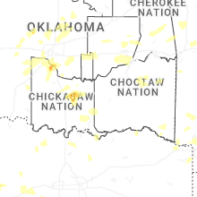
Oklahoma
| Local Time | Report Details |
|---|---|
| 3:04 PM CDT | Quarter sized hail reported near Roff, OK, 45.1 miles WNW of Atoka, OK |
| 5:21 PM CDT | Quarter sized hail reported near Tuttle, OK, 25.9 miles SW of Oklahoma City, OK |
| 5:45 PM CDT | Golf Ball sized hail reported near Blanchard, OK, 31.1 miles SSW of Oklahoma City, OK |
| 6:08 PM CDT | Quarter sized hail reported near Norman, OK, 19.6 miles S of Oklahoma City, OK, report from mping: quarter (1.00 in.). |
| 6:10 PM CDT | Baseball sized hail reported near Norman, OK, 17.4 miles S of Oklahoma City, OK |
| 6:10 PM CDT | Tea Cup sized hail reported near Norman, OK, 22.2 miles S of Oklahoma City, OK |
| 6:15 PM CDT | Half Dollar sized hail reported near Norman, OK, 18.8 miles S of Oklahoma City, OK |
| 6:15 PM CDT | Quarter sized hail reported near Washington, OK, 22.3 miles S of Oklahoma City, OK |
| 6:20 PM CDT | Half Dollar sized hail reported near Norman, OK, 17.4 miles S of Oklahoma City, OK, report from mping: half dollar (1.25 in.). |
| 6:21 PM CDT | Ping Pong Ball sized hail reported near Norman, OK, 19.6 miles S of Oklahoma City, OK, report from mping: ping pong ball (1.50 in.). |
| 6:21 PM CDT | Quarter sized hail reported near Norman, OK, 17.5 miles S of Oklahoma City, OK, report from mping: quarter (1.00 in.). |
| 6:22 PM CDT | Ping Pong Ball sized hail reported near Norman, OK, 19.6 miles S of Oklahoma City, OK, report from mping: ping pong ball (1.50 in.). |
| 6:25 PM CDT | Hen Egg sized hail reported near Norman, OK, 19.3 miles SSE of Oklahoma City, OK, report from mping: hen egg (2.00 in.). |
| 6:28 PM CDT | Half Dollar sized hail reported near Norman, OK, 20.6 miles SSE of Oklahoma City, OK, report from mping: half dollar (1.25 in.). |
| 6:29 PM CDT | Hen Egg sized hail reported near Norman, OK, 19.3 miles SSE of Oklahoma City, OK, report from mping: hen egg (2.00 in.). |
| 6:31 PM CDT | Half Dollar sized hail reported near Norman, OK, 18.5 miles SSE of Oklahoma City, OK, report from mping: half dollar (1.25 in.). |
| 6:36 PM CDT | Half Dollar sized hail reported near Norman, OK, 19.6 miles SSE of Oklahoma City, OK, report from mping: half dollar (1.25 in.). |
| 6:37 PM CDT | Half Dollar sized hail reported near Norman, OK, 21.9 miles SSE of Oklahoma City, OK, report from mping: half dollar (1.25 in.). |
| 6:37 PM CDT | Ping Pong Ball sized hail reported near Norman, OK, 19.3 miles SSE of Oklahoma City, OK, report from mping: ping pong ball (1.50 in.). |
| 6:37 PM CDT | Half Dollar sized hail reported near Norman, OK, 20.9 miles SSE of Oklahoma City, OK |
| 6:38 PM CDT | Ping Pong Ball sized hail reported near Norman, OK, 21.4 miles SSE of Oklahoma City, OK |
| 6:41 PM CDT | Half Dollar sized hail reported near Norman, OK, 20.4 miles SSE of Oklahoma City, OK, report from mping: half dollar (1.25 in.). |
| 6:41 PM CDT | Half Dollar sized hail reported near Norman, OK, 20.3 miles SSE of Oklahoma City, OK, report from mping: half dollar (1.25 in.). |
| 7:15 PM CDT | Quarter sized hail reported near Tryon, OK, 40.3 miles NE of Oklahoma City, OK |
| 7:26 PM CDT | Quarter sized hail reported near Tryon, OK, 43.3 miles NE of Oklahoma City, OK, report from mping: quarter (1.00 in.). |
| 7:29 PM CDT | Quarter sized hail reported near Coyle, OK, 36.5 miles NNE of Oklahoma City, OK |
| 8:40 PM CDT | Quarter sized hail reported near Kingfisher, OK, 41.8 miles WNW of Oklahoma City, OK, report from mping: quarter (1.00 in.). |
| 8:43 PM CDT | Storm damage reported in tillman county OK, 41 miles NW of Wichita Falls, TX |
| 9:20 PM CDT | Storm damage reported in tillman county OK, 26.7 miles NNW of Wichita Falls, TX |
| 9:20 PM CDT | Corrects previous tstm wnd gst report from 3 w grandfiel in tillman county OK, 26.7 miles NNW of Wichita Falls, TX |
Alabama
| Local Time | Report Details |
|---|---|
| 3:12 PM CDT | Lauderdale al 911 call center reported a power pole leaning at 1457 wallace mill r in colbert county AL, 11.2 miles E of Florence, AL |
| 3:33 PM CDT | Ema reported a tree down blocking both lanes at 33041 al hwy 9 in limestone county AL, 29.7 miles ENE of Florence, AL |
| 4:26 PM CDT | Ema reported a tree down at the intersection of hwy 79 and hwy 35 in jackson count in jackson county AL, 51.2 miles WSW of Chattanooga, TN |
| 4:45 PM CDT | Ema reported a tree down across the road at 45549 al hwy 277 in bridgeport a in jackson county AL, 28.3 miles WSW of Chattanooga, TN |
| 4:54 PM CDT | Ema reported a tree down across the road at 7000 hwy 35 in scottsboro a in jackson county AL, 47.4 miles SW of Chattanooga, TN |
| 6:45 PM CDT | 14 power poles down on cr 34. time estimated from rada in washington county AL, 52.9 miles SW of Camden, AL |
| 7:00 PM CDT | Trees and power lines down on catherine st. time estimated from rada in clarke county AL, 47.6 miles SW of Camden, AL |
| 7:01 PM CDT | Trees down on west point dr. time estimated from rada in clarke county AL, 45.8 miles SW of Camden, AL |
| 7:01 PM CDT | Trees down at intersection of college ave and mayton dr. time estimated from rada in clarke county AL, 47.6 miles SW of Camden, AL |
| 7:01 PM CDT | Trees down on bolen dr. time estimated from rada in clarke county AL, 48.5 miles SW of Camden, AL |
| 7:01 PM CDT | Trees down on catherine ave. time estimated from rada in clarke county AL, 47.6 miles SW of Camden, AL |
| 7:01 PM CDT | Trees down at intersection of college ave and mayton dr. time estimated from rada in clarke county AL, 47.6 miles SW of Camden, AL |
| 7:20 PM CDT | Trees blocking both lanes of northbound hwy 43. time estimated from rada in clarke county AL, 37.7 miles SW of Camden, AL |
| 7:30 PM CDT | Quarter sized hail reported near Ethelsville, AL, 34.5 miles E of Starkville, MS, quarter-size hail was reported in the ethelsville area. |
| 8:04 PM CDT | Trees were downed along county road 157 and highway 1 in marion county AL, 44.1 miles SSW of Florence, AL |
| 8:19 PM CDT | Trees were downed in the ethelsville are in pickens county AL, 35 miles E of Starkville, MS |
| 8:42 PM CDT | Numerous trees were downed in the bear creek and hackleburg areas... resulting in power outage in marion county AL, 36.6 miles S of Florence, AL |
| 8:45 PM CDT | Trees were downed in the reform are in pickens county AL, 46.2 miles E of Starkville, MS |
| 8:47 PM CDT | Several trees down in the western part of haleyville in marion count in marion county AL, 39.4 miles S of Florence, AL |
| 8:51 PM CDT | Several trees down around haleyville... with a couple on power line in winston county AL, 39.5 miles S of Florence, AL |
| 9:04 PM CDT | Trees downed in the gordo are in pickens county AL, 53.7 miles E of Starkville, MS |
| 9:13 PM CDT | Lawrence county ema reports a tree down along cr 39 in the mount hope are in lawrence county AL, 24.1 miles SSE of Florence, AL |
| 9:25 PM CDT | A tree was downed along us highway 278 near addiso in winston county AL, 49.8 miles SE of Florence, AL |
| 9:28 PM CDT | Morgan county ema reported a tree down along barely bridge rd and perry anders r in morgan county AL, 49.2 miles SE of Florence, AL |
| 9:45 PM CDT | Quarter sized hail reported near Cuba, AL, 69.5 miles WNW of Camden, AL, quarter-size hail was reported along county road 1 south of cuba. |
| 9:55 PM CDT | Two trees were downed in cub in sumter county AL, 70 miles WNW of Camden, AL |
| 9:58 PM CDT | Trees down along highway 171 and along tierce patton r in tuscaloosa county AL, 47.6 miles WSW of Birmingham, AL |
| 10:07 PM CDT | Cullman county ema reported a tree down at cr 109 and cr 22 in cullman county AL, 35.8 miles NNW of Birmingham, AL |
| 10:15 PM CDT | Multiple trees were downed across sumter count in sumter county AL, 66.4 miles NW of Camden, AL |
| 11:05 PM CDT | A tree was downed at highway 25 and cr 1 in hale county AL, 45.3 miles NNW of Camden, AL |
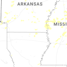
Mississippi
| Local Time | Report Details |
|---|---|
| 3:30 PM CDT | Couple trees dow in hinds county MS, 29.4 miles WSW of Jackson, MS |
| 4:33 PM CDT | Two powerlines reported down in pickens m in holmes county MS, 42.6 miles NNE of Jackson, MS |
| 4:57 PM CDT | Ping Pong Ball sized hail reported near Mantachie, MS, 57.1 miles SW of Florence, AL, corrects previous tstm wnd dmg report from mantachie. quarter to ping pong ball-sized hail. |
| 4:57 PM CDT | Quarter to ping pong ball-sized hai in itawamba county MS, 57.1 miles SW of Florence, AL |
| 5:00 PM CDT | Large tree and power lines down on cr 171 near parks baptist churc in union county MS, 69.2 miles WSW of Florence, AL |
| 5:50 PM CDT | Quarter sized hail reported near Tupelo, MS, 58.4 miles N of Starkville, MS, quarter-sized hail on auburn rd. |
| 6:01 PM CDT | Quarter sized hail reported near Mooreville, MS, 57 miles NNE of Starkville, MS, quarter-sized hail in mooreville. |
| 6:23 PM CDT | Law enforcement reported several trees down on stallings r in webster county MS, 19.4 miles WNW of Starkville, MS |
| 6:30 PM CDT | Tree down across spruill r in lowndes county MS, 27.7 miles ENE of Starkville, MS |
| 6:30 PM CDT | Tree down on highway 25. time estimate in itawamba county MS, 56.8 miles NNE of Starkville, MS |
| 6:30 PM CDT | Trees and powerlines dow in quitman county MS, 63.3 miles SSW of Memphis, TN |
| 6:40 PM CDT | Storm damage reported in quitman county MS, 67.7 miles S of Memphis, TN |
| 6:40 PM CDT | Tree fell through a home on cypress s in lowndes county MS, 25.1 miles E of Starkville, MS |
| 6:40 PM CDT | Trees and power lines down on maple st and gaylane d in lowndes county MS, 25.7 miles E of Starkville, MS |
| 6:41 PM CDT | Trees down along jeff sanders r in panola county MS, 65.5 miles S of Memphis, TN |
| 6:43 PM CDT | Quarter sized hail reported near Coffeeville, MS, 67 miles NW of Starkville, MS |
| 6:45 PM CDT | Multiple large trees and several large limbs down... with streets blocked. house fire due to lightning on n bayo in bolivar county MS, 96.3 miles NE of Bastrop, LA |
| 6:50 PM CDT | Numerous trees dow in leflore county MS, 89.5 miles W of Starkville, MS |
| 6:53 PM CDT | Law enforcement reported numerous trees and powerlines down in clevelan in bolivar county MS, 96.3 miles NE of Bastrop, LA |
| 6:53 PM CDT | Large tree down at paul shady grove rd and tallaha r in tallahatchie county MS, 72.3 miles WNW of Starkville, MS |
| 6:58 PM CDT | Trees down in the oakland are in yalobusha county MS, 75.5 miles S of Memphis, TN |
| 7:02 PM CDT | Three trees down along county rd 43 in yalobusha county MS, 62.8 miles NW of Starkville, MS |
| 7:07 PM CDT | Large tree uprooted along hwy 5 in grenada county MS, 66.7 miles WNW of Starkville, MS |
| 7:08 PM CDT | Trees down in okolon in chickasaw county MS, 36.9 miles N of Starkville, MS |
| 7:10 PM CDT | Observed at the glh airport aso in washington county MS, 72.2 miles NE of Bastrop, LA |
| 7:10 PM CDT | Tree down at county road 403 and 41 in lafayette county MS, 67.3 miles SSE of Memphis, TN |
| 7:15 PM CDT | Tree down at the intersection of cr 325 and 35 in lafayette county MS, 64.3 miles SSE of Memphis, TN |
| 7:15 PM CDT | Tree down across highway in grenada county MS, 66.9 miles WNW of Starkville, MS |
| 7:18 PM CDT | Updates the previous tstm wnd gst report from 2 nne metcalfe. observed at the glh airport aso in washington county MS, 72.2 miles NE of Bastrop, LA |
| 7:20 PM CDT | Power lines down on girls scout rd and rolling oaks r in grenada county MS, 58.2 miles WNW of Starkville, MS |
| 7:27 PM CDT | Numerous trees and powerlines down across leflore count in leflore county MS, 86.1 miles W of Starkville, MS |
| 7:30 PM CDT | Numerous trees dow in leflore county MS, 79.6 miles W of Starkville, MS |
| 7:30 PM CDT | Trees down on highway 2 in monroe county MS, 36.1 miles NNE of Starkville, MS |
| 7:33 PM CDT | Trees down on seymore r in monroe county MS, 42.6 miles NNE of Starkville, MS |
| 7:37 PM CDT | Law enforcement reported numerous trees down between winona and duck hil in montgomery county MS, 51.6 miles W of Starkville, MS |
| 7:40 PM CDT | Tree down on middleton r in montgomery county MS, 53.6 miles W of Starkville, MS |
| 7:46 PM CDT | Trees down on eastport rd; one tree fell on a hom in tishomingo county MS, 28.7 miles W of Florence, AL |
| 7:57 PM CDT | Law enforcement reported a tree down on black bayou r in washington county MS, 68.2 miles NE of Bastrop, LA |
| 8:05 PM CDT | Tree and power lines down at hwy 50 and tabernacle r in lowndes county MS, 27.6 miles E of Starkville, MS |
| 8:17 PM CDT | Tree downed on ms hwy 413 near ms hwy 1 in choctaw county MS, 30.9 miles WSW of Starkville, MS |
| 8:19 PM CDT | Power line down on ann d in sharkey county MS, 60.3 miles NW of Jackson, MS |
| 8:25 PM CDT | Law enforcement reported numerous trees and powerlines down across choctaw count in choctaw county MS, 26.5 miles WSW of Starkville, MS |
| 8:25 PM CDT | Law enforcement reported numerous trees and powerlines down across attala count in attala county MS, 51.4 miles WSW of Starkville, MS |
| 8:45 PM CDT | Multiple trees and powerlines downed across leake count in leake county MS, 48.2 miles NE of Jackson, MS |
| 8:50 PM CDT | Tree downed on a house on twin pine driv in winston county MS, 27.8 miles SSW of Starkville, MS |
| 8:59 PM CDT | Law enforcement reported numerous trees down across lowndes count in lowndes county MS, 21.5 miles E of Starkville, MS |
| 9:15 PM CDT | Half Dollar sized hail reported near Meridian, MS, 76.7 miles WNW of Camden, AL, report via social media. |
| 9:17 PM CDT | Emergency management reported numerous trees and powerlines down across neshoba count in neshoba county MS, 52.5 miles SSW of Starkville, MS |
| 9:18 PM CDT | Tree down across maclean rd near us hwy 4 in hinds county MS, 9.6 miles NW of Jackson, MS |
| 9:18 PM CDT | Trees downed across ms hwy 21 near butler r in noxubee county MS, 36.4 miles S of Starkville, MS |
| 9:20 PM CDT | Golf Ball sized hail reported near Meridian, MS, 76.7 miles WNW of Camden, AL, multiple social media reports of golfball size hail near causeyville. |
| 9:23 PM CDT | Law enforcement reported a tree down on robinson rd near hwy 1 in madison county MS, 25.3 miles NNE of Jackson, MS |
| 9:27 PM CDT | Tree downed across shiloh vimville r in lauderdale county MS, 78.5 miles WNW of Camden, AL |
| 9:27 PM CDT | Trees down and property damage on decatur stratton r in newton county MS, 62 miles ENE of Jackson, MS |
| 9:30 PM CDT | Tree downed across billy fields r in hinds county MS, 19.9 miles W of Jackson, MS |
| 9:30 PM CDT | Several trees downed in decatu in newton county MS, 63.4 miles E of Jackson, MS |
| 9:30 PM CDT | Trees down all over the count in smith county MS, 45.9 miles ESE of Jackson, MS |
| 9:30 PM CDT | Several trees down all over copiah count in copiah county MS, 23.4 miles SSW of Jackson, MS |
| 9:33 PM CDT | Tree downed along gibson r in newton county MS, 64.5 miles ENE of Jackson, MS |
| 9:45 PM CDT | Tree downed along cr 13 in smith county MS, 30.1 miles ESE of Jackson, MS |
| 9:57 PM CDT | Social media report of a tree downed on a hous in lauderdale county MS, 76.9 miles S of Starkville, MS |
| 10:00 PM CDT | Tree downed on cr 504 near the jasper county lin in smith county MS, 51 miles ESE of Jackson, MS |
| 10:00 PM CDT | Tree downed on power lines on 36th near 8th s in lauderdale county MS, 76.4 miles S of Starkville, MS |
| 10:03 PM CDT | Tree down on old marion r in lauderdale county MS, 74.5 miles S of Starkville, MS |
| 10:06 PM CDT | Tree and multiple branches downed on the side of i-5 in clarke county MS, 77.2 miles E of Jackson, MS |
| 10:24 PM CDT | Social media report of a tree downed on ms hwy 496 near russell mount gilead r in lauderdale county MS, 76.6 miles WNW of Camden, AL |
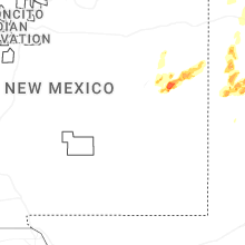
New Mexico
| Local Time | Report Details |
|---|---|
| 3:46 PM MDT | Quarter sized hail reported near Rociada, NM, 41.9 miles SSE of Taos, NM, minor vehicle damage. |
| 6:09 PM MDT | Ping Pong Ball sized hail reported near Clovis, NM, 64.2 miles SSE of Tucumcari, NM, report from mping: ping pong ball (1.50 in.). |
| 6:11 PM MDT | Quarter sized hail reported near Clovis, NM, 57.5 miles SSE of Tucumcari, NM |
Arkansas
| Local Time | Report Details |
|---|---|
| 5:44 PM CDT | Half Dollar sized hail reported near Warren, AR, 58 miles N of Bastrop, LA, hail size estimated off a social media post. |
| 5:50 PM CDT | Two power poles down and several trees dow in phillips county AR, 58.2 miles SW of Memphis, TN |
| 5:55 PM CDT | Trees down in helena-west helen in phillips county AR, 54.2 miles SW of Memphis, TN |
| 6:22 PM CDT | Reports of a couple trees down around center point... a in howard county AR, 8.2 miles NW of Nashville, AR |
| 6:40 PM CDT | Tree down on old millwood road near ashdow in little river county AR, 18.3 miles SSW of Nashville, AR |
| 6:40 PM CDT | Tree down in winthro in little river county AR, 30 miles WSW of Nashville, AR |
| 6:54 PM CDT | Report of a tree down on hwy 24w near wilson l in sevier county AR, 30.6 miles W of Nashville, AR |
| 8:07 PM CDT | Report of a tree down on south fredrick st in magnol in columbia county AR, 59.6 miles SE of Nashville, AR |
| 8:11 PM CDT | Report of powerlines down along hwy 79 north of magnoli in columbia county AR, 57.3 miles SE of Nashville, AR |
Connect with Interactive Hail Maps