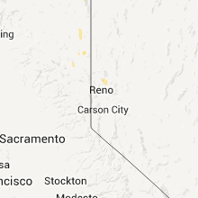
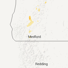
Hail Map for Monday, April 23, 2012

Number of Impacted Households on 4/23/2012
0
Impacted by 1" or Larger Hail
0
Impacted by 1.75" or Larger Hail
0
Impacted by 2.5" or Larger Hail
Square Miles of Populated Area Impacted on 4/23/2012
0
Impacted by 1" or Larger Hail
0
Impacted by 1.75" or Larger Hail
0
Impacted by 2.5" or Larger Hail
Regions Impacted by Hail on 4/23/2012
Cities Most Affected by Hail Storms of 4/23/2012
| Hail Size | Demographics of Zip Codes Affected | ||||||
|---|---|---|---|---|---|---|---|
| City | Count | Average | Largest | Pop Density | House Value | Income | Age |
Hail and Wind Damage Spotted on 4/23/2012
Filter by Report Type:Hail ReportsWind Reports
Montana
| Local Time | Report Details |
|---|---|
| 4:20 PM MDT | Storm damage reported in gallatin county MT, 9.8 miles NW of Bozeman, MT |
| 7:29 PM MDT | Storm damage reported in carbon county MT, 49.2 miles SSE of Billings, MT |
California
| Local Time | Report Details |
|---|---|
| 3:30 PM PDT | Tree limbs to 3" diameter broken. reported by spotter mo32 in modoc county CA, 20.7 miles S of Lakeview, OR |
| 5:59 PM PDT | At blue door raws. el. 5615ft. occurred during previous hou in lassen county CA, 78.6 miles S of Lakeview, OR |
| 6:53 PM PDT | Tree toppled at lone pine school on shore of goose lake at state line. reported by spotter mo32 in modoc county CA, 20.7 miles S of Lakeview, OR |
Nevada
| Local Time | Report Details |
|---|---|
| 3:37 PM PDT | Measured at bluewing mountain raws in pershing county NV, 76.5 miles NNE of Reno, NV |
Oregon
| Local Time | Report Details |
|---|---|
| 4:45 PM PDT | .5" in jackson county OR, 22.2 miles NW of Medford, OR |
| 6:30 PM PDT | Quarter sized hail reported near Fossil, OR, 57.4 miles NNE of Bend, OR, hail damage to recreational vehicle in fossil. |
| 7:00 PM PDT | Quarter sized hail reported near Antelope, OR, 45.8 miles NNE of Bend, OR, public reported hail up to 1 inch in diameter and winds of 40 to 50 mph. |
| 9:01 PM PDT | Hermiston airport asos reported a wind gust of 60 mph at 901 pm and 0.86 inches of rain in 50 minute in umatilla county OR, 48.1 miles WSW of Walla Walla, WA |
| 9:01 PM PDT | Storm damage reported in umatilla county OR, 48.1 miles WSW of Walla Walla, WA |
| 9:04 PM PDT | Madison farms weather instrument recorded 58 mph wind gus in umatilla county OR, 46.8 miles WSW of Walla Walla, WA |
| 9:05 PM PDT | Rocky heights elementary school had roofing mat in umatilla county OR, 48.8 miles WSW of Walla Walla, WA |
| 9:11 PM PDT | Umatilla south hill. weather instrument recorded 58 mph wind gus in umatilla county OR, 48.8 miles WSW of Walla Walla, WA |
| 11:17 PM PDT | Dime size hail with a thunderstorm between 300 and 330 pm monday 4/23. another windy storm came through around 530 pm and oak tree was blown down onto a vehicle. this o in douglas county OR, 42 miles N of Medford, OR |
Idaho
| Local Time | Report Details |
|---|---|
| 9:45 PM MDT | Large tree limbs reported down and power outages at weise in washington county ID, 58.9 miles NW of Boise, ID |
Washington
| Local Time | Report Details |
|---|---|
| 9:42 PM PDT | Storm damage reported in franklin county WA, 39.8 miles WNW of Walla Walla, WA |
| 10:00 PM PDT | Storm damage reported in franklin county WA, 44.1 miles WNW of Walla Walla, WA |


Connect with Interactive Hail Maps