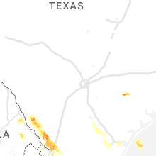
Hail Map for Sunday, April 23, 2023

Number of Impacted Households on 4/23/2023
0
Impacted by 1" or Larger Hail
0
Impacted by 1.75" or Larger Hail
0
Impacted by 2.5" or Larger Hail
Square Miles of Populated Area Impacted on 4/23/2023
0
Impacted by 1" or Larger Hail
0
Impacted by 1.75" or Larger Hail
0
Impacted by 2.5" or Larger Hail
Regions Impacted by Hail on 4/23/2023
Cities Most Affected by Hail Storms of 4/23/2023
| Hail Size | Demographics of Zip Codes Affected | ||||||
|---|---|---|---|---|---|---|---|
| City | Count | Average | Largest | Pop Density | House Value | Income | Age |
| Cuero, TX | 3 | 1.83 | 2.00 | 27 | $49k | $28.0k | 41.9 |
Hail and Wind Damage Spotted on 4/23/2023
Filter by Report Type:Hail ReportsWind Reports
States Impacted
TexasTexas
| Local Time | Report Details |
|---|---|
| 7:12 AM CDT | Golf Ball sized hail reported near Cuero, TX, 76.1 miles ESE of San Antonio, TX, golf ball size hail in cuero. time estimated from radar. |
| 7:15 AM CDT | Ping Pong Ball sized hail reported near Cuero, TX, 76.3 miles ESE of San Antonio, TX, public report of ping pong ball size hail near the intersection of e clayton st and n clinton st in cuero. time estimated from radar. report relayed via social media. |
| 7:18 AM CDT | Hen Egg sized hail reported near Cuero, TX, 76.3 miles ESE of San Antonio, TX, facebook photos of 2 inch hail measured by a ruler. time estimated by radar. |
| 7:20 AM CDT | Golf Ball sized hail reported near Cuero, TX, 74.8 miles ESE of San Antonio, TX, reports of golf ball size hail at the intersection of tulley rd and bubba palmer rd in cuero. report relayed via broadcast media. |
| 9:39 AM CDT | Report from mping: 1-inch tree limbs broken; shingles blown of in webb county TX, 3.6 miles NNE of Laredo, TX |
| 9:52 AM CDT | Quarter sized hail reported near Laredo, TX, 0.8 miles S of Laredo, TX, quarter-size hail picture reported in central laredo. |
| 9:55 AM CDT | Wooden fence blown dow in webb county TX, 0.7 miles E of Laredo, TX |
| 10:00 AM CDT | Photo of tree uprooted at texas a&m international university campus. reported by trained spotter. time estimated by rada in webb county TX, 5.2 miles ENE of Laredo, TX |
| 10:01 AM CDT | Asos station kali alic in jim wells county TX, 38 miles W of Corpus Christi, TX |
| 10:15 AM CDT | Awos station klrd lared in webb county TX, 2.4 miles NE of Laredo, TX |
| 10:42 AM CDT | Storm damage reported in nueces county TX, 7.8 miles SE of Corpus Christi, TX |
| 10:48 AM CDT | Awos station knqi kingsville na in kleberg county TX, 32.7 miles SW of Corpus Christi, TX |
| 10:54 AM CDT | Mesonet station anpt2 9 se aransas pas in gmz255 county TX, 22.5 miles E of Corpus Christi, TX |
| 11:04 AM CDT | Corpus christi nas asos reported peak wind of 51 kt in nueces county TX, 10.1 miles SE of Corpus Christi, TX |
| 11:36 AM CDT | Buoy station babt2 baffin bay... t in gmz231 county TX, 34.2 miles S of Corpus Christi, TX |
| 12:28 PM CDT | Blowing debris with sheet metal pieces lofted hundreds of feet in the air along a thunderstorm outflow. timing estimated by rada in willacy county TX, 43.4 miles NNW of Brownsville, TX |
| 12:30 PM CDT | Roof peeled bac in willacy county TX, 43.9 miles NNW of Brownsville, TX |
| 1:02 PM CDT | Storm damage reported in hidalgo county TX, 50.2 miles WNW of Brownsville, TX |
| 1:03 PM CDT | Storm damage reported in cameron county TX, 24.9 miles NNW of Brownsville, TX |
| 1:38 PM CDT | Storm damage reported in cameron county TX, 20.7 miles NNE of Brownsville, TX |
| 1:45 PM CDT | Siding damage to house in north los fresnos. location and timing are approximate in cameron county TX, 12.5 miles N of Brownsville, TX |
| 1:47 PM CDT | Storm damage reported in cameron county TX, 4.1 miles E of Brownsville, TX |
| 1:53 PM CDT | Multiple large tree branches down in residential are in cameron county TX, 4.3 miles ENE of Brownsville, TX |
| 1:53 PM CDT | Wood paneled fence and gate blown down at the sa recyling facilit in cameron county TX, 5.8 miles NE of Brownsville, TX |
| 2:00 PM CDT | Power lines down near idea robindale schoo in cameron county TX, 4.5 miles NE of Brownsville, TX |
| 2:00 PM CDT | Powerlines down at the intersection of highway 100 and padre blvd in south padre island. time approximated based on radar and time report was receive in cameron county TX, 24.6 miles ENE of Brownsville, TX |
| 2:09 PM CDT | Palm tree down on highway 100 near the base of the causewa in cameron county TX, 21.7 miles NE of Brownsville, TX |
| 2:12 PM CDT | Large metal structure destroyed and blown onto highway 100 about a mile or two west of downtown los fresno in cameron county TX, 11.8 miles N of Brownsville, TX |


Connect with Interactive Hail Maps