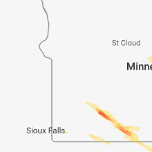
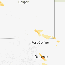
Hail Map for Wednesday, July 25, 2018

Number of Impacted Households on 7/25/2018
0
Impacted by 1" or Larger Hail
0
Impacted by 1.75" or Larger Hail
0
Impacted by 2.5" or Larger Hail
Square Miles of Populated Area Impacted on 7/25/2018
0
Impacted by 1" or Larger Hail
0
Impacted by 1.75" or Larger Hail
0
Impacted by 2.5" or Larger Hail
Regions Impacted by Hail on 7/25/2018
Cities Most Affected by Hail Storms of 7/25/2018
| Hail Size | Demographics of Zip Codes Affected | ||||||
|---|---|---|---|---|---|---|---|
| City | Count | Average | Largest | Pop Density | House Value | Income | Age |
| Blue Earth, MN | 2 | 2.25 | 2.75 | 26 | $64k | $36.4k | 47.1 |
| Bogue, KS | 2 | 1.75 | 1.75 | 1 | $32k | $24.0k | 53.1 |
| Healy, KS | 1 | 1.75 | 1.75 | 3 | $65k | $41.0k | 42.1 |
| Curtis, NE | 1 | 1.75 | 1.75 | 3 | $50k | $32.4k | 32.1 |
Hail and Wind Damage Spotted on 7/25/2018
Filter by Report Type:Hail ReportsWind Reports
States Impacted
Nebraska, New Mexico, Minnesota, Idaho, Wyoming, Wisconsin, Kansas, Colorado, Iowa, South Carolina, Montana, Nevada, Oklahoma, MassachusettsNebraska
| Local Time | Report Details |
|---|---|
| 1:29 PM CDT | Quarter sized hail reported near Curtis, NE, 49.5 miles SSE of North Platte, NE |
| 2:28 PM CDT | Golf Ball sized hail reported near Curtis, NE, 37.4 miles SSE of North Platte, NE |
| 2:32 PM CDT | Ping Pong Ball sized hail reported near Curtis, NE, 44 miles SSE of North Platte, NE, delayed report |
| 4:00 PM CDT | Quarter sized hail reported near Cambridge, NE, 59.4 miles SSE of North Platte, NE |
New Mexico
| Local Time | Report Details |
|---|---|
| 2:01 PM MDT | Quarter sized hail reported near Guadalupita, NM, 27.3 miles SE of Taos, NM |
| 2:30 PM MDT | Storm damage reported in mora county NM, 35.1 miles SE of Taos, NM |
| 2:55 PM MDT | Quarter sized hail reported near Buena Vista, NM, 39 miles SSE of Taos, NM |
| 2:55 PM MDT | Storm damage reported in mora county NM, 39 miles SSE of Taos, NM |
Minnesota
| Local Time | Report Details |
|---|---|
| 3:44 PM CDT | Quarter sized hail reported near Winnebago, MN, 65.5 miles NW of Mason City, IA, nickel to quarter size hail. |
| 4:21 PM CDT | Quarter sized hail reported near Sanborn, MN, 59.7 miles SSE of Montevideo, MN, mostly dimes with a few up to quarter size. heavy rain also. time estimated from radar. |
| 4:22 PM CDT | Quarter sized hail reported near Comfrey, MN, 70.3 miles SSE of Montevideo, MN, dime to quarter size hail. wind driven hail stripped soybeans to stubble and leaves off trees. the duration of the hail event was 8 minutes. |
| 4:22 PM CDT | Wind driven hail destroyed crop in cottonwood county MN, 70.3 miles SSE of Montevideo, MN |
| 4:25 PM CDT | Quarter sized hail reported near Comfrey, MN, 67 miles SSE of Montevideo, MN, hail was quite jagged... not round. |
| 4:30 PM CDT | Ping Pong Ball sized hail reported near Butterfield, MN, 77 miles SE of Montevideo, MN, relayed by wfo fsd. |
| 4:30 PM CDT | Ping Pong Ball sized hail reported near Butterfield, MN, 79 miles SE of Montevideo, MN, relayed by wfo fsd. |
| 5:29 PM CDT | Golf Ball sized hail reported near Blue Earth, MN, 61.1 miles NW of Mason City, IA, reports of crops shredded. |
| 5:33 PM CDT | Half Dollar sized hail reported near Blue Earth, MN, 56.6 miles NW of Mason City, IA |
| 5:35 PM CDT | Baseball sized hail reported near Blue Earth, MN, 57.4 miles NW of Mason City, IA, images on twitter. |
Idaho
| Local Time | Report Details |
|---|---|
| 3:19 PM MDT | Asos station ida... idaho falls airpor in bonneville county ID, 1.9 miles NW of Idaho Falls, ID |
| 3:20 PM MDT | Public reports several large trees snapped off near the base near idaho falls airport... including on singletree circle. tree also reported down at the old butte soccer in bonneville county ID, 1.5 miles WNW of Idaho Falls, ID |
| 3:25 PM MDT | Tree down destroying a fence along e 97th n southwest of ucon. time estimated based on rada in bonneville county ID, 6.6 miles NNE of Idaho Falls, ID |
| 3:30 PM MDT | Power pole down near utah ave. power out in the area. time of damage estimated based on rada in bonneville county ID, 0.4 miles WSW of Idaho Falls, ID |
| 3:30 PM MDT | Corrected report: idaho falls itd site at i-15 and us-2 in bonneville county ID, 1.1 miles WNW of Idaho Falls, ID |
| 3:30 PM MDT | Corrected report: idaho falls itd site at i-15 and us-2 in bonneville county ID, 1.1 miles WNW of Idaho Falls, ID |
| 3:30 PM MDT | Viewer to local media reported a huge tree down on top of car. exact location unknown. time estimated from rada in bonneville county ID, 0.6 miles ESE of Idaho Falls, ID |
| 3:31 PM MDT | 2 trees down on university place campus. time estimated based on rada in bonneville county ID, 2 miles NNW of Idaho Falls, ID |
| 3:32 PM MDT | Row of partially constructed storage units collapsed on e iona rd near n 15th e due to thunderstorm winds. reported by east idaho news. time estimated based on rada in bonneville county ID, 3.4 miles NE of Idaho Falls, ID |
| 3:33 PM MDT | Multiple large trees down at pinecrest municipal golf course. idaho falls power also reports power pole down further south near 7th s in bonneville county ID, 1.7 miles NE of Idaho Falls, ID |
| 3:35 PM MDT | Tree down at rose hill cemetery. time estimated based on rada in bonneville county ID, 0.8 miles S of Idaho Falls, ID |
| 3:48 PM MDT | Multiple reports of trees and power lines down. approximately 2000 without power so far across the cit in bonneville county ID, 0.7 miles NW of Idaho Falls, ID |
| 3:50 PM MDT | Power outages reported throughout idaho falls due to storm. power lines have been reported down as wel in bonneville county ID, 0.6 miles ESE of Idaho Falls, ID |
Wyoming
| Local Time | Report Details |
|---|---|
| 3:49 PM MDT | Quarter sized hail reported near Cheyenne, WY, 25.5 miles E of Laramie, WY, heavy rain 1/3 inch in 10 minutes |
| 4:05 PM MDT | Quarter sized hail reported near Cheyenne, WY, 39.4 miles ESE of Laramie, WY |
| 4:15 PM MDT | Quarter sized hail reported near Cheyenne, WY, 44.1 miles ESE of Laramie, WY, very heavy rain |
| 4:30 PM MDT | Also very heavy rain and one inch hail with the storm in laramie county WY, 59.6 miles ESE of Laramie, WY |
| 4:45 PM MDT | Ping Pong Ball sized hail reported near Cheyenne, WY, 49.3 miles ESE of Laramie, WY |
| 4:45 PM MDT | Ping Pong Ball sized hail reported near Cheyenne, WY, 40.1 miles ESE of Laramie, WY |
Wisconsin
| Local Time | Report Details |
|---|---|
| 5:41 PM CDT | Large tree uprooted. debris scattered across road. radar estimated tim in price county WI, 42.7 miles W of Rhinelander, WI |
| 5:46 PM CDT | Large tree uprooted. radar estimated tim in ashland county WI, 62.1 miles ESE of Duluth, MN |
| 8:59 PM CDT | Storm damage reported in door county WI, 76 miles NW of Traverse City, MI |
| 10:24 PM CDT | Trees and power lines down blocking road in manitowoc county WI, 32.8 miles SSE of Green Bay, WI |
| 10:24 PM CDT | Trees and power lines down blocking road in manitowoc county WI, 32.8 miles SSE of Green Bay, WI |
| 10:24 PM CDT | Trees and power lines down blocking road in manitowoc county WI, 35.7 miles SSE of Green Bay, WI |
| 10:24 PM CDT | Trees and power lines down blocking road in manitowoc county WI, 35.7 miles SSE of Green Bay, WI |
Kansas
| Local Time | Report Details |
|---|---|
| 5:51 PM CDT | Golf Ball sized hail reported near Bogue, KS, 43.5 miles NNW of Hays, KS |
| 5:55 PM CDT | One tree blown over. multiple 3 to 6 inch diameter branches down. time estimated by rada in graham county KS, 38.8 miles NNW of Hays, KS |
| 5:55 PM CDT | Golf Ball sized hail reported near Bogue, KS, 38.8 miles NNW of Hays, KS, relayed via social media. |
| 6:00 PM CDT | Quarter sized hail reported near Bogue, KS, 38.2 miles NNW of Hays, KS, quarter size hail reported south of bogue via graham county sheriff's office. |
| 6:08 PM CDT | Quarter sized hail reported near Damar, KS, 33.7 miles NNW of Hays, KS, nickel to quarter size hail reported. |
| 6:09 PM CDT | Quarter sized hail reported near Bogue, KS, 38.8 miles NNW of Hays, KS, report of 1 inch hail near bogue via a trained spotter. |
| 6:11 PM CDT | Half Dollar sized hail reported near Bogue, KS, 37.9 miles NNW of Hays, KS, report of half dollar sized hail near bogue via a trained spotter. |
| 6:15 PM CDT | Two power poles broken off. time estimated by rada in graham county KS, 27 miles NW of Hays, KS |
| 6:30 PM CDT | Storm damage reported in ellis county KS, 20.5 miles NNW of Hays, KS |
| 6:32 PM CDT | Reports of a shed blown onto vehicles and 8 in. diameter tree branches brok in ellis county KS, 19.9 miles NW of Hays, KS |
| 6:44 PM CDT | Reports of significant roof damage to a school and power lines dow in ellis county KS, 12.7 miles WNW of Hays, KS |
| 6:45 PM CDT | Storm damage reported in trego county KS, 35.5 miles W of Hays, KS |
| 6:46 PM CDT | Social media report of power line dow in ellis county KS, 12.9 miles WNW of Hays, KS |
| 7:11 PM CDT | Storm damage reported in scott county KS, 44.6 miles NNE of Garden City, KS |
| 7:21 PM CDT | Reports of power outages in the are in ellis county KS, 14.9 miles SW of Hays, KS |
| 7:30 PM CDT | Golf Ball sized hail reported near Healy, KS, 41.9 miles NNE of Garden City, KS, most of the hail was quarter to half dollar size. |
| 7:31 PM CDT | Storm damage reported in rush county KS, 19.1 miles SSW of Hays, KS |
| 7:50 PM CDT | Small hail also occurred with this stor in lane county KS, 33.6 miles NNE of Garden City, KS |
| 7:55 PM CDT | Storm damage reported in rush county KS, 33.7 miles S of Hays, KS |
| 8:30 PM CDT | Mesonet station k5nes... 11 n jetmor in hodgeman county KS, 53 miles SW of Hays, KS |
| 8:35 PM CDT | 8 inch diameter tree limbs were blown down. dime size hail also occurre in finney county KS, 23.5 miles NE of Garden City, KS |
| 8:44 PM CDT | Storm damage reported in hodgeman county KS, 45.1 miles E of Garden City, KS |
| 8:46 PM CDT | Reports of 3 transmission lines snapped between jetmore and hansto in hodgeman county KS, 58.6 miles E of Garden City, KS |
| 8:56 PM CDT | Up to 2 in diameter tree branches broke and power out in jetmor in hodgeman county KS, 54.3 miles E of Garden City, KS |
| 9:13 PM CDT | Storm damage reported in finney county KS, 20.3 miles ENE of Garden City, KS |
| 9:22 PM CDT | Reports of a roof and side walls ripped off a 50 x 70 machine she in ford county KS, 66.9 miles E of Garden City, KS |
| 9:24 PM CDT | Asos station ddc... dodge city regional airpor in ford county KS, 51.2 miles ESE of Garden City, KS |
| 9:30 PM CDT | Report of two semis blown over near kinsle in edwards county KS, 65 miles S of Hays, KS |
| 9:33 PM CDT | Mesonet station gesk in finney county KS, 4 miles ENE of Garden City, KS |
| 9:40 PM CDT | Mesonet station ks010... 1 ene garden cit in finney county KS, 1.9 miles ENE of Garden City, KS |
| 9:49 PM CDT | Asos station gck... garden city regional airpor in finney county KS, 8.8 miles ESE of Garden City, KS |
| 9:59 PM CDT | Asos station gck... garden city regional airpor in finney county KS, 8.8 miles ESE of Garden City, KS |
| 10:09 PM CDT | Asos station gck... garden city regional airpor in finney county KS, 8.8 miles ESE of Garden City, KS |
| 10:28 PM CDT | Storm damage reported in dickinson county KS, 40.4 miles WSW of Manhattan, KS |
| 10:40 PM CDT | Storm damage reported in dickinson county KS, 39.2 miles WSW of Manhattan, KS |
Colorado
| Local Time | Report Details |
|---|---|
| 4:58 PM MDT | Mesonet station rddc2... 5 ese wetmor in pueblo county CO, 21.4 miles W of Pueblo, CO |
| 6:45 PM MDT | Quarter sized hail reported near Erie, CO, 22.5 miles N of Denver, CO, wind damage: tree blown down with two large branches from other trees down. |
| 6:45 PM MDT | Corrects previous tstm wnd dmg report from 3 n erie. nws employee and other people in their area reported down trees... tree branches... leaves stripped off trees and s in weld county CO, 23 miles N of Denver, CO |
| 6:49 PM MDT | Awos station eik... 1 ssw eri in weld county CO, 19.6 miles N of Denver, CO |
| 7:52 PM MDT | Mesonet station co073... beverly hill in douglas county CO, 18.4 miles SSE of Denver, CO |
| 8:29 PM MDT | Awos station mnh... 5 w elber in elbert county CO, 40.8 miles SSE of Denver, CO |
| 9:02 PM MDT | Storm damage reported in douglas county CO, 22.6 miles SSE of Denver, CO |
| 10:13 PM MDT | Nws employee and other people in their area reported down trees... tree branches... leaves stripped off trees and some power outage in weld county CO, 23 miles N of Denver, CO |
Iowa
| Local Time | Report Details |
|---|---|
| 6:00 PM CDT | Not widespread... but a handful of 3-4†branches down - via social medi in winnebago county IA, 38.8 miles NW of Mason City, IA |
| 6:04 PM CDT | 2†branches down... 0.5†hail... sustained winds 30-40 mph - via social medi in winnebago county IA, 38.8 miles NW of Mason City, IA |
| 6:52 PM CDT | Quarter sized hail reported near Nora Springs, IA, 9.2 miles E of Mason City, IA |
| 6:55 PM CDT | Quarter sized hail reported near Nora Springs, IA, 8.7 miles E of Mason City, IA |
| 7:00 PM CDT | Delayed report - time estimated by radar - several large branches and one larger tree down...via social medi in cerro gordo county IA, 0.2 miles NNE of Mason City, IA |
| 7:50 PM CDT | Quarter sized hail reported near Rutland, IA, 48.7 miles ENE of Storm Lake, IA, mix of pea to quarter sized hail... some small (less than an inch) branches down. |
| 8:02 PM CDT | Delayed report - large limb broken... wind speed unknow in bremer county IA, 46.9 miles SE of Mason City, IA |
| 9:19 PM CDT | Small limbs (< 2 inches) dow in boone county IA, 30.2 miles N of Des Moines, IA |
South Carolina
| Local Time | Report Details |
|---|---|
| 7:15 PM EDT | Winnsboro pd reported a tree down on a power line on marion ave. time estimate in fairfield county SC, 59.7 miles SSW of Charlotte, NC |
| 7:36 PM EDT | Schp reports tree in roadway on sweet knoll court. time estimated by rada in richland county SC, 74 miles S of Charlotte, NC |
Montana
| Local Time | Report Details |
|---|---|
| 8:50 PM MDT | Estimated winds of 60 mph. lots of pea size hail and rai in teton county MT, 57.9 miles NW of Great Falls, MT |
| 9:00 PM MDT | Quarter sized hail reported near Choteau, MT, 56.7 miles NW of Great Falls, MT, hail started out large then got smaller. enough small hail to cover the ground to a depth of several inches. crops ruined. winds estimated at 30 mph. |
| 9:00 PM MDT | Estimated 65 mph winds with large trees knocked down in multiple location in teton county MT, 47 miles WNW of Great Falls, MT |
| 10:36 PM MDT | Storm damage reported in cascade county MT, 13.8 miles SSW of Great Falls, MT |
| 10:41 PM MDT | 59 mph thunderstorm wind gus in cascade county MT, 8.2 miles W of Great Falls, MT |
Nevada
| Local Time | Report Details |
|---|---|
| 7:55 PM PDT | Public report received via media of two trees downed in the parking lot of college of southern nevada north las vegas campu in clark county NV, 4 miles NE of Las Vegas, NV |
Oklahoma
| Local Time | Report Details |
|---|---|
| 11:25 PM CDT | Storm damage reported in texas county OK, 79 miles SSW of Garden City, KS |
Massachusetts
| Local Time | Report Details |
|---|---|
| 2:40 AM EDT | Lots of debris on the lower end of sutton street in worcester county MA, 20.2 miles NNW of Providence, RI |
| 2:40 AM EDT | Lots of debris on the lower end of sutton street in worcester county MA, 20.2 miles NNW of Providence, RI |
| 2:40 AM EDT | Lots of debris on the lower end of sutton street in worcester county MA, 20.2 miles NNW of Providence, RI |
| 2:40 AM EDT | Lots of debris on the lower end of sutton street in worcester county MA, 20.2 miles NNW of Providence, RI |
| 2:47 AM EDT | Pine tree on a truck and wires torn completely off house at 147 main street in worcester county MA, 26 miles NNW of Providence, RI |
| 2:47 AM EDT | Pine tree on a truck and wires torn completely off house at 147 main street in worcester county MA, 26 miles NNW of Providence, RI |
| 2:47 AM EDT | Pine tree on a truck and wires torn completely off house at 147 main street in worcester county MA, 26 miles NNW of Providence, RI |


Connect with Interactive Hail Maps