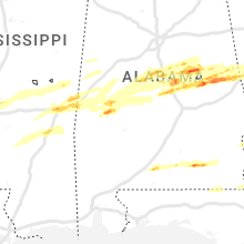
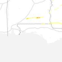
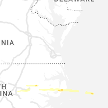
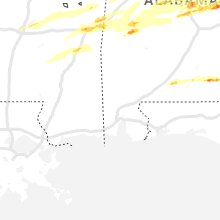
Hail Map for Saturday, March 25, 2023

Number of Impacted Households on 3/25/2023
0
Impacted by 1" or Larger Hail
0
Impacted by 1.75" or Larger Hail
0
Impacted by 2.5" or Larger Hail
Square Miles of Populated Area Impacted on 3/25/2023
0
Impacted by 1" or Larger Hail
0
Impacted by 1.75" or Larger Hail
0
Impacted by 2.5" or Larger Hail
Regions Impacted by Hail on 3/25/2023
Cities Most Affected by Hail Storms of 3/25/2023
| Hail Size | Demographics of Zip Codes Affected | ||||||
|---|---|---|---|---|---|---|---|
| City | Count | Average | Largest | Pop Density | House Value | Income | Age |
| Lafayette, AL | 3 | 2.33 | 2.75 | 23 | $61k | $26.9k | 43.3 |
| Andalusia, AL | 2 | 1.88 | 2.00 | 43 | $0k | $0.0k | 43.0 |
| Dozier, AL | 2 | 1.75 | 1.75 | 14 | $48k | $23.4k | 44.4 |
| Camp Hill, AL | 1 | 2.75 | 2.75 | 16 | $40k | $23.4k | 46.4 |
| Alexander City, AL | 1 | 2.00 | 2.00 | 104 | $72k | $30.8k | 40.8 |
| Titus, AL | 1 | 2.00 | 2.00 | 49 | $126k | $43.6k | 45.9 |
| Deatsville, AL | 1 | 2.00 | 2.00 | 148 | $120k | $49.4k | 37.4 |
| Marbury, AL | 1 | 2.00 | 2.00 | 48 | $64k | $26.4k | 37.1 |
| Soperton, GA | 1 | 1.75 | 1.75 | 29 | $58k | $24.8k | 36.9 |
| Elba, AL | 1 | 1.75 | 1.75 | 34 | $65k | $28.3k | 42.1 |
| Milledgeville, GA | 1 | 1.75 | 1.75 | 176 | $82k | $35.5k | 33.6 |
| Goodwater, AL | 1 | 1.75 | 1.75 | 23 | $47k | $27.3k | 41.7 |
| Jacksons Gap, AL | 1 | 1.75 | 1.75 | 77 | $137k | $35.5k | 46.4 |
| Lanett, AL | 1 | 1.75 | 1.75 | 145 | $60k | $30.0k | 42.2 |
| New Brockton, AL | 1 | 1.75 | 1.75 | 40 | $60k | $29.3k | 42.8 |
| Rockford, AL | 1 | 1.75 | 1.75 | 8 | $75k | $32.9k | 49.0 |
| Thorsby, AL | 1 | 1.75 | 1.75 | 105 | $82k | $36.3k | 36.8 |
| Dadeville, AL | 1 | 1.75 | 1.75 | 56 | $97k | $35.3k | 47.7 |
Hail and Wind Damage Spotted on 3/25/2023
Filter by Report Type:Hail ReportsWind Reports
Alabama
| Local Time | Report Details |
|---|---|
| 8:08 AM CDT | Tree down on s county road 6 in geneva county AL, 62 miles NE of Miramar Beach, FL |
| 4:17 PM CDT | Golf Ball sized hail reported near Andalusia, AL, 62.4 miles SE of Camden, AL, public report of hail at gantt. this is a correction to a previous report. |
| 4:17 PM CDT | Golf Ball sized hail reported near Dozier, AL, 57 miles ESE of Camden, AL, golf ball sized hail reported by public. |
| 4:29 PM CDT | Hen Egg sized hail reported near Andalusia, AL, 64.6 miles SE of Camden, AL, social media report of hen egg size hail (photo provided double size of a quarter). time estimated using radar. |
| 4:33 PM CDT | Golf Ball sized hail reported near Dozier, AL, 69 miles SE of Camden, AL, public report to broadcast media of golf ball sized hail. |
| 5:07 PM CDT | Golf Ball sized hail reported near Elba, AL, 73.9 miles NNE of Miramar Beach, FL, public reported golf ball size hail in elba. report relayed via wdhn media. |
| 5:27 PM CDT | Golf Ball sized hail reported near New Brockton, AL, 76.2 miles NNE of Miramar Beach, FL, public report of golf ball size hail in the new brockton area. |
| 1:11 AM CDT | Quarter sized hail reported near Alexander City, AL, 29.8 miles WNW of Auburn, AL, via social media. time estimated from radar. |
| 2:24 AM CDT | Ping Pong Ball sized hail reported near Eclectic, AL, 29.9 miles WNW of Auburn, AL, reported via social media. |
| 2:26 AM CDT | Hen Egg sized hail reported near Alexander City, AL, 29.8 miles WNW of Auburn, AL, second round of hail tonight. |
| 2:33 AM CDT | Golf Ball sized hail reported near Dadeville, AL, 25.2 miles WNW of Auburn, AL, reported in the lake martin area via social media. time estimated from radar. |
| 2:50 AM CDT | Hen Egg sized hail reported near Marbury, AL, 58 miles W of Auburn, AL, reported via social media. |
| 2:53 AM CDT | Hen Egg sized hail reported near Deatsville, AL, 56 miles W of Auburn, AL, large hail on video. at least two inches in diameter. |
| 2:53 AM CDT | Baseball sized hail reported near Camp Hill, AL, 16.5 miles NW of Auburn, AL, cars battered and windows shattered. |
| 3:06 AM CDT | Hen Egg sized hail reported near Titus, AL, 49.4 miles W of Auburn, AL, reported via social media. |
| 3:09 AM CDT | Golf Ball sized hail reported near Lafayette, AL, 16.7 miles N of Auburn, AL |
| 3:18 AM CDT | Tennis Ball sized hail reported near Lafayette, AL, 19.5 miles NNE of Auburn, AL, reported via social media. |
| 3:18 AM CDT | Baseball sized hail reported near Lafayette, AL, 20.3 miles NNE of Auburn, AL, baseball hail in the lafayette area. |
| 3:29 AM CDT | Golf Ball sized hail reported near Lanett, AL, 24.6 miles NE of Auburn, AL, reported via social media. |
| 3:36 AM CDT | Quarter sized hail reported near Thorsby, AL, 41.8 miles S of Birmingham, AL, reported via social media. |
| 3:37 AM CDT | Golf Ball sized hail reported near Thorsby, AL, 41.9 miles S of Birmingham, AL, reported via social media. |
| 3:47 AM CDT | Golf Ball sized hail reported near Jacksons Gap, AL, 25.4 miles NW of Auburn, AL, golf ball size hail via social media. |
| 4:20 AM CDT | Golf Ball sized hail reported near Rockford, AL, 49.4 miles WNW of Auburn, AL, up to golf ball size. |
| 4:32 AM CDT | Golf Ball sized hail reported near Goodwater, AL, 41.8 miles NW of Auburn, AL |
| 4:41 AM CDT | Ping Pong Ball sized hail reported near Kellyton, AL, 38.9 miles NW of Auburn, AL |
| 4:54 AM CDT | Quarter sized hail reported near Shelby, AL, 36.2 miles SSE of Birmingham, AL |
| 5:20 AM CDT | Ping Pong Ball sized hail reported near Linden, AL, 37 miles NW of Camden, AL |
| 5:32 AM CDT | Car blown off the road into a ditch along county rd 114 near county rd 5 in chambers county AL, 26.4 miles N of Auburn, AL |
Georgia
| Local Time | Report Details |
|---|---|
| 11:30 AM EDT | Corrects time of previous tstm wnd dmg report from 3 s elmodel wma. 2 trees down along jericho r in baker county GA, 60.3 miles N of Tallahassee, FL |
| 12:00 PM EDT | A large pine tree was blown over with downed power lines along old ga highway 3 in mitchell count in mitchell county GA, 63.7 miles N of Tallahassee, FL |
| 12:18 PM EDT | Tree down on josuli r in baker county GA, 55.8 miles NNW of Tallahassee, FL |
| 12:30 PM EDT | 3 trees down along jericho rd and josul in baker county GA, 60.3 miles N of Tallahassee, FL |
| 12:30 PM EDT | 3 trees down along jericho rd and josul in baker county GA, 60.3 miles N of Tallahassee, FL |
| 12:40 PM EDT | Tree down near the intersection of highway 37 and river roa in mitchell county GA, 58.6 miles N of Tallahassee, FL |
| 12:42 PM EDT | Corrects time of previous tstm wnd dmg report from 1 ssw camilla. tree down on newton rd at mm 2 in mitchell county GA, 53.9 miles N of Tallahassee, FL |
| 12:44 PM EDT | Ping Pong Ball sized hail reported near Camilla, GA, 54.1 miles N of Tallahassee, FL |
| 12:52 PM EDT | 2 trees down on johnny freeman rd in colquitt... ga (miller county in miller county GA, 50.2 miles NNW of Tallahassee, FL |
| 12:53 PM EDT | Tree down on john collins roa in mitchell county GA, 49.1 miles N of Tallahassee, FL |
| 1:08 PM EDT | Tree down near gin cree in colquitt county GA, 55.7 miles NNE of Tallahassee, FL |
| 1:17 PM EDT | Power lines down on highway 37 wes in colquitt county GA, 57.9 miles NNE of Tallahassee, FL |
| 1:24 PM EDT | Utility pole reported dow in colquitt county GA, 58.5 miles NNE of Tallahassee, FL |
| 1:45 PM EDT | Couple of downed powerlines. 1 tree fell on a vehicle... damaging its roof. couple of tree tops broke off and landed on roof in cook county GA, 42.1 miles SW of Douglas, GA |
| 1:53 PM EDT | Tree down on county farm rd at mcconnel bridge r in cook county GA, 44.5 miles SW of Douglas, GA |
| 1:53 PM EDT | Power outages and a couple of trees down across old union roa in cook county GA, 44 miles WSW of Douglas, GA |
| 2:09 PM EDT | Tree down on nashville enigma rd near the nashville city limit in berrien county GA, 31.2 miles SW of Douglas, GA |
| 2:11 PM EDT | Cable lines down reported near industrial park blvd and may av in berrien county GA, 30.3 miles SW of Douglas, GA |
| 2:13 PM EDT | Trees down on hwy 125 near allenville r in berrien county GA, 33.5 miles SW of Douglas, GA |
| 2:14 PM EDT | Ambient weather mesonet site griffin ag measured a 58 mph gus in berrien county GA, 27.2 miles SW of Douglas, GA |
| 2:34 PM EDT | Tree down on river r in lanier county GA, 26.5 miles SSW of Douglas, GA |
| 3:50 PM EDT | Tree limb down on lane bridge roa in seminole county GA, 50.9 miles NW of Tallahassee, FL |
| 4:19 PM EDT | Wires down at intersection of meeks rd and hwy 44 in laurens county GA, 62.5 miles N of Douglas, GA |
| 4:23 PM EDT | Tree down on salem church roa in decatur county GA, 37.7 miles NNW of Tallahassee, FL |
| 4:30 PM EDT | Quarter sized hail reported near Hawkinsville, GA, 65.9 miles NW of Douglas, GA, 911 call center reported quarter sized hail at the intersection of perry hwy and truman rd. |
| 4:35 PM EDT | Tree down at intersection of pelham rd and old pelham r in decatur county GA, 38.8 miles NNW of Tallahassee, FL |
| 4:44 PM EDT | Trees down at intersection of hwy 199s and thairdale r in laurens county GA, 56.9 miles NNW of Douglas, GA |
| 4:49 PM EDT | Tree down at lothair church rd and hwy 19 in treutlen county GA, 59.9 miles N of Douglas, GA |
| 4:54 PM EDT | Tree down at pine level rd and owens r in grady county GA, 38 miles N of Tallahassee, FL |
| 4:54 PM EDT | Tree on powerline at spring hill rd and hwy 112 in grady county GA, 37.2 miles N of Tallahassee, FL |
| 4:58 PM EDT | Tree down on newton rd at mm 2 in mitchell county GA, 53.9 miles N of Tallahassee, FL |
| 5:00 PM EDT | Tree down on harrell r in grady county GA, 40.7 miles N of Tallahassee, FL |
| 5:06 PM EDT | Tree down on salem rd at salem church r in decatur county GA, 34 miles NNW of Tallahassee, FL |
| 5:10 PM EDT | Trees down at the intersection of hwy 117 and cj bedingfield r in laurens county GA, 56.9 miles NNW of Douglas, GA |
| 5:30 PM EDT | Ping Pong Ball sized hail reported near Lyons, GA, 66.3 miles NNE of Douglas, GA, caller reported 1.5 inch sized hail near harrington street and oak park hwy. |
| 5:40 PM EDT | A picture of a tree across a road in the pavo area was posted on social medi in brooks county GA, 48.2 miles NE of Tallahassee, FL |
| 5:45 PM EDT | Two trees and one power line down along gardner roa in brooks county GA, 54.1 miles NE of Tallahassee, FL |
| 6:27 PM EDT | Golf Ball sized hail reported near Soperton, GA, 62.1 miles NNE of Douglas, GA, golf ball sized hail reported at 911 call center. |
| 10:50 PM EDT | Half Dollar sized hail reported near Ellaville, GA, 77.3 miles ESE of Auburn, AL, half dollar sized hail reported by emergency manager along hwy 228 near lacross rd. |
| 4:55 AM EDT | Ping Pong Ball sized hail reported near Lagrange, GA, 38 miles NE of Auburn, AL, ping pong ball sized hail reported south of lagrange on salem... whitesville... and hamilton rds. |
| 5:00 AM EDT | Quarter sized hail reported near Lagrange, GA, 42 miles NE of Auburn, AL, 1 inch hail and 50e mph winds at lower big springs rd and stovall rd se of lagrange. |
| 5:30 AM EDT | Quarter sized hail reported near Woodbury, GA, 53.4 miles SSW of Atlanta, GA, report via social media. |
| 5:40 AM EDT | Quarter sized hail reported near Senoia, GA, 32.1 miles SSW of Atlanta, GA, near the intersection of werner way and seavy street. |
| 5:47 AM EDT | Half Dollar sized hail reported near Meansville, GA, 48.4 miles S of Atlanta, GA, report via social media. |
| 6:16 AM EDT | Ping Pong Ball sized hail reported near Locust Grove, GA, 32.8 miles SSE of Atlanta, GA, report via social media. |
| 7:26 AM EDT | Golf Ball sized hail reported near Milledgeville, GA, 74 miles ESE of Atlanta, GA, report via social media for north baldwin county. |
Ohio
| Local Time | Report Details |
|---|---|
| 12:20 PM EDT | Several trees down in count in greene county OH, 42.2 miles WSW of Columbus, OH |
| 12:26 PM EDT | Tree down on starbuck road in clinton county OH, 44.4 miles NE of Cincinnati, OH |
| 1:40 PM EDT | Wires down... tree down against wires... arcing/sparkin in cuyahoga county OH, 8.2 miles SSW of Cleveland, OH |
| 1:41 PM EDT | 63 mph wind measured by trained spotte in cuyahoga county OH, 8.6 miles S of Cleveland, OH |
| 1:45 PM EDT | Trees down in independence from social medi in cuyahoga county OH, 9 miles SSE of Cleveland, OH |
| 1:46 PM EDT | Mesonet station dw7394 parm in cuyahoga county OH, 9.3 miles S of Cleveland, OH |
| 1:48 PM EDT | 60 mph wind gusts estimated by off duty nws employe in cuyahoga county OH, 11 miles SSW of Cleveland, OH |
| 1:50 PM EDT | Tree blown down near broadview height in cuyahoga county OH, 12 miles S of Cleveland, OH |
| 1:55 PM EDT | 55 to 60 mph wind gusts were estimate in geauga county OH, 18.4 miles E of Cleveland, OH |
| 1:58 PM EDT | 62 mph wind gust measured by local media near novelty... ohi in geauga county OH, 18.2 miles E of Cleveland, OH |
| 2:00 PM EDT | Power lines... uprooted trees... and shingles off of roofs in the are in stark county OH, 48.8 miles S of Cleveland, OH |
| 2:03 PM EDT | Delayed report. trees down in twinsburg. report time estimated via rada in summit county OH, 18.7 miles SE of Cleveland, OH |
| 2:04 PM EDT | Numerous trees reported down. images on social medi in geauga county OH, 25.2 miles E of Cleveland, OH |
| 2:05 PM EDT | Pole down - auburn and chardon roa in geauga county OH, 26 miles ENE of Cleveland, OH |
| 2:06 PM EDT | Several trees blown down around aquilla. at least one tree smashed a front porch of a hous in geauga county OH, 27.2 miles E of Cleveland, OH |
| 2:07 PM EDT | 50 to 60 mph wind gusts were estimate in geauga county OH, 25.8 miles E of Cleveland, OH |
| 2:22 PM EDT | 60 mph wind gusts estimated near thompson townshi in geauga county OH, 35.6 miles ENE of Cleveland, OH |
| 2:26 PM EDT | Trees and power lines blown down off i-9 in ashtabula county OH, 44.4 miles ENE of Cleveland, OH |
| 2:30 PM EDT | Mesonet station gelo1 1 w geneva-on-the-lak in lez147 county OH, 44.6 miles ENE of Cleveland, OH |
| 2:30 PM EDT | Mesonet station cmpo1 4 wnw port clinto in ottawa county OH, 69 miles W of Cleveland, OH |
| 2:34 PM EDT | Storm damage reported in ashtabula county OH, 55.7 miles ENE of Cleveland, OH |
| 2:35 PM EDT | Large tree down across roa in trumbull county OH, 47.6 miles ESE of Cleveland, OH |
| 2:35 PM EDT | Large pine tree dow in trumbull county OH, 48.8 miles ESE of Cleveland, OH |
| 2:40 PM EDT | Numerous trees blown down across the area and blocking numerous roads west of warren reported by off duty nws employe in trumbull county OH, 40.5 miles ESE of Cleveland, OH |
| 2:40 PM EDT | Big pine tree fell onto nws employee house near newton fall in trumbull county OH, 42.8 miles ESE of Cleveland, OH |
| 2:40 PM EDT | Several trees blown down... some blocking roads around leavittsburg. esimated winds over 60 mp in trumbull county OH, 45 miles ESE of Cleveland, OH |
| 2:48 PM EDT | Mesonet station xcon conneaut ligh in lez149 county OH, 67 miles ENE of Cleveland, OH |
| 2:50 PM EDT | Numerous trees uprooted and power lines dow in mahoning county OH, 56.5 miles NW of Pittsburgh, PA |
| 2:50 PM EDT | Shingles blown off roof and several trees dow in mahoning county OH, 49.6 miles NW of Pittsburgh, PA |
| 2:51 PM EDT | Asos station kyng youngstow in trumbull county OH, 55.9 miles ESE of Cleveland, OH |
| 2:54 PM EDT | Asos station kyng youngstow in trumbull county OH, 55.9 miles ESE of Cleveland, OH |
| 3:35 PM EDT | Large healthy pine tree down. another house in neighborhood has lost large sections of shingles off the roof. both verified from photo in washington county OH, 72.4 miles N of Charleston, WV |
Pennsylvania
| Local Time | Report Details |
|---|---|
| 2:51 PM EDT | Numerous trees blown down near springfield townshi in erie county PA, 71.7 miles ENE of Cleveland, OH |
| 2:51 PM EDT | Large tree on house near old lake road and holliday roa in erie county PA, 73.3 miles ENE of Cleveland, OH |
| 2:59 PM EDT | Multiple trees down in the are in mercer county PA, 68.3 miles E of Cleveland, OH |
| 3:00 PM EDT | Multiple trees down in the are in lawrence county PA, 44.3 miles NNW of Pittsburgh, PA |
| 3:08 PM EDT | Statue down near county courthouse... along with multiple trees within the are in mercer county PA, 56.1 miles NNW of Pittsburgh, PA |
| 3:14 PM EDT | Storm damage reported in mercer county PA, 50 miles N of Pittsburgh, PA |
| 3:24 PM EDT | Multiple power lines and trees down across the area... some on house in crawford county PA, 84 miles ENE of Cleveland, OH |
| 3:37 PM EDT | Powerlines down on georgetown road in venango county PA, 65.4 miles N of Pittsburgh, PA |
| 4:59 PM EDT | Trees down along route 68 between east brady and rimersbur in clarion county PA, 46.5 miles NNE of Pittsburgh, PA |
| 5:08 PM EDT | Power outages rsulting from downed line in westmoreland county PA, 17.4 miles ESE of Pittsburgh, PA |
| 5:13 PM EDT | Tree and power lines down on warren road in jefferson county PA, 71.1 miles WNW of State College, PA |
| 5:24 PM EDT | Trees down on near hazen exit along i-80... road was closed for a brief tim in jefferson county PA, 59.7 miles WNW of State College, PA |
West Virginia
| Local Time | Report Details |
|---|---|
| 4:09 PM EDT | A 4 inch tree live tree limb is snapped. power is out in the are in putnam county WV, 21.8 miles NNW of Charleston, WV |
Mississippi
| Local Time | Report Details |
|---|---|
| 3:12 AM CDT | Half Dollar sized hail reported near Brandon, MS, 12.6 miles NE of Jackson, MS, half dollar sized hail reported in fanin via twitter. |
| 3:22 AM CDT | Quarter sized hail reported near Brandon, MS, 19.8 miles NE of Jackson, MS, quarter size hail reported in goshen springs via facebook. |
| 4:39 AM CDT | Quarter sized hail reported near Meridian, MS, 74.6 miles S of Starkville, MS, quarter size hail reported via twitter. |
North Carolina
| Local Time | Report Details |
|---|---|
| 5:15 AM EDT | Quarter sized hail reported near Pinetown, NC, 90.2 miles SSW of Virginia Beach, VA, public submitted a picture of hail in pinetown... nc at 5:15 am via social media. |


Connect with Interactive Hail Maps