Hail Map for Friday, May 27, 2011

Number of Impacted Households on 5/27/2011
0
Impacted by 1" or Larger Hail
0
Impacted by 1.75" or Larger Hail
0
Impacted by 2.5" or Larger Hail
Square Miles of Populated Area Impacted on 5/27/2011
0
Impacted by 1" or Larger Hail
0
Impacted by 1.75" or Larger Hail
0
Impacted by 2.5" or Larger Hail
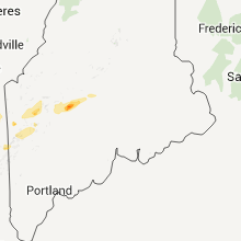
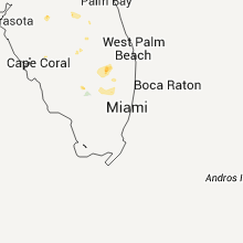
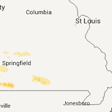
Regions Impacted by Hail on 5/27/2011
Cities Most Affected by Hail Storms of 5/27/2011
| Hail Size | Demographics of Zip Codes Affected | ||||||
|---|---|---|---|---|---|---|---|
| City | Count | Average | Largest | Pop Density | House Value | Income | Age |
| Jacksonville, FL | 2 | 1.75 | 1.75 | 667 | $64k | $33.2k | 34.7 |
| Kannapolis, NC | 2 | 1.75 | 1.75 | 1014 | $86k | $35.7k | 37.0 |
| Bingham, ME | 1 | 2.50 | 2.50 | 3 | $59k | $27.0k | 46.8 |
| North, SC | 1 | 2.00 | 2.00 | 34 | $59k | $27.9k | 41.7 |
| Turon, KS | 1 | 2.00 | 2.00 | 3 | $31k | $28.1k | 44.3 |
| Flintstone, MD | 1 | 1.75 | 1.75 | 26 | $74k | $35.7k | 44.3 |
| Todd, PA | 1 | 1.75 | 1.75 | 35 | $87k | $26.9k | 44.3 |
| Rowland, NC | 1 | 1.75 | 1.75 | 59 | $59k | $28.4k | 37.5 |
| Pelham, GA | 1 | 1.75 | 1.75 | 57 | $64k | $25.1k | 37.3 |
| Canajoharie, NY | 1 | 1.75 | 1.75 | 79 | $58k | $31.4k | 41.3 |
| Moultrie, GA | 1 | 1.75 | 1.75 | 152 | $66k | $27.7k | 35.4 |
| Rembert, SC | 1 | 1.75 | 1.75 | 40 | $64k | $26.0k | 38.6 |
| Concord, NC | 1 | 1.75 | 1.75 | 463 | $114k | $42.2k | 36.7 |
| Stem, NC | 1 | 1.75 | 1.75 | 89 | $119k | $45.5k | 40.1 |
| Endicott, NY | 1 | 1.75 | 1.75 | 879 | $81k | $38.0k | 43.1 |
| Lunenburg, VT | 1 | 1.75 | 1.75 | 18 | $73k | $29.9k | 45.8 |
| Cunningham, KS | 1 | 1.75 | 1.75 | 3 | $48k | $33.1k | 50.4 |
| Cherry Valley, NY | 1 | 1.75 | 1.75 | 19 | $78k | $38.0k | 45.9 |
Hail and Wind Damage Spotted on 5/27/2011
Filter by Report Type:Hail ReportsWind Reports
States Impacted
North Carolina, South Carolina, Georgia, Missouri, Florida, Maryland, Virginia, New York, Pennsylvania, Vermont, Maine, New Hampshire, KansasNorth Carolina
| Local Time | Report Details |
|---|---|
| 4:15 PM UTC | Quarter sized hail reported near Durham, NC, 20.6 miles NW of Raleigh, NC |
| 4:20 PM UTC | Half Dollar sized hail reported near Durham, NC, 21.3 miles NW of Raleigh, NC, hail from a quarter to half dollar size feel for several minutes at the intersection of roxboro street and avondale drive. |
| 12:40 PM EDT | Quarter sized hail reported near Butner, NC, 24.6 miles NNW of Raleigh, NC |
| 4:42 PM UTC | Power pole snappe in granville county NC, 22.8 miles N of Raleigh, NC |
| 4:43 PM UTC | Powerlines down in granville county NC, 23.8 miles NNW of Raleigh, NC |
| 1:10 PM EDT | Golf Ball sized hail reported near Stem, NC, 28.7 miles N of Raleigh, NC, time estimated. |
| 5:21 PM UTC | Quarter sized hail reported near Chapel Hill, NC, 24.4 miles WNW of Raleigh, NC |
| 5:25 PM UTC | Quarter sized hail reported near Oxford, NC, 36.3 miles N of Raleigh, NC, one inch hail reported in oxford. |
| 5:25 PM UTC | 10 inch diameter tree down in granville county NC, 34.2 miles N of Raleigh, NC |
| 5:30 PM UTC | The roof was blown off the tarheel land company in oxfor in granville county NC, 36.3 miles N of Raleigh, NC |
| 5:42 PM UTC | Quarter sized hail reported near Oxford, NC, 36.8 miles N of Raleigh, NC |
| 5:45 PM UTC | Roof peeled up on office buildin in granville county NC, 36.3 miles N of Raleigh, NC |
| 5:54 PM UTC | Quarter sized hail reported near Durham, NC, 16.5 miles WNW of Raleigh, NC |
| 5:55 PM UTC | Several power lines down across chapel hill in orange county NC, 24.4 miles WNW of Raleigh, NC |
| 2:00 PM EDT | Tree fell onto car in forsyth county NC, 75.1 miles NE of Charlotte, NC |
| 2:04 PM EDT | Quarter sized hail reported near Kernersville, NC, 75.1 miles NE of Charlotte, NC |
| 6:05 PM UTC | Roof off of a lumber company buildin in forsyth county NC, 76 miles NE of Charlotte, NC |
| 6:05 PM UTC | Trees down in forsyth county NC, 69.9 miles NE of Charlotte, NC |
| 6:07 PM UTC | Several trees... approx 2 feet in diameter... uprooted in a yard on tanyard ct. radar estimated tim in guilford county NC, 76.7 miles S of Roanoke, VA |
| 6:15 PM UTC | Quarter sized hail reported near Henderson, NC, 44 miles NNE of Raleigh, NC, quarter size hail on spring valley lake road |
| 6:15 PM UTC | Multiple trees down in guilford county NC, 71.2 miles S of Roanoke, VA |
| 6:15 PM UTC | Multiple trees down in guilford county NC, 73.9 miles S of Roanoke, VA |
| 6:15 PM UTC | Trees down in forsyth county NC, 69.9 miles NE of Charlotte, NC |
| 6:21 PM UTC | Quarter sized hail reported near Apex, NC, 11.7 miles WSW of Raleigh, NC |
| 6:25 PM UTC | Quarter sized hail reported near Spring Lake, NC, 44 miles SSW of Raleigh, NC |
| 6:25 PM UTC | Golf Ball sized hail reported near Rowland, NC, 79.6 miles WNW of Wilmington, NC, reported by officer relayed by 911 center |
| 6:30 PM UTC | Trees down all over tow in rockingham county NC, 53.7 miles SSE of Roanoke, VA |
| 6:30 PM UTC | Quarter sized hail reported near Spring Lake, NC, 44.1 miles SSW of Raleigh, NC |
| 6:40 PM UTC | Trees dow in harnett county NC, 26.5 miles SSW of Raleigh, NC |
| 6:47 PM UTC | Quarter sized hail reported near Fuquay-Varina, NC, 15.8 miles SSW of Raleigh, NC, quarter sized hail lasted 10 minutes. |
| 6:48 PM UTC | Tree down on power line in wake county NC, 8.3 miles W of Raleigh, NC |
| 6:52 PM UTC | Large tree dow in wake county NC, 14.3 miles SW of Raleigh, NC |
| 4:25 PM EDT | Golf Ball sized hail reported near Concord, NC, 19 miles NE of Charlotte, NC, golf ball hail on international drive near interstate 85 |
| 4:40 PM EDT | Golf Ball sized hail reported near Kannapolis, NC, 22.8 miles NNE of Charlotte, NC, golf ball hail along enochville avenue. |
| 8:40 PM UTC | Ham radio operator reports tree down on power lines on enochville ave in rowan county NC, 22.6 miles NNE of Charlotte, NC |
| 4:43 PM EDT | Golf Ball sized hail reported near Kannapolis, NC, 22.2 miles NNE of Charlotte, NC |
| 4:45 PM EDT | Half Dollar sized hail reported near Landis, NC, 26 miles NNE of Charlotte, NC, half dollar hail with hail covering ground. |
| 8:58 PM UTC | Ham radio operator relayed report of tree down across sherrills ford rd in rowan county NC, 36 miles NNE of Charlotte, NC |
| 9:00 PM UTC | Quarter sized hail reported near Salisbury, NC, 34.3 miles NNE of Charlotte, NC, several quarter size hailstones...widespread penny to nickel hailstones covering ground. |
| 9:30 PM UTC | Multiple trees down on deadmon road and at the intersection of us hwy 64e and state hwy 80 in davie county NC, 50.4 miles NNE of Charlotte, NC |
South Carolina
| Local Time | Report Details |
|---|---|
| 4:35 PM UTC | Tree down on west hampton point driv in florence county SC, 68.6 miles N of Charleston, SC |
| 5:00 PM UTC | Quarter sized hail reported near Pageland, SC, 43.3 miles SE of Charlotte, NC, one inch hail reported on hatchery road. |
| 6:13 PM UTC | Quarter sized hail reported near Barnwell, SC, 40.6 miles ESE of Augusta, GA |
| 6:55 PM UTC | Highway dept reports large tree down across us-1 near ousleydale road in chesterfield county SC, 63.5 miles SE of Charlotte, NC |
| 7:21 PM UTC | Quarter sized hail reported near Walterboro, SC, 43 miles WSW of Charleston, SC |
| 8:24 PM UTC | Colleton state park reported several trees down on park property and 3 trees down at the entrance along jefferies highwa in colleton county SC, 36.4 miles WSW of Charleston, SC |
| 8:24 PM UTC | Several branches down 2 inches in diamete in dorchester county SC, 35.7 miles WSW of Charleston, SC |
| 11:00 PM UTC | Trees down along macedonia church road in fairfield county SC, 64.7 miles S of Charlotte, NC |
| 1:47 AM UTC | Lexington dispatch reports one tree down on tindall road in pelion in lexington county SC, 46.7 miles ENE of Augusta, GA |
| 2:12 AM UTC | Barnwell county dispatch reports trees down on moonlight road in williston in barnwell county SC, 32.5 miles E of Augusta, GA |
| 3:50 AM UTC | Hen Egg sized hail reported near North, SC, 51.4 miles E of Augusta, GA, cocorahs observer called and reported 1 to 2 inch hail near the town of north. |
| 4:15 AM UTC | Sheriff dispatch reported trees down in nort in orangeburg county SC, 51.4 miles E of Augusta, GA |
| 4:43 AM UTC | Fire department reported one tree down along sams point roa in beaufort county SC, 34.4 miles NE of Savannah, GA |
| 4:56 AM UTC | Golf Ball sized hail reported near Rembert, SC, 70.6 miles NNW of Charleston, SC, sheriff dispatch reported golf ball size hail along black river road. |
| 5:41 AM UTC | Sheriff dispatch reported trees down spring hill roa in lee county SC, 69.2 miles NNW of Charleston, SC |
| 5:58 AM UTC | Sheriff dispatch reported trees down elmore roa in lee county SC, 70.2 miles NNW of Charleston, SC |
| 6:03 AM UTC | Tree down at the intersection of highway 174 and toogoodoo road. report from the charleston county warning poin in charleston county SC, 40 miles SSW of Charleston, SC |
| 6:10 AM UTC | Sheriff dispatch reported trees down on the south side of bishopvill in lee county SC, 71.2 miles N of Charleston, SC |
Georgia
| Local Time | Report Details |
|---|---|
| 6:25 PM UTC | The law enforcement reported a large tree down northwest of sterling. the time given was based on rada in glynn county GA, 60.4 miles SSW of Savannah, GA |
| 6:40 PM UTC | Quarter sized hail reported near Richmond Hill, GA, 15.7 miles SW of Savannah, GA |
| 7:14 PM UTC | Trees down all over southern portion of mitchell county. power outages also being reporte in mitchell county GA, 46 miles N of Tallahassee, FL |
| 7:14 PM UTC | Golf Ball sized hail reported near Pelham, GA, 46 miles N of Tallahassee, FL, multiple reports of golfball size hail by police and fire department |
| 7:38 PM UTC | Quarter sized hail reported near Hartsfield, GA, 54.4 miles NNE of Tallahassee, FL |
| 7:45 PM UTC | Power line down reported on paul murray road by fire department in colquitt county GA, 58.7 miles NNE of Tallahassee, FL |
| 7:48 PM UTC | Quarter sized hail reported near Hartsfield, GA, 54.4 miles NNE of Tallahassee, FL |
| 7:50 PM UTC | Golf Ball sized hail reported near Moultrie, GA, 58.7 miles NNE of Tallahassee, FL |
| 9:10 PM UTC | Quarter sized hail reported near , , 79.6 miles SW of Augusta, GA, public reported quarter sized hail along sandy creek road near toomsboro. |
| 9:37 PM UTC | Ping Pong Ball sized hail reported near Dublin, GA, 71.3 miles N of Douglas, GA, damage reported to vehicles. |
| 9:55 PM UTC | Quarter sized hail reported near Davisboro, GA, 57.9 miles SW of Augusta, GA, quarter sized hail was reported at pecan valley farm just southeast of riddleville. |
| 9:58 PM UTC | Quarter sized hail reported near Riddleville, GA, 56.2 miles SW of Augusta, GA, quarter sized hail reported by the local law enforcement. |
| 11:55 PM UTC | Numerous trees down near satilla church roa in appling county GA, 32.4 miles ENE of Douglas, GA |
| 12:20 AM UTC | One tree down with other large tree limbs down on appling golf course. half inch size hail also reporte in appling county GA, 31.4 miles ENE of Douglas, GA |
| 1:15 AM UTC | Emergency manager reported two large oak trees had fallen down across dove roa in bacon county GA, 30.5 miles E of Douglas, GA |
| 1:15 AM UTC | Emergency manager relayed reports of widespread tree damage in eastern portions of bacon county. in addition a chicken house had portions of its tin roof peeled back ha in bacon county GA, 32.5 miles E of Douglas, GA |
Missouri
| Local Time | Report Details |
|---|---|
| 6:55 PM UTC | Quarter sized hail reported near Cassville, MO, 46.8 miles SW of Springfield, MO, leaves removed from trees |
| 7:05 PM UTC | Quarter sized hail reported near Shell Knob, MO, 44.1 miles SSW of Springfield, MO, report relayed through media |
| 7:20 PM UTC | Quarter sized hail reported near Galena, MO, 34.5 miles SSW of Springfield, MO |
| 9:52 PM UTC | Quarter sized hail reported near Dora, MO, 66.2 miles ESE of Springfield, MO |
| 10:11 PM UTC | Power lines dow in howell county MO, 63.9 miles SSW of Salem, MO |
Florida
| Local Time | Report Details |
|---|---|
| 7:10 PM UTC | The law enforcement reported trees down in satsuma. the time given was based on rada in putnam county FL, 53.8 miles S of Jacksonville, FL |
| 7:35 PM UTC | The law enforcement reported trees down in east palatka. the time given was based on rada in putnam county FL, 47.1 miles S of Jacksonville, FL |
| 7:45 PM UTC | Quarter sized hail reported near Hastings, FL, 46.8 miles SSE of Jacksonville, FL, hail up to quarter size reported near cracker swamp road. |
| 4:11 PM EDT | Golf Ball sized hail reported near Jacksonville, FL, 6.3 miles W of Jacksonville, FL, golf ball size hail at interstate 295 and commonwelth ave |
| 4:15 PM EDT | Quarter sized hail reported near Jacksonville, FL, 8.4 miles NNW of Jacksonville, FL, quarter size hail reported near the intersection of dunn avenue and interstate 295. |
| 4:17 PM EDT | Golf Ball sized hail reported near Jacksonville, FL, 8.2 miles NNW of Jacksonville, FL, two reports of golfball size hail at lem turner rd. and dunn ave. |
| 8:20 PM UTC | Trees reported dow in clay county FL, 28.4 miles S of Jacksonville, FL |
| 8:30 PM UTC | Ping Pong Ball sized hail reported near St Augustine, FL, 27.9 miles SSE of Jacksonville, FL, hail just shy of golf ball size was reported at palms plus. no damage was reported. |
| 8:40 PM UTC | Golf Ball sized hail reported near , , 22.9 miles S of Jacksonville, FL, public reported golf ball sized hail in green cove springs. |
| 8:45 PM UTC | Quarter sized hail reported near Ponte Vedra, FL, 20.5 miles SE of Jacksonville, FL, quarter size hail covered the ground at the palm valley golf club. |
| 9:15 PM UTC | Broadcast media reported a large tree down across scott mill road in the mandarin area. time estimated by radar dat in duval county FL, 11.2 miles S of Jacksonville, FL |
| 5:37 PM EDT | Quarter sized hail reported near Kissimmee, FL, 14.4 miles S of Orlando, FL, quarter-sized hail reported in mill run residential development. |
| 8:50 PM EDT | Quarter sized hail reported near Orlando, FL, 6.2 miles SSW of Orlando, FL |
Maryland
| Local Time | Report Details |
|---|---|
| 7:21 PM UTC | Quarter sized hail reported near Frostburg, MD, 67 miles NE of Elkins, WV |
| 7:30 PM UTC | Half Dollar sized hail reported near Frostburg, MD, 70.8 miles NE of Elkins, WV |
| 7:34 PM UTC | Quarter sized hail reported near Frostburg, MD, 71.3 miles NE of Elkins, WV |
| 9:45 PM UTC | Golf Ball sized hail reported near Flintstone, MD, 84.5 miles SSW of State College, PA |
| 11:59 PM UTC | Storm damage reported in montgomery county MD, 34.6 miles WSW of Baltimore, MD |
| 12:12 AM UTC | Estimated 50 plus mph wind gust. trees down on residential propert in washington county MD, 60.7 miles WNW of Baltimore, MD |
| 12:39 AM UTC | One 4 inch diameter tree destroyed and two 8 inch diameter trees split in hal in carroll county MD, 37 miles NW of Baltimore, MD |
| 12:50 AM UTC | 1 tree blocking most of the roadway near intersection of reisterstown road and st. thomas lan in baltimore county MD, 11.9 miles NW of Baltimore, MD |
Virginia
| Local Time | Report Details |
|---|---|
| 7:35 PM UTC | Trees down all over tow in pittsylvania county VA, 43.2 miles SE of Roanoke, VA |
| 10:40 PM UTC | Large limbs snapped off small- to medium-sized trees in spotsylvania county VA, 54 miles N of Richmond, VA |
| 10:42 PM UTC | Multiple 3-5 inch branches near the intersection of castlebridge road and salem run blv in spotsylvania county VA, 54 miles N of Richmond, VA |
| 10:44 PM UTC | Multiple 4 inch limbs down on the campus of the univeristy of mary washington in city of fredericks county VA, 55.8 miles N of Richmond, VA |
| 10:54 PM UTC | Multiple 3-5 inch branches near the intersection of castlebridge road and salem run blv in spotsylvania county VA, 54 miles N of Richmond, VA |
| 10:58 PM UTC | Multiple trees and power lines down near decatur r in stafford county VA, 64.7 miles NNE of Richmond, VA |
| 11:00 PM UTC | Tree down onto fence on takaro farm lan in loudoun county VA, 67.3 miles WSW of Baltimore, MD |
| 11:00 PM UTC | Tree down on takaro farm lane in loudoun county VA, 67.3 miles WSW of Baltimore, MD |
| 11:10 PM UTC | Trees down along joplin road south of independent hil in prince william county VA, 64.3 miles SW of Baltimore, MD |
| 11:15 PM UTC | Several trees down in lake ridge. one fell into hous in prince william county VA, 55.7 miles SW of Baltimore, MD |
| 11:18 PM UTC | 8 inch diameter tree down south of intersection of routes 15 and 5 in loudoun county VA, 59.2 miles WSW of Baltimore, MD |
| 11:30 PM UTC | Oak tree 15 inches in diameter blocking roadwa in fairfax county VA, 45.8 miles SW of Baltimore, MD |
| 11:41 PM UTC | Large limbs snapped and thrown into neighboring yards by thunderstorm wind in fairfax county VA, 41.2 miles SW of Baltimore, MD |
| 11:43 PM UTC | Storm damage reported in fairfax county VA, 38.7 miles SW of Baltimore, MD |
New York
| Local Time | Report Details |
|---|---|
| 8:44 PM UTC | Essex cty dispatch reported numerous trees and powerlines down in essex county NY, 59 miles SW of Burlington, VT |
| 8:44 PM UTC | Essex cty dispatch reported numerous trees down in essex county NY, 59 miles SW of Burlington, VT |
| 9:45 PM UTC | Tree down on wires on marshall fish roa in warren county NY, 58.3 miles N of Schenectady, NY |
| 9:50 PM UTC | Tree and wires down on igerna road 3 miles from the rte 8/rte 9 intersectio in warren county NY, 58.3 miles N of Schenectady, NY |
| 10:27 PM UTC | Quarter sized hail reported near Vestal, NY, 46.9 miles NNW of Scranton, PA |
| 10:30 PM UTC | Quarter sized hail reported near Johnson City, NY, 51.4 miles NNW of Scranton, PA |
| 10:37 PM UTC | Quarter sized hail reported near Vestal, NY, 46.9 miles NNW of Scranton, PA |
| 10:42 PM UTC | Quarter sized hail reported near Vestal, NY, 49.6 miles NNW of Scranton, PA, hail covering the ground |
| 10:44 PM UTC | Quarter sized hail reported near Vestal, NY, 50 miles NNW of Scranton, PA |
| 10:51 PM UTC | Ping Pong Ball sized hail reported near Johnson City, NY, 51.4 miles NNW of Scranton, PA, near floral park |
| 11:00 PM UTC | Golf Ball sized hail reported near Union, NY, 52.4 miles NNW of Scranton, PA |
| 11:27 PM UTC | Quarter sized hail reported near Otsego, NY, 52 miles W of Schenectady, NY |
| 11:33 PM UTC | Quarter sized hail reported near Otsego, NY, 52 miles W of Schenectady, NY |
| 11:45 PM UTC | Quarter sized hail reported near Elmira, NY, 74.4 miles SSW of Syracuse, NY |
| 11:50 PM UTC | Golf Ball sized hail reported near Cherry Valley, NY, 42.1 miles W of Schenectady, NY |
| 12:00 AM UTC | Quarter sized hail reported near Fort Plain, NY, 35.9 miles WNW of Schenectady, NY, hail lasted 10 to 15 minutes |
| 12:00 AM UTC | Golf Ball sized hail reported near Canajoharie, NY, 35.2 miles W of Schenectady, NY |
| 12:10 AM UTC | Trees down on county road 10 in chenango county NY, 37.7 miles SSE of Syracuse, NY |
| 12:30 AM UTC | Trees down... 25 houses with minor damage... one house with substantial damage in chemung county NY, 75.8 miles NW of Scranton, PA |
| 12:40 AM UTC | Quarter sized hail reported near Earlville, NY, 37.5 miles SE of Syracuse, NY |
| 1:36 AM UTC | Quarter sized hail reported near Middleville, NY, 56.9 miles WNW of Schenectady, NY, wktv spotter. |
| 2:00 AM UTC | Quarter sized hail reported near Brookfield, NY, 41.8 miles ESE of Syracuse, NY |
| 2:05 AM UTC | Quarter sized hail reported near Pittsfield, NY, 51.5 miles SE of Syracuse, NY |
Pennsylvania
| Local Time | Report Details |
|---|---|
| 8:50 PM UTC | Trees wires down in bedford county PA, 47.2 miles SW of State College, PA |
| 9:00 PM UTC | 911 center reported trees and power lines dow in bedford county PA, 45.2 miles SSW of State College, PA |
| 9:18 PM UTC | Golf Ball sized hail reported near Todd, PA, 38.6 miles SSW of State College, PA, estimated wind gusts of 55 to 60 mph at small airstrip in todd township. |
| 9:24 PM UTC | Half Dollar sized hail reported near Todd, PA, 35.3 miles SSW of State College, PA |
| 9:30 PM UTC | 911 center reported numerous trees dow in huntingdon county PA, 33.6 miles SSW of State College, PA |
| 9:45 PM UTC | 911 center reported trees dow in huntingdon county PA, 21.7 miles SSW of State College, PA |
| 9:50 PM UTC | Trees and power lines were down on rte 103 over southern mifflin cty. a funnel cloud was also reporte in mifflin county PA, 25 miles SSE of State College, PA |
| 9:55 PM UTC | Trees down along rte 26 in bedford county PA, 75.3 miles SSW of State College, PA |
| 10:22 PM UTC | Trees on power lines along route 2 in bedford county PA, 66.6 miles SSW of State College, PA |
| 10:35 PM UTC | Trees down along rte 747 in huntingdon county PA, 36.3 miles S of State College, PA |
| 10:50 PM UTC | Trees wires down in cumberland county PA, 53.8 miles SE of State College, PA |
| 10:50 PM UTC | Quarter sized hail reported near Guilford, PA, 62.9 miles SSE of State College, PA |
| 10:55 PM UTC | Trees down along rte 103 in mifflin county PA, 25 miles SSE of State College, PA |
| 11:15 PM UTC | Trees wires down in cumberland county PA, 54.4 miles SSE of State College, PA |
| 11:31 PM UTC | Quarter sized hail reported near Towanda, PA, 47.8 miles WNW of Scranton, PA |
| 11:35 PM UTC | Trees wires down in dauphin county PA, 65 miles ESE of State College, PA |
| 11:40 PM UTC | Trees wires down in cumberland county PA, 58.1 miles SE of State College, PA |
| 11:50 PM UTC | Trees wires down in dauphin county PA, 53.8 miles ESE of State College, PA |
| 12:12 AM UTC | Estimated 50 plus mph wind gust. trees down on residential propert in franklin county PA, 60.8 miles WNW of Baltimore, MD |
| 12:40 AM UTC | Trees down in northumberland county PA, 56.3 miles E of State College, PA |
| 12:45 AM UTC | Trees down in lairdsville and picture rocks in lycoming county PA, 50.9 miles WSW of Scranton, PA |
| 1:00 AM UTC | Trees wires down in dauphin county PA, 66.8 miles ESE of State College, PA |
| 1:10 AM UTC | Trees wires down in york county PA, 53.3 miles NNW of Baltimore, MD |
| 1:15 AM UTC | Trees wires down in york county PA, 57.2 miles N of Baltimore, MD |
| 1:25 AM UTC | Trees down in dauphin county PA, 63.1 miles N of Baltimore, MD |
Vermont
| Local Time | Report Details |
|---|---|
| 9:07 PM UTC | Quarter sized hail reported near Ludlow, VT, 74.7 miles ENE of Schenectady, NY, quarter size hail |
| 9:16 PM UTC | Quarter sized hail reported near Ludlow, VT, 74.7 miles ENE of Schenectady, NY, quarter size hail |
| 10:30 PM UTC | Quarter sized hail reported near Shoreham, VT, 40.8 miles S of Burlington, VT, quarter size hail |
| 10:38 PM UTC | Quarter sized hail reported near Waterbury, VT, 25.3 miles ESE of Burlington, VT, quarter size hail |
| 10:50 PM UTC | Golf Ball sized hail reported near Lunenburg, VT, 75.8 miles E of Burlington, VT, golf-ball size hail |
| 10:51 PM UTC | Trees down on powerlines in lamoille county VT, 36.5 miles ENE of Burlington, VT |
| 10:54 PM UTC | Quarter sized hail reported near Hartford, VT, 69.4 miles SE of Burlington, VT, quarter size hail |
| 11:06 PM UTC | Trees down... time estimated in windsor county VT, 71.2 miles SE of Burlington, VT |
| 11:22 PM UTC | Trees down in washington county VT, 39.7 miles ESE of Burlington, VT |
| 11:40 PM UTC | State police... tree down on rte 122 in caledonia county VT, 60 miles E of Burlington, VT |
| 11:40 PM UTC | Quarter sized hail reported near Topsham, VT, 53.4 miles ESE of Burlington, VT, quarter size hail |
Maine
| Local Time | Report Details |
|---|---|
| 9:15 PM UTC | Tree down across route 4 south of rangeley. time esimated from radar. delayed repor in franklin county ME, 85.4 miles N of Portland, ME |
| 10:40 PM UTC | Quarter sized hail reported near Millinocket, ME, 76.5 miles NNW of Bangor, ME, quarter sized hail along the golden road just east of ripogenus dam. hail size and time are estimated. |
| 10:50 PM UTC | Quarter sized hail reported near Pleasant Ridge Plantation, ME, 59.3 miles WNW of Bangor, ME |
| 10:55 PM UTC | Tennis Ball sized hail reported near Bingham, ME, 55.5 miles WNW of Bangor, ME, time estimated from radar |
| 11:00 PM UTC | Quarter sized hail reported near Bingham, ME, 56.6 miles WNW of Bangor, ME |
| 11:58 PM UTC | Quarter sized hail reported near Guilford, ME, 39.6 miles NW of Bangor, ME |
| 12:00 AM UTC | Half Dollar sized hail reported near Guilford, ME, 40 miles NW of Bangor, ME, hail covering the ground |
| 1:00 AM UTC | Estimated wind gusts of 50 to 60 mph. gusts broke boats free from the dock. time estimated from radar. delayed repor in oxford county ME, 81.5 miles NNW of Portland, ME |
| 2:00 AM UTC | Large trees down on brighton road. time estimated from radar. delayed repor in somerset county ME, 53.6 miles WNW of Bangor, ME |
New Hampshire
| Local Time | Report Details |
|---|---|
| 11:00 PM UTC | Ping Pong Ball sized hail reported near Northumberland, NH, 84.1 miles E of Burlington, VT, just under golf ball size. time estimated |
| 11:00 PM UTC | Quarter sized hail reported near Gorham, NH, 70.5 miles NW of Portland, ME, time estimated from radar. delayed report. |
| 11:03 PM UTC | Quarter sized hail reported near Lancaster, NH, 81.2 miles E of Burlington, VT |
| 12:10 AM UTC | Quarter sized hail reported near Whitefield, NH, 80.6 miles NW of Portland, ME, also estimated wind gusts of 40 to 50 mph. time estimated from radar. |
| 12:20 AM UTC | Quarter sized hail reported near Whitefield, NH, 80.6 miles NW of Portland, ME, also estimated wind gusts of 40 to 50 mph. time estimated from radar. |
Kansas
| Local Time | Report Details |
|---|---|
| 8:42 AM UTC | Trees up to two feet in diameter were blown in stafford county KS, 76.4 miles W of Wichita, KS |
| 9:00 AM UTC | Hen Egg sized hail reported near Turon, KS, 67.6 miles W of Wichita, KS |
| 9:29 AM UTC | Golf Ball sized hail reported near Cunningham, KS, 54 miles W of Wichita, KS |
| 10:10 AM UTC | Quarter sized hail reported near Mound City, KS, 46.8 miles NE of Chanute, KS, mostly nickel sized. a few quarter sized. |









Connect with Interactive Hail Maps