

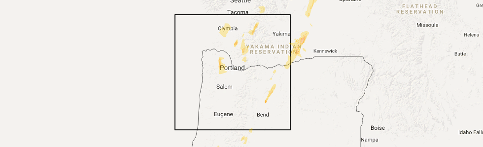
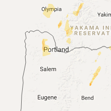
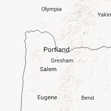
Hail Map for Beaverton, OR
The Beaverton, OR area has had 0 reports of on-the-ground hail by trained spotters, and has been under severe weather warnings 1 time during the past 12 months. Doppler radar has detected hail at or near Beaverton, OR on 2 occasions.
| Name: | Beaverton, OR |
| Where Located: | 6.3 miles W of Portland, OR |
| Map: | Google Map for Beaverton, OR |
| Population: | 89803 |
| Housing Units: | 39500 |
| More Info: | Search Google for Beaverton, OR |
0
The Top Recent Hail Date for Beaverton, OR is Thursday, May 4, 2017 (2nd out of 2)
Hail and Wind Damage Spotted near Beaverton, OR
| Date / Time | Report Details |
|---|---|
| 2/24/2025 4:02 PM PST |
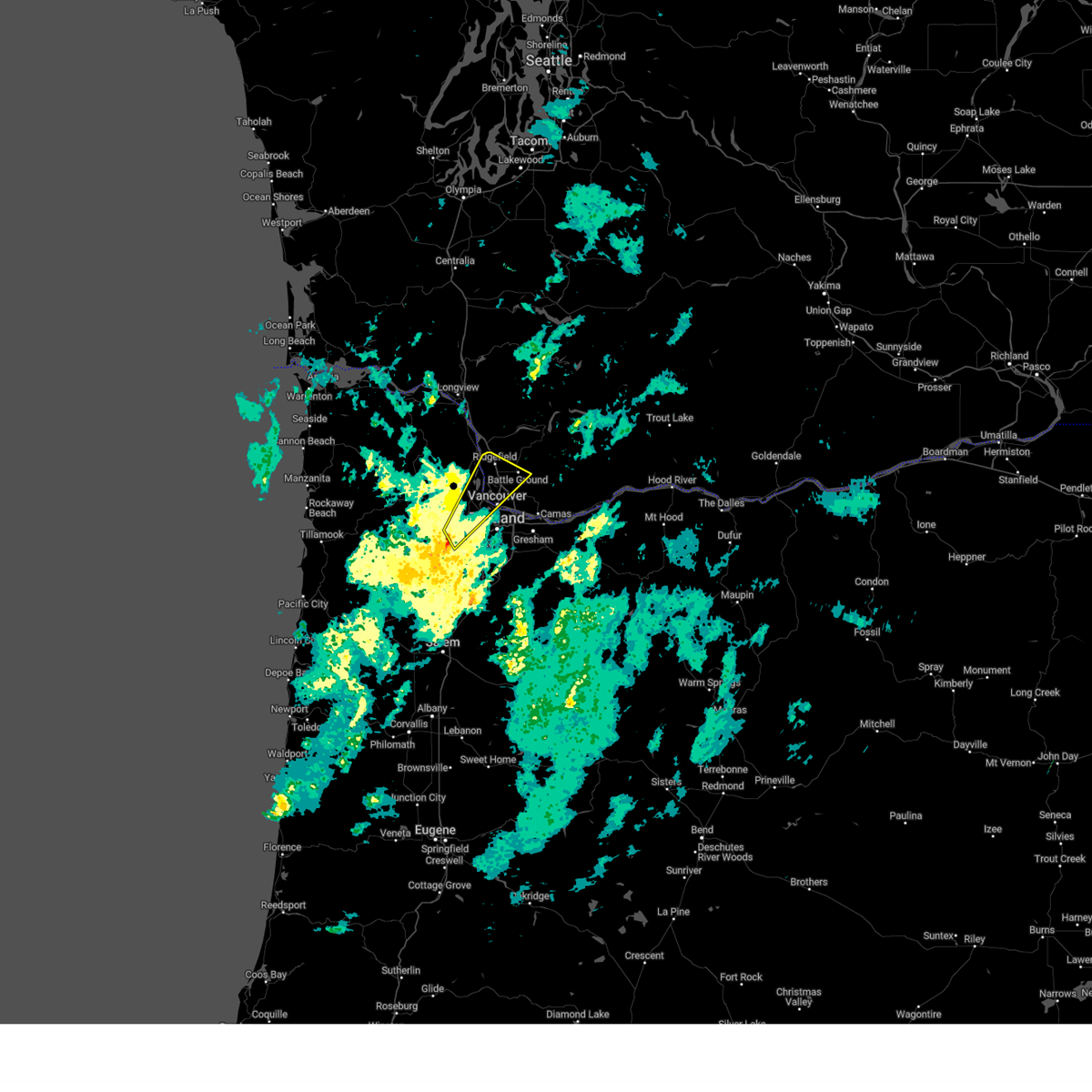 Svrpqr the national weather service in portland has issued a * severe thunderstorm warning for, southeastern columbia county in northwestern oregon, northwestern multnomah county in northwestern oregon, southeastern washington county in northwestern oregon, southwestern clark county in southwestern washington, * until 430 pm pst. * at 400 pm pst, severe thunderstorms were located along a line extending from near hillsboro to 6 miles west of beaverton, moving northeast at 60 mph (radar indicated). Hazards include 60 mph wind gusts. Expect damage to roofs, siding, and trees. Power outages possible. Svrpqr the national weather service in portland has issued a * severe thunderstorm warning for, southeastern columbia county in northwestern oregon, northwestern multnomah county in northwestern oregon, southeastern washington county in northwestern oregon, southwestern clark county in southwestern washington, * until 430 pm pst. * at 400 pm pst, severe thunderstorms were located along a line extending from near hillsboro to 6 miles west of beaverton, moving northeast at 60 mph (radar indicated). Hazards include 60 mph wind gusts. Expect damage to roofs, siding, and trees. Power outages possible.
|
| 10/24/2021 12:27 PM PDT |
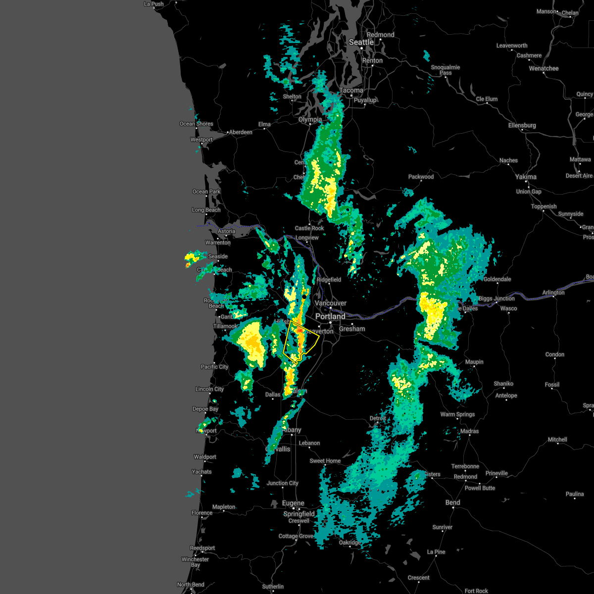 At 1227 pm pdt, a severe thunderstorm was located near newberg, or 12 miles south of hillsboro, moving northeast at 40 mph (radar indicated). Hazards include 60 mph wind gusts. Expect damage to roofs, siding, and trees. locations impacted include, newberg, forest grove, dayton, yamhill, sherwood, cornelius, lafayette, dundee, king city, carlton, gaston, dilley, farmington and scholls. in oregon this includes state highway 18 between mile markers 51 and 52. hail threat, radar indicated max hail size, <. 75 in wind threat, radar indicated max wind gust, 60 mph. At 1227 pm pdt, a severe thunderstorm was located near newberg, or 12 miles south of hillsboro, moving northeast at 40 mph (radar indicated). Hazards include 60 mph wind gusts. Expect damage to roofs, siding, and trees. locations impacted include, newberg, forest grove, dayton, yamhill, sherwood, cornelius, lafayette, dundee, king city, carlton, gaston, dilley, farmington and scholls. in oregon this includes state highway 18 between mile markers 51 and 52. hail threat, radar indicated max hail size, <. 75 in wind threat, radar indicated max wind gust, 60 mph.
|
| 10/24/2021 12:11 PM PDT |
 At 1211 pm pdt, a severe thunderstorm was located near mcminnville, moving northeast at 45 mph (radar indicated). Hazards include 70 mph wind gusts. Expect considerable tree damage. Damage is likely to mobile homes, roofs, and outbuildings. At 1211 pm pdt, a severe thunderstorm was located near mcminnville, moving northeast at 45 mph (radar indicated). Hazards include 70 mph wind gusts. Expect considerable tree damage. Damage is likely to mobile homes, roofs, and outbuildings.
|
Hail Maps for Beaverton, OR
Connect with Interactive Hail Maps